
Search for another town




Free U.S. delivery 7 to 10 days after you order
Richardson, Texas Map Art
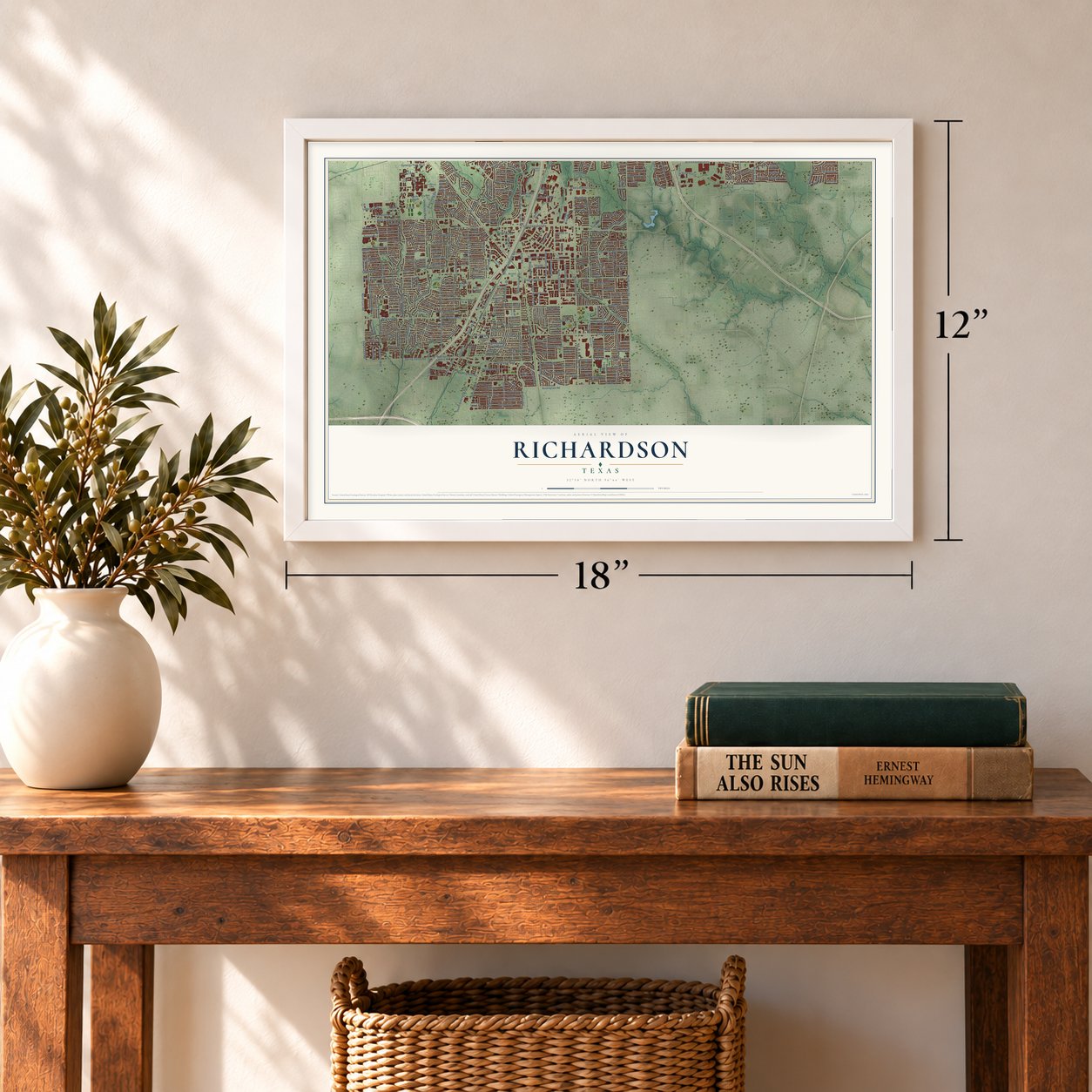
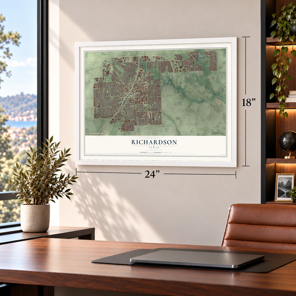
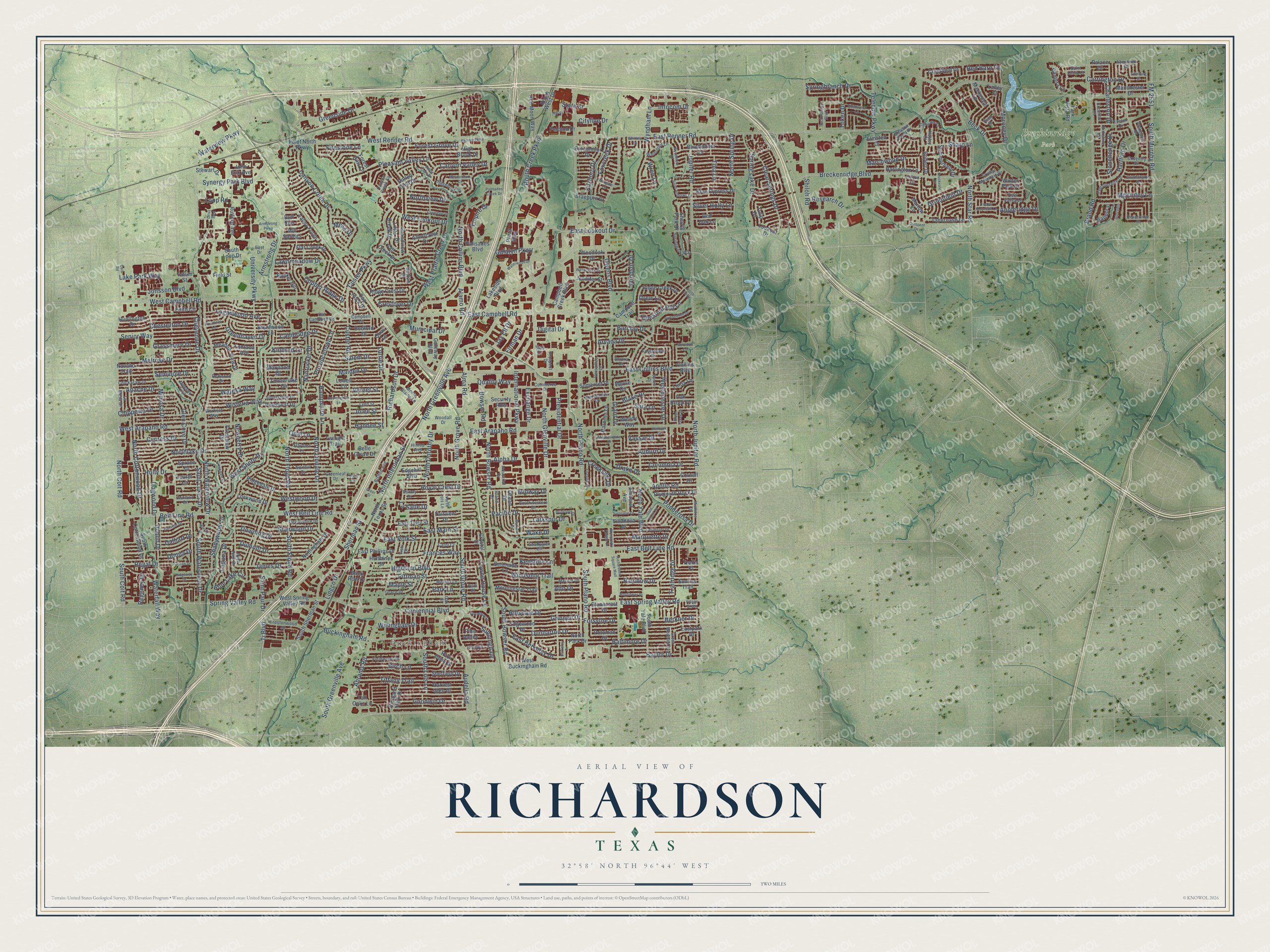
A new map of Richardson, Texas, made in 2026 and printed to order on thick archival matte paper.
12" x 18" Archival Matte Print
A Map of Home. A Work of Art.
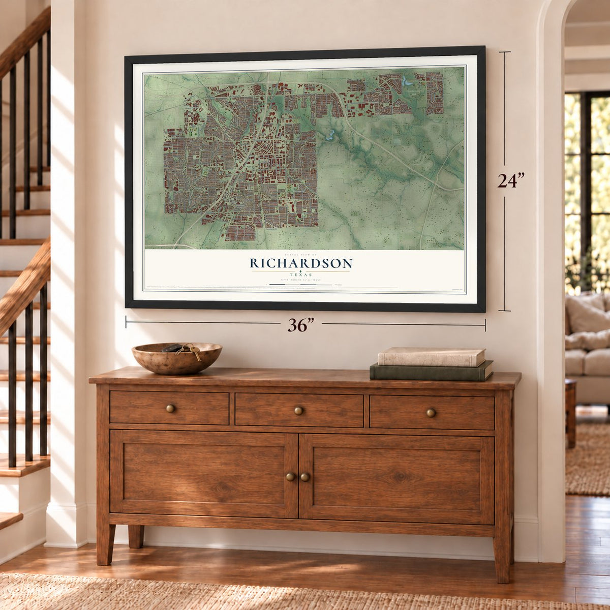
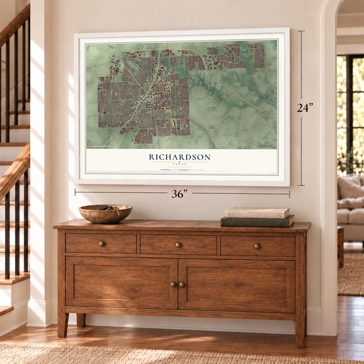
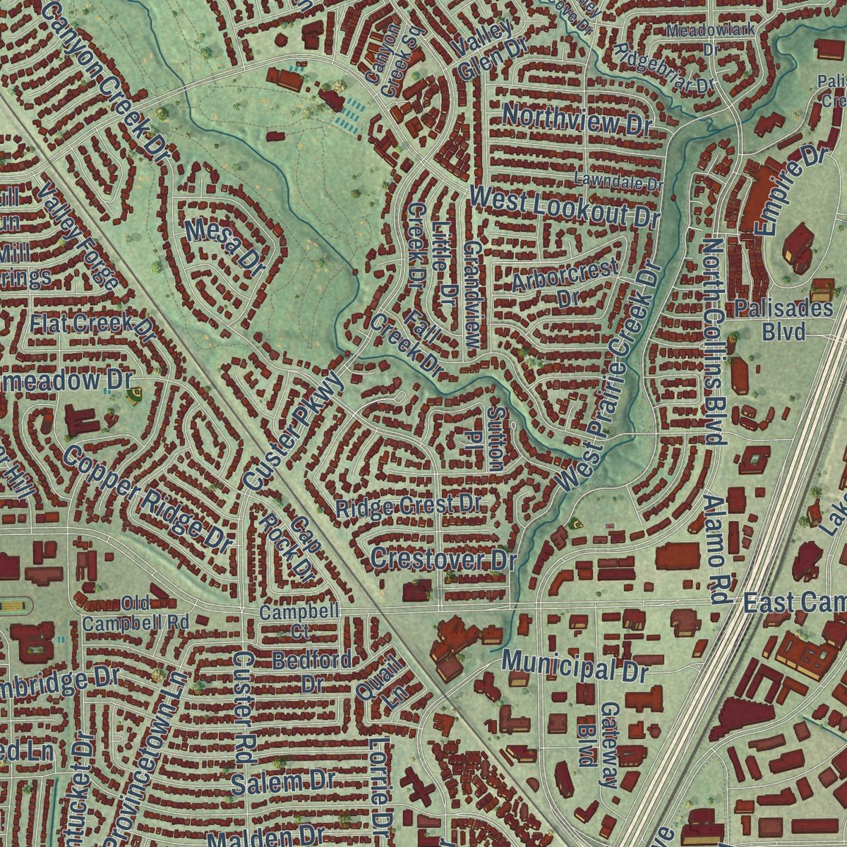
This beautifully detailed map of Richardson, Texas was created in 2026 using aerial imagery combined with modern topographical, census, street and landmark data. It's a modern aerial view of Richardson in Dallas County, Texas, that combines modern data with a vintage aesthetic. Zoom in on the preview and look for your block.
Three ways to hang it
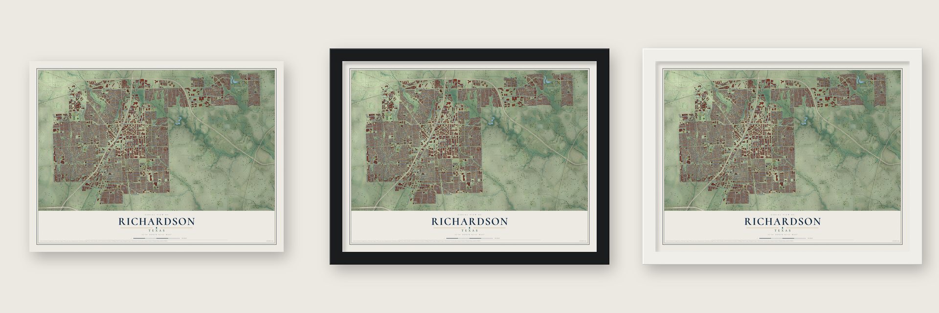
Unframed archival matte, a black wood frame or a white wood frame.
Up close
Real geography. Art worth displaying.
This map was created using accurate cartographic data and authoritative geographic sources, including the U.S. Geological Survey and the Census Bureau. The map brings together terrain, waterways, roads, and building detail. The majority of the streets are labeled, houses are accurately depicted, and the topography is derived from government sources. Combining local data with carefully composed color and shading leads to this beautifully detailed Richardson artwork for your wall.
Rather than simply showing street outlines, we’ve included as many of the street names as we could reasonably fit on the map while keeping their names legible. Zoom in on the high resolution preview to see exactly what’s on the map. We truly set out to create a statement piece for anyone who loves Richardson. So whether it’s for you, or a gift for someone you love, we hope this map of Richardson brings back fond memories.
Read the story behind this map of Richardson, Texas from 2026.

About Richardson, Texas
Richardson lies about fourteen miles north of downtown Dallas, with most of the city in Dallas County and a smaller section in Collin County. Its irregular territory covers slightly more than twenty-eight square miles and is crossed by Prairie, Spring, Duck, and Cottonwood creeks. Rail connections, postwar electronics firms, and Central Expressway each shaped its transition from an agricultural community to a Dallas suburb.
- Railroad TownsiteIn 1873, the Houston and Texas Central Railroad favored a new town over Breckinridge and named it for company secretary Alfred Stephen Richardson.
- City IncorporationRichardson incorporated on June 22, 1925, and voters chose Tom McKamy as its first mayor.
- Postwar ExpansionAfter Collins Radio, Texas Instruments, and Central Expressway arrived, the population rose from 1,288 in 1952 to 16,810 in 1960.
- 2020 PopulationThe United States census counted 119,469 Richardson residents in 2020.
Find your street
Names on the Richardson map
Every name below is printed on this map. Look for your street, your school, the park where you played, or the pond down the road.
Places and landmarks2
- Buckingham
- Breckinridge Park
Streets and roads448
- West Belt Line Road
- East Belt Line Road
- Belt Line Road
- East Main Street
- Sherman Street
- South Floyd Road
- Ti Boulevard
- West Arapaho Road
- East Arapaho Road
- North Coit Road
- South Coit Road
- Saint Paul Drive
- East Campbell Road
- East Lookout Drive
- Routh Creek Parkway
- Barclay Drive
- Telecom Parkway
- South Bowser Road
- Regency Drive
- East Renner Road
- North Plano Road
- North Jupiter Road
- North Glenville Drive
- North Greenville Avenue
- West Campbell Road
- West Renner Road
- North Collins Boulevard
- Custer Parkway
- East Collins Boulevard
- Waterview Parkway
Show all 448 streets
- Centennial Boulevard
- Breckenridge Boulevard
- North Waterview Drive
- South Greenville Avenue
- West Lookout Drive
- North Floyd Road
- North Star Road
- Melrose Drive
- East Spring Valley Road
- Buckingham Road
- Canyon Creek Drive
- Owens Boulevard
- Apollo Road
- Brand Road
- North Yale Boulevard
- Synergy Park Boulevard
- West Shore Drive
- Mimosa Drive
- Jupiter Road
- South Plano Road
- Dumont Drive
- Custer Road
- Abrams Road
- Shiloh Road
- Alma Road
- South Waterview Drive
- South Grove Road
- Cheyenne Drive
- International Parkway
- Audelia Road
- Spring Valley Road
- Wyndham Lane
- FM 2551
- South Murphy Road
- North Cottonwood Drive
- Lake Park Way
- Richardson Drive
- Forest Grove Drive
- Frances Way
- Wisteria Way
- South Lois Lane
- Newberry Drive
- Northlake Drive
- North Bowser Road
- Baltimore Drive
- Carrington Drive
- North Grove Road
- North Spring Drive
- Canyon Valley Drive
- Windsong Trail
- Clear Springs Drive
- Jonsson Boulevard
- Nantucket Drive
- Westwood Drive
- Tiffany Trail
- Provincetown Lane
- Beck Drive
- Loop Road
- Greenfield Drive
- Glen Cove Drive
- Cambridge Drive
- Columbia Drive
- Cityline Drive
- North Interurban Street
- Auburn Drive
- North Dorothy Drive
- East Polk Street
- North Lindale Lane
- Pittman Street
- Drake Drive
- University Parkway
- La Salle Drive
- Birch Lane
- West Prairie Creek Drive
- Westminster Drive
- Downing Drive
- Lorrie Drive
- Blake Drive
- Pleasant Valley Lane
- Wake Drive
- Lawnmeadow Drive
- Presidential Drive
- Sherwood Drive
- Sharp Lane
- Rainbow Drive
- Royal Crest Drive
- Municipal Drive
- Seminole Drive
- Empire Drive
- Copper Ridge Drive
- Vernet Street
- Infocom Drive
- Chesterton Drive
- Salem Drive
- Galatyn Parkway
- Greenside Drive
- Foxboro Drive
- Hillsdale Drive
- Grinnell Drive
- Moroney Drive
- Spring Lake Drive
- Springbranch Drive
- Saint Lukes Drive
- Goodwin Drive
- Hartford Drive
- Arvada Drive
- Jay Ell Drive
- Greenhaven Drive
- Dublin Drive
- Highland Boulevard
- James Drive
- Firman Drive
- Dunbarton Drive
- Loganwood Avenue
- Larkspur Drive
- Ponderosa Drive
- Foxcreek Drive
- Chippewa Drive
- Stonehenge Drive
- Hampshire Lane
- Malden Drive
- Trailridge Drive
- East Berkeley Drive
- Pacific Drive
- Holly Drive
- Marchwood Drive
- Chestnut Hill Lane
- Midway Drive
- Shadywood Lane
- Towne House Lane
- Marquette Drive
- Berkner Drive
- Blue Lake Circle
- Maple Street
- Armstrong Drive
- Park Lane
- Baylor Drive
- Waterfall Way
- Quality Way
- Sunningdale
- Cypress Drive
- Sara Lane
- Wateka Way
- Charleston Drive
- Northview Drive
- Research Drive
- Grassmere Drive
- Digital Drive
- Dogwood Drive
- Firestone Lane
- Willingham Drive
- Silver Holly Lane
- Apache Drive
- Creekside Drive
- Exchange Drive
- Tina Lane
- State Street
- Red Barn Drive
- Bowser Road
- Crestover Drive
- Laguna Drive
- Vassar Drive
- Appleridge Drive
- Jolee Street
- Kindred Lane
- Forsythe Drive
- Senior Way
- Regal Drive
- Lingco Drive
- McKinley Lane
- Dalhart Drive
- Donna Drive
- Drew Lane
- Hanbee Street
- Kenshire Lane
- Windsor Drive
- Alpha Drive
- Token Drive
- Alamo Road
- Wren Lane
- Alto Drive
- Opal Lane
- Grant Drive
- Mesa Drive
- South Sherman Street
- West Buckingham Road
- Lookout Drive
- Tulip Drive
- Lakeside Boulevard
- Fall Creek Drive
- Serenade Lane
- South Yale Boulevard
- Sheffield Drive
- Campbell Creek Boulevard
- Nottingham Drive
- Ridgedale Drive
- Morningstar Trail
- West Spring Valley Road
- Lockwood Drive
- Park Bend Drive
- Navaho Trail
- Cap Rock Drive
- Huntington Drive
- Bedford Drive
- High Brook Drive
- East Tyler Street
- Edgewood Drive
- Rutford Avenue
- Harvest Glen Drive
- Bluebonnet Drive
- Flat Creek Drive
- Linda Lane
- Ridge Crest Drive
- Brentwood Lane
- South Loop Drive
- Richland Park Drive
- Villanova Drive
- Fairview Drive
- Twilight Trail
- Timberlake Circle
- Lowell Lane
- Gateway Boulevard
- Woodoak Drive
- North Park Drive
- Harlington Lane
- Campbell Trail
- Park Vista Road
- Sherrill Park Drive
- South Cottonwood Drive
- Red Moon Way
- Brick Row Drive
- Broadmoor Drive
- Arborcrest Drive
- Little Creek Drive
- Plymouth Rock Drive
- Meadow View Drive
- Forest Hills Lane
- Tabernash Lane
- Grandview Drive
- Ocean Drive
- Edith Circle
- Blue Cypress Drive
- Pinehurst Drive
- Bunker Hill
- Cornell Drive
- Valley Glen Drive
- Sutton Place
- Summerfield Drive
- Ridge Creek Drive
- Balmoral
- East Phillips Drive
- Merrie Circle
- Tall Oaks Lane
- Trellis Place
- Point North Parkway
- Somerset Place
- Mackenzie Lane
- North Texas Street
- Jennifer Street
- Valley Forge
- Security Row
- Winter Park Drive
- Belle Grove Drive
- Crestfield Drive
- Eastpark Drive
- Braeburn Drive
- Laurel Lane
- Stewart Drive
- Manchester Drive
- Pine Valley
- Edgehill Boulevard
- John Erik Avenue
- Harness Lane
- Plaza Boulevard
- Peloton Drive
- Palisades Boulevard
- Mill Springs
- Cantera Lane
- Sunrise Trail
- Potomac Drive
- Collins Boulevard
- Robert Drive
- Stonecrest Drive
- Oak Brook Drive
- Amherst Avenue
- Red Oak Lane
- Crestview Drive
- Maryland Drive
- Fontana Avenue
- Spruce Drive
- Huffhines Street
- Marlow Lane
- Elmsted Drive
- Wendy Way
- Routh West Drive
- Tatum Street
- Field Street
- Palace Drive
- Quail Lane
- Bull Run
- Crystal Court
- Laney Court
- Kas Drive
- Springpark Way
- Prestonwood Drive
- Greenleaf Drive
- Rorary Drive
- Mohawk Trail
- Northill Drive
- Hyde Park Drive
- Shadyglen Circle
- Lincolnshire Drive
- Grace Drive
- North Lois Lane
- Meadow Wood Drive
- Devonshire Drive
- Aurora Drive
- Commerce Drive
- Melody Lane
- Starshadow Drive
- Chickasaw Drive
- Abingdon Drive
- Exeter Drive
- Fieldwood Drive
- Park Place
- Lynn Street
- Woodall Drive
- Silverstone Drive
- Island Drive
- Southwestern Drive
- Ridgebriar Drive
- Coventry Drive
- Versailles Drive
- Crystal Mountain Drive
- Kelly Drive
- Old Campbell Road
- Stardust Lane
- Monte Blaine Lane
- Bishop Avenue
- Waterford Lane
- Technology Boulevard
- Mackie Drive
- Forestdale Drive
- Industrial Drive
- Green Meadow Drive
- East Drive
- Warfield Way
- Olympic
- Campbell Court
- Ashland Drive
- La Mesa Drive
- Birkshire Lane
- Deer Valley Lane
- Oak Street
- Excalibur Court
- Prospect Drive
- Redwood Drive
- Canyon Creek Square
- Hilltop Avenue
- Clifton Drive
- Saint Croix Court
- Aberdeen Drive
- Carol Court
- Vicki Drive
- Hayley Court
- Coit Road
- Dunrobin
- Village Green
- Richardson Square Mall
- Rockingham Lane
- Centenary Drive
- Copper Mountain Lane
- Woodcreek Drive
- Saint Andrews Drive
- Mistletoe Drive
- Palisades Creek Drive
- Lawndale Drive
- Creekdale Drive
- Whitney Drive
- Hanover Drive
- Portsmouth Drive
- North Cliffe
- University Village Drive
- Briarcove Drive
- Danville Drive
- Brush Creek Drive
- Ridgeway Drive
- Colfax Drive
- Drive East
- Southampton Drive
- Valley Cove Drive
- Wyndmere Drive
- Meadowlark Drive
- Rustic Circle
- Syracuse Drive
- Woodway Lane
- Renner Parkway
- Birchwood Lane
- Waterwood Drive
- Edgewater Court
- Meadowgate Drive
- Berkeley Drive
- Mayflower Drive
- Fireside Drive
- Pepperridge Drive
- Gold Finch Drive
- Prestwick Lane
- Mariana Drive
- Brookvale Drive
- Armstrong Parkway
- Crescent Drive
- Meredith Lane
- Bynum Drive
- Edinburg Drive
- Margate Lane
- Greer Street
- Murray Lane
- Hill Street
Names are listed as they appear on the printed map. Zoom into the product photos to find them.
The art of mapping a place
How This Map Was Made
Real places. Remarkable detail. Discover the layers that turn geographic data into a map of home.

The view from above
Aerial imagery reveals the character of the land: woodland, open fields, and the patterns of a place.

The shape of the land
Elevation data brings hills, valleys, and subtle changes in the landscape into view.

The details of home
Roads, waterways, and building footprints come together to make the map feel unmistakably local.

Geography becomes art
Considered color, shading, and typography bring the layers together in a map made for your wall.


Process illustrated with Mendon, Massachusetts. Aerial imagery: USDA NAIP. Terrain: USGS 3D Elevation Program. Map details and finished artwork: KNOWOL.
The Details
About This Print
Choose an archival matte print, or a black or white Ayous wood frame. The archival matte print is unframed.
Select your size and finish above to see the matching product image and price.
Materials & Craftsmanship
A contemporary map with the character of a classic atlas, printed on archival matte paper. Optional frames are made from Ayous wood.
Your printed map does not include the watermark shown in the full-map preview.
Shipping & Delivery
Free shipping within the United States. Every print is made to order in the USA.
Buying a gift? Add a note in your cart and we'll include it. We never put prices in the package.
Prints ship within 2 to 3 business days. Allow 7 to 10 days total from ordering for delivery. Timing may vary during holidays or periods of high order volume.
Read our shipping policy.
Returns and damaged prints
Each print is made to order. Change-of-mind refunds are not available after production.
If your print arrives damaged, misprinted or incorrect, contact support@knowol.com within 30 days of receiving it. Include your order number, photos and a description of the issue.
Read our full refund and replacement policy. For questions about your order, email support@knowol.com.
Find your town
Looking for another city?
Find a map of home in our Texas collection.
Nearby
Maps of towns near Richardson
Know someone from one of these towns? Their map makes a great gift.
 Plano
Plano, Texas
From $39.99See the map
 Garland
, Texas
From $39.99See the map
 Murphy
, Texas
From $39.99See the map
More maps nearby: Addison, Sachse, Parker, Allen and University Park.