
Search for another town





Free U.S. delivery 7 to 10 days after you order
Plano, Texas Map Art
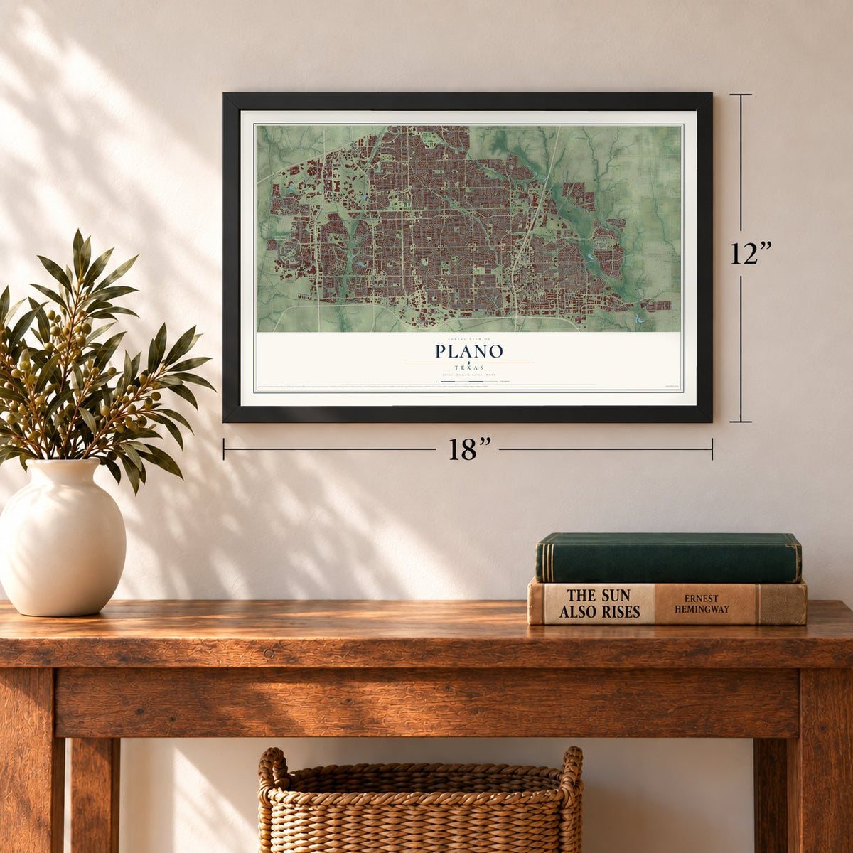
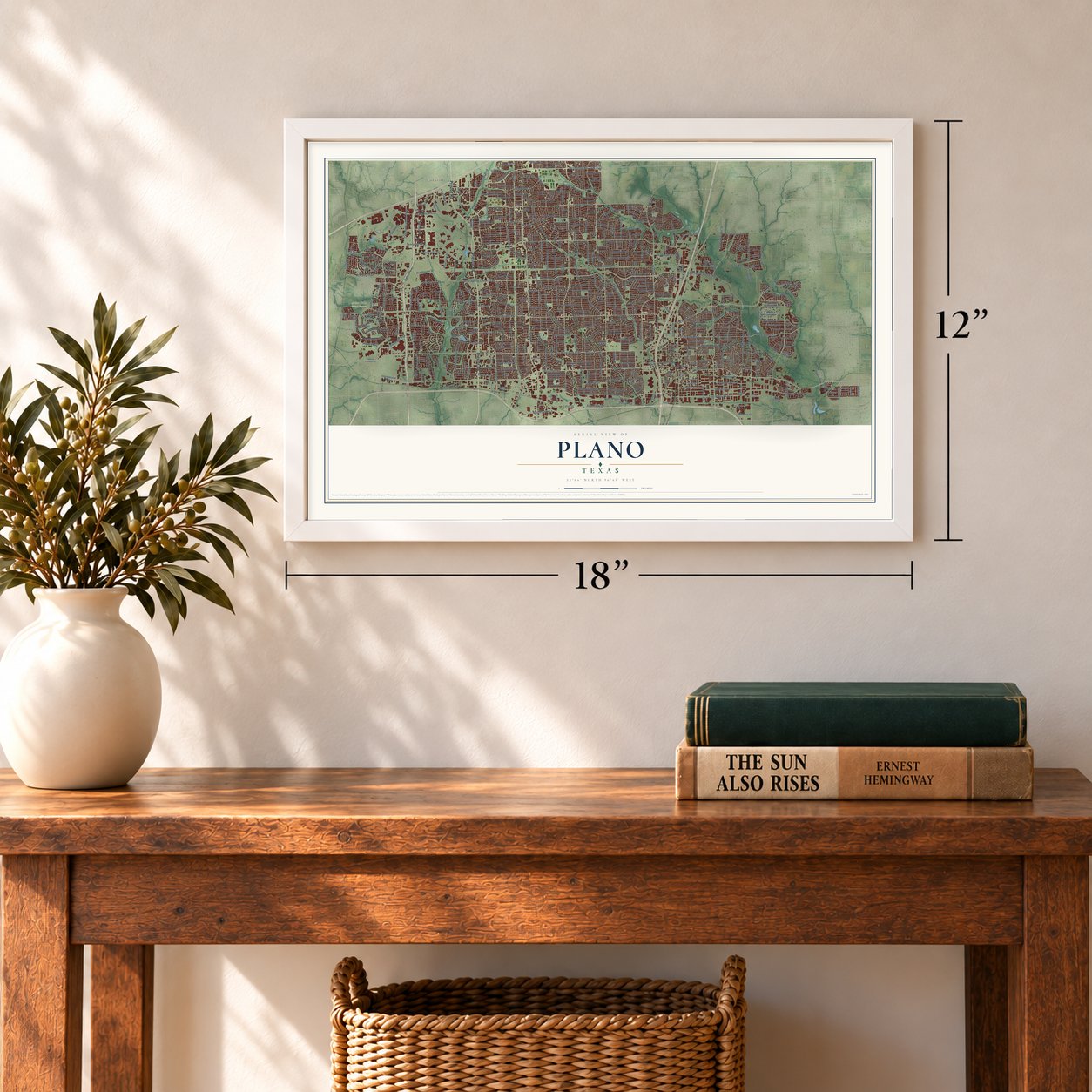
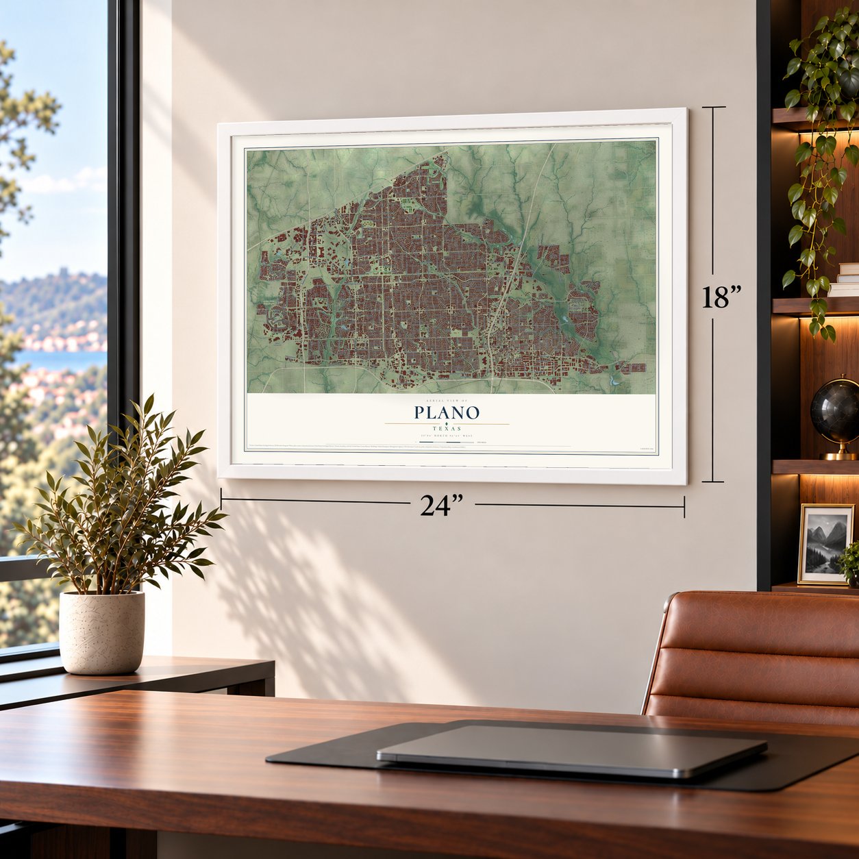
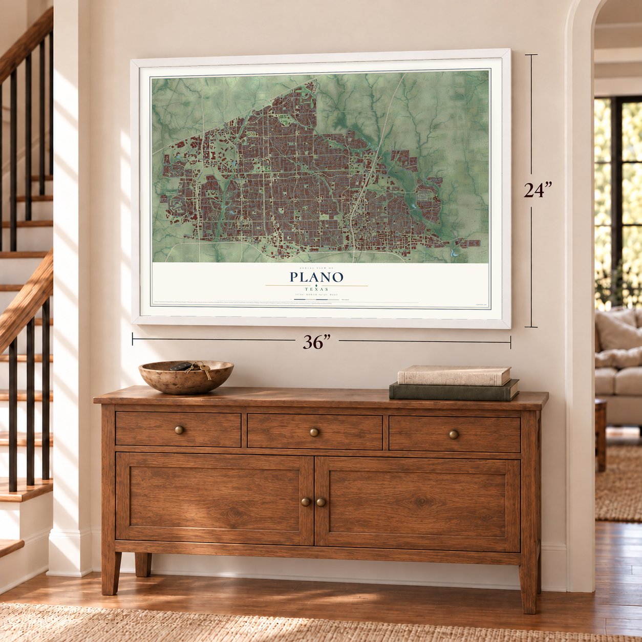
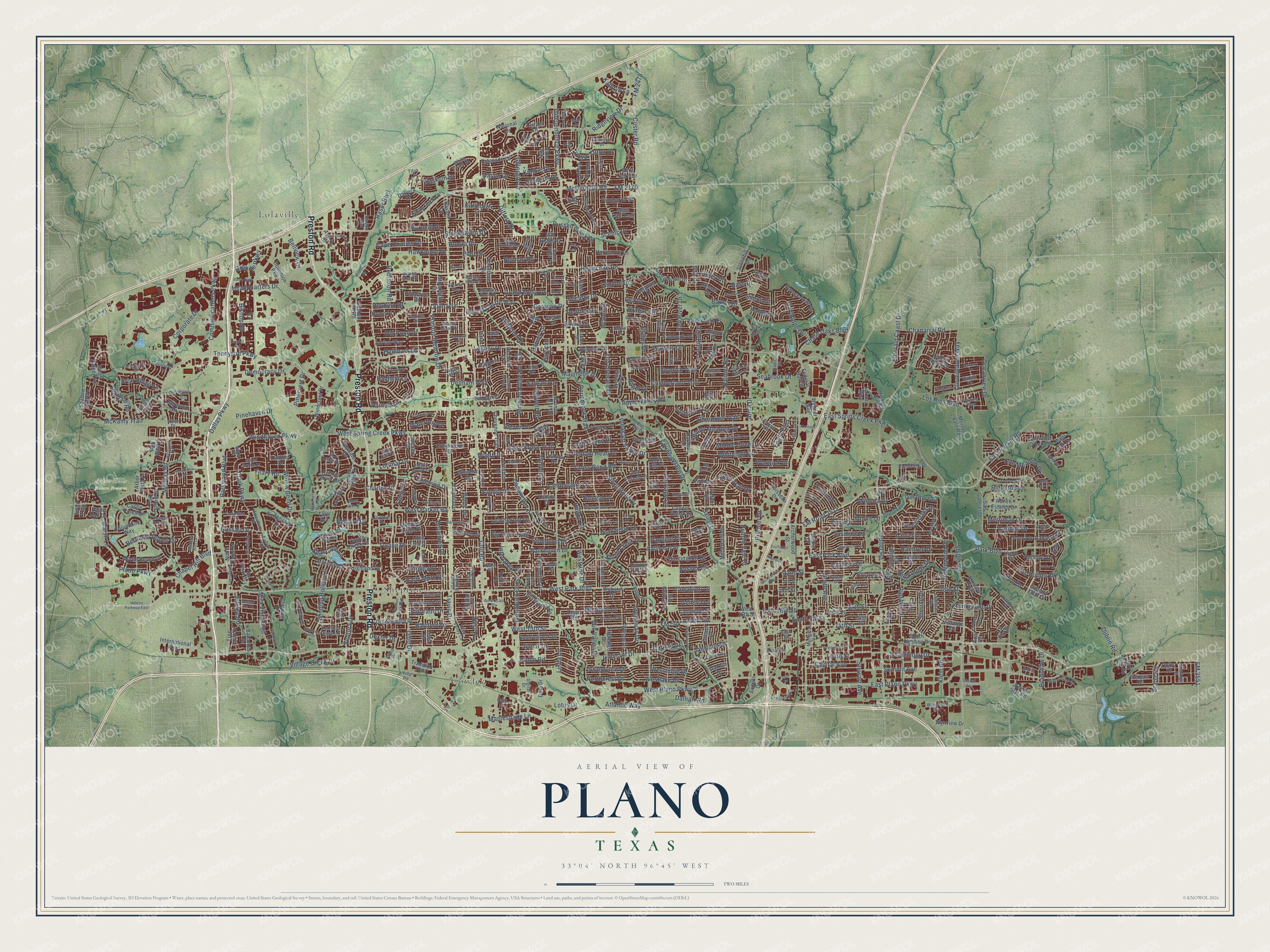
A new map of Plano, Texas, made in 2026 and printed to order on thick archival matte paper.
12" x 18" Archival Matte Print
A Map of Home. A Work of Art.
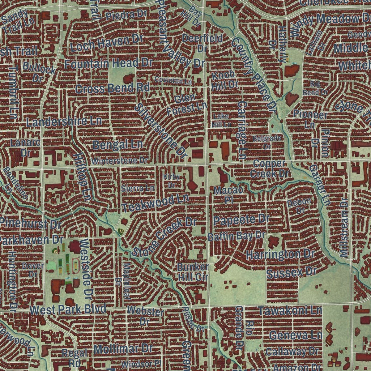
This beautifully detailed map of Plano, Texas was created in 2026 using aerial imagery combined with modern topographical, census, street and landmark data. It's a modern aerial view of Plano in Collin County, Texas, that combines modern data with a vintage aesthetic. Zoom in on the preview and look for your block.
Three ways to hang it
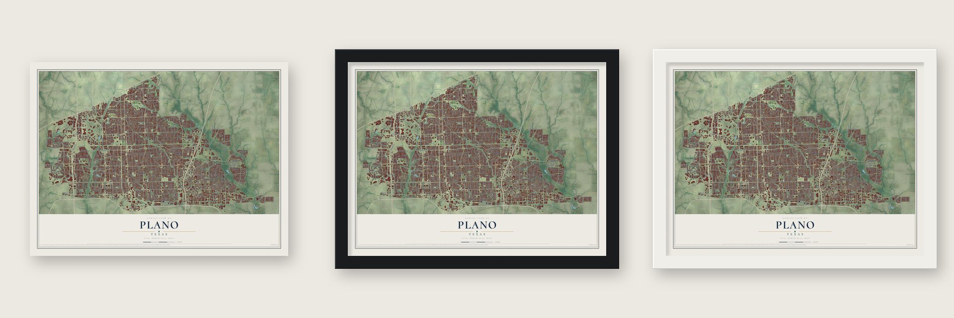
Unframed archival matte, a black wood frame or a white wood frame.
Up close
Real geography. Art worth displaying.
This map was created using accurate cartographic data and authoritative geographic sources, including the U.S. Geological Survey and the Census Bureau. The map brings together terrain, waterways, roads, and building detail. The majority of the streets are labeled, houses are accurately depicted, and the topography is derived from government sources. Combining local data with carefully composed color and shading leads to this beautifully detailed Plano artwork for your wall.
Rather than simply showing street outlines, we’ve included as many of the street names as we could reasonably fit on the map while keeping their names legible. Zoom in on the high resolution preview to see exactly what’s on the map. We truly set out to create a statement piece for anyone who loves Plano. So whether it’s for you, or a gift for someone you love, we hope this map of Plano brings back fond memories.

About Plano, Texas
Plano took shape in southwestern Collin County as settlers and businesses gathered around a mid-19th-century community. Its name, approved for the post office in 1852, reflected the level terrain, and the town incorporated in 1873. Rail connections, rebuilding after the 1881 fire, and rapid growth after 1970 reshaped the farming community; the 2020 census counted 285,494 residents.
- Name and TerrainPostal authorities approved Plano in 1852 after Dr. Henry Dye suggested the Spanish term for "flat" to describe the surrounding land.
- Railroad CrossroadsThe Houston and Texas Central Railway arrived in 1872, and a second railway intersection helped Plano become a retail outlet for area farmers by 1888.
- Fire and RecoveryA fire destroyed 52 buildings in 1881 and briefly left Plano as a tent city, but new markets opened by 1888.
- Population SurgePlano's population rose from 17,872 in 1970 to more than 72,000 in 1980.
- Balloon TraditionPlano hosts balloon races each September and is nicknamed the Balloon Capital of Texas.
Find your street
Names on the Plano map
Every name below is printed on this map. Look for your street, your school, the park where you played, or the pond down the road.
Places and landmarks4
- Arbor Hills Nature Preserve
- Cowley
- Lolaville
- Shepton
Streets and roads555
- Preston Road
- FM 544
- West Plano Parkway
- East Plano Parkway
- 14th Street
- Winding Hollow Lane
- Pleasant Valley Drive
- Bellaire Drive
- West Spring Creek Parkway
- Legacy Drive
- West Parker Road
- Custer Road
- Independence Parkway
- Coit Road
- West Park Boulevard
- Ohio Drive
- Alma Drive
- Parkwood Boulevard
- Hedgcoxe Road
- Dallas Parkway
- Jupiter Road
- McDermott Road
- Tennyson Parkway
- East Park Boulevard
- Los Rios Boulevard
- West 15th Street
- Communications Parkway
- East Parker Road
- FM Road 2514
- Preston Meadow Drive
Show all 555 streets
- Midway Road
- FM 2478
- Ridgeview Drive
- Headquarters Drive
- East Spring Creek Parkway
- Shiloh Road
- Willow Bend Drive
- Windhaven Parkway
- Mapleshade Lane
- 18th Street
- Cross Bend Road
- Rasor Boulevard
- Chase Oaks Boulevard
- Ventura Drive
- Park Boulevard
- North Avenue
- Mission Ridge Road
- Roundrock Trail
- East 15th Street
- Lorimar Drive
- Marsh Lane
- Rainier Road
- Country Place Drive
- Teakwood Lane
- Premier Drive
- Bishop Road
- Old Orchard Drive
- Summit Avenue
- Parkhaven Drive
- Mira Vista Boulevard
- Laurel Lane
- McKamy Trail
- Plano Parkway
- Northcrest Drive
- Westridge Drive
- Woodburn Cors
- Tulane Drive
- Quincy Lane
- Chapel Hill Boulevard
- Robinson Road
- Chaparral Road
- Corporate Drive
- Sherrye Drive
- Rigsbee Drive
- Ridgewood Drive
- FM 2170
- Clark Parkway
- 17th Street
- Tenth Street
- Seabrook Drive
- Maumelle Drive
- Baxter Drive
- Middle Cove Drive
- Russell Creek Drive
- Silverstone Drive
- Charles Place
- Merriman Drive
- Landershire Lane
- Stonehaven Drive
- Atlantic Way
- Cumberland Trail
- Eldorado Drive
- Kathryn Lane
- Granite Parkway
- Pinehurst Drive
- Mollimar Drive
- Early Morn Drive
- Rockbrook Drive
- Gillespie Drive
- Westlake Drive
- Cloverhaven Way
- Mason Drive
- Fountain Head Drive
- Bengal Lane
- Emerald Coast Drive
- Kimble Drive
- Whitehall Drive
- Briarwood Drive
- Cherokee Trail
- Edwards Drive
- Glencliff Drive
- Loch Haven Drive
- Royal Oaks Drive
- Kite Meadow Drive
- Bonita Drive
- Nassau Drive
- Democracy Drive
- Yeary Road
- Grandview Drive
- Micarta Drive
- Village Creek Drive
- Raintree Drive
- Scenic Drive
- Jomar Drive
- Emerson Drive
- Browning Drive
- Los Robles Drive
- Technology Drive
- Robin Road
- Carriage Lane
- Lotus Drive
- Travis Drive
- Stone Creek Drive
- Hawkhurst Drive
- Red River Drive
- Old Pond Drive
- Brand Road
- Bermuda Dunes Drive
- Eagle Pass
- Pinehaven Drive
- East 16th Street
- Usa Drive
- Oceanview Drive
- Ridgetop Lane
- Hearst Castle Way
- Big Horn Trail
- Cape Charles Drive
- Windy Meadow Drive
- Capital Avenue
- Jasmine Lane
- Neiman Road
- Canoncita Lane
- Santana Lane
- Harrington Drive
- Interlaken Drive
- Greenway Drive
- Steven Drive
- Reunion Drive
- Gifford Drive
- Hilltop Lane
- Dalhart Road
- Denham Way
- Ringgold Lane
- Dublin Road
- Wells Drive
- Timberline Drive
- Sage Brush Trail
- Camino Drive
- Oak Ridge Drive
- Hallmark Drive
- Swanson Drive
- Leathertop Drive
- Nest Place
- Burnhill Drive
- Linda Lane
- Fairfield Drive
- Royal Troon Drive
- London Drive
- Briar Ridge Lane
- Geneva Lane
- Apple Valley Road
- Bass Drive
- Stilwell Road
- Pinecrest Drive
- Hartford Drive
- Tawakoni Lane
- Pebble Vale Drive
- Grand Mesa Drive
- Bradshaw Drive
- Leon Drive
- Janwood Drive
- Mill Valley Drive
- Winona Drive
- Stone Trail Drive
- Jubilee Road
- Carmel Drive
- Westside Drive
- Felix Drive
- Spanish Trail
- Tumbril Lane
- Stewart Avenue
- Seascape Lane
- Waterford Drive
- Avalon Drive
- Bellview Drive
- Wyeth Drive
- Warwick Drive
- Old Gate Road
- Papeete Drive
- Amethyst Lane
- Sandia Drive
- Sharps Drive
- Bowie Drive
- Redfield Drive
- Pilot Drive
- Hawken Drive
- Walters Drive
- Waskom Drive
- Emily Drive
- Sussex Drive
- Brabant Drive
- Caravan Drive
- Simon Drive
- Baldwin Lane
- Ruger Drive
- Finley Drive
- Harvey Lane
- Parnell Lane
- Lavaca Drive
- Moore Drive
- Dexter Drive
- Klein Road
- Iola Drive
- FM 2551
- 22nd Street
- Apt Drive
- Mill Ridge Drive
- Shadow Rock Drive
- Old Shepard Place
- Country Club Drive
- Morton Vale Road
- Baywater Drive
- Highland Drive
- San Gabriel Drive
- Timber Brook Drive
- International Parkway
- Sailmaker Lane
- Glen Forest Lane
- Regal Road
- Oak Grove Drive
- Bunker Hill Circle
- North Star Road
- Silver Creek Drive
- Baffin Bay Drive
- Windcrest Drive
- 15th Place
- 19th Street
- Coldwater Creek Lane
- Estacado Lane
- Ranch Estates Drive
- Wilson Drive
- Highedge Drive
- Kesser Drive
- Knob Hill Drive
- Iowa Drive
- Sandy Trail Lane
- Silverwood Lane
- Case Drive
- Kings Ridge Trail
- Piedra Drive
- Myrtle Beach Drive
- Columbine Way
- Hatherly Drive
- Cheyenne Trail
- Greenfield Drive
- Bronze Leaf Drive
- 13th Street
- South Rigsbee Drive
- Webster Drive
- Garner Lane
- California Trail
- Bonniebrook Drive
- Red Wolf Lane
- Rio Grande Drive
- Huntington Drive
- Stoney Point Drive
- Trellis Lane
- Pioneer Lane
- Georgetown Drive
- Kimbrough Lane
- Trailridge Drive
- Rochelle Drive
- White Rock Lane
- Amazon Drive
- Park Vista Road
- Notre Dame Drive
- Mariners Drive
- Tarkio Road
- Millstream Drive
- Natalie Drive
- Cimmaron Drive
- Deerfield Drive
- Copper Creek Drive
- Dominion Parkway
- Harrisburg Lane
- Northbrook Drive
- Creekstone Drive
- Cleveland Drive
- Runnin River Drive
- Lone Tree Drive
- Moonlight Drive
- Callaway Drive
- Archerwood Street
- Falmouth Drive
- Wilshire Drive
- Indian Trail
- Wynview Drive
- Blossom Trail
- Angelina Drive
- Louis Drive
- Polstar Drive
- Lanarc Drive
- Balcones Drive
- Sky Lake Drive
- Hazeltine Drive
- Dobie Drive
- Fieldlark Drive
- Adrian Way
- Saltburn Drive
- Trailwood Drive
- Dalston Lane
- Dunwick Drive
- Meadow Ridge Drive
- West 16th Street
- Anns Way
- Castle Pines Drive
- Havant Lane
- Tree Farm Drive
- Belgium Drive
- Bent Horn Drive
- Terrace View Lane
- National Drive
- Oak Hollow Drive
- Milano Drive
- Virginia Drive
- Matilda Drive
- Hutch Drive
- Firewheel Drive
- Accent Drive
- Whistler Drive
- Ruisseau Drive
- Dalrock Drive
- Bullock Drive
- Wagner Way
- Tradition Trail
- Barbican Drive
- Texana Way
- Hillridge Drive
- Stonehill Drive
- Mesa Oak Trail
- Floyd Drive
- Macao Place
- Janice Drive
- 14th Place
- La Paz Drive
- Breton Drive
- Castle Creek Court
- Lindsey Drive
- Arbor Vista Drive
- Tate Avenue
- Cliffview Drive
- Seneca Drive
- Polo Lane
- Drexel Drive
- Home Place
- Tall Oak Drive
- Burr Oak Drive
- Tarrant Lane
- Data Drive
- Llano Drive
- Hickory Hill Drive
- Valdez Court
- Federal Hall Street
- Colby Drive
- Angels Drive
- Garden Hill Road
- Pinion Drive
- Vero Drive
- Eagle Vail Drive
- Oakhill Drive
- Riley Drive
- Twist Trail
- Amy Lane
- Nash Lane
- Ada Lane
- Ute Court
- Aspen Glen Road
- Winterstone Drive
- Peachtree Lane
- Municipal Avenue
- Lookout Trail
- Goodwin Drive
- High Meadows Drive
- Bandolino Lane
- Eden Valley Lane
- Ranchero Road
- Aqua Springs Drive
- Barnsley Drive
- Jenkins Drive
- Twin Lakes Way
- Corinthian Bay Drive
- Mulholland Drive
- Norman Drive
- Eleventh Street
- Mapleleaf Drive
- Pheasant Run Road
- Cannes Drive
- White Porch Road
- Executive Drive
- Pondview Drive
- Old Westbury Lane
- Windsor Place
- Flowing Way
- Staten Island Drive
- Filmore Drive
- Stone Ridge Drive
- Eastwick Lane
- Bay Hill Drive
- Burningtree Lane
- Precision Drive
- Josephine Street
- Sylvan Drive
- Spring Valley Lane
- Frontier Lane
- Chaney Lane
- Angel Fire Drive
- Latham Drive
- Willow Lane
- Daybreak Trail
- Geiberger Drive
- Wynwood Drive
- Stadium Drive
- Fairfax Hill Drive
- Sonora Drive
- Amesbury Drive
- Rustic Drive
- Newbury Lane
- Linden Drive
- Pebble Brook Lane
- Hillside Drive
- Chicota Drive
- Morning Dove Drive
- Rolling Hills Drive
- Gordon Oaks Drive
- American Drive
- Seltzer Drive
- Sierra Lane
- Coolidge Street
- Spire Lane
- Falcon Drive
- Old Alma Road
- Durham Drive
- Anders Lane
- Dottie Drive
- Evening Sun Drive
- Irvine Drive
- Virgo Drive
- Debon Drive
- Global Lane
- Patriot Drive
- Bull Run Drive
- Price Drive
- Daniel Road
- Empire Boulevard
- Dover Drive
- Wight Street
- Digital Drive
- Tracy Road
- Adriel Lane
- Nettle Drive
- Allied Drive
- Mott Drive
- Waco Drive
- Titus Circle
- Faith Lane
- Villa Road
- Hebron Parkway East
- Preston Park Boulevard
- Westwood Drive
- Decator Drive
- Danbury Lane
- San Mateo Drive
- Hawthorne Lane
- Glenhollow Drive
- Memorial Lane
- Lost Creek Drive
- East Central Parkway
- Maverick Drive
- Silver Lake Drive
- Atlanta Drive
- Lake Hill Lane
- Patrick Lane
- Misted Breeze Drive
- Plantation Lane
- Timothy Drive
- Glenwood Lane
- Gannon Drive
- Covinton Lane
- Stanmore Lane
- Postbridge Drive
- Channel Isle Drive
- Daly Drive
- Sterling Lane
- Kensington Drive
- Belgrade Drive
- Watch Hill Drive
- Deleon Drive
- Fawnwood Drive
- Baltic Boulevard
- Larchmont Drive
- Exchange Drive
- Daystar Drive
- Fallkirk Drive
- Westmont Drive
- 20th Street
- Laser Lane
- Webley Drive
- Bluegrass Drive
- Heritage Drive
- Bearegard Lane
- Plymouth Drive
- Highview Drive
- Hinton Drive
- Coach House Lane
- Big Bend Drive
- Stain Glass Drive
- Lottie Lane
- Camrose Drive
- Breanna Way
- Wildbriar Drive
- Republic Drive
- Texas Drive
- Gallant Fox Lane
- Bella Vista Drive
- Meadow Hills Lane
- Cypress Point Drive
- Kirby Drive
- Buena Vista Drive
- Colt Drive
- Taylor Drive
- Mura Drive
- Lois Lane
- Ellery Avenue
- Benoit Drive
- Glory Lane
Names are listed as they appear on the printed map. Zoom into the product photos to find them.
The art of mapping a place
How This Map Was Made
Real places. Remarkable detail. Discover the layers that turn geographic data into a map of home.

The view from above
Aerial imagery reveals the character of the land: woodland, open fields, and the patterns of a place.

The shape of the land
Elevation data brings hills, valleys, and subtle changes in the landscape into view.

The details of home
Roads, waterways, and building footprints come together to make the map feel unmistakably local.

Geography becomes art
Considered color, shading, and typography bring the layers together in a map made for your wall.


Process illustrated with Mendon, Massachusetts. Aerial imagery: USDA NAIP. Terrain: USGS 3D Elevation Program. Map details and finished artwork: KNOWOL.
The Details
About This Print
Choose an archival matte print, or a black or white Ayous wood frame. The archival matte print is unframed.
Select your size and finish above to see the matching product image and price.
Materials & Craftsmanship
A contemporary map with the character of a classic atlas, printed on archival matte paper. Optional frames are made from Ayous wood.
Your printed map does not include the watermark shown in the full-map preview.
Shipping & Delivery
Free shipping within the United States. Every print is made to order in the USA.
Buying a gift? Add a note in your cart and we'll include it. We never put prices in the package.
Prints ship within 2 to 3 business days. Allow 7 to 10 days total from ordering for delivery. Timing may vary during holidays or periods of high order volume.
Read our shipping policy.
Returns and damaged prints
Each print is made to order. Change-of-mind refunds are not available after production.
If your print arrives damaged, misprinted or incorrect, contact support@knowol.com within 30 days of receiving it. Include your order number, photos and a description of the issue.
Read our full refund and replacement policy. For questions about your order, email support@knowol.com.
Find your town
Looking for another city?
Find a map of home in our Texas collection.
Nearby
Maps of towns near Plano
Know someone from one of these towns? Their map makes a great gift.
 Allen
Allen, Texas
From $39.99See the map
 Richardson
, Texas
From $39.99See the map
 Parker
, Texas
From $39.99See the map
More maps nearby: Addison, Hebron, Frisco, Murphy and The Colony.