
Search for another town



Free U.S. delivery 7 to 10 days after you order
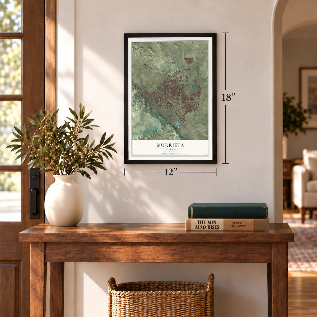
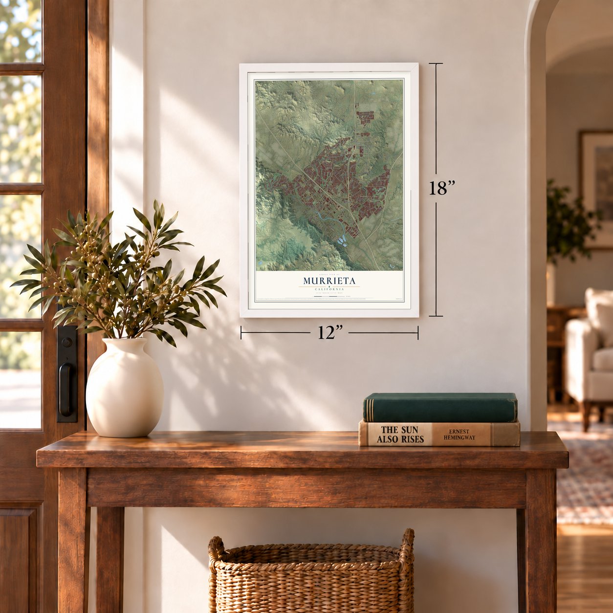
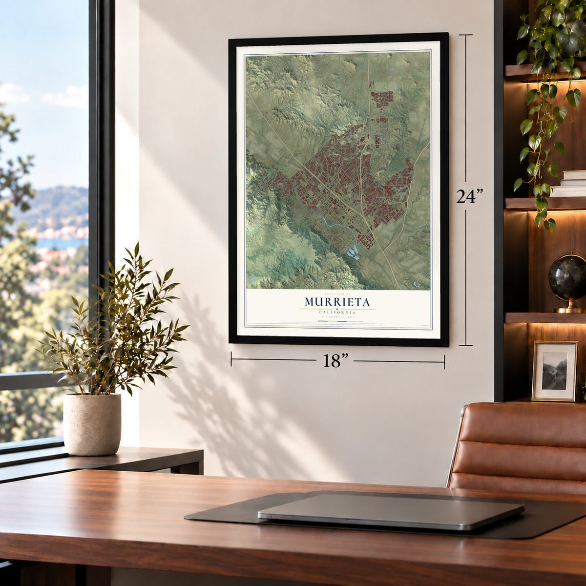
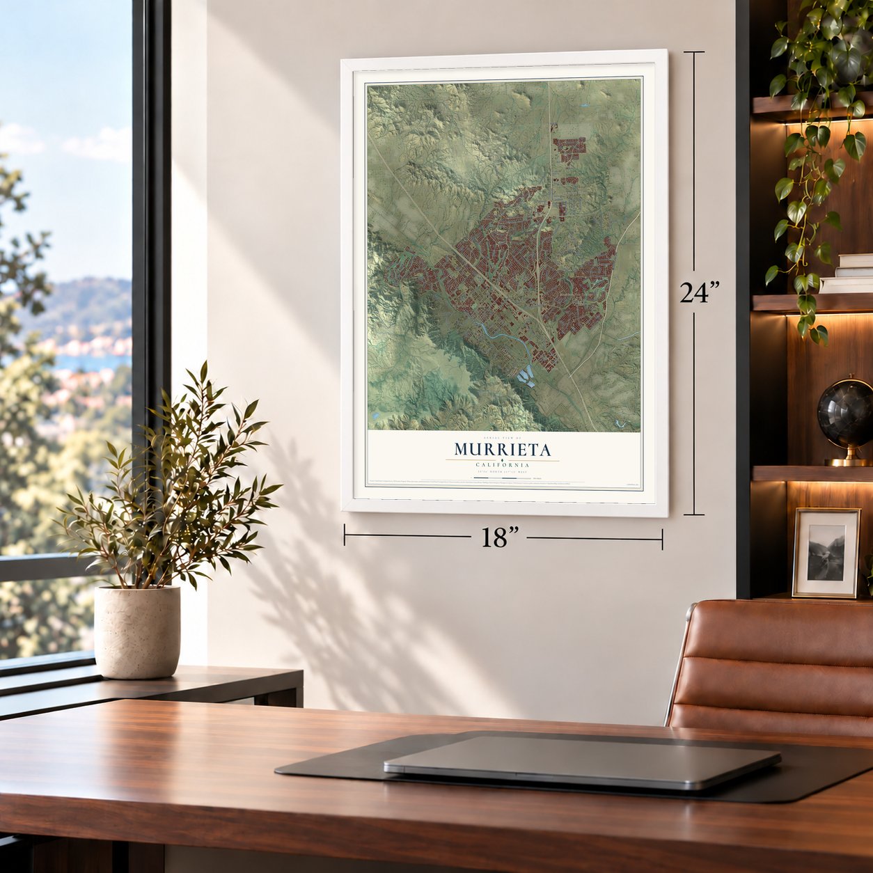
Murrieta, California Map Art
A new map of Murrieta, California, made in 2026 and printed to order on thick archival matte paper.
12" x 18" Archival Matte Print
A Map of Home. A Work of Art.
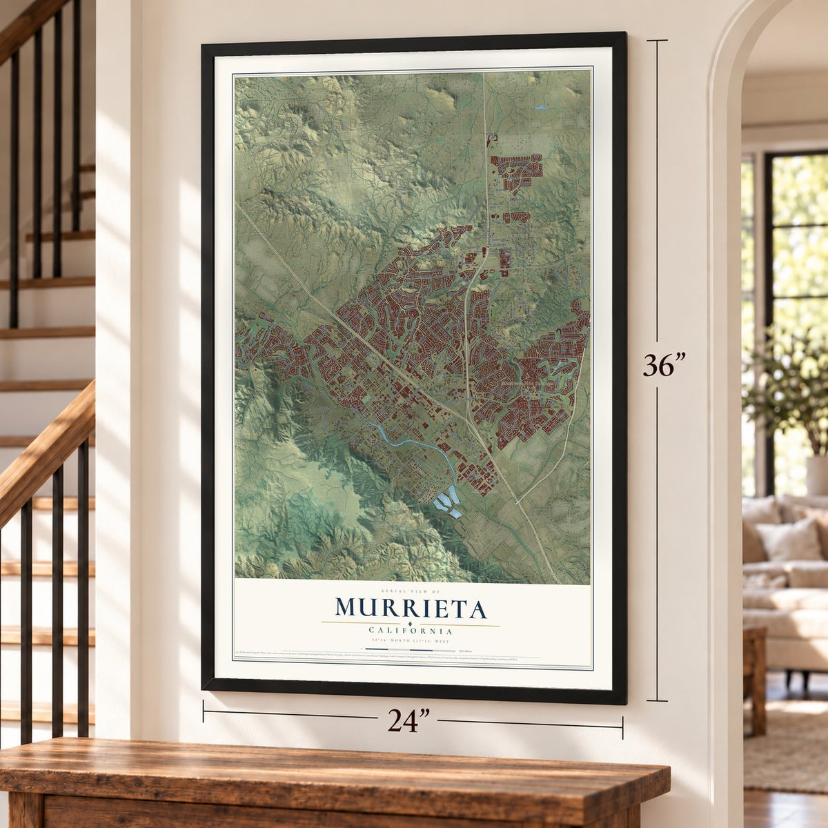
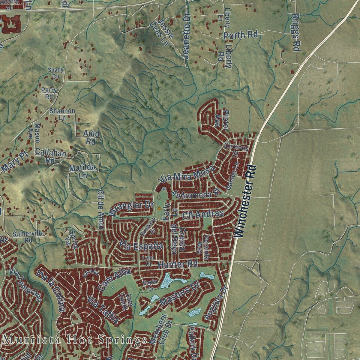
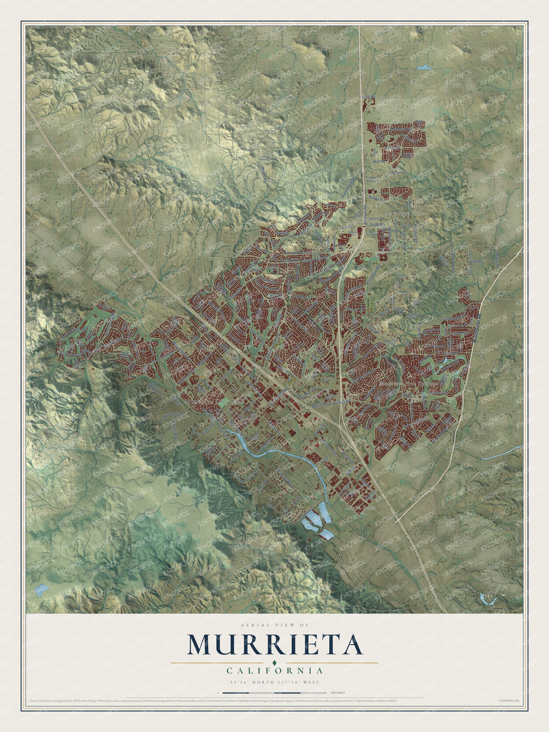
Explore Murrieta, California from a whole new perspective. Created using aerial imagery and detailed geographic data, this map captures Murrieta building by building, with labeled streets, familiar landmarks, and shaded topographical relief that highlights the natural contours of the landscape.
Combining modern data with the timeless character of a vintage atlas, this map is just as interesting up close as it is beautiful on the wall. Whether you grew up in Murrieta, spent memorable years there, or call it home today, this unique map is a great way to celebrate a place that means something to you. Zoom in on the preview to look for your street, and then order a print to put your memories on the wall.
Three ways to hang it
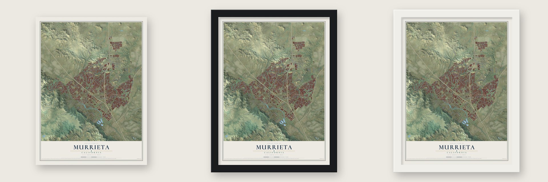
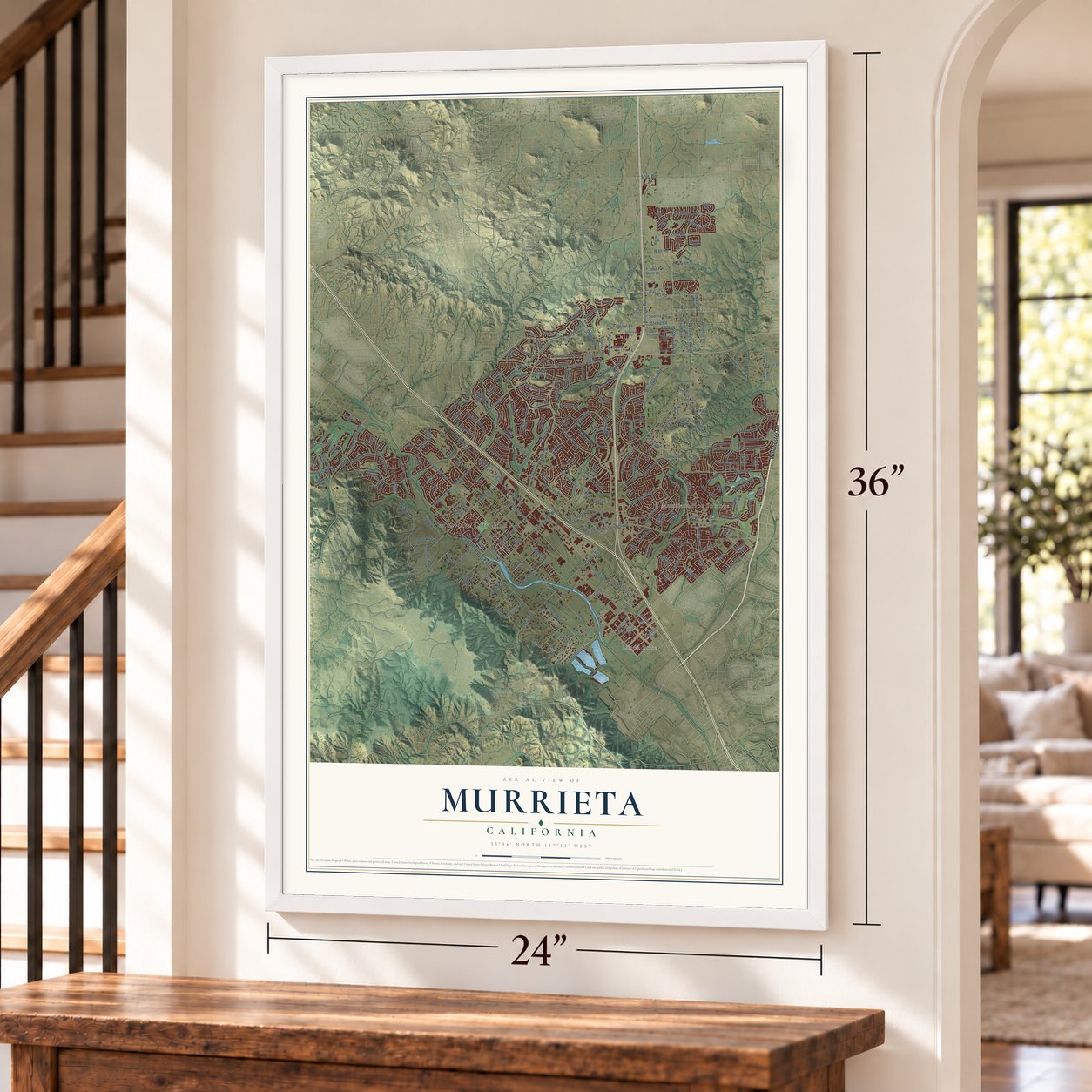
Unframed archival matte, a black wood frame or a white wood frame.
Up close
Geography Worth Displaying
This map was created using accurate cartographic data and authoritative geographic sources, including the U.S. Geological Survey and the Census Bureau. The map brings together terrain, waterways, roads, and building detail. The majority of the streets are labeled, houses are accurately depicted, and the topography is derived from government sources. Combining local data with carefully composed color and shading leads to this beautifully detailed Murrieta artwork for your wall.
Rather than simply showing street outlines, we’ve included as many of the street names as we could reasonably fit on the map while keeping their names legible. Zoom in on the high resolution preview to see exactly what’s on the map. We truly set out to create a statement piece for anyone who loves Murrieta. So whether it’s for you, or a gift for someone you love, we hope this map of Murrieta brings back fond memories.
Read the story behind this map of Murrieta, California from 2026.

About Murrieta, California
Murrieta is a city of 110,949 people in southwestern Riverside County. Long before ranchers arrived, the Luiseño people had a village here called 'Avaa'ax. On June 9, 1873, Juan and Ezequiel Murrieta joined Domingo Pujol and Francisco Sanjurjo to buy the Rancho Pauba and Rancho Temecula land grants, 52,000 acres in all. Ezequiel went home to Spain and left the land to Juan, who brought 7,000 sheep that year to graze the valley's meadows.
When the partnership broke up in 1876, the brothers kept 15,000 acres, the northern half of Rancho Temecula. On April 28, 1882, they gave the California Southern Railroad a strip one hundred feet wide so it could lay track across the valley. Two years later Juan Murrieta sold about 14,500 acres to the Temecula Land and Water Company, which mapped out a townsite beside the tracks, and the town took his name. A depot opened in 1887, and by 1890 about 800 people lived here.
- Trains, then a quiet spellThe railroad and the hot springs drew tourists, and the town lived on their visits. When the trains stopped coming in 1935, the visitors dwindled, and Murrieta settled into life as a small country town. US Route 395 ran through it, but the next boom waited for Interstate 15 in the early 1980s. By the late 1980s new neighborhoods were going up for families from San Diego and Orange counties.
- A city since July 1, 1991Residents began pushing for city status in 1990, and Murrieta incorporated on July 1, 1991. It had grown from 2,200 people in 1980 to 24,000 by then. The 2010 census counted 103,466, which made it the biggest city in its corner of the county.
- A Bible college at the springsCalvary Chapel Bible College held classes at the old Murrieta Hot Springs Resort from 1994 until 2022. Calvary Chapel Costa Mesa owns about 50 acres of the site and spent millions of dollars fixing up and rebuilding the resort's old rooms.
- Two presidents on the courseGerald Ford and Ronald Reagan have both played the Bear Creek Golf and Country Club, a Jack Nicklaus design. Robert Trent Jones, Sr. designed the city's other big course, the Golf Club at Rancho California.
- Olympic gold from local schoolsTennis star Lindsay Davenport, who won Olympic gold, was in the Murrieta Valley High School class of 1994. Sprinter Michael Norman, another Olympic champion, ran track at Vista Murrieta High School.
Find your street
Names on the Murrieta map
Every name below is printed on this map. Look for your street, your school, the park where you played, or the pond down the road.
Places and landmarks4
- Murrieta City Hall
- Linda Rose
- Antelope Hills
- Murrieta Hot Springs
Streets and roads267
- Winchester Road
- Hayes Avenue
- Monroe Avenue
- Mary Place
- Lemon Street
- Briggs Road
- Pabesu Road
- Clinton Keith Road
- Jefferson Avenue
- Whitewood Road
- Adams Avenue
- Los Alamos Road
- Washington Avenue
- Jackson Avenue
- Murrieta Hot Springs Road
- Nutmeg Street
- Madison Avenue
- Antelope Road
- Colony Drive
- Kalmia Street
- Hancock Avenue
- Keller Road
- California Oaks Road
- Juniper Street
- Date Street
- Greer Road
- Cll del Oso Oro
- Menifee Road
- Las Brisas Road
- Via Mira Mosa
Show all 267 streets
- Hunter Road
- Ivy Street
- Elm Street
- Fig Street
- Meadowlark Lane
- Via Princesa
- Mapleton Avenue
- Guava Street
- North Bear Creek Drive
- Hawthorn Street
- Murrieta Oaks Avenue
- Lincoln Avenue
- Scenic View Drive
- Torrey Pines Road
- Poinsettia Street
- Linnel Lane
- Walt Road
- New Clay Street
- Douglass Avenue
- Baxter Road
- Alta Murrieta Drive
- Vis Murrieta
- Blackthorne Drive
- Bear Creek Drive South
- Via Moreno
- Avenue Acacias
- Porth Road
- Masters Drive
- Magnolia Street
- Cll Andras
- Daphne Drive
- Cadenza Drive
- Darcy Street
- Brown Street
- Hollingsworth Drive
- Abelia Street
- Bonaire Way
- Via Segovia
- Ranch House Street
- Via la Colina
- Via Taffia
- Embee Way
- Morning Glory Drive
- Cherrywood Drive
- Carlton Oaks Street
- De Luz Road
- Falconer Drive
- First Avenue
- Hoover Street
- Wood Kott Drive
- Banyan Street
- Stepp Road
- Branwin Street
- Wrangler Drive
- Busman Road
- Via Espada
- Cll Ortega
- Jeanette Drive
- Jaylene Street
- Wright Road
- Duster Road
- Lee Lane
- Cam Alba
- Lenox Lane
- Celia Road
- Medina Court
- Troyes Lane
- Pantera Court
- Pumpkin Street
- Oxford Drive
- Corning Place
- Arron Court
- Via Olivia
- Cll Real
- Scott Road
- Augusta Drive
- Morning Dove Lane
- Cellular Springs Drive
- Madison Street
- Margarita Road
- Capra Road
- Sugarberry Lane
- Rocky Glen Place
- Members Club Drive
- Callahan Road
- Saratoga Springs Place
- Sky High Drive
- Via Temprano
- Chamomile Street
- Via Alisol
- Avenue Miguel Oeste
- Wild Flower Drive
- Palm Tree Lane
- Golden Pheasant Lane
- Leafwood Drive
- Cll de Amor
- Avenue Florita
- Matilda Lane
- Nighthawk Way
- Robards Way
- Andromeda Street
- Liberty Road
- Calle Estancia Road
- Bahama Way
- Somers Road
- Via Reata
- Tinderbox Way
- Dry Creek Road
- Auto Mall Parkway
- Saint Raphael Drive
- Village Walk Place
- Banbury Court
- Avenue Arconte
- Joshua Tree Court
- Mitchell Road
- Jessie Ceas Lane
- Notting Hill Road
- Clearview Street
- Shoal Creek Drive
- Corte Albara
- Via Espana
- Placer Creek Street
- Cll del Lago
- Via Las Flores
- Joan Dunn Lane
- Sonata Drive
- Provence Drive
- Via Astuto
- Toulon Drive
- Via Las Lomas
- Cresta del Reyo
- Crystal Aire Court
- Azara Street
- Eastman Drive
- Sweet William Lane
- Chatenay Lane
- Manista Way
- Sandy Avenue
- Pictor Avenue
- Falkirk Drive
- Holsted Avenue
- Kingwood Road
- Jenny Lane
- Via Marisa
- Fifth Street
- Trefoil Street
- Edna Road
- Plum Avenue
- Douglas Avenue
- Shaw Lane
- Epple Street
- Grizzly Ridge Drive
- Arendt Lane
- Sierra Lane
- Country Mill Road
- Malbec Street
- Kara Street
- Corte Gata
- Shady Glen Street
- Ware Street
- Roland Road
- Jerome Lane
- Falcon Way
- Valor Drive
- Early Lane
- Auld Road
- Ada Avenue
- Vineyard Parkway
- Copper Craft Drive
- McElwain Road
- Horsetail Street
- Grand View Drive
- Catt Road
- Sunrose Drive
- Sycamore Creek Avenue
- Spinning Wheel Drive
- Cape Aire Way
- Shannon Lane
- Liberty Lane
- Marco Polo Street
- Franklin Avenue
- Hillside Trail Drive
- Bending Oak Court
- Jerry Allen Lane
- Galileo Lane
- Savanna Way
- Somerville Road
- Mason Avenue
- Skypark Lane
- Veranda Way
- Corte Emerado
- Circinus Street
- Delaney Circle
- Aquilla Avenue
- Weston Hills Drive
- Warner Place
- Red Bluff Place
- Azalea Lane
- Spring Vw
- Agave Way
- Via Pera
- Via Cadiz
- Perry Road
- Pearl Drive
- Cam Cinife
- Second Avenue
- Via de Gema Linda
- Chisolm Trail
- Lafayette Drive
- Montanya Place
- Walsh Center Drive
- Quail Ridge Drive
- Scooter Way
- Medical Center Drive
- Via Serrano
- Shauna Charmain Lane
- Sweetspire Terrace Place
- Quintana Drive
- Cll Alta
- Deep Wood Drive
- Grizzy Ridge Drive
- Ashwood Lane
- Aspen Drive
- Socorro Street
- Canyon Hills Way
- Carrigan Road
- Corinth Drive
- Gloriosa Place
- Lynn Court
- Via Las Quintas
- Euclid Street
- Mance Street
- Shady Circle
- Eagle Drive
- Taft Court
- Via Lar
- Aviv Court
Names are listed as they appear on the printed map. Zoom into the product photos to find them.
The art of mapping a place
How This Map Was Made
Real places. Remarkable detail. Discover the layers that turn geographic data into a map of home.

The view from above
Aerial imagery reveals the character of the land: woodland, open fields, and the patterns of a place.

The shape of the land
Elevation data brings hills, valleys, and subtle changes in the landscape into view.

The details of home
Roads, waterways, and building footprints come together to make the map feel unmistakably local.

Geography becomes art
Considered color, shading, and typography bring the layers together in a map made for your wall.


Process illustrated with Mendon, Massachusetts. Aerial imagery: USDA NAIP. Terrain: USGS 3D Elevation Program. Map details and finished artwork: KNOWOL.
The Details
About This Print
Choose an archival matte print, or a black or white Ayous wood frame. The archival matte print is unframed.
Select your size and finish above to see the matching product image and price.
Materials & Craftsmanship
A contemporary map with the character of a classic atlas, printed on archival matte paper. Optional frames are made from Ayous wood.
Your printed map does not include the watermark shown in the full-map preview.
Shipping & Delivery
Free shipping within the United States. Every print is made to order in the USA.
Buying a gift? Add a note in your cart and we'll include it. We never put prices in the package.
Prints ship within 2 to 3 business days. Allow 7 to 10 days total from ordering for delivery. Timing may vary during holidays or periods of high order volume.
Read our shipping policy.
Returns and damaged prints
Each print is made to order. Change-of-mind refunds are not available after production.
If your print arrives damaged, misprinted or incorrect, contact support@knowol.com within 30 days of receiving it. Include your order number, photos and a description of the issue.
Read our full refund and replacement policy. For questions about your order, email support@knowol.com.
Find your town
Looking for another city?
Find a map of home in our California collection, or any town in the country.
Nearby
Maps of towns near Murrieta
Know someone from one of these towns? Their map makes a great gift.
 Wildomar
, California
From $39.99See the map
 French Valley
, California
From $39.99See the map
 Temecula
, California
From $39.99See the map
More maps nearby: Menifee, Canyon Lake, Lake Elsinore, Lakeland Village and Rainbow.