
Search for another town





Free U.S. delivery 7 to 10 days after you order
Nixa, Missouri Map Art
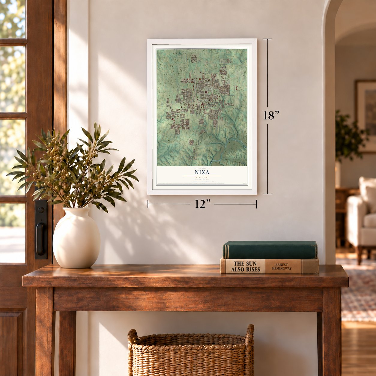
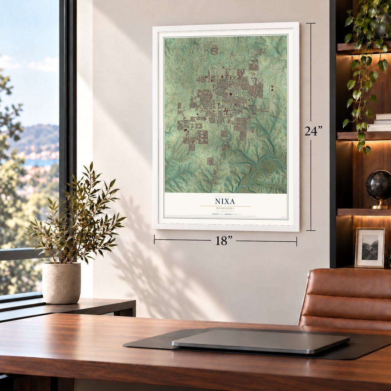
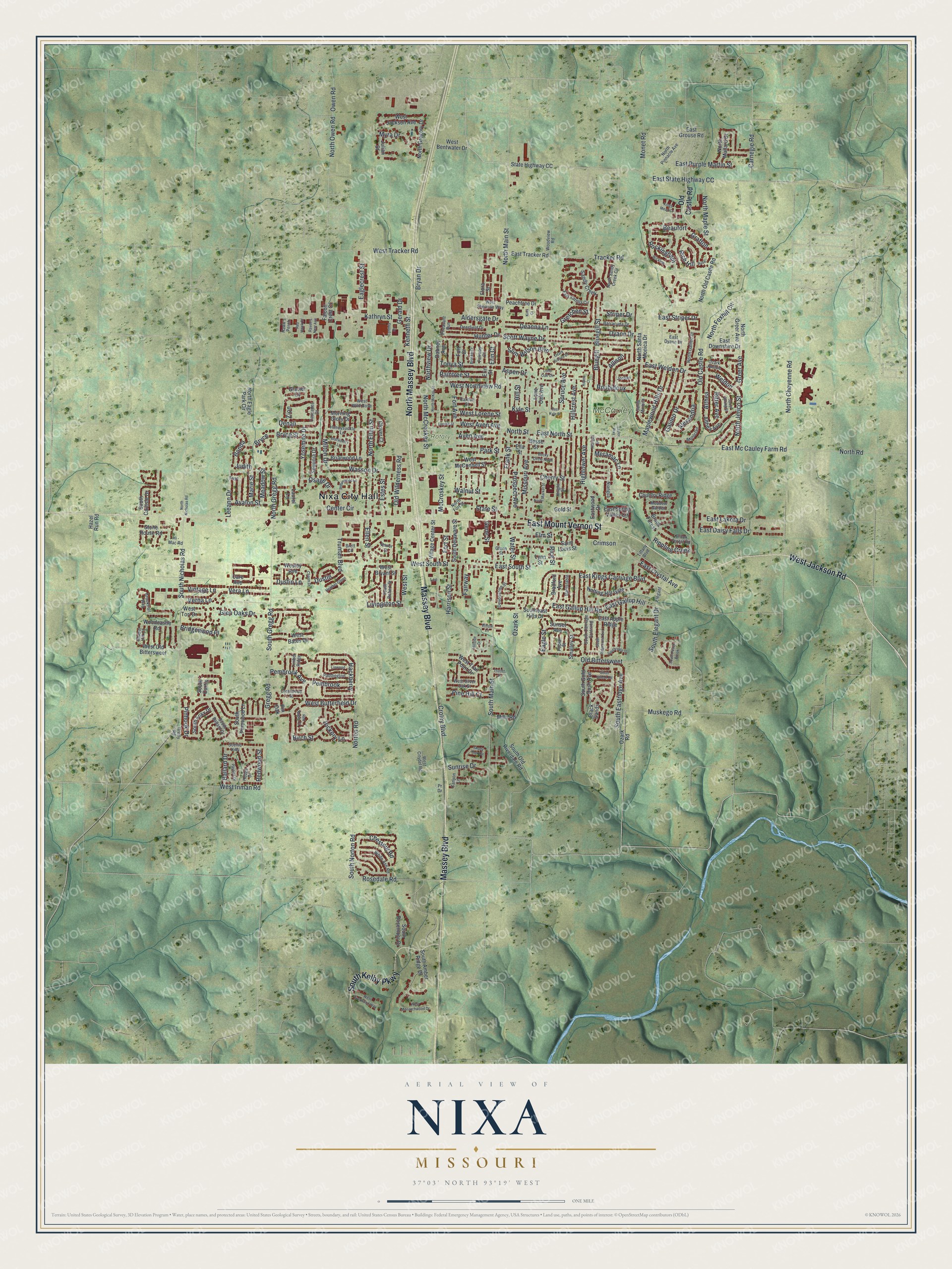
A new map of Nixa, Missouri, made in 2026 and printed to order on thick archival matte paper.
12" x 18" Archival Matte Print
A Map of Home. A Work of Art.
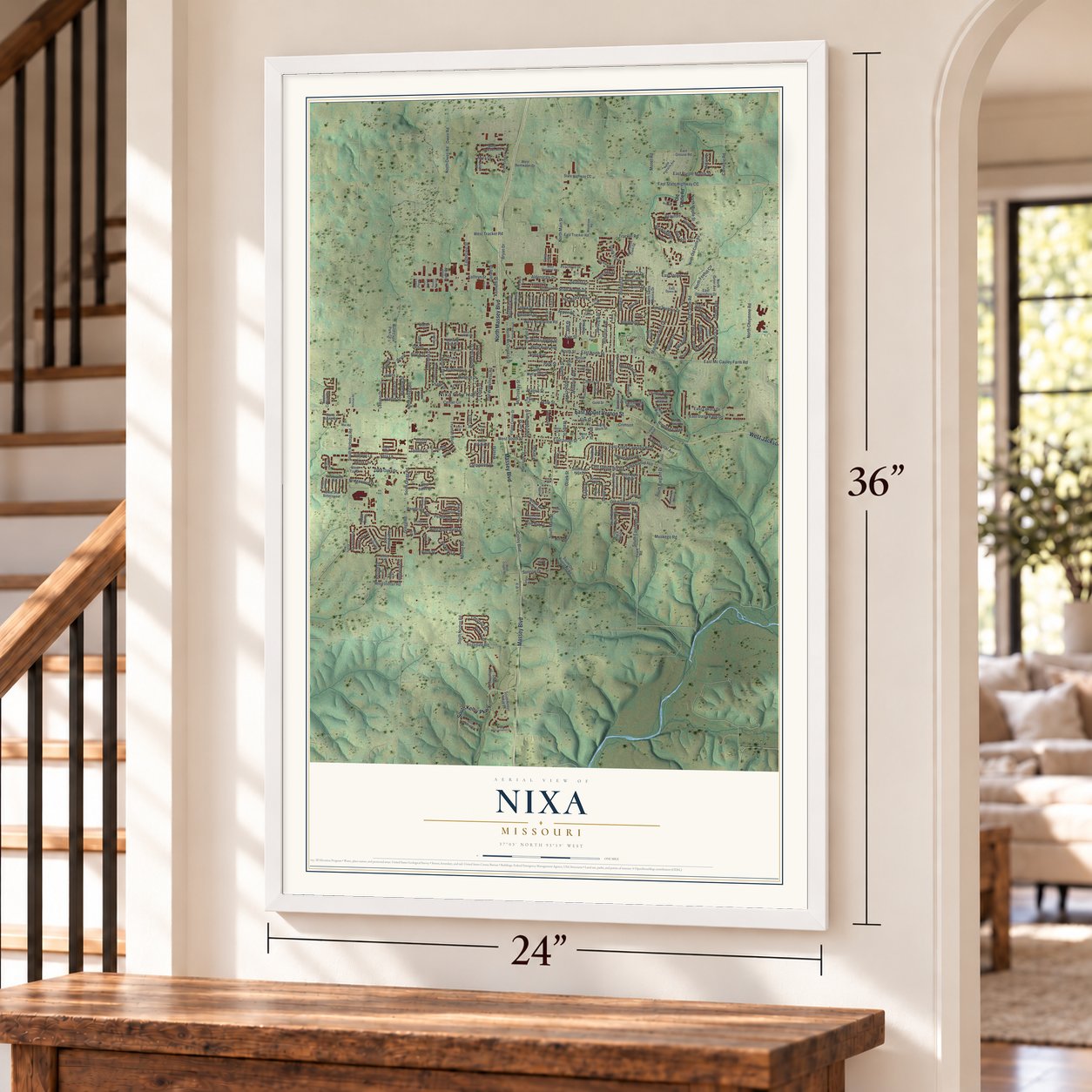
Explore Nixa, Missouri from a whole new perspective. Created using aerial imagery and detailed geographic data, this map captures Nixa building by building, with labeled streets, familiar landmarks, and shaded topographical relief that highlights the natural contours of the landscape.
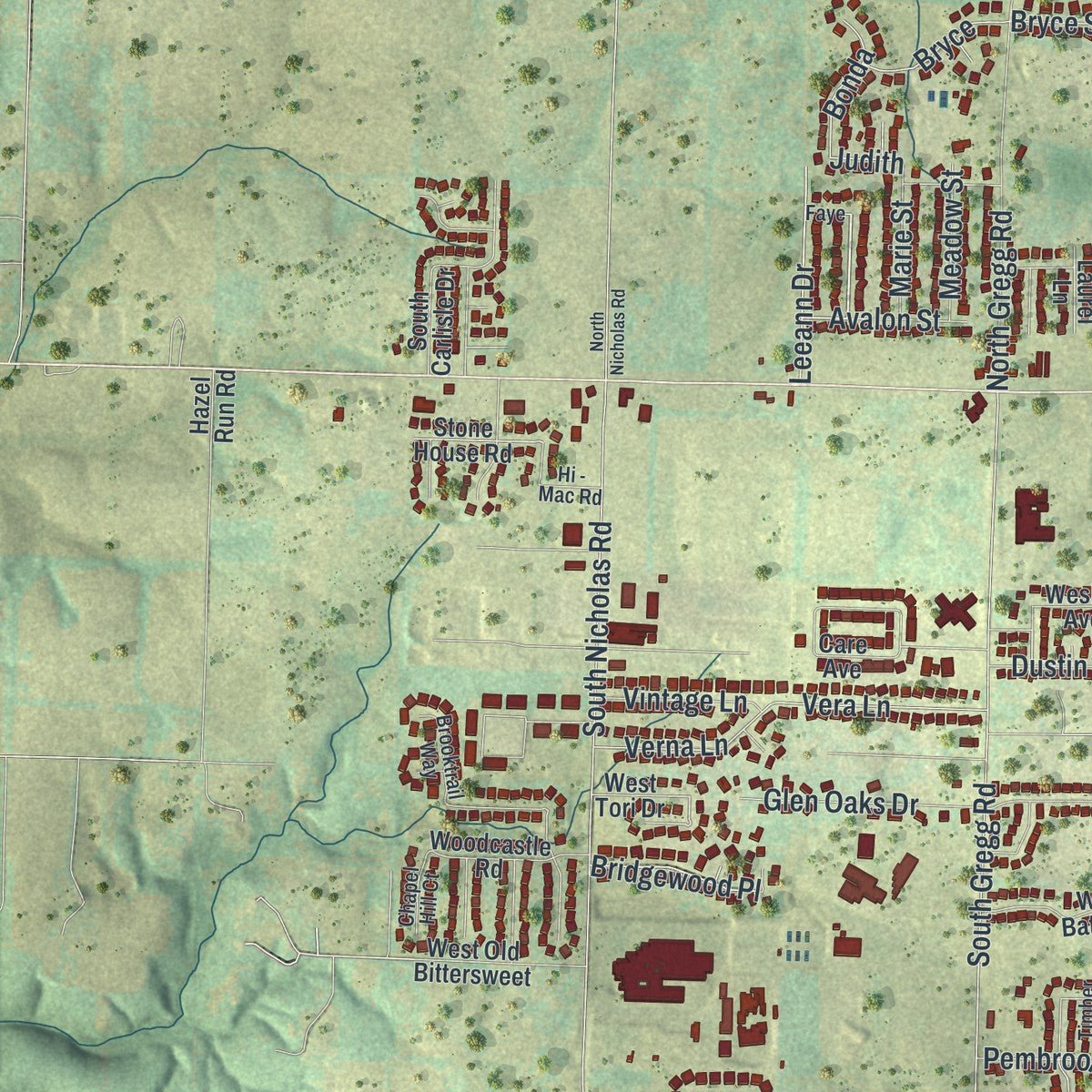
Combining modern data with the timeless character of a vintage atlas, this map is just as interesting up close as it is beautiful on the wall. Whether you grew up in Nixa, spent memorable years there, or call it home today, this unique map is a great way to celebrate a place that means something to you. Zoom in on the preview to look for your street, and then order a print to put your memories on the wall.
Three ways to hang it
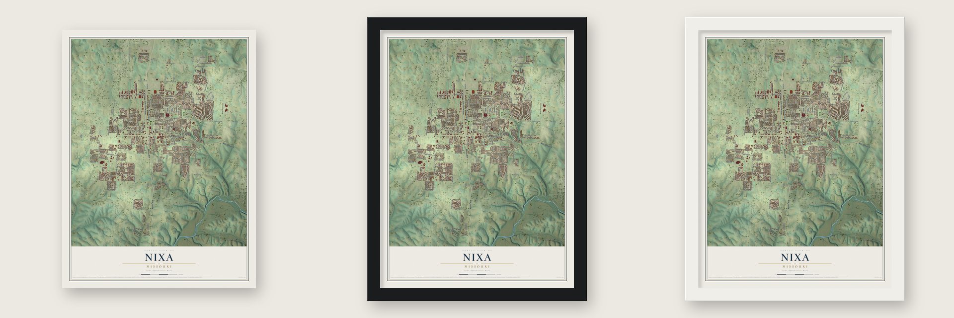
Unframed archival matte, a black wood frame or a white wood frame.
Up close
Geography Worth Displaying
This map was created using accurate cartographic data and authoritative geographic sources, including the U.S. Geological Survey and the Census Bureau. The map brings together terrain, waterways, roads, and building detail. The majority of the streets are labeled, houses are accurately depicted, and the topography is derived from government sources. Combining local data with carefully composed color and shading leads to this beautifully detailed Nixa artwork for your wall.
Rather than simply showing street outlines, we’ve included as many of the street names as we could reasonably fit on the map while keeping their names legible. Zoom in on the high resolution preview to see exactly what’s on the map. We truly set out to create a statement piece for anyone who loves Nixa. So whether it’s for you, or a gift for someone you love, we hope this map of Nixa brings back fond memories.

About Nixa, Missouri
Nixa is a Christian County city whose 2020 population was 23,257. It developed from a farming settlement near wooded streams into a crossroads and freight stop between Springfield and Arkansas. The community's name honors Blacksmith Nicholas A. Inman, who established a shop in 1852 and later inspired the village's name.
- Seven HillsThe city occupies land on and around seven hills and covers 8.48 square miles, all of it land.
- Civic MilestonesThe village incorporated on June 10, 1902, and became a fourth-class city on June 7, 1946.
- Sucker Day TraditionMayor Finis Gold began Nixa Sucker Day in 1957, and the community event is held each May on Main Street.
- Solar PowerNixa's solar farm became operational in November 2017 with 33,288 panels across 72 acres, providing an estimated 9% of the city's power needs.
Find your street
Names on the Nixa map
Every name below is printed on this map. Look for your street, your school, the park where you played, or the pond down the road.
Places and landmarks3
- Nixa City Hall
- McCauley Park
- Rotary Park
Streets and roads310
- Massey Boulevard
- North Massey Boulevard
- East Mount Vernon Street
- South Kelby Parkway
- West Jackson Road
- East Weldon Drive
- Bonda
- Greer Avenue
- Weldon
- Eagle Street
- North Main Street
- Spruce Avenue
- Osage Drive
- Beaufort
- Chestnut Road
- Northview Drive
- Rockingham
- Galileo Drive
- Prospect Avenue
- Roubidoux
- Ellen Street
- Hackberry
- East South Street
- Judith
- Gregg Road
- South Gregg Road
- East Mc Cauley Farm Road
- Norton Road
- South Norton Road
- South Main Street
Show all 310 streets
- North Cheyenne Road
- West Northview Road
- East North Street
- North Street
- South Nicholas Road
- Wasson Drive
- West Butterfield Drive
- East State Highway CC
- North Gregg Road
- East Kings Carriage Boulevard
- Kathryn Street
- Scott Wayne Drive
- North Ellen Street
- Old Castle Road
- Tracker Road
- Hillcrest Avenue
- North Foxhill Circle
- South Eastridge Avenue
- Old Bittersweet
- Ozark Street
- Hightower Avenue
- Harrison Street
- Frank Street
- Maplewood Hills Drive
- North Owen Road
- Owen Road
- Vera Lane
- Verna Lane
- West Tracker Road
- East Daisy Falls Drive
- Slim Wilson Boulevard
- West Street
- Missouri Avenue
- Aldersgate Drive
- West South Street
- North McCroskey Street
- Aspen Drive
- Glen Oaks Drive
- Rosedale Road
- Milton Drive
- Cherry Street
- East Lakota Drive
- North Road
- East Gallup Hill Road
- Eaglecrest Street
- Old Wilderness Road
- Dyann Drive
- Fort Avenue
- Rice Street
- West Lorene Street
- Park Street
- Kenneth Street
- East Purple Martin Street
- South Elegant Drive
- Gerald Drive
- Croley Boulevard
- Fairway
- Elm Street
- Estes Street
- Aven Avenue
- Muskego Road
- Kyle Street
- Truman Boulevard
- North Jerico Street
- Tonya Street
- West Aven Avenue
- Rich Hill
- East Gallup Hill
- Deanna Lane
- Yosemite Drive
- Hickory Lane
- Carnegie Road
- Althea
- Crimson
- Bluegill Street
- Gretchen Street
- Center Circle
- Leeann Drive
- Birch Street
- East Striper Drive
- North Maple Street
- Raintree Street
- Meramac Lane
- East Crystal Avenue
- Pinhook Drive
- Sunrise Drive
- McCroskey Street
- Water Street
- Monet Road
- West Inman Road
- Pine Hill Court
- Pembrook Avenue
- Allison
- Bluegill
- Rippling Creek
- Bridgewood Place
- Pembrook
- Ballard Drive
- Myra Drive
- Vintage Lane
- Alexandria
- Bryce Street
- Dustin Lane
- Avalon Street
- Hunter Drive
- Bryce
- Fort Street
- Livingston Street
- Walnut Street
- Meadow Street
- Striper Drive
- Bryan Drive
- Grafton
- Marie Street
- State Street
- Ritter Avenue
- Redwood Street
- Gene Street
- Dustin
- Hill Street
- Zion
- Erin Court
- Denali
- North Old Castle Road
- Sunset Avenue
- East Grouse Road
- East Spring Valley Circle
- North Santa Monica Drive
- State Highway CC
- South Old Riverdale Road
- Ozark Road
- East Tracker Road
- Saint Louis Street
- West Bentwater Drive
- South Amber Ridge Drive
- Care Avenue
- South Gold Rush Avenue
- Southeast Hills Drive
- Sandy Creek
- Smalley Street
- Briarwood Lane
- Village Center Street
- Dabney Avenue
- South Delaware Street
- West Bates Drive
- Bradford Avenue
- North Gregory Drive
- West Bryant Street
- Eastwood Drive
- Mills Road
- Notting Hill Gate
- East Downshire Drive
- West Old Bittersweet
- West Jackson Avenue
- Sequoia Drive
- Brook Forest
- West McConnell Street
- North Eagle Park Circle
- Woodcastle Road
- Country Ridge
- South Foxx Drive
- East Apple Ridge
- South Rosemoor Drive
- Lynn Street
- South Pinewood Lane
- Clover Court
- West Trail Point Drive
- North Mallard Drive
- Peachtree Drive
- Morning Glory Drive
- Falcon Crest Court
- North Greer Avenue
- Stone House Road
- South Carlisle Drive
- Althea Avenue
- Lone Oak Avenue
- Hazel Run Road
- South Curtis
- Black Sands
- Wesley Avenue
- Julian Street
- Erin Street
- Laurel Lane
- Fort Court
- Ella Street
- Besse Street
- Glacier Court
- West Tori Drive
- Flora Street
- Gold Street
- Pin Oak
- North Galileo Drive
- Santa Monica
- Pheasant Run
- Deerfield Drive
- North Sandy Creek Circle
- South Carriage Crossing
- Ozark Jubilee
- Honeysuckle Lane
- East Katella Circle
- White Ash Road
- Tiffany Boulevard
- West Citydel Road
- Devonshire Street
- North Pinnacle Avenue
- Paddington
- South Ballard Drive
- Barracuda Drive
- Brook Forest Road
- South Robert Street
- Elegant
- West Sherman Way
- Crestwood Street
- Montclair
- Woodview Road
- West Silver Oak Street
- Poplar Street
- Hedge Drive
- North Fort Street
- Barnstable
- Cascades Drive
- West Wild Rose
- Brooktrail Way
- Scenic Hills
- Meadow Garden
- Canyon Lane
- East Dyann Drive
- Knight Street
- Chapel Hill Court
- Timber Ridge
- Fairway Court
- Carlton Street
- Hi - Mac Road
- Glenn Street
- Niangua
- Jordan
- Brett Circle
- Dover Street
- Hawk's Perch
- Firefly Road
- Faye
- Lee
- Pr Drive
- Taylor Way
- Becky Circle North
- East Kyle Street
- North Market Street
- Hillside Drive
- Shady Oak Circle
- Niangua Drive
- Linwood
- Southridge Street
- South Ridgecrest Avenue
- Cynthia Drive
- Blackberry Lane
- Wicklow
- Spout Spring Street
- West Everwood Way
- West Monarchwood Drive
- Kings Mead Cr
- Ozark Jubilee Drive
- North McKay Street
- Silver Streak Road
- Red Maple Court
- Heather Glenn
- Robinwood Lane
- South Peach Brook
- Lone Oak Circle
- North Nicholas Road
- Brooke Court
- Charm Drive
- Pasture Drive
- Lorene Street
- Raven's Nest Avenue
- Red Hawk Court
- Rush
- Trotter Street
- Willow Lane
- Kiwi Court
- Aspen Court
Names are listed as they appear on the printed map. Zoom into the product photos to find them.
The art of mapping a place
How This Map Was Made
Real places. Remarkable detail. Discover the layers that turn geographic data into a map of home.

The view from above
Aerial imagery reveals the character of the land: woodland, open fields, and the patterns of a place.

The shape of the land
Elevation data brings hills, valleys, and subtle changes in the landscape into view.

The details of home
Roads, waterways, and building footprints come together to make the map feel unmistakably local.

Geography becomes art
Considered color, shading, and typography bring the layers together in a map made for your wall.


Process illustrated with Mendon, Massachusetts. Aerial imagery: USDA NAIP. Terrain: USGS 3D Elevation Program. Map details and finished artwork: KNOWOL.
The Details
About This Print
Choose an archival matte print, or a black or white Ayous wood frame. The archival matte print is unframed.
Select your size and finish above to see the matching product image and price.
Materials & Craftsmanship
A contemporary map with the character of a classic atlas, printed on archival matte paper. Optional frames are made from Ayous wood.
Your printed map does not include the watermark shown in the full-map preview.
Shipping & Delivery
Free shipping within the United States. Every print is made to order in the USA.
Buying a gift? Add a note in your cart and we'll include it. We never put prices in the package.
Prints ship within 2 to 3 business days. Allow 7 to 10 days total from ordering for delivery. Timing may vary during holidays or periods of high order volume.
Read our shipping policy.
Returns and damaged prints
Each print is made to order. Change-of-mind refunds are not available after production.
If your print arrives damaged, misprinted or incorrect, contact support@knowol.com within 30 days of receiving it. Include your order number, photos and a description of the issue.
Read our full refund and replacement policy. For questions about your order, email support@knowol.com.
Find your town
Looking for another city?
Find a map of home in our Missouri collection, or any town in the country.
Nearby
Maps of towns near Nixa
Know someone from one of these towns? Their map makes a great gift.
 Fremont Hills
, Missouri
From $39.99See the map
 Ozark
Ozark, Missouri
From $39.99See the map
 Battlefield
, Missouri
From $39.99See the map
More maps nearby: Highlandville, Clever, Springfield, Republic and Sparta.