


Search for another town





Free U.S. delivery 7 to 10 days after you order
Oak Ridge, North Carolina Map Art
Building by building, with labeled streets and shaded relief.
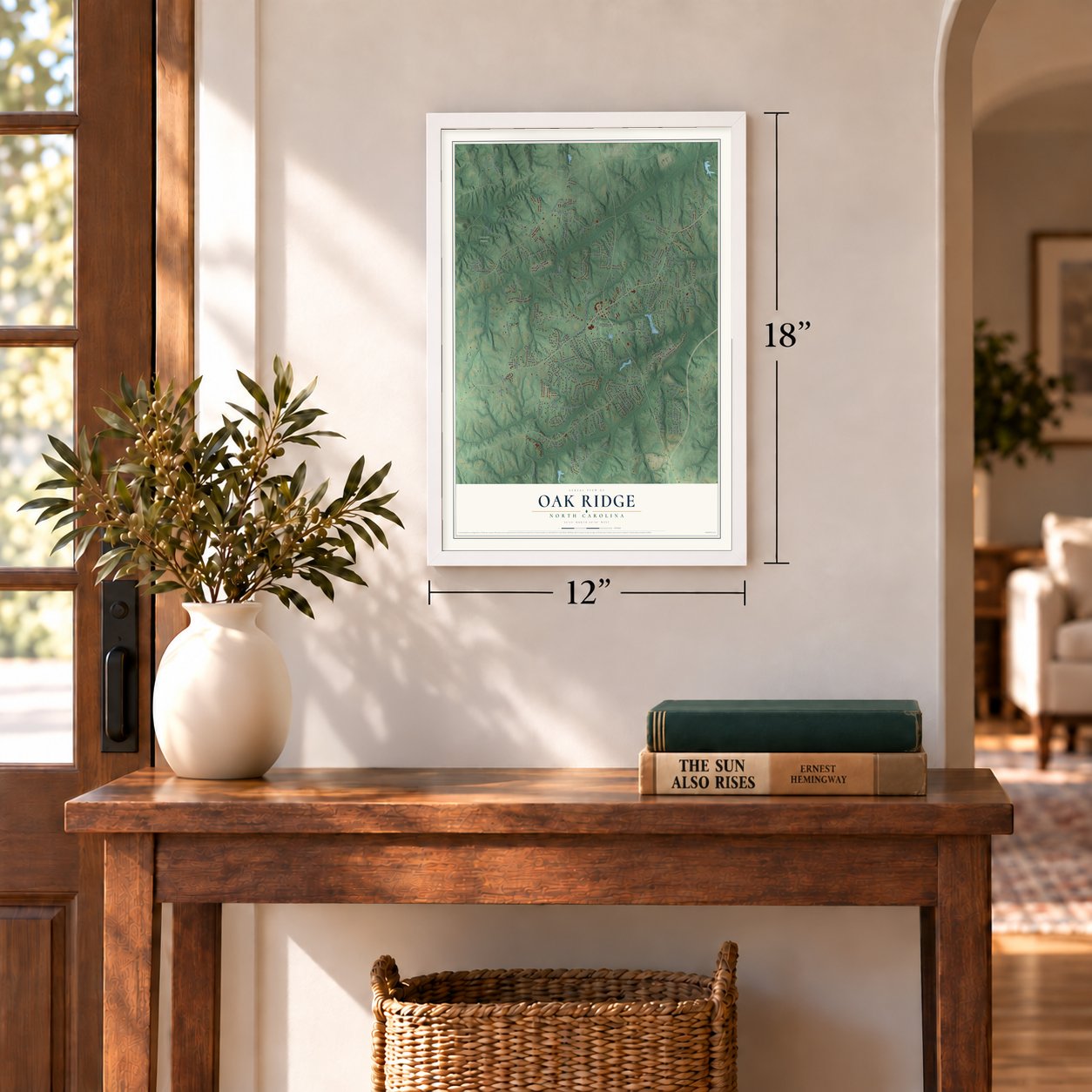
12" x 18" Archival Matte Print
A Map of Home. A Work of Art.
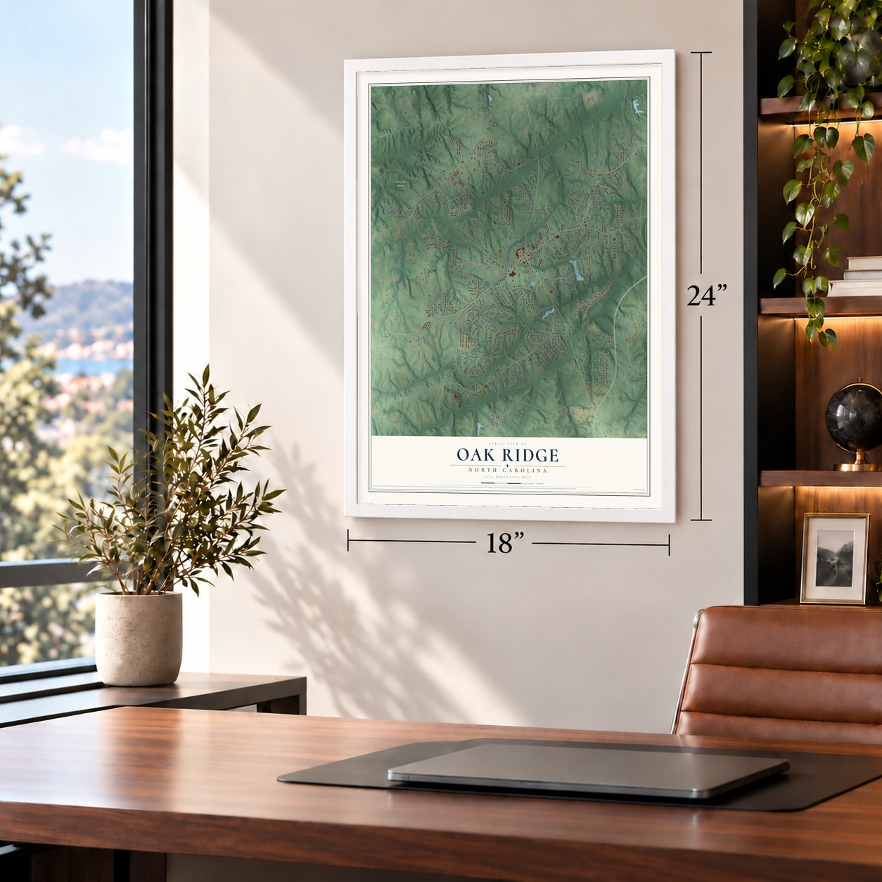
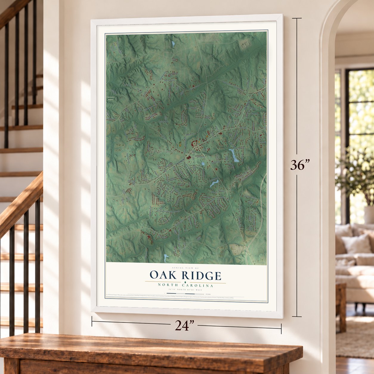
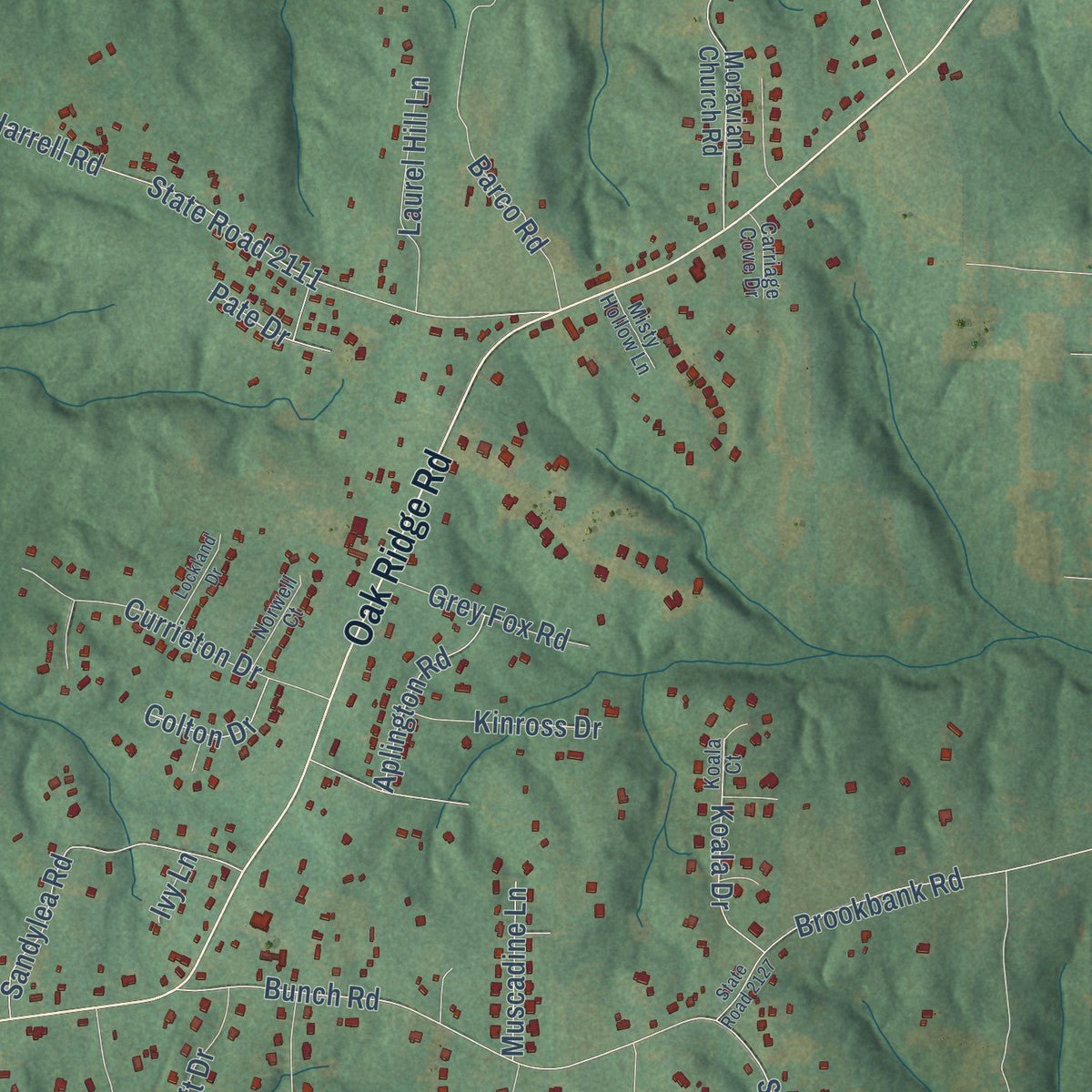
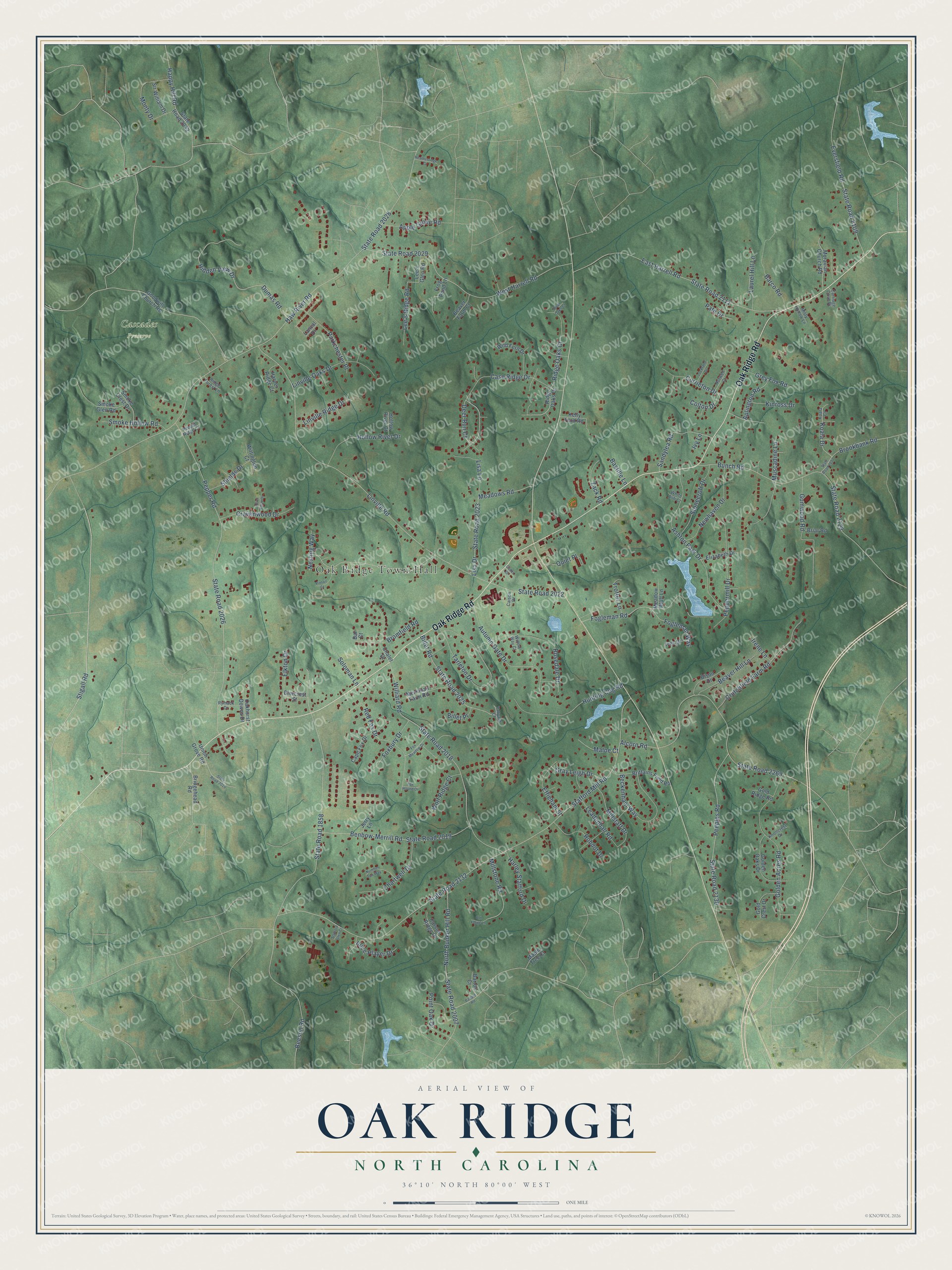
Explore Oak Ridge, North Carolina from a whole new perspective. Created using aerial imagery and detailed geographic data, this map captures Oak Ridge building by building, with labeled streets, familiar landmarks, and shaded topographical relief that highlights the natural contours of the landscape.
Combining modern data with the timeless character of a vintage atlas, this map is just as interesting up close as it is beautiful on the wall. Whether you grew up in Oak Ridge, spent memorable years there, or call it home today, this unique map is a great way to celebrate a place that means something to you. Zoom in on the preview to look for your street, and then order a print to put your memories on the wall.
Three ways to hang it
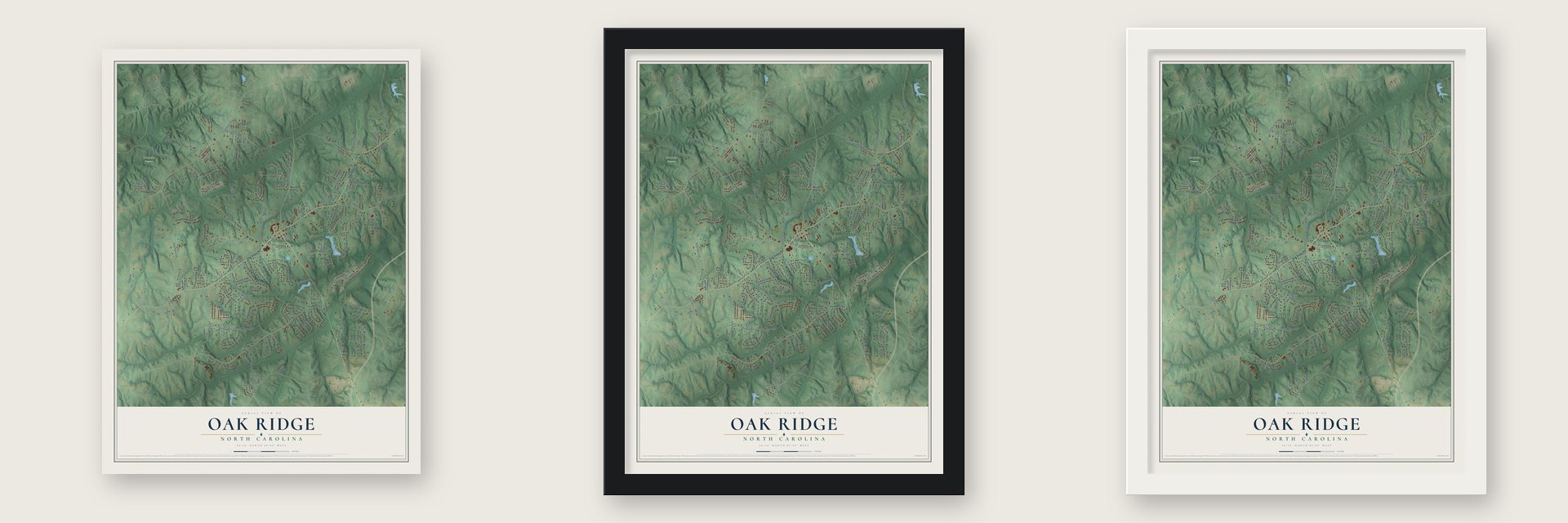
Unframed archival matte, a black wood frame or a white wood frame.
Up close
Geography Worth Displaying
This map was created using accurate cartographic data and authoritative geographic sources, including the U.S. Geological Survey and the Census Bureau. The map brings together terrain, waterways, roads, and building detail. The majority of the streets are labeled, houses are accurately depicted, and the topography is derived from government sources. Combining local data with carefully composed color and shading leads to this beautifully detailed Oak Ridge artwork for your wall.
Rather than simply showing street outlines, we’ve included as many of the street names as we could reasonably fit on the map while keeping their names legible. Zoom in on the high resolution preview to see exactly what’s on the map. We truly set out to create a statement piece for anyone who loves Oak Ridge. So whether it’s for you, or a gift for someone you love, we hope this map of Oak Ridge brings back fond memories.
Read the story behind this map of Oak Ridge, North Carolina from 2026.

Find your street
Names on the Oak Ridge map
Every name below is printed on this map. Look for your street, your school, the park where you played, or the pond down the road.
Places and landmarks2
- Oak Ridge Town Hall
- Cascades Preserve
Streets and roads167
- Oak Ridge Road
- State Road 2018
- Stigall Road
- State Road 2132
- Stafford Mill Road
- Haw River Road
- State Road 2028
- Linville Road
- State Road 2022
- State Road 1858
- Beeson Road
- Pepper Road
- State Road 2026
- State Road 2269
- Alcorn Road
- State Road 2029
- West Harrell Road
- Williard Road
- Bunch Road
- State Road 2128
- East Harrell Road
- State Road 2111
- Case Ridge Drive
- Fogleman Road
- Dumas Road
- Hidden View Drive
- Peeples Road
- State Road 2130
- Tarleton Drive
- Ashton Park Drive
Show all 167 streets
- Eversfield Road
- State Road 2109
- North Bunker Hill Road
- State Road 2007
- Golden Acres Road
- Benbow-Merrill Road
- State Road 2019
- State Road 2023
- Rosedale Drive
- Autumn Gate Drive
- Crutchfield Farm Road
- Hunting Cog Road
- Gumwood Road
- Red Fox Drive
- Peppermill Drive
- Beckenham Way
- Happy Hill Road
- Billet Road
- State Road 2025
- Deer Run Court
- Barco Road
- Linville Oaks Drive
- Newhaven Drive
- Hollow River Drive
- Ridge Oaks Court
- Chartwell Drive
- Parkchester Place
- Sandylea Road
- Stonecroft Drive
- Lisa Drive
- Currieton Drive
- Cravenwood Drive
- Millstaff Drive
- Linville Ridge Drive
- Millstone Road
- Bromfield Road
- Beaver Hill Lane
- Soloman Lane
- Brookbank Road
- Elkton Drive
- Smoke Hollow Road
- Monty Drive
- Robdot Drive
- Apple Grove Road
- Effieham Street
- Lee's Ridge Road
- Lisa Lane
- Shields Drive
- Leadenhall Road
- Koala Drive
- Foxbury Drive
- Harley Stafford Drive
- Point Oak Drive
- Meadows Road
- Quiet Place
- Laurel Hill Lane
- Muscadine Lane
- Gray Leigh Drive
- Wolf Ridge Court
- Grey Fox Road
- Aplington Road
- Zack Road
- Alice Player Drive
- Kinross Drive
- Maloe Court
- Trotter Lane
- Fogleman Way
- Nesting Way
- Colton Drive
- Pate Drive
- Irene Lane
- Billet Place
- Bastille Lane
- Ivy Lane
- Ridge Oaks Drive
- State Road 2032
- Golden Oaks Drive
- Brittains Field Road
- Chalet Drive
- Merriman Farm Road
- Cape Fox Drive
- Moravian Church Road
- Wild Fern Drive
- Goodwill Church Road
- Bridgehead Road
- Kelly Ford Road
- Bison Drive
- Union Grove Road
- Smoke Crest Drive
- Frog Pond Lane
- Gold Crest Drive
- Meadow Bluff Lane
- Carson Ridge Drive
- Elizabeth Drive
- Sir William Drive
- Smoke Glen Road
- Harper Ridge Court
- Wittington Court
- Oakhurst Downs Drive
- Lee's Glen Road
- Beaver Farm Court
- Barton Court
- Maple Tree Court
- Hollow River Court
- Diercrest Street
- Briar Road
- Ives Drive
- Gold Ridge Road
- Jerry Lane
- Lanval Drive
- Bar Court
- Koala Court
- Rymack Drive
- Norwell Court
- Ridge Forest Lane
- Knollcrest Drive
- Carriage Cove Drive
- Misty Hollow Lane
- Pepper Ridge Court
- Tanyard Court
- Willow Way Court
- Caison Drive
- White Ash Court
- State Road 2127
- Number Ten Way
- State Road 2020
- Fox Meadow Drive
- Pintail Court
- Lockland Drive
- Heatherridge Court
- Ballard Road
- River Farm Drive
- River Oaks Court
- Old Forge Lane
- Fox Hound Drive
- Stafford Glen Court
- Cadet Drive
Names are listed as they appear on the printed map. Zoom into the product photos to find them.
About Oak Ridge, North Carolina
Oak Ridge is a town of 7,474 people in northwestern Guilford County, about 15 miles northwest of downtown Greensboro. For most of its past the area was quiet farm country, much of it planted in tobacco, and it did not become an incorporated town until 1998.
Becoming a town brought fast growth. Developers bought many of the old farms and turned them into upscale neighborhoods, and new shopping centers went up along NC 68, most of all near the military academy, where that highway crosses NC 150, known locally as Oak Ridge Road.
- A military school since 1852Oak Ridge Military Academy opened in 1852, and it is now the third-oldest military school in the country that still holds classes. The state legislature named it North Carolina's official military school. The private boarding school now teaches both boys and girls, and it took its present name in 1971. NASCAR driver Dale Earnhardt Jr. studied there before he began racing.
- An Easter horse showEvery Easter weekend from 1945 until 2013, Oak Ridge held a horse show that drew large crowds, a spring tradition that lasted through the town's years as farm country and into its time as a growing suburb.
Keep exploring North Carolina
Oak Ridge is one of 952 North Carolina towns we've mapped. Every dot on the map is a print of its own.
The search covers every state, North Carolina first.
Near Oak Ridge
Order 2 or more town maps and save 10%. Shown in the size and finish you picked above, so they hang as a set.
- Stokesdale 12" x 18" / Archival Matte Print $39.99
- Colfax 12" x 18" / Archival Matte Print $39.99
- Summerfield 12" x 18" / Archival Matte Print $39.99


More maps nearby: Kernersville, Walkertown, Greensboro, Walnut Cove and Pine Hall.
The art of mapping a place
How This Map Was Made
Real places. Remarkable detail. Discover the layers that turn geographic data into a map of home.

The view from above
Aerial imagery reveals the character of the land: woodland, open fields, and the patterns of a place.

The shape of the land
Elevation data brings hills, valleys, and subtle changes in the landscape into view.

The details of home
Roads, waterways, and building footprints come together to make the map feel unmistakably local.

Geography becomes art
Considered color, shading, and typography bring the layers together in a map made for your wall.


Process illustrated with Mendon, Massachusetts. Aerial imagery: USDA NAIP. Terrain: USGS 3D Elevation Program. Map details and finished artwork: KNOWOL.
The Details
About This Print
Choose an archival matte print, or a black or white Ayous wood frame. The archival matte print is unframed.
Select your size and finish above to see the matching product image and price.
Materials & Craftsmanship
A contemporary map with the character of a classic atlas, printed on archival matte paper. Optional frames are made from Ayous wood.
Your printed map does not include the watermark shown in the full-map preview.
Shipping & Delivery
Free shipping within the United States. Every print is made to order in the USA.
Buying a gift? Add a note in your cart and we'll include it. We never put prices in the package.
Prints ship within 2 to 3 business days. Allow 7 to 10 days total from ordering for delivery. Timing may vary during holidays or periods of high order volume.
Read our shipping policy.
Returns and damaged prints
Each print is made to order. Change-of-mind refunds are not available after production.
If your print arrives damaged, misprinted or incorrect, contact support@knowol.com within 30 days of receiving it. Include your order number, photos and a description of the issue.
Read our full refund and replacement policy. For questions about your order, email support@knowol.com.