


Search for another town





Free U.S. delivery 7 to 10 days after you order
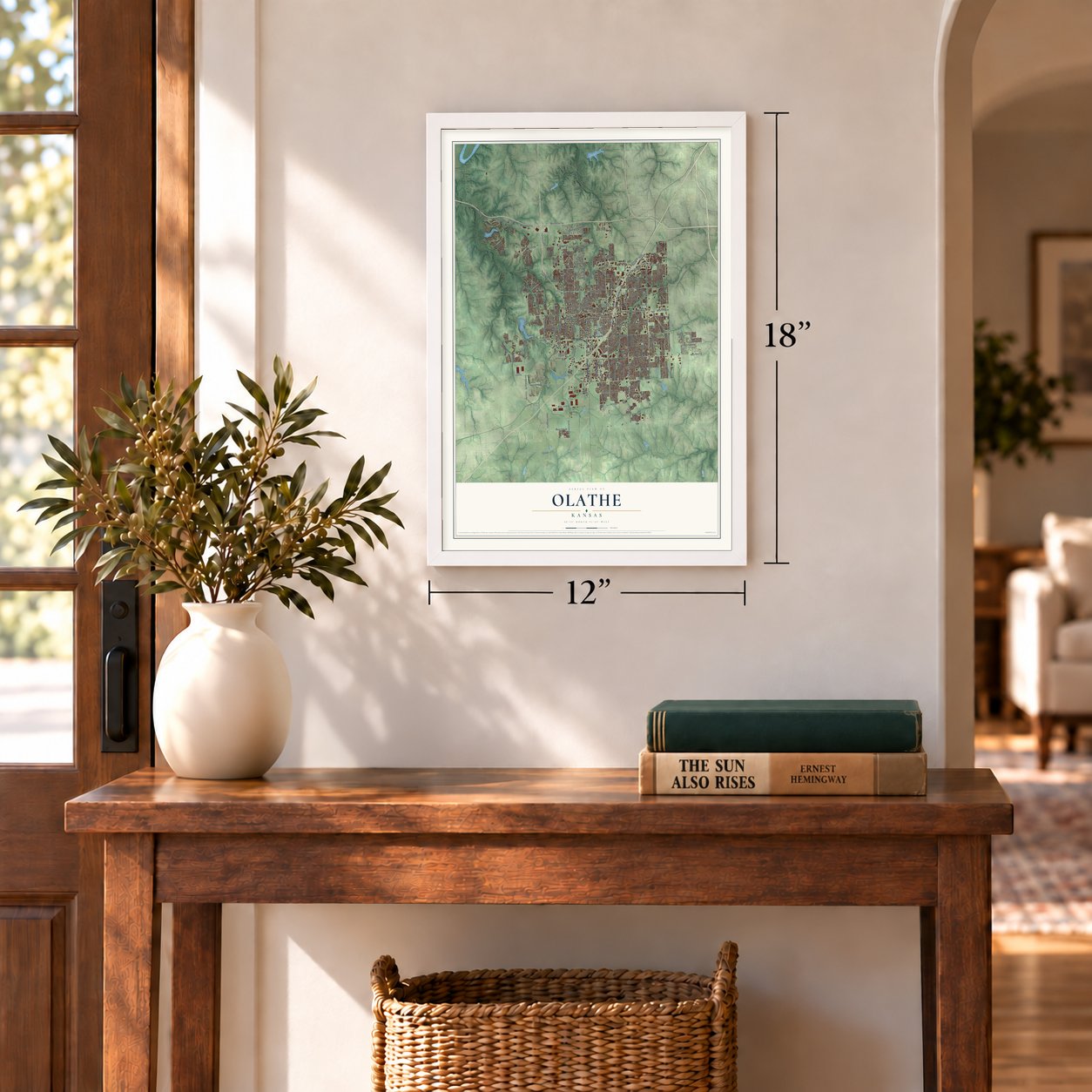
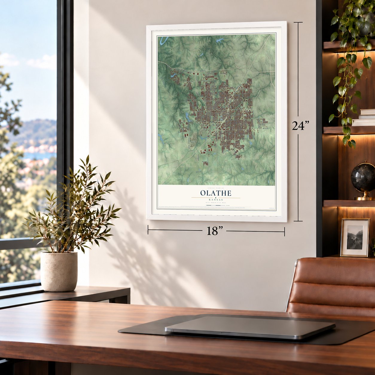
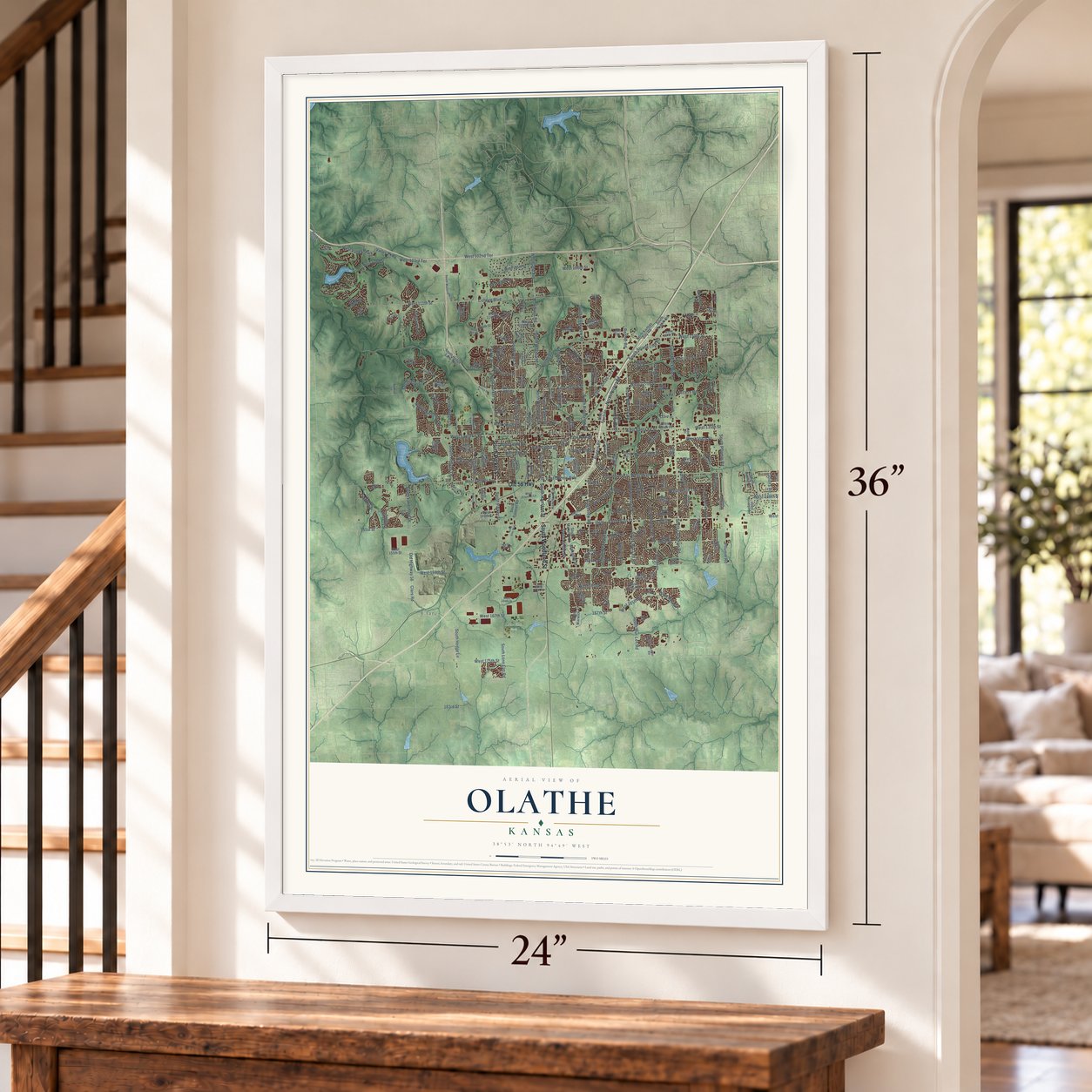
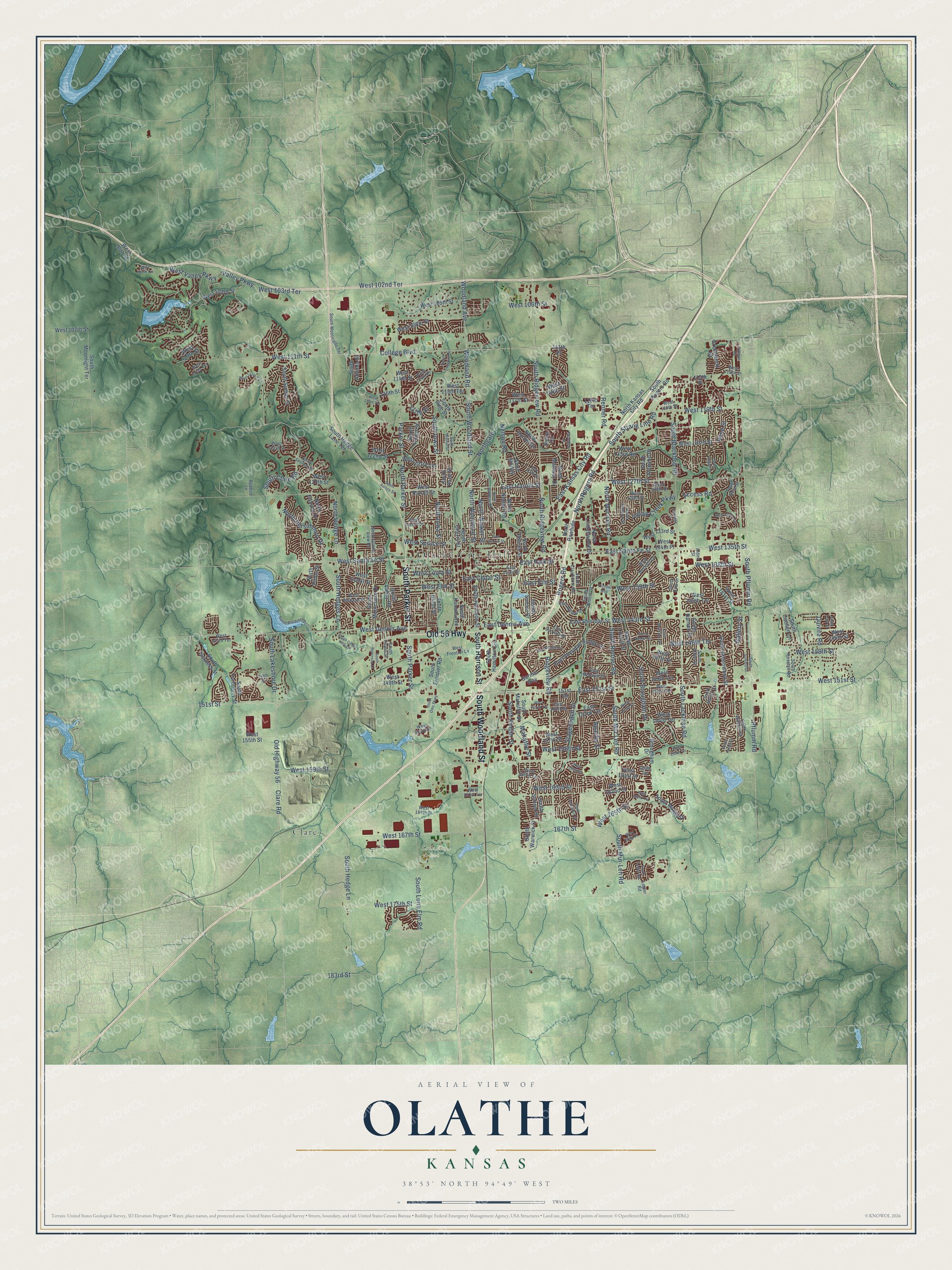
Olathe, Kansas Map Art
Building by building, with labeled streets and shaded relief.
12" x 18" Archival Matte Print
A Map of Home. A Work of Art.
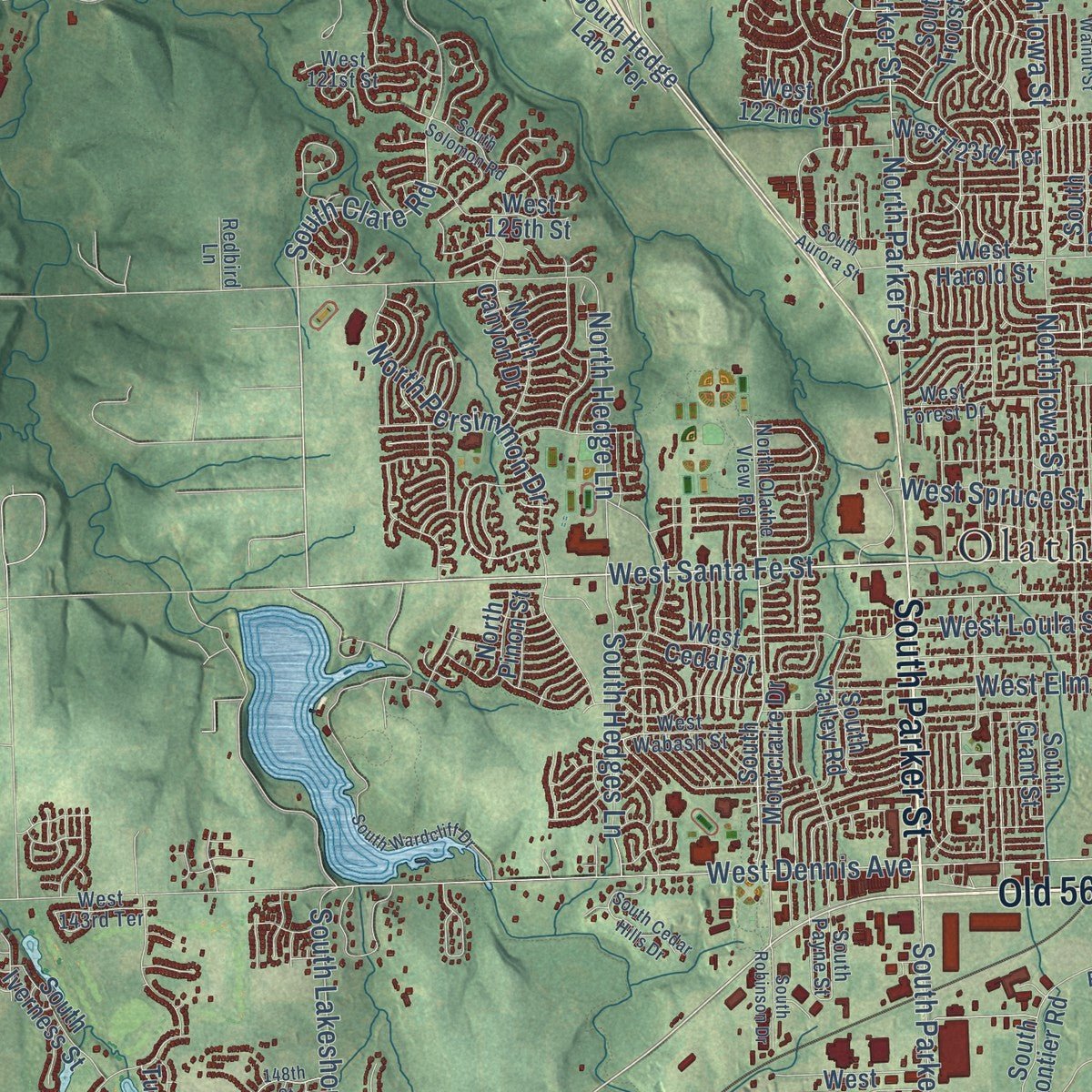
Explore Olathe, Kansas from a whole new perspective. Created using aerial imagery and detailed geographic data, this map captures Olathe building by building, with labeled streets, familiar landmarks, and shaded topographical relief that highlights the natural contours of the landscape.
Combining modern data with the timeless character of a vintage atlas, this map is just as interesting up close as it is beautiful on the wall. Whether you grew up in Olathe, spent memorable years there, or call it home today, this unique map is a great way to celebrate a place that means something to you. Zoom in on the preview to look for your street, and then order a print to put your memories on the wall.
Three ways to hang it
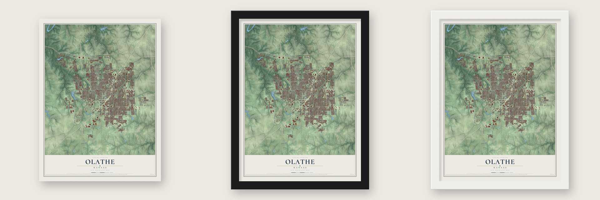
Unframed archival matte, a black wood frame or a white wood frame.
Up close
Geography Worth Displaying
This map was created using accurate cartographic data and authoritative geographic sources, including the U.S. Geological Survey and the Census Bureau. The map brings together terrain, waterways, roads, and building detail. The majority of the streets are labeled, houses are accurately depicted, and the topography is derived from government sources. Combining local data with carefully composed color and shading leads to this beautifully detailed Olathe artwork for your wall.
Rather than simply showing street outlines, we’ve included as many of the street names as we could reasonably fit on the map while keeping their names legible. Zoom in on the high resolution preview to see exactly what’s on the map. We truly set out to create a statement piece for anyone who loves Olathe. So whether it’s for you, or a gift for someone you love, we hope this map of Olathe brings back fond memories.

Find your street
Names on the Olathe map
Every name below is printed on this map. Look for your street, your school, the park where you played, or the pond down the road.
Places and landmarks3
- Olathe City Hall
- Lone Elm Park
- Clare
Streets and roads239
- Old 56 Highway
- South Parker Street
- South Woodland Street
- Old Highway 56
- West Santa Fe Street
- West 138th Street
- East Park Street
- East Dennis Avenue
- South Ridgeview Road
- South Lakeshore Drive
- South Clare Road
- North Ridgeview Road
- West 139th Street
- West 151st Street
- Rene Street
- East Elm Street
- West 159th Street
- West 143rd Street
- West 135th Street
- South Lone Elm Road
- West 119th Street
- Pflumm Road
- South Pflumm Road
- West 111th Street
- College Boulevard
- South Brougham Drive
- South Blackbob Road
- East Santa Fe Street
- Ridgeview Road
- South Renner Road
Show all 239 streets
- West 175th Street
- South Mur Len Road
- West 127th Street
- West 167th Street
- South Hedge Lane
- South Mur-Len Road
- West Dennis Avenue
- South Lackman Road
- West Valley Parkway
- Woodland Avenue
- Woodland Road
- East Kansas City Road
- Access Road
- West 165th Street
- Valley Parkway
- Northgate
- East 151st Street
- West 103rd Terrace
- 167th Street
- South Keeler Street
- West 146th Terrace
- East Cedar Street
- Clare Road
- West Elm Street
- South Strang Line Road
- East Harold Street
- West Loula Street
- North Woodland Street
- North Iowa Street
- West 158th Street
- West Spruce Street
- North Mur-Len Road
- West 102nd Terrace
- Rogers Road
- West 106th Street
- Gallery Street
- North Rogers Road
- 151st Street
- North Hedge Lane
- South Iowa Street
- North Persimmon Drive
- Indian Creek Parkway
- North Parker Street
- West 148th Street
- South Hedges Lane
- Quivira Road
- North Walker Street
- West 163rd Street
- Stagecoach Drive
- 183rd Street
- Mahaffie Street
- Renner Road
- Apache Street
- Nelson Road
- 117th Street
- Parker Street
- South Harrison Street
- South Montclaire Drive
- West 133rd Street
- North Cherry Street
- West 155th Street
- North Church Street
- South Hamilton Circle
- South Greenwood Street
- South Locust Street
- West 116th Street
- West 108th Street
- West 123rd Street
- South Valley Road
- West 147th Street
- South Arapaho Drive
- West 105th Street
- West 125th Street
- West 141st Street
- West 149th Street
- West 161st Street
- West 123rd Road
- West 115th Terrace
- West 107th Street
- West 114th Street
- West 117th Street
- South Sunset Drive
- East Sheridan Street
- South Rogers Road
- West 157th Street
- East Sheridan Bridge Lane
- West 123rd Terrace
- West Cedar Street
- West 146th Street
- South Mahaffie Street
- South Pine Street
- Brougham Drive
- South Warwick Street
- South Troost Street
- West 122nd Street
- North Nelson Road
- West 149th Terrace
- West 110th Street
- East 153rd Terrace
- North Kansas City Road
- South Darnell Street
- West Harold Street
- Greenwood Street
- South Sunset Street
- North Hunter Drive
- South Caenen Lane
- West 162nd Street
- North Lindenwood Drive
- South Kansas Avenue
- North Martway Drive
- South Sumac Street
- West 140th Terrace
- South Moonlight Terrace
- West 103rd Street
- South Race Street
- West 134th Place
- North Rawhide
- West 154th Terrace
- South Marais Drive
- Sierra Circle
- South Grant Street
- Garmin Way
- North Pinon Street
- South Frontier Road
- South Hedge Lane Terrace
- North Canyon Drive
- South Iverness Street
- Anne Shirley
- 118th Terrace
- 151st Terrace
- South Turnberry Street
- South Aminda Street
- 115th Place
- 115th Street
- West 95th Street
- 111th Place
- North Olathe View Road
- South Rene Street
- West 121st Street
- South Widmer Street
- South Clairborne Road
- West 118th Street
- East Loula Street
- West 143rd Terrace
- West 151st Terrace
- West Wabash Street
- South Alden Street
- South Kaw Drive
- East Willow Drive
- East Sunvale Drive
- West Forest Drive
- West 115th Street
- South Monticello Terrace
- South Mullen Street
- West 160th Terrace
- West 129th Street
- West 164th Street
- West 128th Street
- West 153rd Place
- West 111th Terrace
- West 161st Terrace
- East 153rd Street
- West Frontier Lane
- South Willow Drive
- East Mohawk Drive
- South Payne Street
- South Trenton Street
- West Beckett Lane
- South Rosehill Road
- Alden Street
- West 114th Place
- Redbird Lane
- Legler Road
- 160th Terrace
- South Parkwood Street
- Foxridge Drive
- South Blackfoot Drive
- South Wardcliff Drive
- South Summit Street
- West 153rd Street
- South Hallet Street
- West 163rd Terrace
- West 116th Terrace
- East Prairie Street
- West 113th Terrace
- West 158th Terrace
- East Frontier Lane
- South Solomon Road
- West 145th Terrace
- South Walnut Street
- West 152nd Terrace
- West 160th Street
- Pasadena Drive
- West 130th Terrace
- South Crestone Street
- South Omc Parkway
- East 125th Street
- North Parkway Drive
- South Cedar Hills Drive
- South Aurora Street
- South Cody Street
- Pioneer Way
- South Robinson Drive
- South Legler Road
- 148th Street
- South Hagan Lane
- West 100th Terrace
- Pittman Road
- West 168th Place
Names are listed as they appear on the printed map. Zoom into the product photos to find them.
About Olathe, Kansas
Olathe is a city of 141,290 people and the county seat of Johnson County. In the spring of 1857 Dr. John T. Barton rode to the middle of the county, staked out two quarter sections for a townsite, and named it with the Shawnee word for beautiful. Olathe was incorporated that same year, and it grew so quickly that it became the county seat in October 1859.
Kansas entered the Union as a free state in 1861, and that year a military post opened in town to house a company of soldiers along with militia from the area. Confederate guerrillas under William Quantrill struck without warning on September 6, 1862, killing about six people and destroying most of Olathe. Quantrill came through again in August 1863 on his way to Lawrence, and in October 1864 Gen. Sterling Price's army of 10,000 passed through in retreat. The post closed in August 1865.
“...the prairie was covered with verbena and other wild flowers. I kept thinking the land was beautiful and that I should name the town Beautiful.”
- The first house, 12 by 14Early in 1857 Dr. Barton and Charles A. Osgood put up the town's first building, a rough lumber shack 12x14 feet. That one room served as the town's hotel and saloon, and it also sold groceries, drugs and dry goods. Col. Clarkson and Jacob Thuma built the second, of cottonwood boards, by the public square, and Gen. Dick Taylor, son of President Zachary Taylor, built the third.
- John Brown at the Union HouseOlathe's first hotel, the Union House, opened in a pair of small buildings that J. B. Whittier rented by the southwest corner of the square, and his sister Emily helped him run it. In the summer of 1858 its guests included Gen. James H. Lane, S. C. Pomeroy, later a U.S. senator from Kansas, A. D. Richardson, John Brown and Quantrill.
- A stop on three trailsWagons on the Oregon, California and Santa Fe trails passed through Olathe, and serving travelers kept its stores in business. The Mahaffie House was a popular place to resupply and is now a historic site run by the city. Once the railroad crossed the continent, the trails faded and so did the town, until Interstate 35 tied it to Kansas City in the 1950s. Olathe passed 100,000 people around 2001.
Keep exploring Kansas
Olathe is one of 764 Kansas towns we've mapped. Every dot on the map is a print of its own.
The search covers every state, Kansas first.
Near Olathe
Order 2 or more town maps and save 10%. Shown in the size and finish you picked above, so they hang as a set.
- Lenexa 12" x 18" / Archival Matte Print $39.99
- Overland Park 12" x 18" / Archival Matte Print $39.99
- Gardner 12" x 18" / Archival Matte Print $39.99


More maps nearby: Spring Hill, Shawnee, De Soto, Leawood and Edgerton.
The art of mapping a place
How This Map Was Made
Real places. Remarkable detail. Discover the layers that turn geographic data into a map of home.

The view from above
Aerial imagery reveals the character of the land: woodland, open fields, and the patterns of a place.

The shape of the land
Elevation data brings hills, valleys, and subtle changes in the landscape into view.

The details of home
Roads, waterways, and building footprints come together to make the map feel unmistakably local.

Geography becomes art
Considered color, shading, and typography bring the layers together in a map made for your wall.


Process illustrated with Mendon, Massachusetts. Aerial imagery: USDA NAIP. Terrain: USGS 3D Elevation Program. Map details and finished artwork: KNOWOL.
The Details
About This Print
Choose an archival matte print, or a black or white Ayous wood frame. The archival matte print is unframed.
Select your size and finish above to see the matching product image and price.
Materials & Craftsmanship
A contemporary map with the character of a classic atlas, printed on archival matte paper. Optional frames are made from Ayous wood.
Your printed map does not include the watermark shown in the full-map preview.
Shipping & Delivery
Free shipping within the United States. Every print is made to order in the USA.
Buying a gift? Add a note in your cart and we'll include it. We never put prices in the package.
Prints ship within 2 to 3 business days. Allow 7 to 10 days total from ordering for delivery. Timing may vary during holidays or periods of high order volume.
Read our shipping policy.
Returns and damaged prints
Each print is made to order. Change-of-mind refunds are not available after production.
If your print arrives damaged, misprinted or incorrect, contact support@knowol.com within 30 days of receiving it. Include your order number, photos and a description of the issue.
Read our full refund and replacement policy. For questions about your order, email support@knowol.com.