
Search for another town




Free U.S. delivery 7 to 10 days after you order
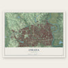
Omaha, Nebraska Map Art
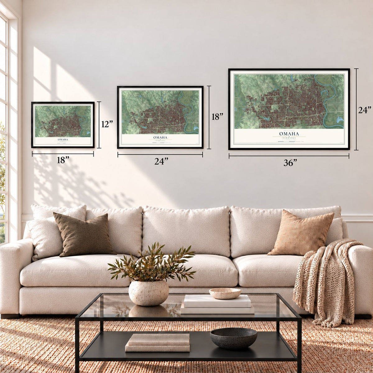
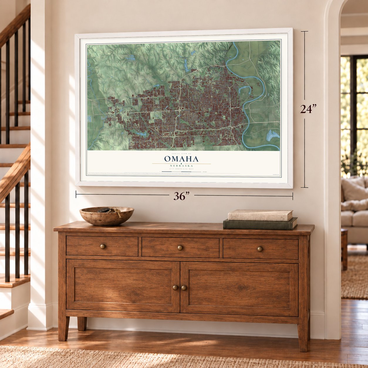
A new map of Omaha, Nebraska, made in 2026 and printed to order on thick archival matte paper.
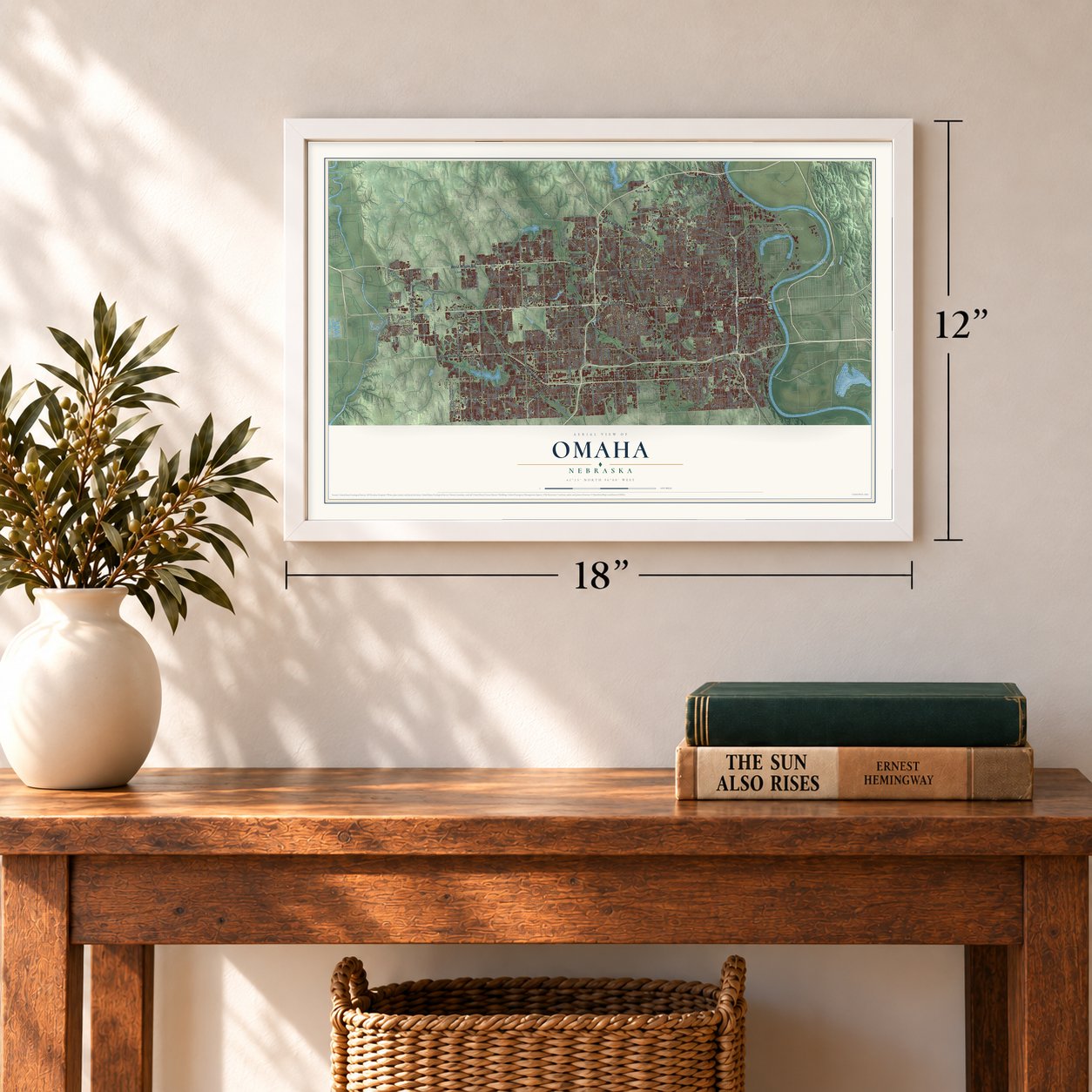
12" x 18" Archival Matte Print
A Map of Home. A Work of Art.
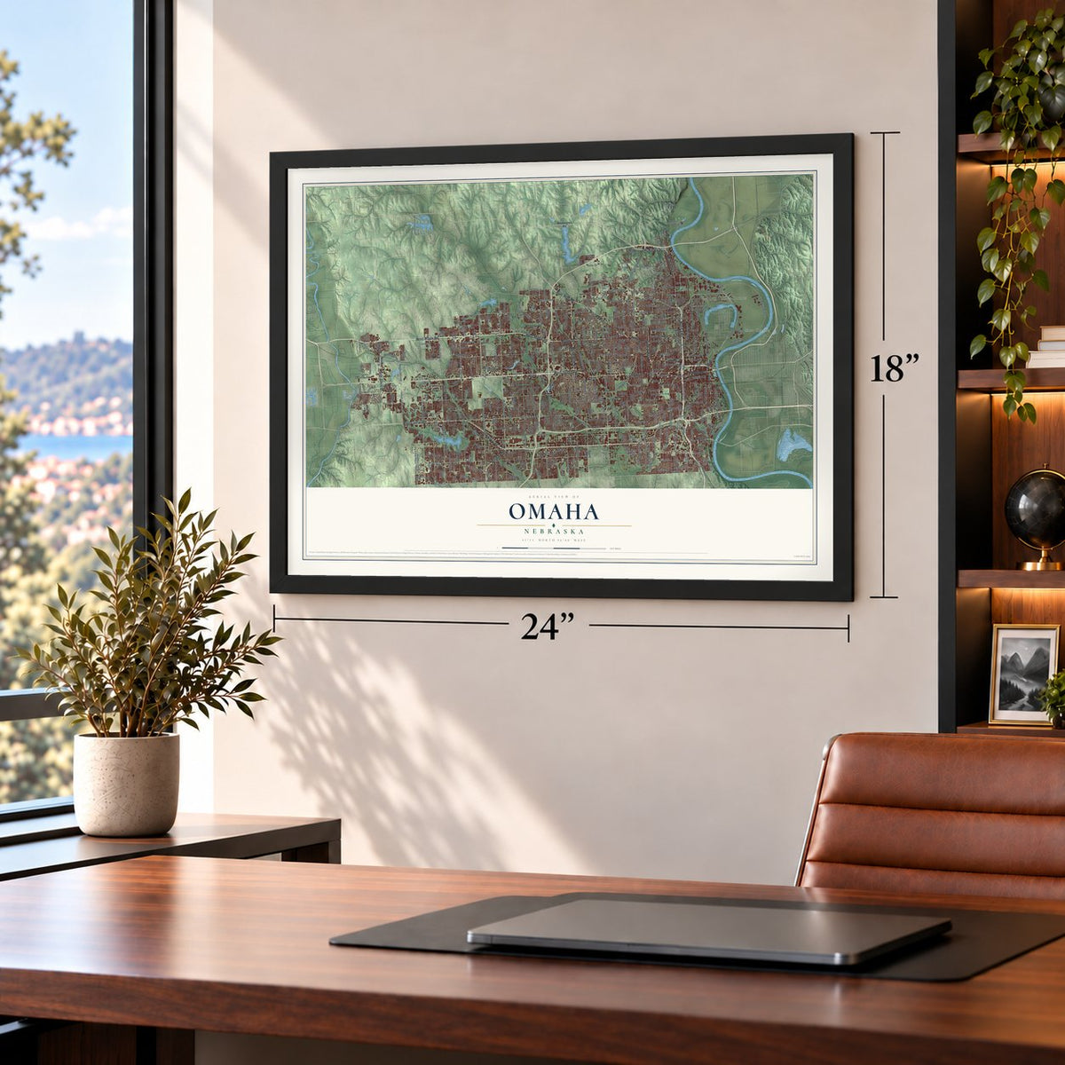
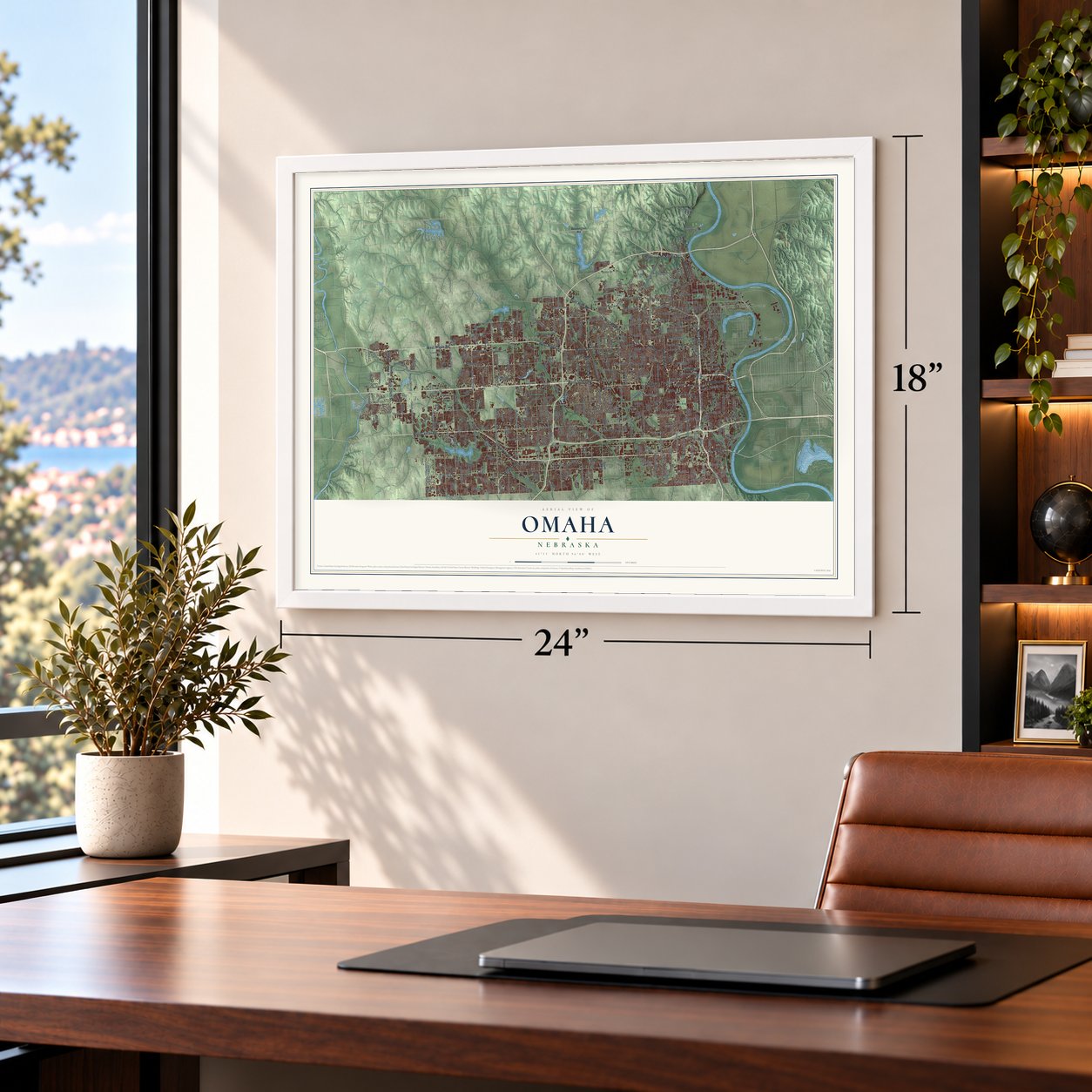
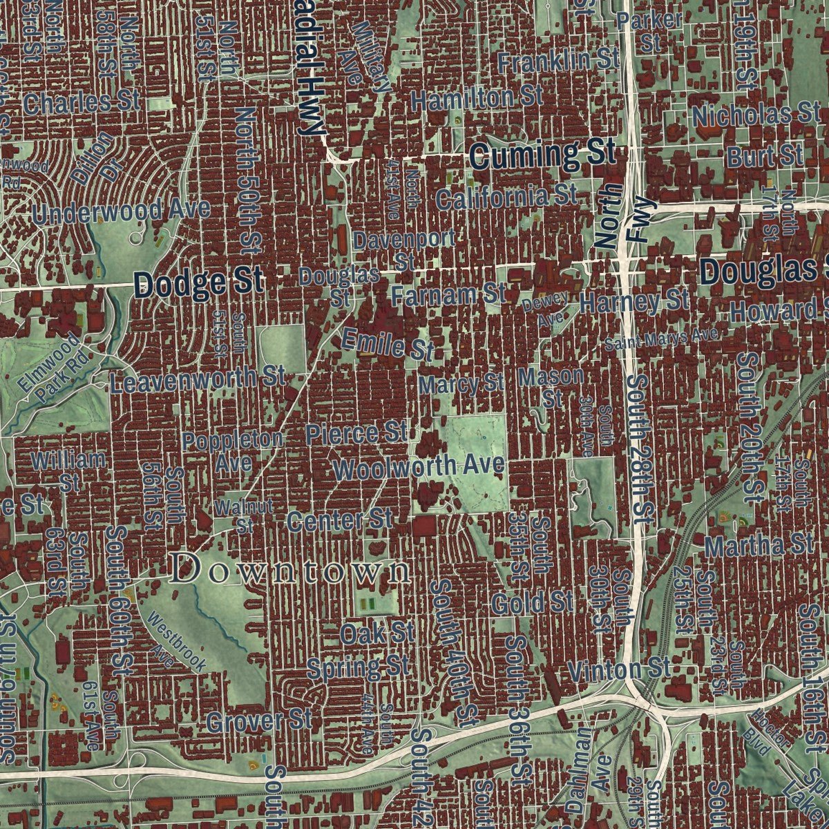
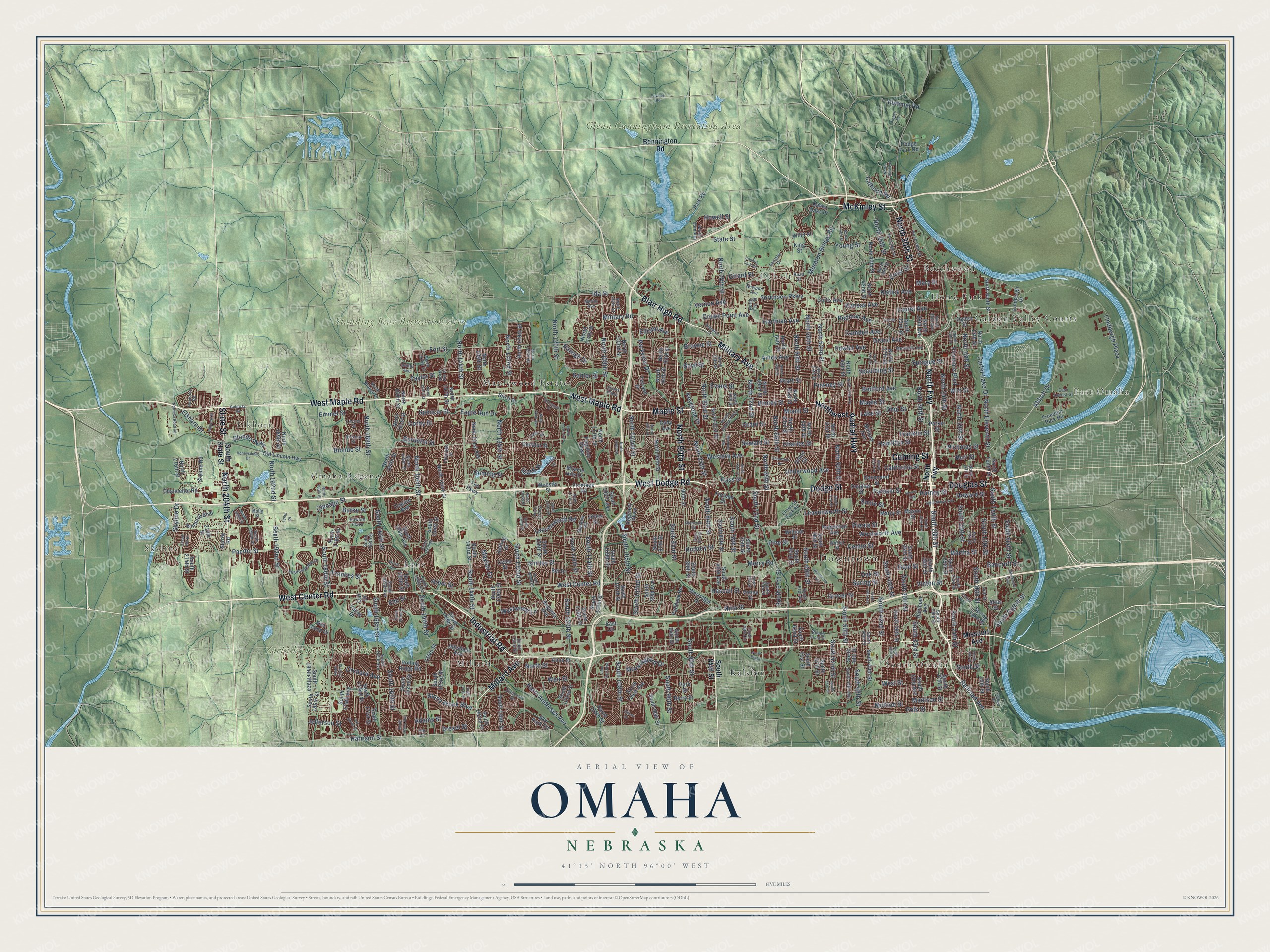
Explore Omaha, Nebraska from a whole new perspective. Created using aerial imagery and detailed geographic data, this map captures Omaha building by building, with labeled streets, familiar landmarks, and shaded topographical relief that highlights the natural contours of the landscape.
Combining modern data with the timeless character of a vintage atlas, this map is just as interesting up close as it is beautiful on the wall. Whether you grew up in Omaha, spent memorable years there, or call it home today, this unique map is a great way to celebrate a place that means something to you. Zoom in on the preview to look for your street, and then order a print to put your memories on the wall.
Three ways to hang it
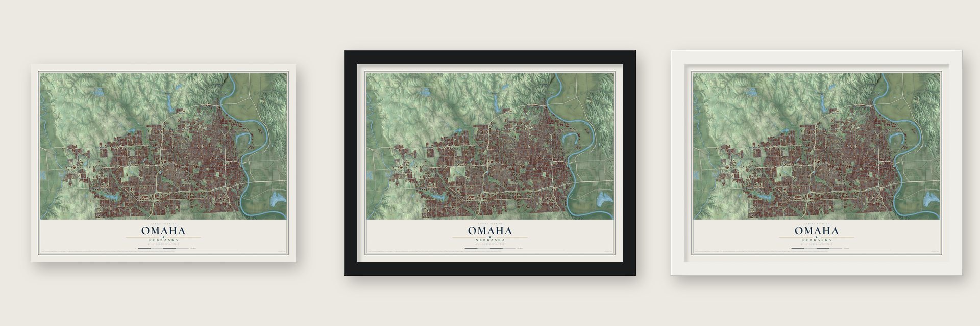
Unframed archival matte, a black wood frame or a white wood frame.
Up close
Geography Worth Displaying
This map was created using accurate cartographic data and authoritative geographic sources, including the U.S. Geological Survey and the Census Bureau. The map brings together terrain, waterways, roads, and building detail. The majority of the streets are labeled, houses are accurately depicted, and the topography is derived from government sources. Combining local data with carefully composed color and shading leads to this beautifully detailed Omaha artwork for your wall.
Rather than simply showing street outlines, we’ve included as many of the street names as we could reasonably fit on the map while keeping their names legible. Zoom in on the high resolution preview to see exactly what’s on the map. We truly set out to create a statement piece for anyone who loves Omaha. So whether it’s for you, or a gift for someone you love, we hope this map of Omaha brings back fond memories.
Read the story behind this map of Omaha, Nebraska from 2026.
About Omaha, Nebraska
Omaha is a city of 486,051 people on the Missouri River and the county seat of Douglas County. Even before settlers could legally claim land in Indian Country, William D. Brown ran the Lone Tree Ferry across the river from Council Bluffs, Iowa. Residents of Council Bluffs staked claims on the west bank, and in 1854 the city was informally founded at a Fourth of July picnic on Capital Hill. On January 16, 1855, Acting Governor Cuming called the first territorial legislature together in Omaha, which made it the capital of Nebraska Territory. It held that role until statehood in 1867, when the capital moved to Lincoln.
The railroad turned the river town into a national hub. Congress cleared the Union Pacific to build west in 1862, and in January 1866 its crews started laying track out of Omaha. The Union Stockyards opened in South Omaha in 1883, and within 20 years the city held four of the nation's five major meatpacking companies. By the 1950s, half of Omaha's workers had jobs in meatpacking and processing.
- Named for the Upstream PeopleThe city takes its name from the Omaha, who with the Ponca had come west from the lower Ohio River valley by the early 17th century. In the Omaha language the word means "Upstream People" or "Against the Current." In 1854 the tribe gave up its claim to most of east-central Nebraska, and that opened the land where the city grew.
- The 1898 World's FairLed by Gurdon Wattles, Omaha's leaders staged the Trans-Mississippi and International Exposition in 1898 to celebrate the farms and factories of the Midwest. An Indian Congress met alongside it and brought more than 500 American Indians from around the nation. Over 2 million visitors came to the grounds at Kountze Park and the Omaha Driving Park.
- Civil rights and a presidentIn 1912 Omaha became home to the first NAACP chapter west of the Mississippi River, the start of the city's civil rights movement. A year later, Gerald R. Ford, who would become President of the United States, was born in Omaha, and a museum now honors his birthplace.
- Invented in OmahaOmaha gave the country the Reuben sandwich, Raisin Bran and the TV dinner. Duncan Hines developed cake mix here, and center-pivot irrigation and the first ski lift in the U.S. came from the city too. KOWH Radio was the first station in the U.S. to use the Top 40 format.
Find your street
Names on the Omaha map
Every name below is printed on this map. Look for your street, your school, the park where you played, or the pond down the road.
Places and landmarks17
- Downtown
- Skyline
- Elkhorn
- East Omaha
- South Omaha
- Glenn Cunningham Recreation Area
- Zorinsky Recreation Area
- Standing Bear Recreation Area
- Beechwood
- Debolt
- Garden Valley Courts
- Home Park
Show all 17 places
- Lane
- Maplewood Estates
- Millard
- Omaha Regency
- Ralston
Streets and roads447
- West Maple Road
- West Dodge Road
- Maple Street
- Dodge Street
- West Center Road
- North Fwy
- Industrial Road
- McKinley Street
- Cuming Street
- North 30th Street
- North 204th Street
- Millard Avenue
- State Street
- North 90th Street
- Northwest Radial Highway
- Blair High Road
- Military Avenue
- Douglas Street
- Grover Street
- Abbott Drive
- South 72nd Street
- Center Street
- South 132nd Street
- North 132nd Street
- South Tenth Street
- Mormon Bridge Road
- Calhoun Road
- Elm Street
- North 66th Street
- Hickory Street
Show all 447 streets
- Chicago Street
- Howard Street
- South 84th Street
- South 28th Street
- Military Road
- South Eighth Street
- North 85th Street
- Blondo Parkway
- Stony Brook Boulevard
- Kansas Avenue
- North 72nd Street
- Ida Street
- Blondo Street
- Pacific Street
- Harrison Street
- Fort Street
- Burt Street
- Harney Street
- Ames Avenue
- Woolworth Avenue
- Seward Street
- Arbor Street
- Farnam Street
- Leavenworth Street
- Fowler Avenue
- Hamilton Street
- Sprague Street
- Charles Street
- Grant Street
- Miami Street
- Shirley Street
- Corby Street
- Grand Avenue
- Lake Street
- Frances Street
- Bedford Avenue
- Pine Street
- Pierce Street
- Franklin Street
- Monroe Street
- Spring Street
- Wirt Street
- Nicholas Street
- South 168th Street
- Pinkney Street
- Ohio Street
- Madison Street
- Spaulding Street
- Polk Street
- North 60th Street
- Pratt Street
- Drexel Street
- Evans Street
- California Street
- Browne Street
- Camden Avenue
- Emmet Street
- Crown Point Avenue
- Cass Street
- Hartman Avenue
- Hascall Street
- North 36th Street
- Binney Street
- South 180th Street
- Spencer Street
- Sahler Street
- South 13th Street
- South 42nd Street
- Florence Boulevard
- Sorensen Parkway
- South Street
- North 16th Street
- North 24th Street
- South 36th Street
- Ellison Avenue
- South 50th Street
- Oak Street
- South 60th Street
- Lindbergh Plaza
- Taylor Street
- Western Avenue
- North 78th Street
- South 120th Street
- Orchard Avenue
- South 48th Street
- North 52nd Street
- South 90th Street
- South 96th Street
- Martha Street
- South 24th Street
- North 56th Street
- North 108th Street
- North Street
- South 33rd Street
- South 108th Street
- Burdette Street
- South 20th Street
- Izard Street
- North 120th Street
- West Street
- South 144th Street
- Vinton Street
- North 144th Street
- Jefferson Street
- Boyd Street
- North 50th Street
- Laurel Avenue
- South 16th Street
- Weir Street
- Redick Avenue
- North 168th Street
- Burke Street
- South 114th Street
- South 156th Street
- North 156th Street
- South 52nd Street
- North 19th Street
- Adams Street
- Bancroft Street
- South 67th Street
- North 69th Street
- Underwood Avenue
- Mary Street
- Keystone Drive
- Carter Lake Drive
- South 192nd Street
- South 40th Street
- South 102nd Street
- North 83rd Street
- South 93rd Street
- Eagle Run Drive
- North 192nd Street
- Redman Avenue
- Gold Street
- Westwood Lane
- South 166th Street
- Mockingbird Drive
- South 78th Street
- Nina Street
- North 102nd Street
- Vernon Avenue
- South 105th Street
- South 165th Street
- Girard Street
- North 135th Street
- Young Street
- Skyline Drive
- Parkview Drive
- Harry Andersen Avenue
- Leavenworth Road
- North Eleventh Street
- Ernst Street
- South Sixth Street
- Railroad Avenue
- Emile Street
- Mercy Road
- Elkhorn Drive
- Hummel Road
- Mayfair Drive
- Howell Street
- Raleigh Drive
- South State Street
- Missouri Avenue
- Bennington Road
- Capitol Avenue
- Frontage Road
- North Tenth Street
- Park Road
- South 138th Street
- North 129th Street
- William Street
- North 114th Street
- Skyline Road
- North Ninth Street
- South 115th Street
- Davenport Street
- Ogden Street
- North 13th Street
- Poppleton Avenue
- Decatur Street
- Parker Street
- Mason Street
- North 40th Street
- North 33rd Street
- North 42nd Street
- North 48th Street
- North 28th Avenue
- Valley Street
- Jones Street
- Webster Street
- Marcy Street
- South 38th Street
- South 15th Street
- Curtis Avenue
- South 27th Street
- North 37th Street
- North 63rd Street
- North 93rd Street
- South 25th Street
- South 49th Street
- North 51st Street
- South 45th Street
- North 96th Street
- North 61st Street
- South 35th Street
- Old Lincoln Highway
- South 30th Street
- South 118th Street
- North 58th Street
- Cedar Street
- South 178th Street
- North 69nd Street
- South 107th Street
- South 153rd Street
- South 88th Street
- North 150th Street
- South 56th Street
- South 94th Street
- North 160th Street
- South 122nd Street
- North 64th Street
- South 149th Street
- South 126th Street
- Papillion Parkway
- South 116th Street
- South 139th Street
- North 81st Street
- South 109th Street
- South 99th Street
- South 160th Street
- Raven Oaks Drive
- South 143rd Street
- Hillsdale Avenue
- South 61st Street
- North 138th Street
- King Street
- South 154th Street
- Dodge Park Road
- South 159th Avenue
- North 161st Street
- South 112th Street
- Willit Street
- South 172nd Street
- Terrace Drive
- North 147th Street
- South 176th Avenue
- South 63rd Street
- South 80th Street
- South 57th Street
- North 216th Street
- North 164th Street
- South 171st Street
- South 75th Street
- Rolling Ridge Road
- Regency Parkway
- Dahlman Avenue
- South 62nd Street
- South 185th Street
- South 142nd Street
- North 94th Street
- North 103rd Street
- Bonanza Boulevard
- South 162nd Street
- Paddock Road
- Westridge Drive
- Cady Avenue
- South 108th Avenue
- South 214th Street
- Augusta Avenue
- North 141st Avenue
- Farnam Drive
- 90th Street
- South 104th Avenue
- Spring Lake Drive
- Berry Street
- North 189th Street
- North 111th Street
- Park Drive
- South 97th Street
- Lindbergh Drive
- Chancellor Road
- Birch Drive
- South 184th Plaza
- South 80th Avenue
- Sky Park Circle
- South 33rd Avenue
- Anne Street
- Freedom Park Road
- South 99th Avenue
- Fnb Parkway
- Valley Drive
- Van Camp Drive
- Atlas Street
- 156th Street
- Oak Drive
- Miracle Hills Drive
- Bel Drive
- Surrey Road
- Holling Drive
- Dillon Drive
- East Circle
- 210th Street
- Elmwood Park Road
- Meredith Avenue
- Newport Avenue
- Erskine Street
- Walnut Street
- South 17th Street
- South 23rd Street
- North 39th Street
- North 54th Street
- Read Street
- South 49th Avenue
- South 29th Street
- North 80th Street
- North 17th Street
- North 28th Street
- Locust Street
- North 25th Avenue
- South 46th Street
- North 76th Street
- South 133rd Street
- South 70th Street
- South 165th Avenue
- South 61st Avenue
- Martin Avenue
- North 152nd Street
- North 126th Street
- South 167th Avenue
- Shadow Ridge Drive
- North 159th Street
- Eldorado Drive
- South 169th Street
- North 71st Street
- North 104th Street
- Evans Plaza
- Butler Avenue
- Yates Street
- Rose Lane
- East Locust Street
- South 156th Circle
- Discovery Drive
- North Branch Drive
- South 197th Street
- Buena Vista Court
- North 83rd Avenue
- Meadow Road
- Howard Plaza
- 14th Street
- Hackney Road
- Fairway Drive
- South 76th Circle
- North 148 Street
- Molly Street
- Pawnee Road
- Jaynes Street
- South 39th Street
- South 19th Street
- North 65th Street
- South 51st Street
- North 20th Street
- North 41st Street
- Dewey Avenue
- North 75th Street
- South 87th Street
- South 123rd Street
- South 147th Street
- South 163rd Street
- North 105th Street
- South 162nd Avenue
- Honeysuckle Drive
- South 155th Street
- North 47th Street
- South 130th Street
- Northridge Drive
- Gifford Drive
- South 177th Street
- North 97th Street
- South 53rd Street
- Shamrock Road
- North 180th Street
- North 47th Avenue
- North 130th Street
- Country Club Road
- Saint Marys Avenue
- South 127th Street
- South 74th Street
- South 200th Street
- Gateway Road
- North 153rd Street
- North 125th Avenue
- North County Road 80
- South 44th Avenue
- Benson Gardens Boulevard
- John Galt Boulevard
- Glenwood Road
- North 41st Avenue
- Westbrook Avenue
- North 117th Street
- Polk Circle
- Hoctor Boulevard
- Riverview Boulevard
- North 117th Avenue
- Chapel Hill Drive
- Maenner Drive
- Hillcrest Street
- North 30th Avenue
- Stonegate Drive
- South 30th Avenue
- Van Buren Drive
- Arlington Drive
- Wood Drive
- Pilcher Road
- Royal Wood Drive
- 188th Street
- North Plaza
- Adams Drive
Names are listed as they appear on the printed map. Zoom into the product photos to find them.
The art of mapping a place
How This Map Was Made
Real places. Remarkable detail. Discover the layers that turn geographic data into a map of home.

The view from above
Aerial imagery reveals the character of the land: woodland, open fields, and the patterns of a place.

The shape of the land
Elevation data brings hills, valleys, and subtle changes in the landscape into view.

The details of home
Roads, waterways, and building footprints come together to make the map feel unmistakably local.

Geography becomes art
Considered color, shading, and typography bring the layers together in a map made for your wall.


Process illustrated with Mendon, Massachusetts. Aerial imagery: USDA NAIP. Terrain: USGS 3D Elevation Program. Map details and finished artwork: KNOWOL.
The Details
About This Print
Choose an archival matte print, or a black or white Ayous wood frame. The archival matte print is unframed.
Select your size and finish above to see the matching product image and price.
Materials & Craftsmanship
A contemporary map with the character of a classic atlas, printed on archival matte paper. Optional frames are made from Ayous wood.
Your printed map does not include the watermark shown in the full-map preview.
Shipping & Delivery
Free shipping within the United States. Every print is made to order in the USA.
Buying a gift? Add a note in your cart and we'll include it. We never put prices in the package.
Prints ship within 2 to 3 business days. Allow 7 to 10 days total from ordering for delivery. Timing may vary during holidays or periods of high order volume.
Read our shipping policy.
Returns and damaged prints
Each print is made to order. Change-of-mind refunds are not available after production.
If your print arrives damaged, misprinted or incorrect, contact support@knowol.com within 30 days of receiving it. Include your order number, photos and a description of the issue.
Read our full refund and replacement policy. For questions about your order, email support@knowol.com.
Find your town
Looking for another city?
Find a map of home in our Nebraska collection, or any town in the country.
Nearby
Maps of towns near Omaha
Know someone from one of these towns? Their map makes a great gift.
 Boys Town
, Nebraska
From $39.99See the map
 Ralston
, Nebraska
From $39.99See the map
 La Vista
, Nebraska
From $39.99See the map
More maps nearby: Chalco, Papillion, Bennington, Bellevue and Richfield.