
Search for another town




Free U.S. delivery 7 to 10 days after you order
Orange, Connecticut Map Art
Building by building, with labeled streets and shaded relief.
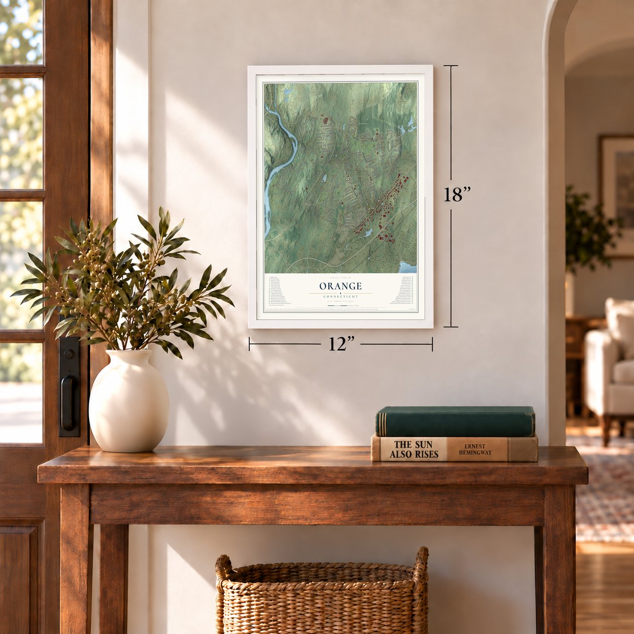
12" x 18" Archival Matte Print
A Map of Home. A Work of Art.
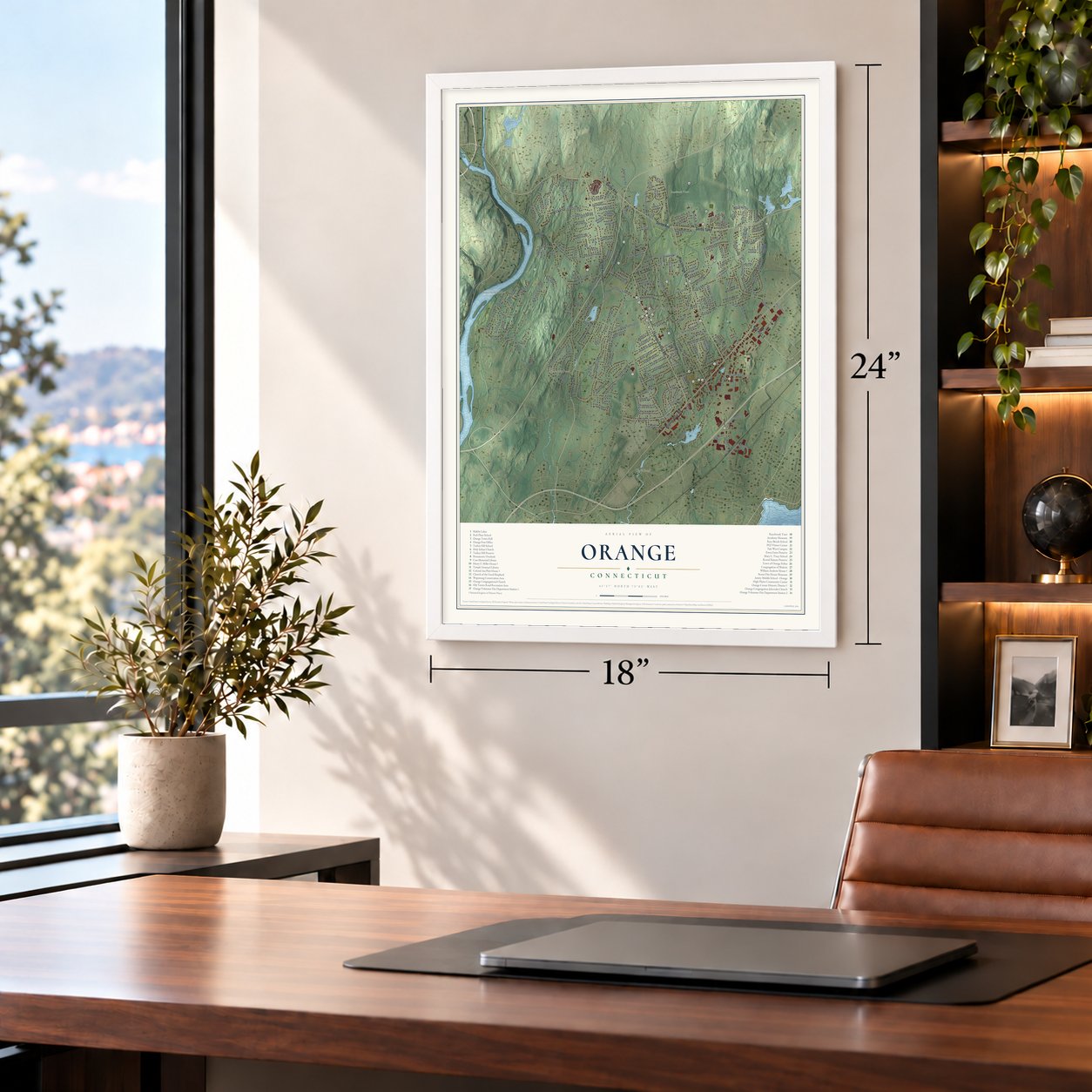
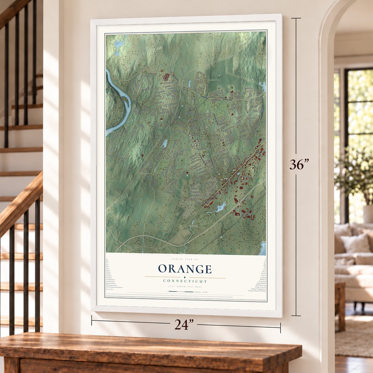
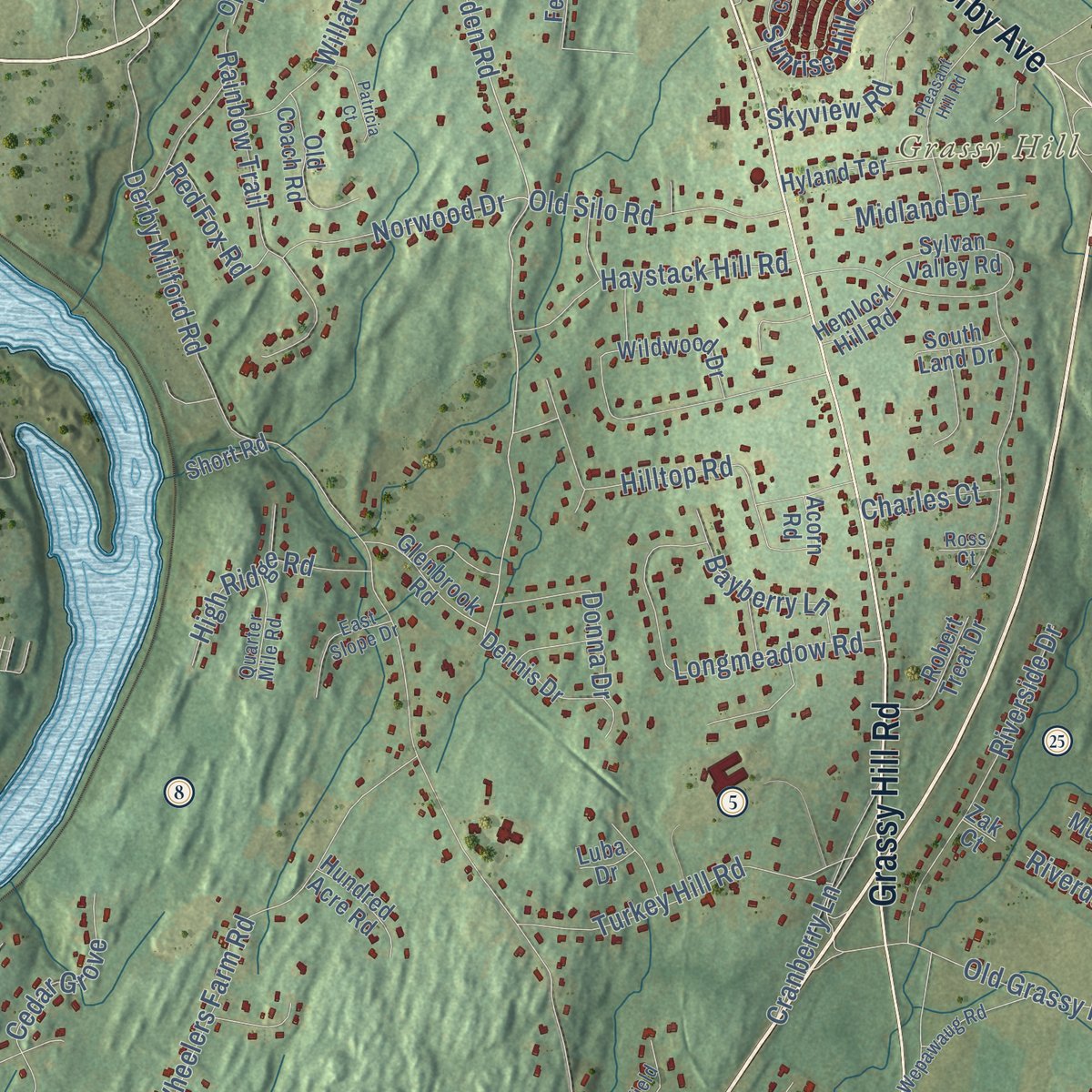
Explore Orange, Connecticut from a whole new perspective. Created using aerial imagery and detailed geographic data, this map captures Orange building by building, with labeled streets, familiar landmarks, and shaded topographical relief that highlights the natural contours of the landscape.
Combining modern data with the timeless character of a vintage atlas, this map is just as interesting up close as it is beautiful on the wall. Whether you grew up in Orange, spent memorable years there, or call it home today, this unique map is a great way to celebrate a place that means something to you. Zoom in on the preview to look for your street, and then order a print to put your memories on the wall.

Three ways to hang it
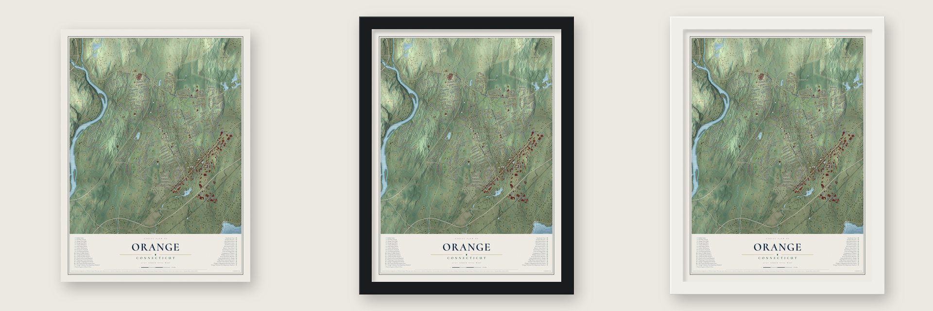
Unframed archival matte, a black wood frame or a white wood frame.
Up close
Geography Worth Displaying
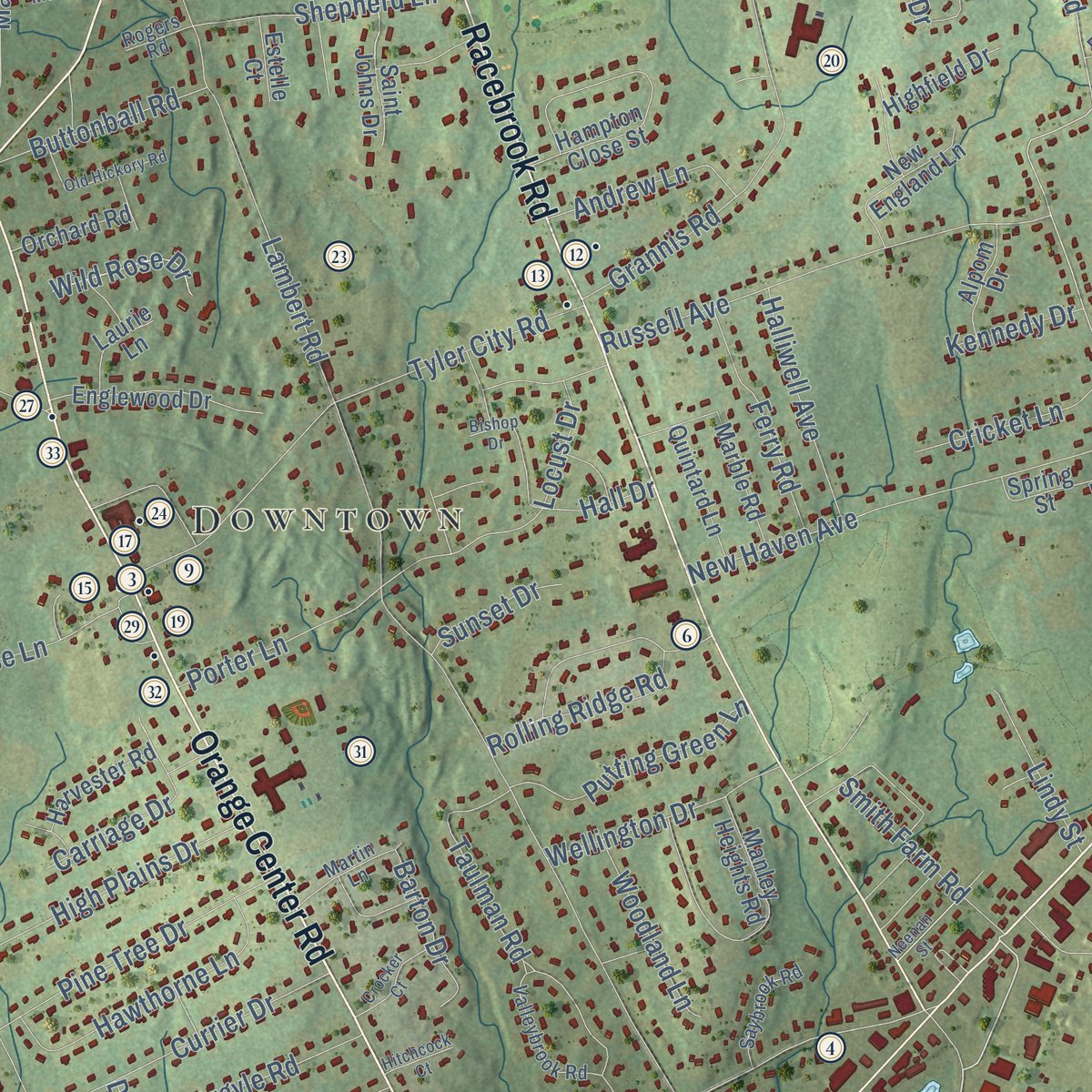
This map was created using accurate cartographic data and authoritative geographic sources, including the U.S. Geological Survey (USGS) and FEMA. The map brings together terrain, waterways, roads, and building detail. The majority of the streets are labeled, houses are accurately depicted, and the topography is derived from government sources. Combining local data with carefully composed color and shading leads to this beautifully detailed Orange artwork for your wall.
Rather than simply showing street outlines, we’ve included as many of the street names as we could reasonably fit on the map while keeping their names legible. Zoom in on the high resolution preview to see exactly what’s on the map. We truly set out to create a statement piece for anyone who loves Orange. So whether it’s for you, or a gift for someone you love, we hope this map of Orange brings back fond memories.
Explore the full map of Orange, Connecticut and read about the local places it shows.

Find your street
Names on the Orange map
Every name below is printed on this map. Look for your street, your school, the park where you played, or the pond down the road.
Places and landmarks8
- Downtown
- Buttermilk Hollow
- Coram Hill
- Grassy Hill
- Clark Pond
- Clarktown Pond
- Racebrook Tract
- Turkey Hill Preserve
Streets and roads224
- Grassy Hill Road
- Orange Center Road
- Derby Avenue
- Derby Turnpike
- Racebrook Road
- Boston Post Road
- Bull Hill Lane
- Indian River Road
- Marsh Hill Road
- Dogwood Road
- Garden Road
- Derby Milford Road
- Lambert Road
- Ridge Road
- Old Tavern Road
- Wheelers Farm Road
- Peck Lane
- Pine Tree Drive
- Dogburn Road
- Treat Lane
- North Greenbrier Drive
- Mapledale Road
- New Haven Avenue
- Tyler City Road
- Russell Avenue
- Ridgeview Road
- Summit Drive
- Taulman Road
- Grannis Road
- Narrow Lane
Show all 224 streets
- Hilltop Road
- Old Grassy Hill Road
- Meetinghouse Lane
- Dogburn Lane
- Longmeadow Road
- Howellton Road
- Rainbow Trail
- Fairlea Road
- Cranberry Lane
- Aspen Lane
- Clark Lane
- Turkey Hill Road
- Riverside Drive
- Wagon Trail
- Sunrise Hill Circle
- Karen Drive
- Currier Drive
- Willard Road
- Prudden Lane
- Hawthorne Lane
- Cummings Drive
- Indian Hill Road
- Haystack Hill Road
- Hall Drive
- Cedar Grove
- High Plains Drive
- Avon Drive
- Skyline Drive
- Putting Green Lane
- Greenway Road
- Sportsman Road
- Shepherd Lane
- Rolling Ridge Road
- Arnold Lane
- Old Silo Road
- Sarah Circle
- Green Circle
- Norwood Drive
- Argyle Road
- Wellington Drive
- West Campus Drive
- Ferry Road
- Halliwell Avenue
- Miles Road
- High Ridge Road
- Arrowhead Drive
- Wilson Road
- Carriage Drive
- Cart Lane
- Farm Hill Road
- Prindle Hill Road
- Buttonball Road
- Porter Lane
- Augusta Drive
- Broadview Road
- Smith Farm Road
- Bayberry Lane
- Oakview Drive
- Skyview Road
- Andrew Lane
- Knight Lane
- Donna Drive
- Cricket Lane
- Woodland Lane
- Bittersweet Road
- Hitching Post Drive
- Wolcott Lane
- Lindy Street
- Midland Drive
- Barton Drive
- Carlson Road
- Clement Lane
- Woodside Drive
- Red Fox Road
- Timberlane Drive
- Golf Road
- Hemlock Drive
- Wild Rose Drive
- Alling Road
- Sunset Drive
- Riverdale Road
- Ohman Avenue
- Kennedy Drive
- Charles Court
- Baldwin Road
- Locust Drive
- Whitney Lane
- Meloy Road
- Juniper Drive
- David Court
- South Lambert Road
- Wildwood Drive
- Drummond Road
- South Greenbrier Drive
- Green Hill Road
- Hampton Close Street
- West River Road
- Chestnut Ridge Road
- Manley Heights Road
- Coram Lane
- Sylvan Valley Road
- Hyland Terrace
- Hemlock Hill Road
- Englewood Drive
- Center Road Circle
- Hotchkiss Road
- Old Country Road
- Yellow Brick Road
- Demarest Drive
- Dennis Drive
- Grace Trail
- Lincoln Road
- Surrey Drive
- Alling Farm Road
- Robinson Boulevard
- New England Lane
- Oakwood Road
- Old Coach Road
- Saddle Ridge Road
- Hillcrest Road
- Mallard Drive
- Glenbrook Road
- Spring Street
- Saint Johns Drive
- Quintard Lane
- Marble Road
- Cherry Hill Road
- Acorn Road
- Robert Treat Drive
- Executive Boulevard
- Harvester Road
- Goldman Road
- College Street
- Stone Hill Drive
- Fernbrook Road
- Burning Tree Drive
- Mulberry Lane
- Highfield Drive
- Orchard Road
- Hundred Acre Road
- Edison Road
- Connair Road
- Alpom Drive
- Kanuga Trail
- Laurie Lane
- Sheldon Court
- Hunting Hill Road
- South Land Drive
- Fawn Drive
- Club Road
- Opekun Road
- Short Road
- Estelle Court
- Glen Road
- Luba Drive
- Zak Court
- Ann Rose Drive
- Butternut Court
- Herbert Street
- Birchwood Drive
- Wepawaug Road
- Valleybrook Road
- Quarter Mile Road
- Williamsburg Drive
- Clover Way
- Harborview Road
- Tall Timber Road
- South Orange Center Road
- Hedgefield Court
- Saybrook Road
- Martin Lane
- Hawkins Road
- Pardee Manor Road
- Walnut Hill Road
- Country Club Close
- East Slope Drive
- Morning Glory Road
- Janet Lane
- Estate Acres Drive
- Rogers Road
- Riggs Road
- Ross Court
- Red Cedar Road
- Meetinghouse Circle
- Pleasant Hill Road
- Dentree Drive
- Old Hickory Road
- Bishop Drive
- Neenan Street
- Crocker Court
- Patricia Court
- Michael Court
- Hollow Road
- Hitchcock Court
Names are listed as they appear on the printed map. Zoom into the product photos to find them.
About Orange, Connecticut
Orange is a town of 14,280 people in New Haven County, with the Housatonic River on its western side. The Reverend Peter Prudden bought this land from its Native owners in 1639, paying in coats, blankets, hatchets, hoes, knives and mirrors. It was surveyed in 1687, but nobody settled for good until after 1700, when Richard Bryan, Jr., of Milford made his home here and the district became known as Bryan's Farms.
For more than a century this was North Milford, and by 1750 its farm families had enough children for a winter school. About 1790 they put up a meeting house for winter preaching, and in 1804 fifty petitioners won a church society of their own. In May 1822 the North Milford and West Haven parishes joined to form the town of Orange, named for William III, Prince of Orange. West Haven split off in 1921 by act of the General Assembly and took most of the town's built-up population, so Orange stayed mostly farmland until suburbs spread here in the postwar years.
“The Green was a goose pasture in those days, and we boys used to chase them about trying to make them shed their quills for pens to be used in school.”
- David Hoadley's church, 1810The North Milford church was organized March 13, 1805, with five members and Erastus Scranton as minister. A man born in the 1840s recalled that when Deacon Beach lay sick, his horse heard the Sunday bell, jumped the fences and trotted to its usual horse shed.
- The oldest house in OrangeThe William Andrew House on Old Tavern Road is the oldest building left in Orange. One account says the Bryan family, the first settlers of North Milford, built it about 1750, and another credits William Andrew, about 1775. Its builders split the lath by hand and put it up without nails. Dairy farm workers later lived in it, and the town bought it in 2000 so the historical society could run it as a museum.
- Colonel Platt and Tyler CityAsa Platt bought land at today's Tyler City Road in 1810 and built a Federal house about 1811, its woodwork credited to David Hoadley. The town later took it for taxes, ran it as the poor farm and sold it in 1847 to William Russell. After the Derby railroad came in 1871, a hamlet called Tyler City grew around its station, where Leonard Schaffnit made cigars from 1882 and Edward W. Russell opened a creamery in May 1890.
- The House of TomorrowHenry F. Miller, a Yale architecture student, built a Derby Avenue house in 1948 and 1949 as his master's thesis. It had a flat roof, glass walls, movable inner walls. Shaded south windows let in winter but not summer sun, and the roof could be flooded to cool the rooms. The New Haven Register named it.
- A country fair since 1898The Orange Country Fair first ran from 1898 to 1912. It came back in 1975 and still fills the fairgrounds at the High Plains Community Center with horse, oxen and tractor pulls and prizes for animals, flowers, fruits, vegetables and baked goods. Each August the volunteer firemen's carnival raises money there for the fire department.
Keep exploring Connecticut
Orange is one of 382 Connecticut towns we've mapped. Every dot on the map is a print of its own.
The search covers every state, Connecticut first.
Near Orange
Order 2 or more town maps and save 10%. Shown in the size and finish you picked above, so they hang as a set.
- West Haven 12" x 18" / Archival Matte Print $39.99
- Westville 12" x 18" / Archival Matte Print $39.99
- Derby 12" x 18" / Archival Matte Print $39.99


More maps nearby: West River, Amity, The Hill, Milford and Woodmont.
The art of mapping a place
How This Map Was Made
Real places. Remarkable detail. Discover the layers that turn geographic data into a map of home.

The view from above
Aerial imagery reveals the character of the land: woodland, open fields, and the patterns of a place.

The shape of the land
Elevation data brings hills, valleys, and subtle changes in the landscape into view.

The details of home
Roads, waterways, and building footprints come together to make the map feel unmistakably local.

Geography becomes art
Considered color, shading, and typography bring the layers together in a map made for your wall.


Process illustrated with Mendon, Massachusetts. Aerial imagery: USDA NAIP. Terrain: USGS 3D Elevation Program. Map details and finished artwork: KNOWOL.
The Details
About This Print
Choose an archival matte print, or a black or white Ayous wood frame. The archival matte print is unframed.
Select your size and finish above to see the matching product image and price.
Materials & Craftsmanship
A contemporary map with the character of a classic atlas, printed on archival matte paper. Optional frames are made from Ayous wood.
Your printed map does not include the watermark shown in the full-map preview.
Shipping & Delivery
Free shipping within the United States. Every print is made to order in the USA.
Buying a gift? Add a note in your cart and we'll include it. We never put prices in the package.
Prints ship within 2 to 3 business days. Allow 7 to 10 days total from ordering for delivery. Timing may vary during holidays or periods of high order volume.
Read our shipping policy.
Returns and damaged prints
Each print is made to order. Change-of-mind refunds are not available after production.
If your print arrives damaged, misprinted or incorrect, contact support@knowol.com within 30 days of receiving it. Include your order number, photos and a description of the issue.
Read our full refund and replacement policy. For questions about your order, email support@knowol.com.