


Search for another town





Free U.S. delivery 7 to 10 days after you order
Milford, Connecticut Map Art
Building by building, with labeled streets and shaded relief.
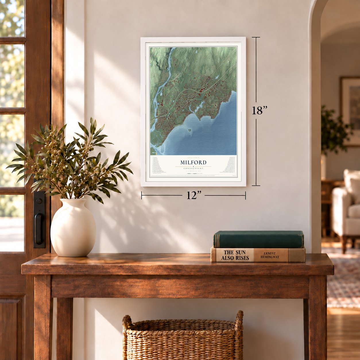
12" x 18" Archival Matte Print
A Map of Home. A Work of Art.
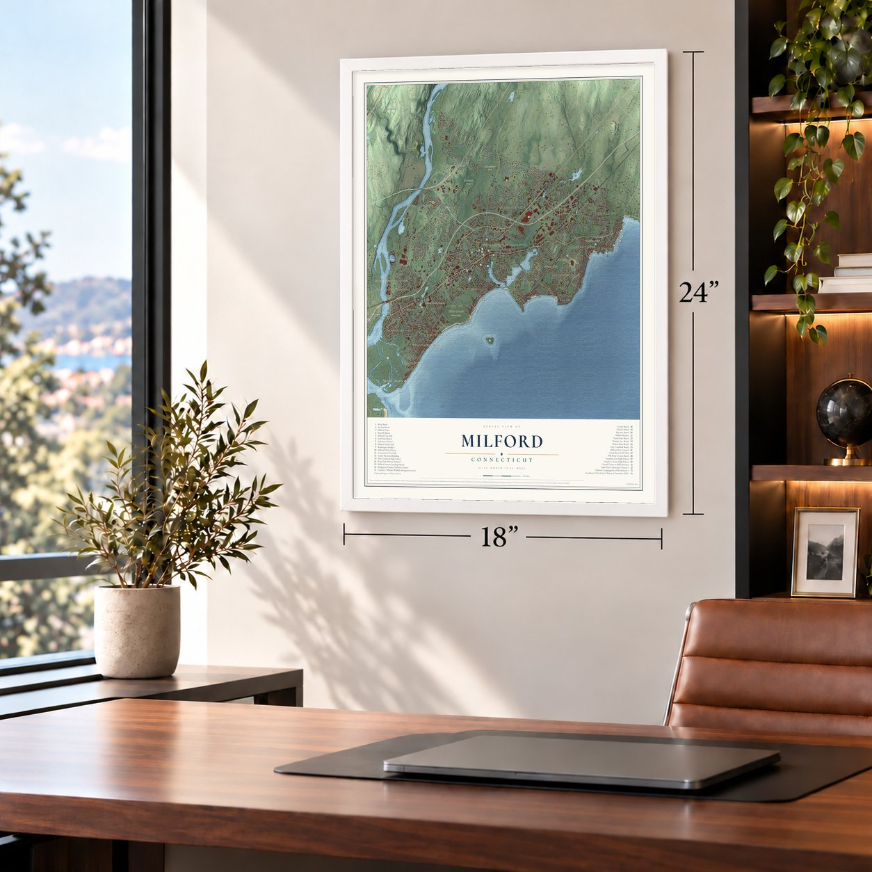
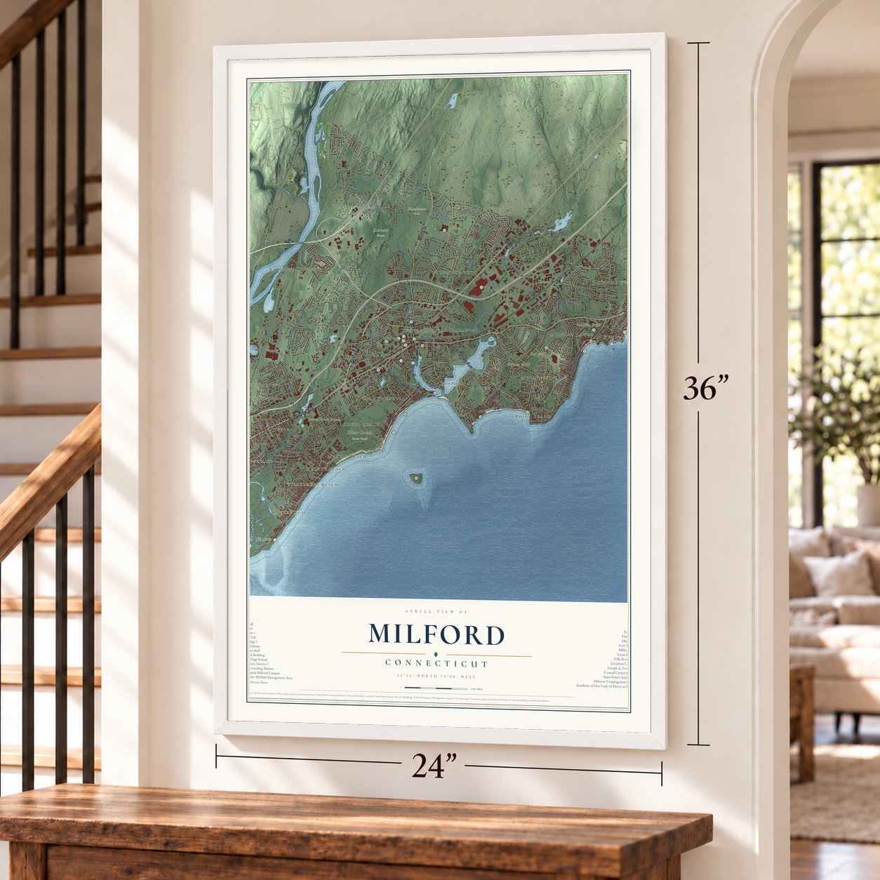
Explore Milford, Connecticut from a whole new perspective. Created using aerial imagery and detailed geographic data, this map captures Milford building by building, with labeled streets, familiar landmarks, and shaded topographical relief that highlights the natural contours of the landscape.
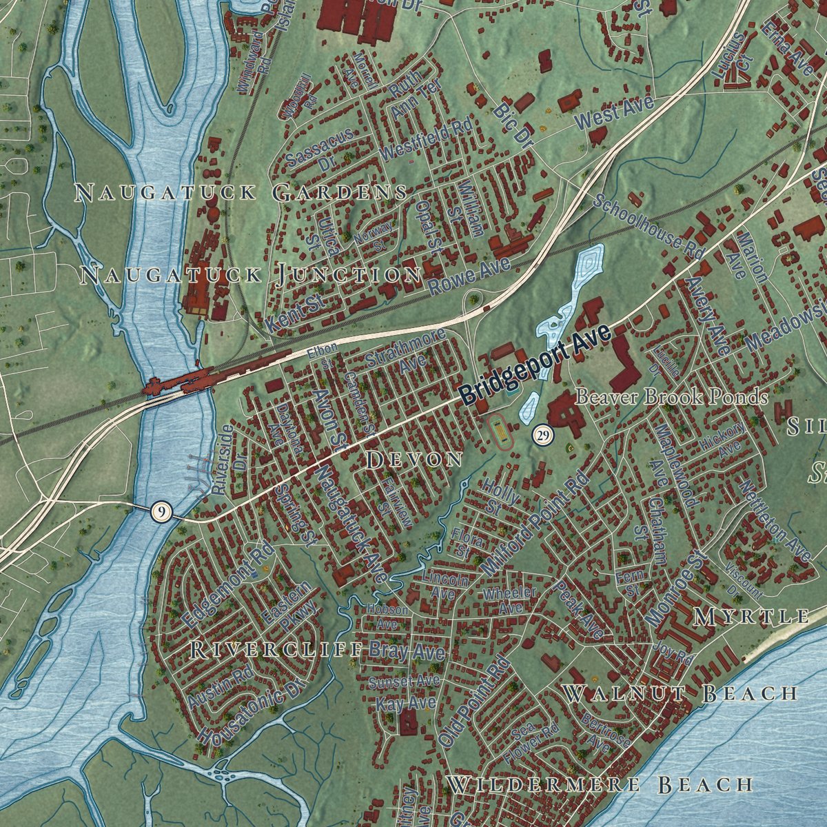
Combining modern data with the timeless character of a vintage atlas, this map is just as interesting up close as it is beautiful on the wall. Whether you grew up in Milford, spent memorable years there, or call it home today, this unique map is a great way to celebrate a place that means something to you. Zoom in on the preview to look for your street, and then order a print to put your memories on the wall.

Three ways to hang it
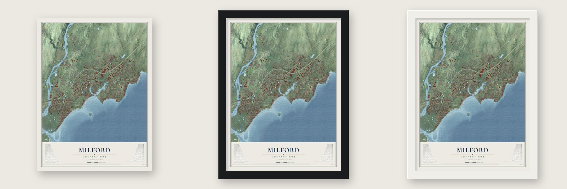
Unframed archival matte, a black wood frame or a white wood frame.
Up close
Geography Worth Displaying
This map was created using accurate cartographic data and authoritative geographic sources, including the U.S. Geological Survey (USGS) and FEMA. The map brings together terrain, waterways, roads, and building detail. The majority of the streets are labeled, houses are accurately depicted, and the topography is derived from government sources. Combining local data with carefully composed color and shading leads to this beautifully detailed Milford artwork for your wall.
Rather than simply showing street outlines, we’ve included as many of the street names as we could reasonably fit on the map while keeping their names legible. Zoom in on the high resolution preview to see exactly what’s on the map. We truly set out to create a statement piece for anyone who loves Milford. So whether it’s for you, or a gift for someone you love, we hope this map of Milford brings back fond memories.
Explore the full map of Milford, Connecticut and read about the local places it shows.

Find your street
Names on the Milford map
Every name below is printed on this map. Look for your street, your school, the park where you played, or the pond down the road.
Places and landmarks28
- Downtown
- Cedar Beach
- Baldwin Point
- Bryan Hill
- Burns Point
- Burwell Hill
- Baird Millpond
- Beaver Brook Ponds
- Eisenhower Park
- Silver Sands State Park
- Solomon Woods
- Baldwins Crossing
Show all 28 places
- Rivercliff
- Forest Heights
- Walnut Beach
- Point Beach
- Devon
- Morningside
- Naugatuck Gardens
- Laurel Beach
- Myrtle Beach
- Wildermere Beach
- Bayview
- Silver Beach
- Fort Trumbull
- Naugatuck Junction
- Woodmont
- Milford Lawns
Streets and roads271
- Boston Post Road
- New Haven Avenue
- Bridgeport Avenue
- Seaside Avenue
- North Street
- Buckingham Avenue
- Edgefield Avenue
- Melba Street
- West Main Street
- Broadway
- Plains Road
- Roses Mill Road
- Cherry Street
- Old Field Lane
- Caswell Drive
- Bic Drive
- Naugatuck Avenue
- Oronoque Road
- West River Street
- Wheelers Farm Road
- Milford Point Road
- Orange Avenue
- West Avenue
- Gulf Street
- Woodruff Road
- Pond Point Avenue
- Anderson Avenue
- High Street
- Meadowside Road
- Welchs Point Road
Show all 271 streets
- Burnt Plains Road
- Old Gate Lane
- Housatonic Drive
- Forest Road
- West Rutland Road
- Woodmont Road
- Herbert Street
- Zion Hill Road
- Ford Street
- Milford Circle
- Wolf Harbor Road
- Pepes Farm Road
- Quarry Road
- Tanglewood Circle
- Old Point Road
- Brewster Road
- Fresh Meadow Lane
- Hawley Avenue
- Baxter Lane
- Red Root Lane
- East Rutland Road
- Monroe Street
- Depot Road
- Rock Lane
- Edgemont Road
- East Town Road
- Rowe Avenue
- Rogers Avenue
- Shelland Street
- Dunbar Road
- Robert Treat Parkway
- Cornfield Road
- Kings Highway
- Grinnell Street
- Platt Street
- Marino Drive
- Walnut Street
- Honeycomb Lane
- Meadow Street
- Magnolia Road
- Maple Street
- Bryan Hill Road
- Oxford Road
- Clark Street
- Platt Lane
- Home Acres Avenue
- Red Bush Lane
- Morningside Drive
- Clark Hill Road
- Wampus Lane
- Hill Street
- Cascade Boulevard
- Timber Trail
- Third Avenue
- Corona Drive
- Judith Drive
- Kozlowski Road
- Juniper Drive
- Locust Street
- Mills Avenue
- Bird Lane
- Ridgewood Drive
- Cheryl Ann Drive
- Seemans Lane
- Foran Road
- Bayshore Drive
- Quirk Road
- Harvest Lane
- Raton Road
- Surf Avenue
- Grant Street
- Lavery Lane
- Lori Drive
- Jepson Drive
- Gunn Street
- Heenan Drive
- Noble Avenue
- Avery Avenue
- Dock Road
- Avon Street
- Bray Avenue
- Dale Drive
- Kent Street
- Peck Street
- Bolt Lane
- East Broadway
- Shadyside Lane
- Merwin Avenue
- Acorn Lane
- Mary Ellen Drive
- Research Drive
- Pine Knob Terrace
- Centennial Drive
- Oak Ridge Lane
- McQuillan Drive
- Wellington Road Extension
- Eastern Parkway
- Southworth Street
- Brooklawn Drive
- Settlers Ridge Road
- Easy Street
- Castle Lane
- Wilcox Road
- Carmen Road
- Berner Terrace
- Joyce Court
- Chatham Street
- Maplewood Avenue
- Eastern Steel Road
- Stiles Street
- Schoolhouse Road
- Riverside Drive
- Ardmore Road
- First Avenue
- Westfield Road
- Cedar Hill Road
- Robert Treat Drive
- Knobb Hill Road
- Popes Island Road
- Terrell Drive
- Sunnyside Court
- Nicole Drive
- Barton Road
- Nettleton Avenue
- Coram Lane
- Point Lookout
- Paschal Drive
- Mansfield Road
- Marion Avenue
- Shell Avenue
- Dart Hill Road
- Erna Avenue
- Strathmore Avenue
- Greer Circle
- Pond Street
- Orland Street
- Utica Street
- Country Lane
- Opal Street
- Sassacus Drive
- Park Circle
- Bailey Lane
- Tower Street
- Flax Mill Lane
- Ruth Ann Terrace
- Peak Avenue
- Shelter Cove Road
- Eels Hill Road
- Sigwin Drive
- Whitney Avenue
- Austin Road
- Narrow Lane
- Marble Lane
- Wilbar Avenue
- Ranch Road
- Sixth Avenue
- Spring Street
- James Street
- Wendy Road
- Kay Avenue
- Franklin Road
- Holly Street
- Lucius Court
- William Street
- Milford Chase
- Lilac Lane
- Lyda Drive
- Peck Lane
- Davis Drive
- Penn Cmn
- Avalon Drive
- Chapel Street
- Sea Flower Road
- Point Beach Drive
- Snowapple Lane
- Seaview Avenue
- Branca Court
- Midwood Road
- Meadow Park Drive
- Trumbull Avenue
- Hilltop Circle
- Governors Avenue
- Bertrose Avenue
- Astriab Lane
- Fairview Street
- Elaine Road
- West Mayflower Place
- Crestwood Road
- Camden Street
- Hickory Avenue
- Daytona Avenue
- Sunset Avenue
- Mark Street
- Barbara Drive
- Lakeview Drive
- Windward Road
- Westport Place
- Whalley Avenue
- Wheeler Avenue
- Lincoln Avenue
- Earle Street
- Flora Street
- Center Street
- Joy Road
- Glen Street
- Fern Street
- Golden Hill Street
- Seabreeze Avenue
- Wepawaug Drive
- Cornflower Drive
- Founders Way
- Captains Walk
- Woodhill Road
- Masters Lane
- Alexander Road
- Smiths Point Road
- Tulip Tree Court
- Marshall Street
- Foxwood Lane
- Wellington Road
- Viscount Drive
- Wilson Street
- Riverdale Road
- Grassland Road
- Elgin Road
- Eisenhower Drive
- Greenfield Road
- Rosebrook Road
- Newton Street
- Henry Albert Drive
- Roller Terrace
- Ray Bob Road
- Charles Street
- Hobson Avenue
- Saley Road
- Norway Street
- Lucille Drive
- Morrell Avenue
- Alfred Road
- Hollis Drive
- Elbon Street
Names are listed as they appear on the printed map. Zoom into the product photos to find them.
About Milford, Connecticut
Milford is a city of 50,558 people on Long Island Sound, in New Haven County, lying between New Haven and Bridgeport. On February 1, 1639, planters linked to the New Haven Colony purchased this ground from Ansantawae, who led the Paugussett people living there. They first called it Wepawaug, after the small river that runs through it. In 1640 William Fowler put up a grist mill on that river, the first mill in the New Haven Colony, and on November 24 of that year the freemen voted to name the plantation Milford.
The town later gave up land to new towns, and in 1822 its northern and eastern sections broke away as Orange. The part that remained made its living from shipbuilding, farming and oystering. In the later 1800s it drew summer crowds from New Haven and Bridgeport to its beaches. The southeastern corner became the Borough of Woodmont in 1903, and in 1959 the town and Woodmont together became the City of Milford.
“He had landed at Milford in passing through the Sound and proclaimed it here first, so for once Milford was ahead of New York.”
- Two judges in the cellarIn August 1661 Major-General Whalley and Major-General Goffe, judges who had condemned King Charles I, slipped into Milford with the new king's men hunting them. For over two years they hid in the stone cellar under a shop on the Tomkins lot, West River Street. Above them the Tomkins daughters spun and sometimes sang a ballad naming the judges, unaware who was listening. Benjamin Fenn helped keep the secret, and the pair later moved to Hadley.
- Oysters, shad and straw hatsOysters at Milford Point lay so thick that a single man could load a two-yoke team in one tide. The town passed its first oyster act in 1764, and sixty or more oystermen wintered in about twenty-five seaweed-covered huts on the point. Each spring brought shad up the Housatonic. A straw hat works came from New York around 1850, and once sewing machines arrived in 1866, Baldwin's shop could make a thousand dozen hats a day.
- Captain Pond's beaver hatCaptain Charles Pond, an officer on one of the first ships the colony fitted out in the Revolution, later kept a Milford store. Robbed one night at seventy, he had seen strangers eyeing his window latches a day earlier. He sailed his fast sloop Sally to Long Island, overtook their boat and found his best beaver hat on its cabin table. His kinsman Adam Pond brought word of Napoleon's escape from Elba to Milford ahead of New York.
- Oatmeal lots from 1902Starting in 1902, Quaker Oats boxes carried a coupon for a genuine deed to a tiny lot in Liberty Park, a Milford subdivision that never got built. Some lots were only 10 feet by 10 feet, carved from a 15-acre tract. Tax collectors had trouble tracing the owners and collected almost nothing. In the mid-1970s the town erased every lot through one general foreclosure, and Bic's lighter factory stands there now.
- A shore hotel from 1847George T. Smith built the Milford Point Hotel in 1847 for travelers riding the new coast railroad. It is one of the oldest shore hotel buildings still standing in Connecticut and joined the National Register in 1988. Now it houses the visitor center for the Coastal Center at Milford Point, a nature center the Connecticut Audubon Society opened in 1995.
Keep exploring Connecticut
Milford is one of 382 Connecticut towns we've mapped. Every dot on the map is a print of its own.
The search covers every state, Connecticut first.
Near Milford
Order 2 or more town maps and save 10%. Shown in the size and finish you picked above, so they hang as a set.
- Woodmont 12" x 18" / Archival Matte Print $39.99
- Oronoque 12" x 18" / Archival Matte Print $39.99
- Stratford 12" x 18" / Archival Matte Print $39.99


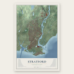
More maps nearby: Stratford Downtown, Orange, Nichols, Lordship and West Haven.
The art of mapping a place
How This Map Was Made
Real places. Remarkable detail. Discover the layers that turn geographic data into a map of home.

The view from above
Aerial imagery reveals the character of the land: woodland, open fields, and the patterns of a place.

The shape of the land
Elevation data brings hills, valleys, and subtle changes in the landscape into view.

The details of home
Roads, waterways, and building footprints come together to make the map feel unmistakably local.

Geography becomes art
Considered color, shading, and typography bring the layers together in a map made for your wall.


Process illustrated with Mendon, Massachusetts. Aerial imagery: USDA NAIP. Terrain: USGS 3D Elevation Program. Map details and finished artwork: KNOWOL.
The Details
About This Print
Choose an archival matte print, or a black or white Ayous wood frame. The archival matte print is unframed.
Select your size and finish above to see the matching product image and price.
Materials & Craftsmanship
A contemporary map with the character of a classic atlas, printed on archival matte paper. Optional frames are made from Ayous wood.
Your printed map does not include the watermark shown in the full-map preview.
Shipping & Delivery
Free shipping within the United States. Every print is made to order in the USA.
Buying a gift? Add a note in your cart and we'll include it. We never put prices in the package.
Prints ship within 2 to 3 business days. Allow 7 to 10 days total from ordering for delivery. Timing may vary during holidays or periods of high order volume.
Read our shipping policy.
Returns and damaged prints
Each print is made to order. Change-of-mind refunds are not available after production.
If your print arrives damaged, misprinted or incorrect, contact support@knowol.com within 30 days of receiving it. Include your order number, photos and a description of the issue.
Read our full refund and replacement policy. For questions about your order, email support@knowol.com.