


Search for another town


Free U.S. delivery 7 to 10 days after you order
West Haven, Connecticut Map Art
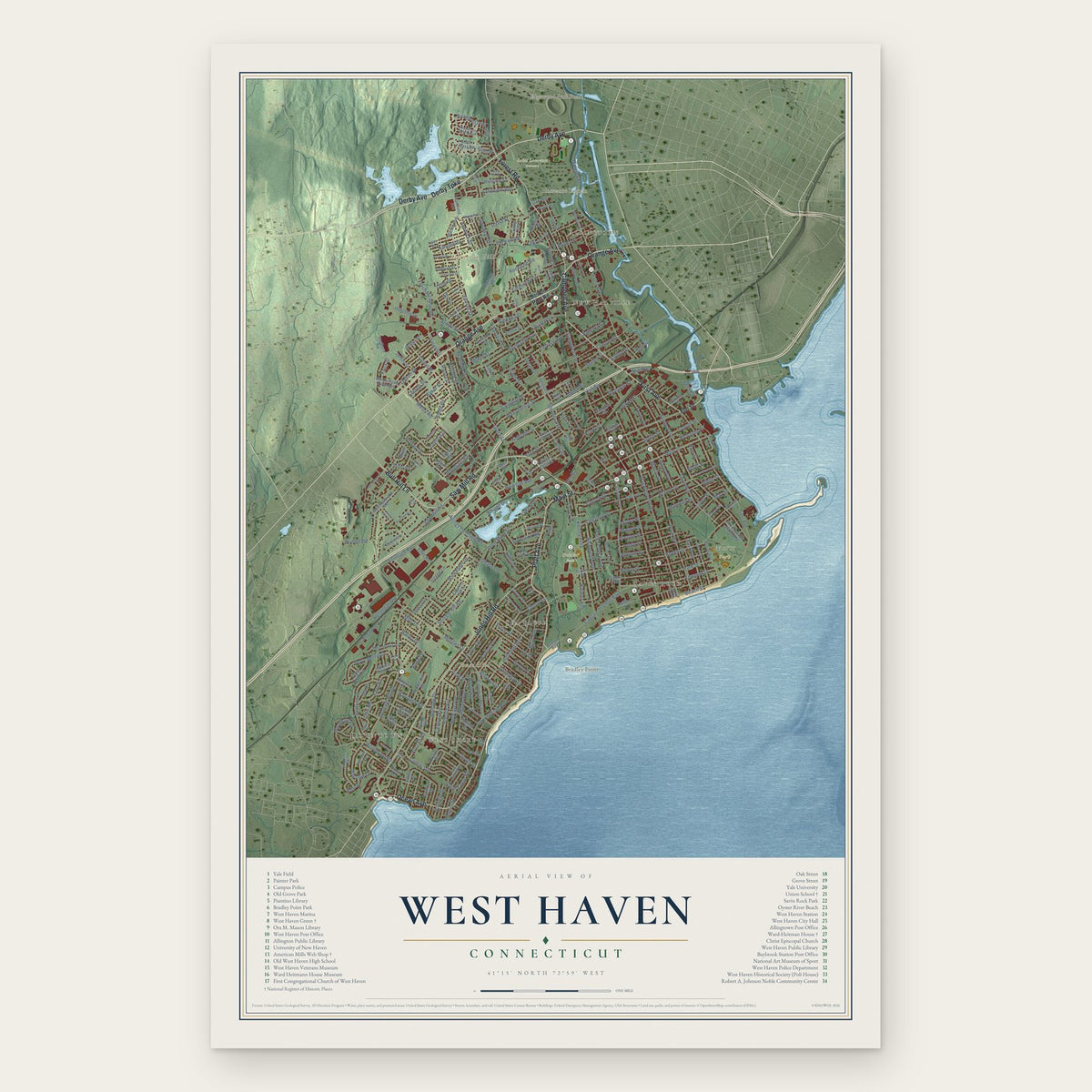
Building by building, with labeled streets and shaded relief.
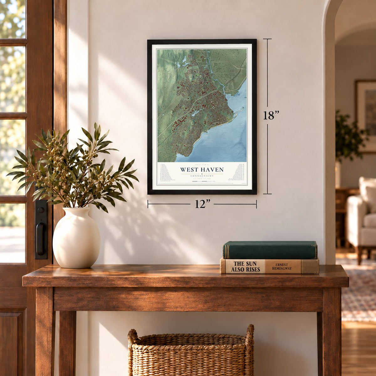
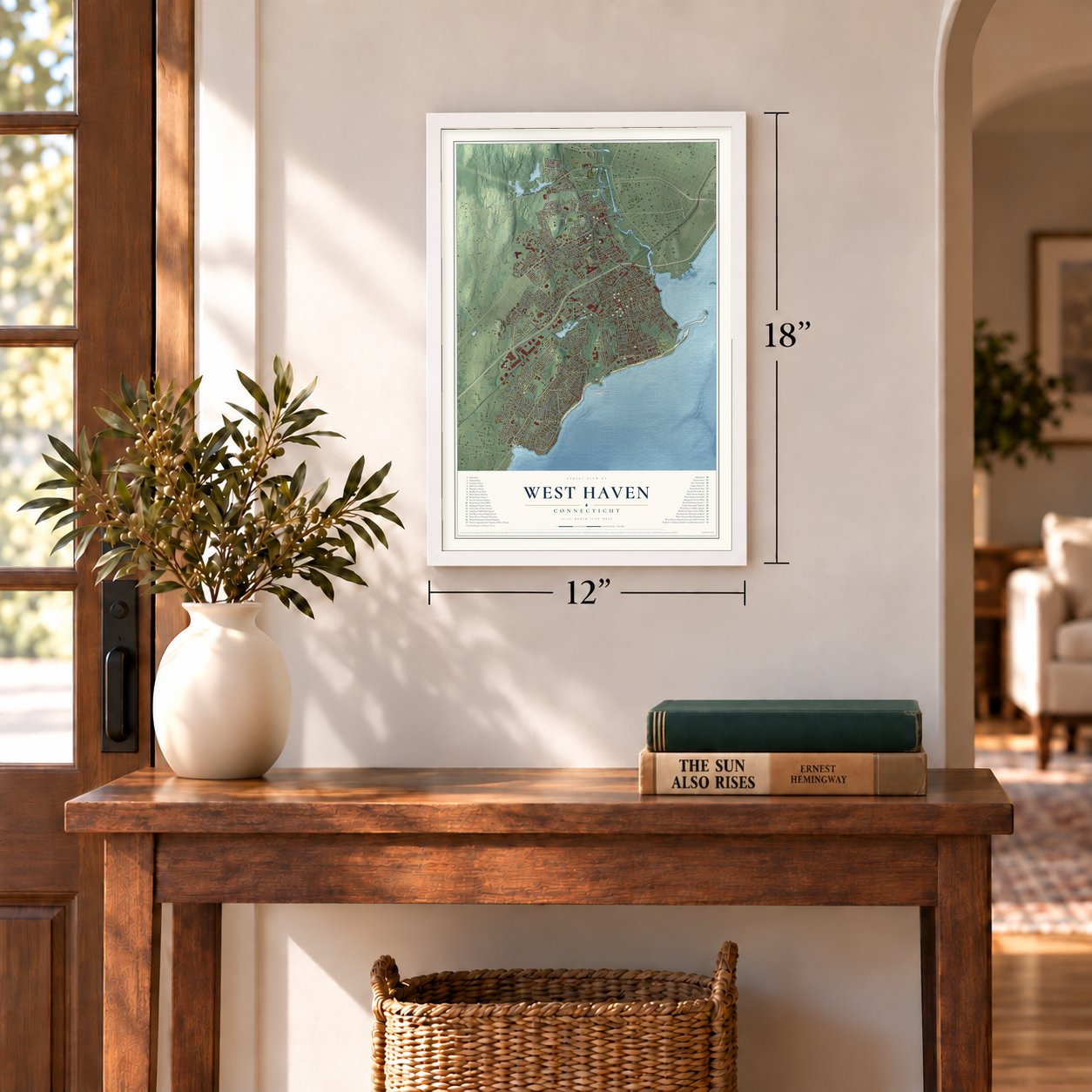
12" x 18" Archival Matte Print
A Map of Home. A Work of Art.
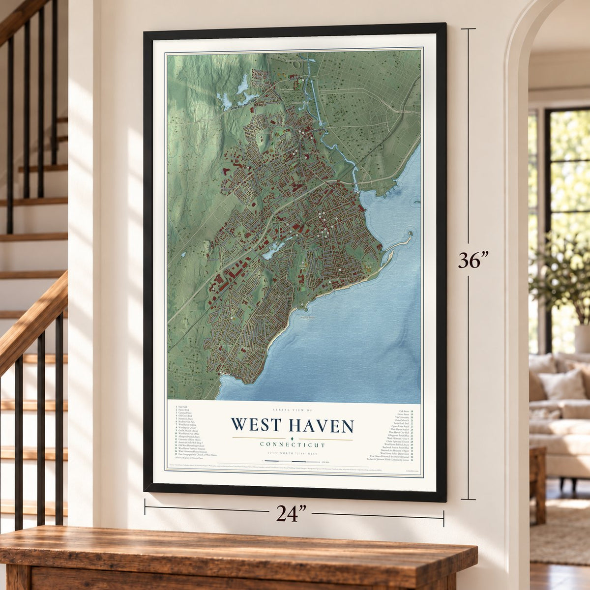
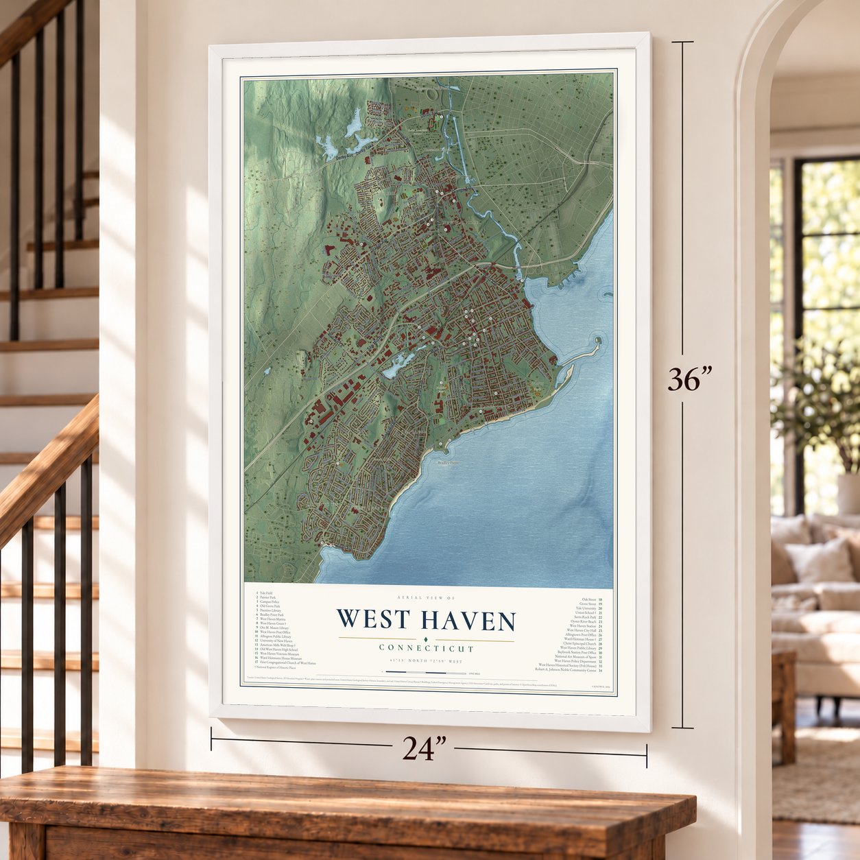
Explore West Haven, Connecticut from a whole new perspective. Created using aerial imagery and detailed geographic data, this map captures West Haven building by building, with labeled streets, familiar landmarks, and shaded topographical relief that highlights the natural contours of the landscape.
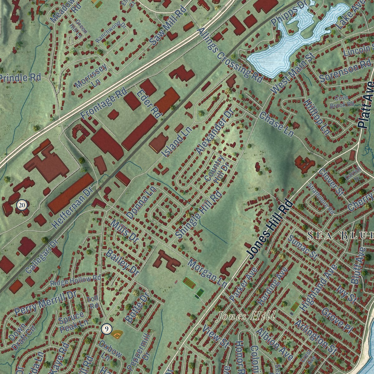
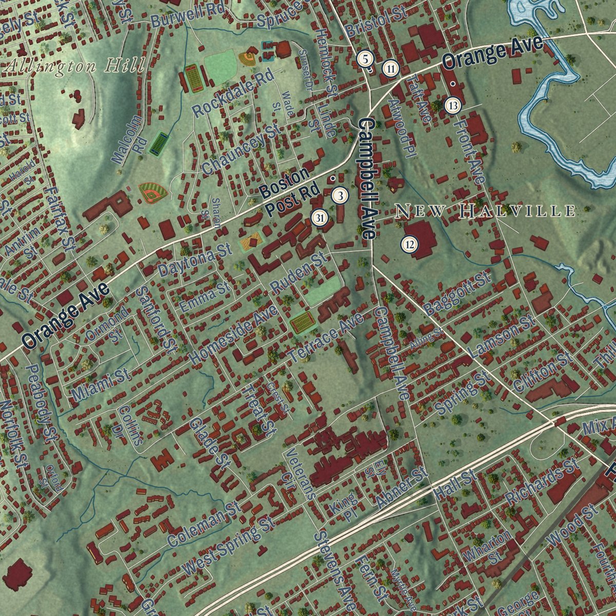
Combining modern data with the timeless character of a vintage atlas, this map is just as interesting up close as it is beautiful on the wall. Whether you grew up in West Haven, spent memorable years there, or call it home today, this unique map is a great way to celebrate a place that means something to you. Zoom in on the preview to look for your street, and then order a print to put your memories on the wall.

Three ways to hang it
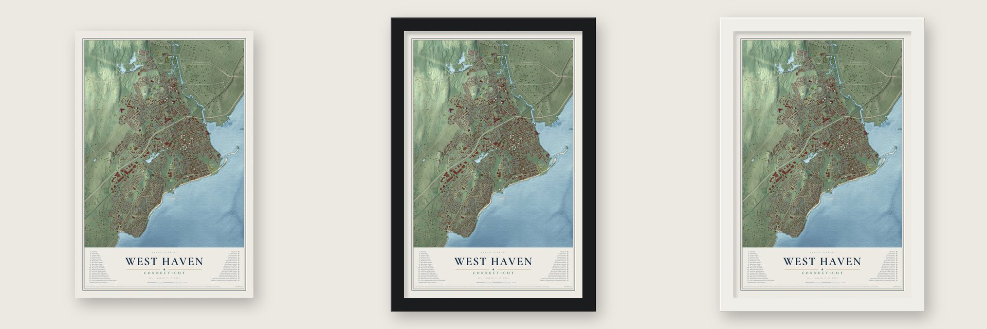
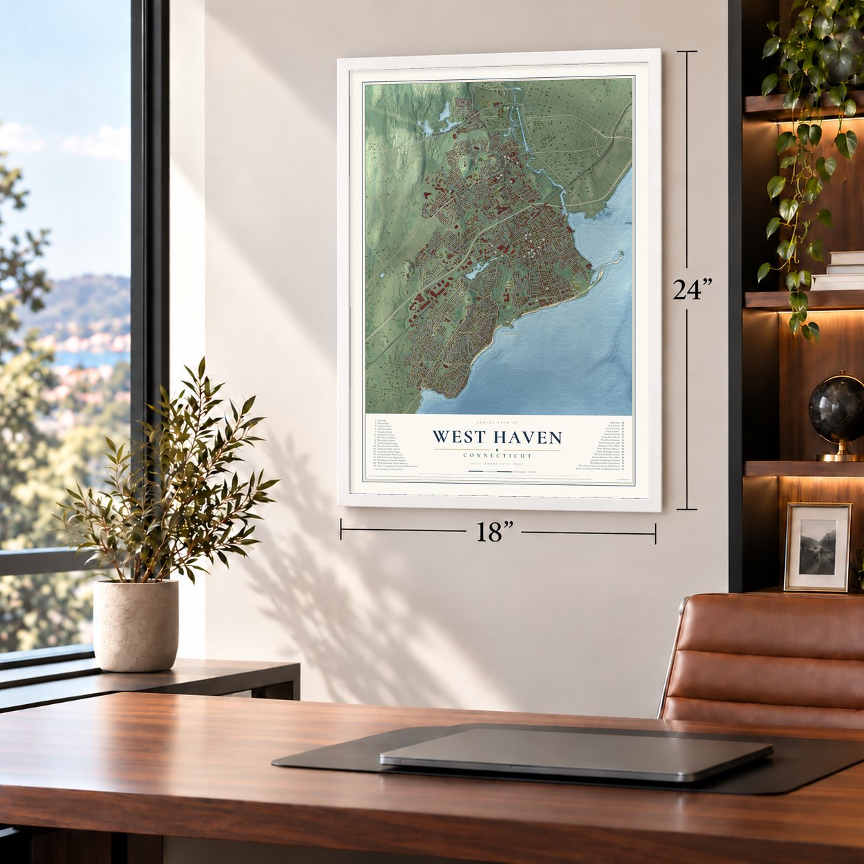
Unframed archival matte, a black wood frame or a white wood frame.
Up close
Geography Worth Displaying
This map was created using accurate cartographic data and authoritative geographic sources, including the U.S. Geological Survey (USGS) and FEMA. The map brings together terrain, waterways, roads, and building detail. The majority of the streets are labeled, houses are accurately depicted, and the topography is derived from government sources. Combining local data with carefully composed color and shading leads to this beautifully detailed West Haven artwork for your wall.
Rather than simply showing street outlines, we’ve included as many of the street names as we could reasonably fit on the map while keeping their names legible. Zoom in on the high resolution preview to see exactly what’s on the map. We truly set out to create a statement piece for anyone who loves West Haven. So whether it’s for you, or a gift for someone you love, we hope this map of West Haven brings back fond memories.
Explore the full map of West Haven, Connecticut and read about the local places it shows.
Find your street
Names on the West Haven map
Every name below is printed on this map. Look for your street, your school, the park where you played, or the pond down the road.
Places and landmarks15
- Downtown
- West Shore
- Allingtown
- Allington Hill
- Bradley Point
- Jones Hill
- Edgewood Park Pond
- Horseshoe Lagoon
- Morse Park
- Painter Park
- Saint Lawrence Cemetery
- Savin Rock
Show all 15 places
- New Halville
- Sea Bluff
- Savin Park
Streets and roads281
- Derby Avenue
- Main Street
- Platt Avenue
- Saw Mill Road
- Orange Avenue
- First Avenue
- Ocean Avenue
- Jones Hill Road
- Forest Road
- Derby Turnpike
- Bull Hill Lane
- Campbell Avenue
- Elm Street
- Meloy Road
- Captain Thomas Boulevard
- Knox Street
- Thomas Street
- Savin Avenue
- West Main Street
- South Street
- Second Avenue
- Frontage Road
- Kelsey Avenue
- Beach Street
- Allings Crossing Road
- Burwell Road
- Fenwick Street
- Alexander Drive
- Spruce Street
- Washington Avenue
Show all 281 streets
- Island Lane
- Morgan Lane
- Third Avenue
- West Spring Street
- Benham Hill Road
- Marginal Drive
- Blohm Street
- Center Street
- Colonial Boulevard
- Front Avenue
- Spring Street
- Union Avenue
- Peck Avenue
- Shingle Hill Road
- Fairfax Street
- Highland Street
- Park Street
- Tuthill Street
- Noble Street
- Terrace Avenue
- York Street
- Richmond Avenue
- William Street
- Brown Street
- Beatrice Drive
- Dalton Street
- Bellevue Avenue
- Phipps Drive
- Woodmont Road
- Homeside Avenue
- Central Avenue
- Greta Street
- Milton Avenue
- Rockdale Road
- Highland Avenue
- Daytona Street
- Winslow Drive
- Fresh Meadow Road
- Coleman Street
- Heffernan Drive
- Perry Merrill Drive
- Leete Street
- Lee Street
- Pheasant Road
- Contact Drive
- Church Street
- White Street
- Peabody Street
- Hillside Avenue
- Wood Street
- Rangely Street
- David Street
- Connecticut Avenue
- Ivy Street
- Everett Street
- Atwater Street
- Hilltop Lane
- Lamson Street
- Woodvale Road
- Arlington Street
- Park Terrace Avenue
- Richards Street
- East Avenue
- Norfolk Street
- Railroad Avenue
- Great Circle Road
- Jones Street
- Collis Street
- May Street
- Stevens Avenue
- Honor Road
- Clark Street
- Mohawk Drive
- Chestnut Street
- Chauncey Street
- Chase Lane
- Grove Place
- Lake Avenue
- Putney Drive
- Bluff Avenue
- Painter Avenue
- Cynthia Drive
- Ardale Street
- Kaye Road
- Donna Lane
- Cherry Lane
- Baker Street
- Industry Drive
- Ruden Street
- Dix Street
- Miami Street
- Baldwin Street
- Pent Road
- Martin Street
- Lakeview Avenue
- Smith Street
- Richards Place
- Prindle Road
- Sorenson Road
- Glade Street
- Sycaway Street
- Hillside Street
- Haystack Road
- Morris Street
- Mills Drive
- Aircraft Road
- Bristol Street
- Marshall Street
- Ida Lane
- Orne Street
- Hall Street
- Albion Avenue
- Baggott Street
- Sanford Street
- North Street
- Hine Street
- Bailey Drive
- Ridge Road
- Acton Street
- Walnut Street
- Clifton Street
- Thill Street
- Fern Street
- Mix Avenue
- View Street
- Eder Road
- Glen Road
- Abner Street
- Oak Road
- Botte Drive
- Lester Street
- Treat Street
- Boston Post Road
- Plainfield Avenue
- Dogburn Road
- Meadowbrook Road
- Court Street
- Callegari Drive
- Jaffrey Street
- Skyline Drive
- Cooper Road
- Glendevon Drive North
- Hemlock Street
- Aimes Drive
- Country Hill Drive
- Malcolm Road
- Gilbert Street
- Maltby Avenue
- Morse Avenue
- Sumac Street
- Eileen Road
- Third Avenue Extended
- Harding Avenue
- Down Draft Circle
- Ruby Road
- Knight Lane
- Fourth Avenue
- Painter Drive
- Peppermill Drive
- Farwell Street
- North Forest Circle
- Circle Street
- Trumbull Street
- Antrim Street
- West Clark Street
- Clover Street
- Oxbow Lane
- Parker Avenue
- Miner Road
- Meloy Road Extended
- Spruce Peak Lane
- Palace Street
- Ormond Street
- Warner Avenue
- Ashford Street
- Malden Street
- Atwood Place
- Ivy Circle
- Ownly Avenue
- Bridle Path Lane
- Wallace Street
- Morrissey Lane
- Veterans Circle
- Lincoln Street
- George Street
- Emma Street
- Voss Road
- Hugo Street
- Wharton Street
- Alden Road
- Howard Street
- Taft Avenue
- Cherry Street
- Chew Street
- Collins Drive
- Brook Lane
- Robin Road
- King Place
- Linde Street
- West Walk
- Honey Pot Road
- Seaview Avenue
- Glendevon Drive South
- Yates Street
- Lake Street
- Edward Street
- Tyler Street
- East Brown Street
- Hood Terrace
- West Prospect Street
- Ridge Hollow Road
- Linwood Street
- Rochdale Terrace
- Morris Avenue
- Atwood Avenue
- Trescott Street
- Monteith Street
- Fair Sailing Road
- Simos Lane
- Monahan Place
- Bayview Place
- Candee Avenue
- Ely Street
- Toll Road
- Ranchwood Drive
- Anderson Avenue
- Orford Street
- Wade Street
- Meadowbrook Court
- Belle Circle
- Carlson Road
- Harold Street
- Daniel Road
- Norwell Street
- Phillips Terrace
- Strathmore Road
- Cove Brook Road
- Claudia Drive
- Batt Lane
- Sunset Drive
- Crest Avenue
- Alling Street
- Crest Street
- Green Hill Lane
- Forest Hills Road
- Myrtle Avenue
- Fairlea Road
- Savin Court
- Sharon Street
- Carroll Street
- Ellyn Court
Names are listed as they appear on the printed map. Zoom into the product photos to find them.
About West Haven, Connecticut
West Haven began as West Farms, settled by English colonists in 1648. It became independent from Orange in 1921 and a city in 1961. Its shoreline and Campbell Avenue carry stories from the Revolutionary era through the Savin Rock resort years.
- Connecticut's youngest cityWest Haven became its own town in 1921 and adopted city government in 1961.
- 55,584 peopleCounted in the 2020 census.
- Campbell AvenueThe main street honors British officer William Campbell, who protected an injured local minister during the 1779 invasion.
- Savin Rock resortThe shore became a regional amusement destination beginning in the 1870s, before the park closed in the 1960s.
- Lender's bagelsHarry Lender opened a bagel bakery here in 1927 that later sold frozen bagels nationwide.
Keep exploring Connecticut
West Haven is one of 382 Connecticut towns we've mapped. Every dot on the map is a print of its own.
The search covers every state, Connecticut first.
Near West Haven
Order 2 or more town maps and save 10%. Shown in the size and finish you picked above, so they hang as a set.
- The Hill 12" x 18" / Archival Matte Print $39.99
- West River 12" x 18" / Archival Matte Print $39.99
- Dwight 12" x 18" / Archival Matte Print $39.99


More maps nearby: Orange, Westville, New Haven, Wooster Square and Dixwell.
The art of mapping a place
How This Map Was Made
Real places. Remarkable detail. Discover the layers that turn geographic data into a map of home.

The view from above
Aerial imagery reveals the character of the land: woodland, open fields, and the patterns of a place.

The shape of the land
Elevation data brings hills, valleys, and subtle changes in the landscape into view.

The details of home
Roads, waterways, and building footprints come together to make the map feel unmistakably local.

Geography becomes art
Considered color, shading, and typography bring the layers together in a map made for your wall.


Process illustrated with Mendon, Massachusetts. Aerial imagery: USDA NAIP. Terrain: USGS 3D Elevation Program. Map details and finished artwork: KNOWOL.
The Details
About This Print
Choose an archival matte print, or a black or white Ayous wood frame. The archival matte print is unframed.
Select your size and finish above to see the matching product image and price.
Materials & Craftsmanship
A contemporary map with the character of a classic atlas, printed on archival matte paper. Optional frames are made from Ayous wood.
Your printed map does not include the watermark shown in the full-map preview.
Shipping & Delivery
Free shipping within the United States. Every print is made to order in the USA.
Buying a gift? Add a note in your cart and we'll include it. We never put prices in the package.
Prints ship within 2 to 3 business days. Allow 7 to 10 days total from ordering for delivery. Timing may vary during holidays or periods of high order volume.
Read our shipping policy.
Returns and damaged prints
Each print is made to order. Change-of-mind refunds are not available after production.
If your print arrives damaged, misprinted or incorrect, contact support@knowol.com within 30 days of receiving it. Include your order number, photos and a description of the issue.
Read our full refund and replacement policy. For questions about your order, email support@knowol.com.