
Search for another town





Free U.S. delivery 7 to 10 days after you order
Oviedo, Florida Map Art
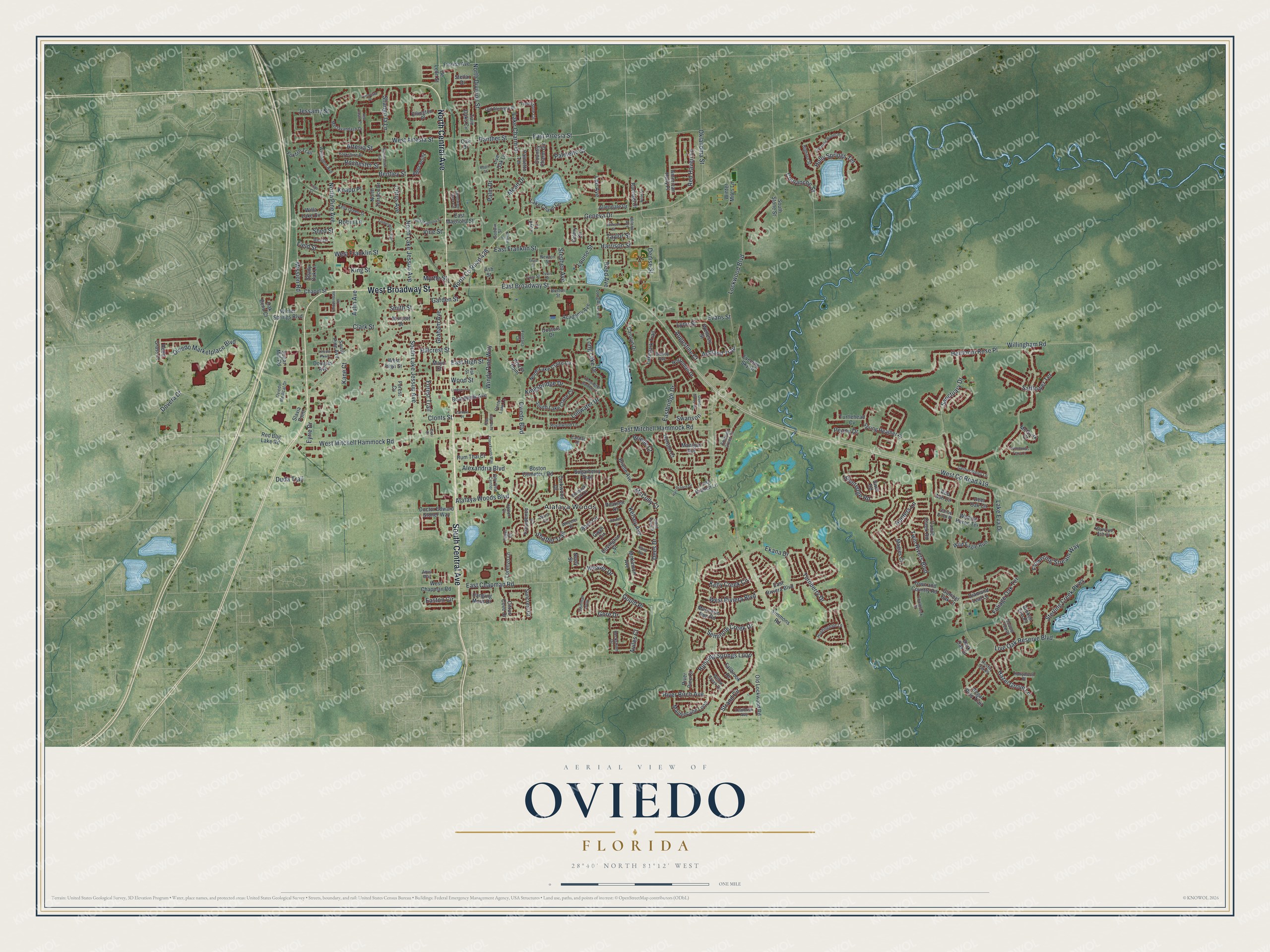
A new map of Oviedo, Florida, made in 2026 and printed to order on thick archival matte paper.
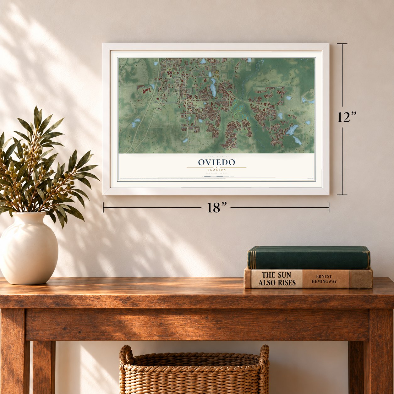
12" x 18" Archival Matte Print
A Map of Home. A Work of Art.
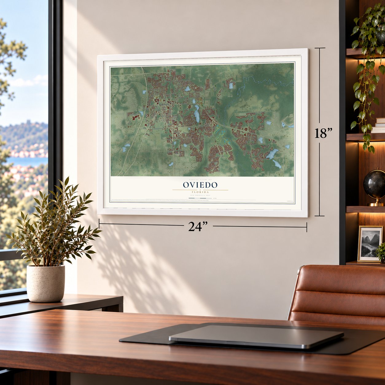
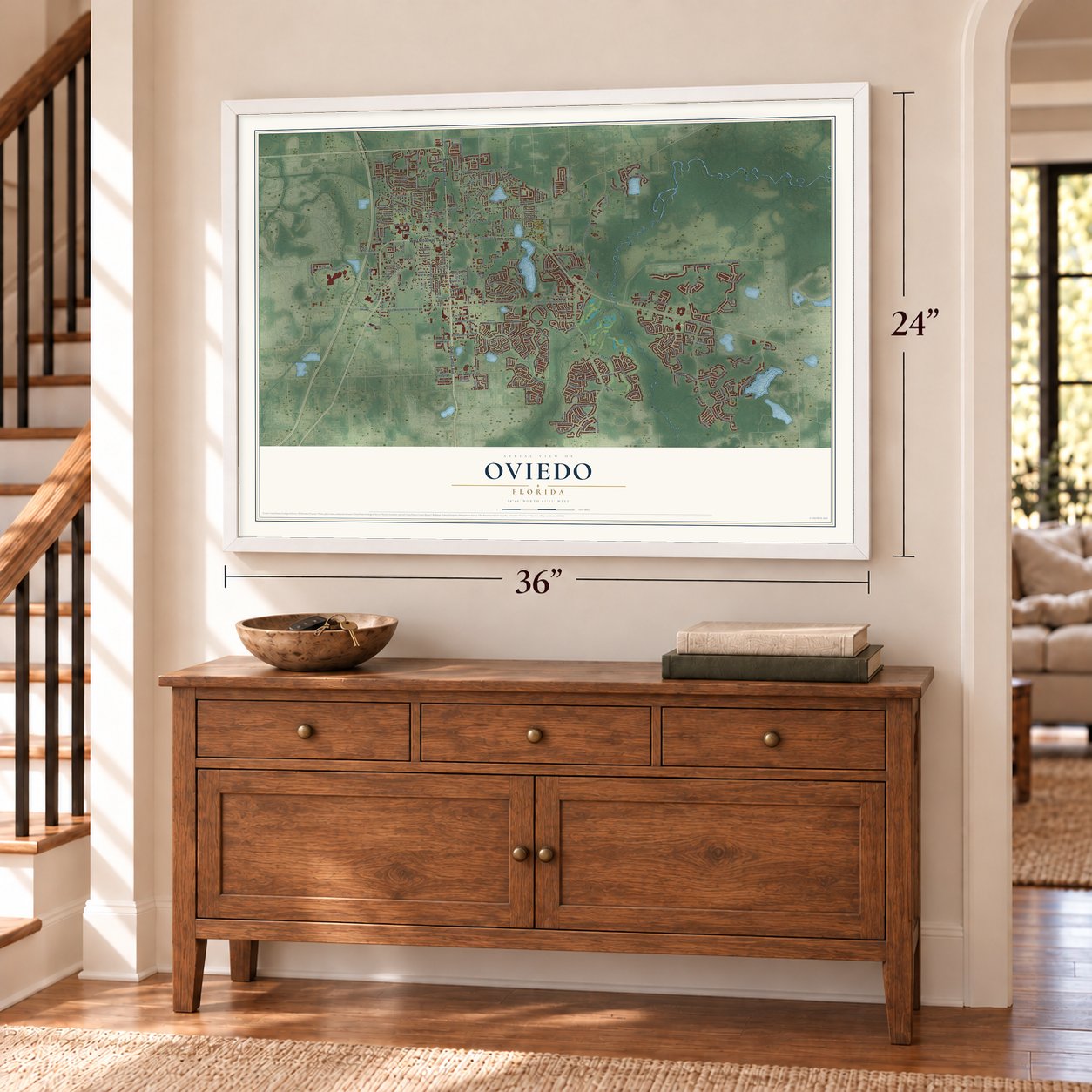
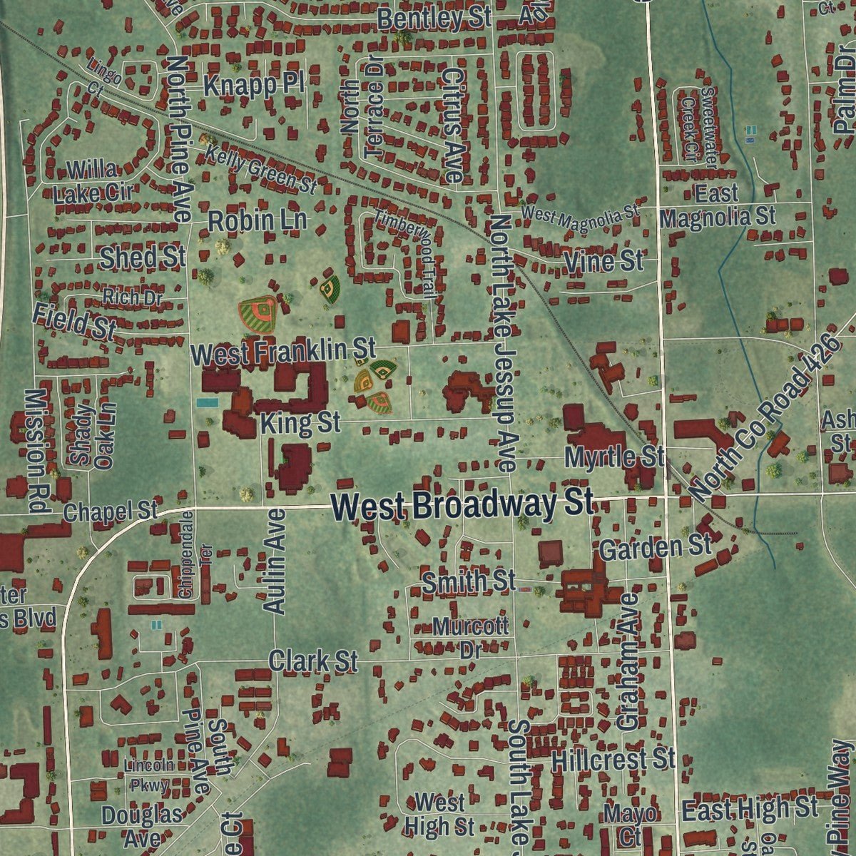
Explore Oviedo, Florida from a whole new perspective. Created using aerial imagery and detailed geographic data, this map captures Oviedo building by building, with labeled streets, familiar landmarks, and shaded topographical relief that highlights the natural contours of the landscape.
Combining modern data with the timeless character of a vintage atlas, this map is just as interesting up close as it is beautiful on the wall. Whether you grew up in Oviedo, spent memorable years there, or call it home today, this unique map is a great way to celebrate a place that means something to you. Zoom in on the preview to look for your street, and then order a print to put your memories on the wall.
Three ways to hang it
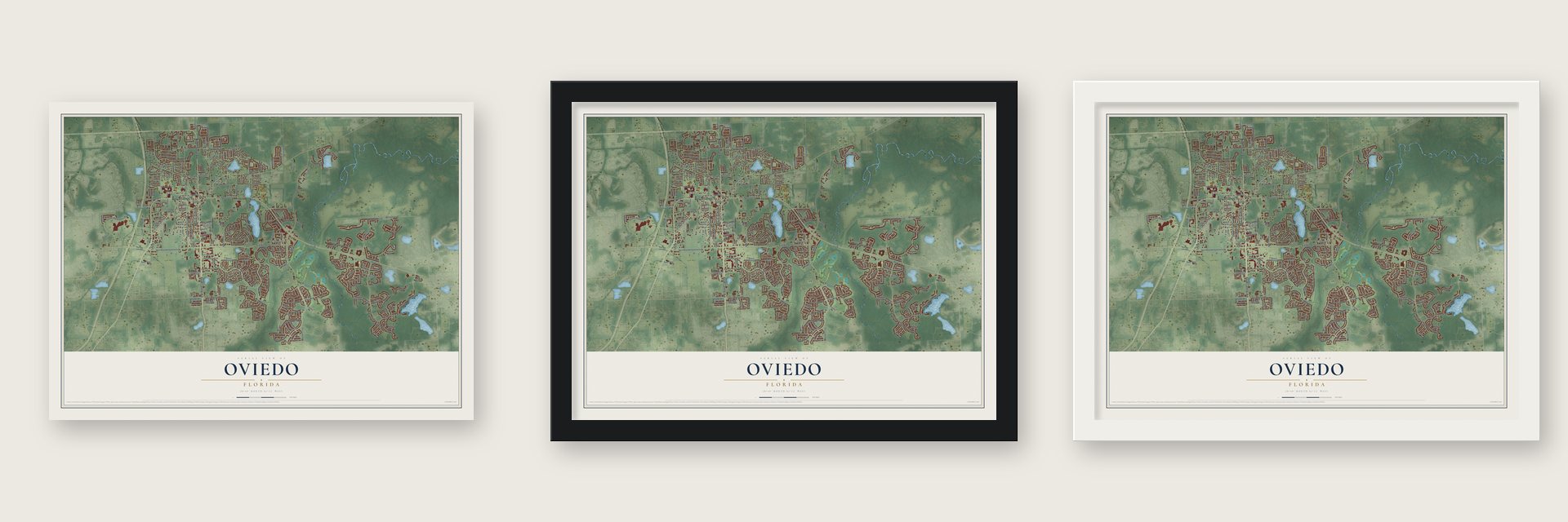
Unframed archival matte, a black wood frame or a white wood frame.
Up close
Geography Worth Displaying
This map was created using accurate cartographic data and authoritative geographic sources, including the U.S. Geological Survey (USGS) and FEMA. The map brings together terrain, waterways, roads, and building detail. The majority of the streets are labeled, houses are accurately depicted, and the topography is derived from government sources. Combining local data with carefully composed color and shading leads to this beautifully detailed Oviedo artwork for your wall.
Rather than simply showing street outlines, we’ve included as many of the street names as we could reasonably fit on the map while keeping their names legible. Zoom in on the high resolution preview to see exactly what’s on the map. We truly set out to create a statement piece for anyone who loves Oviedo. So whether it’s for you, or a gift for someone you love, we hope this map of Oviedo brings back fond memories.
Explore the full map of Oviedo, Florida and read about the local places it shows.

About Oviedo, Florida
Oviedo is a city of 40,059 people in Seminole County, south of Lake Jesup. After the Civil War, settlers moved south to start over, and in 1875 a small group founded the Lake Jesup Settlement a mile southeast of the lake. Its first 40 or so families cooked on wood stoves outdoors and burned rags to drive off mosquitoes, and the settlement soon became a lively place to trade goods.
When the shopkeeper Andrew Aulin applied for a post office in the late 1870s, he needed a name that no other post office in Florida already had. He wanted a Spanish one to honor the state's Spanish past, so he picked Oviedo, the name of a city in northern Spain and of its university. Aulin most likely said it oh-vee-AY-doh, though people here now say oh-VEE-doh. Oviedo was incorporated as a town in 1925 and became a city by referendum in 1967.
- Rails and steamboats for celeryHenry Foster, a friend of the early landholder George Powell, gave local growers a dependable way to get their citrus and celery to market. He paid to bring a rail line to Oviedo and started the Lake Jesup Steamboat Company, and farming stayed the town's main business through the 1940s. Foster also urged settlers to gather for regular services on Powell's land, and that site became the First Methodist Church of Oviedo.
- Butler Boston's orange grovesButler Boston arrived in 1871, at 12, with his father, Dr. Alexander Atkinson, who later returned to Georgia after a freeze and left him the farm. Boston grafted tangerine budwood and budded the Jamaican temple orange into local groves so skillfully that other growers hired him. He served as a school trustee for the Black community and, as a bricklayer, directed construction of a new Antioch Baptist Church building. Mathew Powell had founded that church in April 1875.
- Andrew Duda tries againAndrew Duda Sr., a Slovak immigrant, first farmed in nearby Slavia and gave up when his crops failed. He saved money and came back in 1926, and this time the farm thrived, even through the Great Depression. In 1939 he built St. Luke's Lutheran Church. The family added a sod business in the 1970s, and the road into Oviedo from the west still runs right through its fields.
- The end of the packing houseDuring the 1920s boom, builders put up new stores and banks along Broadway, the downtown main street. For decades the Nelson and Co. packing house was the heart of Oviedo's farm economy, until a string of winter freezes closed it for good in the 1980s. By then new commercial building had already overtaken farming as the town's main work.
- A space university in 1963In 1963 the Orlando Morning Sentinel told residents that a "space university" would rise five miles south of town. The school opened as Florida Technological University, today's University of Central Florida, and many of its faculty and staff settled in Oviedo, with businesses close behind. The Central Florida Research Park next door, begun in 1978, grew into the largest research park in Florida.
Find your street
Names on the Oviedo map
Every name below is printed on this map. Look for your street, your school, the park where you played, or the pond down the road.
Places and landmarks1
- Alafaya Woods
Streets and roads270
- South Central Avenue
- West Broadway Street
- North Central Avenue
- East Broadway Street
- West County Road 419
- West Mitchell Hammock Road
- Clonts Street
- East Chapman Road
- West Artesia Street
- Lake Charm Drive
- East Artesia Street
- Sanctuary Drive
- North Lake Jessup Avenue
- Lockwood Boulevard
- Geneva Drive
- North County Road 426
- Heirloom Rose Place
- Alafaya Woods Boulevard
- Live Oak Reserve Boulevard
- Twin Rivers Boulevard
- East Mitchell Hammock Road
- Willingham Road
- Oviedo Marketplace Boulevard
- North Division Street
- Oviedo Boulevard
- North Pine Avenue
- South Lake Jessup Avenue
- Clark Street
- Sterling Creek Parkway
- Turnberry Drive
Show all 270 streets
- Running Springs Loop
- Shaffer Trail
- Ekana Drive
- Artesia Street
- Kelly Creek Circle
- West Riviera Boulevard
- Aulin Avenue
- Kingsbridge Drive
- East Franklin Street
- Red Haven Lane
- Foliage Oak Terrace
- Panther Street
- Eastbridge Drive
- Riveredge Road
- Palmetto Street
- Safflower Terrace
- Forest Trail
- Mission Road
- Holly Springs Terrace
- Hazel Grove Lane
- Seminole Creek Drive
- Long Lake Drive
- Alexandria Boulevard
- Hillcrest Street
- Bentley Street
- Gould Place
- Lullwater Drive
- Strand Circle
- West Franklin Street
- Easton Circle
- Flowering Stream Way
- Dees Drive
- Graham Avenue
- Reed Avenue
- Evans Street
- Lynn Street
- Weaver Drive
- River Birch Avenue
- Gore Drive
- Smith Street
- Windy Pine Way
- King Street
- Dovera Drive
- Palm Drive
- Rochester Street
- Oklahoma Street
- Duda Trail
- Shangri la Lane
- Mead Drive
- Kane Court
- Lake Eva Drive
- Hunters Lane
- Eyrie Drive
- Kelsey Avenue
- Augustine Court
- Swanson
- Louise Street
- Ashland Trail
- Lee Avenue
- Jessamy Street
- Harrison Street
- Vine Street
- Comanche Street
- Field Street
- East High Street
- Stephen Avenue
- Myrtle Street
- Denise Street
- Knapp Place
- Brielle Court
- McCully Court
- Shed Street
- Peony Drive
- Citrus Avenue
- Garden Street
- Robin Lane
- Wood Street
- Taylor Street
- Aviles Court
- McKinnon Avenue
- Covington Street
- Lake Charm Circle
- Lakepark Trail
- Sugarberry Trail
- Academy Avenue
- Willa Lake Circle
- Providence Lane
- Stellar Drive
- Twin Oaks Circle
- North Lake Claire Circle
- Deer Oak Circle
- Red Ash Circle
- North Terrace Drive
- Manigan Avenue
- Country Charm Circle
- Corkwood Drive
- Evening Sky Drive
- Palmetto Terrace
- Long Branch Lane
- Wading Heron Terrace
- South Lake Claire Circle
- Canoe Creek Road
- Spring Heather Place
- Maidencane Loop
- Regal Pine Trail
- Carolyn Drive
- Abell Circle
- Celery Circle
- Shady Oak Lane
- Brielle Avenue
- Suncrest Court
- Horseman Drive
- Boston Cemetery Road
- Doctors Drive
- Neely Street
- East Riviera Boulevard
- Old Lockwood Road
- Hanging Moss Drive
- Ellington Place
- Wild Eagle Run
- Diamond Leaf Lane
- Winter Springs Boulevard
- Gwyn Circle
- Sugar Mill Road
- Chapel Street
- American Holly Place
- Winter Miles Lane
- Fallbrook Drive
- Doctor Edward Stoner Way
- Douglas Avenue
- West Chapman Road
- Allendale Drive
- Boardwalk Avenue
- Adler Point
- East Magnolia Street
- Turtlehead Cv
- Florida Avenue
- Citrus Cove Drive
- Foxfire Trail
- Lorenzo Lane
- Henson Court
- Rachael Court
- Simmons Road
- Rum Thai Court
- Wellesly Street
- Town and Country Road
- West High Street
- Oak Drive
- Moccasin Run Road
- McGuirk Court
- De Leon Street
- Magies Court
- Live Oak Lane
- Reed Grass Drive
- South Stone Street
- Oak Bend Court
- Red Bug Lake Road
- Broken Elm Place
- Dark Oak Court
- Murcott Drive
- Gambel Oak Court
- River Pine Court
- South Pine Avenue
- Piazza Point
- Pearson Drive
- Swift Road
- Slavia Point
- Mayo Court
- Forest Cv
- Loyd Lane
- Ash Street
- Mactavandash Drive
- Beckstrom Drive
- Center Lake Lane
- Fieldstone Circle
- Fontana Circle
- Emerald Green Circle
- Royalwood Lane
- Yorkshire Drive
- Old Alemany Place
- Dishman Loop
- Bighorn Street
- Double Tree Place
- Gerber Daisy Lane
- Sand Key Circle
- Bluejack Oak Drive
- Long Acres Lane
- Rich Drive
- Ward Circle
- Kelly Green Street
- Bishop Avenue
- Wellington Avenue
- Tealbriar Avenue
- Huntingdale Lane
- City View Center
- Willow Creek Drive
- Rustic Oak Place
- Coolbrook Court
- Hollywood Place
- Wilson Avenue
- Oak Street
- Oviedo Medical Drive
- Canoe Birch Place
- Boston Street
- Horton Court
- Raywood Ash Court
- Newton Street
- Wheeler Place
- Pegel Court
- Aqua Way
- Godwin Street
- First Street
- Calafut Court
- Oviedo Grove Circle
- Timberwood Trail
- Chippendale Terrace
- Sweetwater Creek Circle
- Burnett Street
- Alpug Avenue
- West Magnolia Street
- Gabrielle Woods Place
- Clara Evans Way
- Manchester Avenue
- Hart Branch Drive
- Hammonds Ferry Court
- Kimble Street
- Jackson Street
- Lincoln Parkway
- Neile Court
- Terravista Place
- Kensington Gardens Court
- New Castle Court
- City Plaza Way
- Lindsay Lane
- Maple Court
- Zamora Place
- Tyson Street
- Lingo Court
- Third Street
- Vicki Court
Names are listed as they appear on the printed map. Zoom into the product photos to find them.
The art of mapping a place
How This Map Was Made
Real places. Remarkable detail. Discover the layers that turn geographic data into a map of home.

The view from above
Aerial imagery reveals the character of the land: woodland, open fields, and the patterns of a place.

The shape of the land
Elevation data brings hills, valleys, and subtle changes in the landscape into view.

The details of home
Roads, waterways, and building footprints come together to make the map feel unmistakably local.

Geography becomes art
Considered color, shading, and typography bring the layers together in a map made for your wall.


Process illustrated with Mendon, Massachusetts. Aerial imagery: USDA NAIP. Terrain: USGS 3D Elevation Program. Map details and finished artwork: KNOWOL.
The Details
About This Print
Choose an archival matte print, or a black or white Ayous wood frame. The archival matte print is unframed.
Select your size and finish above to see the matching product image and price.
Materials & Craftsmanship
A contemporary map with the character of a classic atlas, printed on archival matte paper. Optional frames are made from Ayous wood.
Your printed map does not include the watermark shown in the full-map preview.
Shipping & Delivery
Free shipping within the United States. Every print is made to order in the USA.
Buying a gift? Add a note in your cart and we'll include it. We never put prices in the package.
Prints ship within 2 to 3 business days. Allow 7 to 10 days total from ordering for delivery. Timing may vary during holidays or periods of high order volume.
Read our shipping policy.
Returns and damaged prints
Each print is made to order. Change-of-mind refunds are not available after production.
If your print arrives damaged, misprinted or incorrect, contact support@knowol.com within 30 days of receiving it. Include your order number, photos and a description of the issue.
Read our full refund and replacement policy. For questions about your order, email support@knowol.com.
Find your town
Looking for another city?
Find a map of home in our Florida collection, or any town in the country.
Nearby
Maps of towns near Oviedo
Know someone from one of these towns? Their map makes a great gift.
 Black Hammock
, Florida
From $39.99See the map
 Chuluota
, Florida
From $39.99See the map
 University
, Orange County, Florida
From $39.99See the map
More maps nearby: Winter Springs, Geneva, Goldenrod, Union Park and Aloma.