
Search for another town





Free U.S. delivery 7 to 10 days after you order
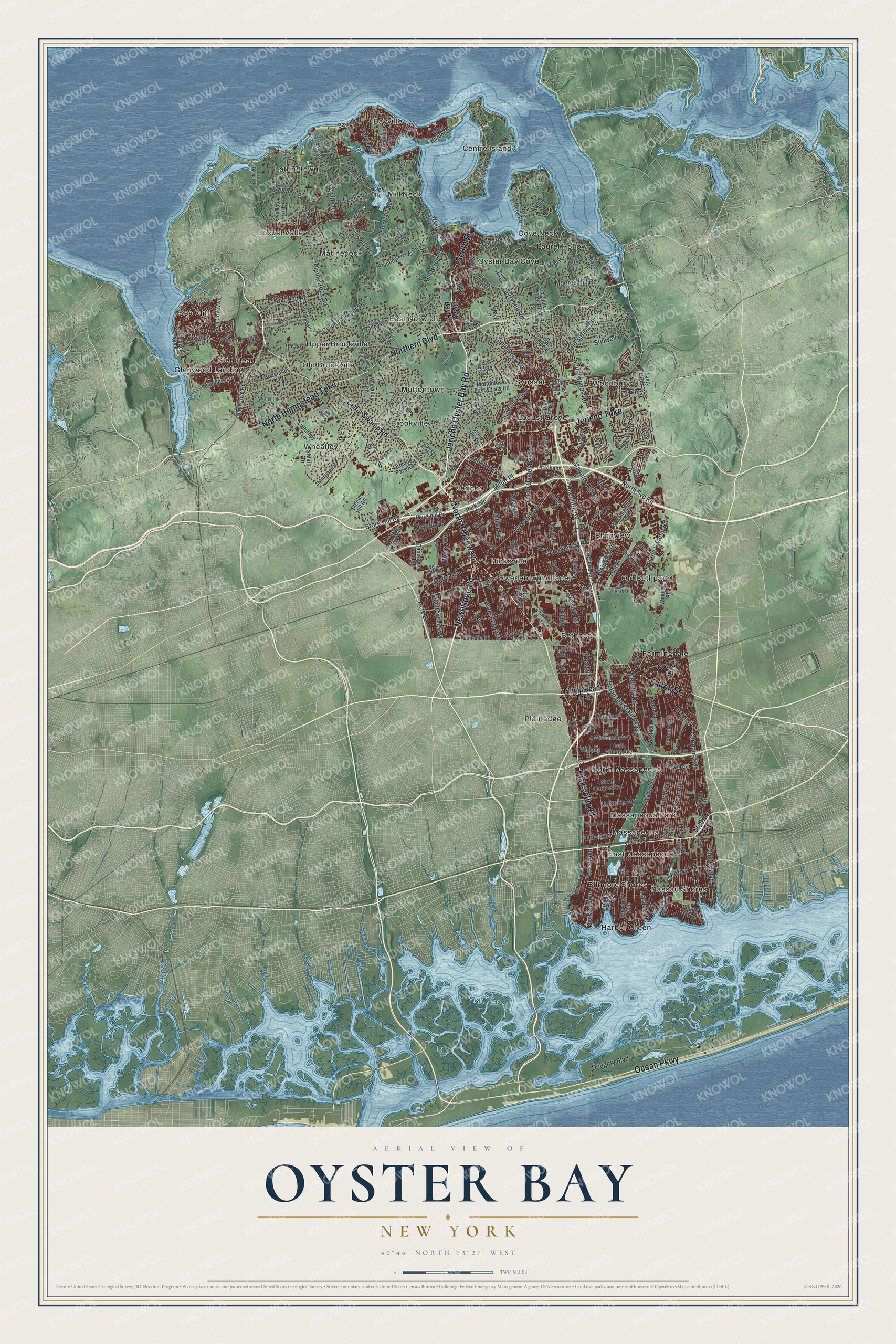
Oyster Bay, New York Map Art
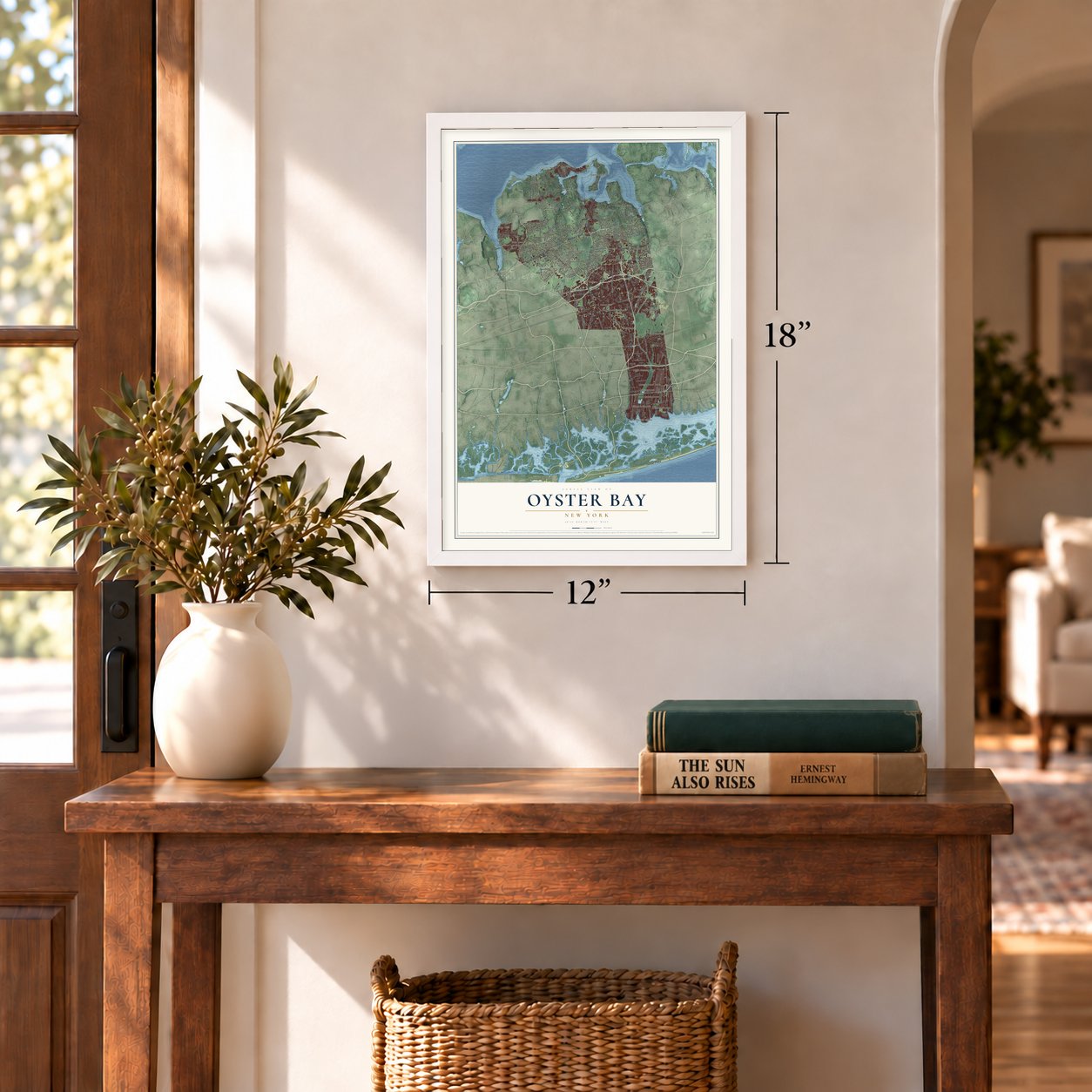
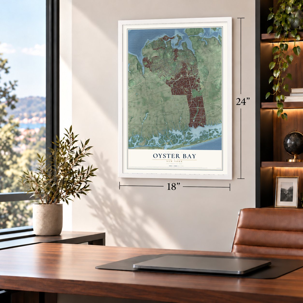
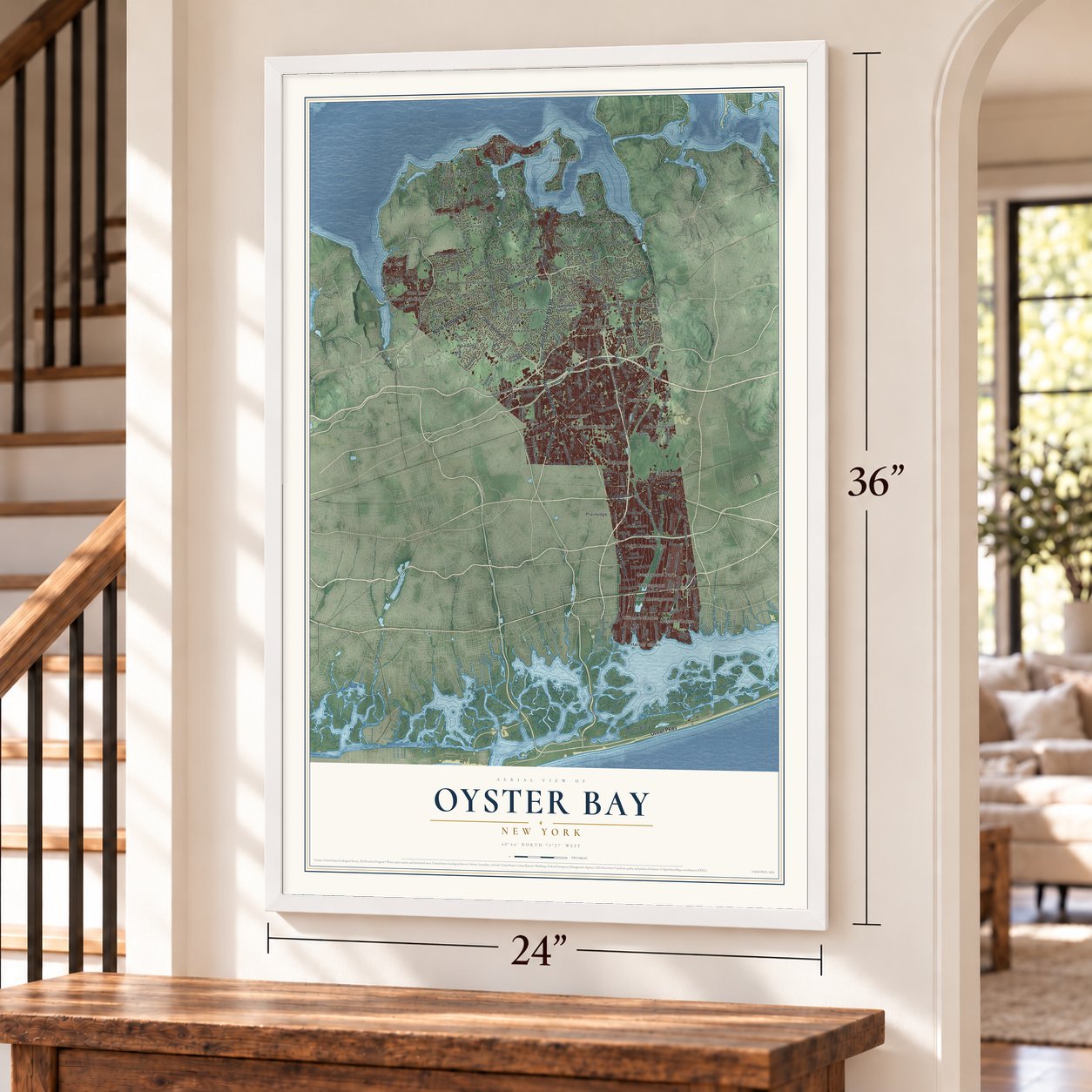
A new map of Oyster Bay, New York, made in 2026 and printed to order on thick archival matte paper.
12" x 18" Archival Matte Print
A Map of Home. A Work of Art.
Bring a piece of Oyster Bay home. Whether it’s where you grew up, your current home, or simply a moment in your life, this Oyster Bay, New York map print brings those memories to your wall. Antique-inspired styling and modern geographic detail combine to create artwork that’s beautiful from across the room, with plenty to study and explore when you get up close.
Three ways to hang it
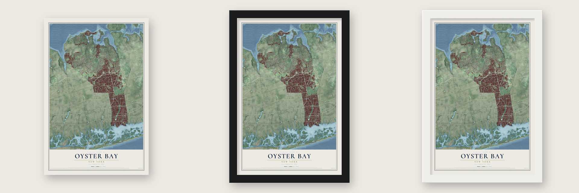
Unframed archival matte, a black wood frame or a white wood frame.
Up close
Real geography. Art worth displaying.
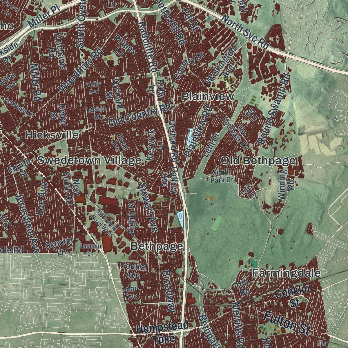
This map was created using accurate cartographic data and authoritative geographic sources, including the U.S. Geological Survey (USGS) and FEMA. The map brings together terrain, waterways, roads, and building detail. The majority of the streets are labeled, houses are accurately depicted, and the topography is derived from government sources. Combining local data with carefully composed color and shading leads to this beautifully detailed Oyster Bay artwork for your wall.
Rather than simply showing street outlines, we’ve included as many of the street names as we could reasonably fit on the map while keeping their names legible. Zoom in on the high resolution preview to see exactly what’s on the map. We truly set out to create a statement piece for anyone who loves Oyster Bay. So whether it’s for you, or a gift for someone you love, we hope this map of Oyster Bay brings back fond memories.
Explore the full map of Oyster Bay, New York and read about the local places it shows.

About Oyster Bay, New York
Within Nassau County, New York, Oyster Bay is classified as a town. The 2020 census recorded 301,332 residents. Together, those details place Oyster Bay within the everyday geography and public life of its part of New York.
- 301,332 residentsThe 2020 census recorded this population for Oyster Bay.
- Nassau CountyOyster Bay lies within Nassau County in New York.
- Swan, Edward H., HouseThe National Register of Historic Places includes Swan, Edward H., House.
Find your street
Names on the Oyster Bay map
Every name below is printed on this map. Look for your street, your school, the park where you played, or the pond down the road.
Places and landmarks36
- Bayville
- Bethpage
- Biltmore Shores
- Brookville
- Centre Island
- Cove Neck
- East Massapequa
- East Norwich
- Farmingdale
- Glen Head
- Glenwood Landing
- Harbor Green
Show all 36 places
- Hicksville
- Jericho
- Lattingtown
- Laurel Hollow
- Locust Grove
- Locust Valley
- Massapequa
- Massapequa Park
- Matinecock
- Mill Neck
- Muttontown
- Nassau Shores
- North Massapequa
- Old Bethpage
- Old Brookville
- Oyster Bay Cove
- Plainedge
- Plainview
- Sea Cliff
- Swedetown Village
- Syosset
- Upper Brookville
- Wheatley
- Woodbury
Streets and roads239
- North Hempstead Turnpike
- Jericho Turnpike
- Northern Boulevard
- Ocean Parkway
- Jericho Oyster Bay Road
- Hicksville Road
- Newbridge Road
- North Broadway
- Fulton Street
- South Street
- Woodbury Road
- Broadway
- Stewart Avenue
- Plainview Road
- South Oyster Bay Road
- Old Country Road
- Ocean Avenue
- Berry Hill Road
- Round Swamp Road
- Chicken Valley Road
- Forest Avenue
- Jerusalem Avenue
- Store Hill Road
- Bethpage State Parkway
- Piping Rock Road
- Split Rock Road
- Merrick Road
- Cold Spring Road
- Mill River Road
- Carmans Road
Show all 239 streets
- Division Avenue
- First Avenue
- Bayville Road
- Manetto Hill Road
- North Svc Road
- Clocks Boulevard
- Main Street
- Park Lane
- Elm Street
- Merritts Road
- Ontario Avenue
- Miller Place
- Southwoods Road
- Stillwell Lane
- Duffy Avenue
- Harbor Lane
- Frost Pond Road
- Rose Street
- Doughty Boulevard
- Acre Lane
- Underhill Boulevard
- Robbins Lane
- Moores Hill Road
- Lee Avenue
- Miller Road
- Sheep Lane
- Juneau Boulevard
- Radcliffe Road
- Hill Drive
- Levittown Parkway
- East Drive
- Feeks Lane
- Myers Avenue
- Perry Avenue
- Orange Drive
- Ohio Avenue
- Ivy Street
- Kent Street
- Pal Street
- Cedar Swamp Road
- Sunrise Highway
- Hempstead Turnpike
- Conklin Street
- Oyster Bay Road
- Glen Cove Road
- Centre Island Road
- Wheatley Road
- Washington Avenue
- Central Avenue
- Bayville Avenue
- Glen Cove Avenue
- Cove Neck Road
- Cove Road
- West Shore Road
- Ridge Road
- Lakeshore Drive
- Orchard Street
- Terrehans Lane
- Winding Road
- Bayview Avenue
- Remsens Lane
- Lattingtown Road
- Park Boulevard
- Cleft Road
- Sunset Road
- Valley Road
- Prospect Avenue
- Muttontown Eastwoods Road
- Foxhunt Crescent
- Grand Boulevard
- Beach Road
- Frost Mill Road
- Cedar Street
- Brookville Lane
- Cantiague Rock Road
- Whitney Lane
- North Queens Avenue
- Front Street
- Boundary Avenue
- New South Road
- Harvard Drive
- Eighth Street
- North Wisconsin Avenue
- Unqua Road
- Stone Hill Drive
- North Marginal Road
- Mountain Avenue
- Sunset Avenue
- Planting Fields Road
- Factory Pond Road
- Fourth Street
- Evans Drive
- West Harbor Drive
- Gerhard Road
- North Albany Avenue
- Yellow Cote Road
- Avery Road
- Parkside Drive
- Circle Road
- Birch Hill Road
- Ketchams Road
- Spindle Road
- Lent Drive
- Scooter Lane
- Ormond Park Road
- Scudders Lane
- Oak Drive
- Fox Lane
- Pine Road
- Overlook Road
- Hoaglands Lane
- Ruby Lane
- Yukon Drive
- Downing Avenue
- Miller Boulevard
- The Boulevard
- Country Drive
- South Bay Drive
- Phipps Lane
- Caffrey Avenue
- Pine Valley Road
- Edge Road
- Melanie Lane
- Morgan Drive
- Steele Hill Road
- Brush Hollow Road
- Keswick Lane
- Hill Road
- William Road
- Colgate Lane
- Main Drive
- Lilac Drive
- The Rise
- Camp Road
- Tiber Road
- Grace Lane
- Ridge Lane
- Fox Place
- Karol Place
- Ivy Drive
- Seaford Avenue
- Horseshoe Road
- Valentines Lane
- South Park Drive
- Wolver Hollow Road
- Euclid Avenue
- West John Street
- Sandy Hill Road
- Floral Avenue
- Old Bethpage Road
- West Shore Drive
- Glenby Lane
- Sugar Toms Lane
- Fruitledge Road
- Pine Hill Terrace
- Colony Lane
- Grant Street
- Bungtown Road
- Gold Coast Road
- Lawn Lane
- East Beach Drive
- West Main Street
- The Glen
- Polo Road
- Anchor Drive
- Lois Lane
- Calvin Avenue
- Quaker Ridge Drive
- Dover Street
- Ludwig Lane
- Willet Avenue
- Oak Lane
- Salem Way
- Relda Street
- Tad Lane
- Jean Avenue
- Wenwood Drive
- Laurel Hollow Road
- Laurel Lane
- Cherry Lane
- Bethpage Road
- Frost Creek Drive
- North Linden Street
- Pound Hollow Road
- Sherwood Gate
- Plitt Avenue
- Glen Cove Drive
- Walnut Avenue
- Peacock Lane
- Shutter Lane
- Rim Lane
- Kuhl Avenue
- West Avenue
- Coves Run
- Vista Drive
- Grumman Road West
- Amby Avenue
- Park Access Road
- Harbor Road
- Kaintuck Lane
- Cornell Drive
- Estate Drive
- Joludow Drive
- Elm Avenue
- East Svc Road
- Lauman Lane
- Ava Drive
- Flower Lane
- Eyre Lane
Names are listed as they appear on the printed map. Zoom into the product photos to find them.
The art of mapping a place
How This Map Was Made
Real places. Remarkable detail. Discover the layers that turn geographic data into a map of home.

The view from above
Aerial imagery reveals the character of the land: woodland, open fields, and the patterns of a place.

The shape of the land
Elevation data brings hills, valleys, and subtle changes in the landscape into view.

The details of home
Roads, waterways, and building footprints come together to make the map feel unmistakably local.

Geography becomes art
Considered color, shading, and typography bring the layers together in a map made for your wall.


Process illustrated with Mendon, Massachusetts. Aerial imagery: USDA NAIP. Terrain: USGS 3D Elevation Program. Map details and finished artwork: KNOWOL.
The Details
About This Print
Choose an archival matte print, or a black or white Ayous wood frame. The archival matte print is unframed.
Select your size and finish above to see the matching product image and price.
Materials & Craftsmanship
A contemporary map with the character of a classic atlas, printed on archival matte paper. Optional frames are made from Ayous wood.
Your printed map does not include the watermark shown in the full-map preview.
Shipping & Delivery
Free shipping within the United States. Every print is made to order in the USA.
Buying a gift? Add a note in your cart and we'll include it. We never put prices in the package.
Prints ship within 2 to 3 business days. Allow 7 to 10 days total from ordering for delivery. Timing may vary during holidays or periods of high order volume.
Read our shipping policy.
Returns and damaged prints
Each print is made to order. Change-of-mind refunds are not available after production.
If your print arrives damaged, misprinted or incorrect, contact support@knowol.com within 30 days of receiving it. Include your order number, photos and a description of the issue.
Read our full refund and replacement policy. For questions about your order, email support@knowol.com.
Find your town
Looking for another city?
Find a map of home in our New York collection.
Nearby
Maps of towns near Oyster Bay
Know someone from one of these towns? Their map makes a great gift.


