
Search for another town




Free U.S. delivery 7 to 10 days after you order
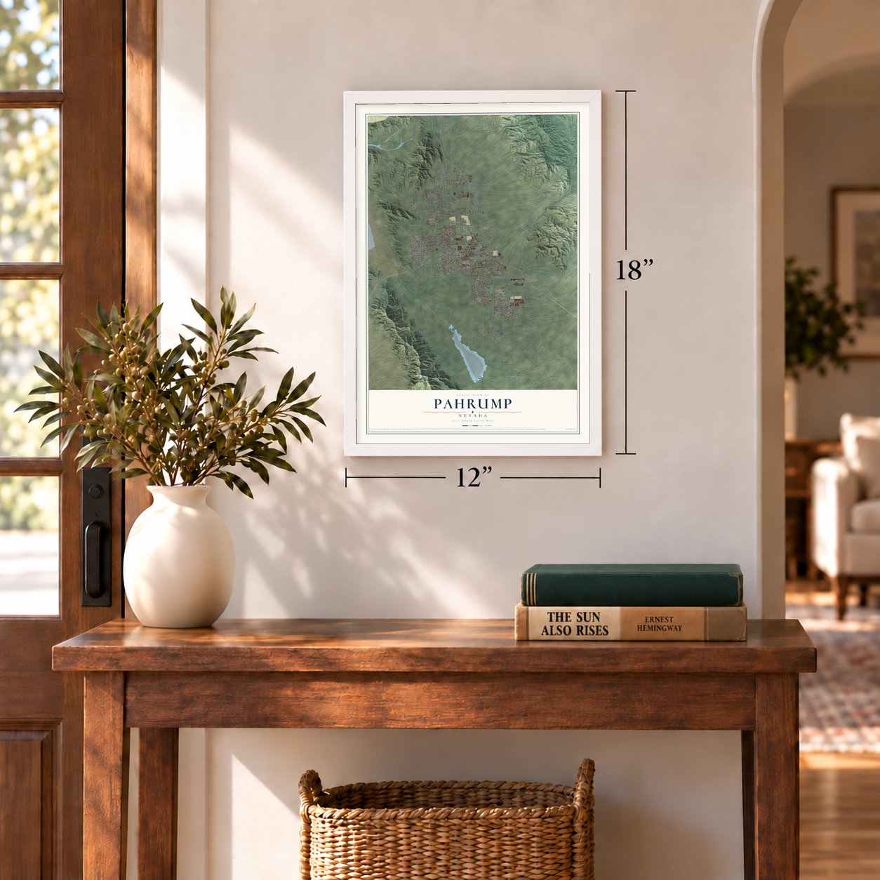
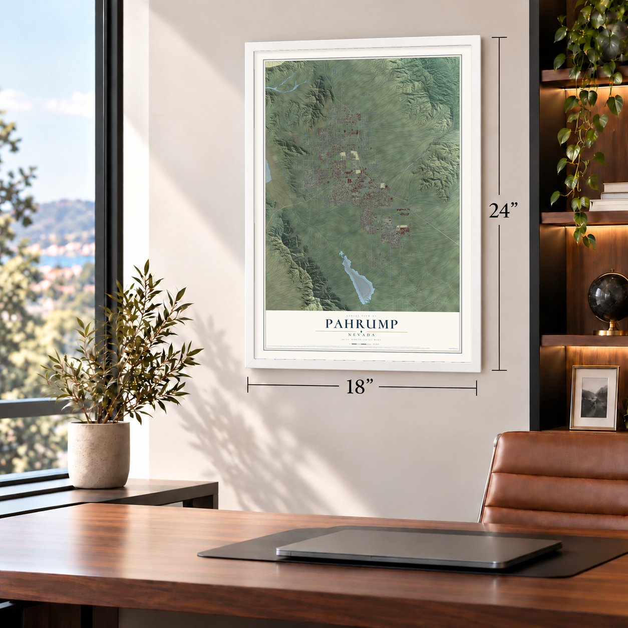
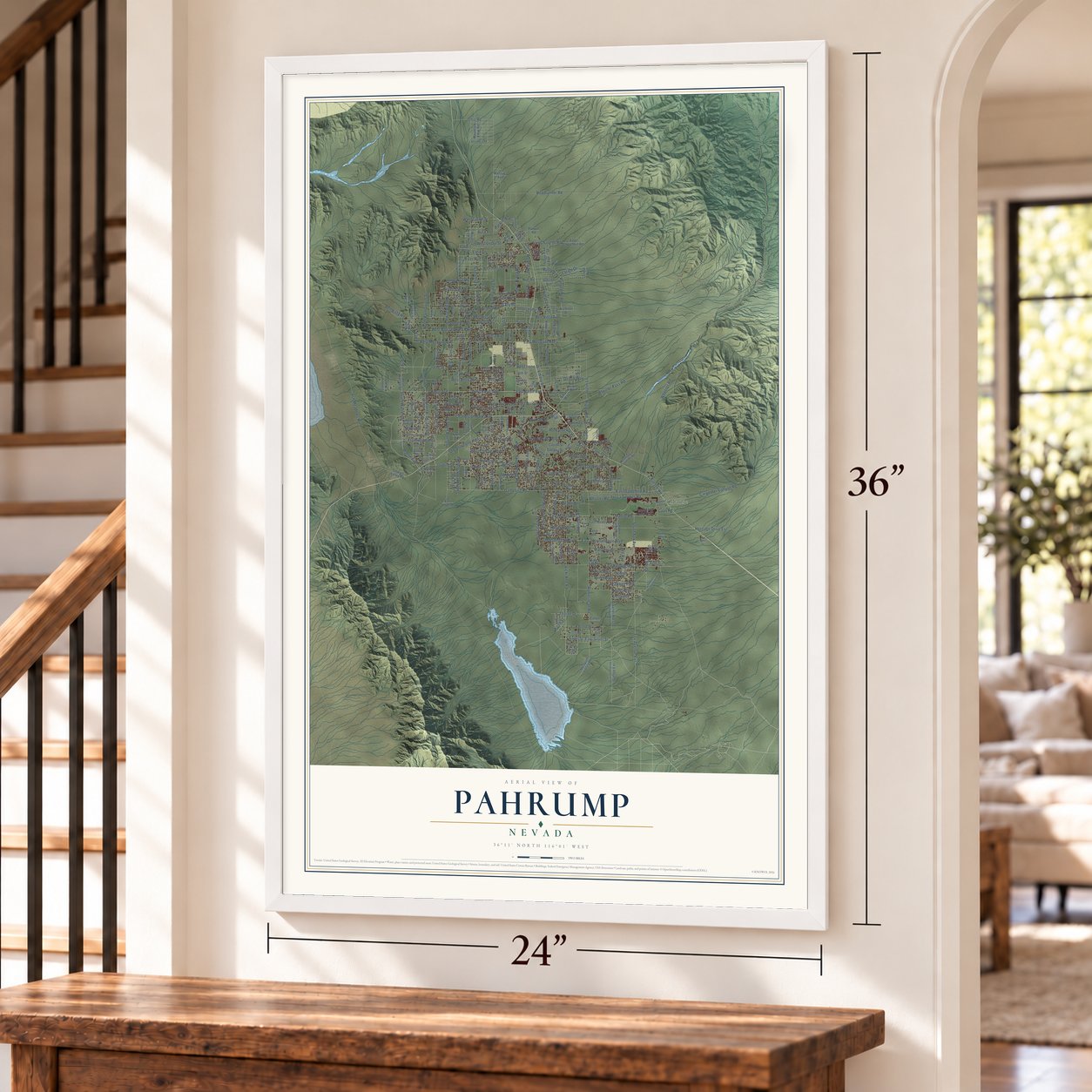
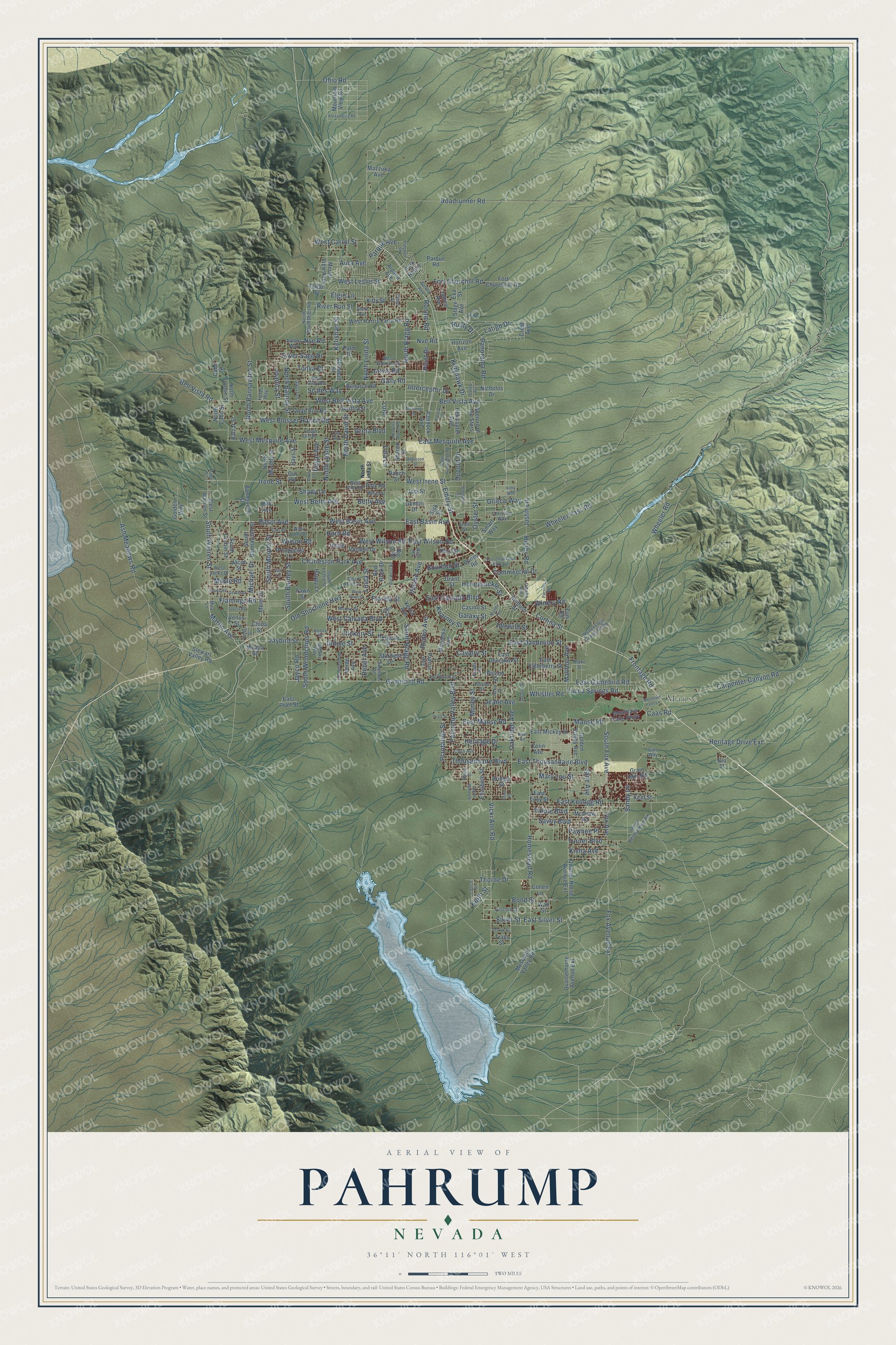
Pahrump, Nevada Map Art
Building by building, with labeled streets and shaded relief.
12" x 18" Archival Matte Print
A Map of Home. A Work of Art.
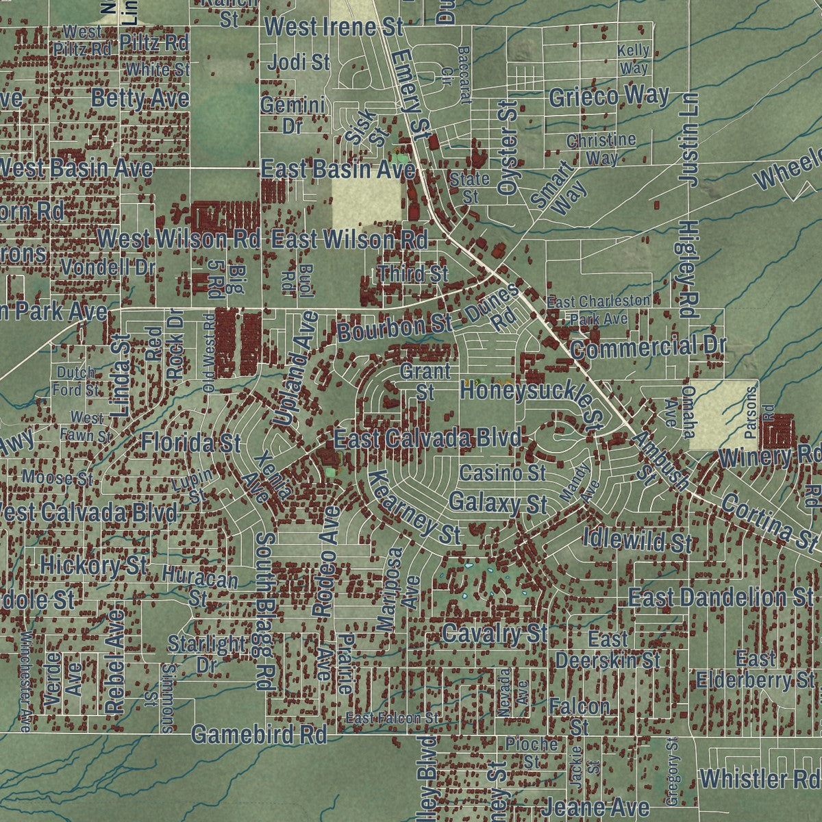
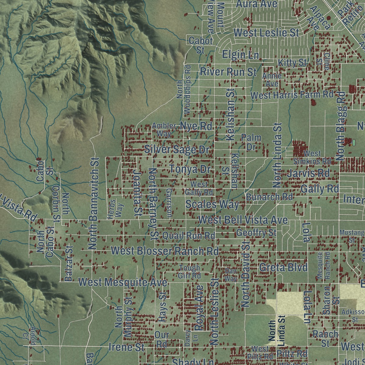
Explore Pahrump, Nevada from a whole new perspective. Created using aerial imagery and detailed geographic data, this map captures Pahrump building by building, with labeled streets, familiar landmarks, and shaded topographical relief that highlights the natural contours of the landscape.
Combining modern data with the timeless character of a vintage atlas, this map is just as interesting up close as it is beautiful on the wall. Whether you grew up in Pahrump, spent memorable years there, or call it home today, this unique map is a great way to celebrate a place that means something to you. Zoom in on the preview to look for your street, and then order a print to put your memories on the wall.
Three ways to hang it
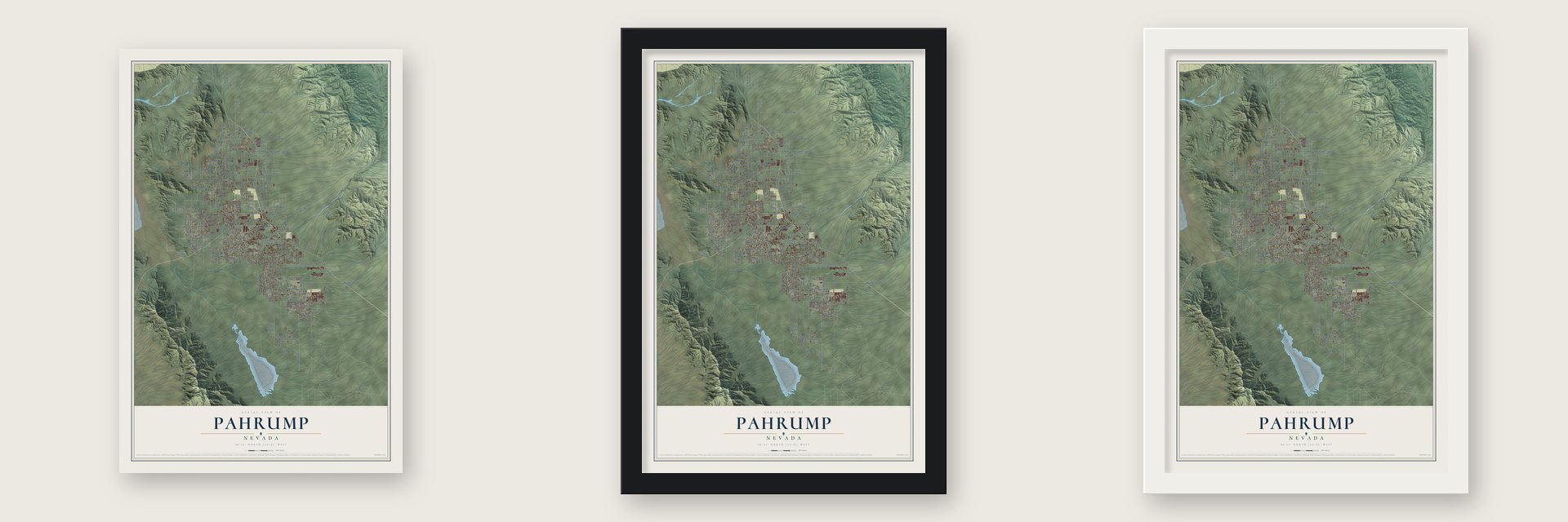
Unframed archival matte, a black wood frame or a white wood frame.
Up close
Geography Worth Displaying
This map was created using accurate cartographic data and authoritative geographic sources, including the U.S. Geological Survey and the Census Bureau. The map brings together terrain, waterways, roads, and building detail. The majority of the streets are labeled, houses are accurately depicted, and the topography is derived from government sources. Combining local data with carefully composed color and shading leads to this beautifully detailed Pahrump artwork for your wall.
Rather than simply showing street outlines, we’ve included as many of the street names as we could reasonably fit on the map while keeping their names legible. Zoom in on the high resolution preview to see exactly what’s on the map. We truly set out to create a statement piece for anyone who loves Pahrump. So whether it’s for you, or a gift for someone you love, we hope this map of Pahrump brings back fond memories.
Read the story behind this map of Pahrump, Nevada from 2026.

Find your street
Names on the Pahrump map
Every name below is printed on this map. Look for your street, your school, the park where you played, or the pond down the road.
Places and landmarks1
- Manse
Streets and roads293
- West Basin Avenue
- North Blagg Road
- Basin Avenue
- Martin Avenue
- South Warren Street
- Maple Road
- Irene Street
- West Irene Street
- Manse Road
- East Manse Road
- Heritage Drive
- Honeysuckle Street
- Plantation Street
- Old Shoshone Highway
- Thousandaire Boulevard
- East Thousandaire Boulevard
- East Mesquite Avenue
- Justin Lane
- Homestead Road
- South Murphy Street
- North Bannavitch Street
- Bell Vista Avenue
- Oyster Street
- Elgin Lane
- Oakridge Avenue
- East Calvada Boulevard
- West Bell Vista Avenue
- North David Street
- Linda Street
- Carpenter Canyon Road
Show all 293 streets
- Kelishan Street
- West Calvada Boulevard
- Grieco Way
- Higley Road
- East Kellogg Road
- Gamebird Road
- East Gamebird Road
- North Linda Street
- North Leslie Street
- Ash Meadows Road
- Vicki Ann Road
- Roadrunner Road
- Pahrump Valley Boulevard
- Wheeler Pass Road
- Heritage Drive Extension
- Bell Vista Road
- Wilson Road
- West Blosser Ranch Road
- West Wilson Road
- South Barney Street
- North Barney Street
- Panorama Road
- West Mesquite Avenue
- Charleston Park Avenue
- Lola Lane
- Fox Avenue Extension
- South Woodchips Road
- South Blagg Road
- Wheeler Road
- Frontage Road
- Fox Avenue
- East Basin Avenue
- Gally Road
- Kittyhawk Drive
- Turner Boulevard
- South Fox Avenue
- Money Street
- Flamingo Road
- West Betty Avenue
- East Dandelion Street
- Hickory Street
- Malibou Avenue
- Nye Road
- Horn Road
- Shady Lane
- Jane Avenue
- Silver Sage Drive
- Jaybird Street
- Latigo Drive
- Galaxy Street
- Jarvis Road
- Savoy Boulevard
- Paiute Boulevard
- Jeane Avenue
- Bond Street
- Cavalry Street
- Yucca Springs Road
- Ohio Road
- Sandy Lane
- Betty Avenue
- Thorne Drive
- East Silver Street
- Rodeo Avenue
- Mary Lou Street
- Indole Street
- West Carrol Street
- Emery Street
- Fort Churchill Road
- Greta Boulevard
- Cortina Street
- Upland Avenue
- West Leslie Street
- East Wilson Road
- Scales Way
- Commercial Drive
- Silver Street
- Irons
- Aura Avenue
- Kearney Street
- River Run Street
- Parque Avenue
- Winery Road
- Jayco Road
- Interceptor Drive
- Lola
- Joanita Street
- Dupont Drive
- Michael Drive
- Tonya Drive
- Kisha Avenue
- Pawnee Place
- Whistler Road
- Bourbon Street
- Ronnie Road
- Nve Road
- Rebel Avenue
- Idlewild Street
- Royal Avenue
- Florida Street
- Point Drive
- Keith Street
- Caas Road
- Rusty Drive
- Bannavitch Street
- South Bannavitch Street
- North Corbin Street
- South Corbin Street
- Avenue of the Stars
- Nicholos Drive
- Our Road
- Verde Avenue
- Kellshan Street
- Mesquite Valley Road
- Sharon Street
- Smart Way
- East Elderberry Street
- Mountain Falls Parkway
- Horizon Avenue
- North Murphy Street
- Bridger Street
- West Harris Farm Road
- Quail Run Road
- Paddock Avenue
- Quarterhorse Avenue Extension
- Red Rock Drive
- Palm Drive
- McGraw Road
- Mountain View Road
- Happy Lane
- East Deerskin Street
- China Street
- Prospector Lane
- Huracan Street
- Elizabeth Street
- East Mickey Street
- Bunarch Road
- Falcon Street
- Meier Drive
- Helicopter Avenue
- Ambush Street
- Vondell Drive
- Xenia Avenue
- Mariposa Avenue
- North Cabo Street
- Mount View Avenue
- West Warren Street
- Golden Valley Avenue
- Piltz Road
- Prairie Avenue
- Fort Churchhill Road
- Geoffry Street
- Quarter Horse Avenue Extension
- East Pratt Street
- Big 5 Road
- Starlight Drive
- Stewart Valley Road
- Golden Way
- Casino Street
- Grain Mill Road
- Zuni Road
- Kitty Street
- Grant Street
- Venus Street
- Hays Street
- Balzar Street
- Kent Street
- Mazzuka Avenue
- Stage Avenue
- Park Retiro
- Dunes Road
- Cabot Street
- Moapa Street
- Parque Road
- Third Street
- Janice Avenue
- Eva Street
- Jodi Street
- Ranch Street
- Jacob Street
- Alpaca Avenue
- Traci Street
- Halo Avenue
- East Easy Street
- Zolin Avenue
- Gemini Drive
- Wall Street
- Cohen Lane
- Cabo Street
- Sisk Street
- Crest Avenue
- Fawn Street
- Mira Lane
- Cline Street
- North Woodchips Road
- West Gally Road
- West Simkins Road
- South Leslie Street
- Ambler Way
- Venza Street
- Big Sky Way
- Cash Avenue
- West Piltz Road
- White Street
- Pioche Street
- Indian Reservation Road
- Lupin Street
- Tough Girl Road
- Wulfenstein Gravel Pit Road
- West Judy Drive
- Paula Drive
- Moose Street
- Fuschia Street
- Christine Way
- Annie Avenue
- Omaha Avenue
- State Street
- Garrison
- Simmons Street
- Van Lane
- Buol Road
- West Jacks Drive
- Aurora Avenue
- Herbs Way
- Blake Street
- Gills Way
- Nita Street
- Kelly Way
- Calico Avenue
- West Fawn Street
- Dan Way
- Dyer Road
- East Falcon Street
- Winchester Avenue
- Brian Road
- East Charleston Park Avenue
- Jackie Street
- Adkisson Street
- Baccarat Circle
- North Promenade Road
- Mustang Street
- Natalia Lane
- Mandy Avenue
- South Money Street
- Pathway Drive
- Alexandrite Road
- Old West Road
- Cajon Lane
- Church Street
- Dutch Ford Street
- Mesquite Ranch Road
- Parsons Road
- Gerald Street
- Gregory Street
- Shirley Street
- Forest Road
- Emma Road
- Pratt Street
- Mountain Falls Lane
- Darcy Lane
- Puma Road
- Nevada Avenue
- Vassar Street
- Arnold Court
Names are listed as they appear on the printed map. Zoom into the product photos to find them.
About Pahrump, Nevada
Pahrump is an unincorporated town of 44,738 people at the southern tip of Nye County, near the California line and about 50 miles west of Las Vegas. The Southern Paiute lived here first. Settlers trickled in during the late 19th century and reportedly kept a form of the Paiute name Pah-Rimpi, or "Water Rock," because the valley held so many artesian wells. Those wells watered big ranches, most of them over 1,000 acres, where families grew alfalfa and cotton and raised livestock.
Into the 1960s the valley's only telephone was a radio phone in a booth beside the small market. Las Vegas kept growing, and so did Pahrump, so in the late 1960s it got phone service and a paved highway to the city. That road, NV 160, later ran north to US 95, and NV 372 linked the town to Shoshone, California. Teenagers rode to Shoshone for high school until Pahrump Valley High School opened in 1974.
- Chief Tecopa of Pahrump SpringBorn about 1815 near Las Vegas, Tecopa became the most famous leader of the Southern Paiute and made his home at Pahrump Spring. As chief over several Paiute villages, Pahrump included, he led their rabbit drives and the festival held each fall once the pine nuts were gathered. His name means wildcat, yet people knew him as a peacemaker. He died in Pahrump in 1904, and the community of Tecopa carries his name.
- Ted Binion's buried silverLas Vegas casino owner Ted Binion hid a large load of silver in a secret vault under the ground in Pahrump. After Binion died under suspicious circumstances in 1998, one of the people accused of his murder was caught digging up that vault. James McManus wrote about the trial in his book Positively Fifth Street.
- A flag law, then a repealOn November 15, 2006, the town board passed an ordinance making English the official language of business, putting the American flag above all others and denying welfare to illegal immigrants. Sheriff Tony DeMeo said he wouldn't enforce it, and after a wave of bad press the board repealed it four months later.
Keep exploring Nevada
Pahrump is one of 148 Nevada towns we've mapped. Every dot on the map is a print of its own.
The search covers every state, Nevada first.
Near Pahrump
Order 2 or more town maps and save 10%. Shown in the size and finish you picked above, so they hang as a set.
- Mount Charleston 12" x 18" / Archival Matte Print $39.99
- Indian Springs 12" x 18" / Archival Matte Print $39.99
- Sandy Valley 12" x 18" / Archival Matte Print $39.99


More maps nearby: Amargosa Valley, Blue Diamond, Summerlin South, Lone Mountain and Summerlin.
The art of mapping a place
How This Map Was Made
Real places. Remarkable detail. Discover the layers that turn geographic data into a map of home.

The view from above
Aerial imagery reveals the character of the land: woodland, open fields, and the patterns of a place.

The shape of the land
Elevation data brings hills, valleys, and subtle changes in the landscape into view.

The details of home
Roads, waterways, and building footprints come together to make the map feel unmistakably local.

Geography becomes art
Considered color, shading, and typography bring the layers together in a map made for your wall.


Process illustrated with Mendon, Massachusetts. Aerial imagery: USDA NAIP. Terrain: USGS 3D Elevation Program. Map details and finished artwork: KNOWOL.
The Details
About This Print
Choose an archival matte print, or a black or white Ayous wood frame. The archival matte print is unframed.
Select your size and finish above to see the matching product image and price.
Materials & Craftsmanship
A contemporary map with the character of a classic atlas, printed on archival matte paper. Optional frames are made from Ayous wood.
Your printed map does not include the watermark shown in the full-map preview.
Shipping & Delivery
Free shipping within the United States. Every print is made to order in the USA.
Buying a gift? Add a note in your cart and we'll include it. We never put prices in the package.
Prints ship within 2 to 3 business days. Allow 7 to 10 days total from ordering for delivery. Timing may vary during holidays or periods of high order volume.
Read our shipping policy.
Returns and damaged prints
Each print is made to order. Change-of-mind refunds are not available after production.
If your print arrives damaged, misprinted or incorrect, contact support@knowol.com within 30 days of receiving it. Include your order number, photos and a description of the issue.
Read our full refund and replacement policy. For questions about your order, email support@knowol.com.