
Search for another town




Free U.S. delivery 7 to 10 days after you order
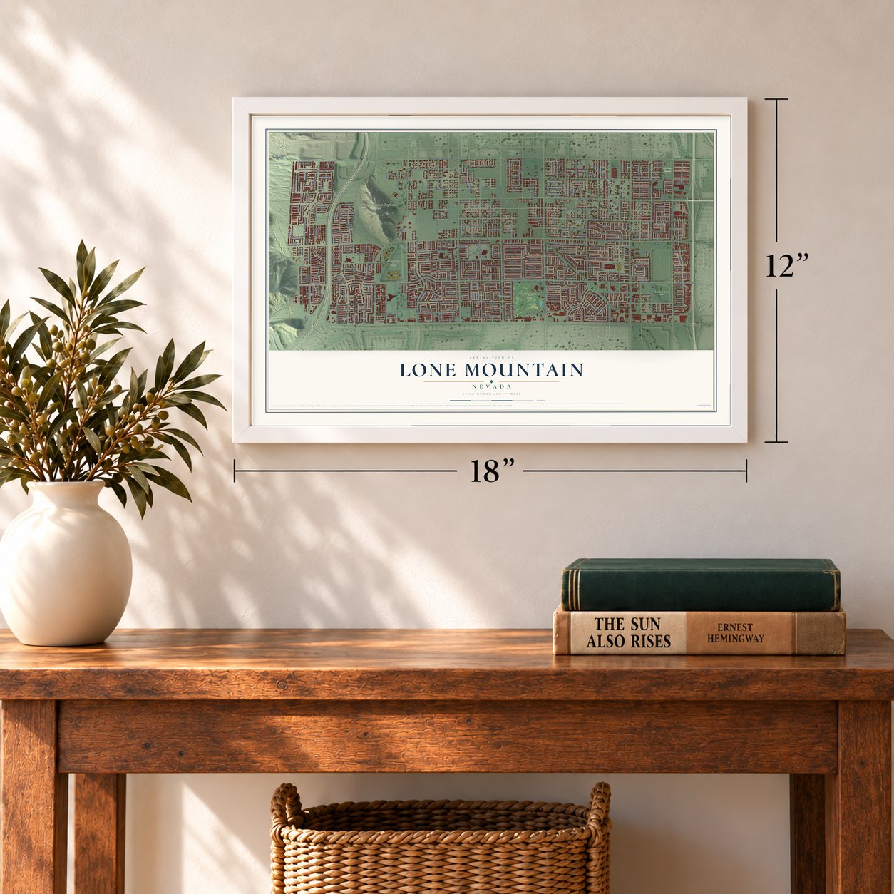
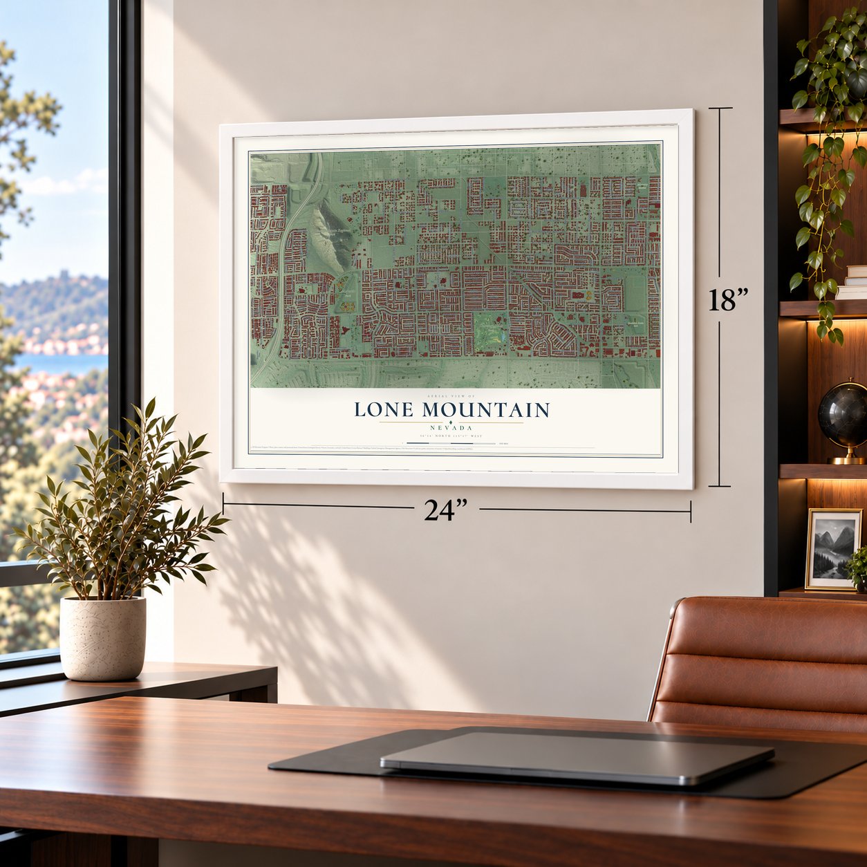
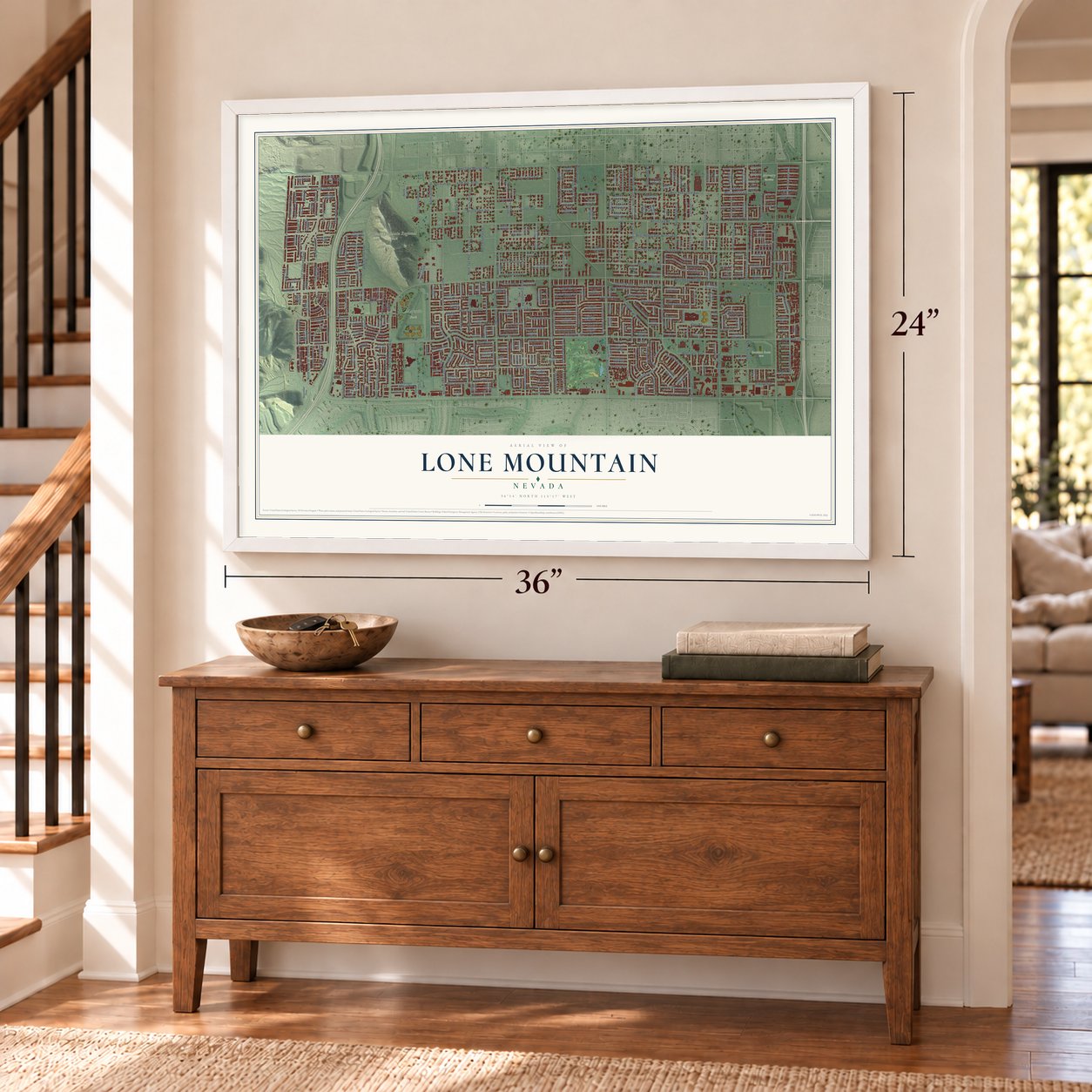
Lone Mountain, Nevada Map Art
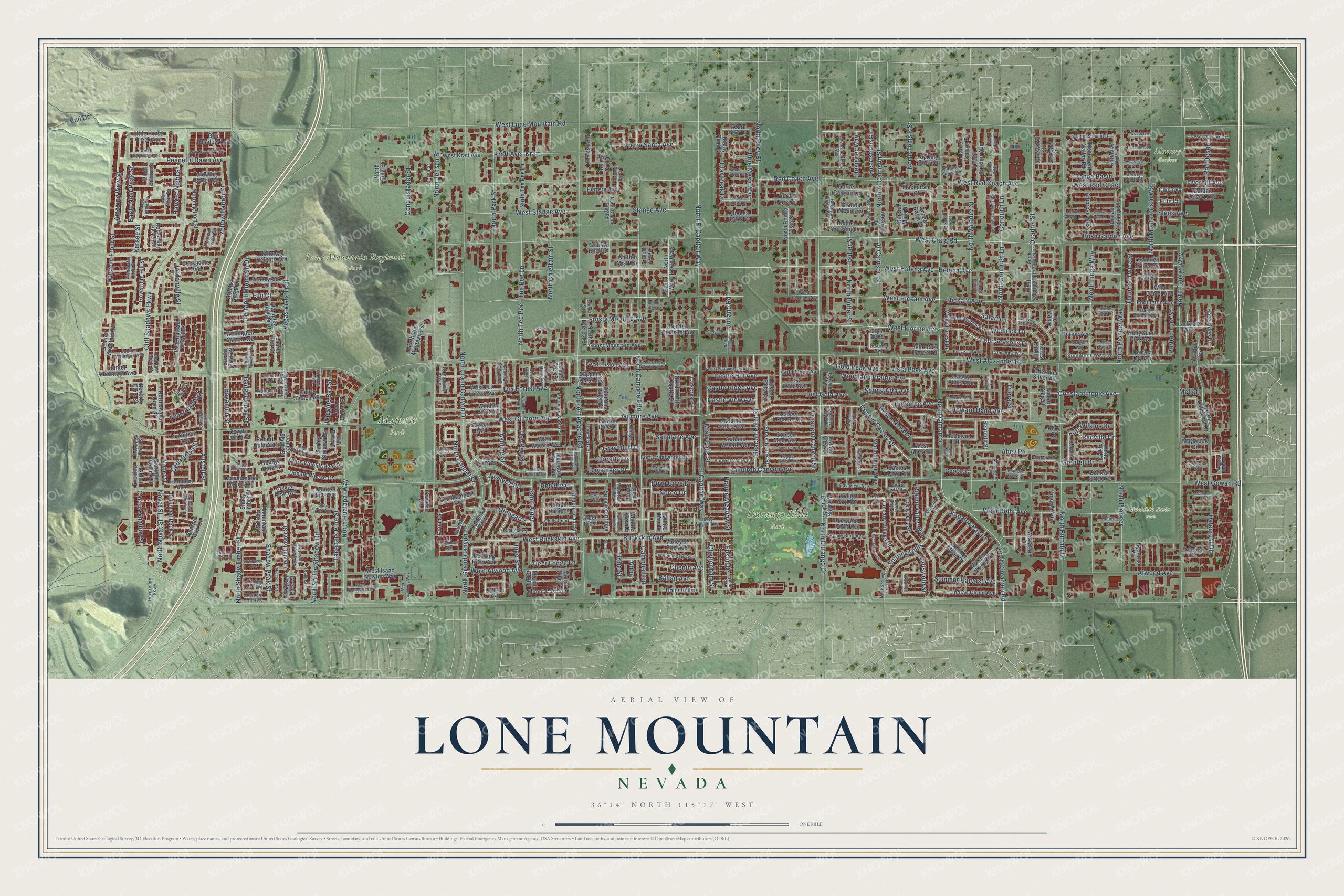
A new map of Lone Mountain, Nevada, made in 2026 and printed to order on thick archival matte paper.
12" x 18" Archival Matte Print
A Map of Home. A Work of Art.
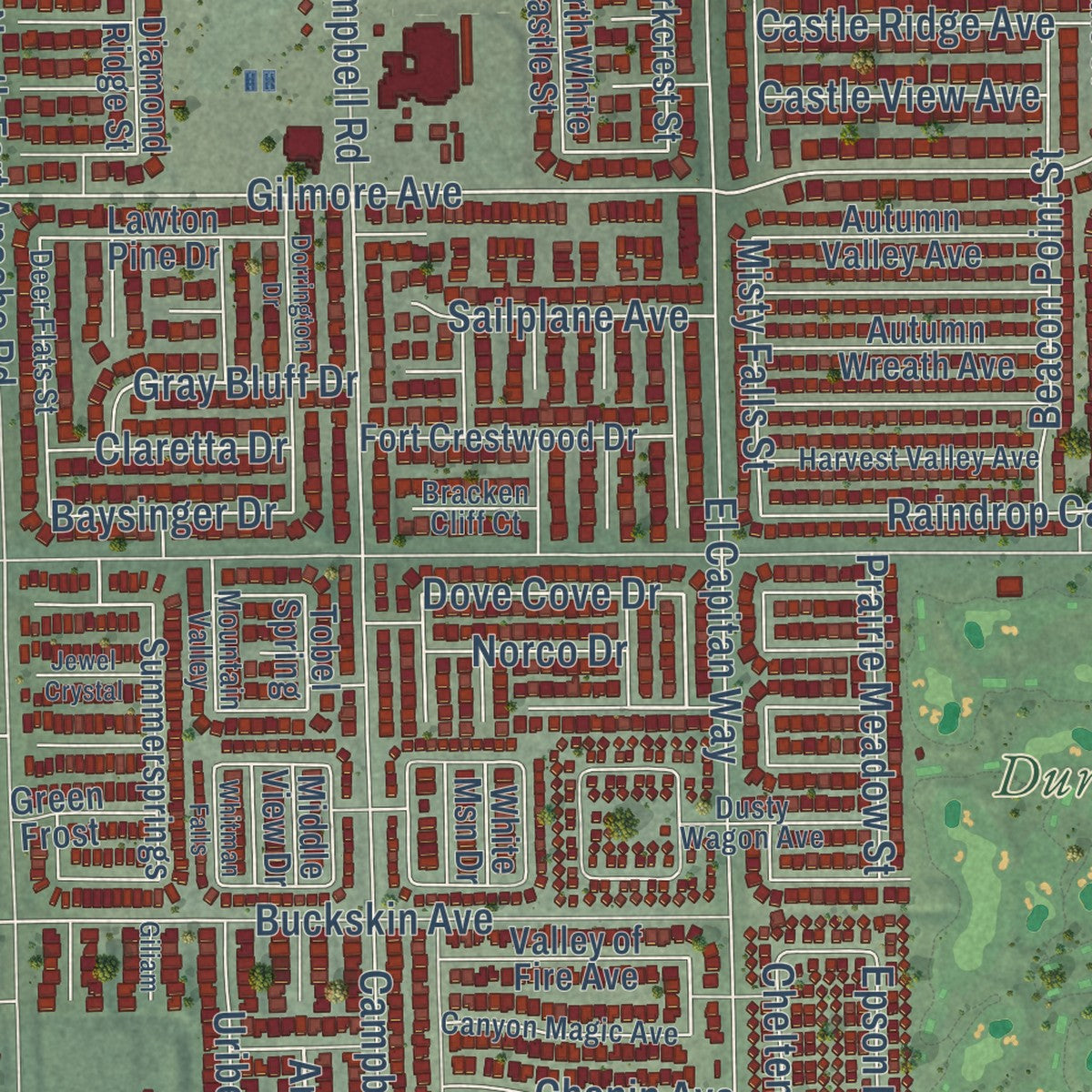
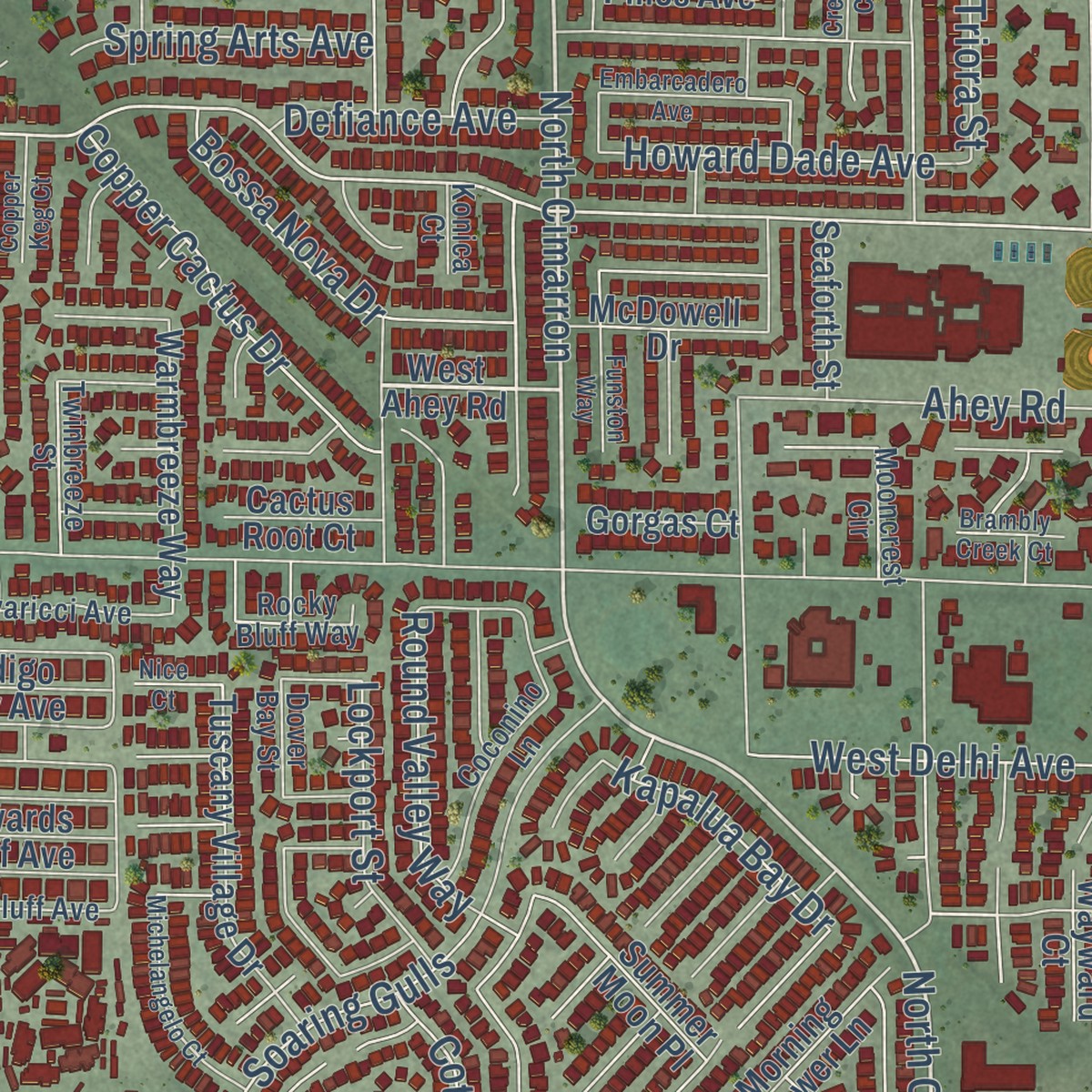
Explore Lone Mountain, Nevada from a whole new perspective. Created using aerial imagery and detailed geographic data, this map captures Lone Mountain building by building, with labeled streets, familiar landmarks, and shaded topographical relief that highlights the natural contours of the landscape.
Combining modern data with the timeless character of a vintage atlas, this map is just as interesting up close as it is beautiful on the wall. Whether you grew up in Lone Mountain, spent memorable years there, or call it home today, this unique map is a great way to celebrate a place that means something to you. Zoom in on the preview to look for your street, and then order a print to put your memories on the wall.
Three ways to hang it
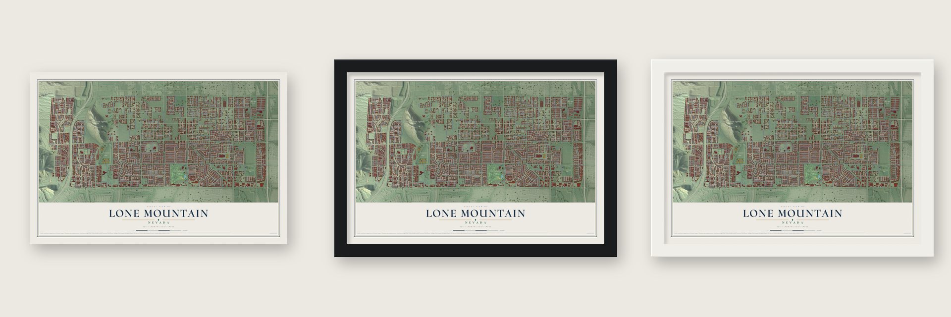
Unframed archival matte, a black wood frame or a white wood frame.
Up close
Geography Worth Displaying
This map was created using accurate cartographic data and authoritative geographic sources, including the U.S. Geological Survey and the Census Bureau. The map brings together terrain, waterways, roads, and building detail. The majority of the streets are labeled, houses are accurately depicted, and the topography is derived from government sources. Combining local data with carefully composed color and shading leads to this beautifully detailed Lone Mountain artwork for your wall.
Rather than simply showing street outlines, we’ve included as many of the street names as we could reasonably fit on the map while keeping their names legible. Zoom in on the high resolution preview to see exactly what’s on the map. We truly set out to create a statement piece for anyone who loves Lone Mountain. So whether it’s for you, or a gift for someone you love, we hope this map of Lone Mountain brings back fond memories.
Read the story behind this map: Detailed Map of Lone Mountain, Nevada.

Find your street
Names on the Lone Mountain map
Every name below is printed on this map. Look for your street, your school, the park where you played, or the pond down the road.
Places and landmarks5
- Buckskin Basin Park
- Durango Hills Park
- Lone Mountain Regional Park
- Majestic Park
- Memory Gardens
Streets and roads440
- North Cimarron Road
- North Campbell Road
- Quadrel Street
- West Florine Avenue
- Ahey Road
- North Cimarron
- Radville Drive
- West Hickam Avenue
- Fort Wilkins Drive
- North Connel Street
- West Craig Road
- West Helena Avenue
- North Durango Drive
- Four Seasons Drive
- West Red Coach
- Ballad Avenue
- West Gilmore Avenue
- Gilmore Avenue
- West Buckskin Avenue
- Kraft Avenue
- Eagle Nest Peak Street
- Kersee Street
- Ariba
- Helena Avenue
- Conquistador Street
- Dove Cove Drive
- Gray Bluff Drive
- West Lone Mountain Road
- West Alexander Road
- West Gowan Road
Show all 440 streets
- West Red Coach Avenue
- Hickam Avenue
- Cliff Shadows Parkway
- El Capitan Way
- North El Capitan Way
- North Tenaya Way
- North Buffalo Drive
- Buckskin Avenue
- North Fort Apache Road
- Stange Avenue
- North Jensen Street
- North Grand Canyon Drive
- North Pioneer Way
- West Stange Avenue
- Conough Lane
- Campbell Road
- Tee Pee Lane
- North Chieftain Street
- North Tomsik Street
- North Hualapai Way
- Shadow Peak Street
- North Al Carrison Street
- North Tioga Way
- Constantinople Avenue
- Dalecrest Drive
- North Valadez Street
- Atwood Avenue
- North Spring Shadow Road
- Vegas Vista Trail
- West Delhi Avenue
- Al Carrison Street
- North Park Street
- North Grand Canyon
- North Riley Street
- North Monte Cristo Way
- Soaring Gulls
- North Shady Timber Street
- Raindrop Canyon Avenue
- Butler Street
- North Butler Street
- Peaceful Dawn Avenue
- North Conough Lane
- Tee-Pee Street
- North Tee Pee
- Amazing View Street
- Yellow Harbor Street
- Wedlock Lane
- North Novat Street
- Novat Street
- Fox Forest Avenue
- Beacon Point Street
- Terrapin Mountain Drive
- Woodland Prairie Avenue
- West Atwood Avenue
- Lacebark Pine Street
- Copper Cactus Drive
- Kraft
- Bush Garden Avenue
- Thunder Twice Street
- Clay Peak Drive
- Blue Mesa Way
- Summer Harvest Avenue
- Lost Gold Avenue
- Puli Drive
- Tierra Santa Avenue
- Frosty Morning Avenue
- Crescent Canyon Street
- Howard Dade Avenue
- Cedartown Street
- Safari Lane
- Castle Hill Avenue
- Castle Ridge Avenue
- Red Coach Avenue
- North Pioneer
- Designer Way
- Western Front Street
- Round Valley Way
- Prairie Meadow Street
- Cactus Shadow Street
- Jordanville Street
- Saint Aiden
- Austell Street
- Lockport Street
- Red Desert
- Spring Arts Avenue
- Sailplane Avenue
- Bossa Nova Drive
- Chenin Avenue
- Vista Peak Avenue
- Defiance Avenue
- Gold Peak Avenue
- Castle View Avenue
- Seasonable Drive
- Glengarry
- Kapalua Bay Drive
- Bayamon Street
- Perfect Lure Street
- Harvest Night Street
- Twelve Pins
- Badgerbrook Street
- Misty Falls Street
- Cotswold Street
- Cheltenham Street
- Wiggins Bay Street
- Heartstone Circle
- Deer Lodge Lane
- Epson Drive
- Juliano Road
- Ashling Street
- Grenfell Drive
- Claretta Drive
- Baysinger Drive
- Tahoe Basin
- Uribe Street
- Overhill Avenue
- Norco Drive
- Red Rose
- Sleek Avenue
- Lingo Street
- Triora Street
- Fuji Court
- Mellott
- West Quadrel Street
- White Star Drive
- West Ahey Road
- North Kevin Way
- Summer Crest Lane
- North Eula Street
- West Kraft Avenue
- Kevin Way
- Golden Pedal Street
- Mountain Park Street
- Hidden Crossing Lane
- Delray Beach Avenue
- Amber Gold Street
- Tobel Spring
- Spring Shadow Road
- North Tee Pee Lane
- Pvt Chateau Verselles
- North Bonita Vista Street
- Shady Timber Street
- North Dalecrest Drive
- Verde Park Circle
- West Fox Forest Avenue
- Hampton Heights Drive
- Niclay Peak Drive
- Warmbreeze Way
- Grayson Lake Court
- Windom Point Avenue
- Tuscany Village Drive
- West Isaac Newton Way
- Ghost Mountain Avenue
- Al Carrison
- West Fusion Way
- Fort Crestwood Drive
- Clark Wooldridge Court
- Bennett Mountain Street
- Morning Port Street
- Donald Weese Court
- Robins Ridge Drive
- Wellington Manor Avenue
- Governors Hill Street
- Autumn Valley Avenue
- Autumn Wreath Avenue
- Indian Cloud Avenue
- Balanced Rock Street
- Monument Valley Road
- North Aspen Cove Street
- Starlight Evening Street
- Copper Ridge Avenue
- Silver Brook Street
- Crystal Tower Street
- Copper Mine Avenue
- Summersprings
- North Everest Street
- Dream Catcher Avenue
- Dunlap Crossing Street
- Ambrose Mesa
- Wake Forest Drive
- Winding Brook Street
- North Via Montagna Street
- Perfect Day Avenue
- Hollywood Park Avenue
- Mount Cash Avenue
- Drumcannon Avenue
- Valley of Fire Avenue
- Antelope Wells Drive
- Lawton Pine Drive
- Golden Desert Avenue
- James Slagle Street
- Holloway Heights Avenue
- Summer Moon Place
- Unique Way
- Gold Shadow Avenue
- Sewards Bluff Avenue
- Indigo Sky Avenue
- Eddington Avenue
- Garnet Canyon Lane
- Gold Flash Avenue
- Danielson Avenue
- Granite Mountain
- Larkvale Way
- Jumpin Juniper
- Queens Brook Court
- Hazelridge Drive
- Hamdem Avenue
- Pewter Pheasant Avenue
- Mountain Forest Court
- Hunter Mountain Avenue
- Camden Pine Avenue
- Morning Flower Lane
- Wild Carrot Avenue
- Laurel Canyon Street
- Leon de Oro Drive
- Little Horse Creek Avenue
- Dolente Avenue
- Florine Avenue
- McDowell Drive
- Copper Basin Drive
- Commanche Moon Avenue
- Forest Knoll Lane
- Larkcrest Street
- North White Castle Street
- Central Butte Avenue
- Diamond Ridge Street
- Glowing Cove Avenue
- Beckaville Avenue
- Warm Waters Avenue
- Robert Dula Avenue
- Junewood Street
- Aviano Pines Avenue
- Last Point Avenue
- Boylagh Avenue
- Laurel Flat Court
- Herrera Avenue
- Grassyrock Court
- Mackenzie Court
- Seaforth Street
- Maybrook Drive
- Cherokee Silver Avenue
- Sweden Street
- Crystal Arch Avenue
- Camsore Point
- Elkridge Drive
- Bending River Avenue
- Azure Sky Drive
- Rockaway Beach Street
- Sapphire Ridge Avenue
- Cactus Root Court
- Conan Street
- Plum Button Street
- Gorgas Court
- Bearpin Gap Lane
- Metter Street
- Mountain Crest Street
- Coyote Cub Avenue
- Wayward Court
- Mineral Mine Drive
- Green Frost
- George Hart Court
- Chiffon Mist Avenue
- Juno Beach Street
- Chic Avenue
- Coluter Pine Avenue
- Spring Buck Court
- Sinew Court
- Evening Fog Street
- Russet Falls Street
- Granite Knoll Court
- Baxter Peak Street
- Mount Austin
- Mount Sierra
- Hyannis Circle
- White Msn Drive
- Elite Court
- Middle View Drive
- Beverly Elms Street
- Estate View Street
- Copper Glen Street
- Rory Court
- Crimson Avenue
- West Wedlock Lane
- North Dapple Gray Road
- North Quadrel Street
- Sparrow Rock Street
- Mountain Waters Street
- Crenshaw Way
- Harvest Valley Avenue
- Deer Flats Street
- Copper Falls Avenue
- Epson Street
- Alamo Summit Drive
- Canyon Magic Avenue
- Jubilee Mountain Avenue
- Desert Clover Court
- Stoney Bluff Avenue
- Nordic Cliff Avenue
- Cavaricci Avenue
- Mooncrest Circle
- Coconino Lane
- Borrego Spring Way
- Los Rancheros Avenue
- Dusty Wagon Avenue
- Ballindarry Avenue
- El Presidente Drive
- Daily Double Avenue
- Chilly Pond
- Dalegrove Drive
- West Hickman Avenue
- Narrow Canyon Street
- North Vegas Vista Trail
- Twinbreeze Street
- Reverence Parkway
- Jadewood Street
- Wonderful Life Street
- Dawn Peak Street
- Mountain Valley
- Broad Meadow Court
- North Teal Sunset Street
- Winterthur Court
- Wexford Lane
- Daily Hope Avenue
- Jeneen Street
- Sage River Street
- Rocky Bluff Way
- Sherman Oaks Avenue
- Sloping Hill Avenue
- Mornings Dawn Street
- Camryn Holly Street
- Caprock Circle
- Smoking Gun Court
- Velvet Ridge Court
- Ohana Court
- Deluge Drive
- John Bailey Street
- Breezy Night Court
- Adrianna Avenue
- Bracken Cliff Court
- Angela Robin Street
- Dover Bay Street
- Soaring Owl
- Eagle Dancer
- Bird View Court
- Konica Court
- North Juliano Road
- Lookout Rock Circle
- North Soaring Gulls Drive
- West Tuckermans Avenue
- Dorrington Drive
- Total Eclipse Street
- Copper Knoll Avenue
- Everest Street
- West Fortune Gem Avenue
- Kelly Creek Avenue
- James Harbin Avenue
- Palisades Canyon Circle
- Michelangelo Court
- Amber Canyon Lane
- Turning Leaf Avenue
- Belle Glade Street
- Holly Knoll Avenue
- Embarcadero Avenue
- Perfect Diamond Court
- Funston Way
- North Tee Pee Street
- Metro Academy Way
- Prairie Schooner Avenue
- Rockland Drive
- Cactus Creek Drive
- Golden Canyon Road
- Dusty Riggs Creek Street
- Hill Valley Street
- Ridgecliff Street
- Nut Creek Avenue
- Driscoll Mountain Street
- West Bonterra Avenue
- Cobal Canyon Lane
- Crema Court
- Creeping Fig Court
- Rosegrass Way
- Alcove Glen Court
- Golden Glaze Court
- Gatewood Terrace Lane
- Teton Wood Avenue
- Destiny Avenue
- Copper Keg Court
- Shore Pine Avenue
- Tuscany Rose Court
- Kingship Court
- Moonlight View Court
- Orange Heights Street
- Woodstone Court
- Faustine Avenue
- Rockwood Court
- Bracknell Street
- Jewel Crystal
- Whitman Falls
- Mountain River Street
- Peaceful Harbor Street
- Brambly Creek Court
- Sand Hawk Court
- Blatimac Avenue
- Hopland Circle
- Helena Cove Court
- Blue Sage Court
- Turtle Dove Court
- Mount Hood Court
- Nice Court
- Florine
- Giliam
Names are listed as they appear on the printed map. Zoom into the product photos to find them.
The art of mapping a place
How This Map Was Made
Real places. Remarkable detail. Discover the layers that turn geographic data into a map of home.

The view from above
Aerial imagery reveals the character of the land: woodland, open fields, and the patterns of a place.

The shape of the land
Elevation data brings hills, valleys, and subtle changes in the landscape into view.

The details of home
Roads, waterways, and building footprints come together to make the map feel unmistakably local.

Geography becomes art
Considered color, shading, and typography bring the layers together in a map made for your wall.


Process illustrated with Mendon, Massachusetts. Aerial imagery: USDA NAIP. Terrain: USGS 3D Elevation Program. Map details and finished artwork: KNOWOL.
The Details
About This Print
Choose an archival matte print, or a black or white Ayous wood frame. The archival matte print is unframed.
Select your size and finish above to see the matching product image and price.
Materials & Craftsmanship
A contemporary map with the character of a classic atlas, printed on archival matte paper. Optional frames are made from Ayous wood.
Your printed map does not include the watermark shown in the full-map preview.
Shipping & Delivery
Free shipping within the United States. Every print is made to order in the USA.
Buying a gift? Add a note in your cart and we'll include it. We never put prices in the package.
Prints ship within 2 to 3 business days. Allow 7 to 10 days total from ordering for delivery. Timing may vary during holidays or periods of high order volume.
Read our shipping policy.
Returns and damaged prints
Each print is made to order. Change-of-mind refunds are not available after production.
If your print arrives damaged, misprinted or incorrect, contact support@knowol.com within 30 days of receiving it. Include your order number, photos and a description of the issue.
Read our full refund and replacement policy. For questions about your order, email support@knowol.com.
Find your town
Looking for another city?
Find a map of home in our Nevada collection, or any town in the country.
Nearby
Maps of towns near Lone Mountain
Know someone from one of these towns? Their map makes a great gift.
 Las Vegas
, Nevada
From $39.99See the map
 Summerlin
, Nevada
From $39.99See the map
 The Lakes
, Nevada
From $39.99See the map
More maps nearby: Summerlin South, West Las Vegas, Spring Valley, Downtown Las Vegas and Winchester.