
Search for another town





Free U.S. delivery 7 to 10 days after you order
Las Vegas, Nevada Map Art
Building by building, with labeled streets and shaded relief.
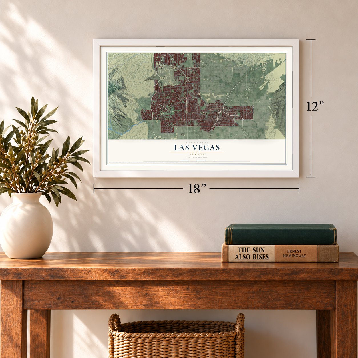
12" x 18" Archival Matte Print
A Map of Home. A Work of Art.
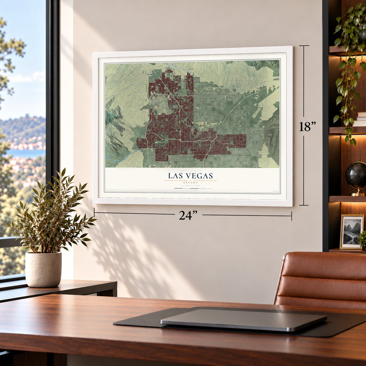
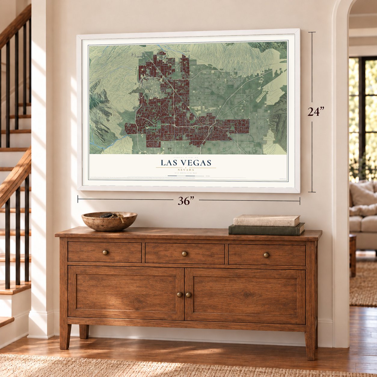
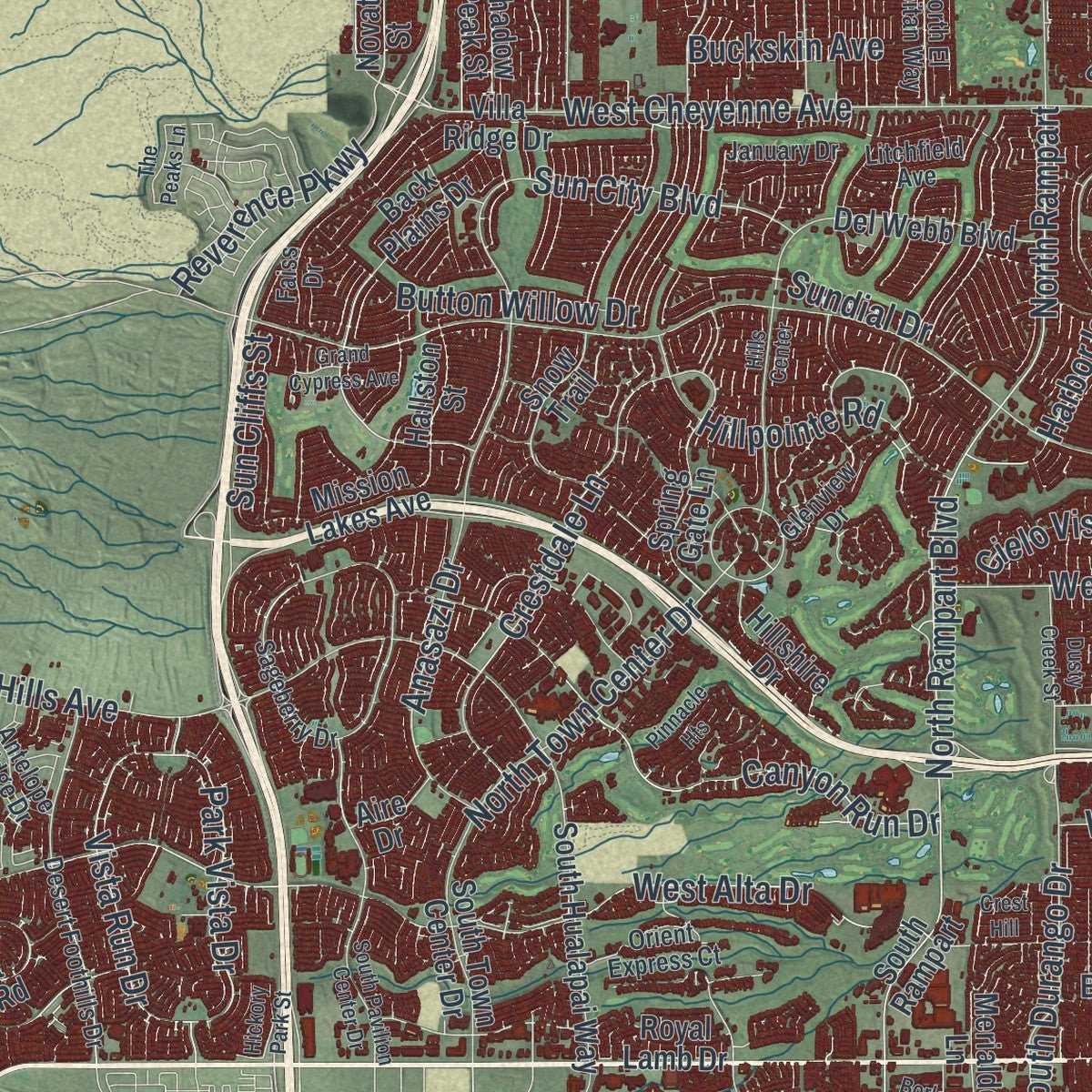
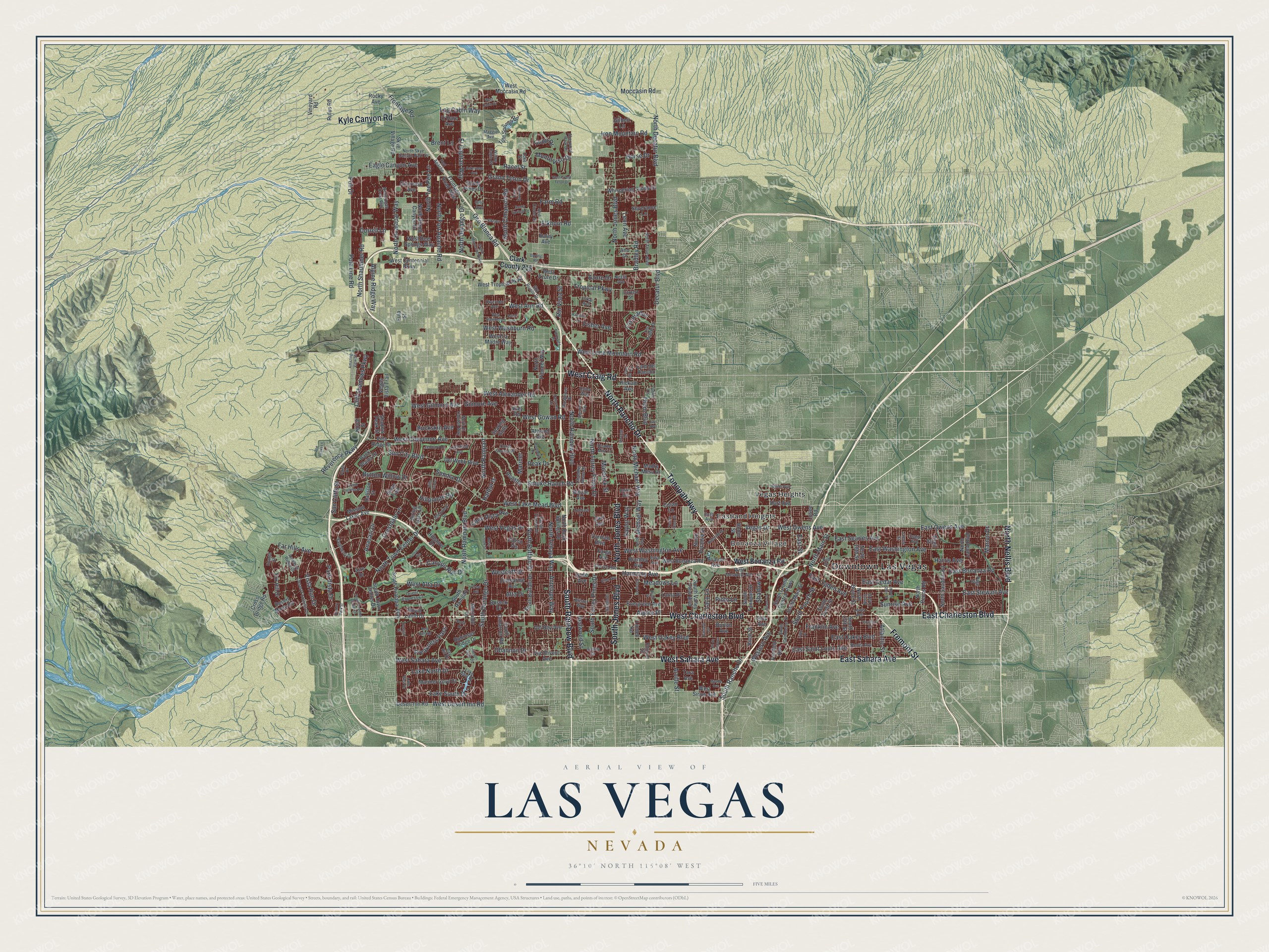
Explore Las Vegas, Nevada from a whole new perspective. Created using aerial imagery and detailed geographic data, this map captures Las Vegas building by building, with labeled streets, familiar landmarks, and shaded topographical relief that highlights the natural contours of the landscape.
Combining modern data with the timeless character of a vintage atlas, this map is just as interesting up close as it is beautiful on the wall. Whether you grew up in Las Vegas, spent memorable years there, or call it home today, this unique map is a great way to celebrate a place that means something to you. Zoom in on the preview to look for your street, and then order a print to put your memories on the wall.
Three ways to hang it
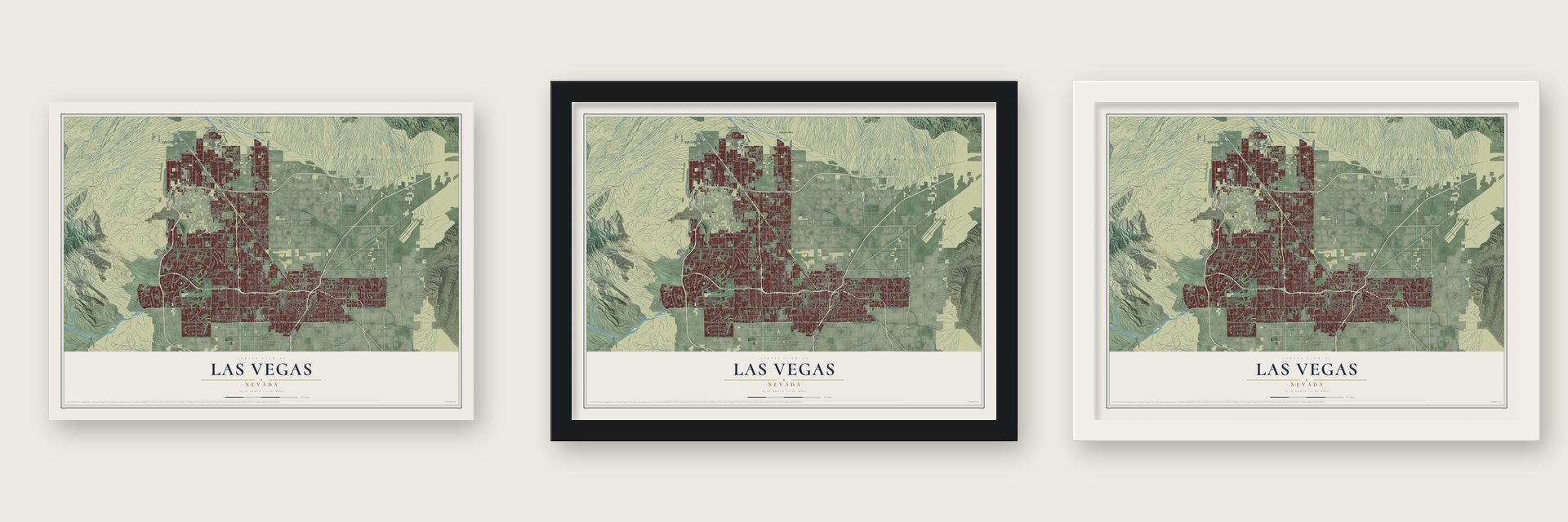
Unframed archival matte, a black wood frame or a white wood frame.
Up close
Geography Worth Displaying
This map was created using accurate cartographic data and authoritative geographic sources, including the U.S. Geological Survey and the Census Bureau. The map brings together terrain, waterways, roads, and building detail. The majority of the streets are labeled, houses are accurately depicted, and the topography is derived from government sources. Combining local data with carefully composed color and shading leads to this beautifully detailed Las Vegas artwork for your wall.
Rather than simply showing street outlines, we’ve included as many of the street names as we could reasonably fit on the map while keeping their names legible. Zoom in on the high resolution preview to see exactly what’s on the map. We truly set out to create a statement piece for anyone who loves Las Vegas. So whether it’s for you, or a gift for someone you love, we hope this map of Las Vegas brings back fond memories.
Read the story behind this map of Las Vegas, Nevada from 2026.

Find your street
Names on the Las Vegas map
Every name below is printed on this map. Look for your street, your school, the park where you played, or the pond down the road.
Places and landmarks4
- Downtown Las Vegas
- Bonanza Village
- Eastland Heights
- Vegas Heights
Streets and roads325
- West Charleston Boulevard
- Tonopah Highway
- North Rancho Drive
- West Sahara Avenue
- East Charleston Boulevard
- West Craig Road
- Fremont Street
- South Rainbow Boulevard
- East Sahara Avenue
- South Jones Boulevard
- Kyle Canyon Road
- North Nellis Boulevard
- North Jones Boulevard
- Alta Drive
- West Lake Mead Boulevard
- North Decatur Boulevard
- North Tenaya Way
- North Rainbow Boulevard
- North Buffalo Drive
- North Torrey Pines Drive
- North Durango Drive
- West Washington Avenue
- Vegas Drive
- West Alexander Road
- Farm Road
- Moccasin Road
- West Gowan Road
- West Vegas Drive
- West Oakey Boulevard
- West Lone Mountain Road
Show all 325 streets
- Grand Teton Drive
- West Alta Drive
- Bradley Road
- Oso Blanca Road
- North Shaumber Road
- West Ann Road
- North Cimarron Road
- East Stewart Avenue
- North Hualapai Way
- West Cheyenne Avenue
- North Fort Apache Road
- Puli Drive
- East Bonanza Road
- Elkhorn Road
- East Washington Avenue
- East Owens Avenue
- South Rancho Drive
- Maverick Street
- Obannon Drive
- Thom Boulevard
- West Gilmore Avenue
- Pole Line Road
- North Michael Way
- North Rampart
- North Rampart Boulevard
- West Washburn Road
- El Capitan Way
- Racel Street
- Smoke Ranch Road
- South Durango Drive
- Horse Drive
- Dorrell Lane
- Gilmore Avenue
- Leon Avenue
- East Saint Louis Avenue
- Frontage Road
- Azure Drive
- West Desert Inn Road
- Sunrise Avenue
- East Oakey Boulevard
- North Tee Pee Lane
- Anasazi Drive
- Harris Avenue
- Tropical Parkway
- Far Hills Avenue
- Buckskin Avenue
- Los Prados
- Iron Mountain Road
- Crestdale Lane
- Marion Drive
- Brent Lane
- Michael Way
- Cliff Shadows Parkway
- South Torrey Pines Drive
- Westcliff Drive
- Sun City Boulevard
- Alpine Ridge Way
- Park Vista Drive
- Log Cabin Way
- East Ogden Avenue
- Arville Street
- Canyon Run Drive
- Rio Vista Street
- Hillpointe Road
- Peak Drive
- Vista Run Drive
- Button Willow Drive
- North Town Center Drive
- Lake North Drive
- Sundial Drive
- East Searles Avenue
- Cielo Vista Avenue
- Franklin Avenue
- Lake South Drive
- West Owens Avenue
- Fisher Avenue
- Western Avenue
- Shadow Lane
- Reverence Parkway
- North Main Street
- Eagle Canyon Avenue
- Mariner
- South Fourth Street
- Alpine Place
- Meadows Lane
- Saylor Way
- Pinto Lane
- Harbor Is
- Preakness Pass
- East Cedar Avenue
- Antelope Way
- Monte Viso Drive
- Redwood Street
- Decatur Boulevard
- Atlantic Street
- Harmony Avenue
- Sun Cliffs Street
- East Street
- Cupp Drive
- Lacy Lane
- Clark County 215
- West Bonanza Road
- North Grand Canyon Drive
- West Centennial Parkway
- South Valley View Boulevard
- Del Rey Avenue
- South Hualapai Way
- West Deer Springs Way
- Villa Ridge Drive
- West Tropical Parkway
- Via Olivero Avenue
- North Pioneer Way
- Hickam Avenue
- South Buffalo Drive
- South Cimarron Road
- Carmen Boulevard
- Frontage Road West
- North Pecos Road
- North Lamb Boulevard
- Desert Inn Road
- Evergreen Avenue
- West La Madre Way
- Balzar Avenue
- South Main Street
- North Bruce Street
- Whispering Sands Drive
- North Rock Springs Drive
- Fox Hill Drive
- North Sandhill Road
- Del Webb Boulevard
- Coran Lane
- South Tenth Street
- South 17th Street
- Tule Springs Road
- Skye Village Road
- Severance Lane
- West Azure Drive
- South Town Center Drive
- South Grand Central Parkway
- Rocky Avenue
- Spring Gate Lane
- South Rampart
- West Sirius Avenue
- Atwood Avenue
- Gilcrease Avenue
- West Moccasin Road
- Carl Avenue
- Mariner Cove Drive
- Shadow Peak Street
- Robinson Ridge Drive
- Mission Lakes Avenue
- North 18th Street
- Eula Street
- Robin Street
- South Tonopah Drive
- Lindell Road
- Ducharme Avenue
- Madre Mesa Drive
- Bromley Avenue
- North Pyramid Drive
- Fairfield Avenue
- Merialdo Lane
- Cross Bridge Road
- Haley Avenue
- Hallston Street
- Back Plains Drive
- Cam del Rancho
- Regatta
- Vegas Vista Trail
- Hillshire Drive
- Desert Moon Road
- Birch Street
- Gilbert Lane
- Shady Pines Drive
- Snow Trail
- Vineyard Road
- Soaring Gulls
- Calico Vis
- Boseck Drive
- Virgil Street
- Rufus Road
- Burton Avenue
- Tara Avenue
- O'Hare Avenue
- Hart Avenue
- Lorna Place
- Avalon Avenue
- Royal Lamb Drive
- Hyde Avenue
- Ahey Road
- Ano Drive
- Novat Street
- Losee Road
- Fargo Avenue
- Ellis Avenue
- Aire Drive
- North El Capitan Way
- Los Prados Drive
- Sky Pointe Drive
- North 21st Street
- West Mesquite Avenue
- Desert Foothills Drive
- Bonita Avenue
- North Skye Canyon Park Drive
- Lewis Avenue
- Faiss Drive
- Page Street
- South Commerce Street
- North Egan Crest Way
- Sageberry Drive
- North Thom Boulevard
- Holly Avenue
- Lake East Drive
- Coral Shores Drive
- Pacific Terrace Drive
- Bristol Way
- Glenview Drive
- Sherwood Park Drive
- Corbett Street
- Orient Express Court
- Maggie Avenue
- Broadriver Drive
- Antelope Ridge Drive
- Chandler Mews Drive
- Clarice Avenue
- Fort Apache
- Miller Avenue
- January Drive
- Salem Drive
- Edmond Street
- Willow Cabin Street
- Red Cinder Street
- Bay Hill Drive
- Reiter Avenue
- Litchfield Avenue
- Divernon Avenue
- Fay Boulevard
- Vicuna Drive
- James Street
- Portraits Place
- Heather Mist Lane
- Coke Street
- Evante Street
- Tuffer Lane
- Ouida Way
- Negril Avenue
- Osage Avenue
- Lokai Avenue
- Iowa Avenue
- Orly Avenue
- Bell Drive
- Grand Montecito Parkway
- West Grand Teton Drive
- Darling Road
- North 28th Street
- Ackerman Avenue
- Sunny Springs Lane
- South Pavilion Center Drive
- Hammer Lane
- Hills Center
- West Hammer Lane
- Dalecrest Drive
- Red Hills Road
- Elton Avenue
- Meade Avenue
- Grand Cypress Avenue
- Brush Street
- Desert Lane
- Elkhorn
- Ronemus Drive
- Barnard Drive
- Cam del Oro
- Falcon Lane
- Riverside Drive
- Jay Avenue
- Miramar Drive
- Shermcrest Way
- Palm Grove Road
- Pinnacle Heights
- West Cabin Drive
- Canyon Gate Drive
- Fifth Place
- Amazing View Street
- Houston Drive
- Dusty Creek Street
- Lombard Drive
- The Peaks Lane
- Lake West Drive
- Hickory Park Street
- Crest Hill
- Cll de Espana
- Yellow Rose Street
- Paraiso Street
- Astral Avenue
- Borla Drive
Names are listed as they appear on the printed map. Zoom into the product photos to find them.
About Las Vegas, Nevada
Las Vegas is a city of 641,903 people and the county seat of Clark County, set in a desert basin ringed by mountains. Southern Paiute people spent their winters beside its springs. In 1829 the trader Antonio Armijo stopped at the same water with 60 men and 100 mules, bound from New Mexico for California on the Old Spanish Trail. Spanish speakers called the green lowlands las vegas, the meadows, and the name stayed with the place.
The modern city began in 1905, when 110 acres beside the Union Pacific Railroad tracks were sold at auction, and those lots became downtown. Las Vegas was incorporated in 1911. In 1931 Nevada legalized casino gambling and cut the time a person had to live in the state before a divorce to six weeks. That same year work started on the tunnels for nearby Hoover Dam, and the workers and their families carried the town through the Great Depression until the dam was finished in 1935.
“German-born Frank and Martha Matzdorf, who arrived in 1905 in a mule-drawn cart, opened Las Vegas's first hotel and restaurant.”
- The Mormon fortLatter-day Saints chose this valley for a fort on the Mormon Road, the route from Salt Lake City to southern California. They abandoned it in 1857. What is left of it still stands where Las Vegas Boulevard meets Washington Avenue, and the Las Vegas Mormon Fort joined the National Register in 1972.
- Fremont Street's namesakeJohn C. Frémont reached the valley in 1844, and his writings drew pioneers to it. Downtown's Fremont Street carries his name. In 1995 five blocks of the street were covered by the canopy of the Fremont Street Experience, which glows with 12.5 million LED lights during hourly shows from dusk until midnight.
- Integrated in 1955The Moulin Rouge Hotel opened in 1955 as the first casino-hotel in Las Vegas to welcome guests of every race. It joined the National Register in 1992.
- The Atomic CityIn 1951 the government began testing nuclear weapons at the Nevada Test Site, 65 miles northwest of town, and Las Vegas earned the nickname Atomic City. People in the city could watch the clouds rise over the desert, and the radioactive dust drifted over them as well. The open-air blasts ended in 1963, when a treaty sent the tests underground.
Keep exploring Nevada
Las Vegas is one of 152 Nevada towns we've mapped. Every dot on the map is a print of its own.
The search covers every state, Nevada first.
Near Las Vegas
Order 2 or more town maps and save 10%. Shown in the size and finish you picked above, so they hang as a set.
- Lone Mountain 12" x 18" / Archival Matte Print $39.99
- Summerlin 12" x 18" / Archival Matte Print $39.99
- West Las Vegas 12" x 18" / Archival Matte Print $39.99


More maps nearby: The Lakes, Downtown Las Vegas, Summerlin South, Spring Valley and Winchester.
The art of mapping a place
How This Map Was Made
Real places. Remarkable detail. Discover the layers that turn geographic data into a map of home.

The view from above
Aerial imagery reveals the character of the land: woodland, open fields, and the patterns of a place.

The shape of the land
Elevation data brings hills, valleys, and subtle changes in the landscape into view.

The details of home
Roads, waterways, and building footprints come together to make the map feel unmistakably local.

Geography becomes art
Considered color, shading, and typography bring the layers together in a map made for your wall.


Process illustrated with Mendon, Massachusetts. Aerial imagery: USDA NAIP. Terrain: USGS 3D Elevation Program. Map details and finished artwork: KNOWOL.
The Details
About This Print
Choose an archival matte print, or a black or white Ayous wood frame. The archival matte print is unframed.
Select your size and finish above to see the matching product image and price.
Materials & Craftsmanship
A contemporary map with the character of a classic atlas, printed on archival matte paper. Optional frames are made from Ayous wood.
Your printed map does not include the watermark shown in the full-map preview.
Shipping & Delivery
Free shipping within the United States. Every print is made to order in the USA.
Buying a gift? Add a note in your cart and we'll include it. We never put prices in the package.
Prints ship within 2 to 3 business days. Allow 7 to 10 days total from ordering for delivery. Timing may vary during holidays or periods of high order volume.
Read our shipping policy.
Returns and damaged prints
Each print is made to order. Change-of-mind refunds are not available after production.
If your print arrives damaged, misprinted or incorrect, contact support@knowol.com within 30 days of receiving it. Include your order number, photos and a description of the issue.
Read our full refund and replacement policy. For questions about your order, email support@knowol.com.