
Search for another town





Free U.S. delivery 7 to 10 days after you order
Palatine, Illinois Map Art
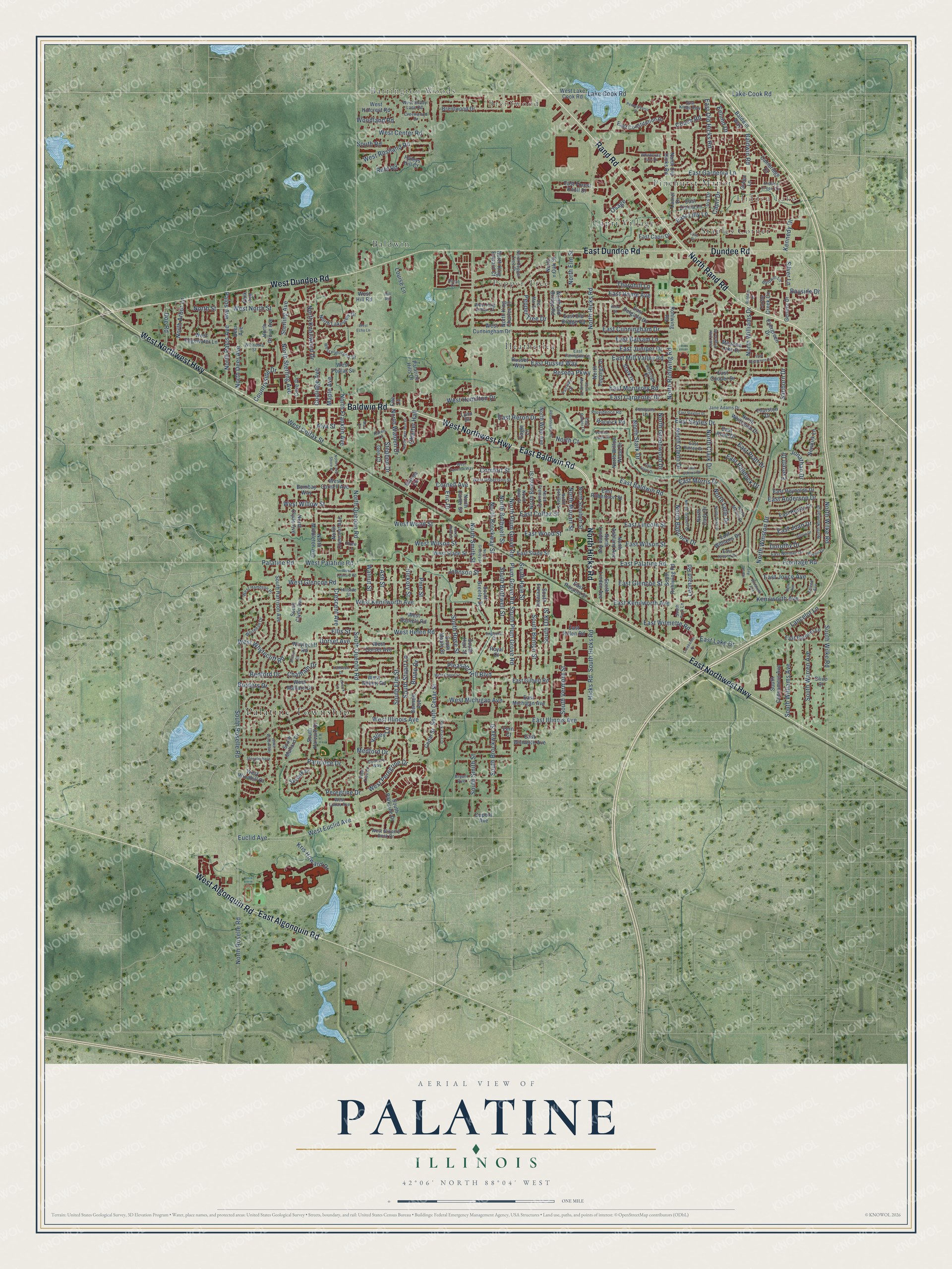
A new map of Palatine, Illinois, made in 2026 and printed to order on thick archival matte paper.
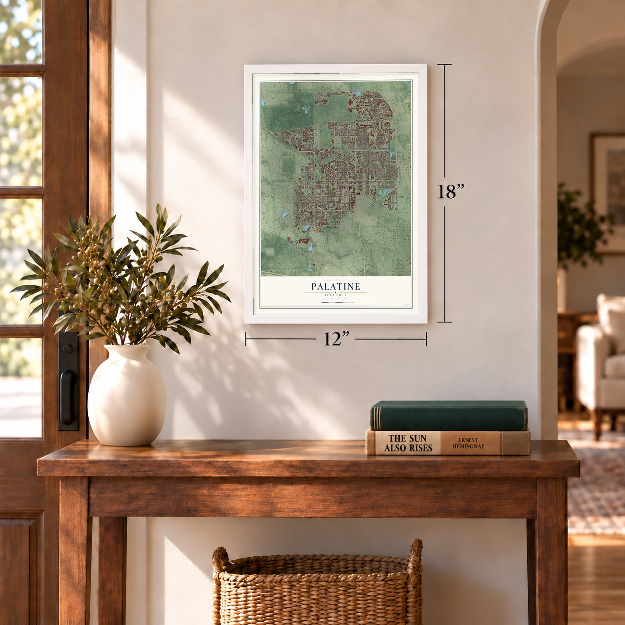
12" x 18" Archival Matte Print
A Map of Home. A Work of Art.
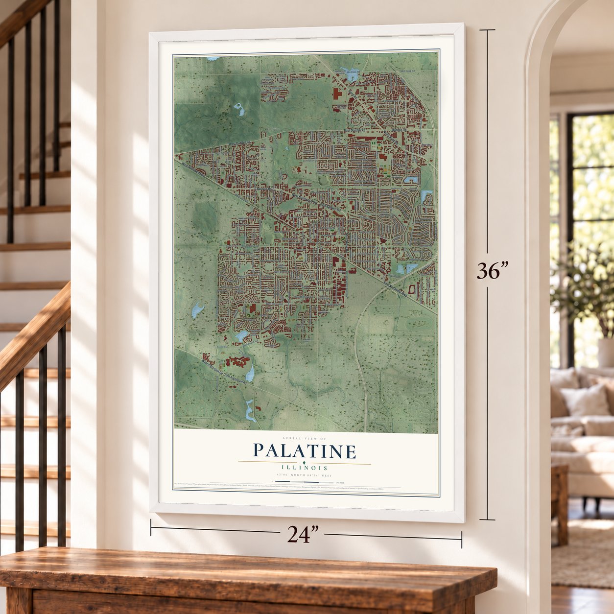
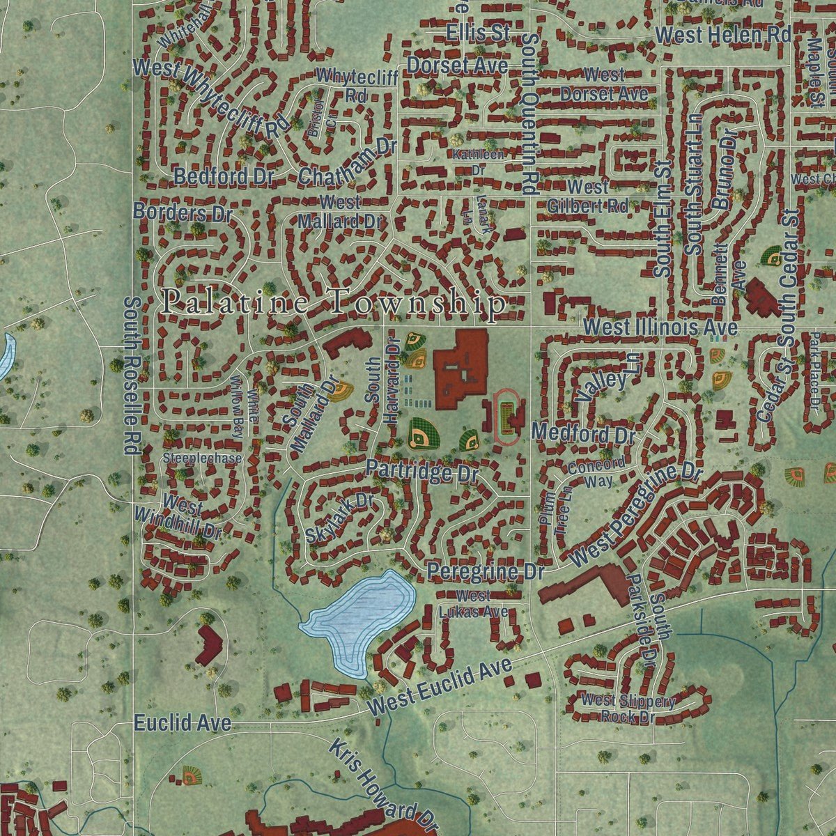
Explore Palatine, Illinois from a whole new perspective. Created using aerial imagery and detailed geographic data, this map captures Palatine building by building, with labeled streets, familiar landmarks, and shaded topographical relief that highlights the natural contours of the landscape.
Combining modern data with the timeless character of a vintage atlas, this map is just as interesting up close as it is beautiful on the wall. Whether you grew up in Palatine, spent memorable years there, or call it home today, this unique map is a great way to celebrate a place that means something to you. Zoom in on the preview to look for your street, and then order a print to put your memories on the wall.
Three ways to hang it
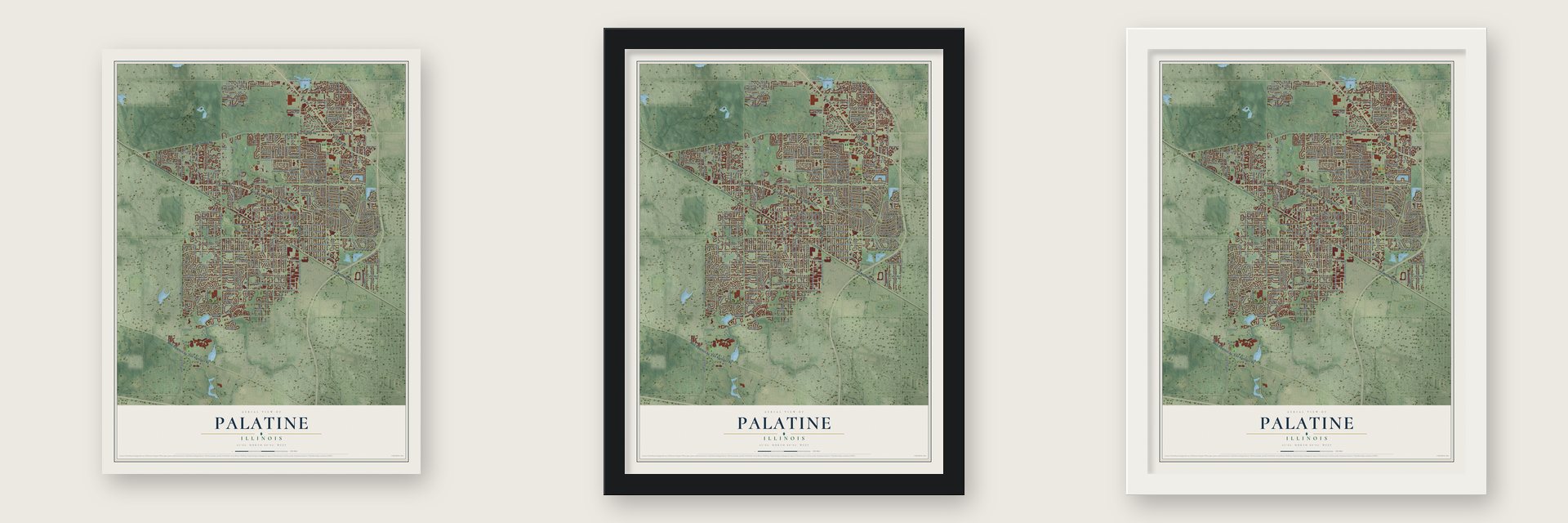
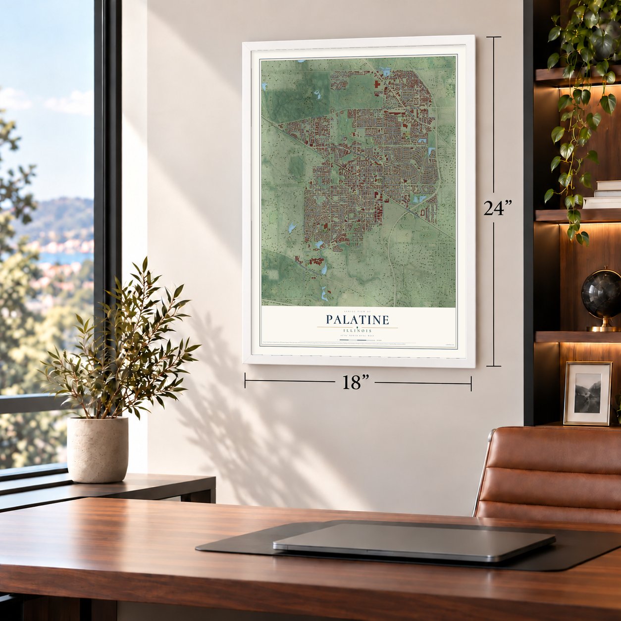
Unframed archival matte, a black wood frame or a white wood frame.
Up close
Geography Worth Displaying
This map was created using accurate cartographic data and authoritative geographic sources, including the U.S. Geological Survey and the Census Bureau. The map brings together terrain, waterways, roads, and building detail. The majority of the streets are labeled, houses are accurately depicted, and the topography is derived from government sources. Combining local data with carefully composed color and shading leads to this beautifully detailed Palatine artwork for your wall.
Rather than simply showing street outlines, we’ve included as many of the street names as we could reasonably fit on the map while keeping their names legible. Zoom in on the high resolution preview to see exactly what’s on the map. We truly set out to create a statement piece for anyone who loves Palatine. So whether it’s for you, or a gift for someone you love, we hope this map of Palatine brings back fond memories.
Read the story behind this map of Palatine, Illinois from 2026.
About Palatine, Illinois
Palatine is a village of 67,908 people in Cook County, northwest of Chicago, and a small part of it reaches into Lake County. Settlers began arriving in 1836, when George Ela took land on Section 4 near Deer Grove, a grove that may have had its name before any white settler came. Ela Road, on the village's western edge, still carries his name.
In 1853 the Illinois & Wisconsin Railroad crossed the township, and a town grew up beside its depot, on the south edge of the Salt Creek swamp. Some residents wanted to call it Yankton, but the town took the name Palatine, after a town in New York. Joel Wood, who had arrived in 1847, surveyed and laid out the village, which was founded in 1866, and he is remembered as its founder. By 1880 Palatine had 731 people and its own flour and planing mills, and by 1900 it had 1,020.
- A night ride for landIn May 1847, D. B. Wood learned that another settler planned to claim forty acres of Government land in the southeast quarter of Section 15. Whoever reached the land office first would get it, so Wood rode on horseback through the night to Chicago, through water for most of the trip. He got there first and took up the tract, one of the last pieces of Government land claimed in the township.
- A short line to WaucondaBuilt in 1911, the Palatine, Lake Zurich and Wauconda Railroad ran full passenger service to Wauconda starting in 1912. Its trains also brought visitors out to Deer Grove Park, which Dr. Wilson ran a short way north of Dundee Road. Money troubles followed one after another, better roads pulled travelers away, and the line shut down in 1924.
- The Cook County FairFrom 1914 to 1931, Palatine hosted the Cook County Fair. When the fair left, its grounds were later built over with houses, and that subdivision is called Fairgrounds Park in memory of them.
- American Indian Day, 1920Camp Reinberg in Palatine was the setting in 1920 when the Indian Fellowship League staged its first celebration of American Indian Day. According to the Daily Herald, 60,000 people turned out, and cars jammed the highways leading to the camp.
- A village without a sealIn the early 1990s the atheist activist Rob Sherman sued Palatine over its village seal and flag, which showed a Christian cross inside an outline of an eagle. Voters in 1992 backed keeping the seal, but they turned down spending public money to defend it, so the village dropped it. Palatine has had no official seal or flag since, the largest city or village in Illinois without one.
Find your street
Names on the Palatine map
Every name below is printed on this map. Look for your street, your school, the park where you played, or the pond down the road.
Places and landmarks11
- Palatine Township
- Barrington Woods
- Brentwood
- Hidden Lake
- Aspen Park
- Baldwin
- Capri Village
- Heatherlea
- Pepper Tree
- Pinehurst Manor
- Staples Corner
Streets and roads337
- Rand Road
- East Northwest Highway
- Baldwin Road
- East Baldwin Road
- North Hicks Road
- West Northwest Highway
- East Algonquin Road
- West Dundee Road
- Dundee Road
- East Dundee Road
- North Rand Road
- West Algonquin Road
- North Wilke Road
- Plum Grove Road
- South Plum Grove Road
- North Plum Grove Road
- Lake-Cook Road
- Kennedy Drive
- Borders Drive
- Silver Lane
- Frontage Road
- East Palatine Road
- South Roselle Road
- North Williams Drive
- West Euclid Avenue
- North Brockway Street
- North Lytle Drive
- North Quentin Road
- North Clark Drive
- South Wilke Road
Show all 337 streets
- East Colfax Street
- East Illinois Avenue
- Eric Drive
- Palatine Road
- North Smith Street
- West Illinois Avenue
- South Quentin Road
- West Palatine Road
- Lake Cook Road
- Kris Howard Drive
- West Colfax Street
- East Carpenter Drive
- North Rohlwing Road
- West Wood Street
- West Kenilworth Avenue
- Euclid Avenue
- South Elm Street
- East Cunningham Drive
- South Cedar Street
- South Brockway Street
- West Glencoe Road
- East Anderson Drive
- South Benton Street
- West Helen Road
- East Kenilworth Avenue
- North Sterling Avenue
- Sterling Avenue
- East Glencoe Street
- West Wilson Street
- Peregrine Drive
- West Peregrine Drive
- Hicks Road
- South Hicks Road
- Capri Drive
- North Winston Drive
- South Hale Street
- East Home Avenue
- East Old Hicks Road
- South Oak Street
- North Stark Drive
- East Lincoln Street
- South Vermont Street
- North Roselle Road
- Bayside Drive
- East Wilson Street
- South Smith Street
- East Sayles Drive
- South Bothwell Street
- North Palos Avenue
- Palos Avenue
- West Whytecliff Road
- Pleasant Hill Boulevard
- Pepper Tree Drive
- East Pratt Drive
- East Morris Drive
- North Glenn Drive
- East Paddock Drive
- North Knollwood Drive
- South Warren Avenue
- North Franklin Avenue
- South Stuart Lane
- North Deer Avenue
- South Rose Street
- East Balsam Lane
- South Williams Avenue
- East Russet Way
- East Gardenia Lane
- Coolidge Avenue
- North Babcock Drive
- East Juniper Drive
- Crescent Avenue
- East Wood Street
- Dorset Avenue
- North Street
- West Michigan Avenue
- Maple Avenue
- West Willow Street
- West North Street
- Stephen Drive
- West Rosiland Road
- East Mill Valley Road
- East Monterey Road
- Partridge Drive
- West Center Road
- Johnson Street
- North Bothwell Street
- East Lilly Lane
- West Hamilton Drive
- Osage
- Ruhl Road
- North Greenwood Drive
- Thornhill Lane
- Reseda Parkway
- North Arbor Lane
- Lancelot Lane
- Cornell Avenue
- Leonard Road
- Kenilworth Avenue
- East Wilmette Road
- Countryside Drive
- Dorothy Drive
- North Court
- East Lake Drive
- East Joan Drive
- North Walden Drive
- Chatham Drive
- East Heron Drive
- North Mozart Street
- Doe Road
- Bruno Drive
- East Joyce Avenue
- Jonathan Drive
- Bedford Drive
- Coach Road
- Enlund Drive
- Everett Drive
- Charter Hall
- North Elm Street
- Alva Street
- Comfort Street
- Walnut Street
- Sanborn Drive
- Hickory Street
- Ash Street
- Woodland Road
- Louise Lane
- Valley Lane
- Medford Drive
- Pine Street
- Ellis Street
- South Road
- West Lake Cook Road
- East Robertson Street
- East Williams Drive
- East Delgado Drive
- Brentwood Drive
- North Benton Street
- West Dorset Avenue
- West Gilbert Road
- South Parkside Drive
- East Cooper Drive
- North Ashland Avenue
- North Oak Street
- North Lakeview Drive
- West Cornell Avenue
- Whytecliff Road
- West Daniels Road
- East Plate Drive
- South Mallard Drive
- North Linden Avenue
- East Capri Drive
- South Rohlwing Road
- Evergreen Drive
- Russet Way
- East Helen Road
- Bennett Avenue
- South Clyde Avenue
- North Old Hicks Road
- East Constitution Drive
- North Clyde Avenue
- North Willow Wood Drive
- West Slade Street
- Deer Avenue
- North Grove Avenue
- South Greeley Street
- North Middleton Avenue
- Palatine Hills Drive
- North Whitcomb Drive
- Park Avenue
- South Harrison Avenue
- West Edgewater Lane
- Turtle Creek Circle
- East Baronet Lane
- North Crescent Avenue
- North Schubert Street
- East Rosita Drive
- East Reynolds Drive
- South Consumers Avenue
- West Poplar Street
- Skylark Drive
- South Maple Street
- Meadow Lake Drive
- Olive Street
- South Harvard Drive
- North Carter Street
- North Wren Avenue
- Green Lane
- North Topanga Drive
- North King Charles Court
- South Linden Avenue
- East Slade Street
- West Cunningham Drive
- North Cady Drive
- East Michigan Avenue
- Cambridge Court
- East Gilbert Road
- South Hart Street
- Cedar Street
- Warwick Road
- East Forest Knoll Drive
- West Hill Road
- East Wilmette Avenue
- East Old Bridge Road
- East Parallel Street
- Eagle Lane
- West Hillcrest Road
- East Zinnia Lane
- Stark Drive
- West Windhill Drive
- Newkirk Lane
- Cove Drive
- West Mallard Drive
- Royal Court
- Baldwin Way
- Laurel Drive
- Geneva Drive
- North Old Bridge Road
- Haleys Hill Court
- North King Edward Court
- Bombay Way
- Thurston Drive
- Rohlwing Road
- South Freemont
- Lynn Drive
- Fern Court
- Iris Drive
- Dupont Avenue
- Wanda Lane
- Geri Court
- Fire Lane
- Baldwin Lane
- Imperial Court
- Hidden Creek Circle
- North Pepper Tree Drive
- East Patten Drive
- West Panorama Drive
- North Hale Street
- Whitehall Drive
- East Farmgate Lane
- North Norman Drive
- West Hampton Place
- East Norman Drive
- Bryant Avenue
- North Fremont Street
- North Morris Drive
- Winnetka Street
- West Robertson Street
- Del Mar Drive
- North Bissell Drive
- Hillside Street
- Arlene Avenue
- East Rimini Court
- Pompano Lane
- West Slippery Rock Drive
- East Kings Row
- Providence Road
- Jane Adams Drive
- Saratoga Drive
- North Schiller Street
- East Kitson Drive
- West Lukas Avenue
- Fairway Drive
- Plum Tree Lane
- West Shady Lane Road
- Creekwood Drive
- Hill Road
- Concord Way
- West King Arthur Court
- South Park Lane
- Alison Drive
- Karen Lane
- Doral Court
- Drew Lane
- Baldwin Court
- North Deer Run Drive
- East Evergreen Drive
- North Lake Shore Drive
- East Olde Virginia Road
- White Willow Bay
- North Rose Street
- Gloria Drive
- Lilac Drive
- West Cheryl Lane
- North Dean Drive
- Belle Avenue
- Pennsylvania Drive
- Renaissance Place
- East Slayton Drive
- East Stark Drive
- Creekside Drive
- Whispering Oaks Drive
- West Fairview Way
- Park Place Drive
- Steeplechase
- Pebble Creek Road
- North Marsha Drive
- Kathleen Drive
- East Schirra Drive
- Elizabeth Avenue
- West Leonard Road
- North Greeley Street
- Bristol Court
- Knox Street
- West Echo Lane
- Lanark Lane
- Harold Avenue
- Mart Court
Names are listed as they appear on the printed map. Zoom into the product photos to find them.
The art of mapping a place
How This Map Was Made
Real places. Remarkable detail. Discover the layers that turn geographic data into a map of home.

The view from above
Aerial imagery reveals the character of the land: woodland, open fields, and the patterns of a place.

The shape of the land
Elevation data brings hills, valleys, and subtle changes in the landscape into view.

The details of home
Roads, waterways, and building footprints come together to make the map feel unmistakably local.

Geography becomes art
Considered color, shading, and typography bring the layers together in a map made for your wall.


Process illustrated with Mendon, Massachusetts. Aerial imagery: USDA NAIP. Terrain: USGS 3D Elevation Program. Map details and finished artwork: KNOWOL.
The Details
About This Print
Choose an archival matte print, or a black or white Ayous wood frame. The archival matte print is unframed.
Select your size and finish above to see the matching product image and price.
Materials & Craftsmanship
A contemporary map with the character of a classic atlas, printed on archival matte paper. Optional frames are made from Ayous wood.
Your printed map does not include the watermark shown in the full-map preview.
Shipping & Delivery
Free shipping within the United States. Every print is made to order in the USA.
Buying a gift? Add a note in your cart and we'll include it. We never put prices in the package.
Prints ship within 2 to 3 business days. Allow 7 to 10 days total from ordering for delivery. Timing may vary during holidays or periods of high order volume.
Read our shipping policy.
Returns and damaged prints
Each print is made to order. Change-of-mind refunds are not available after production.
If your print arrives damaged, misprinted or incorrect, contact support@knowol.com within 30 days of receiving it. Include your order number, photos and a description of the issue.
Read our full refund and replacement policy. For questions about your order, email support@knowol.com.
Find your town
Looking for another city?
Find a map of home in our Illinois collection, or any town in the country.
Nearby
Maps of towns near Palatine
Know someone from one of these towns? Their map makes a great gift.
 Inverness
, Illinois
From $39.99See the map
 Rolling Meadows
, Illinois
From $39.99See the map
 Arlington Heights
, Illinois
From $39.99See the map
More maps nearby: Deer Park, Kildeer, Barrington, Buffalo Grove and Long Grove.