
Search for another town



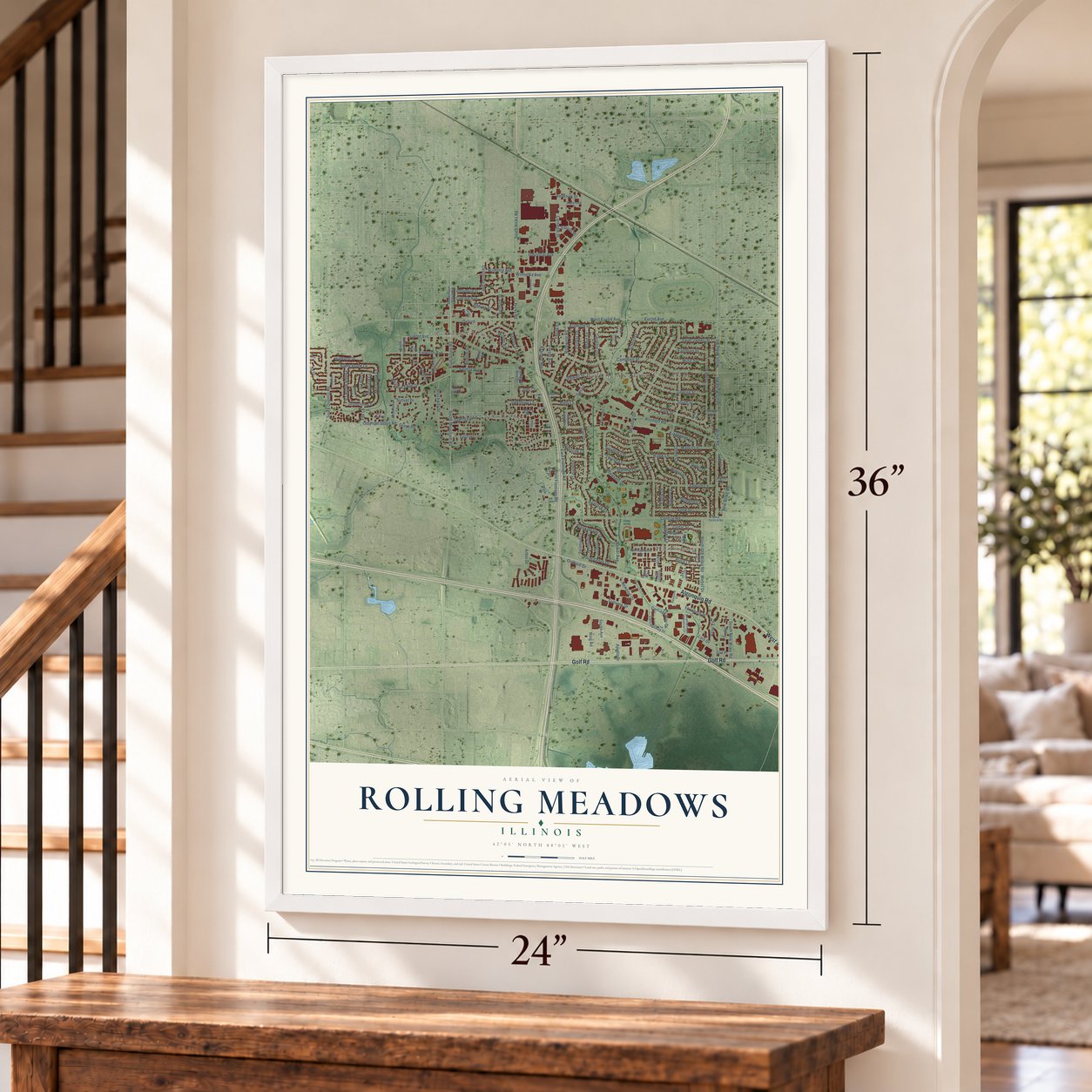

Free U.S. delivery 7 to 10 days after you order
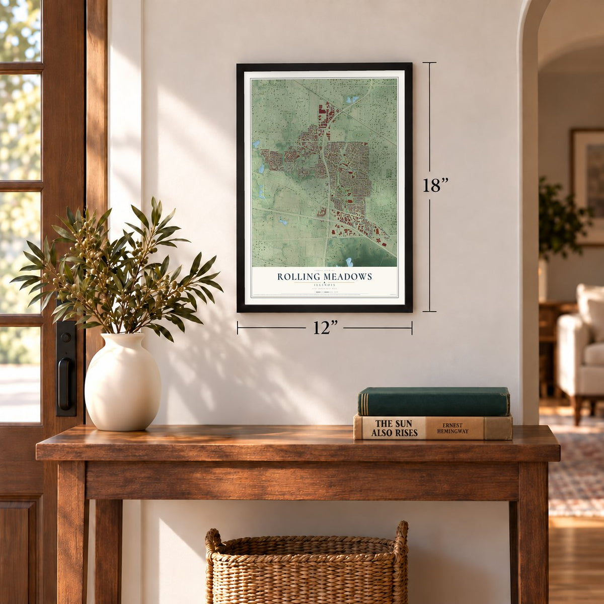
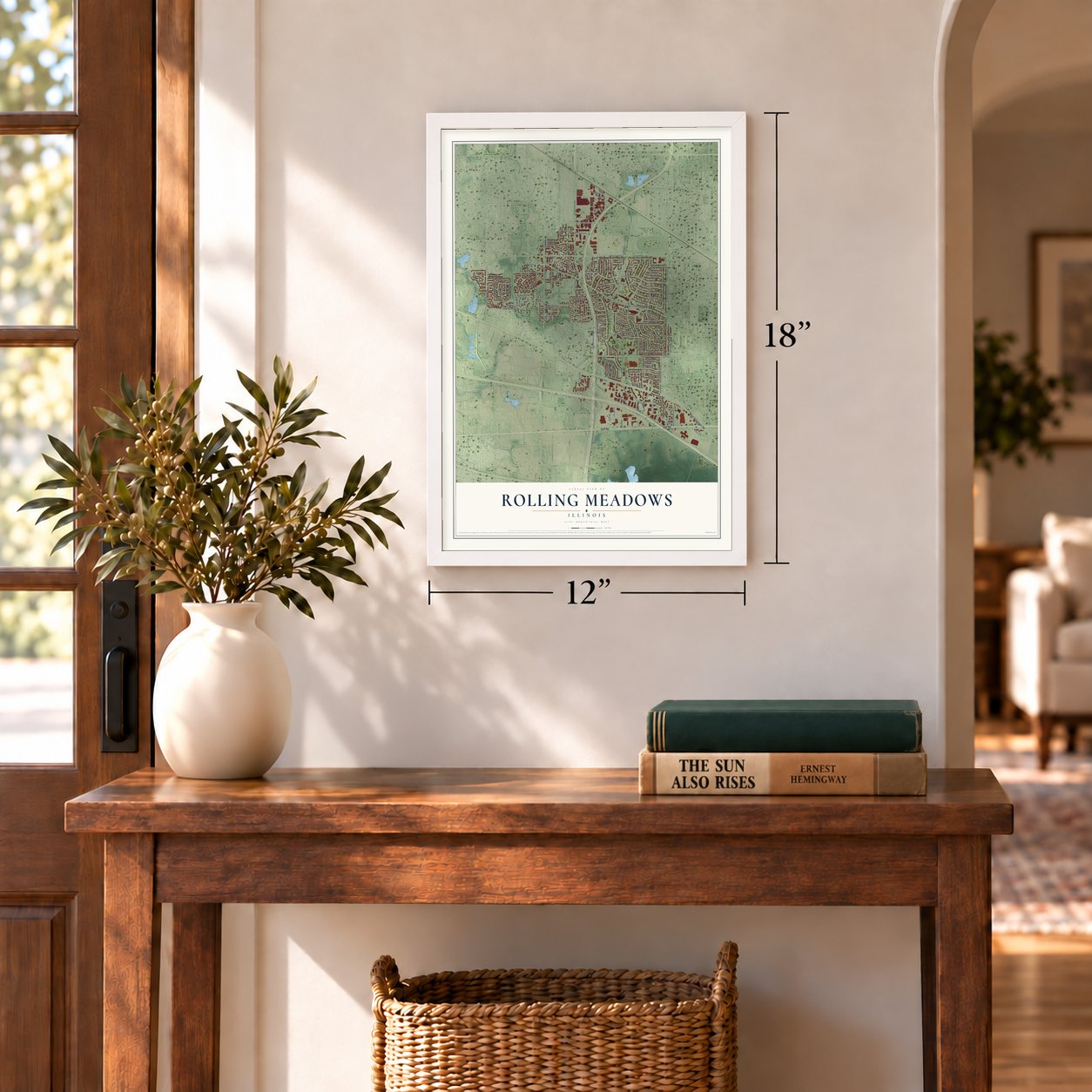
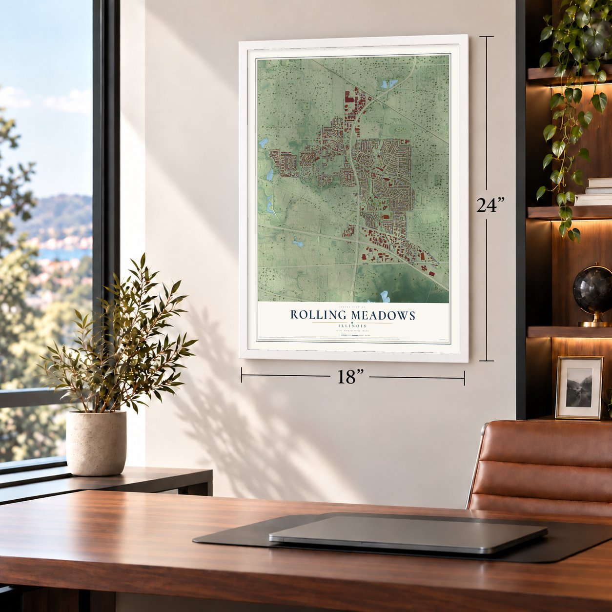
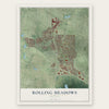
Rolling Meadows, Illinois Map Art
A new map of Rolling Meadows, Illinois, made in 2026 and printed to order on thick archival matte paper.
12" x 18" Archival Matte Print
A Map of Home. A Work of Art.
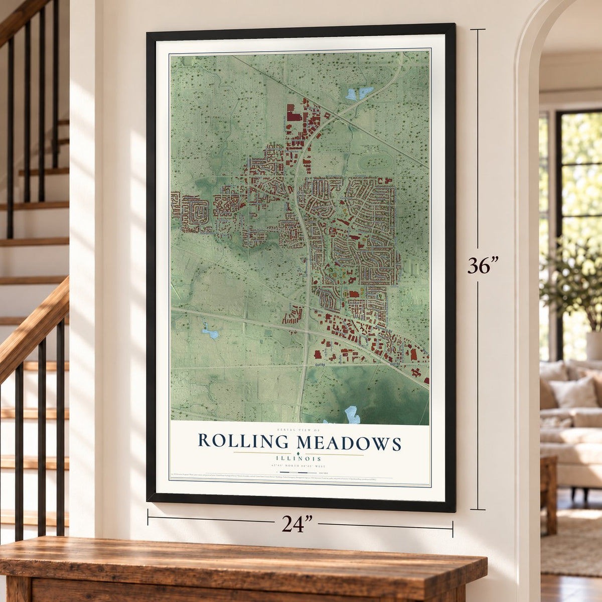
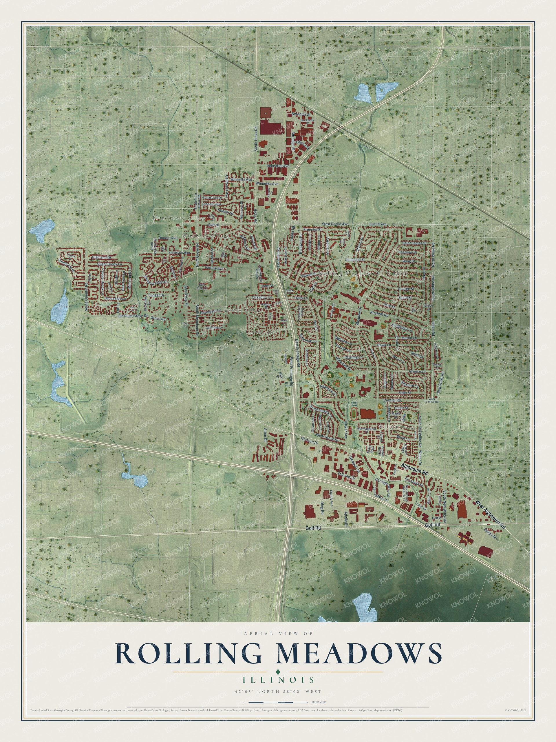
Explore Rolling Meadows, Illinois from a whole new perspective. Created using aerial imagery and detailed geographic data, this map captures Rolling Meadows building by building, with labeled streets, familiar landmarks, and shaded topographical relief that highlights the natural contours of the landscape.
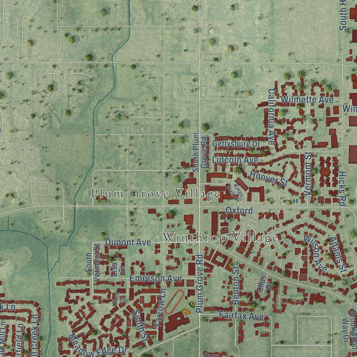
Combining modern data with the timeless character of a vintage atlas, this map is just as interesting up close as it is beautiful on the wall. Whether you grew up in Rolling Meadows, spent memorable years there, or call it home today, this unique map is a great way to celebrate a place that means something to you. Zoom in on the preview to look for your street, and then order a print to put your memories on the wall.
Three ways to hang it
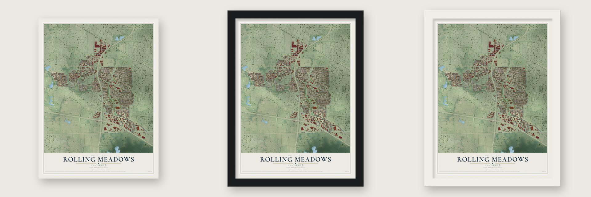
Unframed archival matte, a black wood frame or a white wood frame.
Up close
Geography Worth Displaying
This map was created using accurate cartographic data and authoritative geographic sources, including the U.S. Geological Survey and the Census Bureau. The map brings together terrain, waterways, roads, and building detail. The majority of the streets are labeled, houses are accurately depicted, and the topography is derived from government sources. Combining local data with carefully composed color and shading leads to this beautifully detailed Rolling Meadows artwork for your wall.
Rather than simply showing street outlines, we’ve included as many of the street names as we could reasonably fit on the map while keeping their names legible. Zoom in on the high resolution preview to see exactly what’s on the map. We truly set out to create a statement piece for anyone who loves Rolling Meadows. So whether it’s for you, or a gift for someone you love, we hope this map of Rolling Meadows brings back fond memories.
Read the story behind this map of Rolling Meadows, Illinois from 2026.
About Rolling Meadows, Illinois
Rolling Meadows is a city of 24,200 people in Cook County, 24 miles northwest of the Chicago Loop. Orrin Ford made the first recorded land claim here in 1836, taking 160 acres in a place called Plum Grove. Farm families, many of them from Vermont, followed him, and by the early 1840s settlers had built a dam on Salt Creek.
In 1927 H. D. "Curly" Brown bought 1,000 acres here for a golf course and a racetrack. In the early 1950s the builder Kimball Hill took over the land Brown had meant for golf and ran an ad for a model home in the Chicago Tribune. Arlington Heights officials wanted the land saved for estate homes, but the Cook County Board approved the zoning, and Hill kept building. The first families moved in during 1953. By 1955 about 700 homes had sold, mostly to blue-collar families, and that year the city incorporated under the name Hill had chosen.
- $200 a house for schoolsKimball Hill set aside $200 from every home he sold for the local schools, and he paid to build and equip the community's first elementary school. He also started the homeowners' association, gave land for parks and helped pay for Clearbrook Center, which opened in 1955 to house and support people with cognitive disabilities.
- Salem Church from 1862Plum Grove became part of the new Palatine Township in 1850, as German immigrants were moving in. They built Salem Evangelical Church in 1862, and its small cemetery still sits where Kirchoff Road meets Plum Grove Road.
- Crawford's, 1957 to 1994Businesses arrived through the 1950s and 1960s. Crawford's department store opened in 1957 and grew into the biggest in the northwestern suburbs, staying open until 1994. In 1958 North Hicks Road got an industrial park, and Western Electric later opened a plant that employed about 1,500 people.
- Tougher rules after the firesApartments went up fast, and by 1970 multifamily buildings made up 35 percent of the city's structures. After a string of apartment fires in the 1970s, Rolling Meadows adopted stricter building rules for multifamily housing.
- From Wilco to the NFLRolling Meadows counts among its people Jay Bennett, guitarist with the band Wilco, the actor Gary Cole, known for film and television work, and Carol Marin, a journalist in both television and print. NFL quarterback Jimmy Garoppolo, who played for the Patriots, 49ers and Raiders, is one of its own too.
Find your street
Names on the Rolling Meadows map
Every name below is printed on this map. Look for your street, your school, the park where you played, or the pond down the road.
Places and landmarks6
- Rolling Meadows City Hall
- Plum Grove Village
- Winthrop Village
- Williamsburg
- Creekside
- Fairfax Village
Streets and roads167
- Golf Road
- Algonquin Road
- West Algonquin Road
- Wilke Road
- South Wilke Road
- Old Plum Grove Road
- North Wilke Road
- Plum Grove Road
- New Wilke Road
- Rohlwing Road
- South Meacham Road
- Dupont Avenue
- Mill Creek Lane
- Groveside Lane
- Vermont Street
- Dawngate Lane
- Meadow Edge Drive
- School Drive
- Sunset Drive
- Kirchoff Road
- Euclid Avenue
- Hicks Road
- East Frontage Road
- West Euclid Avenue
- West Frontage Road
- Meadow Drive
- Central Road
- Arbor Drive
- Campbell Street
- Owl Drive
Show all 167 streets
- Oriole Lane
- Dove Street
- Bluebird Lane
- Wren Lane
- Sigwalt Street
- Fremont Street
- Hawk Lane
- Jay Lane
- Carriage Way Drive
- Ring Road
- Grouse Lane
- Emerson Avenue
- Highland Drive
- Cardinal Drive
- Martin Lane
- Saint James Street
- South Old Wilke Road
- Weber Drive
- South Quentin Road
- South Hicks Road
- Brockway Street
- California Avenue
- Park Street
- Pheasant Drive
- Flicker Lane
- South New Wilke Road
- Kingfisher Lane
- South Street
- Brookmeade Drive
- Lincoln Avenue
- Tollview Drive
- Winnetka Avenue
- George Street
- Astor Lane
- Barker Avenue
- Fulle Street
- Arlingdale Drive
- Industrial Avenue
- Peacock Lane
- Oxford
- Silent Brook Lane
- Fairfax Avenue
- Thrush Lane
- Elizabeth Place
- Lois Drive
- Wilson Avenue
- Linden Lane
- Benton Street
- Wing Street
- Plum Grove Drive
- Pebble Brook Lane
- Newport Drive
- Robin Lane
- Deerfield Lane
- Hoover Street
- Smith Street
- Cedar Street
- Birch Lane
- Eastman Street
- Forest Avenue
- Carnegie Street
- Adams Street
- Wilmette Avenue
- Starling Lane
- Swallow Lane
- Yarrow Lane
- Bobolink Lane
- Apollo Drive
- Oaksbury Lane
- Ashland Avenue
- Owl Lane
- Meijer Drive
- Berdnick Street
- Eagle Lane
- Orchard Drive
- Grove Road
- Raven Lane
- Holly Lane
- Quail Lane
- Theda Lane
- Edison Place
- Jody Court
- Fox Lane
- South Plum Grove Road
- Bobwhite Lane
- South Vermont Street
- Kevin Lane
- Carriageway Drive
- Squibb Avenue
- Brookwood Way Drive
- Magnolia Drive
- Sycamore Lane
- Gettysburg Drive
- Northampton Drive
- Tinder
- Old Mill Lane
- Asbury Street
- Brookview Lane
- Kilarney Court
- Tall Oaks Lane
- Library Road
- Calvert Drive
- Kimball Hill Drive
- Golf Place
- Maple Lane
- Burr Oak Court
- Essex Way
- Grove Street
- Chas Drive
- Cyndi Court
- Park Drive
- Lisa Court
- Prairie Lane
- Algonquin Parkway
- Meadowbrook Industrial Court
- Thorntree Lane
- Millstone Lane
- Meadow Lane
- Blackhawk Drive
- Falcon Court West
- Carr Street
- West Central Road
- Keystone Court
- Maple Court
- Swan Lane
- Heron Court
- Park Court
- Cole Court
- Kings Walk Drive
- Auburn Drive
- Auburn
- Bent Creek Court
- Winnetka Circle
- Viola Court
- Walnut Court
- Rywick Court
- Sue Lane
Names are listed as they appear on the printed map. Zoom into the product photos to find them.
The art of mapping a place
How This Map Was Made
Real places. Remarkable detail. Discover the layers that turn geographic data into a map of home.

The view from above
Aerial imagery reveals the character of the land: woodland, open fields, and the patterns of a place.

The shape of the land
Elevation data brings hills, valleys, and subtle changes in the landscape into view.

The details of home
Roads, waterways, and building footprints come together to make the map feel unmistakably local.

Geography becomes art
Considered color, shading, and typography bring the layers together in a map made for your wall.


Process illustrated with Mendon, Massachusetts. Aerial imagery: USDA NAIP. Terrain: USGS 3D Elevation Program. Map details and finished artwork: KNOWOL.
The Details
About This Print
Choose an archival matte print, or a black or white Ayous wood frame. The archival matte print is unframed.
Select your size and finish above to see the matching product image and price.
Materials & Craftsmanship
A contemporary map with the character of a classic atlas, printed on archival matte paper. Optional frames are made from Ayous wood.
Your printed map does not include the watermark shown in the full-map preview.
Shipping & Delivery
Free shipping within the United States. Every print is made to order in the USA.
Buying a gift? Add a note in your cart and we'll include it. We never put prices in the package.
Prints ship within 2 to 3 business days. Allow 7 to 10 days total from ordering for delivery. Timing may vary during holidays or periods of high order volume.
Read our shipping policy.
Returns and damaged prints
Each print is made to order. Change-of-mind refunds are not available after production.
If your print arrives damaged, misprinted or incorrect, contact support@knowol.com within 30 days of receiving it. Include your order number, photos and a description of the issue.
Read our full refund and replacement policy. For questions about your order, email support@knowol.com.
Find your town
Looking for another city?
Find a map of home in our Illinois collection, or any town in the country.
Nearby
Maps of towns near Rolling Meadows
Know someone from one of these towns? Their map makes a great gift.
 Arlington Heights
, Illinois
From $39.99See the map
 Palatine
, Illinois
From $39.99See the map
 Schaumburg
, Illinois
From $39.99See the map
More maps nearby: Mount Prospect, Inverness, Elk Grove Village, Prospect Heights and Hoffman Estates.