
Search for another town




Free U.S. delivery 7 to 10 days after you order
Parma Heights, Ohio Map Art
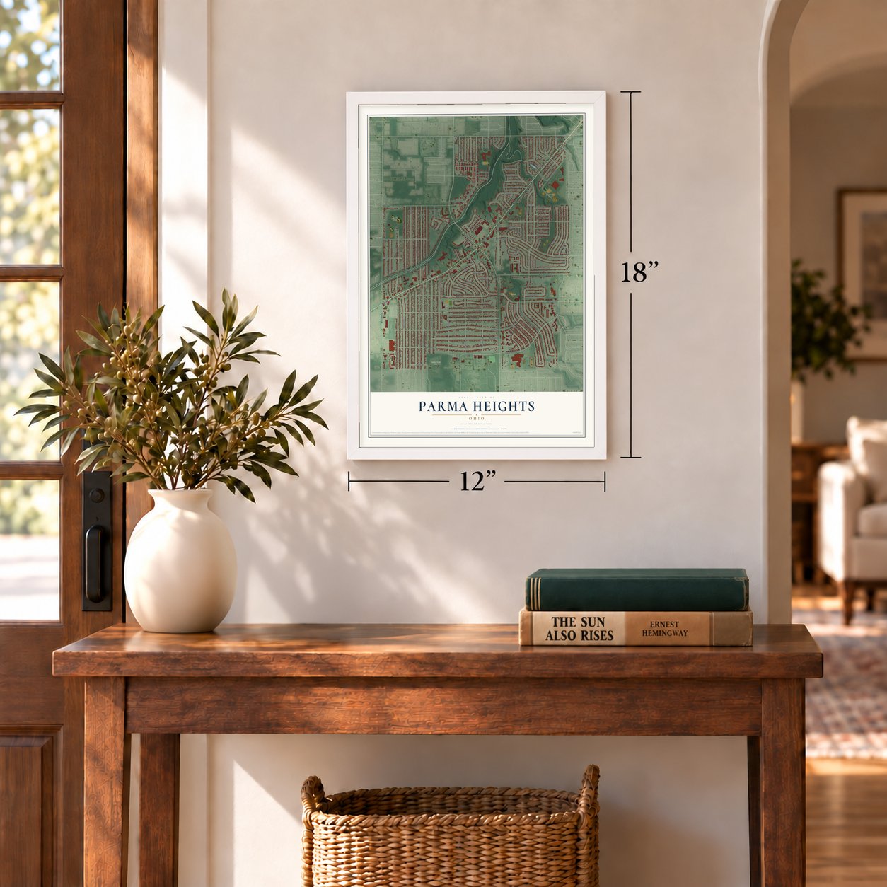
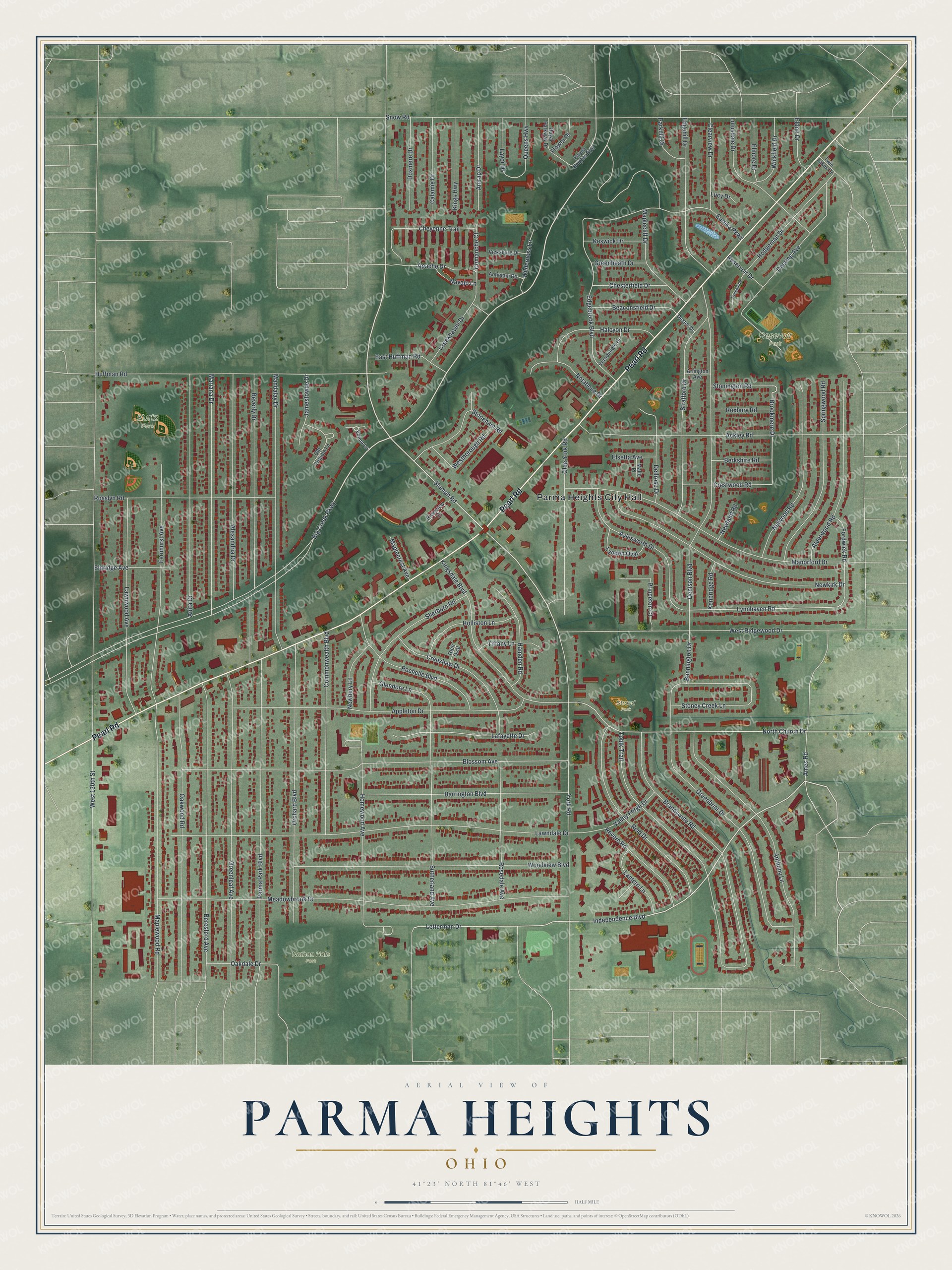
A new map of Parma Heights, Ohio, made in 2026 and printed to order on thick archival matte paper.
12" x 18" Archival Matte Print
A Map of Home. A Work of Art.
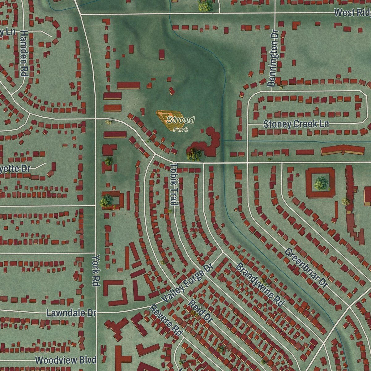
If you grew up on a street off Pearl Road or went to Holy Name High School, you'll know this place from above. It's a new aerial view of Parma Heights in Cuyahoga County, Ohio, made from modern data and given a vintage feel. Zoom in on the preview and look for your block.
Three ways to hang it
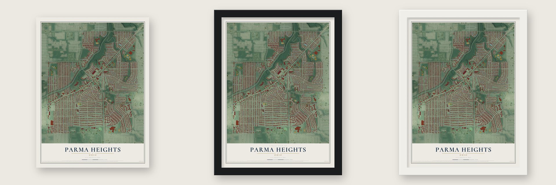
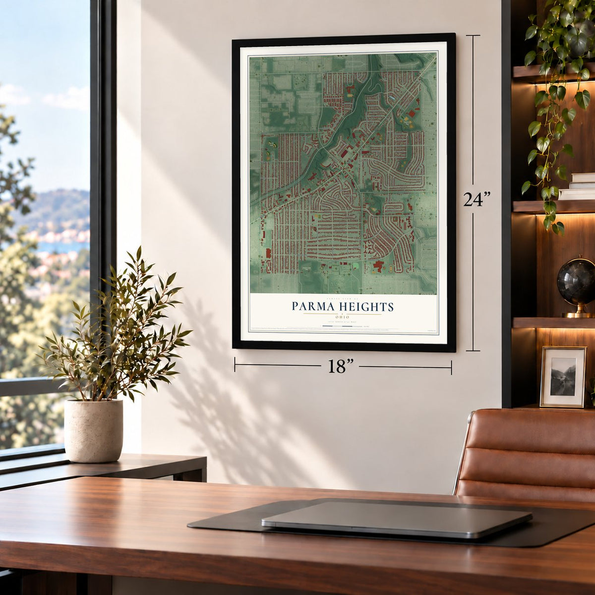
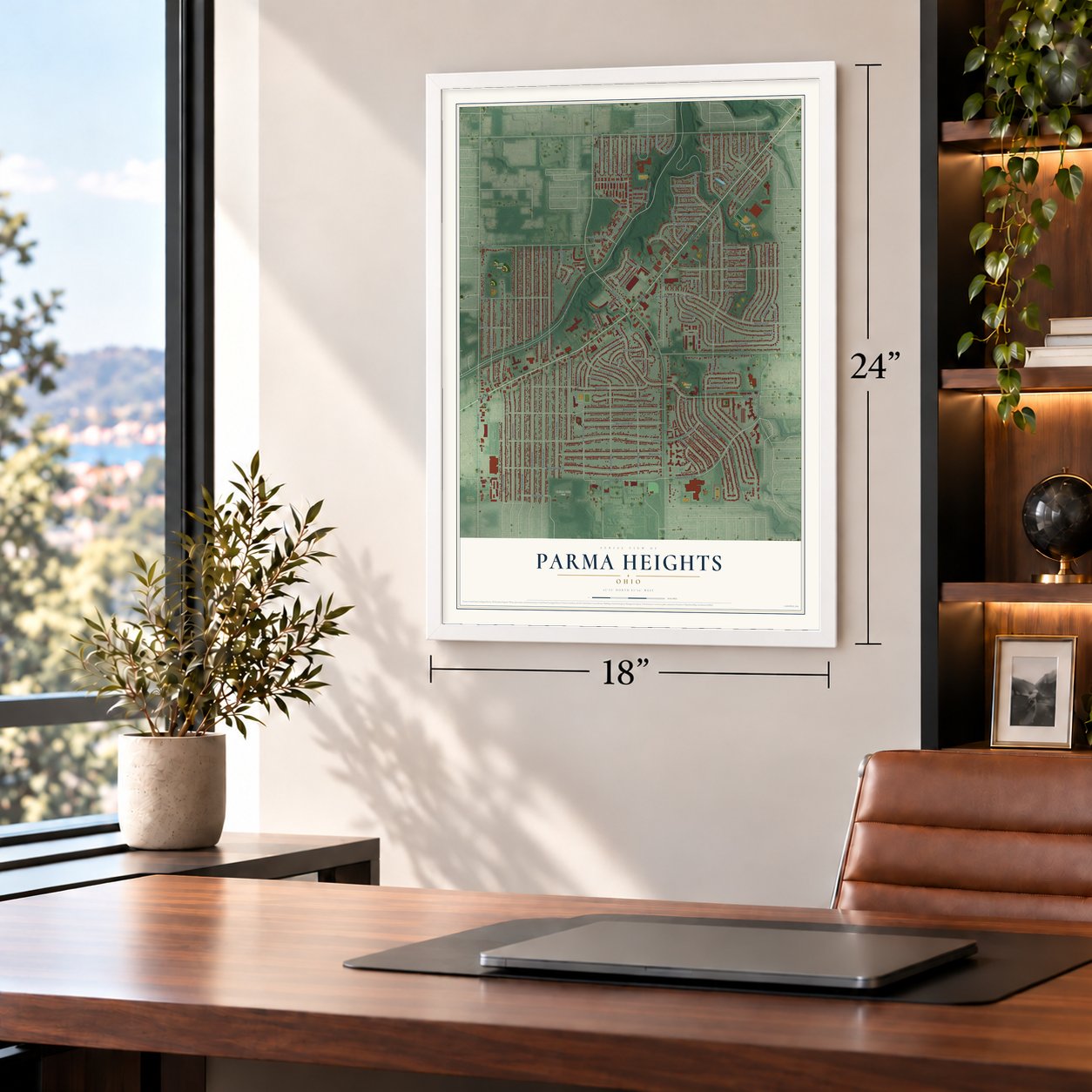
Unframed archival matte, a black wood frame or a white wood frame.
Up close
Real geography. Art worth displaying.
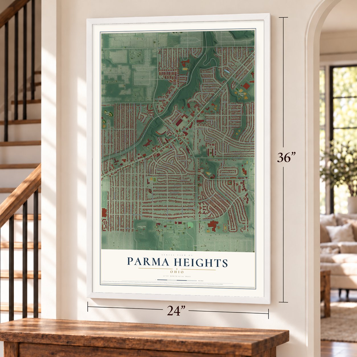
This map was created using accurate cartographic data and authoritative geographic sources, including the U.S. Geological Survey and the Census Bureau. The map brings together terrain, waterways, roads, and building detail. The majority of the streets are labeled, houses are accurately depicted, and the topography is derived from government sources. Combining local data with carefully composed color and shading leads to this beautifully detailed Parma Heights artwork for your wall.
Rather than simply showing street outlines, we’ve included as many of the street names as we could reasonably fit on the map while keeping their names legible. Zoom in on the high resolution preview to see exactly what’s on the map. We truly set out to create a statement piece for anyone who loves Parma Heights. So whether it’s for you, or a gift for someone you love, we hope this map of Parma Heights brings back fond memories.
Read the story behind this map of Parma Heights, Ohio from 2026.

About Parma Heights, Ohio
Parma Heights is a Cuyahoga County city whose recorded past reaches back to the Greenbriar settlement era. Voters created a 4.13-square-mile village in 1911, and Parma Heights became a city in December 1956. Pearl Road remains a setting for historical markers connected to the community's cemetery and an early brick-paving project.
- Greenbriar BeginningsThe area later called Parma Heights was first settled in 1817, when the wider locality was known as Greenbriar.
- Cemetery LandmarkBurials at Parma Heights Cemetery date to the 1820s, and a nearby log building served as school, meeting place, and church from 1826 to 1841.
- Village VoteIn 1911, residents voted 42 to 32 to separate from Parma Township and incorporate Parma Heights as a village.
- Brick Road MarkerA historical marker near Pearl Road and Olde York Road identifies the First Brick Rural Road in U.S.
- 2020 PopulationThe 2020 census counted 20,863 residents in Parma Heights.
Find your street
Names on the Parma Heights map
Every name below is printed on this map. Look for your street, your school, the park where you played, or the pond down the road.
Places and landmarks5
- Parma Heights City Hall
- Kurtz Park
- Nathan Hale Park
- Resevoir Park
- Stroud Park
Streets and roads133
- Pearl Road
- Big Creek Parkway
- Independence Boulevard
- Stumph Road
- Letterman Drive
- Brookmere Drive
- North Church Drive
- Lynnhaven Road
- West 130th Street
- Snow Road
- Meadowbrook Drive
- Greenbriar Drive
- Lawndale Drive
- Blossom Avenue
- Denison Boulevard
- York Road
- Parma Park Boulevard
- Greenleaf Avenue
- Manorford Drive
- West Ridgewood Drive
- Appleton Drive
- Beresford Avenue
- Brandywine Road
- Huffman Road
- Anthony Lane
- Oakwood Road
- Orchard Boulevard
- Beverly Drive
- Ackley Road
- Mandalay Drive
Show all 133 streets
- Woodview Boulevard
- Maplewood Road
- Homewood Avenue
- Tobik Trail
- Newkirk Drive
- Anita Drive
- Fernhurst Avenue
- Mariana Drive
- Alexandria Drive
- Lawnwood Avenue
- Deering Avenue
- Kingsdale Boulevard
- Stratford Drive
- Barrington Boulevard
- Reid Drive
- Commonwealth Boulevard
- Sutherland Avenue
- Springwood Road
- Alderwood Road
- Nelwood Road
- Rosslyn Road
- Olde York Road
- Edgebrook Boulevard
- Eureka Parkway
- Aylesworth Drive
- Edgehill Drive
- Sherborn Road
- Rochelle Boulevard
- Crenshaw Drive
- Lotusdale Drive
- Lafayette Drive
- Rosedale Avenue
- Hodgeman Drive
- Cheyenne Trail
- Halcyon Drive
- Stoneham Road
- Beaconsfield Drive
- Hamden Road
- Maplecliff Drive
- Holliston Lane
- Revere Road
- Dellrose Drive
- Valley Forge Drive
- Doxmere Drive
- Calamie Drive
- Kings Highway
- Apache Drive
- Amrap Drive
- Clearview Drive
- Notabene Drive
- Crestwood Road
- Westborough Road
- East Huffman Road
- Layor Drive
- Princeton Court
- Eldridge Avenue
- Comanche Court
- Wickfield Drive
- Lantern Lane
- Chesterfield Drive
- Glendora Lane
- Creekhaven Drive
- Jamestowne Drive
- Stoney Creek Lane
- Newbury Lane
- Oakdale Drive
- Wilderness Lane
- Lynden Oval
- Elmore Drive
- Tiffany Lane
- Keswick Drive
- Roxbury Road
- Stonington Road
- Berkshire Road
- Parkhill Drive
- Greenheath Drive
- Eldon Drive
- Bennington Drive
- Fordwick Road
- Queens Highway
- Maplecrest Avenue
- Navajo Lane
- Kenbridge Road
- Reservoir Drive
- Elsetta Avenue
- Flower Drive
- Newland Road
- Ames Road
- Lucy Drive
- Emma Lane
- Parma Heights Boulevard
- Royal Parkway Drive
- Old Virginia Lane
- Vernondale Drive
- Vicksburg Drive
- Antietam Road
- Riverview Court
- Arlington Avenue
- Dexter Drive
- Twin Lakes Drive
- Mallo Place
- Glen Oval
- Creekside
Names are listed as they appear on the printed map. Zoom into the product photos to find them.
The art of mapping a place
How This Map Was Made
Real places. Remarkable detail. Discover the layers that turn geographic data into a map of home.

The view from above
Aerial imagery reveals the character of the land: woodland, open fields, and the patterns of a place.

The shape of the land
Elevation data brings hills, valleys, and subtle changes in the landscape into view.

The details of home
Roads, waterways, and building footprints come together to make the map feel unmistakably local.

Geography becomes art
Considered color, shading, and typography bring the layers together in a map made for your wall.


Process illustrated with Mendon, Massachusetts. Aerial imagery: USDA NAIP. Terrain: USGS 3D Elevation Program. Map details and finished artwork: KNOWOL.
The Details
About This Print
Choose an archival matte print, or a black or white Ayous wood frame. The archival matte print is unframed.
Select your size and finish above to see the matching product image and price.
Materials & Craftsmanship
A contemporary map with the character of a classic atlas, printed on archival matte paper. Optional frames are made from Ayous wood.
Your printed map does not include the watermark shown in the full-map preview.
Shipping & Delivery
Free shipping within the United States. Every print is made to order in the USA.
Buying a gift? Add a note in your cart and we'll include it. We never put prices in the package.
Prints ship within 2 to 3 business days. Allow 7 to 10 days total from ordering for delivery. Timing may vary during holidays or periods of high order volume.
Read our shipping policy.
Returns and damaged prints
Each print is made to order. Change-of-mind refunds are not available after production.
If your print arrives damaged, misprinted or incorrect, contact support@knowol.com within 30 days of receiving it. Include your order number, photos and a description of the issue.
Read our full refund and replacement policy. For questions about your order, email support@knowol.com.
Find your town
Looking for another city?
Find a map of home in our Ohio collection.
Nearby
Maps of towns near Parma Heights
Know someone from one of these towns? Their map makes a great gift.


