


Search for another town





Free U.S. delivery 7 to 10 days after you order
Picacho, New Mexico Map Art
Building by building, with labeled streets and shaded relief.
12" x 18" Archival Matte Print
A Map of Home. A Work of Art.
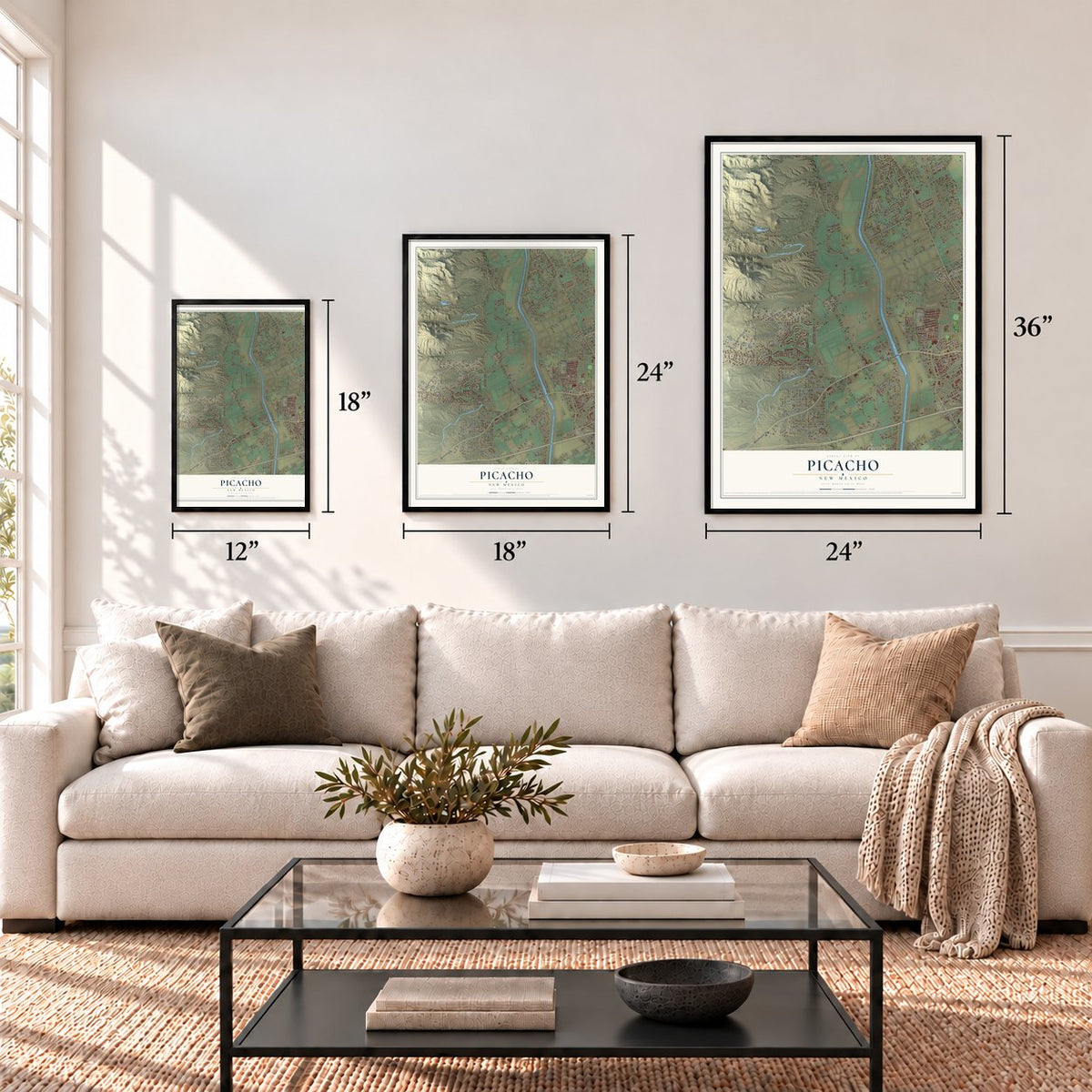
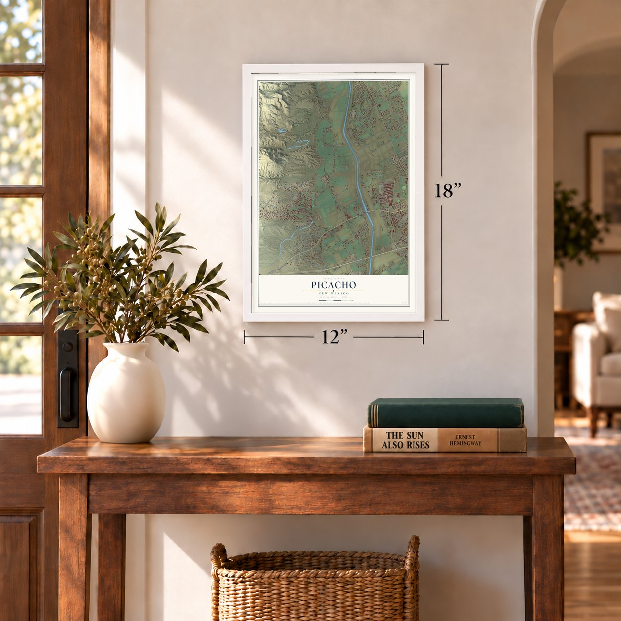
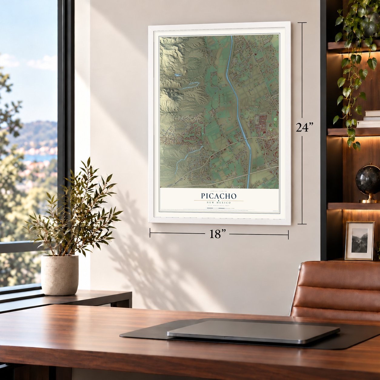
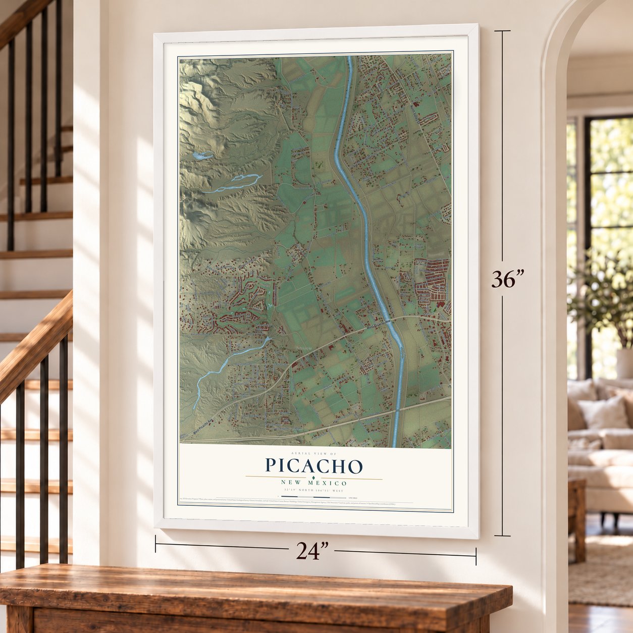
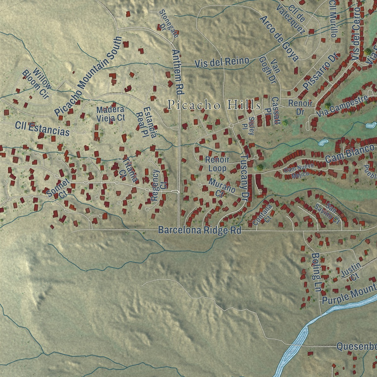
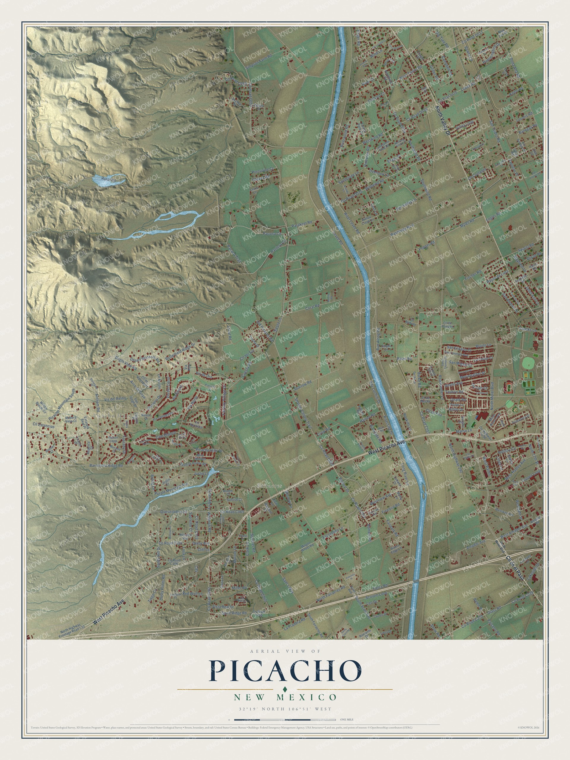
Explore Picacho, New Mexico from a whole new perspective. Created using aerial imagery and detailed geographic data, this map captures Picacho building by building, with labeled streets, familiar landmarks, and shaded topographical relief that highlights the natural contours of the landscape.
Combining modern data with the timeless character of a vintage atlas, this map is just as interesting up close as it is beautiful on the wall. Whether you grew up in Picacho, spent memorable years there, or call it home today, this unique map is a great way to celebrate a place that means something to you. Zoom in on the preview to look for your street, and then order a print to put your memories on the wall.
Three ways to hang it
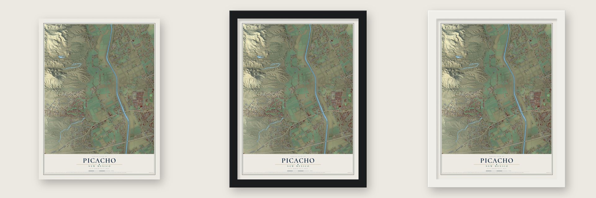
Unframed archival matte, a black wood frame or a white wood frame.
Up close
Geography Worth Displaying
This map was created using accurate cartographic data and authoritative geographic sources, including the U.S. Geological Survey and the Census Bureau. The map brings together terrain, waterways, roads, and building detail. The majority of the streets are labeled, houses are accurately depicted, and the topography is derived from government sources. Combining local data with carefully composed color and shading leads to this beautifully detailed Picacho artwork for your wall.
Rather than simply showing street outlines, we’ve included as many of the street names as we could reasonably fit on the map while keeping their names legible. Zoom in on the high resolution preview to see exactly what’s on the map. We truly set out to create a statement piece for anyone who loves Picacho. So whether it’s for you, or a gift for someone you love, we hope this map of Picacho brings back fond memories.
Read the story behind this map: Detailed Map of Picacho, New Mexico.

Find your street
Names on the Picacho map
Every name below is printed on this map. Look for your street, your school, the park where you played, or the pond down the road.
Places and landmarks2
- Picacho Hills
- Fairacres
Streets and roads267
- Cll de el Paso
- West Picacho Avenue
- North Valley Drive
- Anthem Road
- Ancho Avenue
- West Amador Avenue
- Tashiro Road
- Roadrunner Lane
- Levee Road
- Ray Luchini Drive
- Vis del Cerro
- Local Road
- Cll del Sur
- La Quinta Street
- Amador Avenue
- Northwind Road
- Tuscany Drive
- North Fairacres Road
- Quesenberry Lane
- Fairway Village Drive
- Long River Lane
- Riverside Drive
- Shalem Colony Trail
- North Motel Boulevard
- River Levee Road
- Rural Road
- Pantera Circle
- Burke Road
- Barcelona Ridge Road
- Pacana Trail
Show all 267 streets
- Picacho Hills Drive
- Dona Ana Road
- West Taylor Road
- Squirrel Road
- San Ysidro Road
- Wasteway No 6
- Vis del Reino
- Weinrich Road
- Simpson Farm Road
- Arco de Goya
- Glass Road
- Bruins Lane
- Scorpio Loop
- Justin Lane
- West Hadley Avenue
- Westwind Road
- Via Norte
- Wildwind Road
- Cll Estancias
- San Andres Drive
- Lopez Road
- Bamert Drive
- Bamert Road
- Southwind Road
- Tierra Road
- Banegas Road
- Morton Lane
- Dusty Prints Road
- North Highway 292
- Swartz Road
- North 17th Street
- Sparrow Road
- Picacho Mountain South
- Mayfield Lane
- Engler Road
- Bright View Road
- Villita Loop
- Sam's Way
- Coral Road
- Fischer Road
- Copper Loop
- Parakeet Road
- Cam Blanco
- Fairpark Road
- Desert Blossom Road
- Myles Road
- Isaacks Lane
- South Aries Avenue
- San Elizario Court
- Maese Lane
- Derby Avenue
- Sandy Hill Drive
- La Union Court
- Sun Valley Lane
- San Miguel Court
- Pacona Circle
- Westview Avenue
- La Pradera Road
- Purple Mountain Avenue
- Cll de Fira
- Hummingbird Drive
- Holiday Circle
- Riverwood Road
- Clark Lane
- Butterfield Ridge Drive
- West Palms
- Freebird Road
- Vis de Oro
- Bales Road
- Cuesta Road
- Keelo Road
- Miller Road
- C84
- Haines Road
- Run Along Road
- Grider Road
- Boling Lane
- Hoskins Lane
- Pepper Road
- Riverside Road
- Campbell Road
- Escondido Lane
- Janet Ann Lane
- Pissarro Drive
- Cll Contento
- Tingo Circle
- Lakeside Drive
- Paisano Road
- Spirit Ridge Road
- Sandstone Lane
- Chavez Road
- Lost Lane
- Singer Road
- Pineview Road
- Westgate Street
- Foxboro Court
- Old Picacho Road
- Via Emma
- River Court
- Loomis Road
- Minnow Lane
- Big Tree Road
- Crow Road
- Porcupine Court
- Red Wolf Lane
- Meriweather Street
- Aliyah Road
- Vista Real Drive
- Rayos de Luna
- Siesta Lane
- Overlook Lane
- Snow Road
- Bowra Lane
- Shady Place
- Supreme Court
- Wind Lane
- Ox Cart Court
- Loya Lane
- Onate Road
- Vaquero Place
- Belen Place
- Cliff Lane
- Linda Lane
- Rillito Drive
- Leo Drive
- Amador Road
- Via Campestre
- Moon River Loop
- Lonesome Pine Road
- North Highway Frontage Road I-10
- Vis Hermosa
- San Lorenzo Avenue
- County Highway Co 58
- Willow Bloom Circle
- Renoir Loop
- Regency Court
- Renoir Drive
- Primavera Street
- South Fairacres Road
- Estancia Real Place
- Mira Montes
- Titania Court
- Spanish Pointe Road
- Westway Avenue
- Wagon Wheel Road
- Hillcrest Avenue
- Cerro Lane
- Willow Creek Lane
- Sonnet Court
- County Road Co45
- Canary Court
- Skyline Drive
- Cll de Valezquez
- Forest Park Drive
- Hadley Lane
- Muhly Lane
- Van Gogh Drive
- Enriquez Lane
- Leroy Lane
- Taurus Drive
- Harris Road
- Rociante Drive
- Murano Court
- Cll de Mecho
- Tamariz Court
- Pigeon Road
- Burgers Drive
- Doolittle Drive
- Sunfish Court
- Cll Murillo
- Western Court
- Trucha Drive
- Delphi Lane
- Rivers Edge Lane
- Northfield Road
- Polder Lane
- Chagar Court
- Cll de Pompeii
- Aries Avenue
- Cll Bedado
- Daisy Lane
- Libra Drive
- Madera Vieja Court
- Rodeo Court
- Cassatt Place
- Calo Lane
- Blue Jay Road
- Galaz Road
- Elsie Lane
- Justin Court
- Via Rubi
- Sue Court
- Vis Real Drive
- Calle de Vis
- Larkspur Drive
- Los Banegas Road
- San Savino Court
- Meadow Circle
- Santa Thomas Street
- Del Rio Drive
- Marwood Lane
- Plazuela Court
- Contana Court
- Las Vegas Court
- Eastview Avenue
- Stonegate Drive
- Morning Glory Lane
- Brandy Lane
- Pueblo Vis
- Moo Road
- Gerald Drive
- Sisley Place
- Murillo Road
- Freese Lane
- Waltz Lane
- Picacho Vistas Court
- Las Casitas
- Clear Creek Lane
- Tierra del Sol Drive
- Borroughs Street
- Cam Nuevo Mejico
- Carretas Court
- Quesenberry Street
- Shakespeare Lane
- Vis del Monte
- Sunbonnet Lane
- Olde Country Road
- Sandy Beach Road
- Holiday Avenue
- Shady Wood Lane
- Amarantha Court
- Pueblo Gardens Court
- Brass Way
- Volterra Way
- Esterlina Place
- Moraga Court
- Lark Place
Names are listed as they appear on the printed map. Zoom into the product photos to find them.
About Picacho, New Mexico
Candelaro Chavez led a band of settlers from Socorro to found Picacho in 1855. They first called the village Picacho de los Nevarez. The name came from Picacho Mountain, which honored the Nevarez family.
From 1858 to 1861, Picacho had a stagecoach stop on the Butterfield Overland Mail. It held the last natural water for westbound travelers until Cooke's Spring, 52 miles away. Later stations had to haul water and dig earthen tanks for rain.
Keep exploring New Mexico
Picacho is one of 544 New Mexico towns we've mapped. Every dot on the map is a print of its own.
The search covers every state, New Mexico first.
Near Picacho
Order 2 or more town maps and save 10%. Shown in the size and finish you picked above, so they hang as a set.
- Fairacres 12" x 18" / Archival Matte Print $39.99
- Picacho Hills 12" x 18" / Archival Matte Print $39.99
- Las Cruces 12" x 18" / Archival Matte Print $39.99

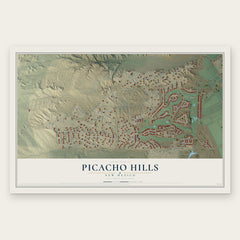
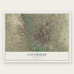
More maps nearby: Mesilla, Doña Ana, Tortugas, University Park and San Pablo.
The art of mapping a place
How This Map Was Made
Real places. Remarkable detail. Discover the layers that turn geographic data into a map of home.

The view from above
Aerial imagery reveals the character of the land: woodland, open fields, and the patterns of a place.

The shape of the land
Elevation data brings hills, valleys, and subtle changes in the landscape into view.

The details of home
Roads, waterways, and building footprints come together to make the map feel unmistakably local.

Geography becomes art
Considered color, shading, and typography bring the layers together in a map made for your wall.


Process illustrated with Mendon, Massachusetts. Aerial imagery: USDA NAIP. Terrain: USGS 3D Elevation Program. Map details and finished artwork: KNOWOL.
The Details
About This Print
Choose an archival matte print, or a black or white Ayous wood frame. The archival matte print is unframed.
Select your size and finish above to see the matching product image and price.
Materials & Craftsmanship
A contemporary map with the character of a classic atlas, printed on archival matte paper. Optional frames are made from Ayous wood.
Your printed map does not include the watermark shown in the full-map preview.
Shipping & Delivery
Free shipping within the United States. Every print is made to order in the USA.
Buying a gift? Add a note in your cart and we'll include it. We never put prices in the package.
Prints ship within 2 to 3 business days. Allow 7 to 10 days total from ordering for delivery. Timing may vary during holidays or periods of high order volume.
Read our shipping policy.
Returns and damaged prints
Each print is made to order. Change-of-mind refunds are not available after production.
If your print arrives damaged, misprinted or incorrect, contact support@knowol.com within 30 days of receiving it. Include your order number, photos and a description of the issue.
Read our full refund and replacement policy. For questions about your order, email support@knowol.com.