
Search for another town





Free U.S. delivery 7 to 10 days after you order
Pinecrest, Florida Map Art
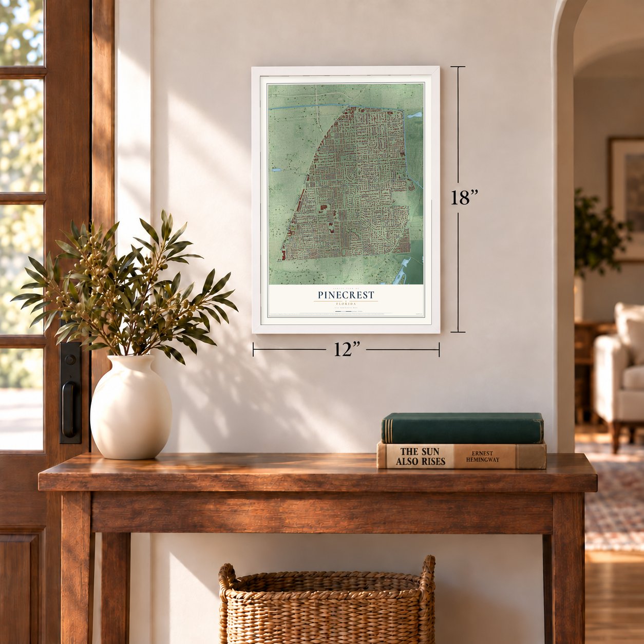
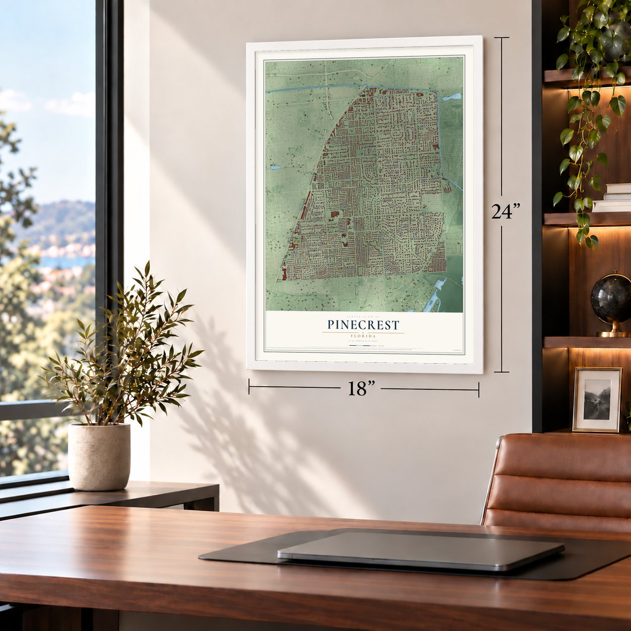
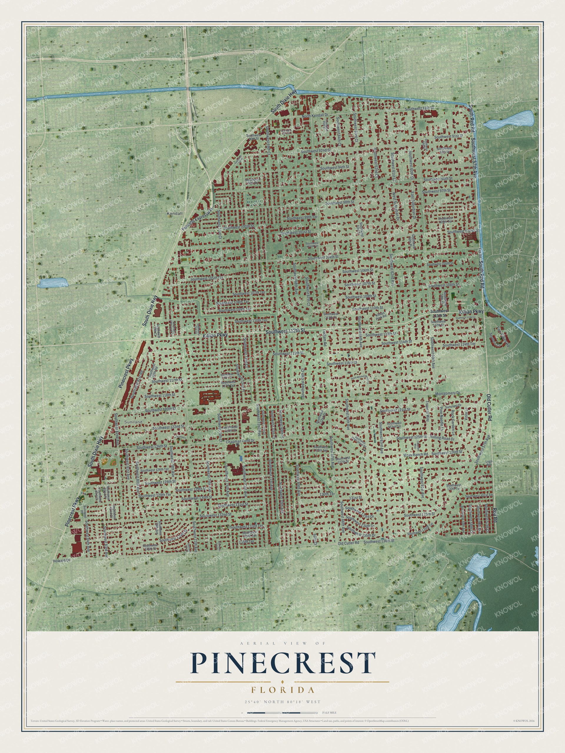
A new map of Pinecrest, Florida, made in 2026 and printed to order on thick archival matte paper.
12" x 18" Archival Matte Print
A Map of Home. A Work of Art.
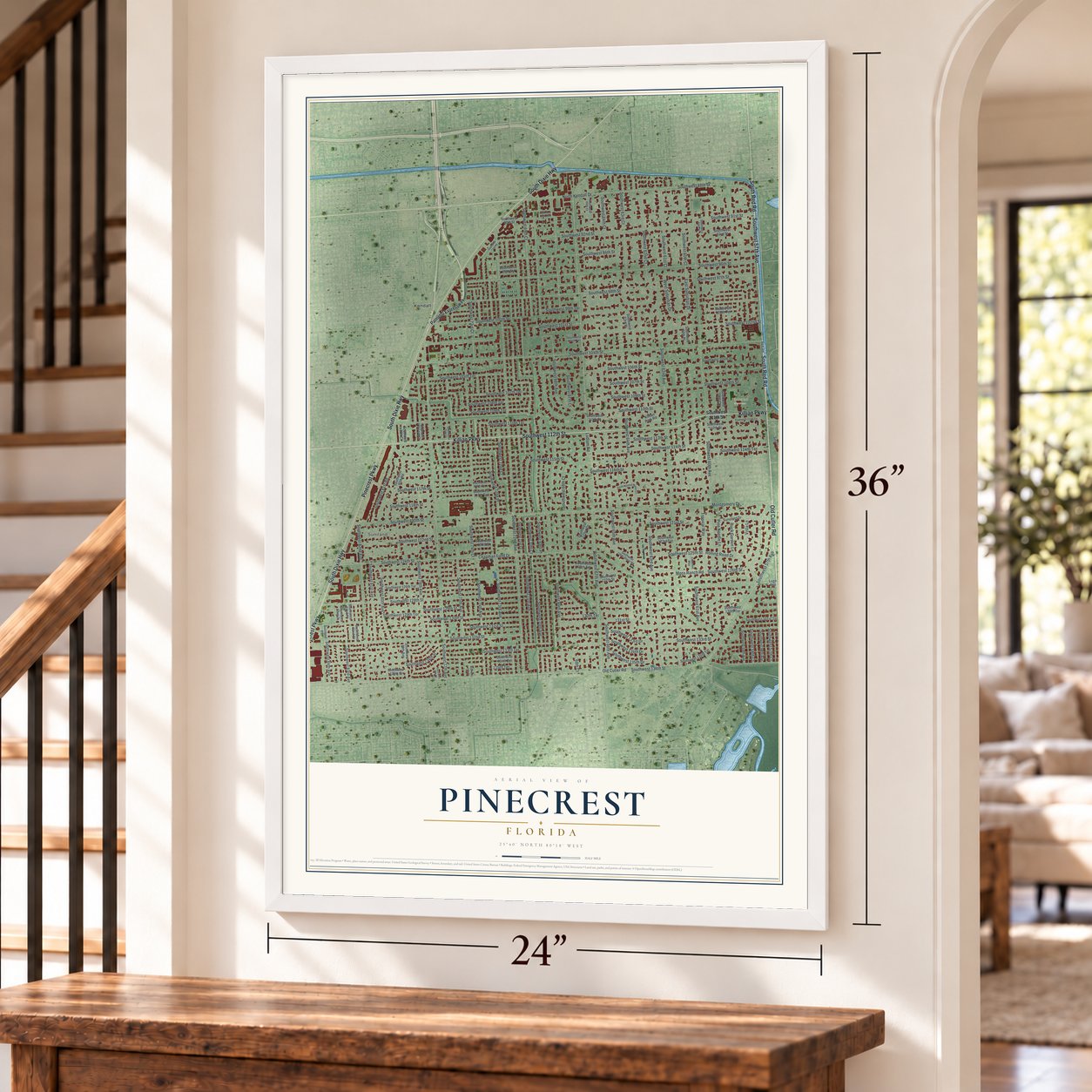
Explore Pinecrest, Florida from a whole new perspective. Created using aerial imagery and detailed geographic data, this map captures Pinecrest building by building, with labeled streets, familiar landmarks, and shaded topographical relief that highlights the natural contours of the landscape.
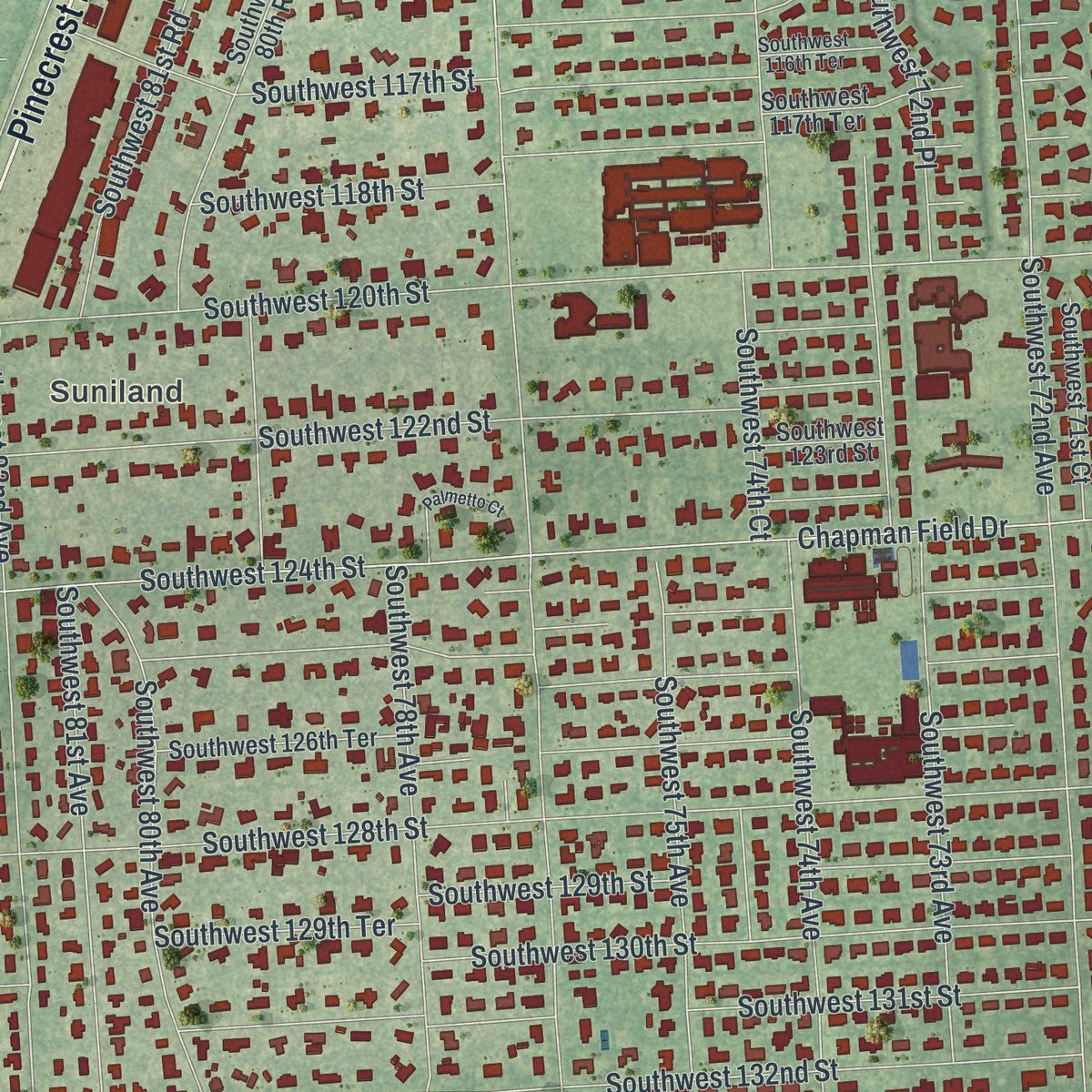
Combining modern data with the timeless character of a vintage atlas, this map is just as interesting up close as it is beautiful on the wall. Whether you grew up in Pinecrest, spent memorable years there, or call it home today, this unique map is a great way to celebrate a place that means something to you. Zoom in on the preview to look for your street, and then order a print to put your memories on the wall.
Three ways to hang it
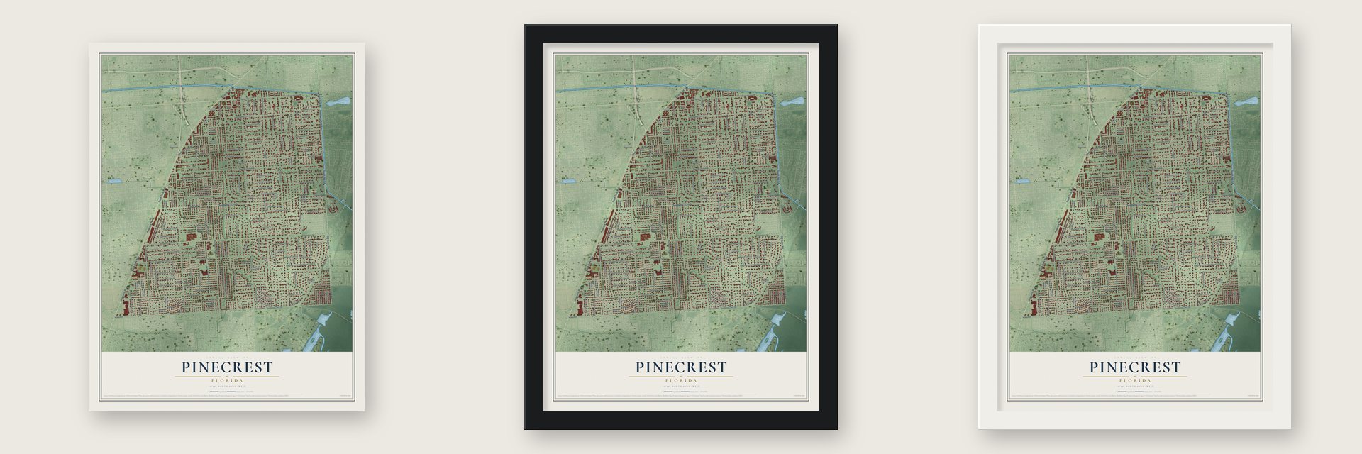
Unframed archival matte, a black wood frame or a white wood frame.
Up close
Geography Worth Displaying
This map was created using accurate cartographic data and authoritative geographic sources, including the U.S. Geological Survey (USGS) and FEMA. The map brings together terrain, waterways, roads, and building detail. The majority of the streets are labeled, houses are accurately depicted, and the topography is derived from government sources. Combining local data with carefully composed color and shading leads to this beautifully detailed Pinecrest artwork for your wall.
Rather than simply showing street outlines, we’ve included as many of the street names as we could reasonably fit on the map while keeping their names legible. Zoom in on the high resolution preview to see exactly what’s on the map. We truly set out to create a statement piece for anyone who loves Pinecrest. So whether it’s for you, or a gift for someone you love, we hope this map of Pinecrest brings back fond memories.
Explore the full map of Pinecrest, Florida and read about the local places it shows.

About Pinecrest, Florida
Pinecrest is a village of 18,388 people in Miami-Dade County. It sits 11 miles southwest of downtown Miami, and in the 1900s Henry Flagler used the ground at U.S. 1 and Southwest 102nd Street to stage supplies for his Overseas Railroad to the Florida Keys. The community began to take shape in the 1930s around Parrot Jungle, one of the Miami area's earliest tourist attractions.
In the 1950s and 1960s builders put up ranch-style houses on 1-acre lots, which gave the neighborhoods their rural, leafy look. Hurricane Andrew struck in August 1992 and destroyed many homes and businesses, and the area rebuilt slowly over the following years. Fast growth and local concerns then led Evelyn Greer Langlieb and Gary C. Matzner, who both lived here, to push for self-government, and the Village of Pinecrest was incorporated on March 12, 1996.
- Parrot Jungle, 1936Franz Scherr, who ran a Homestead feed and supply store, dreamed of a garden where birds flew uncaged. With Louise Scherr he rented 20 acres of hammock land at Red Road and Southwest 111th Street for $25 a year, cutting a winding trail through the coral rock and sparing the native plants. About 100 visitors paid 25 cents apiece on opening day, December 20, 1936. Over the years more than a million came, Winston Churchill among them.
- Pinecrest Gardens since 2003When Parrot Jungle moved to Watson Island, between downtown Miami and Miami Beach, the village bought the old grounds on December 17, 2002. The village council dedicated them as Pinecrest Gardens on March 8, 2003. The old mosaic paths and birdcages survive, along with an amphitheater under a geodesic dome built in the early 1940s, among more than 1,000 kinds of tropical plants, streams, sinkholes and caves.
- Evelyn Greer, first mayorEvelyn Greer helped lead the drive for incorporation and was elected Pinecrest's first mayor. After two terms she handed the job to Matzner in 2004, and on November 9, 2004, Pinecrest Park was renamed Evelyn Greer Park in her honor.
- 10,000 street treesSince 1997 Pinecrest has lined its streets with more than 10,000 new trees, and the Arbor Day Foundation has named it a Tree City USA. In 2008 the council dedicated Flagler Grove Park and a community center at Pinecrest Gardens, and that October a Pinecrest branch library opened next to the center.
Find your street
Names on the Pinecrest map
Every name below is printed on this map. Look for your street, your school, the park where you played, or the pond down the road.
Places and landmarks3
- Suniland
- Pinecrest Gardens
- Kendall
Streets and roads165
- Old Cutler Road
- Southwest 112th Street
- Pinecrest Parkway
- Southwest 57th Avenue
- South Red Road
- Red Road
- South Dixie Highway
- Killian Parkway
- Southwest 72nd Court
- North Kendall Drive
- Southwest 107th Terrace
- Southwest 74th Court
- Montgomery Drive
- Southwest 70th Avenue
- Southwest 124th Street
- Southwest 63rd Court
- Moss Ranch Road
- Southwest 64th Court
- Southwest 58th Court
- Ludlam Road
- Southwest 67th Avenue
- Southwest 136th Street
- Southwest 72nd Avenue
- Southwest 120th Street
- Southwest 128th Street
- Southwest 69th Court
- Southwest 60th Avenue
- Southwest 69th Avenue
- Southwest 62nd Avenue
- Southwest 104th Street
Show all 165 streets
- Chapman Field Drive
- Southwest 132nd Street
- Southwest 77th Avenue
- Howard Drive
- Southwest 96th Street
- Southwest 74th Avenue
- Southwest 102nd Street
- Southwest 73rd Avenue
- Southwest 98th Street
- Southwest 125th Street
- Southwest 68th Court
- Southwest 63rd Avenue
- Southwest 60th Court
- Southwest 71st Avenue
- Southwest 133rd Street
- Southwest 126th Street
- Southwest 64th Avenue
- Southwest 68th Avenue
- Southwest 92nd Street
- Southwest 118th Street
- Southwest 106th Street
- Southwest 114th Street
- Southwest 134th Street
- Southwest 116th Street
- Southwest 88th Street
- Southwest 94th Street
- Southwest 100th Street
- Southwest 122nd Street
- Southwest 130th Street
- Southwest 82nd Avenue
- Southwest 113th Street
- Southwest 61st Court
- Southwest 115th Street
- Southwest 65th Avenue
- Southwest 131st Street
- Southwest 73rd Court
- Southwest 62nd Court
- Southwest 67th Court
- Southwest 107th Street
- Southwest 129th Terrace
- Southwest 121st Street
- Southwest 117th Street
- Southwest 78th Avenue
- Rolling Road Drive
- Southwest 80th Avenue
- Southwest 75th Avenue
- Southwest 110th Street
- Southwest 133rd Terrace
- Southwest 108th Street
- Southwest 97th Street
- Southwest 109th Terrace
- Southwest 99th Terrace
- Southwest 81st Road
- Southwest 61st Avenue
- Pine Needle Lane
- Southwest 109th Street
- Southwest 81st Avenue
- Southwest 129th Street
- Southwest 105th Terrace
- Southwest 57th Court
- West Suburban Drive
- Southwest 101st Street
- Southwest 108th Terrace
- Southwest 114th Terrace
- Southwest 66th Avenue
- Southwest 72nd Place
- Southwest 91st Street
- Southwest 83rd Avenue
- Southwest 84th Avenue
- Southwest 69th Place
- East Suburban Drive
- Four Fillies Road
- Southwest 70th Court
- Southwest 110th Terrace
- Tropical Way
- Southwest 134th Drive
- Southwest 133rd Drive
- Vista Lane
- Southwest 135th Drive
- Rock Garden Lane
- 130th Terrace
- 131st Street
- 135th Terrace
- 68th Court
- Palmetto Expressway
- Southwest 111th Street
- Southwest 59th Avenue
- Southwest 135th Street
- Southwest 58th Avenue
- Southwest 93rd Street
- Southwest 80th Road
- Southwest 79th Avenue
- Southwest 123rd Terrace
- Southwest 127th Street
- Southwest 126th Terrace
- Southwest 130th Terrace
- Southwest 135th Terrace
- Southwest 59th Court
- Southwest 134th Terrace
- Southwest 83rd Court
- Southwest 125th Terrace
- Southwest 90th Street
- Southwest 82nd Court
- Southwest 117th Terrace
- Suncrest Drive
- Southwest 123rd Street
- Southwest 100th Terrace
- Smathers Circle
- Southwest 78th Court
- Southwest 105th Street
- Southwest 71st Court
- Southwest 131st Terrace
- Killian Park Road
- Southwest 122nd Drive
- Southwest 60th Place
- Southwest 82nd Place
- Suniland Place
- Southwest 95th Street
- Lugo Avenue
- Southwest 63rd Place
- Southwest 126th Street Road
- Southwest 77th Court Circle
- Southwest 75th Court
- Southwest 116th Terrace
- Crescent Way
- Southwest 65th Court
- Southwest 59th Place
- Southwest 102nd Terrace
- Southwest 73rd Road
- Southwest 111th Terrace
- South Mitchell Manor Circle
- Southwest 77th Court
- Southwest 89th Terrace
- Palmetto Court
- Southwest 74th Place
Names are listed as they appear on the printed map. Zoom into the product photos to find them.
The art of mapping a place
How This Map Was Made
Real places. Remarkable detail. Discover the layers that turn geographic data into a map of home.

The view from above
Aerial imagery reveals the character of the land: woodland, open fields, and the patterns of a place.

The shape of the land
Elevation data brings hills, valleys, and subtle changes in the landscape into view.

The details of home
Roads, waterways, and building footprints come together to make the map feel unmistakably local.

Geography becomes art
Considered color, shading, and typography bring the layers together in a map made for your wall.


Process illustrated with Mendon, Massachusetts. Aerial imagery: USDA NAIP. Terrain: USGS 3D Elevation Program. Map details and finished artwork: KNOWOL.
The Details
About This Print
Choose an archival matte print, or a black or white Ayous wood frame. The archival matte print is unframed.
Select your size and finish above to see the matching product image and price.
Materials & Craftsmanship
A contemporary map with the character of a classic atlas, printed on archival matte paper. Optional frames are made from Ayous wood.
Your printed map does not include the watermark shown in the full-map preview.
Shipping & Delivery
Free shipping within the United States. Every print is made to order in the USA.
Buying a gift? Add a note in your cart and we'll include it. We never put prices in the package.
Prints ship within 2 to 3 business days. Allow 7 to 10 days total from ordering for delivery. Timing may vary during holidays or periods of high order volume.
Read our shipping policy.
Returns and damaged prints
Each print is made to order. Change-of-mind refunds are not available after production.
If your print arrives damaged, misprinted or incorrect, contact support@knowol.com within 30 days of receiving it. Include your order number, photos and a description of the issue.
Read our full refund and replacement policy. For questions about your order, email support@knowol.com.
Find your town
Looking for another city?
Find a map of home in our Florida collection, or any town in the country.
Nearby
Maps of towns near Pinecrest
Know someone from one of these towns? Their map makes a great gift.
 Coral Gables
, Florida
From $39.99See the map
 South Miami
, Florida
From $39.99See the map
 Kendall
, Florida
From $39.99See the map
More maps nearby: Palmetto Bay, Glenvar Heights, Sunset, Palmetto Estates and Richmond Heights.