
Search for another town




Free U.S. delivery 7 to 10 days after you order
Plainfield, Illinois Map Art
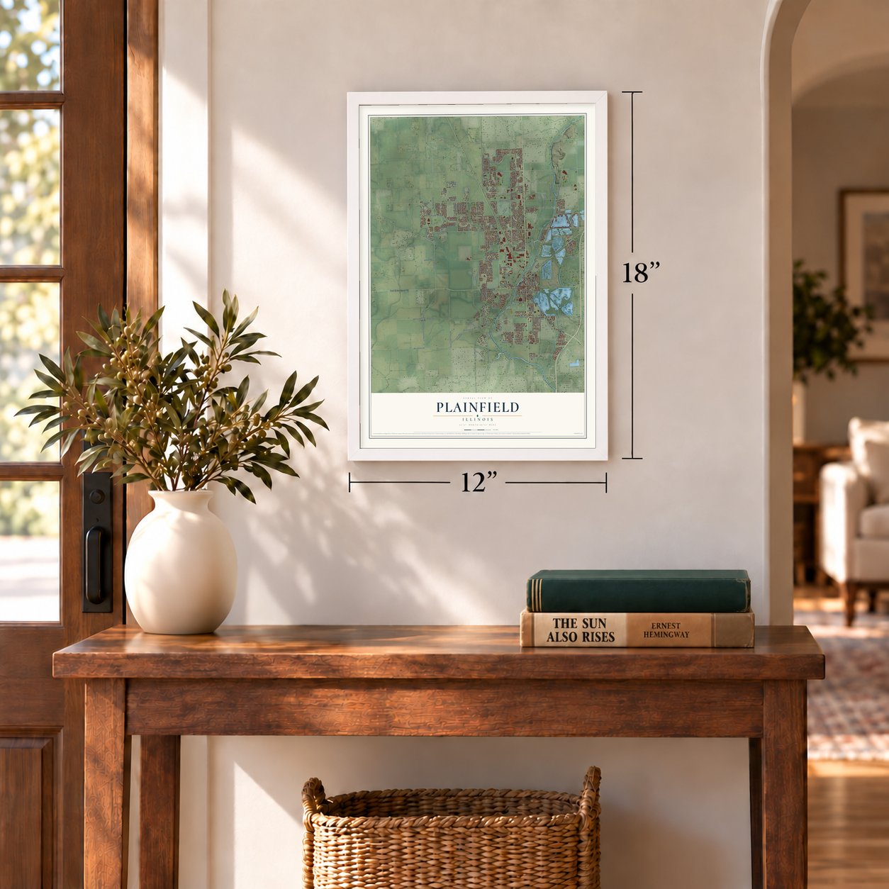
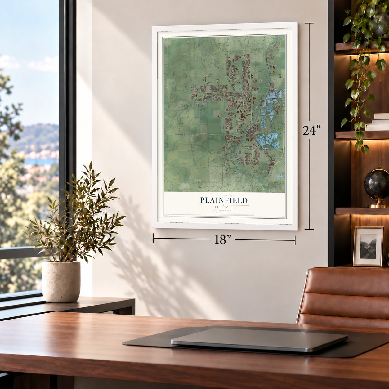
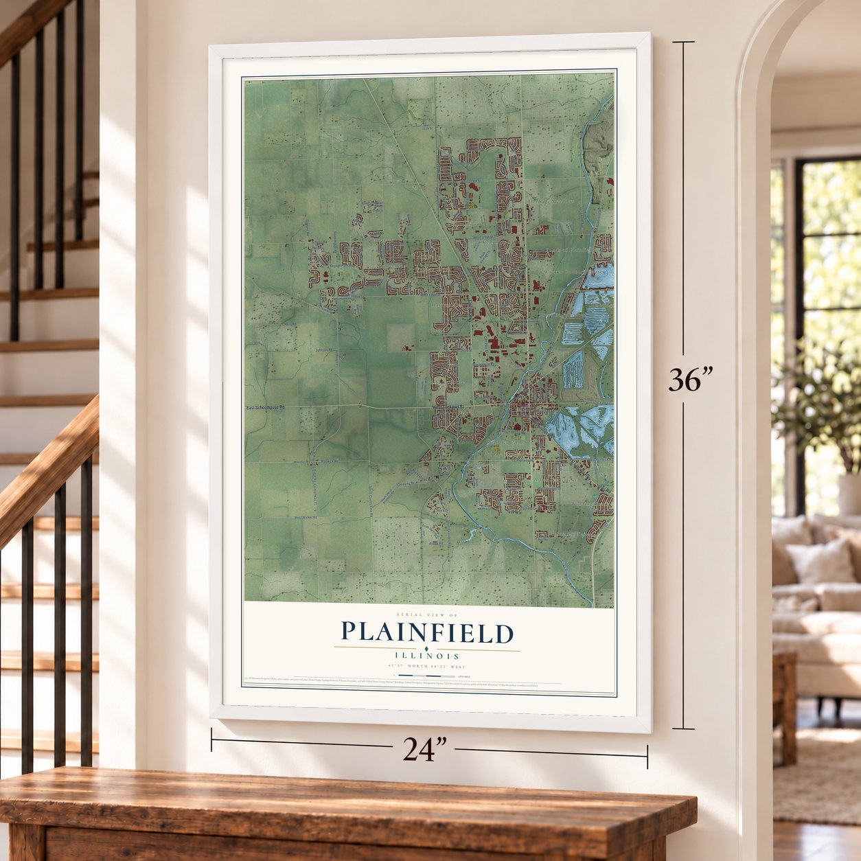
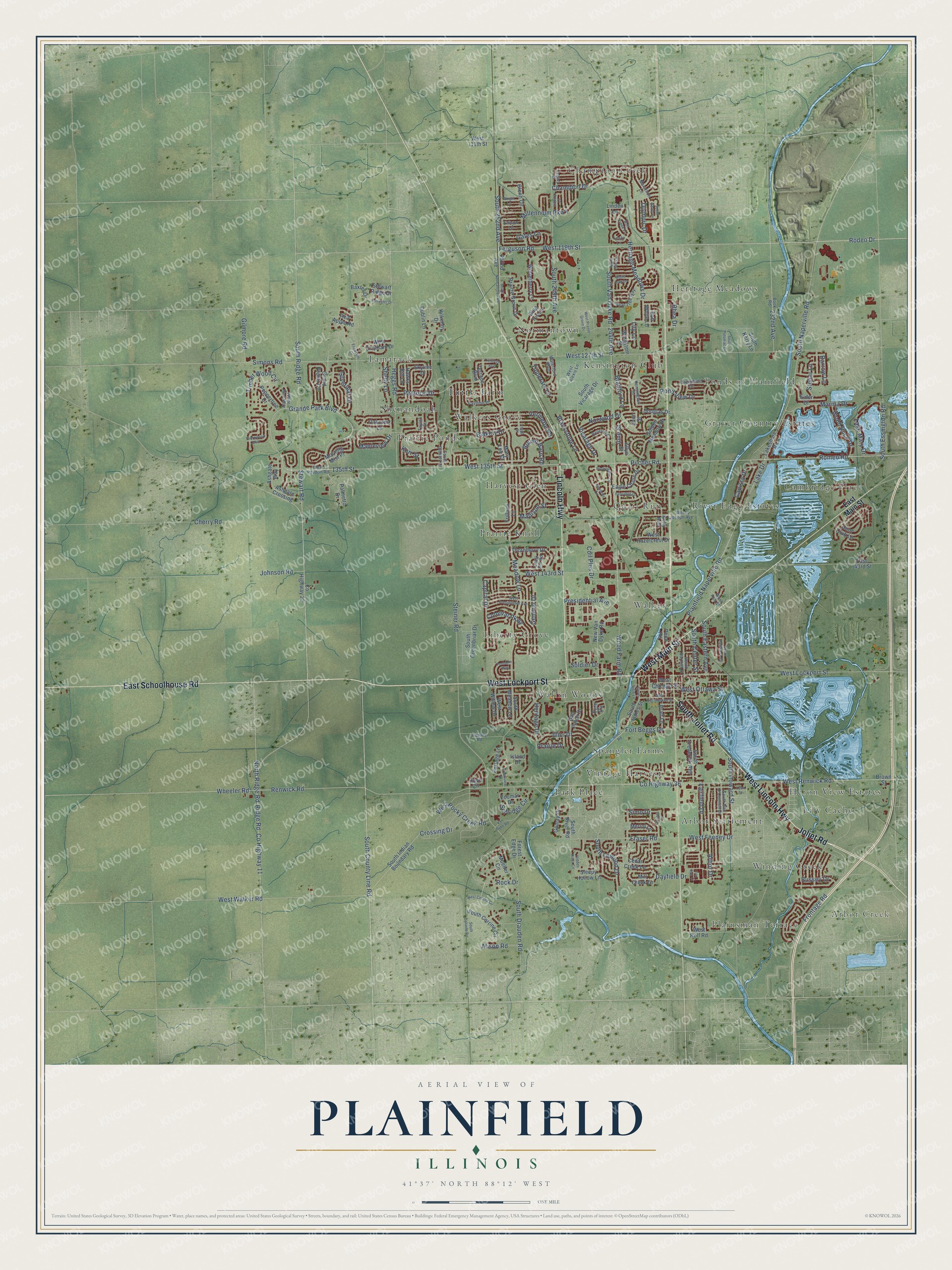
A new map of Plainfield, Illinois, made in 2026 and printed to order on thick archival matte paper.
12" x 18" Archival Matte Print
A Map of Home. A Work of Art.
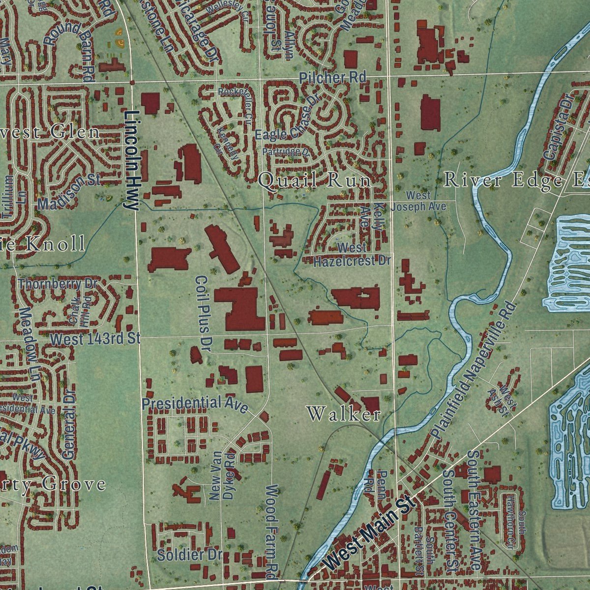
Explore Plainfield, Illinois from a whole new perspective. Created using aerial imagery and detailed geographic data, this map captures Plainfield building by building, with labeled streets, familiar landmarks, and shaded topographical relief that highlights the natural contours of the landscape.
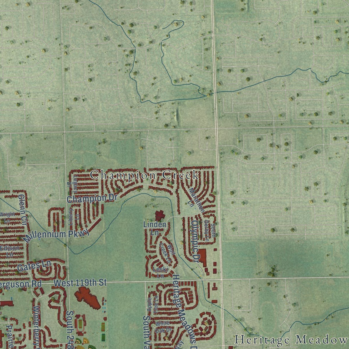
Combining modern data with the timeless character of a vintage atlas, this map is just as interesting up close as it is beautiful on the wall. Whether you grew up in Plainfield, spent memorable years there, or call it home today, this unique map is a great way to celebrate a place that means something to you. Zoom in on the preview to look for your street, and then order a print to put your memories on the wall.
Three ways to hang it
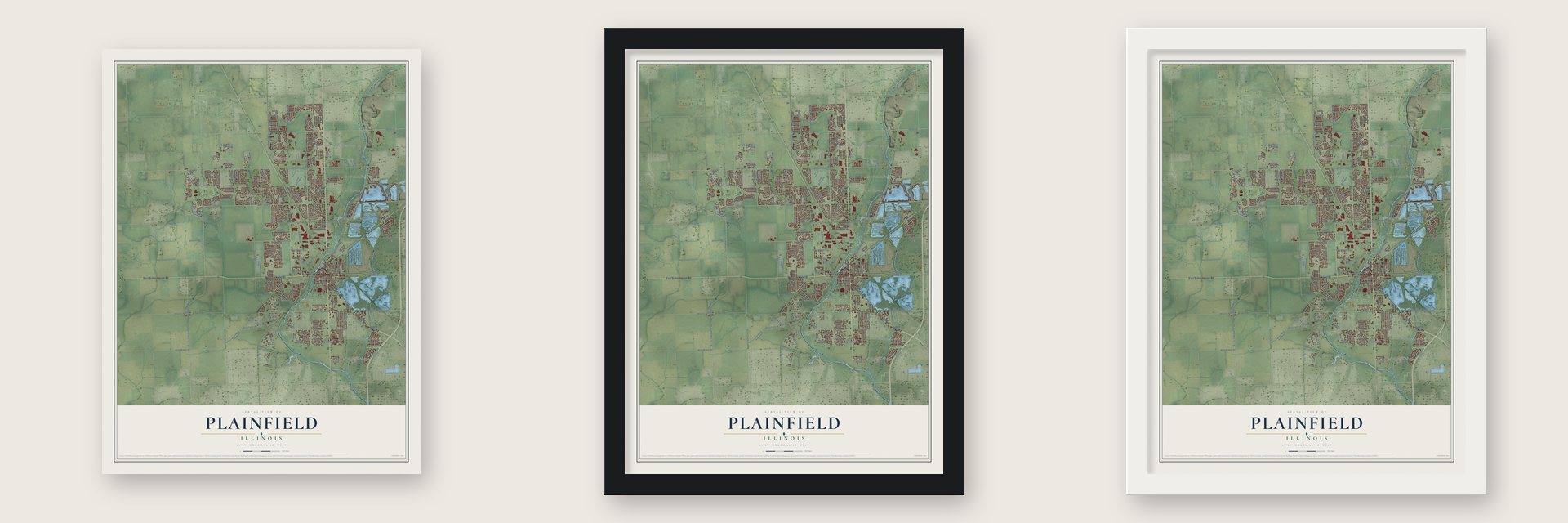
Unframed archival matte, a black wood frame or a white wood frame.
Up close
Geography Worth Displaying
This map was created using accurate cartographic data and authoritative geographic sources, including the U.S. Geological Survey and the Census Bureau. The map brings together terrain, waterways, roads, and building detail. The majority of the streets are labeled, houses are accurately depicted, and the topography is derived from government sources. Combining local data with carefully composed color and shading leads to this beautifully detailed Plainfield artwork for your wall.
Rather than simply showing street outlines, we’ve included as many of the street names as we could reasonably fit on the map while keeping their names legible. Zoom in on the high resolution preview to see exactly what’s on the map. We truly set out to create a statement piece for anyone who loves Plainfield. So whether it’s for you, or a gift for someone you love, we hope this map of Plainfield brings back fond memories.
Read the story behind this map of Plainfield, Illinois from 2026.
About Plainfield, Illinois
Plainfield is a village of 44,762 people in Will County, on the DuPage River, with part of it reaching into Kendall County. A large Potawatomi community once lived here. The land passed to the United States in the Treaty of St. Louis in 1816. In 1826 the Methodist minister Jesse Walker came to set up a small mission for the Potawatomi. His son-in-law James Walker claimed land in 1828 and built a sawmill with several other men. The settlement that grew up around the mill, Walkers' Grove, is counted as the oldest in Will County.
Chester Ingersoll laid out a village just north of the grove in 1834. Levi Arnold, a New Yorker who arrived that same year, laid out a north division. The two men did not get along, so the streets of the two halves met at an angle of about forty-five degrees. North Plainfield was incorporated on February 23, 1861. A second act in April 1869 joined both halves, and the village was incorporated again under state law on June 30, 1877.
- Lumber for early ChicagoReuben Flagg hauled boards from Walker's mill to Chicago. They went into the city's first two frame buildings, the George Dole Forwarding House and the P.F.W. Peck House. Chicago also relied on the settlement for mail and supplies. That early boom slowed after the Illinois and Michigan Canal opened in 1848 and passed the village by.
- Where Route 66 met the LincolnUntil the late 1950s, when Interstate 55 went in east of the village, the Lincoln Highway, U.S. Route 30, and U.S. Route 66 shared three blocks of a single downtown street, now Illinois Route 59. Will County held the only two places where the two highways crossed: here and Joliet.
- The F5 tornado of 1990At about 3:28 p.m. on August 28, 1990, an F5 tornado struck Plainfield. It killed 29 people, injured 353 and damaged or destroyed more than 1,100 homes. It also wrecked the town's only high school, now Plainfield Central High School, and the warning came only after the storm had passed.
- From 4,500 to 44,762In the years after the tornado, new subdivisions spread across what had mostly been a farm town. The village grew from 4,500 people in 1990 to 44,762 in 2020.
Find your street
Names on the Plainfield map
Every name below is printed on this map. Look for your street, your school, the park where you played, or the pond down the road.
Places and landmarks28
- Arbor Creek
- Arbor Settlement
- Cambridge Place
- Champion Creek
- Graver Country Estates
- Harvest Glen
- Heritage Meadows
- Heron View Estates
- Kensington Club
- Liberty Grove
- Lily Cache
- Normantown
Show all 28 places
- Park Place
- Plainsman Terrace
- Ponds of Plainfield
- Prairie Knoll
- Prairie Ponds
- Quail Run
- River Edge Estates
- Shenandoah
- Spangler Farms
- Tamarack
- Tuttle Farm
- Vintage Harvest
- Walker
- Walkers Grove
- Wallin Woods
- Winding Creek
Streets and roads227
- West Lockport Street
- West Lincoln Highway
- West Main Street
- Lincoln Highway
- East Schoolhouse Road
- South Joliet Road
- Joliet Road
- West 135th Street
- South Ridge Road
- Grande Park Boulevard
- West 119th Street
- Ridge Road
- Romeo Road
- Rodeo Drive
- South County Line Road
- 135th Street
- South Naperville Road
- West Renwick Road
- South Drauden Road
- Renwick Road
- South 252nd Avenue
- Champion Drive
- Capital Drive
- West 127th Street
- South Van Dyke Road
- 244th Avenue
- Meadow Lane
- Pilcher Road
- County Highway 36
- West 143rd Street
Show all 227 streets
- Plainfield Naperville Road
- South 248th Avenue
- South Essington Road
- Ferguson Road
- West Walker Road
- County Highway 11
- North Ridge Road
- Simons Road
- Johnson Road
- Heritage Meadows Drive
- Millennium Parkway
- Blakely Drive
- Heggs Road
- Pastoral Drive
- Frontage Road
- Rock Drive
- Lake Mary Drive
- Wheeler Road
- Fairfield Drive
- Fraser Road
- Timber Wood Circle
- Steiner Road
- Arbor Drive
- West Ottawa Street
- Alison Road
- Crossing Drive
- Silverleaf Drive
- Round Barn Road
- Cherry Road
- West Rocky Creek Road
- Selfridge Circle
- South Howard Street
- Vicarage Drive
- Colonial Parkway
- Wood Farm Road
- Marina Drive
- South Lewood Drive
- Norwood Drive
- Coil Plus Drive
- Bradford Lane
- Wood Duck Drive
- Vermette Road
- Illini Drive
- West Feeney Drive
- South Eastern Avenue
- 232nd Avenue
- Gilmore Road
- Dayfield Drive
- Gates Lane
- Lake Drive
- Blackstone Lane
- Presidential Avenue
- Fort Beggs Drive
- Pond View Drive
- Shelly Lane
- Olympic Drive
- Mapleview Drive
- Tipperary Lane
- South Center Street
- Stellar Lane
- Capista Drive
- Madison Street
- General Drive
- Barrow Lane
- Rhea Drive
- Heritage Drive
- Bussey Drive
- Kerr Street
- Simo Drive
- Ione Street
- Stewart Road
- Soldier Drive
- Prairie Drive
- Lily Lane
- East Main Street
- County Highway 22
- Ashgate Way
- West 111th Street
- 252nd Avenue
- Skyline Drive
- South Meadow Lane
- Prairie Grove Drive
- Winterberry Lane
- South Indian Boundary Road
- New Van Dyke Road
- Golden Meadow Drive
- Grand Poplar Circle
- Glenn Circle
- Thornberry Drive
- West Willow Drive
- Mueller Circle
- Hunt Club Lane
- South River Road
- West Hazelcrest Drive
- South Vicarage Drive
- Dan Patch Drive
- Cedar Creek Lane
- West Rolf Road
- Red Apple Road
- Lakeshore Drive
- South James Street
- Ashgate Crossing
- Blue Iris Lane
- West Chicago Street
- Sleepy Hollow Lane
- South Frederick Avenue
- South Corrine Circle
- Cove Circle
- Eagle Chase Drive
- Morning Mist Place
- Terrace Boulevard
- Portage Lane
- Peppertree Drive
- Gamay Drive
- South Greenbriar Drive
- Trillium Lane
- Palmetto Drive
- Kilkenny Drive
- Mill Creek Lane
- Douglas Drive
- Dublin Lane
- West Chatham Drive
- Baxter Drive
- Stewart Ridge Drive
- Eider Drive
- Hawks Bill Lane
- Wingstem Street
- Allyn Street
- Oakcrest Lane
- South Kerry Lane
- East 143rd Street
- Zoumar Drive
- Forest Edge Drive
- Merlot Lane
- Pratt Lane
- Bob White Lane
- Penn Road
- Kelly Avenue
- Mary Lee Court
- Brown Street
- Evon Street
- Eyre Circle
- Island Drive
- Linden Lane
- West Paydon Road
- West Alexis Lane
- Kensington Drive
- Pavilion Place
- South Dan O'Connell Drive
- Book Road
- Marathon Lane
- Pear Tree Way
- Greenfield Drive
- South Bartlett Street
- South Blakely Drive
- Waterford Boulevard
- Leski Lane
- Taylor Street
- West Joseph Avenue
- White Pine Way
- Edison Lane
- Chalk Hill Road
- West Ash Street
- Rowley Road
- River Road
- South Normantown Road
- West Presidential Avenue
- West Cerena Circle
- West Prairie Grove Drive
- Thornwood Boulevard
- South Hawthorn Circle
- Hidden River Circle
- White Oak Drive
- Kennedy Circle
- South Corinne Circle
- Freedom Way
- Flagg Drive
- Apple Tree Lane
- West Commercial Street
- Van Dyke Road
- Wellesley Circle
- South Derby Lane
- Creekview Drive
- Rockefeller Circle
- Fox Run Cr
- Trelliage Avenue
- Forrester Drive
- Wolf Creek Lane
- Liberty Lane
- Partridge Drive
- South Potomac Drive
- Wright Lane
- South Vista Lane
- Elizabeth Drive
- Legacy Drive
- Lynn Street
- Chablis Lane
Names are listed as they appear on the printed map. Zoom into the product photos to find them.
The art of mapping a place
How This Map Was Made
Real places. Remarkable detail. Discover the layers that turn geographic data into a map of home.

The view from above
Aerial imagery reveals the character of the land: woodland, open fields, and the patterns of a place.

The shape of the land
Elevation data brings hills, valleys, and subtle changes in the landscape into view.

The details of home
Roads, waterways, and building footprints come together to make the map feel unmistakably local.

Geography becomes art
Considered color, shading, and typography bring the layers together in a map made for your wall.


Process illustrated with Mendon, Massachusetts. Aerial imagery: USDA NAIP. Terrain: USGS 3D Elevation Program. Map details and finished artwork: KNOWOL.
The Details
About This Print
Choose an archival matte print, or a black or white Ayous wood frame. The archival matte print is unframed.
Select your size and finish above to see the matching product image and price.
Materials & Craftsmanship
A contemporary map with the character of a classic atlas, printed on archival matte paper. Optional frames are made from Ayous wood.
Your printed map does not include the watermark shown in the full-map preview.
Shipping & Delivery
Free shipping within the United States. Every print is made to order in the USA.
Buying a gift? Add a note in your cart and we'll include it. We never put prices in the package.
Prints ship within 2 to 3 business days. Allow 7 to 10 days total from ordering for delivery. Timing may vary during holidays or periods of high order volume.
Read our shipping policy.
Returns and damaged prints
Each print is made to order. Change-of-mind refunds are not available after production.
If your print arrives damaged, misprinted or incorrect, contact support@knowol.com within 30 days of receiving it. Include your order number, photos and a description of the issue.
Read our full refund and replacement policy. For questions about your order, email support@knowol.com.
Find your town
Looking for another city?
Find a map of home in our Illinois collection, or any town in the country.
Nearby
Maps of towns near Plainfield
Know someone from one of these towns? Their map makes a great gift.
 Crystal Lawns
, Illinois
From $39.99See the map
 Sunnyland
, Illinois
From $39.99See the map
 Romeoville
, Illinois
From $39.99See the map
More maps nearby: Crest Hill, Shorewood, Oswego, Bolingbrook and Joliet.