
Search for another town





Free U.S. delivery 7 to 10 days after you order
Plymouth, Massachusetts Map Art
Building by building, with labeled streets and shaded relief.
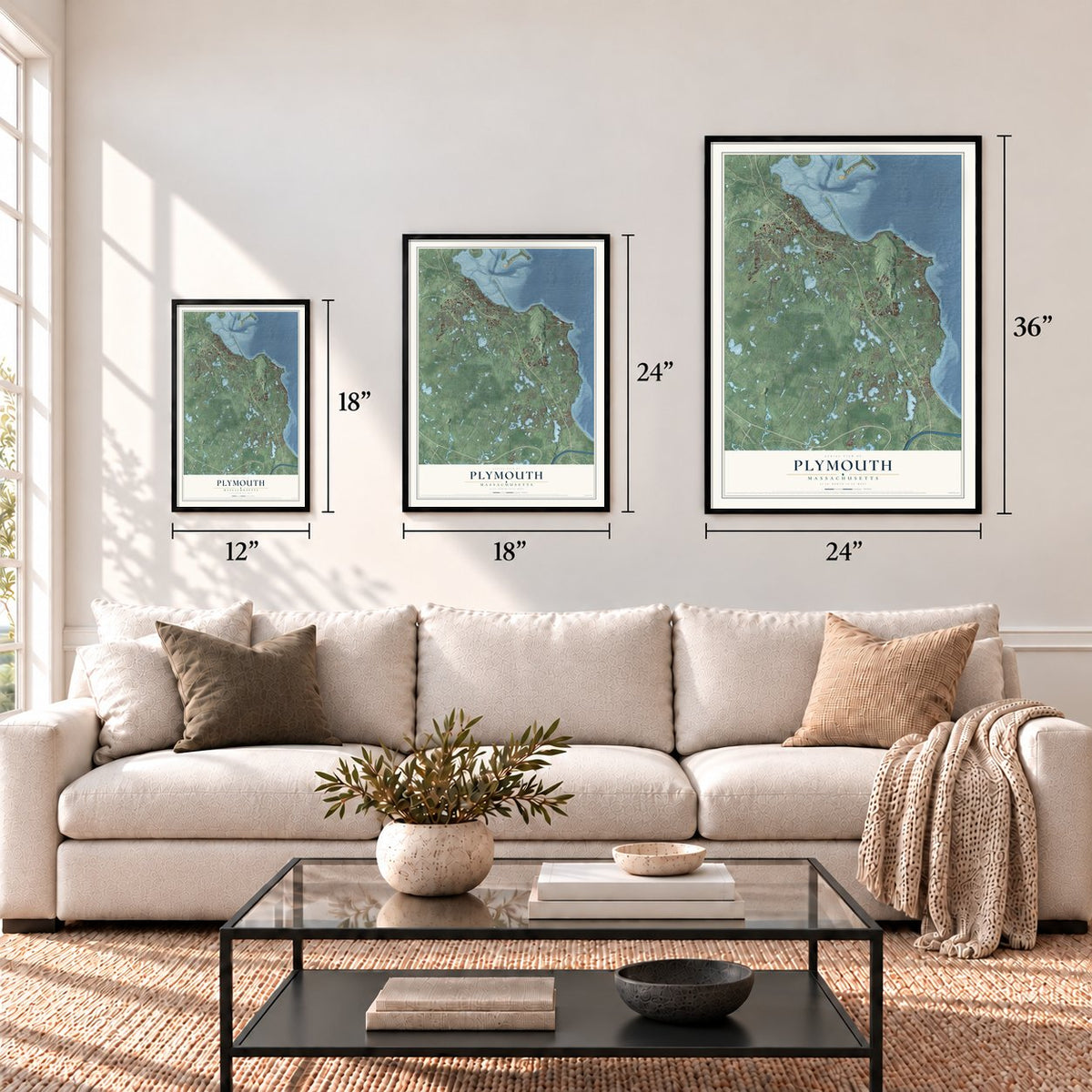
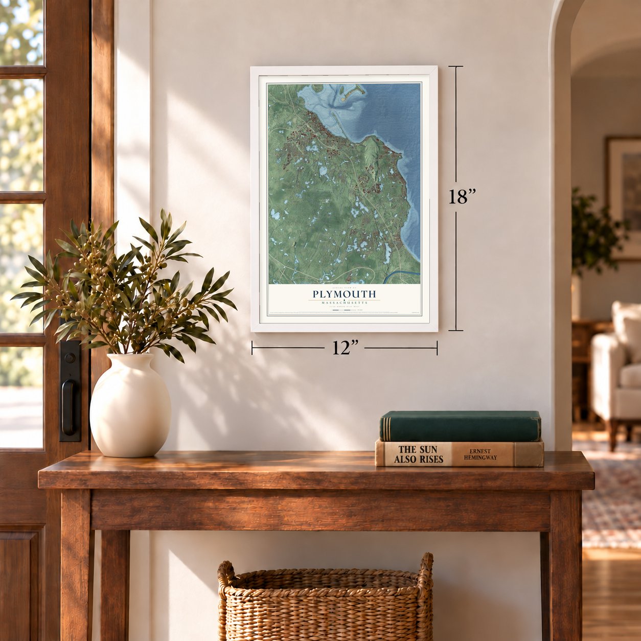
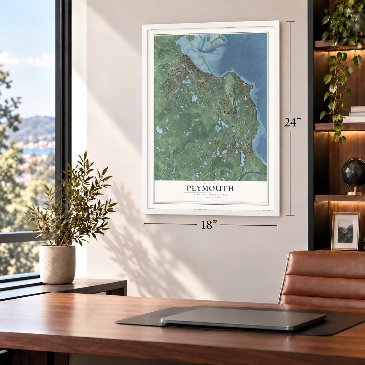
12" x 18" Archival Matte Print
A Map of Home. A Work of Art.
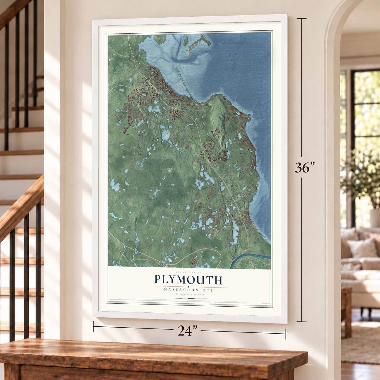
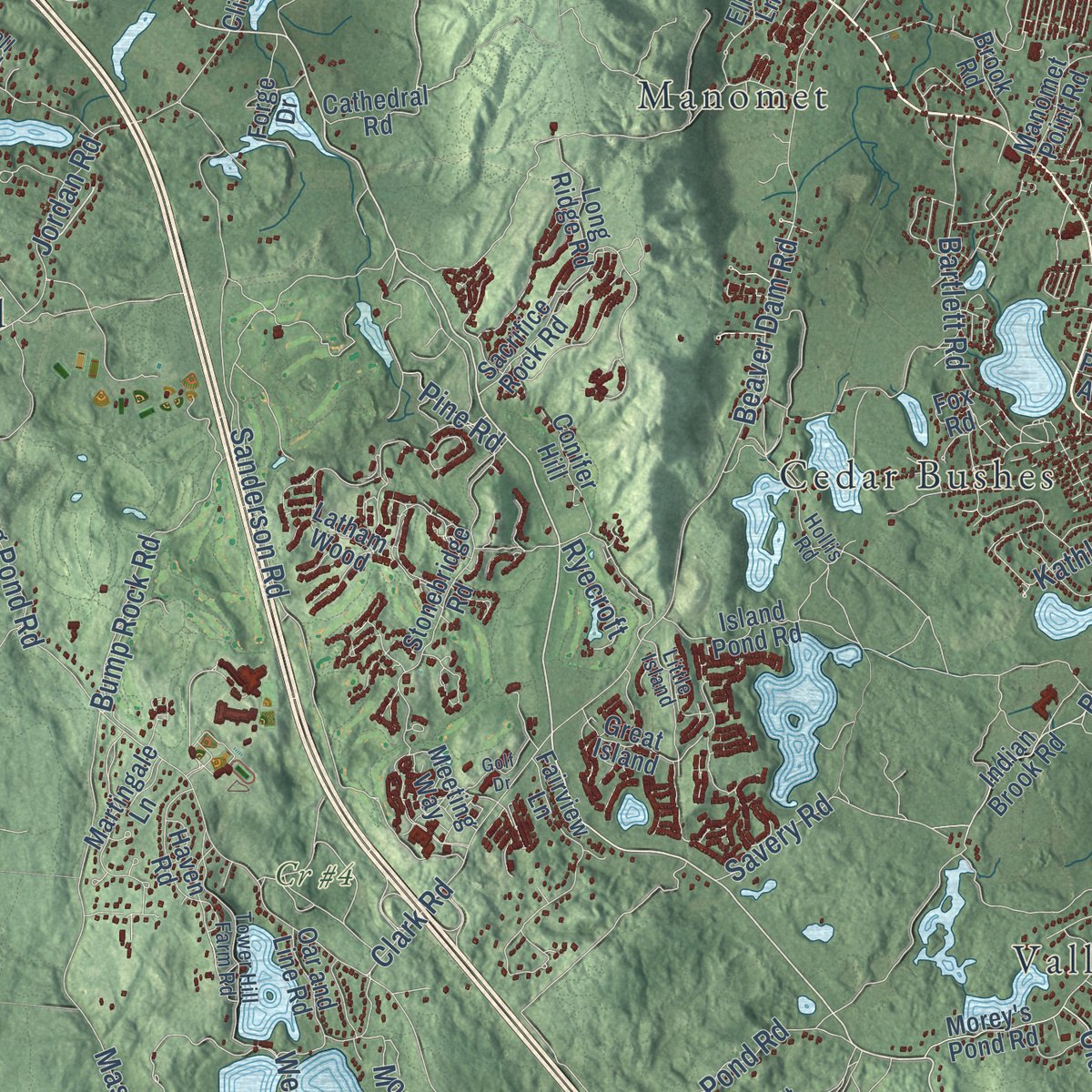
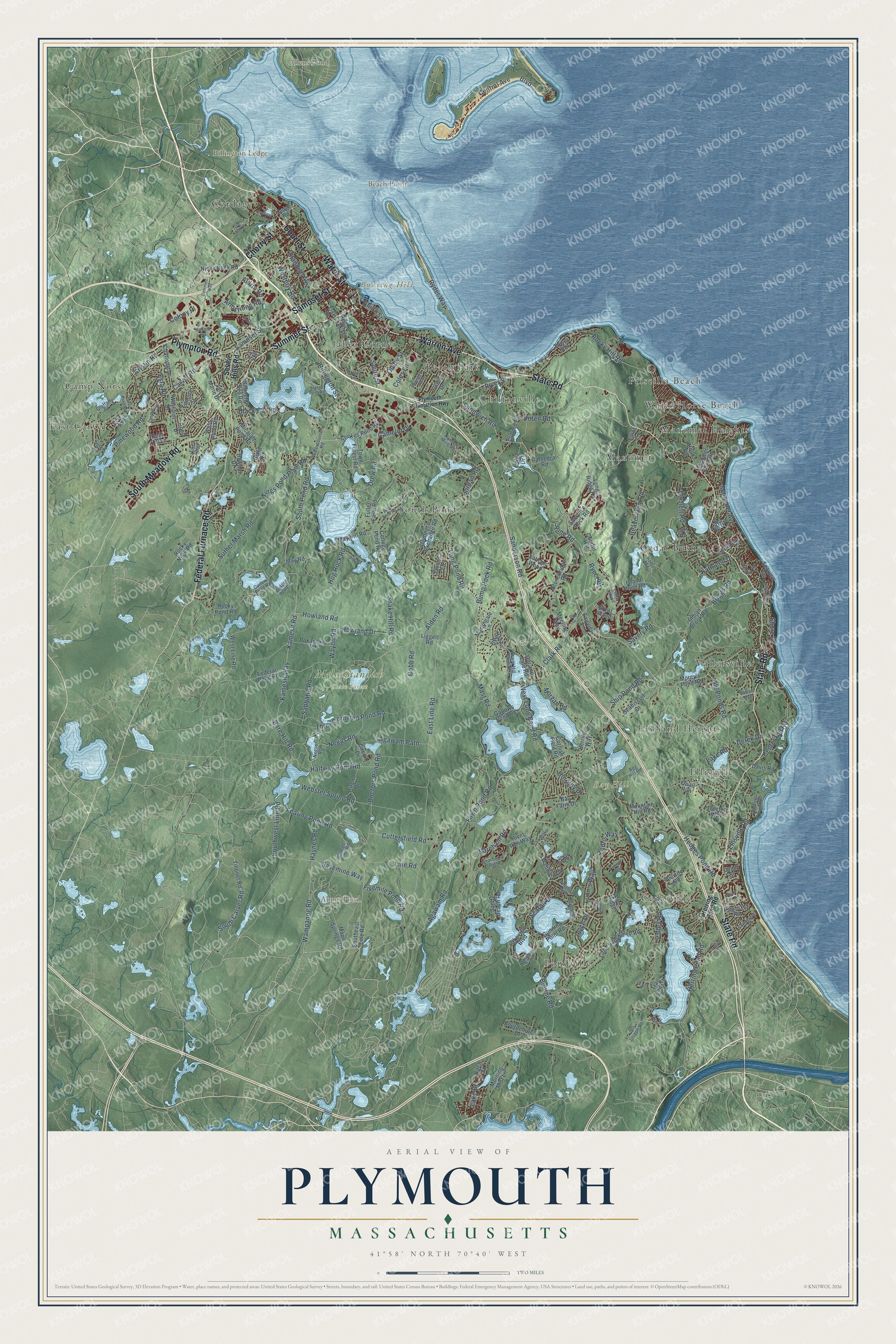
Explore Plymouth, Massachusetts from a whole new perspective. Created using aerial imagery and detailed geographic data, this map captures Plymouth building by building, with labeled streets, familiar landmarks, and shaded topographical relief that highlights the natural contours of the landscape.
Combining modern data with the timeless character of a vintage atlas, this map is just as interesting up close as it is beautiful on the wall. Whether you grew up in Plymouth, spent memorable years there, or call it home today, this unique map is a great way to celebrate a place that means something to you. Zoom in on the preview to look for your street, and then order a print to put your memories on the wall.
Three ways to hang it
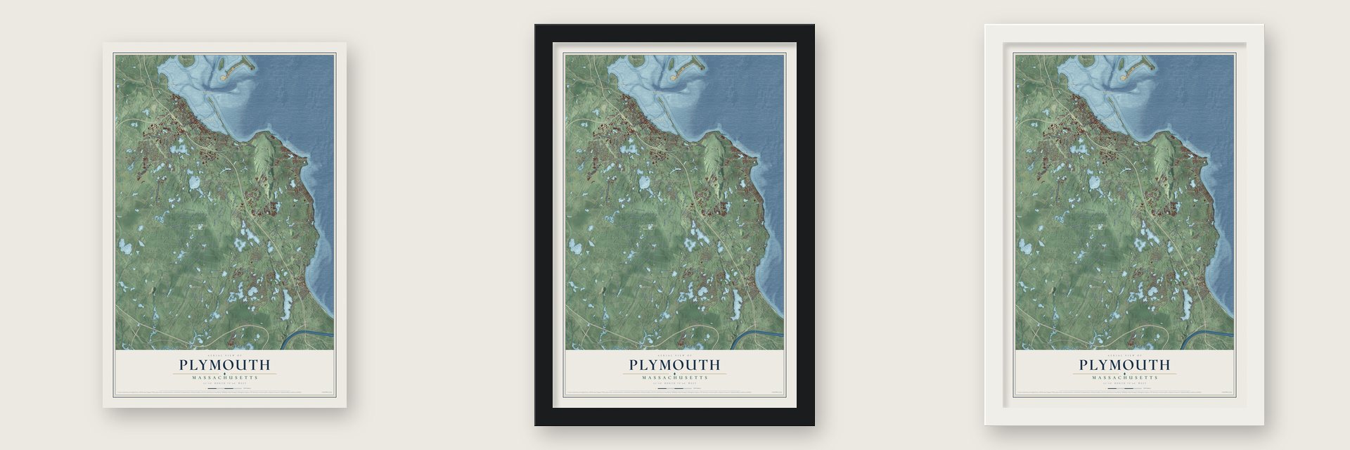
Unframed archival matte, a black wood frame or a white wood frame.
Up close
Geography Worth Displaying
This map was created using accurate cartographic data and authoritative geographic sources, including the U.S. Geological Survey (USGS) and FEMA. The map brings together terrain, waterways, roads, and building detail. The majority of the streets are labeled, houses are accurately depicted, and the topography is derived from government sources. Combining local data with carefully composed color and shading leads to this beautifully detailed Plymouth artwork for your wall.
Rather than simply showing street outlines, we’ve included as many of the street names as we could reasonably fit on the map while keeping their names legible. Zoom in on the high resolution preview to see exactly what’s on the map. We truly set out to create a statement piece for anyone who loves Plymouth. So whether it’s for you, or a gift for someone you love, we hope this map of Plymouth brings back fond memories.
Explore the full map of Plymouth, Massachusetts and read about the local places it shows.

Find your street
Names on the Plymouth map
Every name below is printed on this map. Look for your street, your school, the park where you played, or the pond down the road.
Places and landmarks25
- Bay Hill
- Beach Point
- Billington Ledge
- Burying Hill
- Abner Pond
- Allens Pond
- Cr #4
- Myles Standish State Forest
- East Carver
- White Horse Beach
- Pondville
- Cedarville
Show all 25 places
- South Pond
- Beach Park
- Vallersville
- Manomet
- Camp Norse
- Jabez Corner
- Ellisville
- Chiltonville
- Cedar Bushes
- Cordage
- Manomet Heights
- Eastland Heights
- Priscilla Beach
Streets and roads234
- Court Street
- Warren Avenue
- Summer Street
- Samoset Street
- State Road
- Federal Furnace Road
- South Meadow Road
- Plympton Road
- Water Street
- Cherry Street
- Carver Road
- Sandwich Road
- Black Cat Road
- Wampanog Road
- Lake Drive
- Kings Pond Plain Road
- Fearing Pond Road
- River Street
- Ship Pond Road
- South Street
- Line Road
- Negas Road
- South Pond Road
- Standish Avenue
- Old Ponds Road
- Long Pond Road
- Bourne Road
- Halfway Pond Road
- East Line Road
- Agawam Road
Show all 234 streets
- Three Cornered Pond Road
- Wareham Road
- Mast Road
- Beaver Dam Road
- Rocky Hill Road
- Bare Hill Road
- Bump Rock Road
- Lunn's Way
- Kamesit Road
- Kamesit Way
- Briggs Road
- Hog Rock Road
- Ryder Way
- Central Avenue
- South Carver Road
- Billington Street
- Webster Spring Road
- Jordan Road
- Suther Marsh Road
- Cobb Road
- Center Hill Road
- Sanderson Road
- Howland Drive
- Howland Road
- Hedges Pond Road
- Drew Road
- Bartlett Road
- Clark Road
- Herring Pond Road
- West Long Pond Road
- Snake Hill Road
- Valley Road
- Southwest Line Road
- Ellisville Road
- Westerly Road
- Boulevard
- Cuttersfield Road
- Alden Road
- Fivemile Pond Road
- Esta Road
- Colony Place
- Manomet Avenue
- Derek Drive
- Lunns Way
- Fawn Pond Road
- Doctors Pond Road
- Savery Road
- Sabbatia Road
- Camelot Drive
- Sasemine Way
- Obery Street
- Agawam Path
- Pinewood Road
- Coles Lane
- Scarlet Drive
- Dorothy Drive
- Kathleen Drive
- Armstrong Road
- Haynes Road
- Kristin Road
- Shore Drive
- Joyce Drive
- Morgan Road
- Wayon Road
- Ryecroft
- Lake Road
- Doten Road
- Aldrin Road
- Union Street
- Pine Road
- Seven Hills Road
- Southeast Line Road
- Circuit Drive
- May Road
- Rocky Pond Road
- Little Sandy Pond Road
- Indian Brook Road
- Tihonet Road
- Nicks Rock Road
- Long Ridge Road
- Federal Pond Road
- Morey's Pond Road
- Gunners Exchange Road
- Manomet Point Road
- Pokanoket Road
- Fuller Farm Road
- Sandy Beach Road
- May Hill Road
- Circle Drive
- Clifford Road
- Island Pond Road
- Stonebridge Road
- Bournehurst Drive
- Lakeview Boulevard
- College Pond Road
- Micajah Pond Road
- Fairview Lane
- Forge Drive
- Mountain Hill Road
- West Line Road
- West Pond Road
- Great Island
- Brook Road
- Jan Marie Drive
- Gallows Pond Road
- Cornish Field Road
- Cookes Pond Road
- Charlotte Drive
- Seaview Drive
- Maple Springs Road
- Sacrifice Rock Road
- Alewife Road
- Martingale Lane
- Gunning Point Road
- Town Forest Road
- Wallwind Drive
- Rocky Neck Road
- Seabiscuit Drive
- Filmore Street
- Quail Run
- River Run Way
- Newfield Street
- Reed Avenue
- Haven Road
- Billington Sea Road
- Treetop Way
- Meeting Way
- Howard Drive
- Wayfarer Drive
- Morning Mist Lane
- Lisa Avenue
- Hood Drive
- Cathedral Road
- Pawtuxet Road
- Bay Farm Drive
- Herring Way
- Oar and Line Road
- Curtis Drive
- Jasons Lane
- Davis Road
- Oak Street
- Conifer Hill
- Trail End Cv
- Hedge Road
- Pond Avenue
- Liggett Road
- Arbor Ridge
- Latham Wood
- Birch Street
- Elliot Lane
- Janet Street
- Tower Road
- Deer Hill Lane
- Guild Road
- Fox Road
- Watercourse Road
- Charge Pond Road
- Bog Hill Road
- Russell Mills Road
- Peter Road
- Negus Road
- Widgeon Pond Road
- Graffam Road
- Tower Hill Farm Road
- Sanderson Drive
- Stage Point Road
- Ellisville Drive
- Braley Lane
- Curlew Pond Road
- Blueberry Road
- Resnik Road
- Hollis Road
- Lookout Point Road
- Little Island
- Amanda Avenue
- Bearberry Path
- Dwight Avenue
- Lantern Lane
- Sol Joseph Road
- Fuller Way
- Whitley Trail
- Shoals Avenue
- Lukes Way
- Plymouth Plantation Highway
- Spooner Street
- Old Mill Lane
- Boot Pond Road
- White Cliff Drive
- Janebar Circle
- Commerce Way
- Nathan Lane
- Winthrop Road
- Clear Pond Road
- South Wind Drive
- Pioneer Trail
- Golf Drive
- Spinnaker Drive
- Old Bog Road
- Indian Trail
- Branch Point Road
- Deer Run
- North Street
- Lake Avenue
- Swift Avenue
Names are listed as they appear on the printed map. Zoom into the product photos to find them.
About Plymouth, Massachusetts
Plymouth is a town of 61,217 people and a seat of Plymouth County, on the western shore of Cape Cod Bay. The Wampanoag village of Patuxet stood here first, but epidemics between 1614 and 1620 left just one Patuxet alive, a man named Tisquantum. The Mayflower's passengers came ashore on December 21, 1620, and roughly half of the 102 settlers died during that first winter.
The colony survived with Native help. Samoset arrived first, then Tisquantum, whom the English called Squanto, and the sachem Massasoit made a peace treaty with the newcomers on March 22, 1621. After a good harvest that fall, ninety Wampanoag men joined the colonists for the feast now called the First Thanksgiving. Plymouth remained the capital of Plymouth Colony until 1691, when the colony was merged into the Province of Massachusetts Bay.
“The most famous boulder in the world is Plymouth Rock, a bit of stone as geographically erratic and as influentially enduring as the Pilgrim Fathers themselves.”
- The rock that kept movingNo record from 1620 marks the Pilgrims' landing spot. In 1741 Thomas Faunce, the first church's last ruling elder, was 94 when he learned a wharf would bury a boulder by the water, so he came into town and named it the landing place. Townspeople tried to haul it up to Town Square in 1774, and it split in two. The halves were rejoined on the shore in 1880, and Plymouth Rock has sat under a granite portico since 1921.
- Rope from North PlymouthFounded in 1824, the Plymouth Cordage Company had a three-story, water-powered ropewalk near the Kingston line by 1832. On March 28, 1859, it hired Gideon F. Holmes, fifteen, to sweep the office and run errands. Fifty years later he held its top post, and the company closed for a holiday and fed nearly two thousand people to honor him. By 1925 more than three thousand people worked there. Competition from synthetic-fiber rope shut it down in 1964.
- Free families at Parting WaysIn 1792 four Black men who had fought in the Revolution, all of them once enslaved, received 94 acres at Parting Ways, on Route 80 near the Kingston line. Plato Turner, Quamony Quash, Cato Howe and Prince Goodwin started a community of free Black families there. In the 1970s a team under the archaeologist James Deetz excavated its cemetery and the sites of its houses.
- A speech on Cole's HillIn 1970, the 350th anniversary of the landing, the state invited Frank "Wamsutta" James, who led the Gay Head Wampanoag, to speak at its Thanksgiving celebration, then refused to let him give the speech he had written. On Thanksgiving Day, November 26, he gave a revised version on Cole's Hill beside Cyrus Dallin's statue of Massasoit, to close to 500 Native Americans. The National Day of Mourning has gathered there every fourth Thursday in November since.
- Pilgrim Hall, opened in 1824The Pilgrim Society opened Pilgrim Hall on Court Street in 1824, in a granite building designed by Alexander Parris, and it's counted as America's oldest public museum in continuous operation. Among its treasures is a likeness of Edward Winslow made in 1651, the only portrait of a Pilgrim known to have been painted while he was alive. Pilgrim Hall joined the National Register in 1972.
Keep exploring Massachusetts
Plymouth is one of 461 Massachusetts towns we've mapped. Every dot on the map is a print of its own.
The search covers every state, Massachusetts first.
Near Plymouth
Order 2 or more town maps and save 10%. Shown in the size and finish you picked above, so they hang as a set.
- The Pinehills 12" x 18" / Archival Matte Print $39.99
- Manomet 12" x 18" / Archival Matte Print $39.99
- Carver 12" x 18" / Archival Matte Print $39.99


More maps nearby: White Island Shores, North Plymouth, Bournedale, Kingston and Sagamore.
The art of mapping a place
How This Map Was Made
Real places. Remarkable detail. Discover the layers that turn geographic data into a map of home.

The view from above
Aerial imagery reveals the character of the land: woodland, open fields, and the patterns of a place.

The shape of the land
Elevation data brings hills, valleys, and subtle changes in the landscape into view.

The details of home
Roads, waterways, and building footprints come together to make the map feel unmistakably local.

Geography becomes art
Considered color, shading, and typography bring the layers together in a map made for your wall.


Process illustrated with Mendon, Massachusetts. Aerial imagery: USDA NAIP. Terrain: USGS 3D Elevation Program. Map details and finished artwork: KNOWOL.
The Details
About This Print
Choose an archival matte print, or a black or white Ayous wood frame. The archival matte print is unframed.
Select your size and finish above to see the matching product image and price.
Materials & Craftsmanship
A contemporary map with the character of a classic atlas, printed on archival matte paper. Optional frames are made from Ayous wood.
Your printed map does not include the watermark shown in the full-map preview.
Shipping & Delivery
Free shipping within the United States. Every print is made to order in the USA.
Buying a gift? Add a note in your cart and we'll include it. We never put prices in the package.
Prints ship within 2 to 3 business days. Allow 7 to 10 days total from ordering for delivery. Timing may vary during holidays or periods of high order volume.
Read our shipping policy.
Returns and damaged prints
Each print is made to order. Change-of-mind refunds are not available after production.
If your print arrives damaged, misprinted or incorrect, contact support@knowol.com within 30 days of receiving it. Include your order number, photos and a description of the issue.
Read our full refund and replacement policy. For questions about your order, email support@knowol.com.