
Search for another town





Free U.S. delivery 7 to 10 days after you order
The Pinehills, Massachusetts Map Art
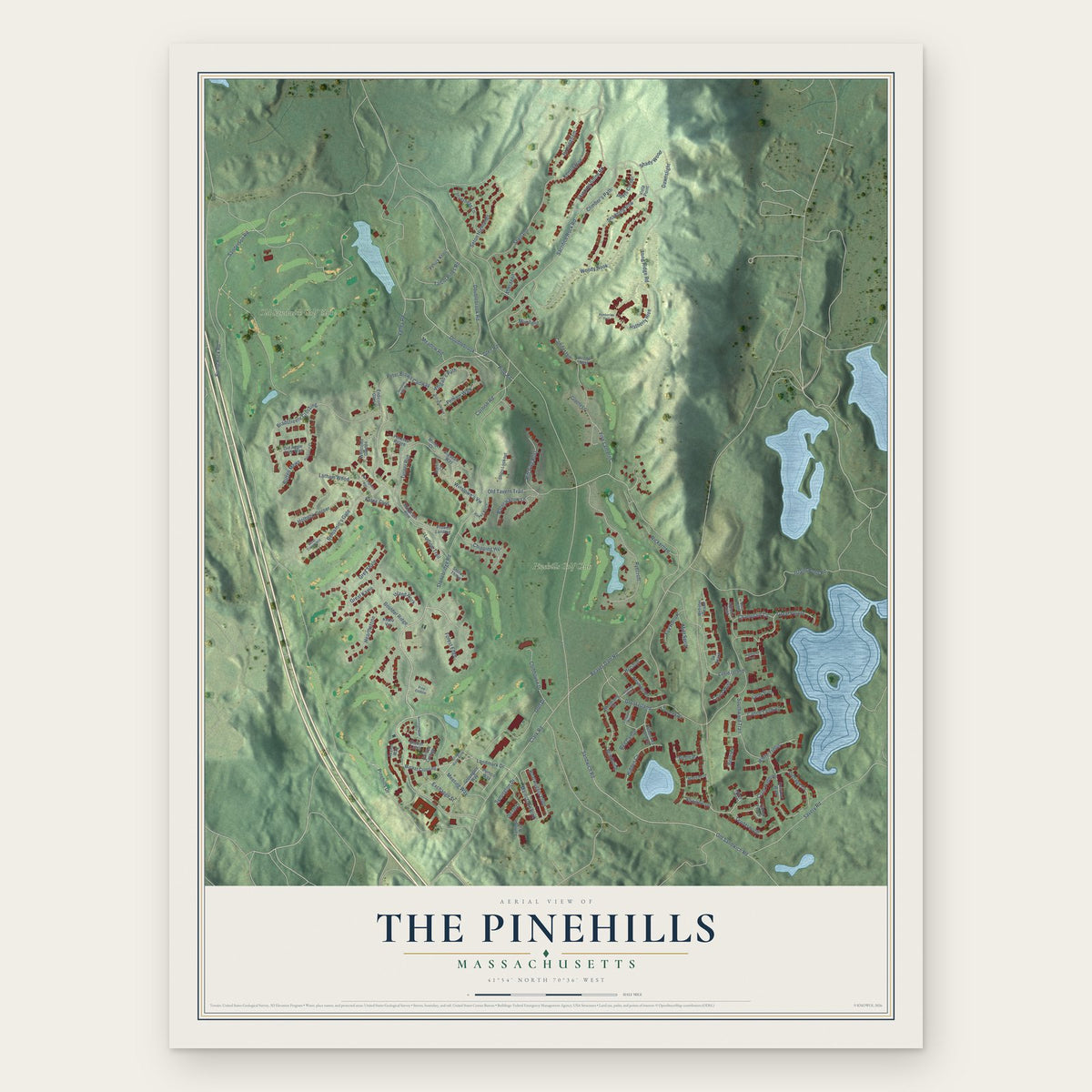
Building by building, with labeled streets and shaded relief.
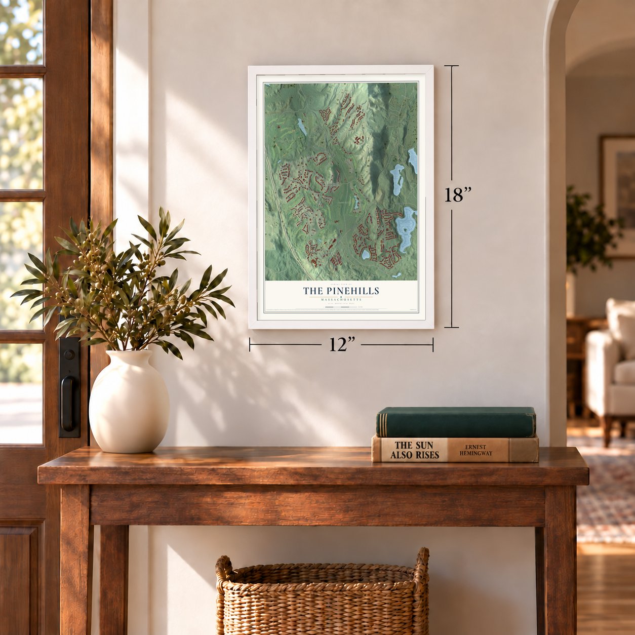
12" x 18" Archival Matte Print
A Map of Home. A Work of Art.
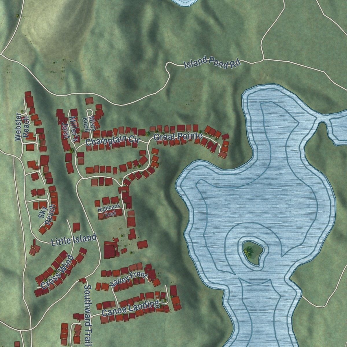
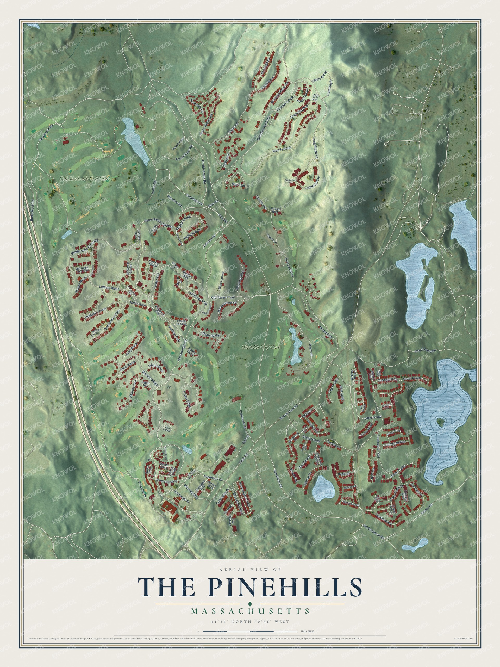
Explore The Pinehills, Massachusetts from a whole new perspective. Created using aerial imagery and detailed geographic data, this map captures The Pinehills building by building, with labeled streets, familiar landmarks, and shaded topographical relief that highlights the natural contours of the landscape.
Combining modern data with the timeless character of a vintage atlas, this map is just as interesting up close as it is beautiful on the wall. Whether you grew up in The Pinehills, spent memorable years there, or call it home today, this unique map is a great way to celebrate a place that means something to you. Zoom in on the preview to look for your street, and then order a print to put your memories on the wall.
Three ways to hang it
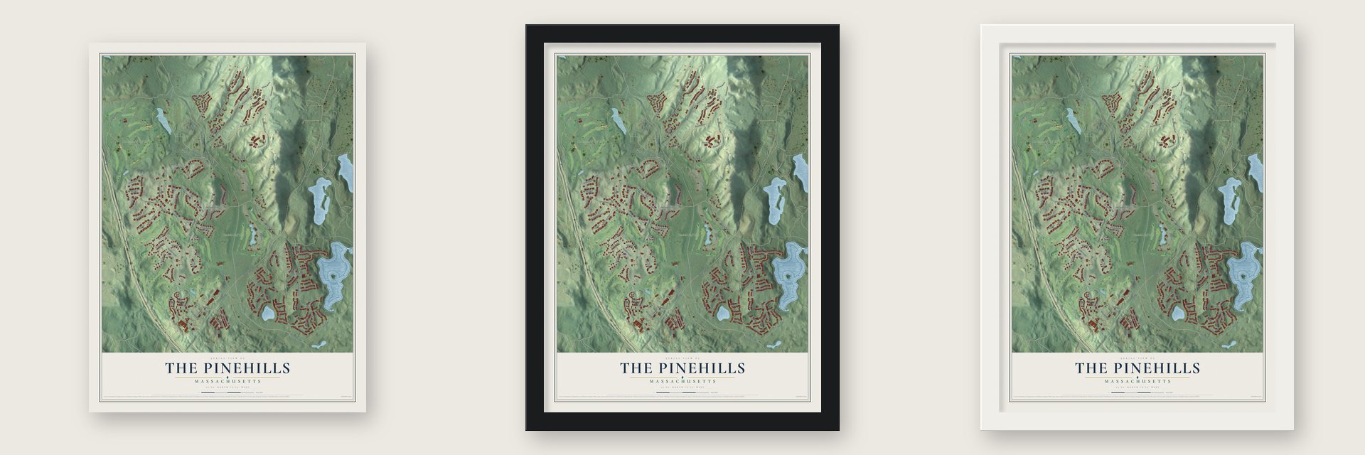
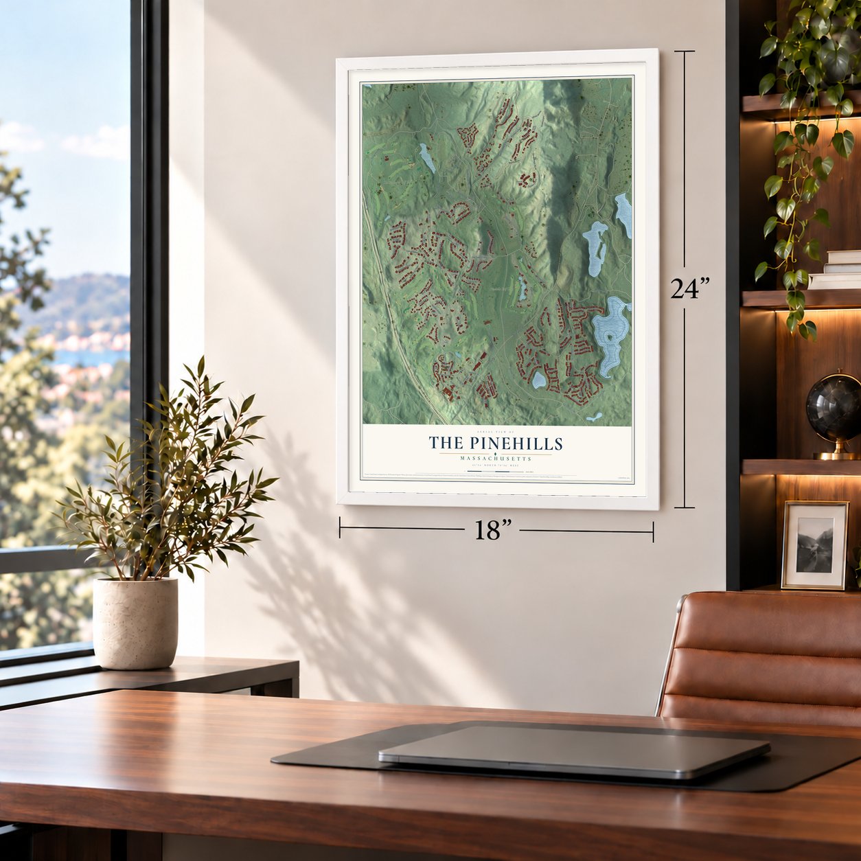
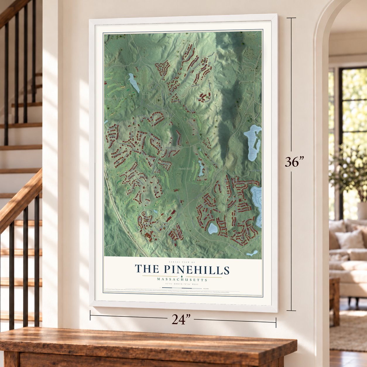
Unframed archival matte, a black wood frame or a white wood frame.
Up close
Geography Worth Displaying
This map was created using accurate cartographic data and authoritative geographic sources, including the U.S. Geological Survey and the Census Bureau. The map brings together terrain, waterways, roads, and building detail. The majority of the streets are labeled, houses are accurately depicted, and the topography is derived from government sources. Combining local data with carefully composed color and shading leads to this beautifully detailed The Pinehills artwork for your wall.
Rather than simply showing street outlines, we’ve included as many of the street names as we could reasonably fit on the map while keeping their names legible. Zoom in on the high resolution preview to see exactly what’s on the map. We truly set out to create a statement piece for anyone who loves The Pinehills. So whether it’s for you, or a gift for someone you love, we hope this map of The Pinehills brings back fond memories.
Read the story behind this map of The Pinehills, Massachusetts from 2026.

Find your street
Names on the The Pinehills map
Every name below is printed on this map. Look for your street, your school, the park where you played, or the pond down the road.
Places and landmarks2
- Old Sandwich Golf Club
- Pinehills Golf Club
Streets and roads139
- Stonebridge Road
- Meeting Way
- Forest Edge
- Pinehills Drive
- Clam Pudding
- Champlain Circle
- Old Tavern Trail
- Glen Road
- Sanderson Road
- Great Kame
- Mainstone Boulevard
- Sandwich Road
- Doublebrook
- Pine Road
- Landmark Drive
- Old Sandwich Road
- Long Ridge Road
- Winslowe's Vw
- Great Island
- Clark Road
- Doublebrook Road
- Sacrifice Rock Road
- Woody Nook
- Peter Brown Cartway
- Seton Highlands
- Island Pond Road
- Beaver Dam Road
- Bump Rock Road
- Bradstreete Crossing
- Savery Road
Show all 139 streets
- Ryecroft
- Little Island
- Holbeck Corner
- Hatherly Rise
- Benjamin's Gate
- Kensington
- Boatwrights Loop
- Golf Drive
- Conifer Hill
- Muirfield
- Snapping Bow
- Birmingham
- Skipping Stone Road
- Cottage Cv
- Latham Wood
- Barnswallow Lane
- Poets Corner
- Five Lanterns
- Southward Trail
- Clubhouse Drive
- Boulder Ridge
- Hearthstone
- White Trellis
- Shetland
- Abigall's Path
- Chipping Hill
- Belltree
- Valley Road
- Hitching Post
- Hidden Cv
- Talcot Pines Road
- Canoe Landing
- Meadow Road
- Tenderwood
- Pelham Walk
- Horizon
- Dawnslight
- Island Rock
- Cornish Road
- Great Pointe
- Inverness Lane
- Fox Hollow
- Kates Glen
- Cross Wind
- Redleaf
- Exchange Street
- Wickertree
- Windsong
- Grey Shale
- Aberdeen
- Mint Sprig
- Climber's Path
- Ludlow Trail
- Red Canoe
- Symington Drive
- Turner Run
- Butten Mews
- Shady Wood
- Webster Reach
- Shinglewood
- Market Crossing
- Portico Way
- Prower Landing
- Avalon Way
- Margeson Row
- Greengate Way
- Whitcomb Garden
- Picket Fence
- Woodsong Drive
- Jamison Way
- Crooked Walk
- Weathervane
- Rigsdale Way
- Martin Circle
- Ships Lookout
- Valley Front
- Endicott Glen
- Rebecca's Landing
- Sky Reach
- Old Apple Tree Trail
- Fletcher Reach
- Penick Knoll
- Saddleback
- Miller's Joist
- Painted Cottage
- Shutter Latch
- Stones Throw
- Cupola Lane
- Wrens Nest
- Dorset Lane
- Minter Court
- Kettle Vw
- Vista Point
- Pine Cobble
- Maplewood
- Trillium Rise
- Misty Knoll
- Hawks Perch
- West Trevor Hill
- Henloe Green
- Autumn Glen
- Highbank Trail
- Summerhouse Drive
- Old Langmore Way
- Dillingham Way
- Village Green North
- Looking Glass
- Pinchion Vale
- Pemberton Trail
Names are listed as they appear on the printed map. Zoom into the product photos to find them.
About The Pinehills, Massachusetts
The Pinehills is a community of 4,515 people in the Pine Hills region of Plymouth, in Plymouth County. For a long time nobody built on this land. The ground was dry and steep, and later two families, one after the other, held it as private property.
Digital Equipment Corporation bought the tract in the early 1980s, planning a corporate campus there. A new master plan and revised zoning then cleared the way for homes, and builders broke ground on The Pinehills in the spring of 1999. By 2008 no other new project of homes and businesses in New England was as big.
- Feasts at Clam Pudding PondClam Pudding Pond lies along the old road to Sandwich, seven miles south of Plymouth's center. Travelers heading to or from Cape Cod used to stop there to rest, and Plymouth's early settlers met at the pond every year for festivals of clam pudding. The historian James Thacher recorded the custom in his 1835 history of Plymouth.
- Built around open spaceThe plan puts 3,065 homes on just 30 percent of a 3,060 acre tract, so that more than 2,200 acres stay open. That tract is larger than many Massachusetts towns. Its homes are grouped into nearly 40 neighborhoods, with eleven builders working in styles from cottages to townhomes.
- Nicklaus, Rees Jones and Old SandwichPinehills Golf Club runs two public 18-hole courses that wind between the neighborhoods, the Nicklaus Course and the Rees Jones Course. Old Sandwich Golf Club, a private club, plays a course laid out by Bill Coore and Ben Crenshaw.
- The Village GreenThe community's commercial center holds a market, a post office, shops, offices and medical services, and a gas station opened there in the spring of 2012. It is also home to Mirbeau Inn & Spa, the second Mirbeau in the country after the first in New York's Finger Lakes, with pond gardens inspired by Monet.
Keep exploring Massachusetts
The Pinehills is one of 461 Massachusetts towns we've mapped. Every dot on the map is a print of its own.
The search covers every state, Massachusetts first.
Near The Pinehills
Order 2 or more town maps and save 10%. Shown in the size and finish you picked above, so they hang as a set.
- Plymouth 12" x 18" / Archival Matte Print $39.99
- Manomet 12" x 18" / Archival Matte Print $39.99
- North Plymouth 12" x 18" / Archival Matte Print $39.99


More maps nearby: White Island Shores, Carver, Sagamore, Bournedale and South Duxbury.
The art of mapping a place
How This Map Was Made
Real places. Remarkable detail. Discover the layers that turn geographic data into a map of home.

The view from above
Aerial imagery reveals the character of the land: woodland, open fields, and the patterns of a place.

The shape of the land
Elevation data brings hills, valleys, and subtle changes in the landscape into view.

The details of home
Roads, waterways, and building footprints come together to make the map feel unmistakably local.

Geography becomes art
Considered color, shading, and typography bring the layers together in a map made for your wall.


Process illustrated with Mendon, Massachusetts. Aerial imagery: USDA NAIP. Terrain: USGS 3D Elevation Program. Map details and finished artwork: KNOWOL.
The Details
About This Print
Choose an archival matte print, or a black or white Ayous wood frame. The archival matte print is unframed.
Select your size and finish above to see the matching product image and price.
Materials & Craftsmanship
A contemporary map with the character of a classic atlas, printed on archival matte paper. Optional frames are made from Ayous wood.
Your printed map does not include the watermark shown in the full-map preview.
Shipping & Delivery
Free shipping within the United States. Every print is made to order in the USA.
Buying a gift? Add a note in your cart and we'll include it. We never put prices in the package.
Prints ship within 2 to 3 business days. Allow 7 to 10 days total from ordering for delivery. Timing may vary during holidays or periods of high order volume.
Read our shipping policy.
Returns and damaged prints
Each print is made to order. Change-of-mind refunds are not available after production.
If your print arrives damaged, misprinted or incorrect, contact support@knowol.com within 30 days of receiving it. Include your order number, photos and a description of the issue.
Read our full refund and replacement policy. For questions about your order, email support@knowol.com.