
Search for another town





Free U.S. delivery 7 to 10 days after you order
Port Angeles, Washington Map Art
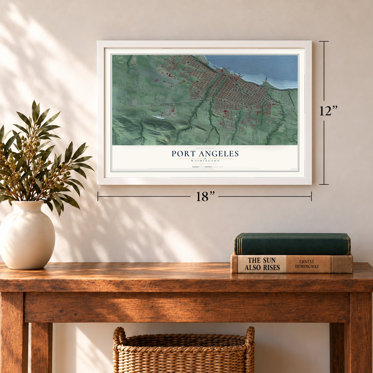
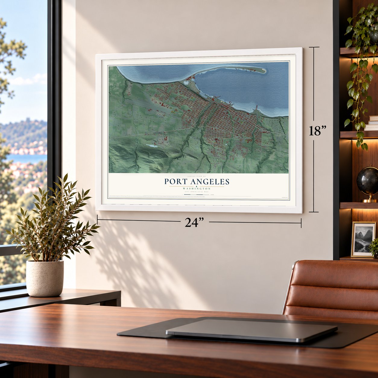
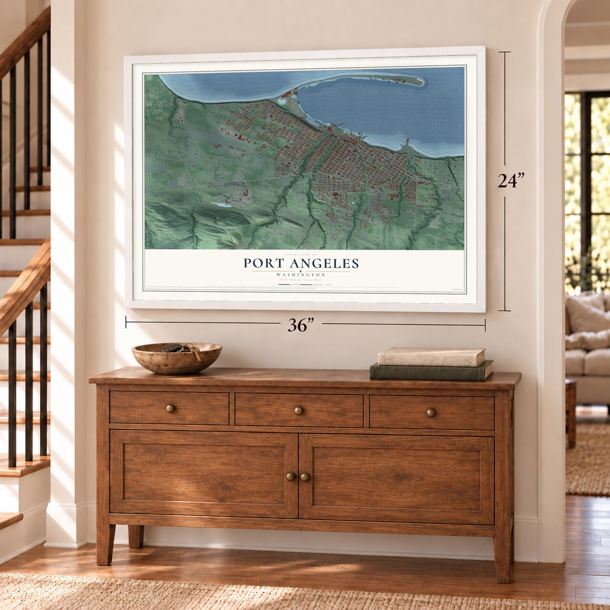
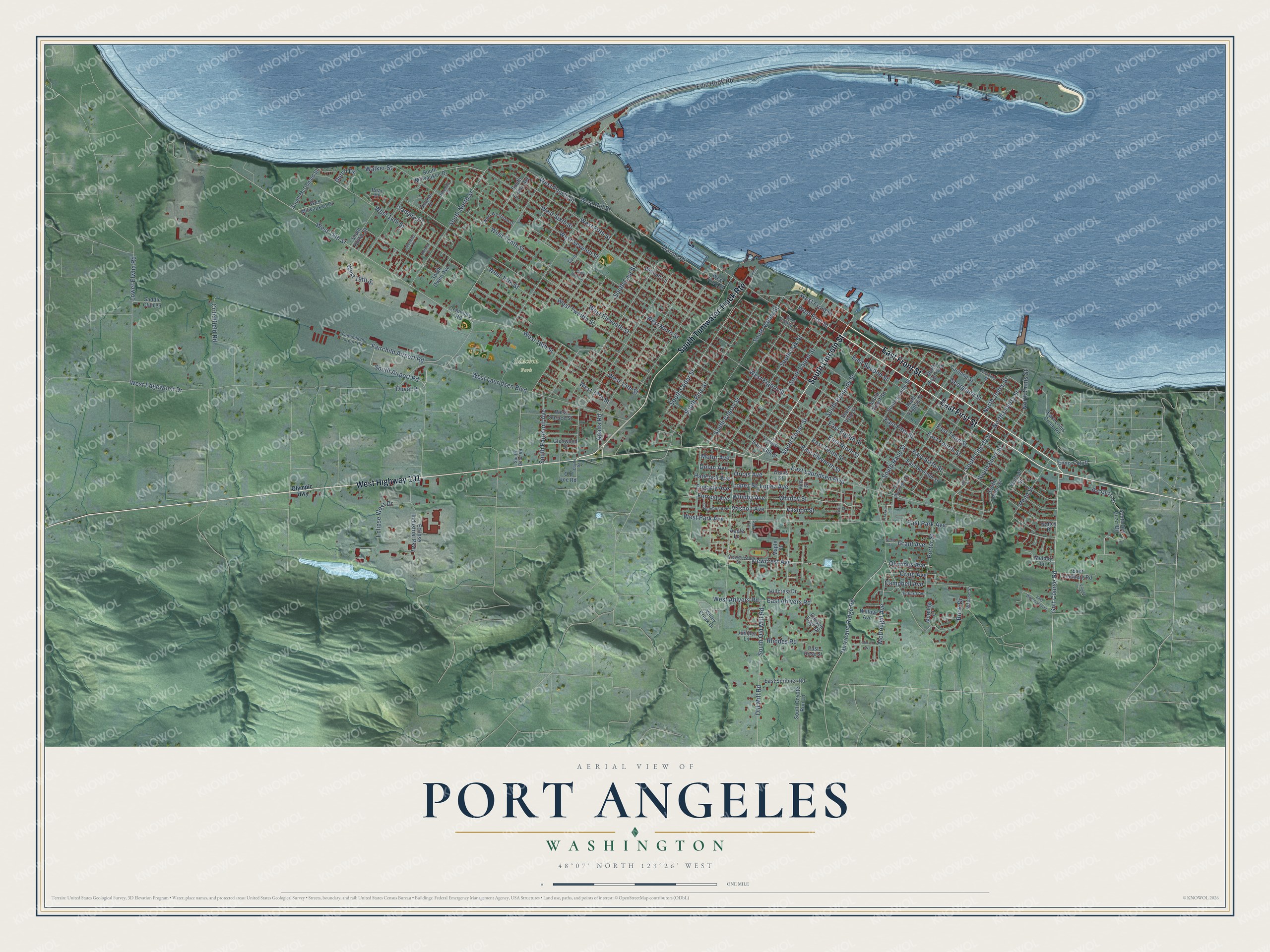
A new map of Port Angeles, Washington, made in 2026 and printed to order on thick archival matte paper.
12" x 18" Archival Matte Print
A Map of Home. A Work of Art.
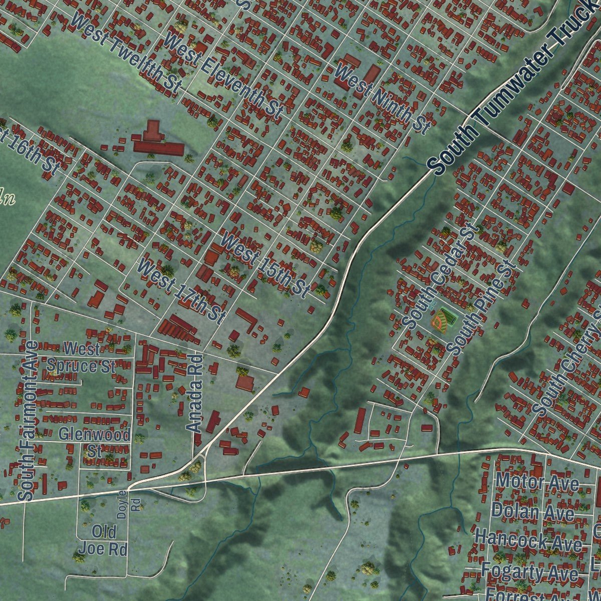
Explore Port Angeles, Washington from a whole new perspective. Created using aerial imagery and detailed geographic data, this map captures Port Angeles building by building, with labeled streets, familiar landmarks, and shaded topographical relief that highlights the natural contours of the landscape.
Combining modern data with the timeless character of a vintage atlas, this map is just as interesting up close as it is beautiful on the wall. Whether you grew up in Port Angeles, spent memorable years there, or call it home today, this unique map is a great way to celebrate a place that means something to you. Zoom in on the preview to look for your street, and then order a print to put your memories on the wall.
Three ways to hang it
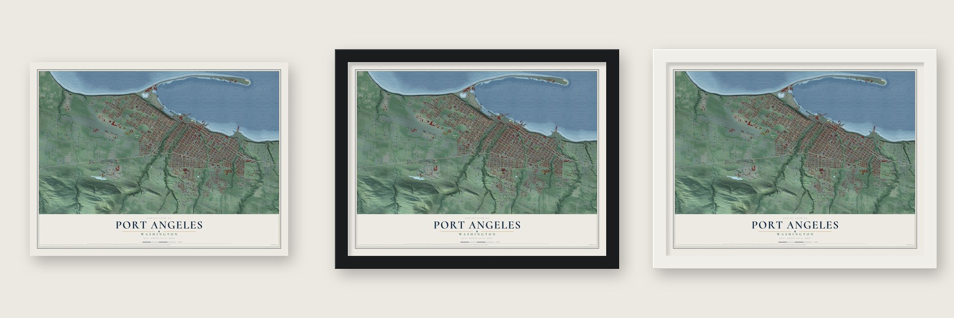
Unframed archival matte, a black wood frame or a white wood frame.
Up close
Geography Worth Displaying
This map was created using accurate cartographic data and authoritative geographic sources, including the U.S. Geological Survey and the Census Bureau. The map brings together terrain, waterways, roads, and building detail. The majority of the streets are labeled, houses are accurately depicted, and the topography is derived from government sources. Combining local data with carefully composed color and shading leads to this beautifully detailed Port Angeles artwork for your wall.
Rather than simply showing street outlines, we’ve included as many of the street names as we could reasonably fit on the map while keeping their names legible. Zoom in on the high resolution preview to see exactly what’s on the map. We truly set out to create a statement piece for anyone who loves Port Angeles. So whether it’s for you, or a gift for someone you love, we hope this map of Port Angeles brings back fond memories.
Read the story behind this map of Port Angeles, Washington from 2026.

About Port Angeles, Washington
Port Angeles is a city of 19,960 people and the county seat of Clallam County, on the Strait of Juan de Fuca. Two large Klallam villages, I'e'nis and Tse-whit-zen, stood on this harbor long before any outsiders came. In 1791 the Spanish explorer Francisco de Eliza sailed in and called it Puerto de Nuestra Señora de Los Angeles. A year later George Vancouver shortened the name to the one it carries now.
Victor Smith, the customs collector for Puget Sound, won a law in 1862 that moved the Port of Entry here from Port Townsend. Then Smith drowned when the Brother Jonathan sank on July 30, 1865, and in 1866 Port Townsend took the customs house back. The town stayed quiet until the mid 1880s, when the Puget Sound Co-operative Colony brought a wave of new settlers. By 1890 more than 3,000 people lived here, and voters incorporated the city that June. In November they won the county seat.
“largest prehistoric Indian village and burial ground found in the United States”
- The Second National CitySmith got President Abraham Lincoln to set aside 3,520 acres here as a federal reserve. Army engineers drew its streets on the model of Cincinnati, Smith's old home, and that plan still shapes the city. Washington, D.C., was the only other city the federal government had officially laid out, so in 1890 the U.S. Board of Trade called Port Angeles the Second National City.
- Jumping the Reserve in 1890Most of the federal reserve was still closed to settlers. In July 1890, a month after the city incorporated, squatters moved onto it together and each claimed two lots. They kept pressing Congress, and an 1891 law opened the reserve to homesteading.
- Lauridsen MoneyThe Panic of 1893 drove land and timber prices down, and the city's only bank failed in June 1893. Businessman Gregers M. Lauridsen filled the gap with money of his own. It was meant only for goods at his store, but people all over the Olympic Peninsula took it as if it were U.S. currency.
- Tse-whit-zen found in 2003In August 2003 crews began a $275 million graving dock on the waterfront for the Hood Canal Bridge replacement. Digging uncovered the old Klallam village of Tse-whit-zen, with about 300 graves and 785 pieces of human bone, some at least 8,000 years old. The project was abandoned in December 2004 to protect the site.
Find your street
Names on the Port Angeles map
Every name below is printed on this map. Look for your street, your school, the park where you played, or the pond down the road.
Places and landmarks1
- Lincoln Park
Streets and roads169
- East First Street
- East Front Street
- West Highway 101
- South Lincoln Street
- South Tumwater Truck Route
- Golf Course Road
- South Liberty Street
- South Airport Road
- North Liberty Street
- West Front Street
- West 18th Street
- Marine Drive
- South Peabody Street
- West First Street
- South Chase Street
- South Cedar Street
- North Jones Street
- South Race Street
- East Ninth Street
- West Tenth Street
- Ediz Hook Road
- West 14th Street
- West Eighth Street
- West Twelfth Street
- West Sixth Street
- West Fifth Street
- South Laurel Street
- West 16th Street
- East Fifth Street
- West Seventh Street
Show all 169 streets
- West Eleventh Street
- West 15th Street
- East Lauridsen Boulevard
- East Fourth Street
- East Sixth Street
- South Cherry Street
- West Lauridsen Boulevard
- East Second Street
- East Park Avenue
- South Oak Street
- West Ninth Street
- West 13th Street
- East Eighth Street
- East Third Street
- West Fourth Street
- South Pine Street
- South Valley Street
- West Edgewood Drive
- Georgiana Street
- South East Street
- South North Street
- East Tenth Street
- Lower Elwha Road
- Whidby Avenue
- Whidby Street
- Old Mill Road
- South Old Mill Road
- Hurricane Ridge Road
- East Eleventh Street
- Fairchild Airport Road
- Lopez Avenue
- Lopez Street
- Critchfield Road
- Campbell Avenue
- Viewcrest Avenue
- Vashon Avenue
- Vashon Street
- Eclipse West Drive
- West 17th Street
- South Ennis Street
- Orcas Avenue
- North Ennis Street
- McDougal Avenue
- Porter Street
- West 19th Street
- Penn Street
- South Fairmont Avenue
- Rook Drive
- West Ahlvers Road
- West Hill Street
- East Ahlvers Road
- Rhodes Road
- West Park Avenue
- Forrest Avenue
- Grant Avenue
- Olympus Avenue
- Craig Avenue
- Samara Drive
- Fogarty Avenue
- Hancock Avenue
- Anada Road
- Dolan Avenue
- Motor Avenue
- Walker Street
- Duval Place
- Dutch Drive
- Melody Lane
- Valley Creek Drive
- East 13th Street
- East Seventh Street
- South Vine Street
- South Francis Street
- South Eunice Street
- South Albert Street
- Del Guzzi Drive
- South Del Guzzi Drive
- South Milwaukee Drive
- Caroline Street
- West Third Street
- East Ennis Creek Road
- Eclipse Industrial Parkway
- Orcas Street
- West Milwaukee Drive
- South McDonald Street
- East Lindberg Road
- South Butler Street
- South Evans Avenue
- East Scribner Road
- Canyon Edge Drive
- South Coyote Run Lane
- South Alder Street
- West Spruce Street
- Maple Street
- Woolett Lane
- North Francis Street
- South Owen Avenue
- Ennis Cutoff
- Glenwood Street
- Old Joe Road
- Saddle Club Lane
- Hillcrest Drive
- Vine Street
- Willow Avenue
- Cemetary Road
- Juniper Lane
- Morning Court
- Dunker Drive
- Wolcott Street
- East Rose Street
- Pear Place
- Nancy Place
- Apple Lane
- Olympic Highway
- West Second Street
- Fairchild Int Airport Road
- Viewcrest Street
- Eckard Avenue
- Columbus Avenue
- West Westview Drive
- Wabash Street
- South Bean Road
- Gund Lane
- Park Lane
- Eunice Street
- Madeline Street
- South Washington Street
- East Twelfth Street
- Cedar Street
- Liberty Street
- Columbia Street
- East Woodhaven Lane
- Grant Street
- Village Place
- Church Avenue
- Doyle Road
- Pendley Court
- Franklin Lane
- Park View Lane
- Aurora Court
Names are listed as they appear on the printed map. Zoom into the product photos to find them.
The art of mapping a place
How This Map Was Made
Real places. Remarkable detail. Discover the layers that turn geographic data into a map of home.

The view from above
Aerial imagery reveals the character of the land: woodland, open fields, and the patterns of a place.

The shape of the land
Elevation data brings hills, valleys, and subtle changes in the landscape into view.

The details of home
Roads, waterways, and building footprints come together to make the map feel unmistakably local.

Geography becomes art
Considered color, shading, and typography bring the layers together in a map made for your wall.


Process illustrated with Mendon, Massachusetts. Aerial imagery: USDA NAIP. Terrain: USGS 3D Elevation Program. Map details and finished artwork: KNOWOL.
The Details
About This Print
Choose an archival matte print, or a black or white Ayous wood frame. The archival matte print is unframed.
Select your size and finish above to see the matching product image and price.
Materials & Craftsmanship
A contemporary map with the character of a classic atlas, printed on archival matte paper. Optional frames are made from Ayous wood.
Your printed map does not include the watermark shown in the full-map preview.
Shipping & Delivery
Free shipping within the United States. Every print is made to order in the USA.
Buying a gift? Add a note in your cart and we'll include it. We never put prices in the package.
Prints ship within 2 to 3 business days. Allow 7 to 10 days total from ordering for delivery. Timing may vary during holidays or periods of high order volume.
Read our shipping policy.
Returns and damaged prints
Each print is made to order. Change-of-mind refunds are not available after production.
If your print arrives damaged, misprinted or incorrect, contact support@knowol.com within 30 days of receiving it. Include your order number, photos and a description of the issue.
Read our full refund and replacement policy. For questions about your order, email support@knowol.com.
Find your town
Looking for another city?
Find a map of home in our Washington collection, or any town in the country.
Nearby
Maps of towns near Port Angeles
Know someone from one of these towns? Their map makes a great gift.
 Port Angeles East
, Washington
From $39.99See the map
 Carlsborg
, Washington
From $39.99See the map
 River Road
, Washington
From $39.99See the map
More maps nearby: Jamestown, Sequim, Bell Hill, Blyn and Port Townsend.