
Search for another town


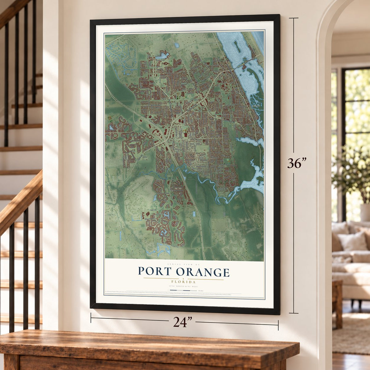
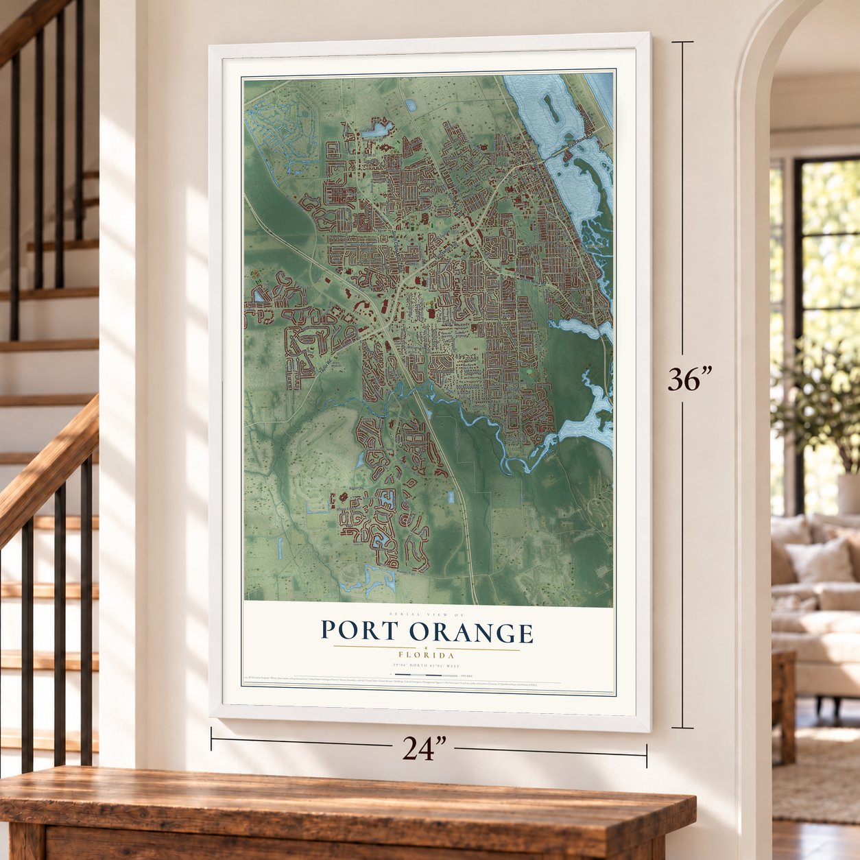
Free U.S. delivery 7 to 10 days after you order
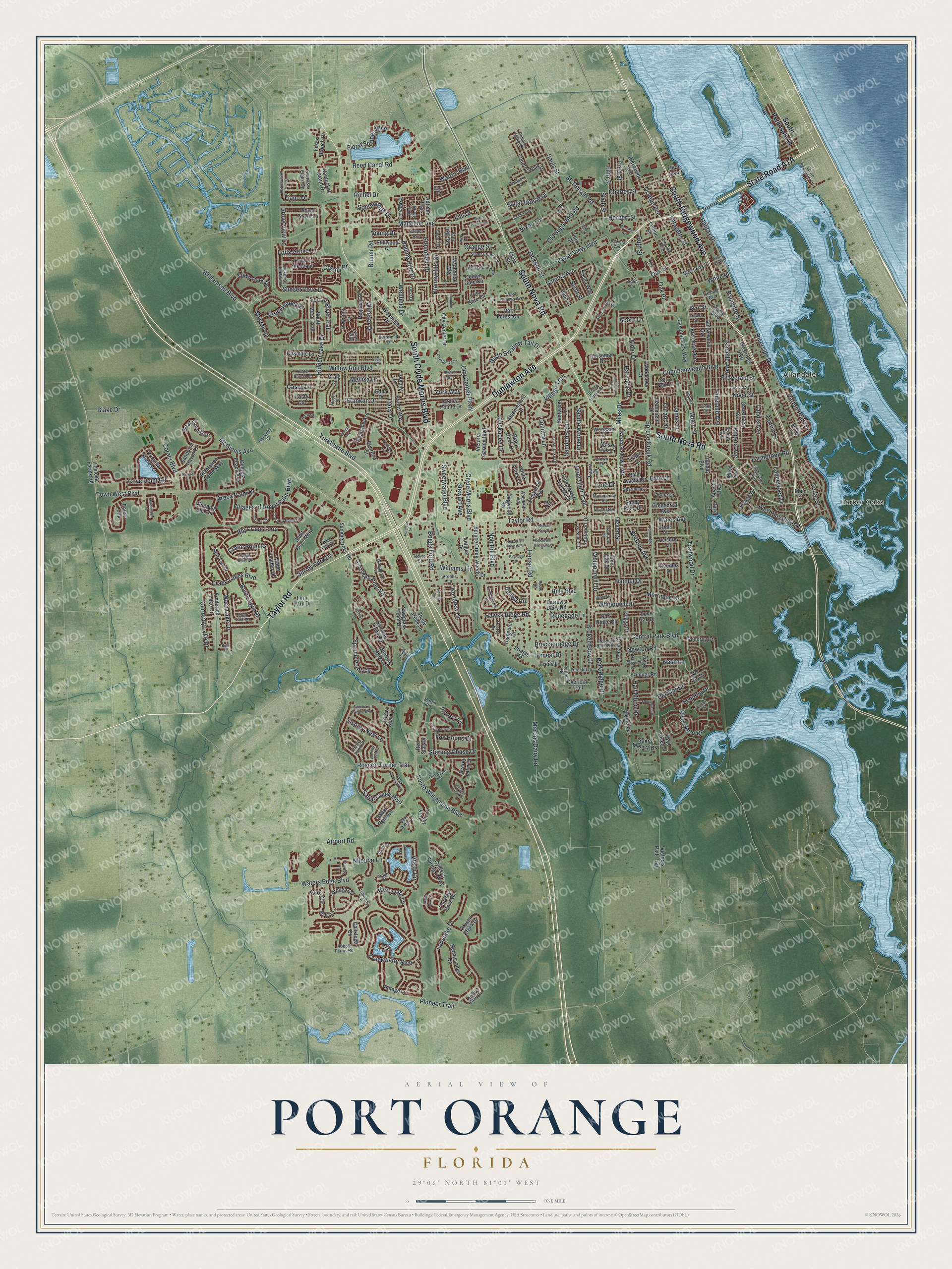
Port Orange, Florida Map Art
A new map of Port Orange, Florida, made in 2026 and printed to order on thick archival matte paper.
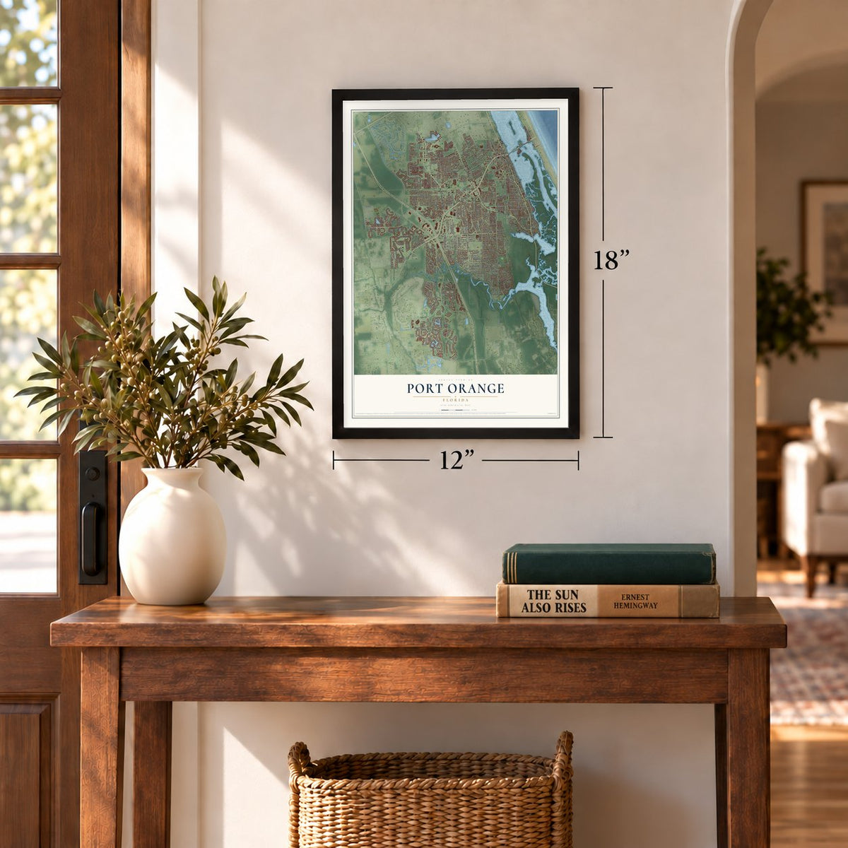
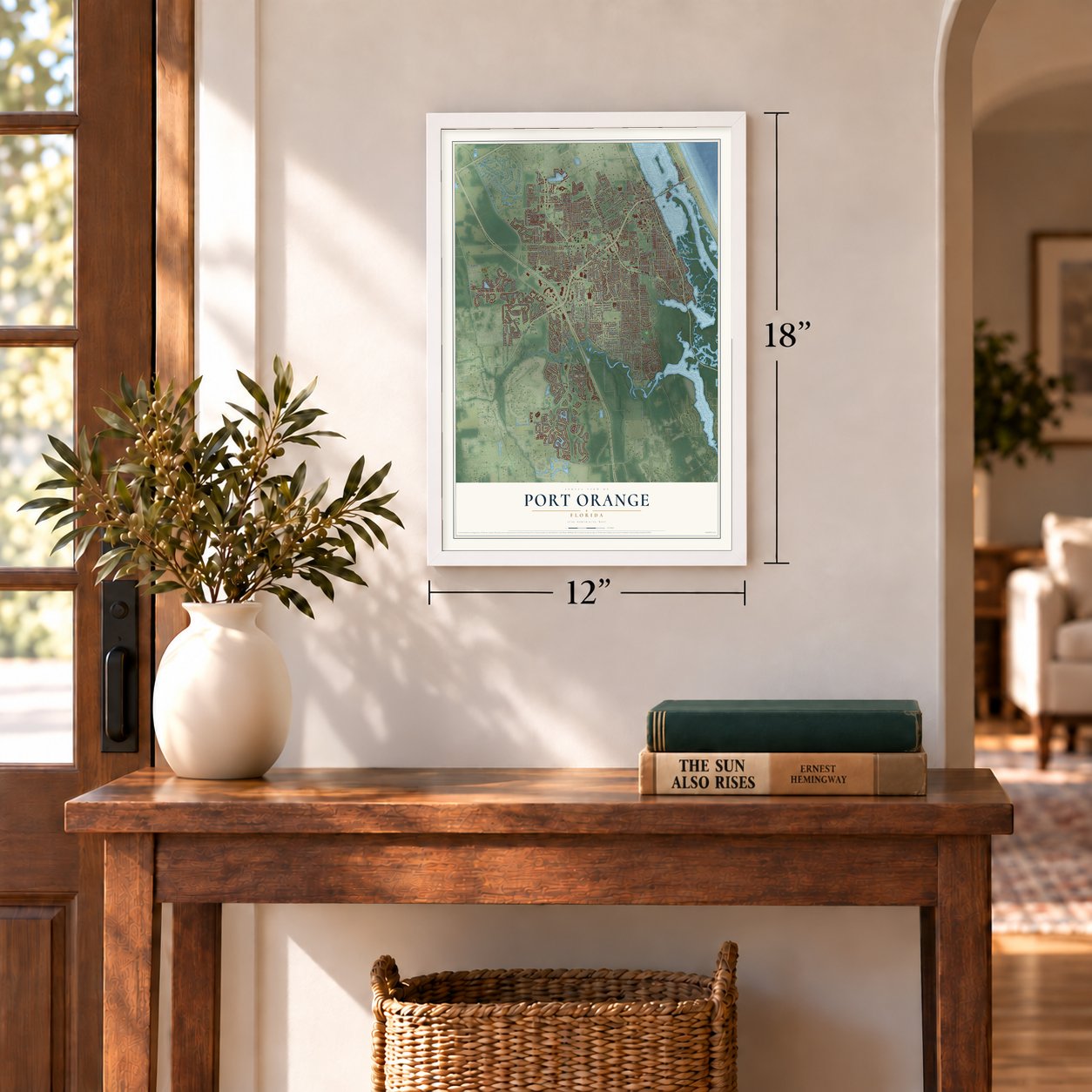
12" x 18" Archival Matte Print
A Map of Home. A Work of Art.
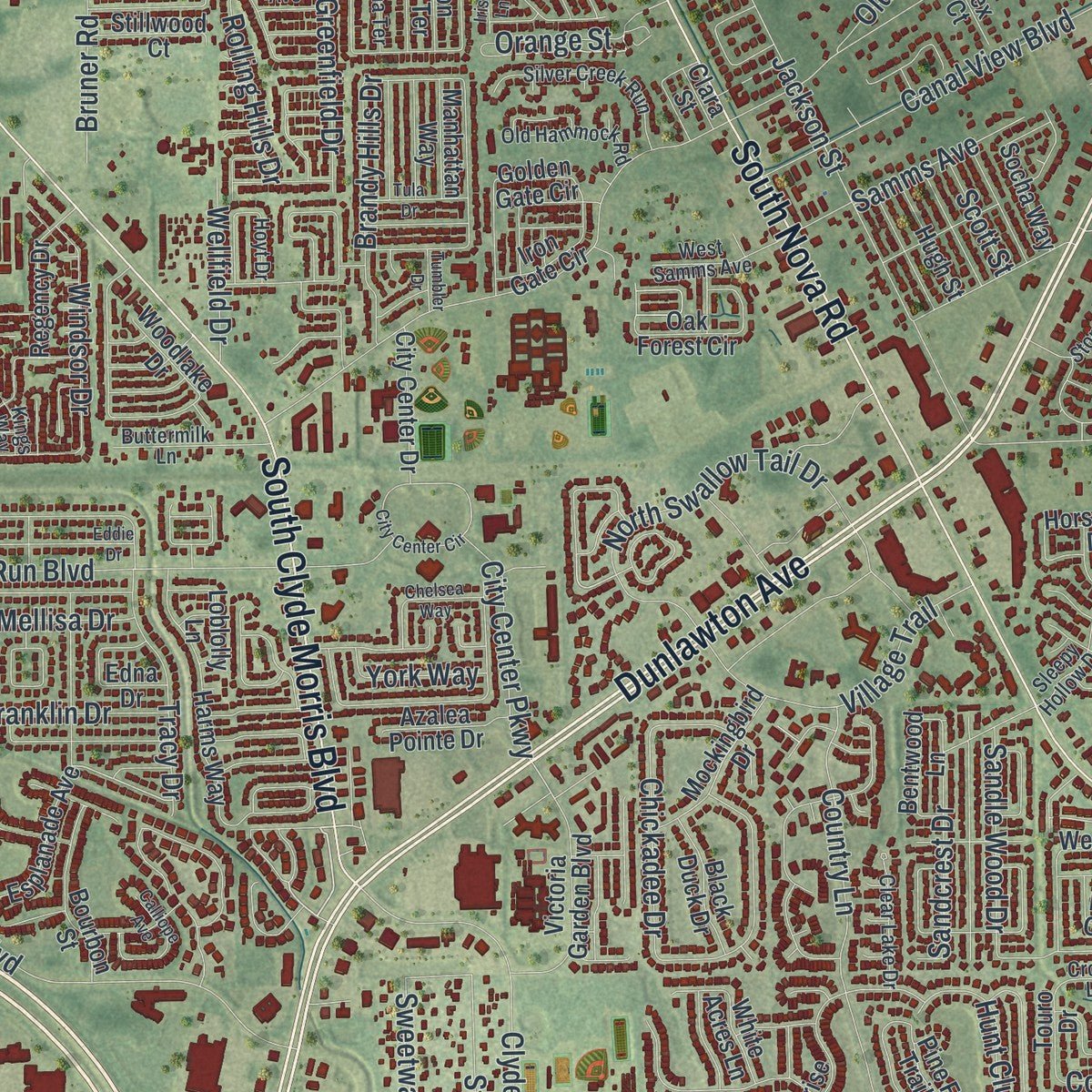
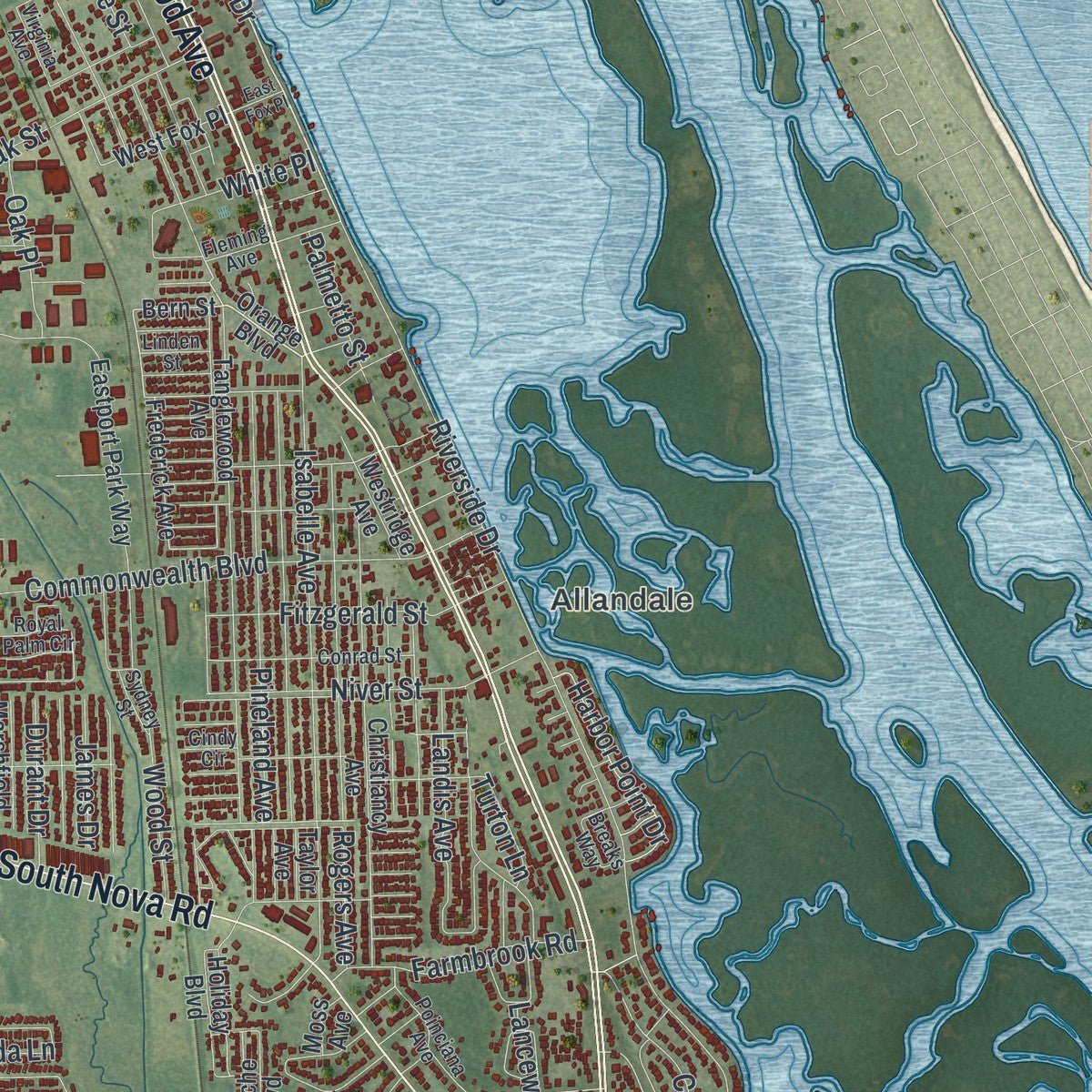
Explore Port Orange, Florida from a whole new perspective. Created using aerial imagery and detailed geographic data, this map captures Port Orange building by building, with labeled streets, familiar landmarks, and shaded topographical relief that highlights the natural contours of the landscape.
Combining modern data with the timeless character of a vintage atlas, this map is just as interesting up close as it is beautiful on the wall. Whether you grew up in Port Orange, spent memorable years there, or call it home today, this unique map is a great way to celebrate a place that means something to you. Zoom in on the preview to look for your street, and then order a print to put your memories on the wall.
Three ways to hang it
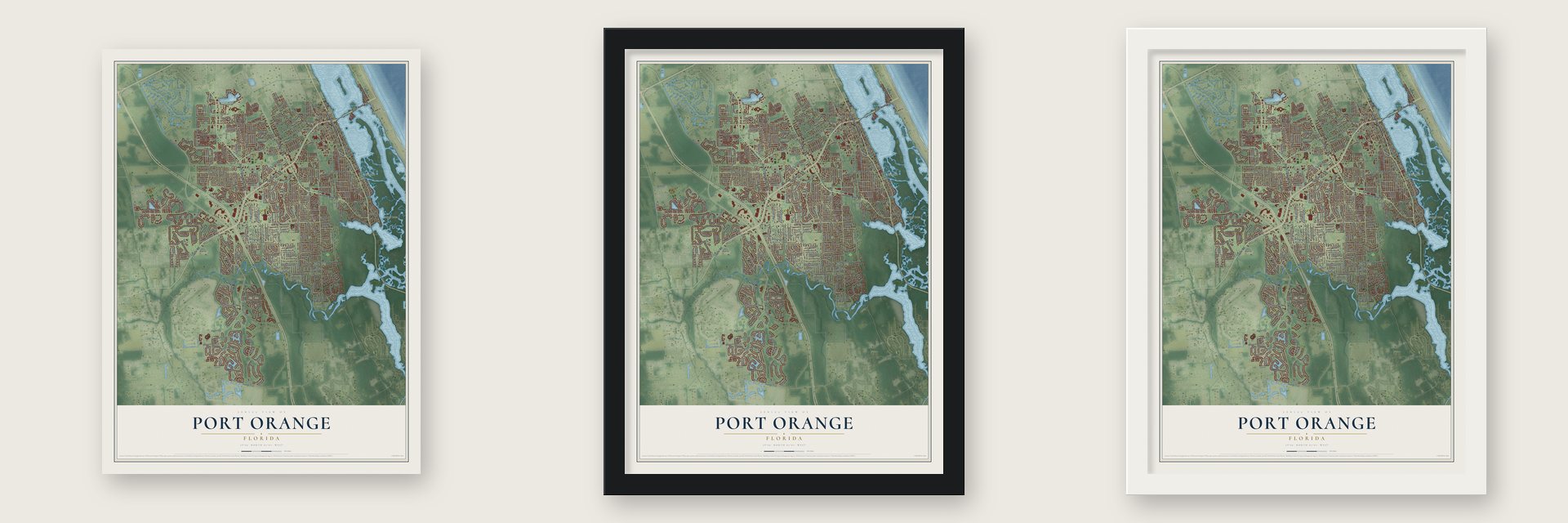
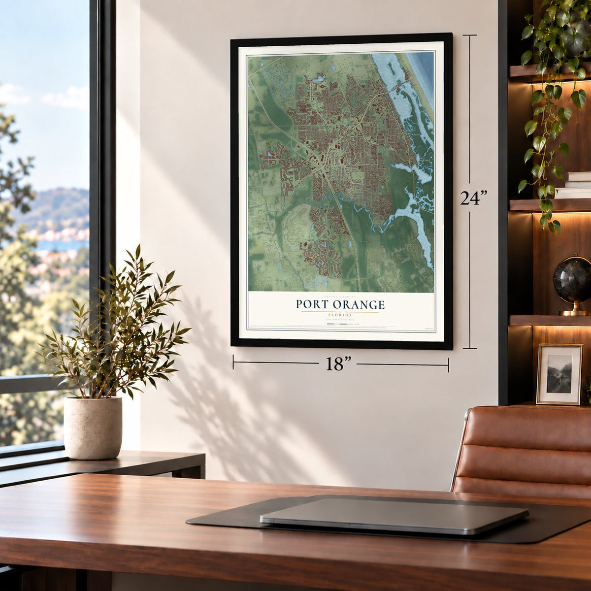
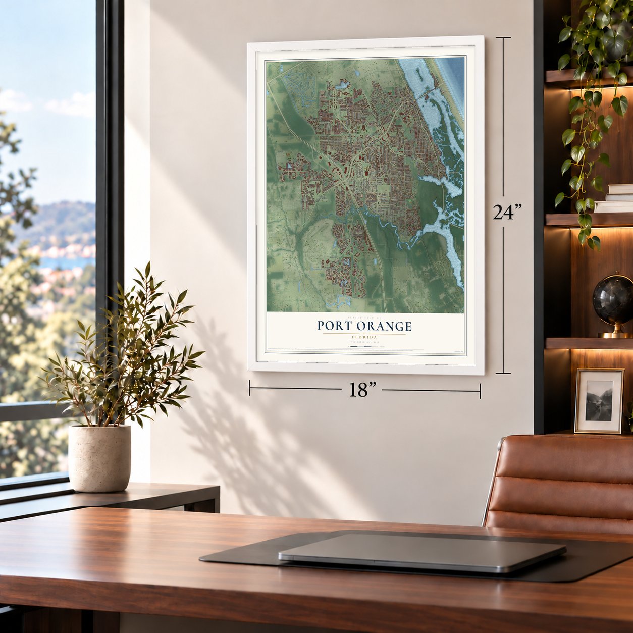
Unframed archival matte, a black wood frame or a white wood frame.
Up close
Geography Worth Displaying
This map was created using accurate cartographic data and authoritative geographic sources, including the U.S. Geological Survey (USGS) and FEMA. The map brings together terrain, waterways, roads, and building detail. The majority of the streets are labeled, houses are accurately depicted, and the topography is derived from government sources. Combining local data with carefully composed color and shading leads to this beautifully detailed Port Orange artwork for your wall.
Rather than simply showing street outlines, we’ve included as many of the street names as we could reasonably fit on the map while keeping their names legible. Zoom in on the high resolution preview to see exactly what’s on the map. We truly set out to create a statement piece for anyone who loves Port Orange. So whether it’s for you, or a gift for someone you love, we hope this map of Port Orange brings back fond memories.
Explore the full map of Port Orange, Florida and read about the local places it shows.
About Port Orange, Florida
Port Orange is a city of 62,596 people in Volusia County. After the Civil War, John Milton Hawks, a doctor and abolitionist from New Hampshire, led a colony of freed African Americans here. He had been a surgeon with the Union Army's Black regiments, and in 1865 he helped organize the Florida Land and Lumber Company. Through it the families got houses and jobs at his sawmill, and he named the settlement Port Orange.
Most of the homesteads lay above Spruce Creek, to the northwest of the inlet and close to Dunlawton. The sandy ground made farming hard, so the colony struggled and most of its settlers gave up and moved away. Some families stayed, and the neighborhood called Freemanville grew from them.
- A doctor who taught schoolEsther Hill Hawks, John's wife, earned her medical degree in 1857. In Port Orange she taught for the Freedmen's Aid Society, and her school may have been the first integrated one in Florida.
- The Tollivers' farmHenry Tolliver, a Black homesteader who did well here, held land with his wife, Hannah, in the northwest corner of Port Orange, the area where some of the former colonists lived. He made molasses and raised corn, cotton, peas, beans and sweet potatoes, while she sewed clothing and sold it.
- Trains on Dunlawton AvenueThe Florida East Coast Railway kept a passenger station and a freight station on Dunlawton Avenue until the two were combined in 1924. Regular passenger trains stopped calling in 1932, though a flag stop lasted until the long strike of 1963, and freight service ended in 1964. Trains still pass through the city without stopping.
- An airfield from World War IISpruce Creek Airport, a private community airport, was founded in 1974 on land that had been a naval airfield during World War II.
Find your street
Names on the Port Orange map
Every name below is printed on this map. Look for your street, your school, the park where you played, or the pond down the road.
Places and landmarks2
- Harbor Oaks
- Allandale
Streets and roads387
- Dunlawton Avenue
- Taylor Road
- South Ridgewood Avenue
- South Nova Road
- South Clyde Morris Boulevard
- Halifax Drive
- South Williamson Boulevard
- Colony Road
- Airport Road
- Orange Street
- Boggs Ford Road
- McDonald Road
- Fiano Drive
- Spruce Creek Road
- Martins Dairy Road
- Madeline Avenue
- Herbert Street
- Williamson Boulevard
- Riverside Drive
- Orange Avenue
- Pioneer Trail
- Jackson Street
- Central Park Boulevard
- Oak Street
- Hensel Road
- Crane Lakes Boulevard
- Hidden Lake Drive
- Creekwater Boulevard
- Town West Boulevard
- Willow Run Boulevard
Show all 387 streets
- Devon Street
- Chickadee Drive
- Brandy Hills Drive
- Isabelle Avenue
- Big Crane Loop
- Reed Canal Road
- Windsor Drive
- Riverwood Drive
- Country Lane
- Arash Circle
- Longlake Drive
- Lafayette Street
- Commonwealth Boulevard
- Areca Palm Drive
- Long Grove Lane
- Whiporwill Drive
- Whipporwill Drive
- Niver Street
- Pineland Avenue
- Rogers Avenue
- Yorktowne Boulevard
- Merryvale Lane
- Mayfair Lane
- Sunset Cove Drive
- Town Park Drive
- Clyde Morris Boulevard
- Miles Drive
- Tracy Drive
- Trailwood Drive
- North Swallow Tail Drive
- Crooked Pine Road
- Richel Drive
- Charles Street
- Broken Bow Lane
- Waters Edge Boulevard
- Canal View Boulevard
- Nash Lane
- Half Moon Drive
- Floral Springs Boulevard
- Promenade Circle
- West Bayshore Drive
- Village Trail
- Sandle Wood Drive
- Bear Corn Run
- Landis Avenue
- Villages of Royal Palm Boulevard
- Park Ridge Drive
- Hills Boulevard
- Crane Point Drive
- Southwinds Drive
- Del Mar Drive
- Nixon Lane
- Samms Avenue
- Wood Street
- Breckenridge Drive
- Newton Road
- Hawks Ridge Road
- Old Sugar Mill Road
- Merrimac Drive
- Sabal Creek Boulevard
- Hamlet Drive
- Kendrew Drive
- Cedar Street
- Sugar House Drive
- Spruce Point Circle
- Farmbrook Road
- Roscoe Turner Trail
- Wales Avenue
- Sterling Chase Drive
- Hunt Club Trail
- Sandcrest Drive
- Stewart Avenue
- Secret River Trail
- Sweetwater Boulevard
- Fifth Street
- City Center Parkway
- Ward Lake Drive
- Viking Drive
- Carmody Lake Drive
- Harbor Point Drive
- Greenfield Drive
- Fall Drive
- Victory Lane
- Lancewood Drive
- Coraci Boulevard
- Bald Eagle Drive
- Ferri Circle
- Nob Hill Boulevard
- Alder Drive
- Fitzgerald Street
- Cove Point Road
- Casey Lane
- Bruner Road
- Fox Hound Drive
- Franklin Drive
- Surrey Park Drive
- Rolling Hills Drive
- Barnacle Drive
- Grove View Lane
- Osprey Nest Lane
- Third Street
- Brittany Avenue
- Sauls Street
- Oak Place
- McGinnis Avenue
- Wellfield Drive
- White Place
- Palmetto Street
- Blake Drive
- Durant Drive
- Walton Boulevard
- Renegade Lane
- Sequoia Drive
- York Way
- Mellisa Drive
- Williams Lane
- James Drive
- Niloufar Lane
- Ruth Street
- Turton Lane
- Reillys Road
- Scott Street
- Ernest Drive
- Acorn Lane
- Sixth Street
- Elda Lane
- Cole Drive
- South Peninsula Drive
- Orange Boulevard
- Summertrees Road
- Summer Trees Road
- Bern Street
- Autumn Trail
- Frederick Avenue
- Foggy Lane
- Cypress Springs Parkway
- Estero Loop
- Taylor Avenue
- Tomoka Farms Road
- Smokerise Boulevard
- Christiancy Avenue
- Vintage Lane
- Eastport Park Way
- Harms Way
- Palm Castle Drive
- Woodlake Drive
- Plantation Home Way
- Spruce Creek Woods Drive
- Shady Creek Lane
- Leisure Circle
- Forough Circle
- Country Walk Drive
- Del Rio Drive
- Shoreline Drive
- Park Ridge Circle
- Sabal Point Circle
- Calistoga Circle
- Esplanade Avenue
- Leslie Drive
- Sawgrass Point Drive
- Crystal Creek Drive
- Forest Branch Drive
- Saint Regis Way
- Oak Forest Circle
- Victoria Garden Boulevard
- Golden Gate Circle
- Winding Ridge Lane
- North Greenway Drive
- Weeping Elm Circle
- Horseman Drive
- Renaissance Drive
- Renner Road
- Tanglewood Avenue
- Barrows Dairy Road
- Craig Court
- Rusty Circle
- Red Stag Drive
- Pelham Drive
- Crane Feather Drive
- Bourbon Street
- Highpoint Drive
- South Moon Trail
- Mockingbird Drive
- Apache Boulevard
- Pine Forest Trail West
- Coquina Shores Lane
- Socha Way
- Downing Drive
- Regency Drive
- Pendrey Drive
- Red Tail Drive
- Southport Drive
- City Center Drive
- Nantucket Island Drive
- Frederick Lake Drive
- White Acres Lane
- Royal Grove Lane
- Edna Drive
- Chamale Lane
- Black Duck Drive
- Oxbow Bend Lane
- Sandpine Haven Lane
- Bentwood Lane
- Westridge Avenue
- Georgia Peach Avenue
- Iron Gate Circle
- Fern Park Drive
- Overlook Trail
- Tropic Drive
- Azalea Pointe Drive
- Hugh Street
- Victorys Path Trail
- Dogwood Road
- West Fox Place
- Stillwood Court
- Loblolly Lane
- Holiday Boulevard
- Lone Oak Drive
- Main Street
- Wendam Court
- Golf Villa Drive
- Marshfield Drive
- Santa Monica Drive
- Manhattan Way
- Greenbriar Avenue
- Alexander Avenue
- Woodcove Drive
- Holly in the Wood
- Sunrise Oaks Drive
- Kon Tiki Terrace
- Acacia Drive
- Mossy Oak Lane
- Fairway Cove Drive
- Oak River Drive
- Pringle Road
- Needles Drive
- Bent Oak Drive
- Sandy Palm Drive
- Secret Lake Drive
- Touro Drive
- Peggy Drive
- Freda Lane
- Antigua Drive
- Lex Court
- Park Street
- Lemon Street
- Clara Street
- Moss Avenue
- Third Avenue
- Circle Drive
- Stonybrook Circle
- Oakwater Lane
- Poinciana Avenue
- Coconut Palm Circle
- Royal Palm Circle
- Raintree Drive
- Ferncliff Drive
- Tributory Lane
- Moonpenny Circle
- Touchstone Circle
- Sleepy Hollow Drive
- Eagle Claw Drive
- Fleming Avenue
- Silver Creek Run
- Conrad Street
- Woodpoint Terrace
- Powers Avenue
- Country Manor Drive
- Canna Court
- Swan Lake Drive
- Blue Sky Drive
- Heron Pond Drive
- Hickory in the Wood
- Sydney Street
- Clear Lake Drive
- Westport Drive
- Old Hammock Road
- Buttermilk Lane
- West Samms Avenue
- Kings Way
- Virginia Avenue
- Abbott Farms Road
- Woodcliff Road
- Nature View Circle
- Dalford Road
- Osprey Drive
- Sparton Avenue
- Gladys Street
- Breaks Way
- Hyde Park Drive
- Rutter Road
- Prospect Point Drive
- Aloha Terrace
- Hockney Court
- Martin Road
- Hudson Lane
- Casper Avenue
- Brooks Lane
- Alcorn Road
- Mofid Lane
- Paria Court
- Pham Drive
- Boyte Street
- Oxford Drive
- Linden Street
- Hoyt Drive
- Biro Drive
- Crown Lane
- Chris Drive
- Aruna Drive
- Cindy Circle
- Mori Court
- Armin Court
- Selin Circle
- Anita Street
- Peterson Lane
- Birch Mountain Road
- Sanctuary Garden Boulevard
- Tumblebrook Drive
- Tarry Town Trail
- Wingate Trail
- City Center Circle
- Sabal Hammock Circle
- Deer Springs Road
- Jasmine Vine Drive
- Cambridge Drive
- Dexter Drive North
- Bayridge Lane
- Banbury Drive
- Siesta Key Circle
- Caramel Avenue
- Eddie Drive
- Tara Marie Lane
- Moon Rise Drive
- Calliope Avenue
- Chelsea Way
- Tortoise Creek Lane
- Upland Drive
- Dorsiere Avenue
- Hensel Hill Drive West
- Hensel Hill Drive East
- Tula Drive
- Pheasant Run Court
- Ranier Circle
- Saint Thomas Court
- Tarleton Lane
- Hutchinson Street
- Dairy Court
- Amici Court
- Hickory Lane
- Adrianne Court
- Irish Lane
- Eddy Lane
- Tumbler Drive
- East Fox Place
- Rocko Road
- Beth Court
Names are listed as they appear on the printed map. Zoom into the product photos to find them.
The art of mapping a place
How This Map Was Made
Real places. Remarkable detail. Discover the layers that turn geographic data into a map of home.

The view from above
Aerial imagery reveals the character of the land: woodland, open fields, and the patterns of a place.

The shape of the land
Elevation data brings hills, valleys, and subtle changes in the landscape into view.

The details of home
Roads, waterways, and building footprints come together to make the map feel unmistakably local.

Geography becomes art
Considered color, shading, and typography bring the layers together in a map made for your wall.


Process illustrated with Mendon, Massachusetts. Aerial imagery: USDA NAIP. Terrain: USGS 3D Elevation Program. Map details and finished artwork: KNOWOL.
The Details
About This Print
Choose an archival matte print, or a black or white Ayous wood frame. The archival matte print is unframed.
Select your size and finish above to see the matching product image and price.
Materials & Craftsmanship
A contemporary map with the character of a classic atlas, printed on archival matte paper. Optional frames are made from Ayous wood.
Your printed map does not include the watermark shown in the full-map preview.
Shipping & Delivery
Free shipping within the United States. Every print is made to order in the USA.
Buying a gift? Add a note in your cart and we'll include it. We never put prices in the package.
Prints ship within 2 to 3 business days. Allow 7 to 10 days total from ordering for delivery. Timing may vary during holidays or periods of high order volume.
Read our shipping policy.
Returns and damaged prints
Each print is made to order. Change-of-mind refunds are not available after production.
If your print arrives damaged, misprinted or incorrect, contact support@knowol.com within 30 days of receiving it. Include your order number, photos and a description of the issue.
Read our full refund and replacement policy. For questions about your order, email support@knowol.com.
Find your town
Looking for another city?
Find a map of home in our Florida collection, or any town in the country.
Nearby
Maps of towns near Port Orange
Know someone from one of these towns? Their map makes a great gift.
 South Daytona
, Florida
From $39.99See the map
 Daytona Beach Shores
, Florida
From $39.99See the map
 Ponce Inlet
, Florida
From $39.99See the map
More maps nearby: Samsula-Spruce Creek, New Smyrna Beach, Glencoe, Daytona Beach and Holly Hill.