
Search for another town





Free U.S. delivery 7 to 10 days after you order
South Daytona, Florida Map Art
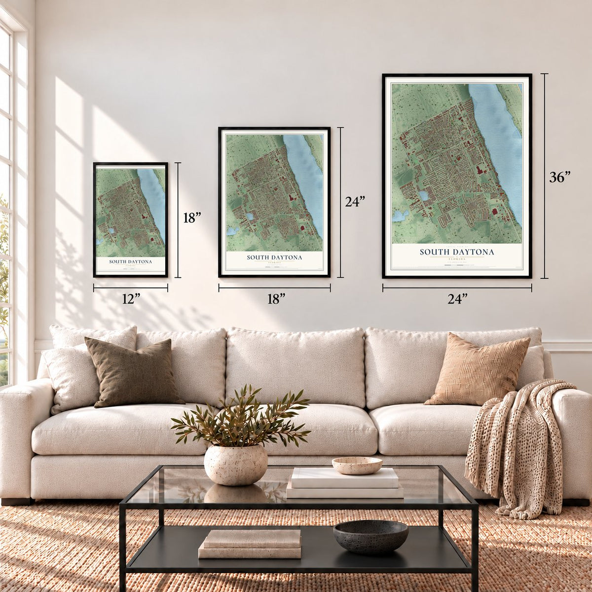
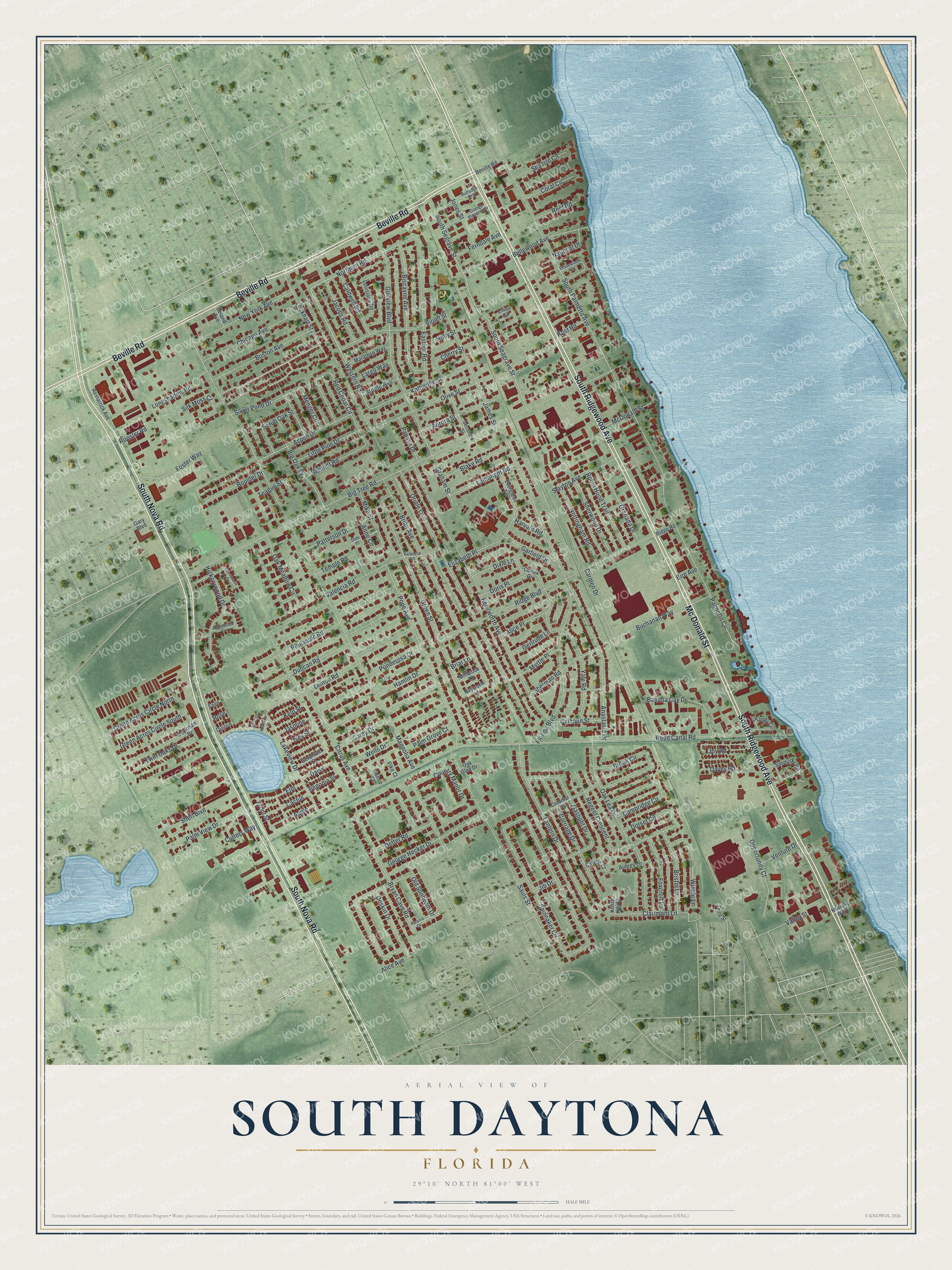
A new map of South Daytona, Florida, made in 2026 and printed to order on thick archival matte paper.
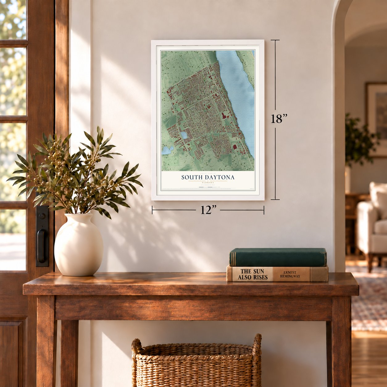
12" x 18" Archival Matte Print
A Map of Home. A Work of Art.
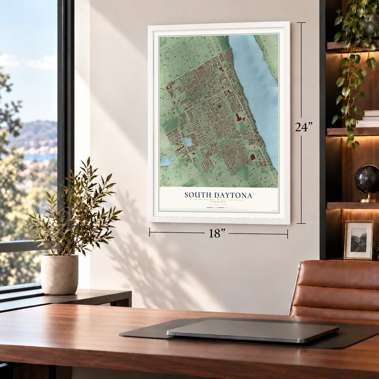
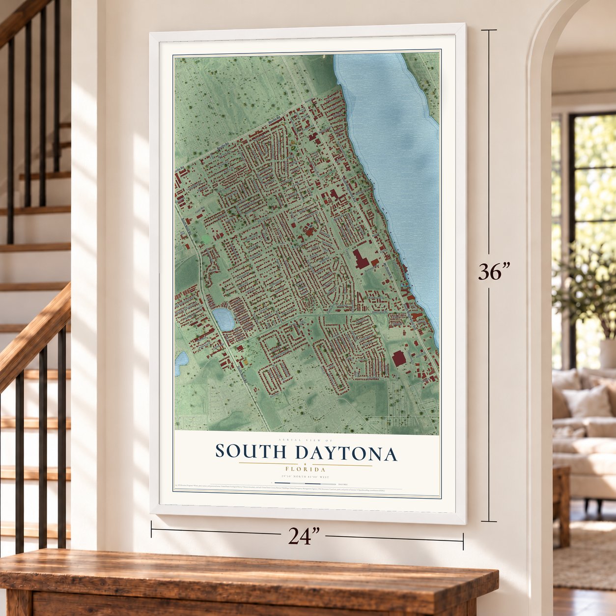
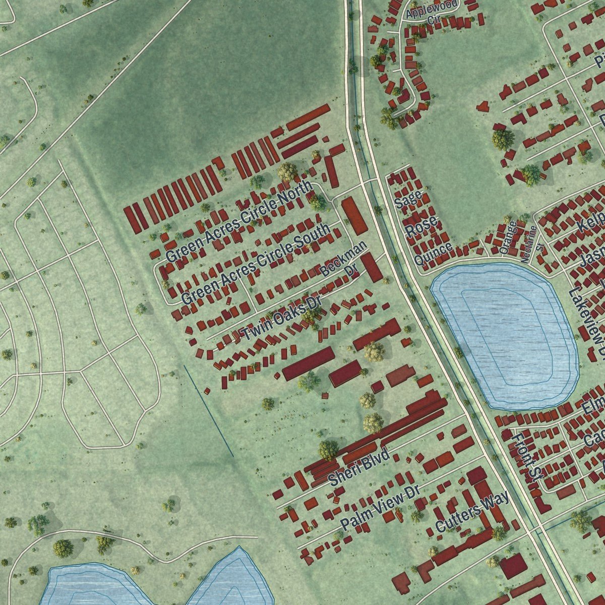
Explore South Daytona, Florida from a whole new perspective. Created using aerial imagery and detailed geographic data, this map captures South Daytona building by building, with labeled streets, familiar landmarks, and shaded topographical relief that highlights the natural contours of the landscape.
Combining modern data with the timeless character of a vintage atlas, this map is just as interesting up close as it is beautiful on the wall. Whether you grew up in South Daytona, spent memorable years there, or call it home today, this unique map is a great way to celebrate a place that means something to you. Zoom in on the preview to look for your street, and then order a print to put your memories on the wall.
Three ways to hang it
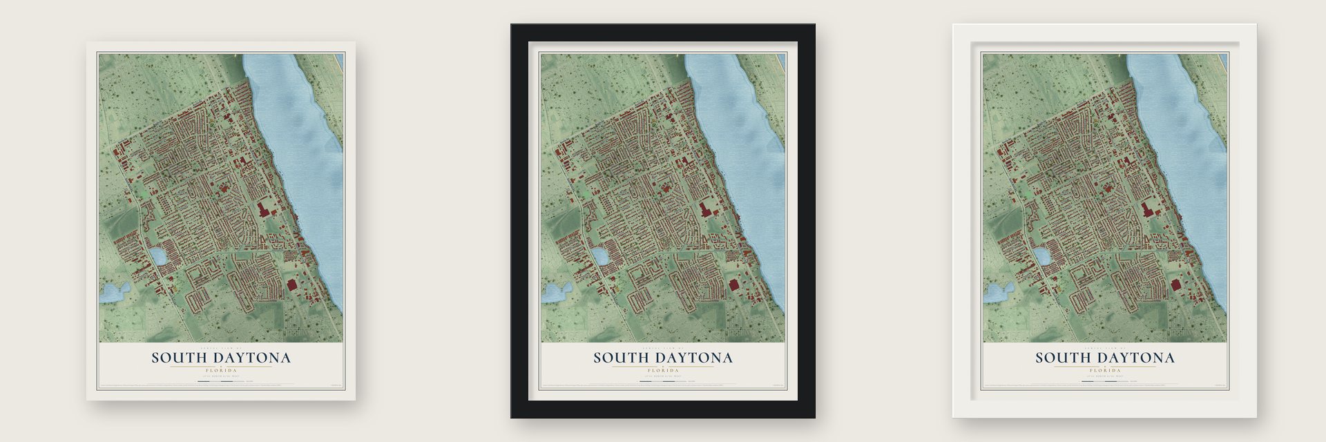
Unframed archival matte, a black wood frame or a white wood frame.
Up close
Geography Worth Displaying
This map was created using accurate cartographic data and authoritative geographic sources, including the U.S. Geological Survey (USGS) and FEMA. The map brings together terrain, waterways, roads, and building detail. The majority of the streets are labeled, houses are accurately depicted, and the topography is derived from government sources. Combining local data with carefully composed color and shading leads to this beautifully detailed South Daytona artwork for your wall.
Rather than simply showing street outlines, we’ve included as many of the street names as we could reasonably fit on the map while keeping their names legible. Zoom in on the high resolution preview to see exactly what’s on the map. We truly set out to create a statement piece for anyone who loves South Daytona. So whether it’s for you, or a gift for someone you love, we hope this map of South Daytona brings back fond memories.
Explore the full map of South Daytona, Florida and read about the local places it shows.

About South Daytona, Florida
South Daytona is a city of 12,865 people in Volusia County, on the Halifax River with Daytona Beach to its north. It began as Blake, a settlement named for Alpheus P. Blake, a wealthy businessman from Boston. About forty families lived there, and roughly as many owners held land without living on it. Many of the early settlers made money raising oranges and vegetables.
In 1926 Daytona, Daytona Beach and Seabreeze joined to form one city, Daytona Beach, which then annexed the land around it, Blake included. The annexation brought new taxes and appraisals, so Blake's residents hired an attorney to fight it. Around 1938 they won their separation and became the incorporated town of South Daytona, and the town became a city in 1951.
- Mail and railsBlake's first post office opened for business on August 19, 1878, according to the National Archives. Trains reached Daytona around 1886, and a decade later the line ran on to Miami. Not long after that, a railroad station went up at Big Tree Crossing.
- Building up after the warSoon after World War II, the town formed a Building Department and then a Planning and Zoning Board. Builders and developers took notice, and South Daytona grew enough to ask the federal government for help expanding its utilities and streets. Only Daytona Beach put in a sanitary sewer system in the Halifax area before South Daytona did.
- A city manager since 1980South Daytona has been governed by a city manager and council since 1980. Starting in 1990, the mayor and four council members have served four-year terms that are staggered so they don't all end at once.
Find your street
Names on the South Daytona map
Every name below is printed on this map. Look for your street, your school, the park where you played, or the pond down the road.
Streets and roads184
- South Ridgewood Avenue
- South Nova Road
- Beville Road
- Mc Donald Street
- Violet Street
- Magnolia Avenue
- Western Road
- Northern Road
- Jasmine
- Reed Canal Road
- South Palmetto Avenue
- Big Tree Road
- Spinnaker Circle
- Anastasia Drive
- Kenilworth Avenue
- Oriole Lane
- Ridge Boulevard
- Sauls Street
- Golfview Boulevard
- South Seagrave Street
- South Segrave Street
- Carmen Drive
- Brian Avenue
- Pope Avenue
- Green Street
- Bryan Cave Road
- Lakeview Drive
- Country Manor Drive
- Old Sunbeam Drive
- Citrus Avenue
Show all 184 streets
- Lantern Drive
- Oak Lea Drive
- Olive Street
- Lemon Road
- Aspen Drive
- Florida Boulevard
- Pineapple Road
- Duncan Road
- Oak Meadow Circle
- Eastern Road
- Valencia Road
- Bellewood Avenue
- Biscayne Avenue
- Gaslight Drive
- Brook Circle
- Carriage Drive
- James Street
- Katherine Street
- Ponderosa Drive
- Hickorywood Drive
- Hamlin Drive
- Cambridge Circle
- Carey Drive
- Wells Drive
- Regent Crescent
- George Hecker Drive
- Elizabeth Place
- Chicago Avenue
- Boston Avenue
- New York Avenue
- Dorset Circle
- Menger Circle
- Red Cedar Circle
- Davey Road
- Clairmont Lane
- Joy Road
- Bennett Road
- Opportunity Court
- Yale Road
- Banana Cay Drive
- Granada Drive
- Jacobs Road
- Nottingham Road
- Sheri Boulevard
- Palm View Drive
- Sherwood Drive
- Robin Hood Trail
- Bristol Lane
- Jones Street
- Twin Oaks Drive
- Aurora Street
- Windle Lane
- Green Acres Circle South
- Sherman Road
- Green Acres Circle North
- Buchanan Way
- Foster Way
- Foxcroft Lane
- Lambright Road
- Slayton Avenue
- Blake Road
- Boulder Drive
- Deskin Drive
- Big Oak Drive
- Little Pine Drive
- Longshadow Road
- Silk Moss Court
- Caldwell Road
- Garfield Drive
- Oetter Road
- Scrub Oak Street
- Lockhart Street
- Myrtle Place
- Dixie Lane
- Palmetto Circle
- Silver Pond Drive
- Sea Isle Circle
- Gertrude Lane
- Mike Street
- McDonald Street
- Patterson Drive
- Ferndale Avenue
- Palm Grove Court
- Coral Circle
- Elm
- Graham Street
- Apple
- Calhoun Street
- Doris Place
- Alice Place
- Valley Street
- Papaya Drive
- Cactus
- Cherry Street
- Anne Circle
- Kelp Street
- Venture Drive
- Alice Avenue
- Reef Road
- Nautical Drive
- Teague Street
- Temple Road
- Largo Way
- Daisy
- Begonia Street
- Ivey Street
- Steele Avenue
- Rooster Road
- Holly Street
- Harvard Road
- Cutters Way
- Kost Road
- Briar Lane
- Jib Drive
- Front Street
- Eire Avenue
- Rose
- Sandusky Road
- Colfax Drive
- Restarrick Avenue
- Second Street
- Beckman Drive
- Louisiana Road
- Linda Circle
- Sandy Circle
- Colonial Drive
- Marathon Way
- Geranium Street
- Evergreen Terrace
- Baywood Lane
- Millbrook Lane
- Oak Glen Drive
- Candle Court
- Aubrey Lane
- Ridge Road
- Deland Avenue
- Gary Boulevard
- Kristy Kay Court
- Third Street
- Pike Court
- Bishop Court
- Murray Way
- Quince
- Sage
- Valencia Lane
- Tradewinds Circle
- Orange Blossom Drive
- Rutledge Avenue
- Applewood Circle
- Pizarro Drive
- Debi Place
- Orange
- Cherrywood Court
- Nectarine Street
Names are listed as they appear on the printed map. Zoom into the product photos to find them.
The art of mapping a place
How This Map Was Made
Real places. Remarkable detail. Discover the layers that turn geographic data into a map of home.

The view from above
Aerial imagery reveals the character of the land: woodland, open fields, and the patterns of a place.

The shape of the land
Elevation data brings hills, valleys, and subtle changes in the landscape into view.

The details of home
Roads, waterways, and building footprints come together to make the map feel unmistakably local.

Geography becomes art
Considered color, shading, and typography bring the layers together in a map made for your wall.


Process illustrated with Mendon, Massachusetts. Aerial imagery: USDA NAIP. Terrain: USGS 3D Elevation Program. Map details and finished artwork: KNOWOL.
The Details
About This Print
Choose an archival matte print, or a black or white Ayous wood frame. The archival matte print is unframed.
Select your size and finish above to see the matching product image and price.
Materials & Craftsmanship
A contemporary map with the character of a classic atlas, printed on archival matte paper. Optional frames are made from Ayous wood.
Your printed map does not include the watermark shown in the full-map preview.
Shipping & Delivery
Free shipping within the United States. Every print is made to order in the USA.
Buying a gift? Add a note in your cart and we'll include it. We never put prices in the package.
Prints ship within 2 to 3 business days. Allow 7 to 10 days total from ordering for delivery. Timing may vary during holidays or periods of high order volume.
Read our shipping policy.
Returns and damaged prints
Each print is made to order. Change-of-mind refunds are not available after production.
If your print arrives damaged, misprinted or incorrect, contact support@knowol.com within 30 days of receiving it. Include your order number, photos and a description of the issue.
Read our full refund and replacement policy. For questions about your order, email support@knowol.com.
Find your town
Looking for another city?
Find a map of home in our Florida collection, or any town in the country.
Nearby
Maps of towns near South Daytona
Know someone from one of these towns? Their map makes a great gift.
 Daytona Beach Shores
, Florida
From $39.99See the map
 Port Orange
, Florida
From $39.99See the map
 Daytona Beach
, Florida
From $39.99See the map
More maps nearby: Holly Hill, Ponce Inlet, Samsula-Spruce Creek, New Smyrna Beach and Ormond Beach.