
Search for another town





Free U.S. delivery 7 to 10 days after you order
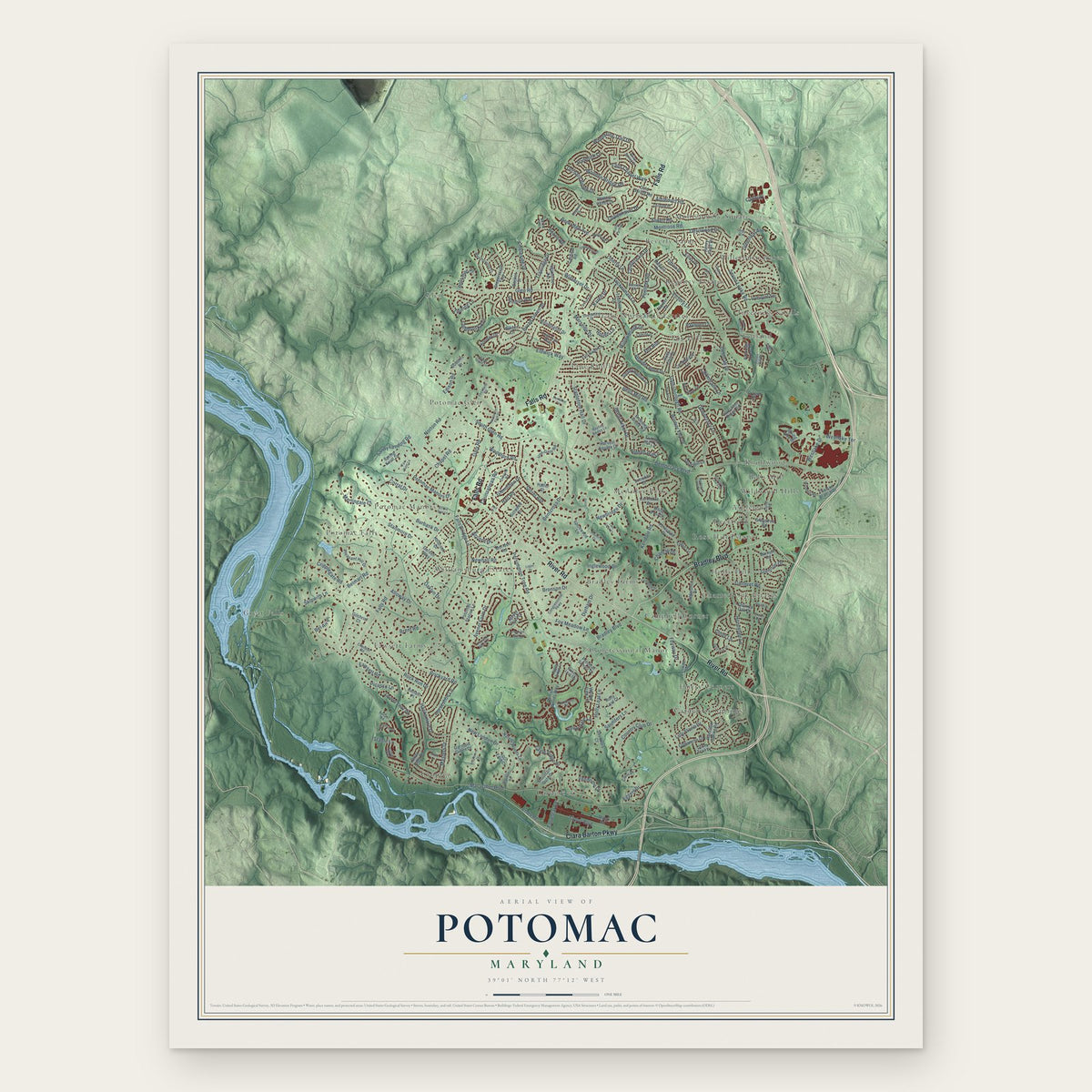
Potomac, Maryland Map Art
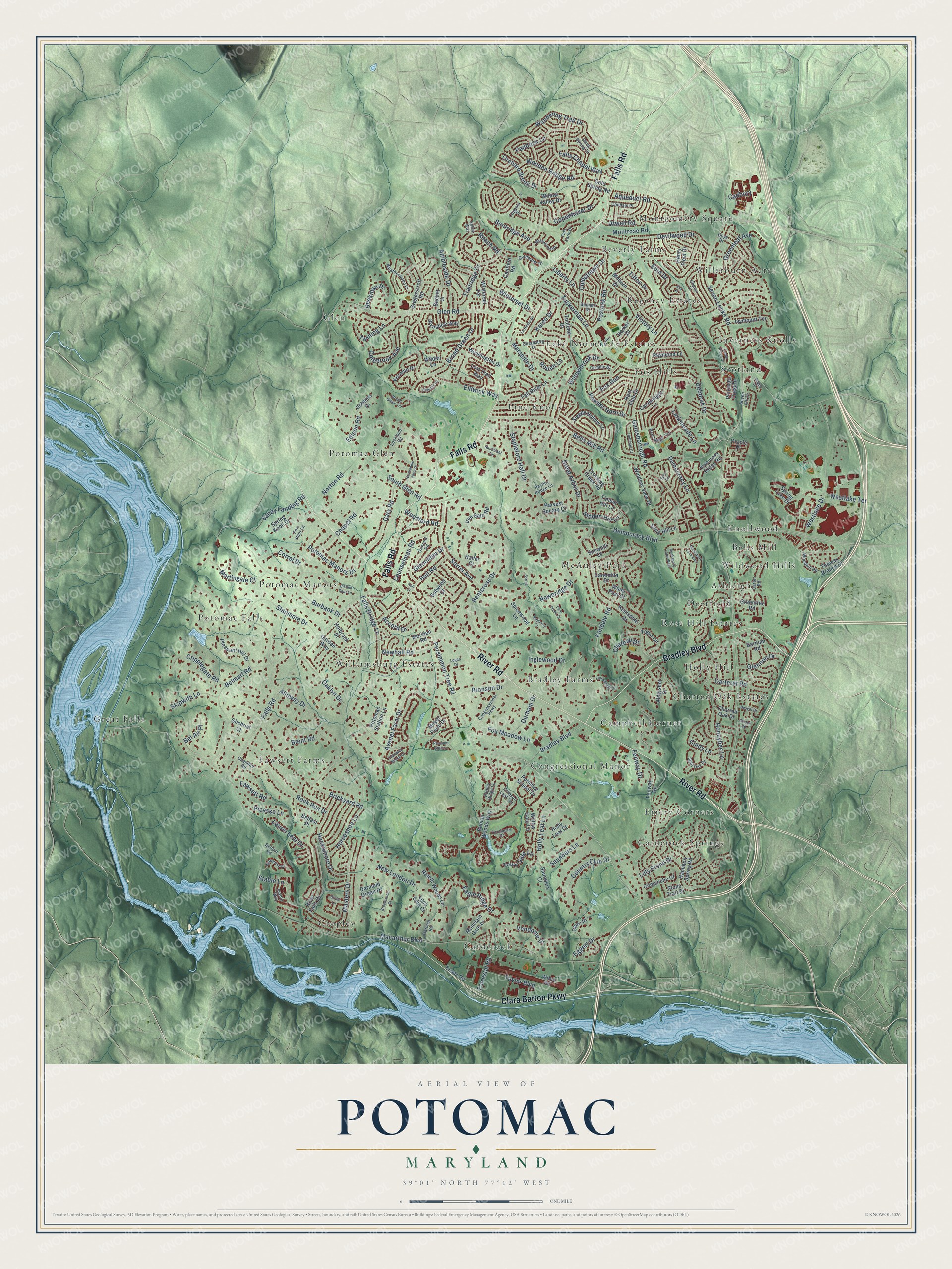
A new map of Potomac, Maryland, made in 2026 and printed to order on thick archival matte paper.
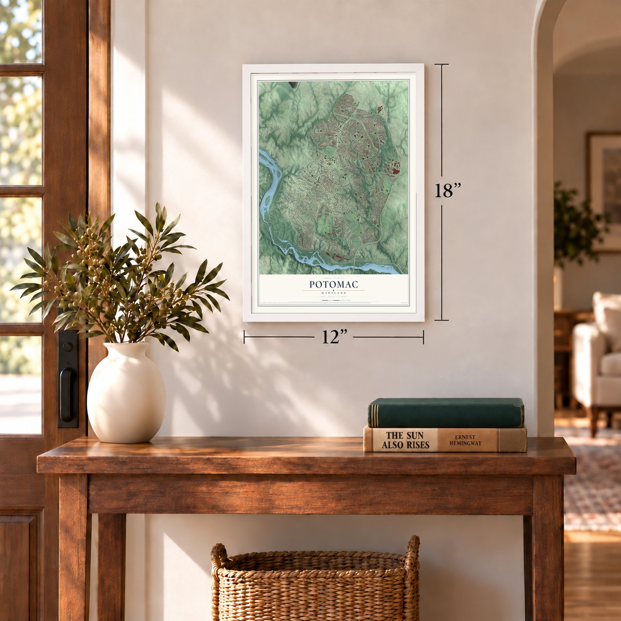
12" x 18" Archival Matte Print
A Map of Home. A Work of Art.
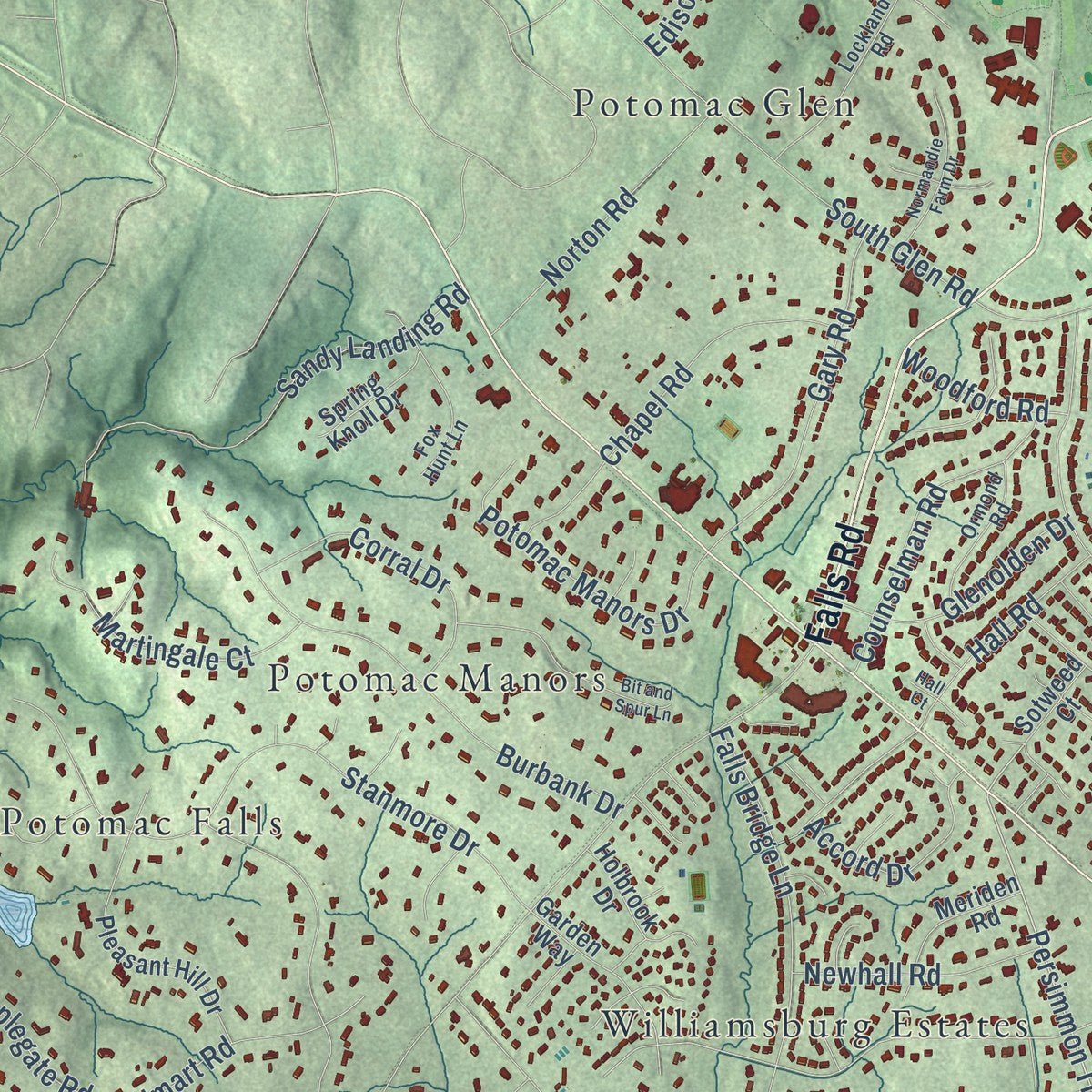
Explore Potomac, Maryland from a whole new perspective. Created using aerial imagery and detailed geographic data, this map captures Potomac building by building, with labeled streets, familiar landmarks, and shaded topographical relief that highlights the natural contours of the landscape.
Combining modern data with the timeless character of a vintage atlas, this map is just as interesting up close as it is beautiful on the wall. Whether you grew up in Potomac, spent memorable years there, or call it home today, this unique map is a great way to celebrate a place that means something to you. Zoom in on the preview to look for your street, and then order a print to put your memories on the wall.
Three ways to hang it
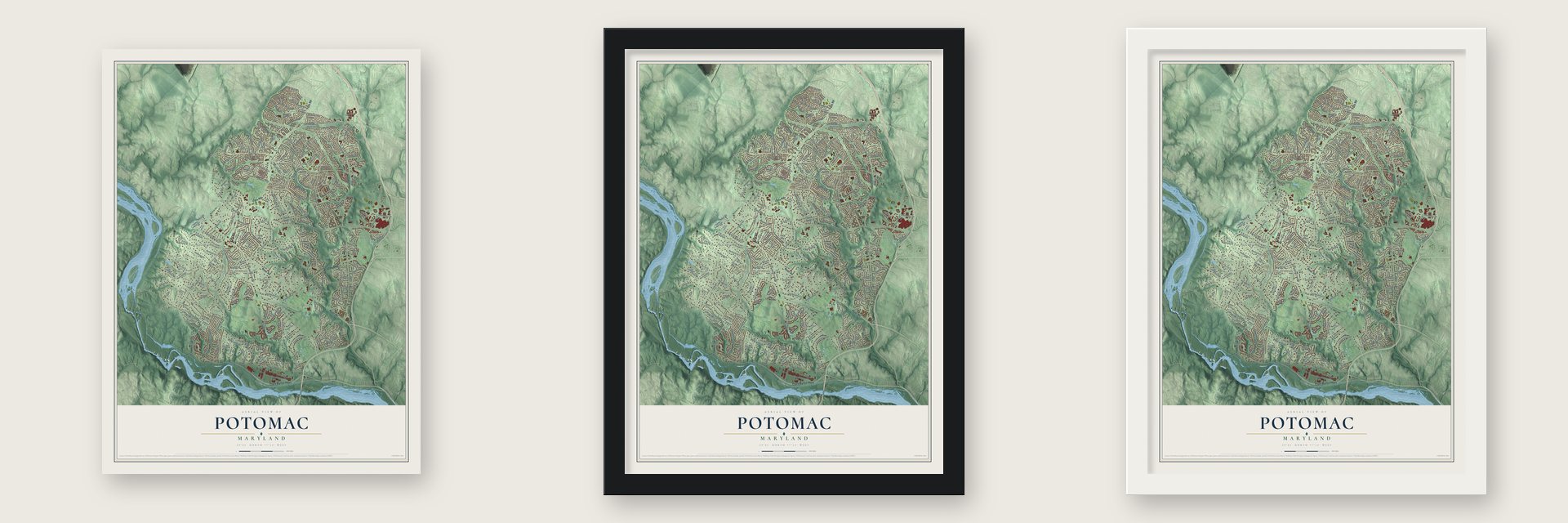
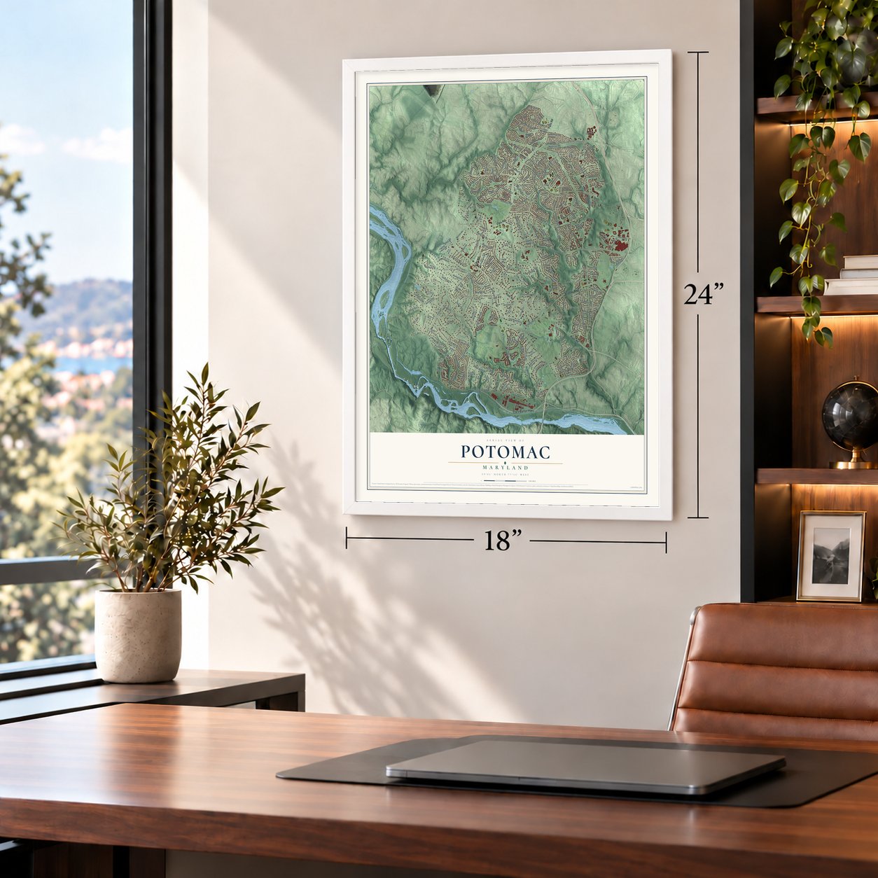
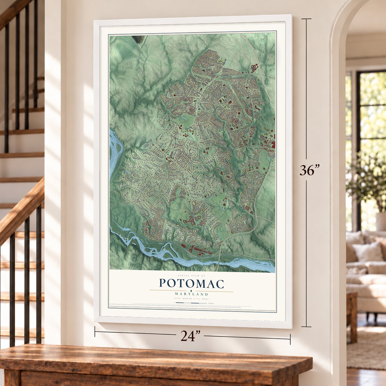
Unframed archival matte, a black wood frame or a white wood frame.
Up close
Geography Worth Displaying
This map was created using accurate cartographic data and authoritative geographic sources, including the U.S. Geological Survey and the Census Bureau. The map brings together terrain, waterways, roads, and building detail. The majority of the streets are labeled, houses are accurately depicted, and the topography is derived from government sources. Combining local data with carefully composed color and shading leads to this beautifully detailed Potomac artwork for your wall.
Rather than simply showing street outlines, we’ve included as many of the street names as we could reasonably fit on the map while keeping their names legible. Zoom in on the high resolution preview to see exactly what’s on the map. We truly set out to create a statement piece for anyone who loves Potomac. So whether it’s for you, or a gift for someone you love, we hope this map of Potomac brings back fond memories.
Read the story behind this map of Potomac, Maryland from 2026.

About Potomac, Maryland
From the Montgomery County Planning Department: "Historian Walter Goetz has identified 22 gold mines in the county, and more than half of them were located in the Potomac area. The first county gold mine to be commercially exploited was the Maryland Mine, near Great Falls."
Find your street
Names on the Potomac map
Every name below is printed on this map. Look for your street, your school, the park where you played, or the pond down the road.
Places and landmarks32
- Ashleigh
- Bells Mill
- Beverly Farms
- Bradley Farms
- Campbell Corner
- Carderock
- Carderock Springs
- Charred Oak Estates
- Congressional Manor
- Cropley
- Deerfield
- Emery Corners
Show all 32 places
- Fawsett Farms
- Fox Hills
- Glen
- Great Falls
- Holly Hill
- Inverness Knolls
- Knollwood
- Lake Normandy Estates
- McAuley Park
- Montgomery Square
- Pine Knolls
- Potomac Falls
- Potomac Glen
- Potomac Manors
- Regency Estates
- Rose Hill Estates
- Scotland
- Wildwood Hills
- Willerburn Acres
- Williamsburg Estates
Streets and roads241
- Falls Road
- River Road
- Clara Barton Parkway
- Bradley Boulevard
- Persimmon Tree Road
- Seven Locks Road
- Deborah Drive
- Falls Chapel Way
- Larkmeade Lane
- Macarthur Boulevard
- Democracy Boulevard
- Gainsborough Road
- Bells Mill Road
- Tuckerman Lane
- Oaklyn Drive
- Brickyard Road
- Montrose Road
- South Glen Road
- Belmart Road
- Glen Road
- Newbridge Drive
- Avenel Farm Drive
- Kendale Road
- Copenhaver Drive
- Stanmore Drive
- Alloway Drive
- Willowbrook Drive
- Postoak Road
- Westlake Drive
- Sorrel Avenue
Show all 241 streets
- Horseshoe Lane
- Devilwood Drive
- Bentcross Drive
- Victory Lane
- Broad Green Drive
- Burbank Drive
- Stable Lane
- Sandy Landing Road
- Rock Run Drive
- Hall Road
- Vendome Drive
- Hackamore Drive
- Lilly Stone Drive
- Falls Bridge Lane
- Taylor Boulevard
- Masters Drive
- Stapleford Hall Drive
- Wooden Bridge Road
- Reach Road
- Coldstream Drive
- Marseille Drive
- Trailridge Drive
- Cindy Lane
- Chapel Road
- Eggert Drive
- Wandering Trail Drive
- Twining Lane
- Powder Horn Drive
- Enid Drive
- Great Arbor Drive
- Westlake Terrace
- Gary Road
- Potomac Manors Drive
- Democracy Lane
- Forrestal Road
- New London Drive
- Fox Run
- Counselman Road
- Greenleaf Avenue
- Colebrook Avenue
- Eagle Ridge Drive
- Holly Leaf Lane
- Laurel Leaf Drive
- Corral Drive
- Norton Road
- Martingale Court
- Paddock Lane
- Honeybee Lane
- Ambleside Drive
- Eldwick Way
- Cripplegate Road
- Carteret Road
- Country Club Drive
- Winterset Drive
- Brent Road
- Glenolden Drive
- Karen Drive
- Saunders Lane
- Liberty Lane
- Orchard Brook Drive
- Newhall Road
- Accord Drive
- Skipwith Lane
- Bronson Drive
- Fox Meadow Lane
- Picasso Lane
- Hidden Hill Lane
- Aqueduct Road
- Chateau Drive
- Glennon Drive
- Edison Road
- Durham Drive
- Town Gate Lane
- Bentridge Avenue
- Atwell Road
- Woodford Road
- Rouen Lane
- Inglewood Drive
- Fawsett Road
- Tifton Drive
- Beekman Place
- Fenway Drive
- Bel Air Place
- Cadbury
- Kentsdale Drive
- Fenway Road
- River Falls Drive
- Hamilton Spring Road
- Windsor View Drive
- Greentree Road
- Iron Gate Road
- Carmelita Drive
- Witek Road
- Pleasant Hill Drive
- Beman Woods Way
- Candlelight Lane
- Cold Spring Road
- Ivymount Terrace
- Milbern Drive
- Potomac Station Lane
- Crossing Creek Road
- Gregerscroft Road
- Mountain Gate Drive
- Natelli Woods Lane
- Sleepy Hollow Lane
- Capri Place
- Fall River Lane
- Charred Oak Drive
- Garden Way
- Korman Drive
- Toulone Drive
- Aldershot Drive
- Inverness Ridge Road
- Darmuid Green Drive
- Winterset Terrace
- Loch Edin Court
- Woodington Drive
- Harvest Square Court
- Hunt Club Drive
- Tobin Circle
- Becket Street
- Canfield Road
- Meriden Road
- Potomac Crest Drive
- Wilden Lane
- Lost Trail Way
- Timber Hill Lane
- Comanche Court
- Essex Road
- Glynshire Way
- Potomac School Drive
- Thomas Branch Drive
- Spicewood Lane
- Stone Trail Drive
- Snowhill Court
- Raymond Lane
- Spring Knoll Drive
- Harker Drive
- Snug Hill Lane
- Willow Gate Lane
- Holly Leaf Court
- Sotweed Court
- Dobbins Drive
- Henry Fleet Drive
- Meyer Point Drive
- Holbrook Drive
- Saunders Court
- Spring Lake Drive
- Gilchrist Court
- Oracle Place
- Willow Valley Drive
- White Post Court
- Barnum Road
- Halter Court
- Belfast Place
- Cherbourg Drive
- Lockland Road
- Goya Drive
- Congressional Parkway
- Gatewater Drive
- Carter Road
- Bunnell Drive
- Charen Lane
- Belfast Road
- Chilham Place
- Ormond Road
- Fox Hunt Lane
- Stable Way
- Weatherwood Court
- Chandler Road
- Falls Farm Drive
- Whiterim Drive
- Bells Ridge Terrace
- Mistwood Drive
- Paytley Bridge Lane
- Coppola Drive
- Turnberry Drive
- Woodhill Road
- Split Oak Drive
- Crimson Leaf Terrace
- Seven Hill Drive
- Camille Drive
- Garmon Road
- Rapley Ridge Lane
- Deep Spring Drive
- Seline Way
- Logan Drive
- Le Havre Drive
- Bit and Spur Lane
- Normandie Farm Drive
- Nantucket Terrace
- Buckspark Lane East
- Buckspark Lane West
- Hob Nail Court
- Brookstone Court
- Farnsworth Drive
- Dwight Drive
- Chartwell Manor Court
- Twin Creek Court
- Cedar Ridge Drive
- Broad Green Terrace
- Groton Road
- Mayberry Court
- Eldwick Court
- Kim Place
- Bridle Lane
- Pleasant Gate Lane
- Tyler Terrace
- Sorrel
- Angus Place
- Hall Court
Names are listed as they appear on the printed map. Zoom into the product photos to find them.
The art of mapping a place
How This Map Was Made
Real places. Remarkable detail. Discover the layers that turn geographic data into a map of home.

The view from above
Aerial imagery reveals the character of the land: woodland, open fields, and the patterns of a place.

The shape of the land
Elevation data brings hills, valleys, and subtle changes in the landscape into view.

The details of home
Roads, waterways, and building footprints come together to make the map feel unmistakably local.

Geography becomes art
Considered color, shading, and typography bring the layers together in a map made for your wall.


Process illustrated with Mendon, Massachusetts. Aerial imagery: USDA NAIP. Terrain: USGS 3D Elevation Program. Map details and finished artwork: KNOWOL.
The Details
About This Print
Choose an archival matte print, or a black or white Ayous wood frame. The archival matte print is unframed.
Select your size and finish above to see the matching product image and price.
Materials & Craftsmanship
A contemporary map with the character of a classic atlas, printed on archival matte paper. Optional frames are made from Ayous wood.
Your printed map does not include the watermark shown in the full-map preview.
Shipping & Delivery
Free shipping within the United States. Every print is made to order in the USA.
Buying a gift? Add a note in your cart and we'll include it. We never put prices in the package.
Prints ship within 2 to 3 business days. Allow 7 to 10 days total from ordering for delivery. Timing may vary during holidays or periods of high order volume.
Read our shipping policy.
Returns and damaged prints
Each print is made to order. Change-of-mind refunds are not available after production.
If your print arrives damaged, misprinted or incorrect, contact support@knowol.com within 30 days of receiving it. Include your order number, photos and a description of the issue.
Read our full refund and replacement policy. For questions about your order, email support@knowol.com.
Find your town
Looking for another city?
Find a map of home in our Maryland collection, or any town in the country.
Nearby
Maps of towns near Potomac
Know someone from one of these towns? Their map makes a great gift.
 Cabin John
, Maryland
From $39.99See the map
 Glen Echo
, Maryland
From $39.99See the map
 North Bethesda
, Maryland
From $39.99See the map
More maps nearby: Bethesda, Travilah, Rockville, Brookmont and Garrett Park.