
Search for another town





Free U.S. delivery 7 to 10 days after you order
North Bethesda, Maryland Map Art
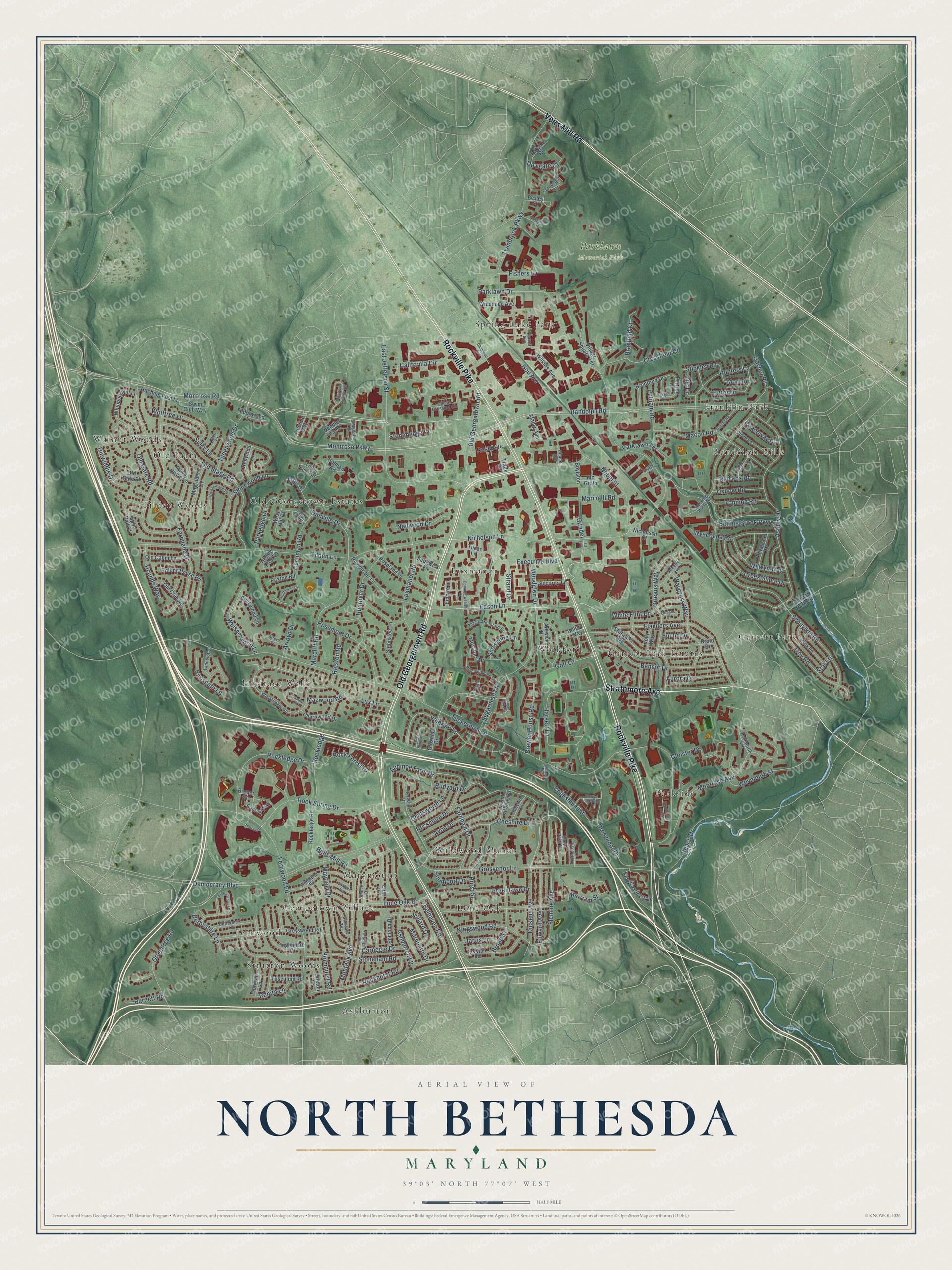
A new map of North Bethesda, Maryland, made in 2026 and printed to order on thick archival matte paper.
12" x 18" Archival Matte Print
A Map of Home. A Work of Art.
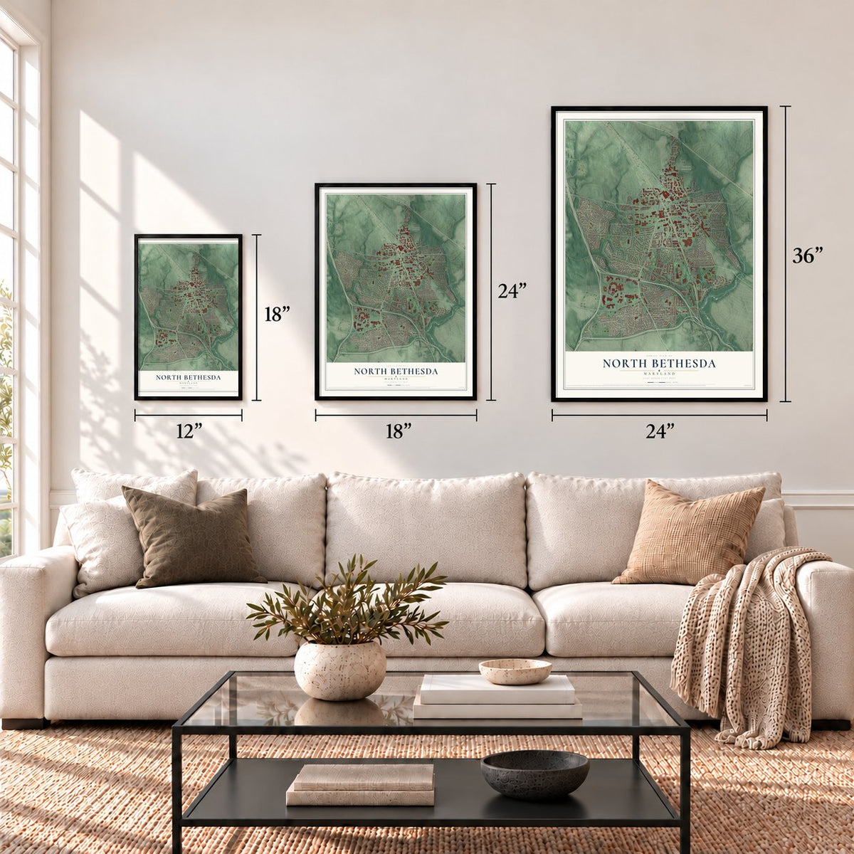
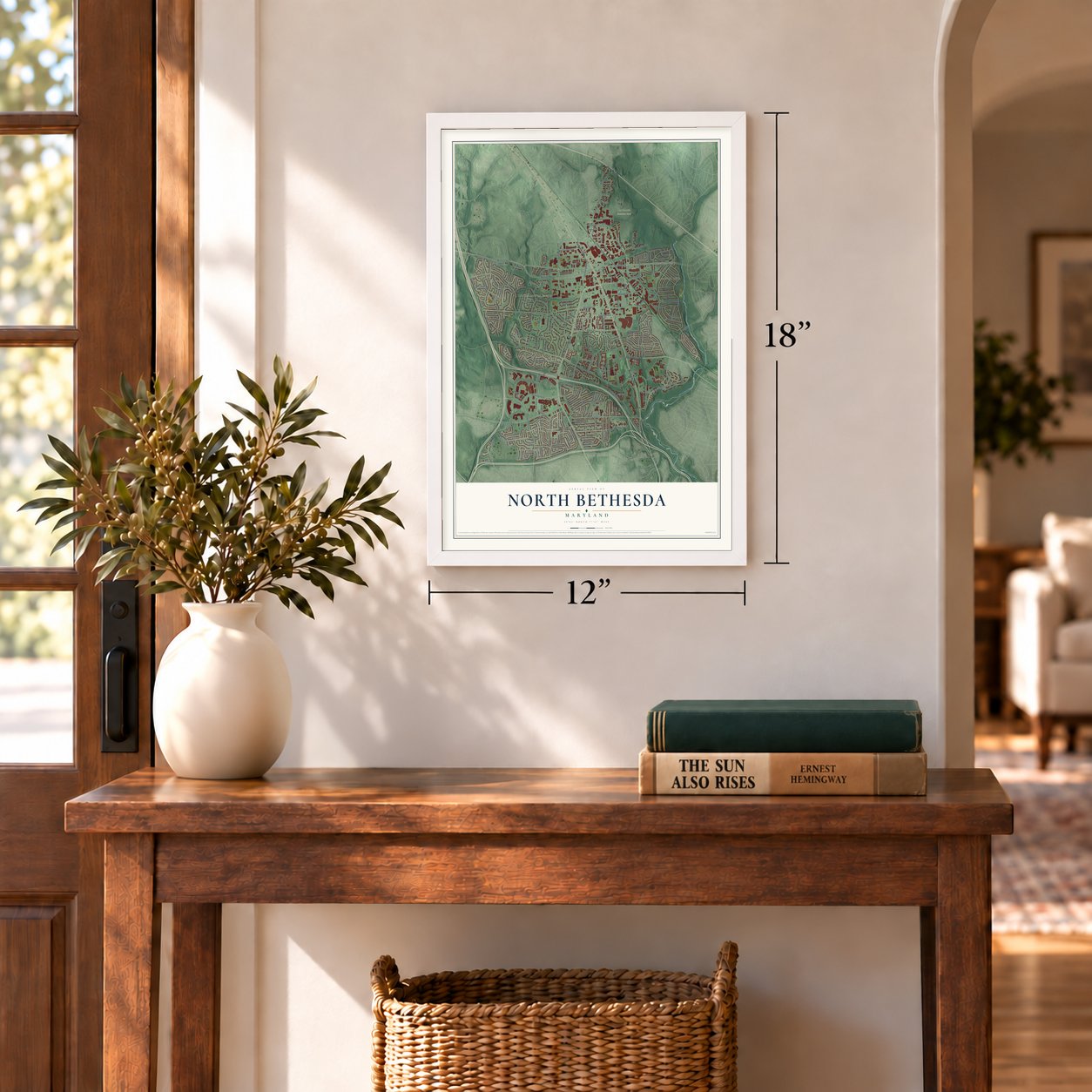
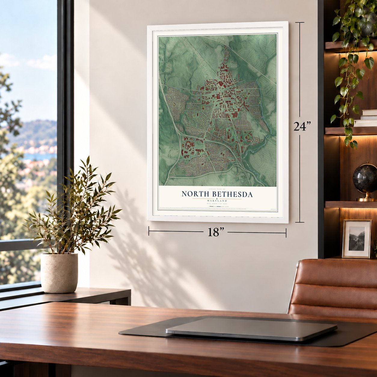
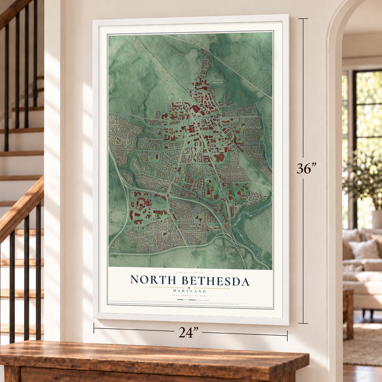
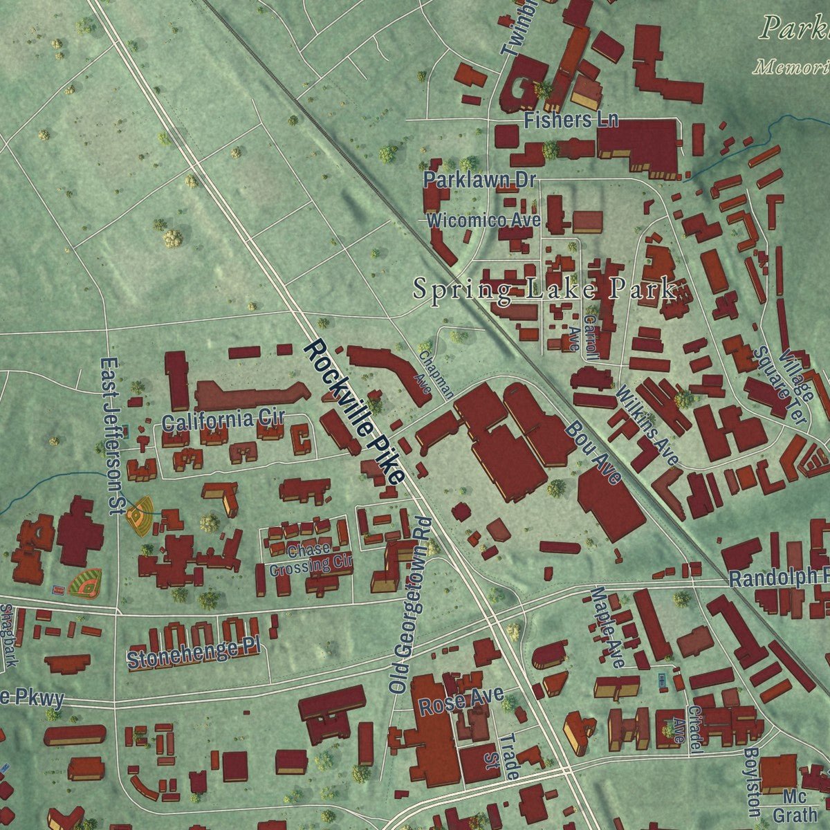
Explore North Bethesda, Maryland from a whole new perspective. Created using aerial imagery and detailed geographic data, this map captures North Bethesda building by building, with labeled streets, familiar landmarks, and shaded topographical relief that highlights the natural contours of the landscape.
Combining modern data with the timeless character of a vintage atlas, this map is just as interesting up close as it is beautiful on the wall. Whether you grew up in North Bethesda, spent memorable years there, or call it home today, this unique map is a great way to celebrate a place that means something to you. Zoom in on the preview to look for your street, and then order a print to put your memories on the wall.
Three ways to hang it
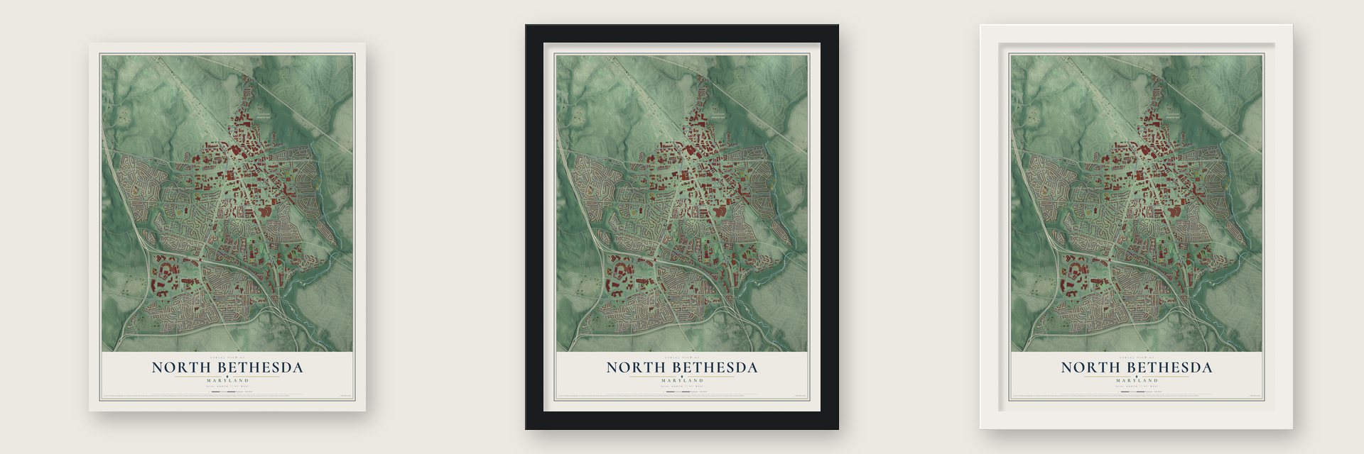
Unframed archival matte, a black wood frame or a white wood frame.
Up close
Geography Worth Displaying
This map was created using accurate cartographic data and authoritative geographic sources, including the U.S. Geological Survey and the Census Bureau. The map brings together terrain, waterways, roads, and building detail. The majority of the streets are labeled, houses are accurately depicted, and the topography is derived from government sources. Combining local data with carefully composed color and shading leads to this beautifully detailed North Bethesda artwork for your wall.
Rather than simply showing street outlines, we’ve included as many of the street names as we could reasonably fit on the map while keeping their names legible. Zoom in on the high resolution preview to see exactly what’s on the map. We truly set out to create a statement piece for anyone who loves North Bethesda. So whether it’s for you, or a gift for someone you love, we hope this map of North Bethesda brings back fond memories.
Read the story behind this map of North Bethesda, Maryland from 2026.

About North Bethesda, Maryland
From the Montgomery County Planning Department: "One of the earliest of several brick Classical Revival mansions was the Charles Corby Estate (c1914), now known as Strathmore Hall. Corby, a bread manufacturer and inventor, hired Charles Barton Keen to enlarge an existing house, creating a grand residence with oak paneling, parquet floors, stone fireplaces, and a two-story music room."
Find your street
Names on the North Bethesda map
Every name below is printed on this map. Look for your street, your school, the park where you played, or the pond down the road.
Places and landmarks21
- Parklawn Memorial Park
- Ashburton
- Fernwood
- Franklin Park
- Garrett Park
- Garrett Park Estates
- Georgetown Village
- Heritage Walk
- Lone Oak
- Luxmanor
- Marymount
- Old Farm
Show all 21 places
- Old Georgetown Estates
- Parkside
- Randolph Hills
- Spring Lake Park
- Stratton Woods
- Tilden Woods
- Walnut Woods
- Wickford
- Wildwood Manor
Streets and roads243
- Strathmore Avenue
- Rockville Pike
- Old Georgetown Road
- Veirs Mill Road
- Montrose Road
- Edson Lane
- Citadel
- Montrose Parkway
- Nicholson Lane
- Dickens Avenue
- Tuckerman Lane
- Randolph Road
- Democracy Boulevard
- Parklawn Drive
- Tilden Lane
- Lone Oak Drive
- Ashley Drive
- Boiling Brook Parkway
- Grosvenor Place
- Schuylkill Road
- Fernwood Road
- Grosvenor Lane
- Old Stage Road
- Executive Boulevard
- Twinbrook Parkway
- Valerian Lane
- Farmland Drive
- Flanders Avenue
- Montrose Avenue
- Rockledge Drive
Show all 243 streets
- Luxmanor Road
- Fleming Avenue
- Rossmore Drive
- Danville Drive
- Sulky Lane
- Bou Avenue
- Farnham Drive
- Beach Drive
- Hunters Lane
- Cheshire Drive
- Nebel Street
- Sugarbush Lane
- Orleans Way
- Macon Road
- Rock Spring Drive
- Hargett Lane
- Bangor Drive
- California Circle
- East Jefferson Street
- Marinelli Road
- Stonewood Lane
- Rosemont Drive
- Weymouth Street
- Marcliff Road
- Ashburton Lane
- Montauk Avenue
- Cushman Road
- Troy Road
- Holmhurst Road
- Huntover Drive
- Stoneham Road
- Waycross Way
- Rockhurst Road
- Bells Mill Road
- Mayfield Drive
- Brewer House Road
- Belhaven Road
- Broad Street
- Wyaconda Road
- Avon Drive
- Creek Shore Drive
- Greentree Road
- Kingswood Road
- Braxfield Court
- Old Gate Road
- Wolftree Lane
- Whisperwood Lane
- Fishers Lane
- Tildenwood Drive
- White Flint Drive
- Edward Avenue
- Aubinoe Farm Drive
- Snowshoe Lane
- Greenlawn Drive
- Cloister Drive
- Wilwyn Way
- Ralston Road
- Rudyard Drive
- Woodglen Drive
- Ertter Drive
- Rock Forest Drive
- Gaynor Road
- Derbyshire Lane
- Merriam Street
- Aurora Drive
- Hounds Way
- Hurst Street
- Stonehenge Place
- Parkedge Drive
- Jarvis Lane
- Crossfield Court
- Lux Lane
- Golf Lane
- Neilwood Drive
- Topping Road
- Oxbow Road
- Chatsworth Lane
- Julliard Drive
- Dinwiddie Drive
- Marquette Drive
- Englishman Drive
- Parklawn Terrace
- Red Fox Road
- Renita Lane
- Earlsgate Lane
- Putnam Road
- Mori Drive
- Arroyo Drive
- Strand Drive
- Carnegie Drive
- Southport Drive
- Coachway Drive
- Mazwood Road
- Rose Avenue
- Barnett Road
- Dowgate Court
- Stickley Road
- Otis Drive
- Rockledge
- Euclid Drive
- Star Lane
- Portree Drive
- Hitching Post Lane
- Wilkins Avenue
- Greyswood Road
- Brixton Lane
- Gloxinia Drive
- Poindexter Lane
- Stillwater Avenue
- Stephalee Lane
- Village Square Terrace
- Ipswich Road
- King Charles Way
- Roseland Drive
- Whippoorwill Lane
- Rolling House Road
- Inglemere Drive
- Magruder Lane
- Empire Lane
- Old Club Road
- Druid Drive
- Rockledge Road
- Tudor Lane
- Jolly Way
- Mossrock Drive
- Clue Drive
- West Hill Drive
- Ardwick Drive
- Halpine Road
- Patapsco Drive
- Brentford Drive
- Pomona Drive
- Buckwood Lane
- Old Cabin Lane
- Corkran Lane
- Besley Court
- Eames Way
- Charnwood Drive
- Swim Club Way
- Wicomico Avenue
- Renwood Lane
- Old Gate Place
- Security Lane
- Tusculum Road
- Tildenwood Lane
- Race Horse Lane
- Saint Albans Drive
- Needle Leaf Drive
- Nicholson Court
- Paxton Road
- Sedgwick Lane
- Garrett Park Road
- Maple Avenue
- Treeline Way
- Tall Tree Terrace
- Holman Road
- Trade Street
- Boylston
- Ibsen Drive
- Hollow Tree Lane
- Mc Grath
- Split Rail Court
- Breuer Street
- Hillery Way
- Windermere Circle
- Rocking Horse Road
- Berkshire Drive
- Chase Crossing Circle
- Winnepeg Road
- Rokeby Avenue
- De Paul Drive
- Rock Road
- Crookston Lane
- Olden Road
- Sinnott Drive
- Bloomingdale Drive
- Buttermere Lane
- Magic Mountain Drive
- Shagbark Drive
- Camrose Terrace
- Carroll Avenue
- Kenilworth Avenue
- Lancelot Drive
- Citadel Avenue
- Old Farm Lane
- Cheshire Terrace
- Tisdale Terrace
- Thornbush Lane
- Oden Court
- Cameo Court
- Snow Point Drive
- Huff Court
- Surreywood Lane
- Commonwealth Drive
- Montrose Village Terrace
- Galena Road
- Rosemont Circle
- Breezewood Terrace
- Marriott Drive
- Strathmore Hall
- Coakley Circle
- Tuckerman Acc
- Inman Park Circle
- Alderbrook Court
- Grove Ridge Way
- Struttmann Lane
- Timber Lane
- Oakglen Drive
- Lady Slipper Terrace
- Luxberry Drive
- Chapman Avenue
- Arroyo Court
- Orleans Court
Names are listed as they appear on the printed map. Zoom into the product photos to find them.
The art of mapping a place
How This Map Was Made
Real places. Remarkable detail. Discover the layers that turn geographic data into a map of home.

The view from above
Aerial imagery reveals the character of the land: woodland, open fields, and the patterns of a place.

The shape of the land
Elevation data brings hills, valleys, and subtle changes in the landscape into view.

The details of home
Roads, waterways, and building footprints come together to make the map feel unmistakably local.

Geography becomes art
Considered color, shading, and typography bring the layers together in a map made for your wall.


Process illustrated with Mendon, Massachusetts. Aerial imagery: USDA NAIP. Terrain: USGS 3D Elevation Program. Map details and finished artwork: KNOWOL.
The Details
About This Print
Choose an archival matte print, or a black or white Ayous wood frame. The archival matte print is unframed.
Select your size and finish above to see the matching product image and price.
Materials & Craftsmanship
A contemporary map with the character of a classic atlas, printed on archival matte paper. Optional frames are made from Ayous wood.
Your printed map does not include the watermark shown in the full-map preview.
Shipping & Delivery
Free shipping within the United States. Every print is made to order in the USA.
Buying a gift? Add a note in your cart and we'll include it. We never put prices in the package.
Prints ship within 2 to 3 business days. Allow 7 to 10 days total from ordering for delivery. Timing may vary during holidays or periods of high order volume.
Read our shipping policy.
Returns and damaged prints
Each print is made to order. Change-of-mind refunds are not available after production.
If your print arrives damaged, misprinted or incorrect, contact support@knowol.com within 30 days of receiving it. Include your order number, photos and a description of the issue.
Read our full refund and replacement policy. For questions about your order, email support@knowol.com.
Find your town
Looking for another city?
Find a map of home in our Maryland collection, or any town in the country.
Nearby
Maps of towns near North Bethesda
Know someone from one of these towns? Their map makes a great gift.
 Garrett Park
, Maryland
From $39.99See the map
 Chevy Chase View
, Maryland
From $39.99See the map
 Kensington
, Maryland
From $39.99See the map
More maps nearby: North Kensington, South Kensington, Bethesda, Wheaton and North Chevy Chase.