
Search for another town





Free U.S. delivery 7 to 10 days after you order
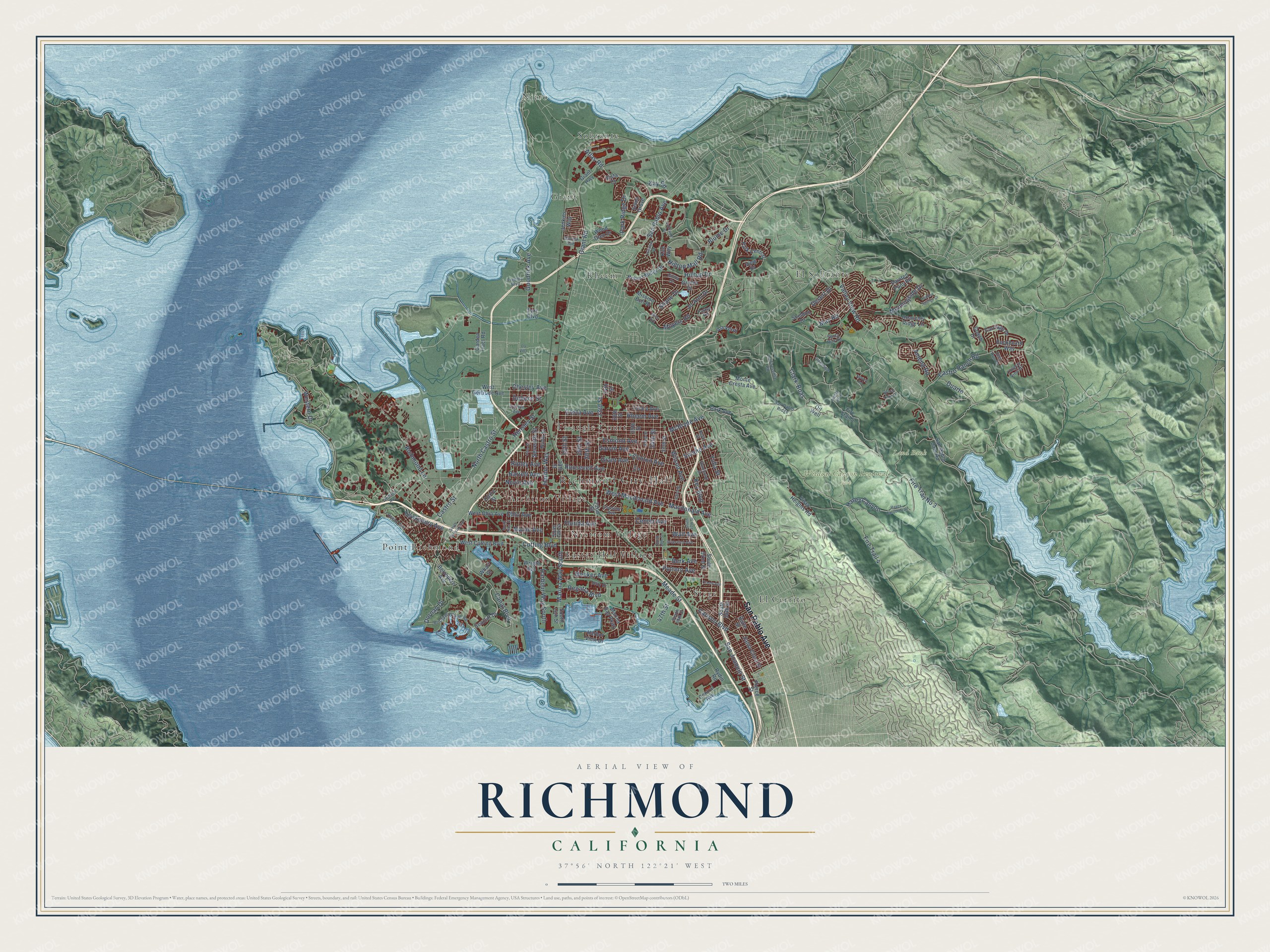
Richmond, California Map Art
Building by building, with labeled streets and shaded relief.
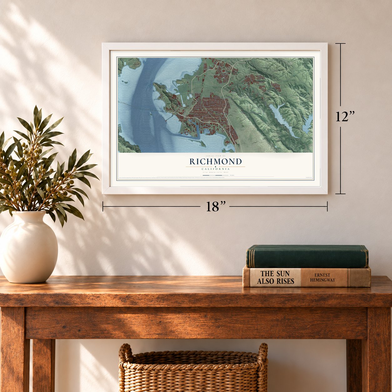
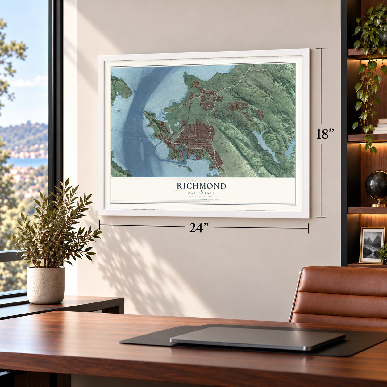
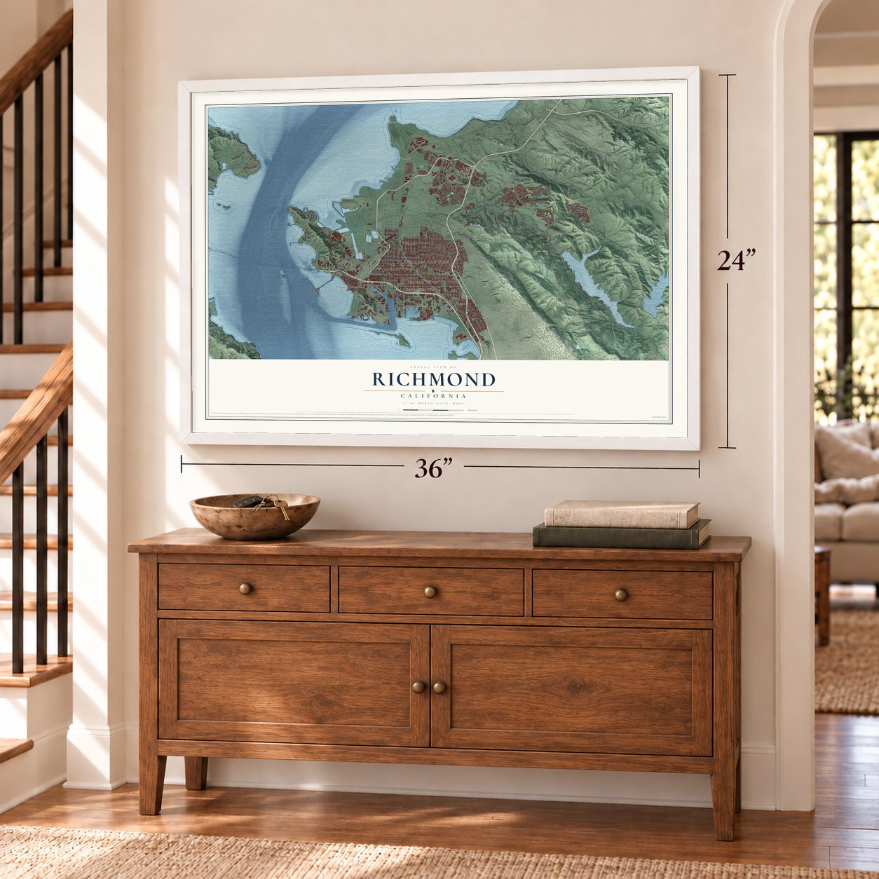
12" x 18" Archival Matte Print
A Map of Home. A Work of Art.
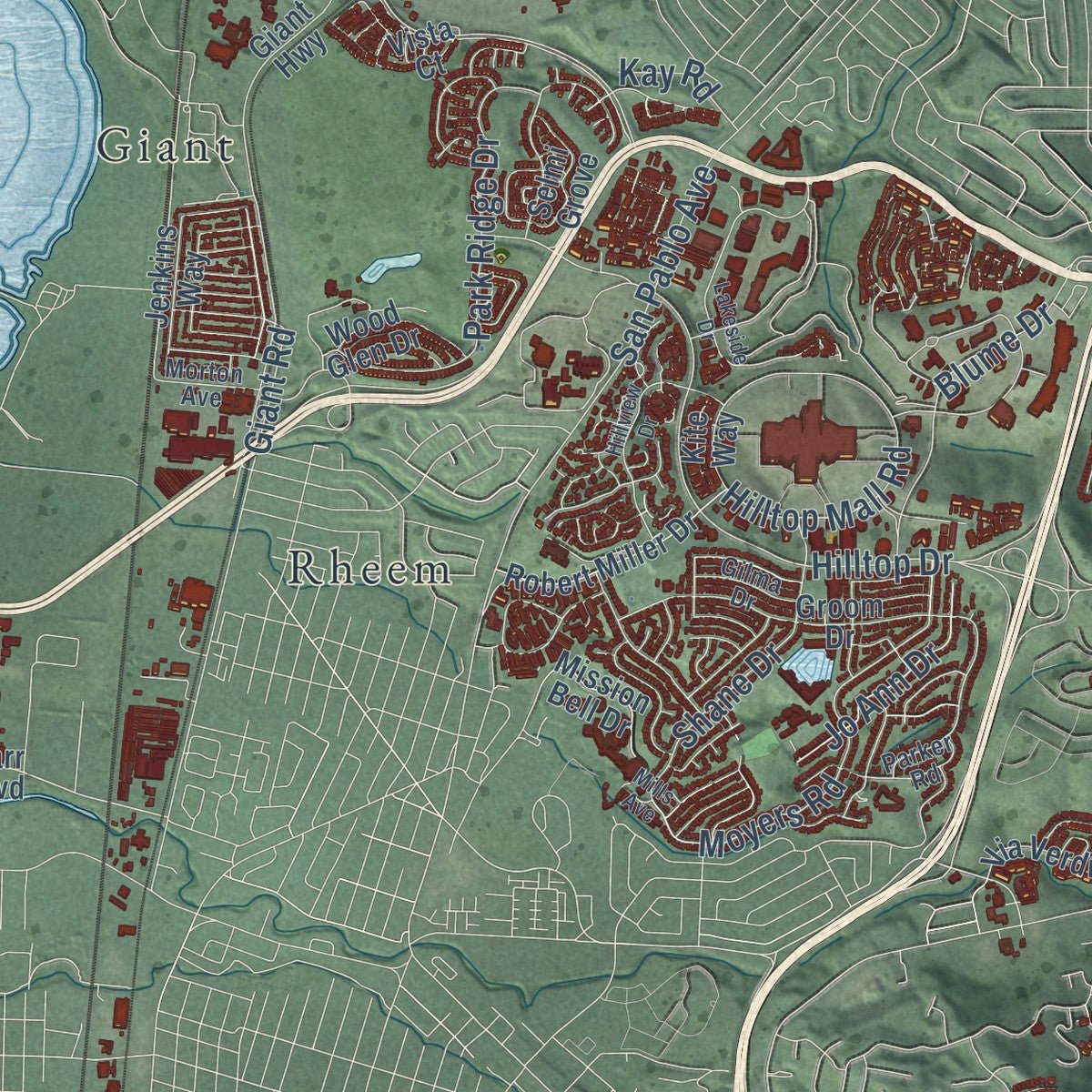
Explore Richmond, California from a whole new perspective. Created using aerial imagery and detailed geographic data, this map captures Richmond building by building, with labeled streets, familiar landmarks, and shaded topographical relief that highlights the natural contours of the landscape.
Combining modern data with the timeless character of a vintage atlas, this map is just as interesting up close as it is beautiful on the wall. Whether you grew up in Richmond, spent memorable years there, or call it home today, this unique map is a great way to celebrate a place that means something to you. Zoom in on the preview to look for your street, and then order a print to put your memories on the wall.
Three ways to hang it
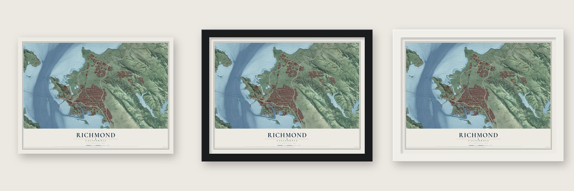
Unframed archival matte, a black wood frame or a white wood frame.
Up close
Geography Worth Displaying
This map was created using accurate cartographic data and authoritative geographic sources, including the U.S. Geological Survey and the Census Bureau. The map brings together terrain, waterways, roads, and building detail. The majority of the streets are labeled, houses are accurately depicted, and the topography is derived from government sources. Combining local data with carefully composed color and shading leads to this beautifully detailed Richmond artwork for your wall.
Rather than simply showing street outlines, we’ve included as many of the street names as we could reasonably fit on the map while keeping their names legible. Zoom in on the high resolution preview to see exactly what’s on the map. We truly set out to create a statement piece for anyone who loves Richmond. So whether it’s for you, or a gift for someone you love, we hope this map of Richmond brings back fond memories.
Read the story behind this map of Richmond, California from 2026.

Find your street
Names on the Richmond map
Every name below is printed on this map. Look for your street, your school, the park where you played, or the pond down the road.
Places and landmarks15
- Richmond City Hall
- Land Bank
- Wildcat Canyon Regional Park
- Atchison Village
- Easter Hill Village
- El Cerrito
- El Sobrante
- Giant
- Nitro
- Nystrom Village
- Point Richmond
- Rheem
Show all 15 places
- Sobrante
- Stege
- Triangle Court
Streets and roads164
- San Pablo Avenue
- Castro Street
- North Castro Street
- 23rd Street
- Ohio Avenue
- Canal Boulevard
- West Macdonald Avenue
- McBryde Avenue
- Carlson Boulevard
- Clark-Boas
- Fire Trail No 3
- Western Drive
- Hilltop Drive
- Richmond Lane
- Cutting Boulevard
- Macdonald Avenue
- Barrett Avenue
- Nevin Avenue
- Florida Avenue
- Roosevelt Avenue
- Fire Trail 4
- Garvin Avenue
- Esmond Avenue
- Clinton Avenue
- Atlas Road
- Rheem Avenue
- Havey Canyon
- Castro Ranch Road
- Harbour Way South
- Potrero Avenue
Show all 164 streets
- Maine Avenue
- Regatta Boulevard
- Valley View Road
- Seventh Street
- Hilltop Mall Road
- 34th Street
- May Road
- Marina Way South
- 20th Street
- Moyers Road
- Goodrick Avenue
- Park Ridge Drive
- 18th Street
- Dornan Drive
- 15th Street
- Morningside Drive
- Wilson Avenue
- Shane Drive
- San Joaquin Street
- Center Avenue
- Solano Avenue
- Blume Drive
- Amend Road
- Wall Avenue
- Yuba Street
- Harbor Way
- Hensley Street
- Meeker Avenue
- Berk Avenue
- Grant Avenue
- Jo Ann Drive
- Meade Street
- Key Boulevard
- Chesley Avenue
- Tewksbury Avenue
- Costa Avenue
- Ripley Avenue
- Duarte
- Duboce Street
- Desert Drive
- Kay Road
- Giant Road
- 47th Street
- West Ohio Avenue
- West Gertrude Avenue
- 22nd Street
- Oil Well
- Parr Boulevard
- Park Avenue
- Pierce Street
- 24th Street
- Marina Bay Parkway
- Santa Clara Street
- 29th Street
- 13th Street
- 26th Street
- Giant Highway
- 37th Street
- Ninth Street
- Fire Trail 5
- Park Central
- Heavenly Ridge Lane
- Wright Avenue
- West Cutting Boulevard
- Central Avenue
- Sheldon Drive
- Groom Drive
- Buckboard Way
- Vista Heights Road
- Robert Miller Drive
- Coach Drive
- San Pablo Dam Road
- Carriage Drive
- South 56th Street
- Painted Pony Road
- Monte Cresta Avenue
- Belvedere Avenue
- Garden Tract Road
- Seacliff Drive
- Tulare Avenue
- Wood Glen Drive
- Selmi Grove
- Mission Bell Drive
- Jenkins Way
- Harbor View Drive
- Via Verdi
- Rydin Road
- South 14th Street
- South 52nd Street
- Curry Street
- View Drive
- Butte Street
- Wharf Street
- Kite Way
- Vista Court
- Chanslor Avenue
- 32nd Street
- Santa Rita Road
- Humboldt Street
- San Pablo Ridge
- Kern Street
- Brickyard Cove Road
- South 13th Street
- South 50th Street
- 43rd Street
- Country View Drive
- Overend Avenue
- La Cresenta Road
- Parker Road
- Jetty Drive
- Ocean Avenue
- Freethy Boulevard
- Gilma Drive
- Morton Avenue
- Vernon Avenue
- Deer Run Drive
- South Garrard Boulevard
- Havey Canyon Trail
- South 47th Street
- 31st Street
- Fifth Street
- Nimitz Way
- Lakeside Drive
- Hillview Drive
- Greenridge
- South 39th Street
- Scofield Avenue
- South First Street
- Hidden Springs Court
- Creely Avenue
- Mills Avenue
- Bristle Cone Drive
- Lenora Road
- Da Villa
Names are listed as they appear on the printed map. Zoom into the product photos to find them.
About Richmond, California
Richmond is a city of 116,448 people in Contra Costa County. With San Rafael, it is one of only two cities that face both San Francisco Bay and San Pablo Bay. The Ohlone lived here first, and the land later became part of Rancho San Pablo, granted to Don Francisco María Castro. The name came from Edmund Randolph, a San Francisco assemblyman born in Richmond, Virginia, who talked a federal survey crew into marking "Point Richmond" and "Richmond" on its 1854 map of the bay.
The Santa Fe Railroad made Point Richmond the western end of its line on July 4, 1900. Ferries linked it to San Francisco, and boats carried freight cars across the bay. Point Richmond had been an island, but fill joined it to the mainland by the early 1900s. Standard Oil built a refinery in 1901 on land sold by Emily Tewksbury, and Chevron still runs it. The post office opened in 1900, and the city incorporated on August 3, 1905.
“East Brother is the oldest wood-frame lighthouse on the West Coast still fully operational and still in its historic configuration with functioning equipment.”
- 747 ships for the warWhen World War II began, four shipyards rose on Richmond's waterfront. Recruiters brought in thousands of workers, many of them Black Americans from the South, and women took industrial jobs for the first time. Kaiser's Richmond yards built 747 Liberty and Victory ships, more than any other place in the country. One Liberty ship was finished in five days, and the average was 30. The city grew from 23,000 people in 1940 to 114,899 in 1942.
- Where Kaiser Permanente beganThe yards set up a medical plan for their workers at the Richmond Field Hospital, and that plan grew into today's Kaiser Permanente. The hospital stayed open until 1993, when the Richmond Medical Center replaced it.
- The world's largest wineryUntil Prohibition arrived in 1919, Richmond had the biggest winery in the world. Its company village, Winehaven, still stands empty behind a fence on Western Drive near Point Molate.
- Ford on the waterfrontFord opened its Richmond Assembly Plant in 1930 and ran it until the work moved to Milpitas in 1956. Developer Eddie Orton bought the old plant in 2004 and turned it into an event center, the Craneway.
Keep exploring California
Richmond is one of 1,990 California towns we've mapped. Every dot on the map is a print of its own.
The search covers every state, California first.
Near Richmond
Order 2 or more town maps and save 10%. Shown in the size and finish you picked above, so they hang as a set.
- Iron Triangle 12" x 18" / Archival Matte Print $39.99
- North Richmond 12" x 18" / Archival Matte Print $39.99
- San Pablo 12" x 18" / Archival Matte Print $39.99
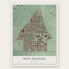

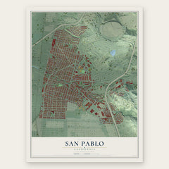
More maps nearby: Atchison Village, Rollingwood, Marina Bay, East Richmond Heights and Point Richmond.
The art of mapping a place
How This Map Was Made
Real places. Remarkable detail. Discover the layers that turn geographic data into a map of home.

The view from above
Aerial imagery reveals the character of the land: woodland, open fields, and the patterns of a place.

The shape of the land
Elevation data brings hills, valleys, and subtle changes in the landscape into view.

The details of home
Roads, waterways, and building footprints come together to make the map feel unmistakably local.

Geography becomes art
Considered color, shading, and typography bring the layers together in a map made for your wall.


Process illustrated with Mendon, Massachusetts. Aerial imagery: USDA NAIP. Terrain: USGS 3D Elevation Program. Map details and finished artwork: KNOWOL.
The Details
About This Print
Choose an archival matte print, or a black or white Ayous wood frame. The archival matte print is unframed.
Select your size and finish above to see the matching product image and price.
Materials & Craftsmanship
A contemporary map with the character of a classic atlas, printed on archival matte paper. Optional frames are made from Ayous wood.
Your printed map does not include the watermark shown in the full-map preview.
Shipping & Delivery
Free shipping within the United States. Every print is made to order in the USA.
Buying a gift? Add a note in your cart and we'll include it. We never put prices in the package.
Prints ship within 2 to 3 business days. Allow 7 to 10 days total from ordering for delivery. Timing may vary during holidays or periods of high order volume.
Read our shipping policy.
Returns and damaged prints
Each print is made to order. Change-of-mind refunds are not available after production.
If your print arrives damaged, misprinted or incorrect, contact support@knowol.com within 30 days of receiving it. Include your order number, photos and a description of the issue.
Read our full refund and replacement policy. For questions about your order, email support@knowol.com.