
Search for another town


Free U.S. delivery 7 to 10 days after you order
San Pablo, California Map Art
Building by building, with labeled streets and shaded relief.
12" x 18" Archival Matte Print
A Map of Home. A Work of Art.
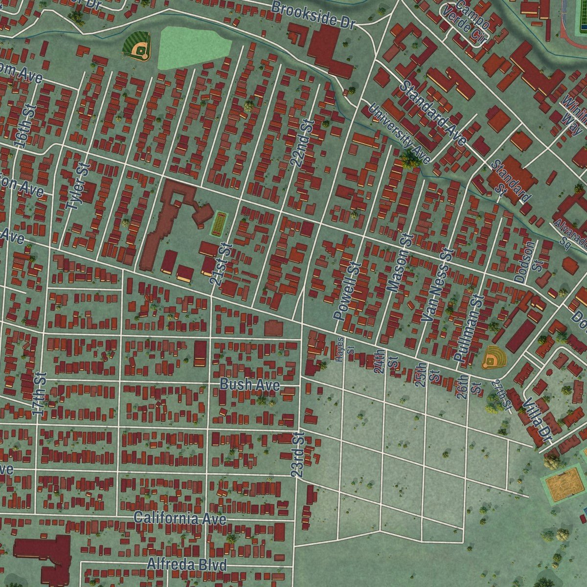
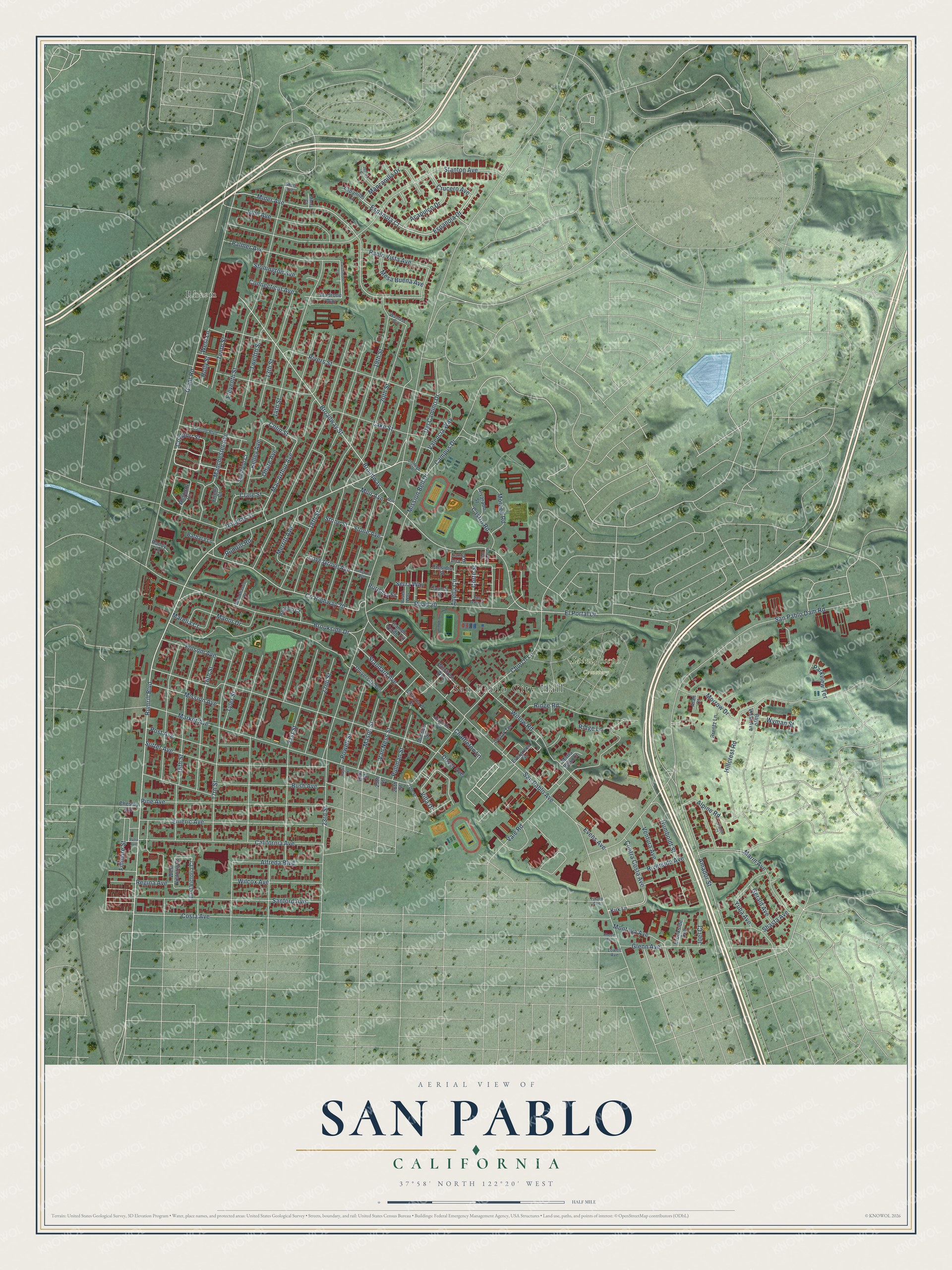
Explore San Pablo, California from a whole new perspective. Created using aerial imagery and detailed geographic data, this map captures San Pablo building by building, with labeled streets, familiar landmarks, and shaded topographical relief that highlights the natural contours of the landscape.
Combining modern data with the timeless character of a vintage atlas, this map is just as interesting up close as it is beautiful on the wall. Whether you grew up in San Pablo, spent memorable years there, or call it home today, this unique map is a great way to celebrate a place that means something to you. Zoom in on the preview to look for your street, and then order a print to put your memories on the wall.
Three ways to hang it
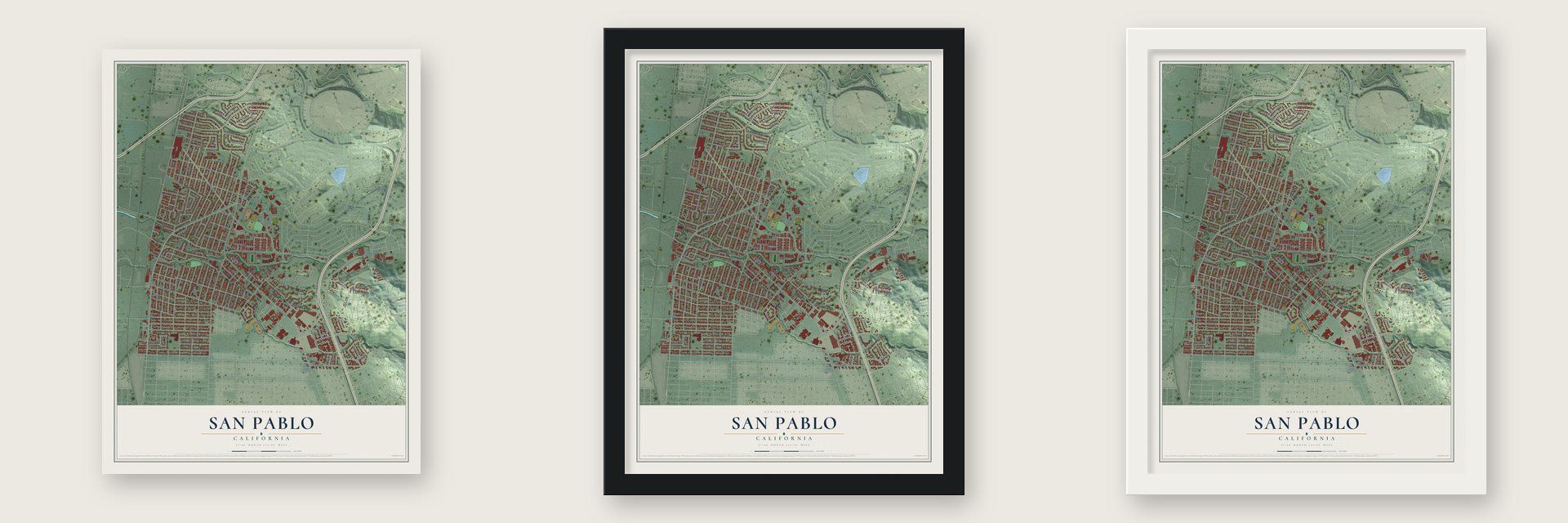
Unframed archival matte, a black wood frame or a white wood frame.
Up close
Geography Worth Displaying
This map was created using accurate cartographic data and authoritative geographic sources, including the U.S. Geological Survey and the Census Bureau. The map brings together terrain, waterways, roads, and building detail. The majority of the streets are labeled, houses are accurately depicted, and the topography is derived from government sources. Combining local data with carefully composed color and shading leads to this beautifully detailed San Pablo artwork for your wall.
Rather than simply showing street outlines, we’ve included as many of the street names as we could reasonably fit on the map while keeping their names legible. Zoom in on the high resolution preview to see exactly what’s on the map. We truly set out to create a statement piece for anyone who loves San Pablo. So whether it’s for you, or a gift for someone you love, we hope this map of San Pablo brings back fond memories.
Read the story behind this map of San Pablo, California from 2026.

Find your street
Names on the San Pablo map
Every name below is printed on this map. Look for your street, your school, the park where you played, or the pond down the road.
Places and landmarks3
- San Pablo City Hall
- Saint Joseph Cemetery
- Rheem
Streets and roads166
- Rumrill Boulevard
- Coalport Street
- Espanola Court
- Espanola Drive
- Miner Avenue
- Villa Drive
- Crucero Avenue
- Manzanilla Drive
- El Portal Drive
- Dover Avenue
- Broadway
- Broadway Street
- Colin Street
- San Pablo Avenue
- 21st Street
- 17th Street
- Road 20
- 19th Street
- San Pablo Dam Road
- 20th Street
- Giant Road
- 18th Street
- 23rd Street
- 15th Street
- Stanton Avenue
- Market Avenue
- 14th Street
- Hillcrest Road
- Brookside Drive
- 16th Street
Show all 166 streets
- Church Lane
- Lake Street
- Eleventh Street
- Sanford Avenue
- Amador Street
- Rivers Street
- 13th Street
- 22nd Street
- Vale Road
- Bush Avenue
- Emeric Avenue
- Pine Avenue
- Costa Avenue
- California Avenue
- Sutter Avenue
- County Highway 20
- Merritt Avenue
- Glenn Avenue
- Willow Road
- Ridge Road
- Twelfth Street
- Abella Circle
- Palmer Avenue
- John Avenue
- Van Ness Street
- Del Camino Drive
- Yuba Avenue
- Manchester Avenue
- Mission Bell Drive
- Mason Street
- Pullman Street
- Campus Drive
- Marin Avenue
- Post Avenue
- Alfreda Boulevard
- Wilcox Avenue
- Mac Arthur Avenue
- Standard Avenue
- Contra Costa Avenue
- Manor Drive
- Riverside Avenue
- Powell Street
- Tyler Street
- Kelley Avenue
- Mission Avenue
- Folsom Avenue
- Moraga Road
- Morrow Drive
- Pablo Vista Avenue
- Castro Road
- Marelia Court
- Love Grove Avenue
- Douglas Street
- Clare Street
- Ohare Avenue
- Valencia Way
- Mesa Buena Avenue
- Alpine Road
- Stone Avenue
- Stone Street
- Acapulco Drive
- Shasta Avenue
- Tenth Street
- Montoya Avenue
- Fillmore Street
- Ventura Avenue
- Chattleton Lane
- Connecticut Avenue
- Muir Avenue
- Rumrill Road
- Gerald Avenue
- Stonington Avenue
- West Lane
- Humboldt Street
- Evens Avenue
- Parkview Terrace
- Wyman Street
- Regina Avenue
- Ridge Lane
- Corte Street
- Purisma Street
- Serra Way
- Holly Street
- Joel Court
- Sheffield Court
- Madrone Way
- Standard Street
- Westgate Circle
- Campo Verde Circle
- Brentz Lane
- Evergreen Terrace
- East Victoria Court
- University Avenue
- Cedar Terrace
- Regello Court
- West Victoria Court
- Alvarado Street
- Barbara Lane
- Brookside Avenue
- Winifred Way
- Maria Vega Court
- Santa Ana Street
- Espanillo Court
- Carmel Street
- Bayo Vista Avenue
- Presidio Street
- Frieda Court
- Chesley Avenue
- Dodson Street
- Kirk Lane
- Randy Lane
- Alan Court
- 24th Street
- 26th Street
- 25th Street
- College Lane
- Trenton Boulevard
- Alvarado Square
- Brookhaven Court
- Wanlass Avenue
- Paseo Way
- 27th Street
- Murra Court
- Lowell Avenue
- Tulare Avenue
- Short Avenue
- Larchmont Lane
- Lovegrove Avenue
- Muir Street
- Alpine Court
- Juarez Court
- San Diego Street
- San Pedro Street
- Sutro Avenue
- Rheem Avenue
- Hayes Street
Names are listed as they appear on the printed map. Zoom into the product photos to find them.
About San Pablo, California
San Pablo is a city of 32,127 people in Contra Costa County. It sits on a flat plain that stretches from the northern tip of the Berkeley Hills to the shore of San Pablo Bay. The Cuchiyun band of the Ohlone people lived here before Spain claimed the land in the late 18th century. Spain then gave it to Mission Dolores, in what is now San Francisco, as grazing land.
Mexico won its independence from Spain in 1821, and the mission's lands were then secularized. In 1823 Governor Luís Antonio Argüello granted this ground to Francisco María Castro, a former soldier at the San Francisco Presidio, and the grant was called Rancho San Pablo. San Pablo got its first post office in 1854 and incorporated as a city in 1948.
“Site of adobe house, grape arbor, and gardens built in 1842 by Jesús María Castro for his mother, Dona Gabriéla Berryessa de Castro, widow of Francisco María Castro who had been granted Rancho (Cuchiyunes) San Pablo in 1823.”
- A road named for the ranchoSan Pablo Avenue, one of the oldest main roads in the East Bay, also takes its name from the rancho. In Spanish colonial times it was El Camino Real de la Contra Costa, the royal road along the bayshore across from San Francisco. It begins in San Pablo and crosses the whole East Bay.
- A governor's family homeWhen Gabriéla Berryessa de Castro died in 1851, her adobe passed to her daughter, Martina Castro de Alvarado. Martina's husband, Juan Bautista Alvarado, had served as Governor of California from 1836 to 1842.
- Rebuilt with one old beamThe Alvarado Adobe was torn down in the mid-20th century so a motel could go up. A reproduction was built later that century at San Pablo Civic Center, at San Pablo Avenue and Church Lane. One beam saved from the first house sits in its roof, at the back facing the courtyard, and the site is California State Landmark No. 512.
Keep exploring California
San Pablo is one of 1,990 California towns we've mapped. Every dot on the map is a print of its own.
The search covers every state, California first.
Near San Pablo
Order 2 or more town maps and save 10%. Shown in the size and finish you picked above, so they hang as a set.
- Rollingwood 12" x 18" / Archival Matte Print $39.99
- Richmond 12" x 18" / Archival Matte Print $39.99
- North Richmond 12" x 18" / Archival Matte Print $39.99
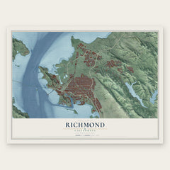

More maps nearby: Iron Triangle, East Richmond Heights, El Sobrante, Montalvin Manor and Tara Hills.
The art of mapping a place
How This Map Was Made
Real places. Remarkable detail. Discover the layers that turn geographic data into a map of home.

The view from above
Aerial imagery reveals the character of the land: woodland, open fields, and the patterns of a place.

The shape of the land
Elevation data brings hills, valleys, and subtle changes in the landscape into view.

The details of home
Roads, waterways, and building footprints come together to make the map feel unmistakably local.

Geography becomes art
Considered color, shading, and typography bring the layers together in a map made for your wall.


Process illustrated with Mendon, Massachusetts. Aerial imagery: USDA NAIP. Terrain: USGS 3D Elevation Program. Map details and finished artwork: KNOWOL.
The Details
About This Print
Choose an archival matte print, or a black or white Ayous wood frame. The archival matte print is unframed.
Select your size and finish above to see the matching product image and price.
Materials & Craftsmanship
A contemporary map with the character of a classic atlas, printed on archival matte paper. Optional frames are made from Ayous wood.
Your printed map does not include the watermark shown in the full-map preview.
Shipping & Delivery
Free shipping within the United States. Every print is made to order in the USA.
Buying a gift? Add a note in your cart and we'll include it. We never put prices in the package.
Prints ship within 2 to 3 business days. Allow 7 to 10 days total from ordering for delivery. Timing may vary during holidays or periods of high order volume.
Read our shipping policy.
Returns and damaged prints
Each print is made to order. Change-of-mind refunds are not available after production.
If your print arrives damaged, misprinted or incorrect, contact support@knowol.com within 30 days of receiving it. Include your order number, photos and a description of the issue.
Read our full refund and replacement policy. For questions about your order, email support@knowol.com.