


Search for another town





Free U.S. delivery 7 to 10 days after you order
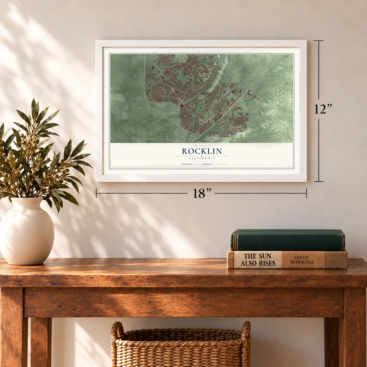
Rocklin, California Map Art
Building by building, with labeled streets and shaded relief.
12" x 18" Archival Matte Print
A Map of Home. A Work of Art.
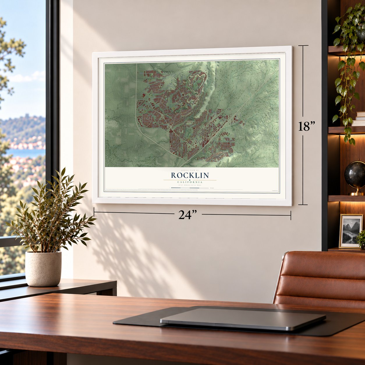
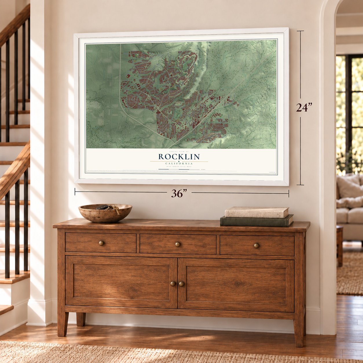
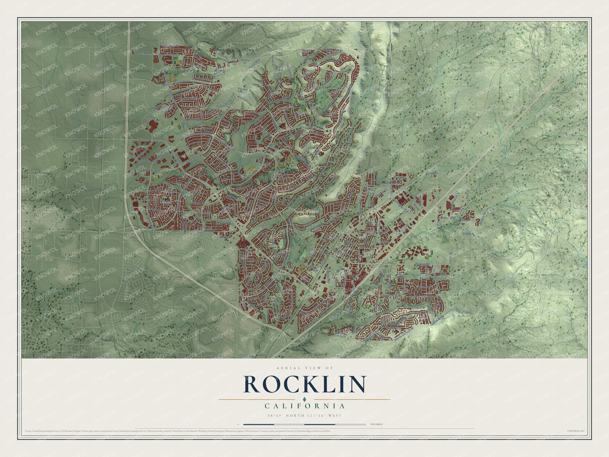
Explore Rocklin, California from a whole new perspective. Created using aerial imagery and detailed geographic data, this map captures Rocklin building by building, with labeled streets, familiar landmarks, and shaded topographical relief that highlights the natural contours of the landscape.
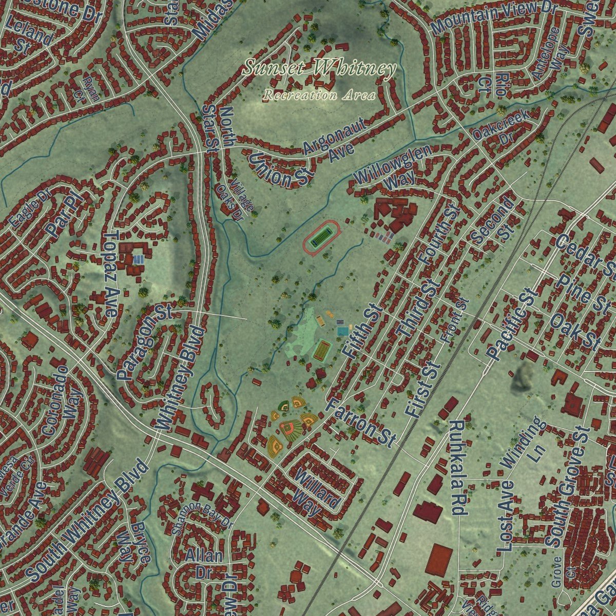
Combining modern data with the timeless character of a vintage atlas, this map is just as interesting up close as it is beautiful on the wall. Whether you grew up in Rocklin, spent memorable years there, or call it home today, this unique map is a great way to celebrate a place that means something to you. Zoom in on the preview to look for your street, and then order a print to put your memories on the wall.
Three ways to hang it
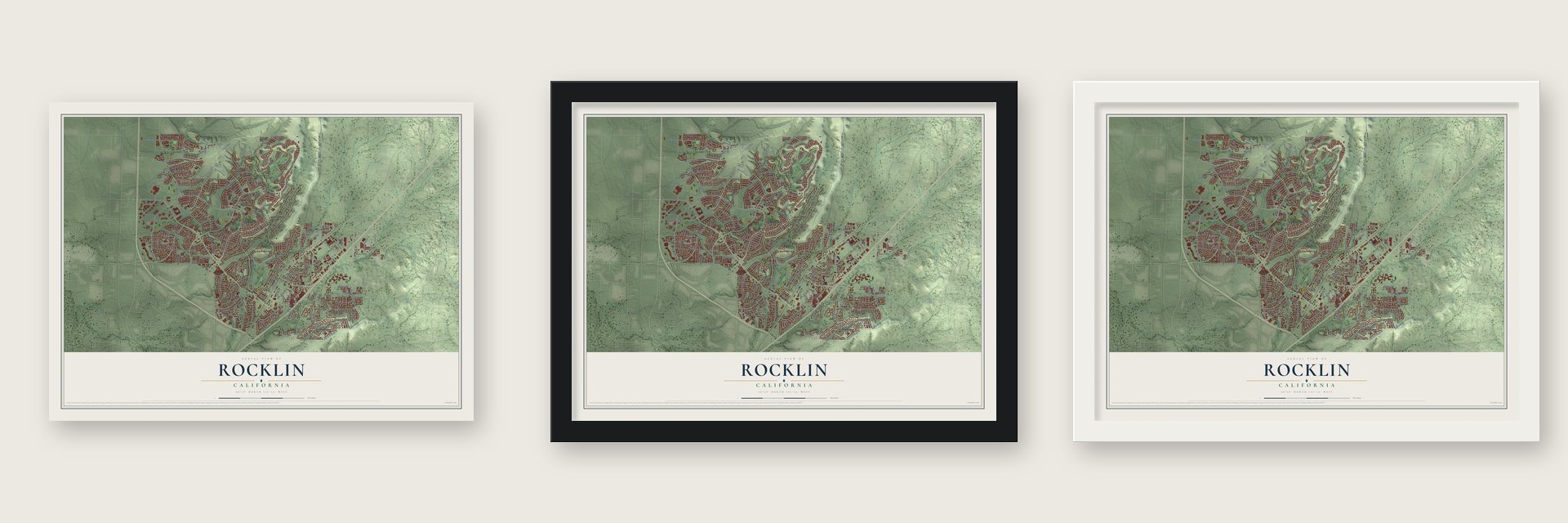
Unframed archival matte, a black wood frame or a white wood frame.
Up close
Geography Worth Displaying
This map was created using accurate cartographic data and authoritative geographic sources, including the U.S. Geological Survey and the Census Bureau. The map brings together terrain, waterways, roads, and building detail. The majority of the streets are labeled, houses are accurately depicted, and the topography is derived from government sources. Combining local data with carefully composed color and shading leads to this beautifully detailed Rocklin artwork for your wall.
Rather than simply showing street outlines, we’ve included as many of the street names as we could reasonably fit on the map while keeping their names legible. Zoom in on the high resolution preview to see exactly what’s on the map. We truly set out to create a statement piece for anyone who loves Rocklin. So whether it’s for you, or a gift for someone you love, we hope this map of Rocklin brings back fond memories.
Read the story behind this map of Rocklin, California from 2026.

Find your street
Names on the Rocklin map
Every name below is printed on this map. Look for your street, your school, the park where you played, or the pond down the road.
Places and landmarks1
- Sunset Whitney Recreation Area
Streets and roads280
- Sunset Boulevard
- Pacific Street
- Rocklin Road
- Blue Oaks Boulevard
- Farrier Road
- Devon Drive
- Spring Creek Drive
- Clubhouse Drive
- Tahoe Vista Drive
- El Don Drive
- Yuma Way
- Clubhouse Drive West
- Pine Street
- Strand Road
- Delmar Avenue
- Club Drive
- Park Drive
- Stanford Ranch Road
- Whitney Boulevard
- Sierra College Boulevard
- Whitney Ranch Parkway
- West Oaks Boulevard
- Clover Valley Road
- Granite Drive
- Midas Avenue
- University Avenue
- Wildcat Boulevard
- Coldwater Drive
- West Stanford Ranch Road
- Crest Drive
Show all 280 streets
- Lonetree Bl
- Springview Drive
- Rawhide Road
- Whitney Oaks Drive
- West Oaks Bl
- Ranch View Drive
- Lonetree Boulevard
- Sunset Bl
- China Garden Road
- Scarborough Drive
- Third Street
- Fairway Drive
- Atherton Road
- Longtree Boulevard
- Black Oak Drive
- Longview Drive
- Hillcrest Road
- Sioux Street
- Wyckford Boulevard
- Sierra College Bl
- Yankee Hill Road
- Dusty Stone Loop
- Pebble Beach Road
- Mountaingate Drive
- South Whitney Boulevard
- Greenbrae Road
- Fifth Street
- Westwood Drive
- Charter Road
- Briddlewood Drive
- Cobblestone Drive
- Par Place
- Topaz Avenue
- Modoc Street
- Arnold Drive
- Echo Ridge Road
- Grove Street
- Southside Ranch Road
- Woodside Drive
- Terrace Drive
- Barton Road
- Paragon Street
- Iroquois Road
- Rainier Avenue
- Silver Lupine Lane
- Sweetwater Drive
- Scenic Drive
- Dias Lane
- Spotted Pony Lane
- Aguilar Road
- Humboldt Drive
- Wesley Road
- Dominguez Road
- Larkspur Drive
- Farron Street
- Coppervale Drive
- Breen Drive
- South Grove Street
- Cedar Street
- Stoney Road
- First Street
- Outlook Drive
- Five Star Boulevard
- Schribler Way
- Tenbury Lane
- Hidden Glen Drive
- Redwood Drive
- Oak Street
- Ruhkala Road
- Lavastone Drive
- Knotty Pine Place
- Lost Avenue
- Croft Lane
- Cameron Drive
- Blaydon Road
- Del Rio Court
- Tuttle Drive
- Kali Place
- Onyx Drive
- Schatz Lane
- Hunter Drive
- Alvis Court
- Silver Street
- Durham Road
- James Drive
- Meyers Street
- Bay Street
- Cornwall Court
- Sierra Boulevard
- Plaza Drive
- Union Street
- Sylvan Drive
- Piute Street
- Isle Street
- Vine Circle
- Brace Road
- Balfor Drive
- Vine Ci
- Blue Oaks Bl
- Monroe Way
- Tripp Way
- Argonaut Avenue
- Sierra Meadows Drive
- Second Street
- Casa Grande Avenue
- Old Ranch House Road
- Fenway Circle
- Saratoga Circle
- Sorrell Circle
- Rustic Hills Drive
- Fourth Street
- Wild Plains Circle
- Jewel Street
- Hoot Owl Loop
- Tanus Circle
- Thunder Ridge Circle
- Little Rock Road
- Painted Pony Lane
- Creek Hollow Road
- Windham Way
- Turnstone Way
- Racetrack Circle
- Aitken Dairy Road
- Mountain View Drive
- Swindon Road
- North Star Street
- Anvil Circle
- Winding Lane
- Calico Drive
- Pleasant Creek Drive
- Broken Rail Lane
- Coronado Way
- Albatross Way
- Menlo Drive
- Lakepointe Drive
- Barrington Hills Drive
- Abby Road
- Destiny Drive
- West Ranch View Drive
- Sammy Way
- Bluffs Drive
- Fox Hill Drive
- Mariella Drive
- Avon Road
- Cassia Way
- Navajo Drive
- Poppy Drive
- Willard Way
- Syracuse Drive
- Allan Drive
- Taft Drive
- Citrus Avenue
- Willowglen Way
- Hickory Way
- Sandhill Drive
- Turquoise Drive
- Water Lily Lane
- Genesee Drive
- Marlee Way
- Crestwood Drive
- Brant Way
- Stardust Street
- Bent Oak Lane
- Sterling Drive
- Klamath Drive
- Jersey Drive
- Apache Drive
- Pioneer Way
- Bryce Way
- Ford Road
- Foothill Road
- Powder Ridge Drive
- Victory Drive
- Misty Hollow Drive
- Miravista Drive
- Adobe Road
- Glacier Drive
- Holden Drive
- Orion Way
- Circuit Drive
- Sandy Trail
- Leland Street
- Hood Road
- Holly Court
- Jade Drive
- Lake Side
- Rio Court
- Apple Grey Lane
- Pebble Creek Drive
- Lakebreeze Drive
- Darby Road
- River Run Circle
- Front Street
- Kingwood Circle
- Monument Springs Drive
- Silver Peak Lane
- Collet Quarry Drive
- Preston Circle
- Black Willow Street
- Warren Lane
- Flintlock Lane
- Casa del Oro Way
- Sonora Pass Way
- Corona Circle
- Americana Way
- Camelot Drive
- Old Oak Creek Way
- Eagle Drive
- Archer Circle
- Antelope Way
- Aaron Drive
- Oakcreek Drive
- Tamarack Drive
- Laredo Drive
- Victory Lane
- Vivian Way
- Gatwick Way
- Raintree Court
- Regina Street
- Santa Fe Way
- Live Oak Lane
- Evan Court
- Cody Court
- Camp Whitney Circle
- Gold Circle
- Brookside Circle
- Legend Drive
- Ridge View Circle
- Miners Circle
- Baronial Lane
- Twin Creeks Lane
- Shannon Bay Drive
- Adams Drive
- Fleet Circle
- Mesa Verde Circle
- Freeman Drive
- Grove Court
- Creekwood Drive
- Theona Way
- Surfbird Lane
- Village Oaks Drive
- Bass Pro Drive
- Manzanita Drive
- Winter Rush Drive
- Badger Pass Drive
- Anthony Court
- King Pine Drive
- Spring Court
- Piton Way
- Ryan Court
Names are listed as they appear on the printed map. Zoom into the product photos to find them.
About Rocklin, California
Rocklin is a city of 71,601 people in Placer County, about 22 miles northeast of Sacramento. Nisenan Maidu villages stood along the streams here before the Gold Rush, and in the 1850s miners worked Secret Ravine for gold. Men also cut granite from the ravine and hauled it out by oxcart, and the earliest record of its use is at Fort Mason in San Francisco in 1855. The 1860 census found 440 people around Secret Ravine, most of them miners and about 16% born in Ireland.
The Pacific Railroad Act of 1862 gave the Central Pacific land near the ravine, and its tracks reached the quarries in 1864. The railroad named the stop Rocklin for its granite, used it to take on fuel and water, and built a roundhouse there in 1867. After the transcontinental line was finished in 1869, traffic through town grew. The 1870 census counted 542 residents, and by then most of the Irish had left mining for railroad jobs. A post office opened in 1868, and Rocklin incorporated in 1893.
“The Central Pacific Railroad arrived in Rocklin in May of 1864 and extended onto Newcastle in July, 1864. The first loads, put on freight cars in Rocklin, were pieces of granite to be used for the construction of the tunnels and roadbed as it proceeded toward Newcastle.”
- Extra engines for the mountainThe Rocklin roundhouse kept the extra locomotives that were hooked onto trains climbing the mountain. It could hold about thirty engines, though a fire later burned part of it, and the yard sometimes had as much as 25,000 cords of wood stacked up to fuel them. In 1908 the Central Pacific moved its shops from Rocklin to Roseville, where it had room to grow.
- Free water from the tendersWells dug into the granite gave fair water, but people drank mountain water instead. Locomotive tenders came down from the mountains full, and a siphon stayed hooked to one engine's tank so anyone could take what they wanted for free. Residents credited that water for keeping intermittent fever away, and they boasted that the town had never had a case of diphtheria.
- Granite until 2004The quarries at Secret Ravine, near where Ruhkala Road meets Pacific Street, supplied granite for the base course of the California Capitol Building. They gave work to many people for generations, and granite mining in Rocklin finally ended in 2004.
- China GardensIn 1869 a group of Chinese railroad workers who had lost their jobs settled in Secret Ravine, where they mined and grew vegetables to sell in the area. In 1876, after some of them were accused of killing three people near Rocklin, the Chinese were violently forced out. People still called the spot China Gardens in 1974.
Keep exploring California
Rocklin is one of 1,990 California towns we've mapped. Every dot on the map is a print of its own.
The search covers every state, California first.
Near Rocklin
Order 2 or more town maps and save 10%. Shown in the size and finish you picked above, so they hang as a set.
- Loomis 12" x 18" / Archival Matte Print $39.99
- Whitney 12" x 18" / Archival Matte Print $39.99
- Roseville 12" x 18" / Archival Matte Print $39.99


More maps nearby: Penryn, Lincoln, Granite Bay, Newcastle and Citrus Heights.
The art of mapping a place
How This Map Was Made
Real places. Remarkable detail. Discover the layers that turn geographic data into a map of home.

The view from above
Aerial imagery reveals the character of the land: woodland, open fields, and the patterns of a place.

The shape of the land
Elevation data brings hills, valleys, and subtle changes in the landscape into view.

The details of home
Roads, waterways, and building footprints come together to make the map feel unmistakably local.

Geography becomes art
Considered color, shading, and typography bring the layers together in a map made for your wall.


Process illustrated with Mendon, Massachusetts. Aerial imagery: USDA NAIP. Terrain: USGS 3D Elevation Program. Map details and finished artwork: KNOWOL.
The Details
About This Print
Choose an archival matte print, or a black or white Ayous wood frame. The archival matte print is unframed.
Select your size and finish above to see the matching product image and price.
Materials & Craftsmanship
A contemporary map with the character of a classic atlas, printed on archival matte paper. Optional frames are made from Ayous wood.
Your printed map does not include the watermark shown in the full-map preview.
Shipping & Delivery
Free shipping within the United States. Every print is made to order in the USA.
Buying a gift? Add a note in your cart and we'll include it. We never put prices in the package.
Prints ship within 2 to 3 business days. Allow 7 to 10 days total from ordering for delivery. Timing may vary during holidays or periods of high order volume.
Read our shipping policy.
Returns and damaged prints
Each print is made to order. Change-of-mind refunds are not available after production.
If your print arrives damaged, misprinted or incorrect, contact support@knowol.com within 30 days of receiving it. Include your order number, photos and a description of the issue.
Read our full refund and replacement policy. For questions about your order, email support@knowol.com.