
Search for another town





Free U.S. delivery 7 to 10 days after you order
Round Lake, Illinois Map Art
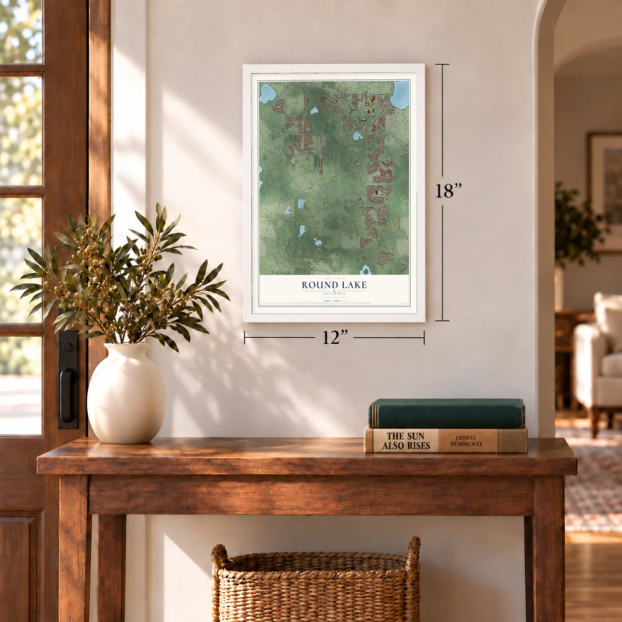
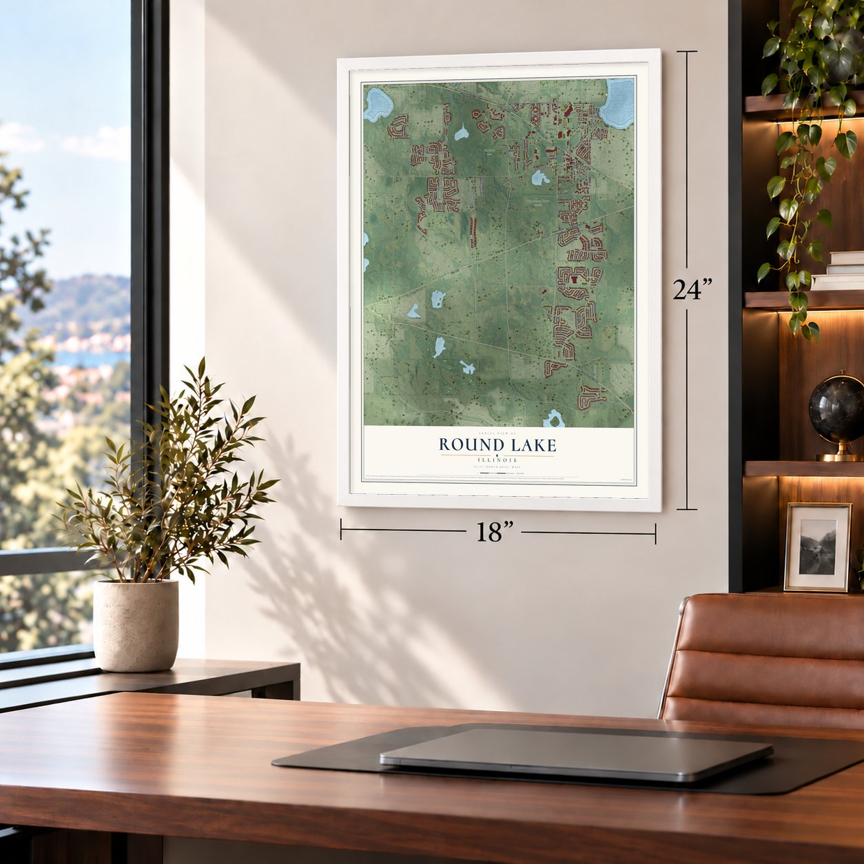
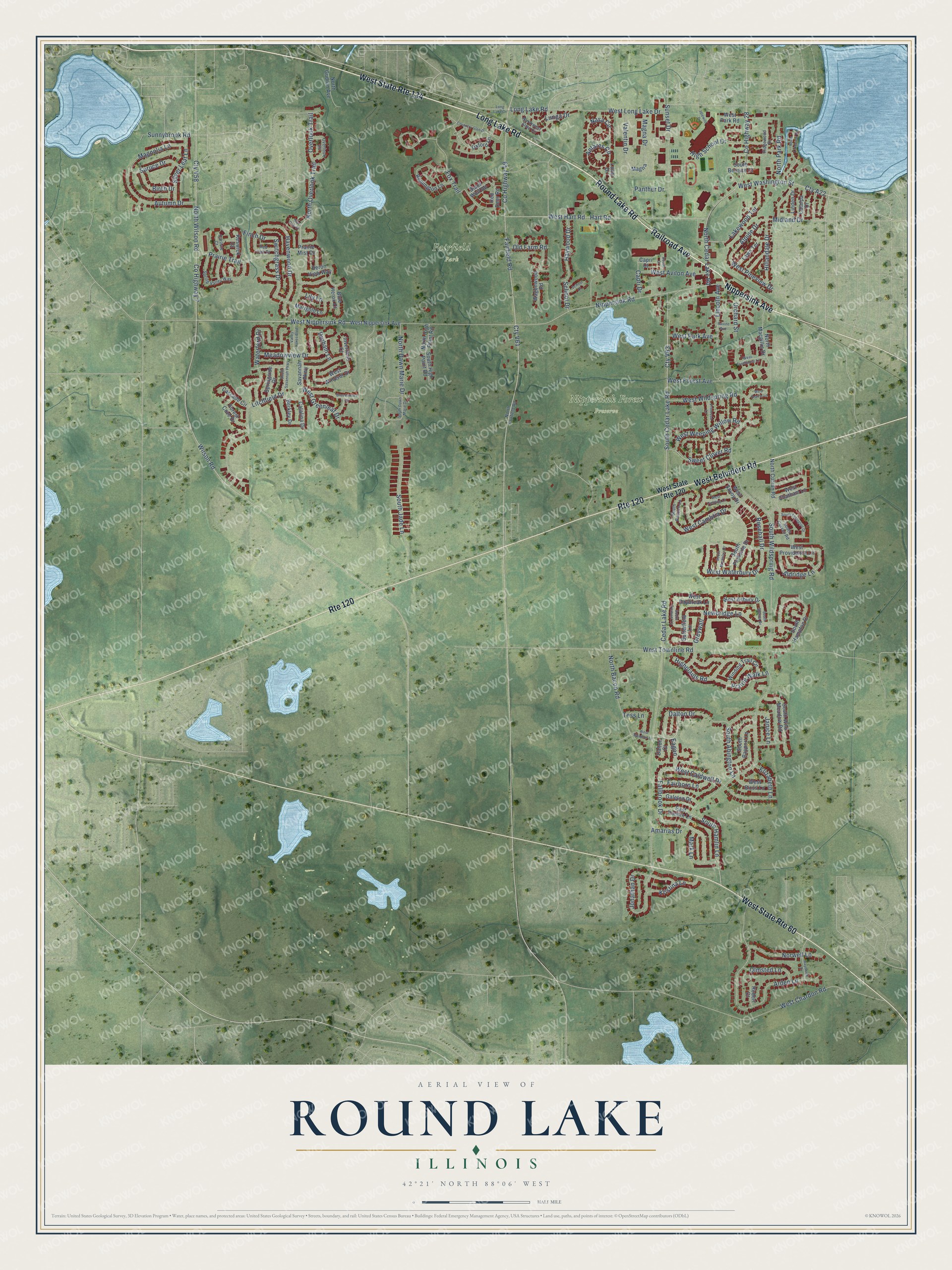
A new map of Round Lake, Illinois, made in 2026 and printed to order on thick archival matte paper.
12" x 18" Archival Matte Print
A Map of Home. A Work of Art.
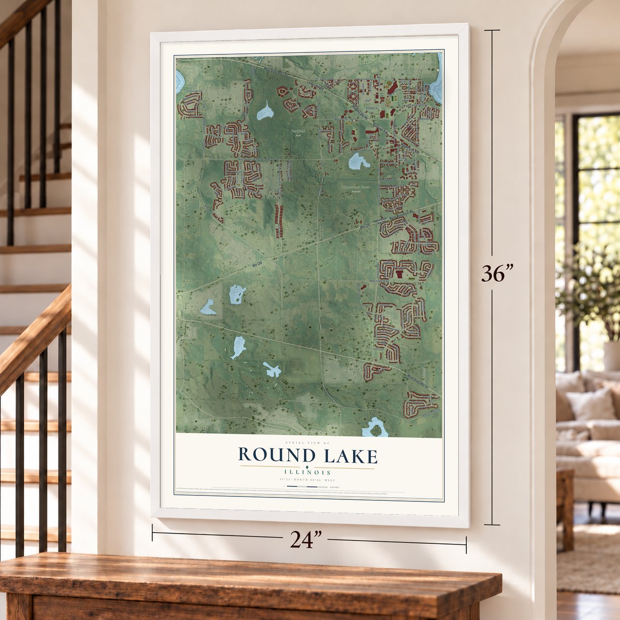
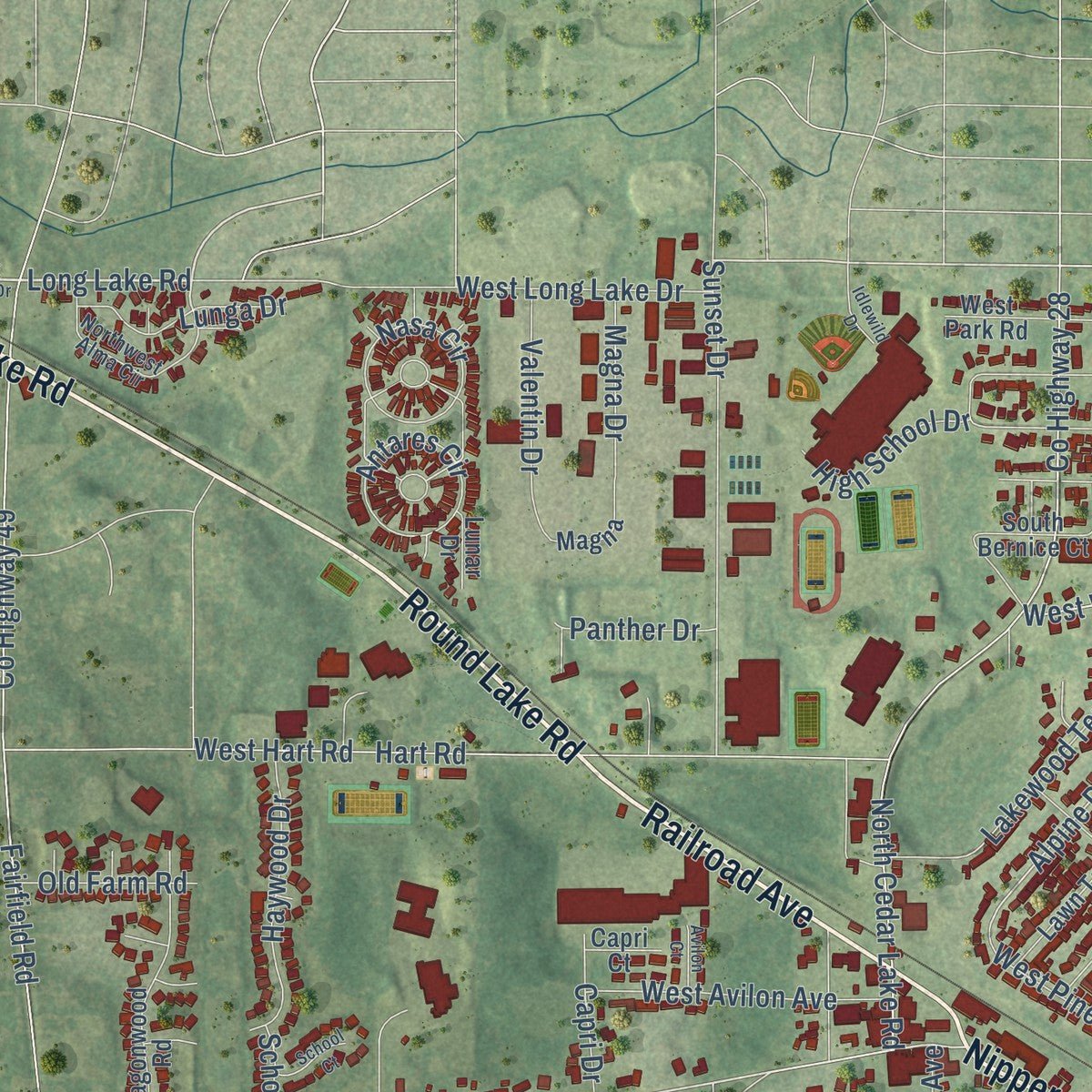
Explore Round Lake, Illinois from a whole new perspective. Created using aerial imagery and detailed geographic data, this map captures Round Lake building by building, with labeled streets, familiar landmarks, and shaded topographical relief that highlights the natural contours of the landscape.
Combining modern data with the timeless character of a vintage atlas, this map is just as interesting up close as it is beautiful on the wall. Whether you grew up in Round Lake, spent memorable years there, or call it home today, this unique map is a great way to celebrate a place that means something to you. Zoom in on the preview to look for your street, and then order a print to put your memories on the wall.
Three ways to hang it
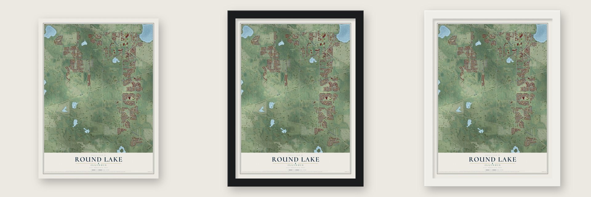
Unframed archival matte, a black wood frame or a white wood frame.
Up close
Geography Worth Displaying
This map was created using accurate cartographic data and authoritative geographic sources, including the U.S. Geological Survey and the Census Bureau. The map brings together terrain, waterways, roads, and building detail. The majority of the streets are labeled, houses are accurately depicted, and the topography is derived from government sources. Combining local data with carefully composed color and shading leads to this beautifully detailed Round Lake artwork for your wall.
Rather than simply showing street outlines, we’ve included as many of the street names as we could reasonably fit on the map while keeping their names legible. Zoom in on the high resolution preview to see exactly what’s on the map. We truly set out to create a statement piece for anyone who loves Round Lake. So whether it’s for you, or a gift for someone you love, we hope this map of Round Lake brings back fond memories.
Read the story behind this map of Round Lake, Illinois from 2026.

About Round Lake, Illinois
Round Lake is a village of 18,721 people in Lake County, about 55 miles northwest of Chicago's Loop. Once the Black Hawk War of 1832 ended, farmers began settling the western part of Lake County, but its many lakes and wet prairies made it hard to get goods to market. They traded eggs and dairy goods at stagecoach stops like Hainesville. In the 1890s the Chicago, Milwaukee & St. Paul Railroad built a branch line through the area from Libertyville Junction to Janesville, Wisconsin.
Amarias M. White, who owned land near Hainesville, knew a station would raise property values. He offered the railroad free land and drew up a town plat to prove the stop would bring business. Hainesville offered nothing, so the station went to White's site and took the name of the nearby lake. White and his partners moved to incorporate in 1908, and Round Lake became a village on January 7, 1909, with White as its first president.
“In 1901, Armour and Company completed work on a five acre ice house in Round Lake and was said to be the largest in the world.”
- Armour's ice houseThe Armour Company began cutting ice from Round Lake in 1901 to supply its refrigerator railcars. Its huge storage building held more than 100,000 tons, saved for shipping in the warm months. Fire destroyed the operation in 1917, but the dormitory for the winter ice cutters survived, and Armour turned it into a summer retreat for its workers. Their praise for the area drew the first residents who weren't farmers.
- A village without its lakeThe station area had too few people to incorporate, so White's group took in nearby farms and promised the farmers they could leave once the vote passed. Many did leave soon after, and because of that the village has no public access to the lake it is named for.
- Many Round LakesAfter World War II, newcomers settled the unincorporated land around the lake and asked for town services, but the village didn't annex them. New villages formed with Round Lake in their names, each with its own government and services. Round Lake began a broad annexation program in the 1970s, and between 2000 and 2010 it grew 213.1%, from 5,842 people to 18,289.
- Born here in 1981Clay Guida, who went on to fight in the UFC, was born in Round Lake in 1981.
Find your street
Names on the Round Lake map
Every name below is printed on this map. Look for your street, your school, the park where you played, or the pond down the road.
Places and landmarks2
- Fairfield Park
- Nippersink Forest Preserve
Streets and roads183
- Railroad Avenue
- Round Lake Road
- Nippersink Avenue
- West State Route 134
- Long Lake Road
- Route 120
- West Belvidere Road
- West State Route 60
- Fallbrook Drive
- Eagon
- South Hamlin Lane
- County Highway 7
- Cty V58
- North Wilson Road
- West Waterbury Drive
- Nippersink Road
- Rosehall Drive
- Midland Drive
- Alpine Drive
- West Washington Street
- Switchgrass Drive
- Sunnybrook Road
- Cedar Lake Road
- County Highway 28
- Cty V63
- Wilson Road
- Amarias Drive
- County Highway 49
- Cty V61
- West Townline Road
Show all 183 streets
- South Wildspring Road
- West Nippersink Road
- North Cedar Lake Road
- Arden Lane
- Fairfield Road
- South Cedar Lake Road
- Hart Road
- West Hart Road
- Fox Trail
- North Overlook Trail
- Overlook Trail
- Litchfield Drive
- South Jade Lane
- West Wildspring Road
- West Long Lake Drive
- Sunset Drive
- West Chardon Road
- North Bacon Road
- West Caldwell Drive
- Havenwood Drive
- Newbridge Lane
- West Forest Avenue
- Prairie Trail
- Autumn Drive
- Lakewood Terrace
- Cty A22
- Dalton Drive
- Kristina Lane
- Waterford Drive
- Lincoln Avenue
- Jonathan Drive
- West Weeping Willow Road
- South Abington Lane
- Highplains Road
- Haywood Drive
- West Cambria Drive
- North Dawn Marie Drive
- Norwell Lane
- Silver Leaf Lane
- Nasa Circle
- West Avilon Avenue
- Antares Circle
- Sweet Clover Road
- Meadowview Drive
- Hillandale Drive
- Magnolia Lane
- Prairie Walk Lane
- North Park Road
- West Greenleaf Drive
- Valentin Drive
- Aldridge Lane
- Olmsted Lane
- West Pineview Drive
- Fairborn Lane
- Spruce Drive
- Lunga Drive
- West Park Avenue
- Panther Drive
- High School Drive
- Mark Lane
- Birch Drive
- Durham Lane
- Orchard Street
- Magna Drive
- Old Farm Road
- Janice Lane
- Elizabeth Lane
- Tess Lane
- Capri Drive
- Lily Lane
- Greywall
- Finch Drive
- School Drive
- West State Route 120
- West Daybreak Lane
- Butterfield Lane
- South Wild Meadow Road
- West Nippersink Avenue
- West Providence Lane
- Oxford Lane
- Remington Lane
- West Savoy Drive
- South Parkside Drive
- Springside Drive
- West Park Road
- Wagonwood Road
- Heron View Way
- Winding Trail Circle
- South Bayport Lane
- North Macgillis Drive
- North Curran Road
- West Asbury Drive
- West Windsor Drive
- Prairie Mist Drive
- North Gudrun Avenue
- Forest Cove Drive
- Savannah Parkway
- Marigold Lane
- South Hampton Drive
- Galeton Drive
- West Chatham Lane
- West Biros Lane
- Cascade Circle
- Linden Drive
- Lawn Terrace
- Catalpa Drive
- East Hamlin Lane
- Inverness Court
- Catalina Drive
- South High Point Road
- Black Wolf Road
- Keswick Court
- Blue Heron Court
- Berkley Drive
- North High Point Road
- South Bernice Court
- Magna
- Red Deer Road
- Robert Court
- Dalton Court
- Lunar Drive
- Capri Court
- North Fairfield Road
- Spring Valley Way
- Northwest Alma Circle
- Overlook Circle
- South Curran Road
- South Beacon Lane
- Red Oak Drive
- Ridgewood Drive
- Carlisle Court
- West Meadow Lane
- Long Lake Drive
- South Tremont Lane
- South Savannah Parkway
- West Treehouse Lane
- Valley Lakes Boulevard
- South Dawn Marie Drive
- Coventry Glen Drive
- North Lakeview Drive
- Raymond Drive
- South Essington Drive
- West Fielding Lane
- Primrose Lane
- South Montclair Drive
- South Sienna Drive
- Broadsmore Lane
- West Prairie Lane
- Ravine Avenue
- School Court
- Avilon Court
- Idlewild Drive
- Burr Oak Court
Names are listed as they appear on the printed map. Zoom into the product photos to find them.
The art of mapping a place
How This Map Was Made
Real places. Remarkable detail. Discover the layers that turn geographic data into a map of home.

The view from above
Aerial imagery reveals the character of the land: woodland, open fields, and the patterns of a place.

The shape of the land
Elevation data brings hills, valleys, and subtle changes in the landscape into view.

The details of home
Roads, waterways, and building footprints come together to make the map feel unmistakably local.

Geography becomes art
Considered color, shading, and typography bring the layers together in a map made for your wall.


Process illustrated with Mendon, Massachusetts. Aerial imagery: USDA NAIP. Terrain: USGS 3D Elevation Program. Map details and finished artwork: KNOWOL.
The Details
About This Print
Choose an archival matte print, or a black or white Ayous wood frame. The archival matte print is unframed.
Select your size and finish above to see the matching product image and price.
Materials & Craftsmanship
A contemporary map with the character of a classic atlas, printed on archival matte paper. Optional frames are made from Ayous wood.
Your printed map does not include the watermark shown in the full-map preview.
Shipping & Delivery
Free shipping within the United States. Every print is made to order in the USA.
Buying a gift? Add a note in your cart and we'll include it. We never put prices in the package.
Prints ship within 2 to 3 business days. Allow 7 to 10 days total from ordering for delivery. Timing may vary during holidays or periods of high order volume.
Read our shipping policy.
Returns and damaged prints
Each print is made to order. Change-of-mind refunds are not available after production.
If your print arrives damaged, misprinted or incorrect, contact support@knowol.com within 30 days of receiving it. Include your order number, photos and a description of the issue.
Read our full refund and replacement policy. For questions about your order, email support@knowol.com.
Find your town
Looking for another city?
Find a map of home in our Illinois collection, or any town in the country.
Nearby
Maps of towns near Round Lake
Know someone from one of these towns? Their map makes a great gift.
 Round Lake Park
, Illinois
From $39.99See the map
 Hainesville
, Illinois
From $39.99See the map
 Long Lake
, Illinois
From $39.99See the map
More maps nearby: Round Lake Heights, Round Lake Beach, Volo, Grayslake and Wauconda.