
Search for another town




Free U.S. delivery 7 to 10 days after you order
Schenectady, New York Map Art
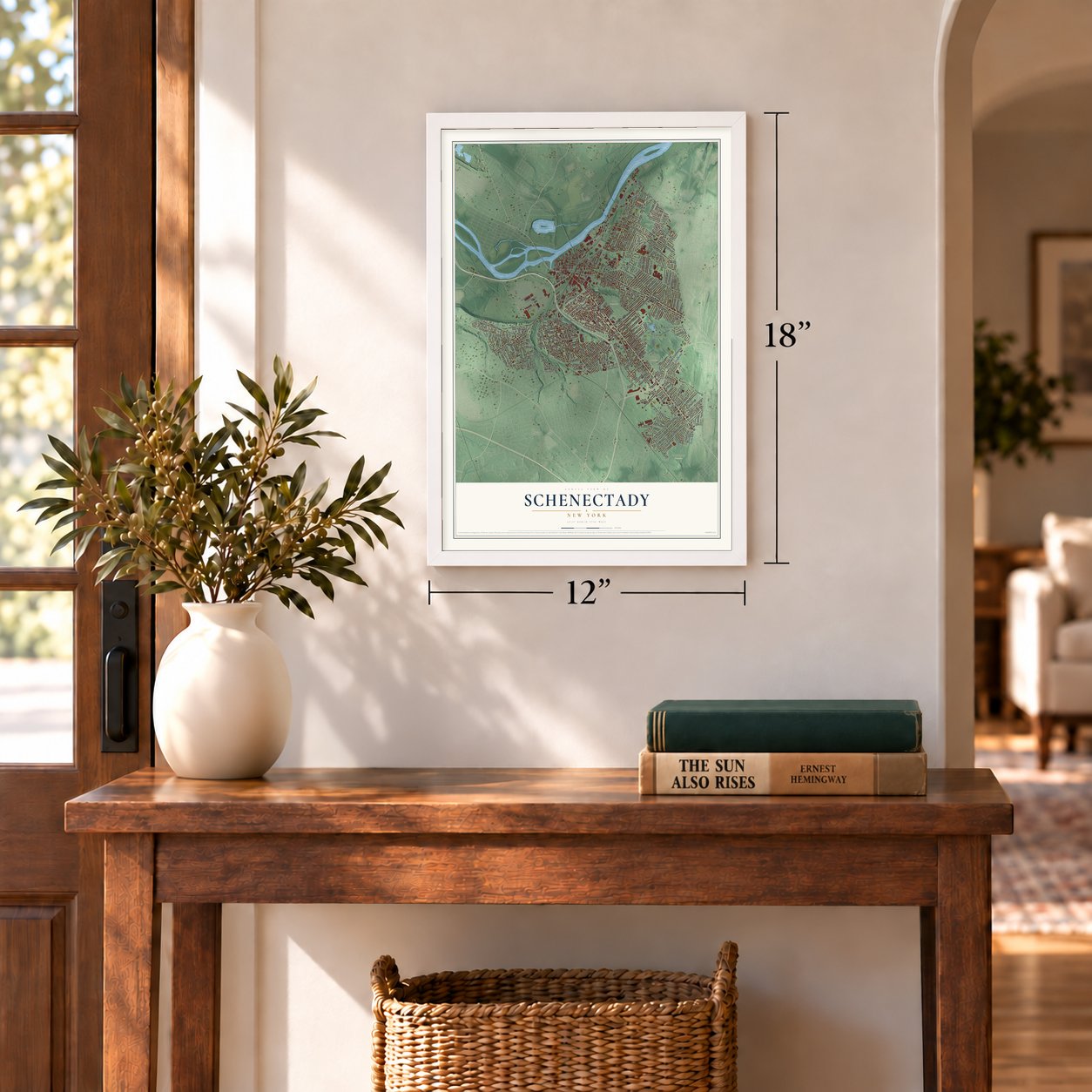
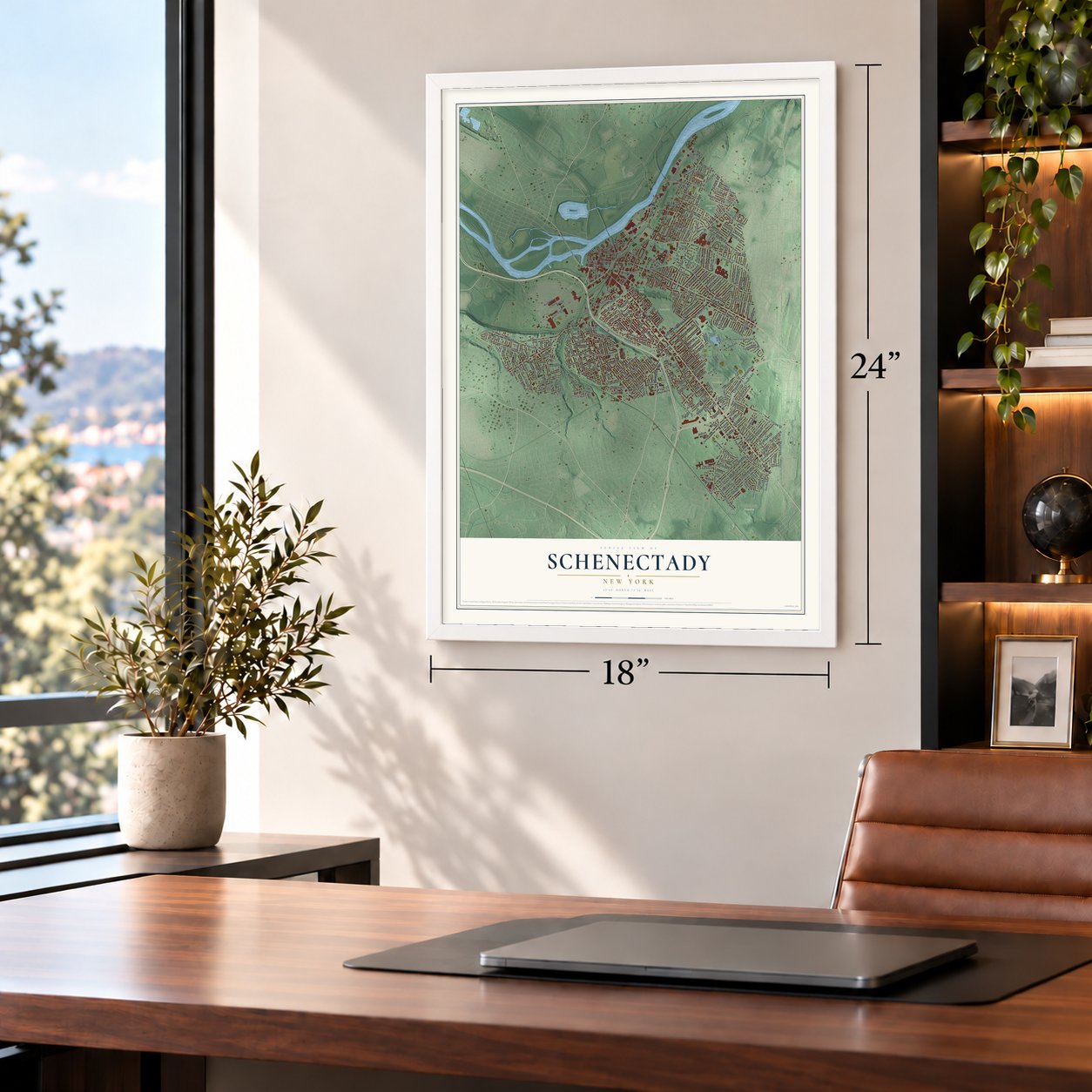
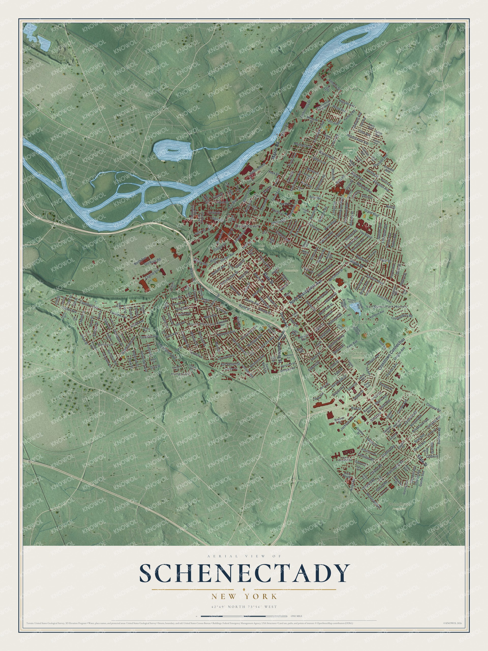
A new map of Schenectady, New York, made in 2026 and printed to order on thick archival matte paper.
12" x 18" Archival Matte Print
A Map of Home. A Work of Art.
Bring a piece of Schenectady home. Whether it’s where you grew up, your current home, or simply a moment in your life, this Schenectady, New York map print brings those memories to your wall. Antique-inspired styling and modern geographic detail combine to create artwork that’s beautiful from across the room, with plenty to study and explore when you get up close.
Three ways to hang it
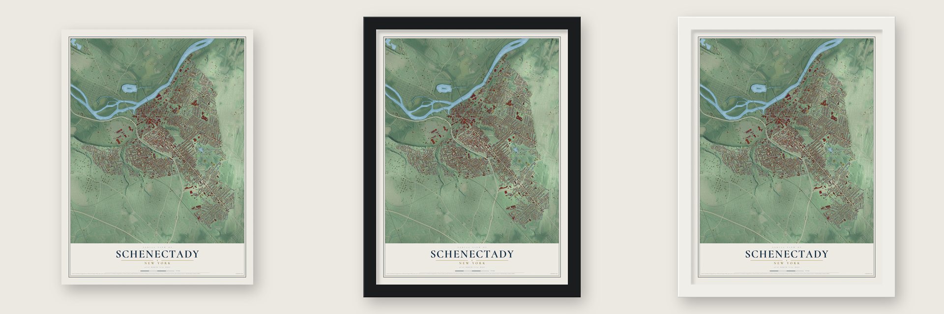
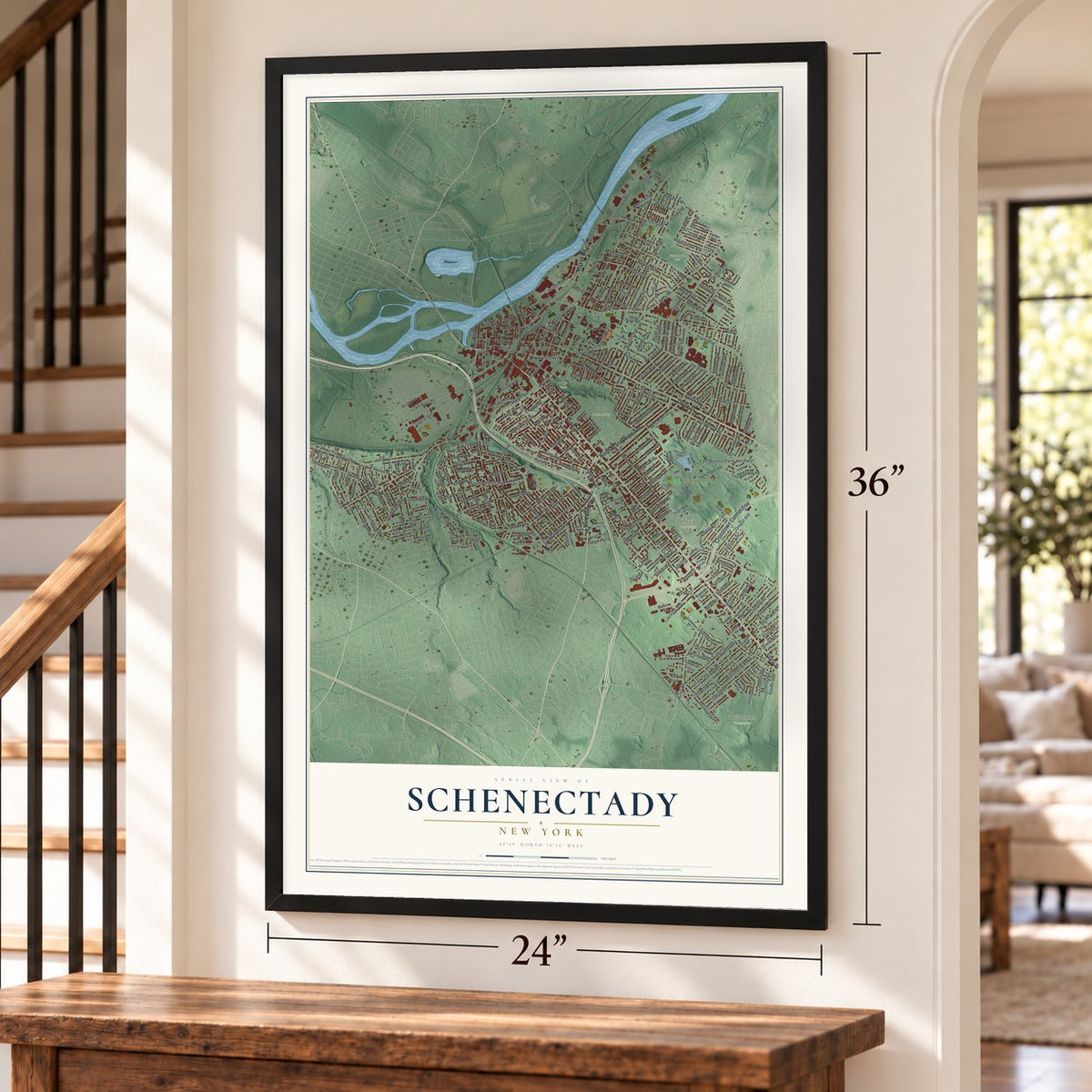
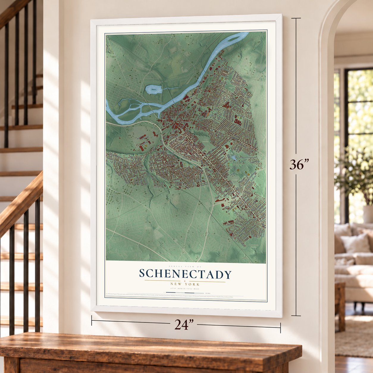
Unframed archival matte, a black wood frame or a white wood frame.
Up close
Real geography. Art worth displaying.
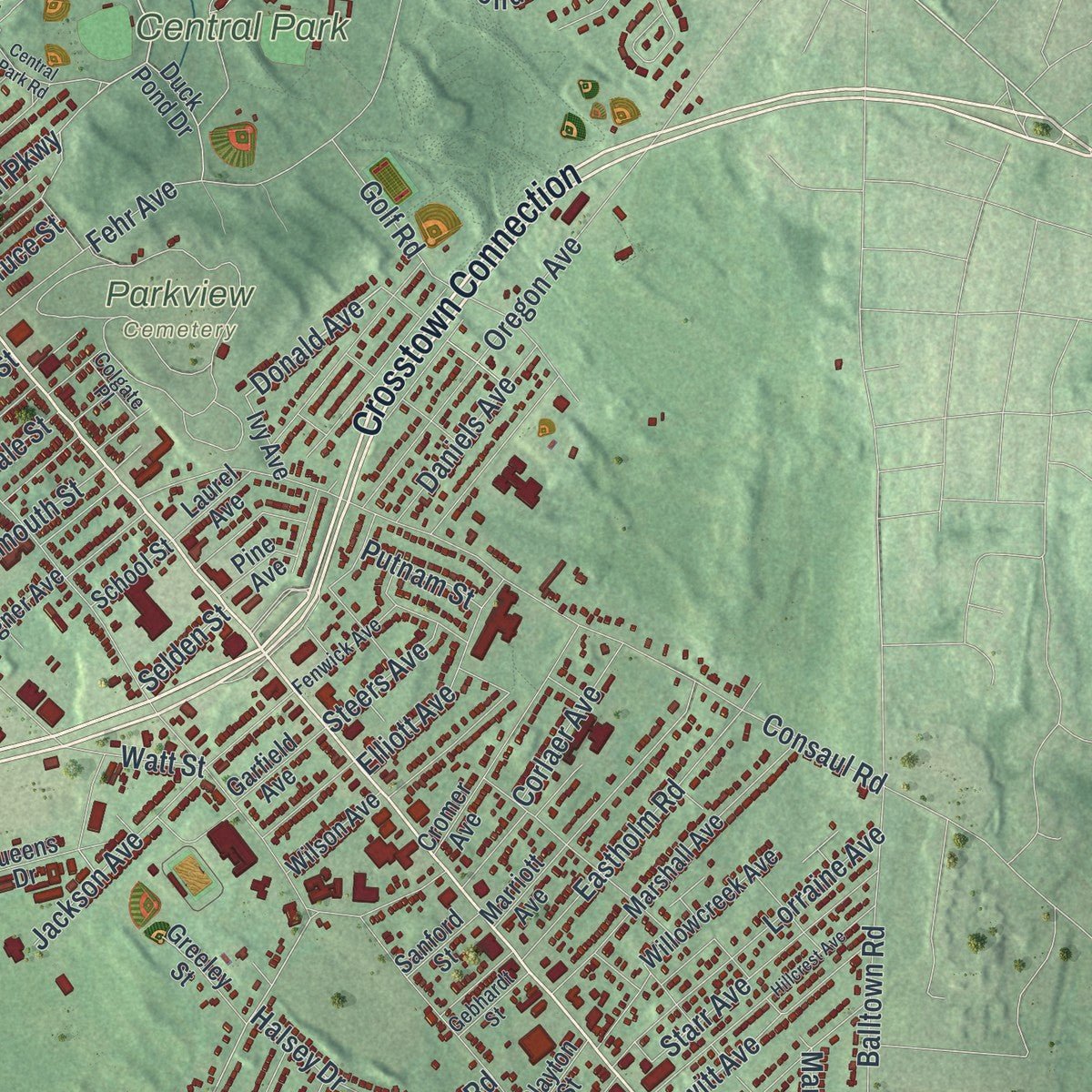
This map was created using accurate cartographic data and authoritative geographic sources, including the U.S. Geological Survey (USGS) and FEMA. The map brings together terrain, waterways, roads, and building detail. The majority of the streets are labeled, houses are accurately depicted, and the topography is derived from government sources. Combining local data with carefully composed color and shading leads to this beautifully detailed Schenectady artwork for your wall.
Rather than simply showing street outlines, we’ve included as many of the street names as we could reasonably fit on the map while keeping their names legible. Zoom in on the high resolution preview to see exactly what’s on the map. We truly set out to create a statement piece for anyone who loves Schenectady. So whether it’s for you, or a gift for someone you love, we hope this map of Schenectady brings back fond memories.
Explore the full map of Schenectady, New York and read about the local places it shows.

About Schenectady, New York
Within Schenectady County, New York, Schenectady is classified as a city, with an identity tied to places residents know by name. Local reference points include Franklin School and Bellevue, connecting the community's present landscape with the names that define this part of the state.
- 67,047 peopleCounted in the 2020 census.
- A historic landmarkFranklin School appears in National Register records associated with Schenectady.
- A historic landmarkSeeley Farmhouse appears in National Register records associated with Schenectady.
- Named local placesSources connect Schenectady with Mount Pleasant, Hungry Hill and Bellevue.
- Familiar local routesCrosstown Connection, Union Street and Brandywine Avenue cross the community.
Find your street
Names on the Schenectady map
Every name below is printed on this map. Look for your street, your school, the park where you played, or the pond down the road.
Places and landmarks11
- Downtown
- Central Park
- Parkview Cemetery
- Steinmetz Park
- Vale Cemetery
- Vale Park
- Woodlawn Preserve
- Bellevue
- Hungry Hill
- Mount Pleasant
- Van Buren Park Homes
Streets and roads341
- Crosstown Connection
- Union Street
- North Brandywine Avenue
- Hamburg Street
- State Street
- Maxon Road
- Broadway
- Donald Avenue
- Erie Boulevard
- Center Alley
- Western Parkway
- Van Vranken Avenue
- Vanvranken Avenue
- Congress Street
- Kings Road
- Summit Avenue
- North Elm Street
- Robinson Street
- Edison Avenue
- Albany Street
- McClellan Street
- Nott Street
- Lenox Road
- Eastern Parkway
- Watt Street
- Grand Boulevard
- Campbell Avenue
- Crane Street
- Consaul Road
- Eastern Avenue
Show all 341 streets
- Wendell Avenue
- Balltown Road
- Fehr Avenue
- Gerling Street
- Rosa Road
- Rugby Road
- Chrisler Avenue
- Strong Street
- Foster Avenue
- Lexington Avenue
- Central Avenue
- The Plaza
- Garner Avenue
- Guilderland Avenue
- Front Street
- Van Cortland Street
- Gifford Road
- Oregon Avenue
- Manchester Road
- Old River Road
- Liberty Street
- Duane Avenue
- Sumner Avenue
- Baker Avenue
- Hegeman Street
- Olean Street
- Altamont Avenue
- Chiswell Road
- Park Avenue
- Parkwood Boulevard
- Waverly Place
- Glenwood Boulevard
- East Alley
- Norwood Avenue
- West Alley
- Belmont Avenue
- Becker Street
- Bradford Road
- Seneca Street
- Clayton Road
- Michigan Avenue
- Dean Street
- Forest Road
- Emmett Street
- Technology Drive
- Twelfth Street
- Clinton Street
- Harrison Avenue
- Lafayette Street
- Pleasant Street
- Hulett Street
- Ten Eyck Avenue
- Turner Avenue
- Keyes Avenue
- Randolph Road
- Cutler Street
- Raymond Street
- Oakland Avenue
- Phoenix Avenue
- Cheltingham Avenue
- Eastholm Road
- Golf Road
- Jackson Avenue
- Lorraine Avenue
- Furman Street
- McDonald Avenue
- Division Street
- Wylie Street
- Sixth Avenue
- Fourth Avenue
- Paige Street
- Harborside Drive
- Veeder Avenue
- Helderberg Avenue
- Regal Avenue
- Union Avenue
- Stanley Street
- Webster Street
- Craig Street
- Starr Avenue
- Main Avenue
- Schenectady Street
- Hendrickson Avenue
- Sheridan Avenue
- Tenth Avenue
- Terrace Lane
- Nott Terrace
- Park Place
- Kingston Avenue
- Alexander Lane
- Third Avenue
- Perry Street
- Corlaer Avenue
- Seward Place
- Frank Street
- Londonderry Road
- Elder Street
- Elmer Avenue
- Linden Street
- Dewitt Avenue
- Lowell Road
- Ardsley Road
- North Jay Street
- Bedford Road
- Barrett Street
- Elton Avenue
- Dartmouth Street
- Plum Street
- Fairview Avenue
- Plymouth Avenue
- Steuben Street
- Edward Street
- Austin Place
- South Lane
- Elliott Avenue
- Francis Avenue
- Henry Street
- Carrie Street
- Clement Avenue
- Green Street
- Fuller Street
- Daniels Avenue
- Avon Road
- Davis Terrace
- North Lane
- Wright Avenue
- Gray Street
- Hillside Avenue
- Victory Avenue
- Weaver Street
- Jay Street
- Ulster Street
- Thompson Street
- Mason Street
- Gasner Avenue
- Wood Avenue
- Odell Street
- Stratford Road
- Haigh Avenue
- Van Velsen Street
- Eleanor Street
- Park Road
- Euclid Avenue
- 14th Street
- Osterlitz Avenue
- Swan Street
- Anthony Street
- Athol Road
- North Avenue
- Coniston Road
- Main Street
- Manhattan Street
- Grant Avenue
- Halsey Drive
- Steers Avenue
- Linda Lane
- 15th Street
- Oxford Place
- Marie Street
- Jerry Street
- Thew Street
- Regent Street
- Fourth Street
- Putnam Street
- Peek Street
- Cedar Street
- Spruce Street
- Third Street
- Selden Street
- Yale Street
- 17th Street
- Bradley Boulevard
- Washington Avenue
- Duck Pond Drive
- Dalton Drive
- Central Parkway
- Yates Village
- Maryvale Drive
- Iroquois Way
- Ashmore Avenue
- Marshall Avenue
- Alexander Street
- Van Curler Avenue
- Marriott Avenue
- Pennsylvania Avenue
- Cleveland Avenue
- Fifth Avenue
- Maxon Road Extended
- Cromer Avenue
- Cullen Avenue
- Rankin Avenue
- Ontario Street
- Salina Street
- University Place
- Second Avenue
- Bridge Street
- Colonial Avenue
- Poplar Street
- Oakwood Avenue
- Willowcreek Avenue
- South Church Street
- California Avenue
- Decamp Avenue
- Court Royale
- Golf Avenue
- North Ferry Street
- Millard Street
- Kailberg Road
- Greeley Street
- Dorwaldt Boulevard
- Kenwood Street
- Beaver Street
- Glengary Road
- Saint Marys Lane
- Lakeview Avenue
- Wagner Avenue
- Earl Avenue
- Livingston Avenue
- Frantzke Avenue
- Starling Avenue
- Wilson Avenue
- Garfield Avenue
- Catalyn Street
- Tracy Avenue
- John Street
- Gibson Street
- Kent Avenue
- Maple Avenue
- Tower Avenue
- Fifth Street
- Oak Street
- Vischer Avenue
- School Street
- Laurel Avenue
- Sixth Street
- Alice Street
- Second Street
- Clayton Street
- Sanford Street
- Queens Drive
- First Avenue
- Lake Boulevard
- Pine Avenue
- Ivy Avenue
- Mader Street
- 16th Street
- Ninth Street
- Bigelow Avenue
- Bailey Street
- 21st Street
- Yates Street
- Close Street
- White Street
- Morris Avenue
- Vale Place
- Erie Street
- Berg Road
- Sara Court
- Coplon Avenue
- Oneida Street
- Hattie Street
- 13th Street
- Bradt Street
- Fenwick Avenue
- Abbottsford Road
- Hampton Avenue
- Arthur Street
- Clinton Avenue
- Windermere Road
- Wyoming Avenue
- Unadilla Street
- Kelton Avenue
- Moyston Street
- Huron Street
- Lansing Street
- Fulton Avenue
- Gebhardt Street
- Delaware Avenue
- Charles Street
- Ferndale Avenue
- Vienna Street
- Monroe Street
- Sterling Avenue
- Colgate Place
- River Street
- Taylor Street
- Waldorf Place
- Robin Street
- Rush Street
- Bluff Avenue
- Villa Place
- Central Park Road
- Torrington Avenue
- Hamilton Street
- Santa Fe Street
- Hillcrest Avenue
- Wells Avenue
- Bradley Street
- Chadwick Road
- South Avenue
- Monument Hill Road
- Amsterdam Avenue
- Queen Philomena Boulevard
- Stanford Street
- Gillespie Street
- Douglas Road
- Palmer Avenue
- Park Street
- Devine Street
- Lewis Place
- Donnan Avenue
Names are listed as they appear on the printed map. Zoom into the product photos to find them.
The art of mapping a place
How This Map Was Made
Real places. Remarkable detail. Discover the layers that turn geographic data into a map of home.

The view from above
Aerial imagery reveals the character of the land: woodland, open fields, and the patterns of a place.

The shape of the land
Elevation data brings hills, valleys, and subtle changes in the landscape into view.

The details of home
Roads, waterways, and building footprints come together to make the map feel unmistakably local.

Geography becomes art
Considered color, shading, and typography bring the layers together in a map made for your wall.


Process illustrated with Mendon, Massachusetts. Aerial imagery: USDA NAIP. Terrain: USGS 3D Elevation Program. Map details and finished artwork: KNOWOL.
The Details
About This Print
Choose an archival matte print, or a black or white Ayous wood frame. The archival matte print is unframed.
Select your size and finish above to see the matching product image and price.
Materials & Craftsmanship
A contemporary map with the character of a classic atlas, printed on archival matte paper. Optional frames are made from Ayous wood.
Your printed map does not include the watermark shown in the full-map preview.
Shipping & Delivery
Free shipping within the United States. Every print is made to order in the USA.
Buying a gift? Add a note in your cart and we'll include it. We never put prices in the package.
Prints ship within 2 to 3 business days. Allow 7 to 10 days total from ordering for delivery. Timing may vary during holidays or periods of high order volume.
Read our shipping policy.
Returns and damaged prints
Each print is made to order. Change-of-mind refunds are not available after production.
If your print arrives damaged, misprinted or incorrect, contact support@knowol.com within 30 days of receiving it. Include your order number, photos and a description of the issue.
Read our full refund and replacement policy. For questions about your order, email support@knowol.com.
Find your town
Looking for another city?
Find a map of home in our New York collection.
Nearby
Maps of towns near Schenectady
Know someone from one of these towns? Their map makes a great gift.


