
Search for another town





Free U.S. delivery 7 to 10 days after you order
Scotchtown, New York Map Art
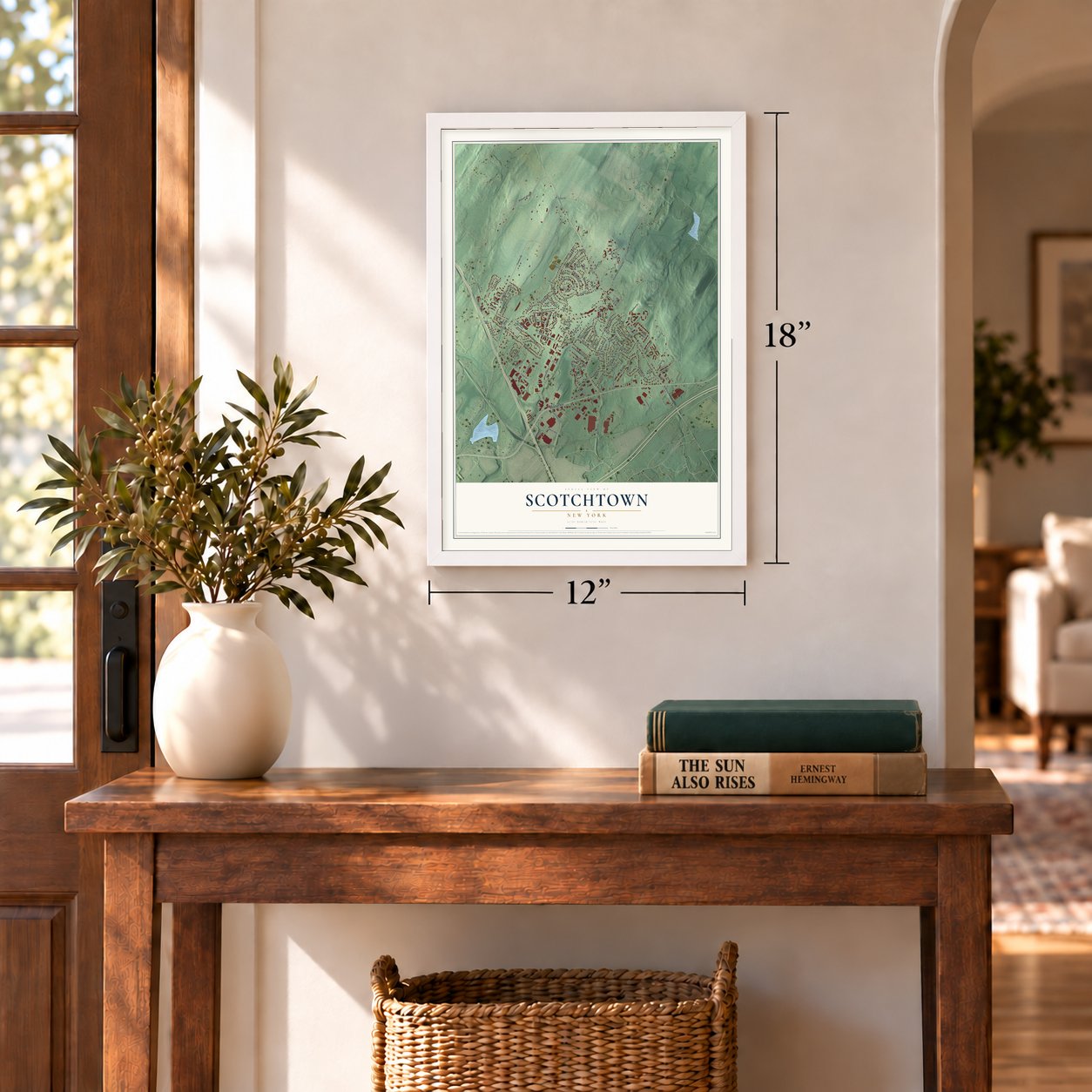
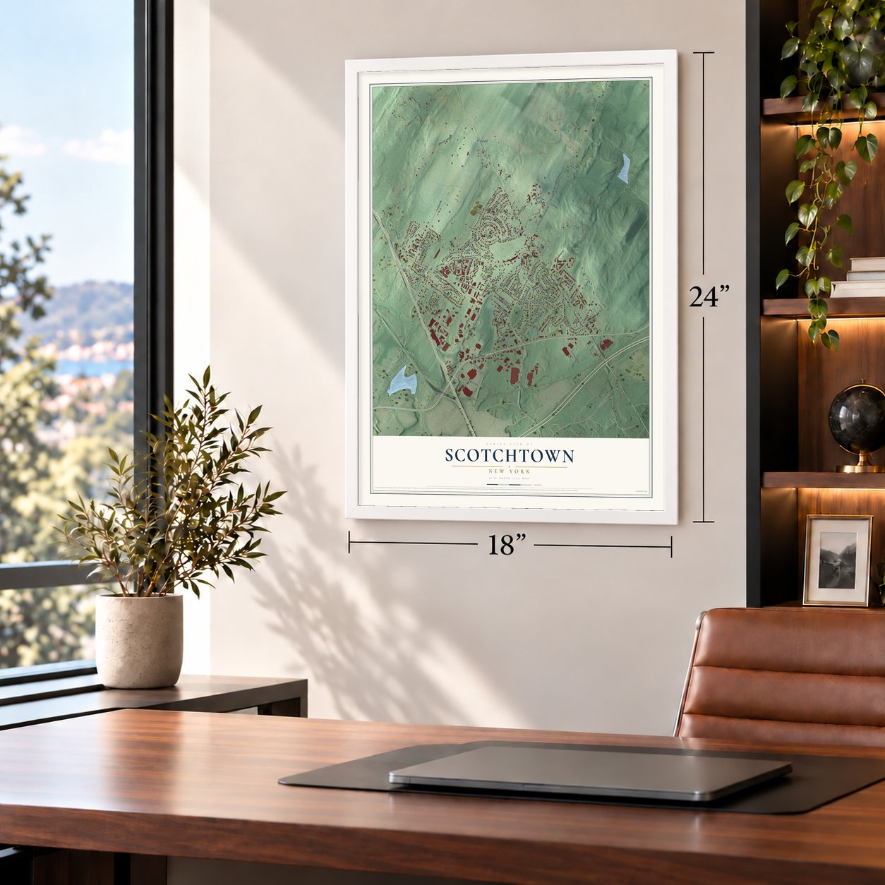
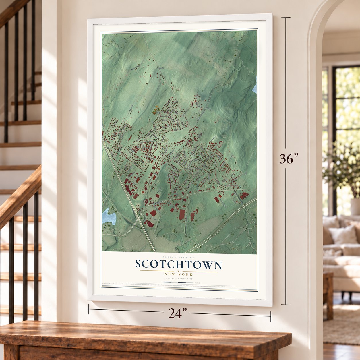
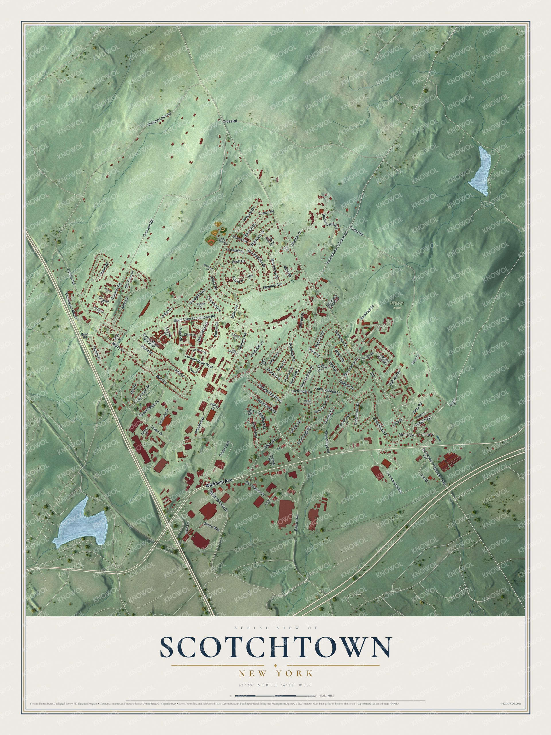
A new map of Scotchtown, New York, made in 2026 and printed to order on thick archival matte paper.
12" x 18" Archival Matte Print
A Map of Home. A Work of Art.
Bring a piece of Scotchtown home. Whether it’s where you grew up, your current home, or simply a moment in your life, this Scotchtown, New York map print brings those memories to your wall. Antique-inspired styling and modern geographic detail combine to create artwork that’s beautiful from across the room, with plenty to study and explore when you get up close.
Three ways to hang it
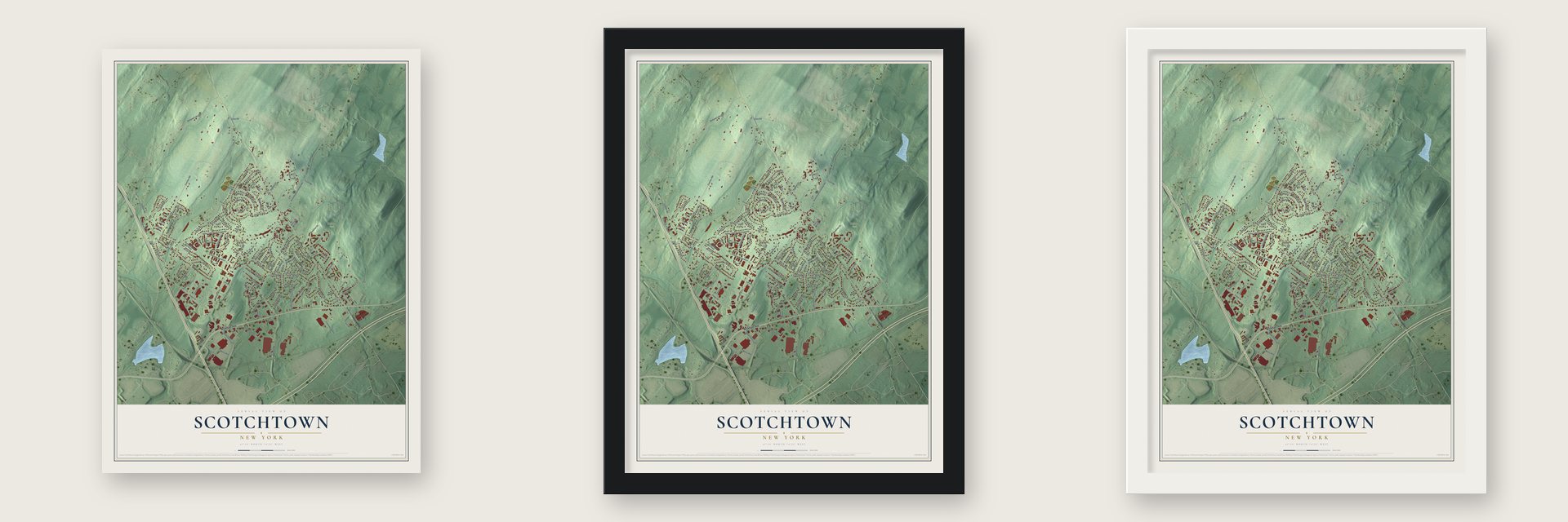
Unframed archival matte, a black wood frame or a white wood frame.
Up close
Real geography. Art worth displaying.
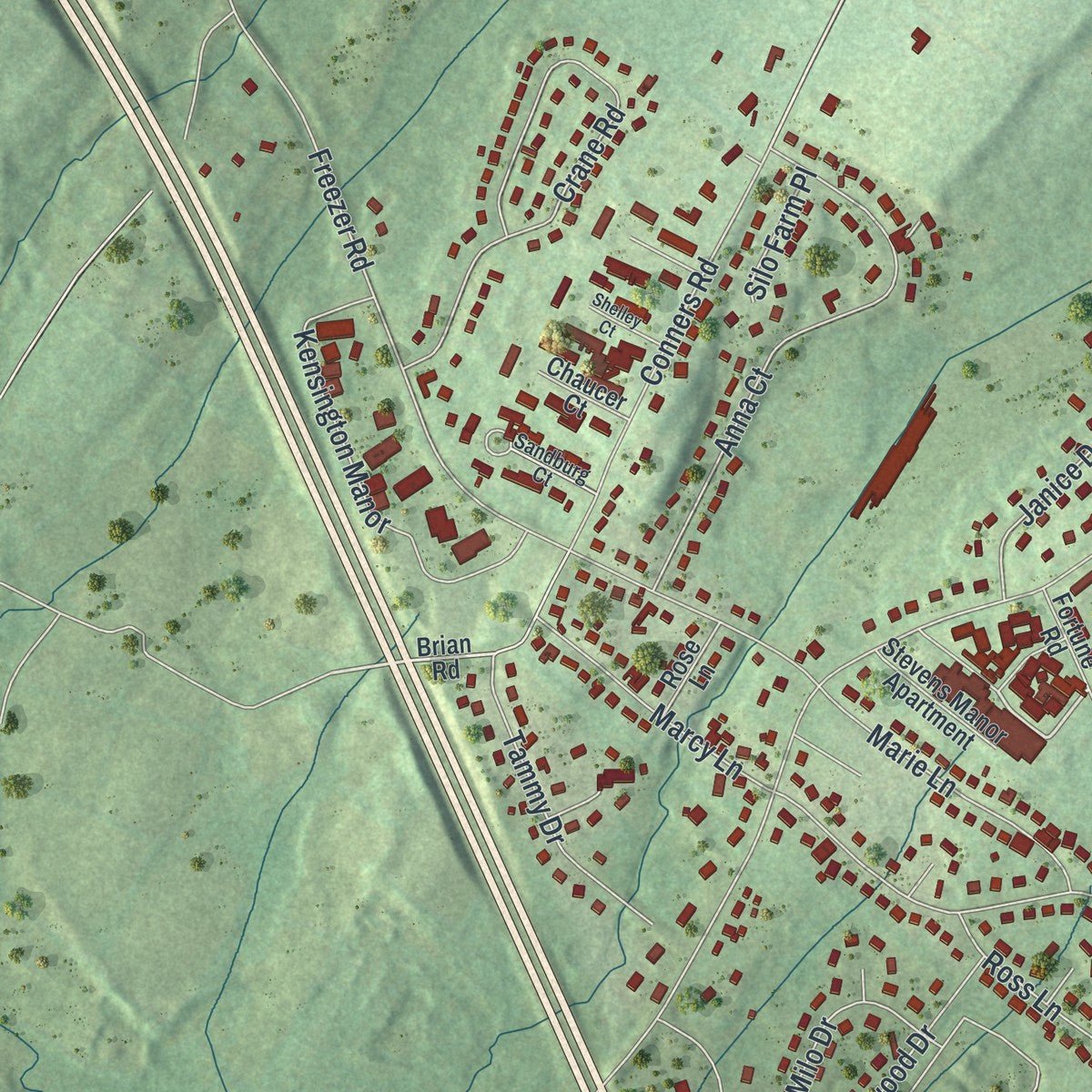
This map was created using accurate cartographic data and authoritative geographic sources, including the U.S. Geological Survey (USGS) and FEMA. The map brings together terrain, waterways, roads, and building detail. The majority of the streets are labeled, houses are accurately depicted, and the topography is derived from government sources. Combining local data with carefully composed color and shading leads to this beautifully detailed Scotchtown artwork for your wall.
Rather than simply showing street outlines, we’ve included as many of the street names as we could reasonably fit on the map while keeping their names legible. Zoom in on the high resolution preview to see exactly what’s on the map. We truly set out to create a statement piece for anyone who loves Scotchtown. So whether it’s for you, or a gift for someone you love, we hope this map of Scotchtown brings back fond memories.
Explore the full map of Scotchtown, New York and read about the local places it shows.

About Scotchtown, New York
Within New York State, Scotchtown is classified as a community, with an identity tied to places residents know by name. Local reference points include Foster Road, connecting the community's present landscape with the names that define this part of the state.
- Familiar local routesFoster Road, Tower Drive and Heather Court cross the community.
- Part of New YorkScotchtown is identified in the sources as a community in this New York county.
Find your street
Names on the Scotchtown map
Every name below is printed on this map. Look for your street, your school, the park where you played, or the pond down the road.
Places and landmarks3
- Michigan Corners
- Stirba Park
- Trailer Park
Streets and roads125
- Wickham Avenue
- Foster Road
- Tower Drive
- Heather Court
- Berkman Drive
- Connors Road
- Blumel Road
- Goshen Turnpike
- Conners Road
- Silver Lake Scotchtown Road
- Midland Lake Road
- North Galleria Drive
- Freezer Road
- Edinburgh Road
- Scotchtown Collabar Road
- Scott Drive
- Baldwin Hill Road
- Scotchtown Place
- Amy Lane
- Crane Road
- Anna Court
- Howard Drive
- Ballard Road
- Tower Ridge Circle
- Wes Warren Drive
- Industrial Drive
- Fortune Road East
- Fortune Road West
- Kensington Manor
- Scotchtown Drive
Show all 125 streets
- Sharon Drive
- Johns Road
- Stephen Avenue
- Woodstock Lane
- Placid Avenue
- Commercial Avenue
- Highview Drive
- Beth Drive
- Ebert Road
- Georges Road
- Badami Drive
- Macintosh Drive
- Acorn Avenue
- Dundee Circle
- Loch Lomond Lane
- Mills Road
- Ross Lane
- Elizabeth Avenue
- Morningside Drive
- Rondack Road
- Ben Lomond Drive
- Marie Lane
- Janice Drive
- Tammy Drive
- Leewood Drive
- Dominick Street
- Metro Way
- Patio Road
- Marcy Lane
- Patricia Road
- Greenway Terrace
- Pinto Road
- Laddie Road
- 84th Lane
- Milo Drive
- Longview Lane
- Keats Road
- Wayne Court
- Circle Drive
- Bartlett Drive
- Mabel Road
- Inwood Road
- Fini Drive
- Conning Avenue
- Oak Hill Road
- Stoneridge Road
- Bonnie Brae Drive
- Cross Road
- Shagbark Street
- Mills Avenue
- Disco Drive
- Loch Invar Lane
- Gene Road
- Silo Farm Place
- Kelly Street
- Stevens Manor Apartment
- Brian Road
- Imperial Gardens
- Scotchtown Avenue
- Enterprise Place
- Renfrew Shire Drive
- Scotchtown Lane
- Comfort Road
- Todd Drive
- Crabapple Lane
- Hasbrouck Heights Lane
- Frederick Street
- Denton Avenue
- Turner Drive
- Cindy Lane
- Laurie Anne Drive
- Jeffrey Drive
- Imperial Park Drive
- Peace Drive
- Brae Mar Road
- Rose Lane
- Fortune Road
- Chaucer Court
- Asaro Lane
- Lodi Street
- Inwood Drive
- Rockwood Drive
- Red Oak Court
- Poplar Lane
- Greencrest Drive
- Sandburg Court
- Alberta Drive
- Butternut Lane
- Sun Glow Terrace
- Rockwood Circle
- Little League Way
- Shelley Court
- Robert Bruce Place
- Tucci Road
- Wesley Court
Names are listed as they appear on the printed map. Zoom into the product photos to find them.
The art of mapping a place
How This Map Was Made
Real places. Remarkable detail. Discover the layers that turn geographic data into a map of home.

The view from above
Aerial imagery reveals the character of the land: woodland, open fields, and the patterns of a place.

The shape of the land
Elevation data brings hills, valleys, and subtle changes in the landscape into view.

The details of home
Roads, waterways, and building footprints come together to make the map feel unmistakably local.

Geography becomes art
Considered color, shading, and typography bring the layers together in a map made for your wall.


Process illustrated with Mendon, Massachusetts. Aerial imagery: USDA NAIP. Terrain: USGS 3D Elevation Program. Map details and finished artwork: KNOWOL.
The Details
About This Print
Choose an archival matte print, or a black or white Ayous wood frame. The archival matte print is unframed.
Select your size and finish above to see the matching product image and price.
Materials & Craftsmanship
A contemporary map with the character of a classic atlas, printed on archival matte paper. Optional frames are made from Ayous wood.
Your printed map does not include the watermark shown in the full-map preview.
Shipping & Delivery
Free shipping within the United States. Every print is made to order in the USA.
Buying a gift? Add a note in your cart and we'll include it. We never put prices in the package.
Prints ship within 2 to 3 business days. Allow 7 to 10 days total from ordering for delivery. Timing may vary during holidays or periods of high order volume.
Read our shipping policy.
Returns and damaged prints
Each print is made to order. Change-of-mind refunds are not available after production.
If your print arrives damaged, misprinted or incorrect, contact support@knowol.com within 30 days of receiving it. Include your order number, photos and a description of the issue.
Read our full refund and replacement policy. For questions about your order, email support@knowol.com.
Find your town
Looking for another city?
Find a map of home in our New York collection.
Nearby
Maps of towns near Scotchtown
Know someone from one of these towns? Their map makes a great gift.


