
Search for another town





Free U.S. delivery 7 to 10 days after you order
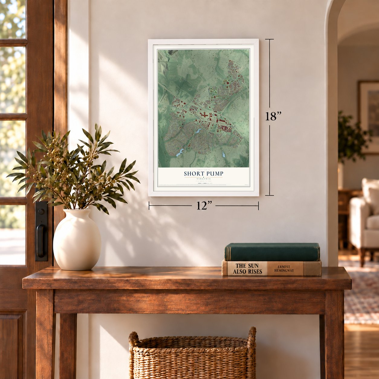
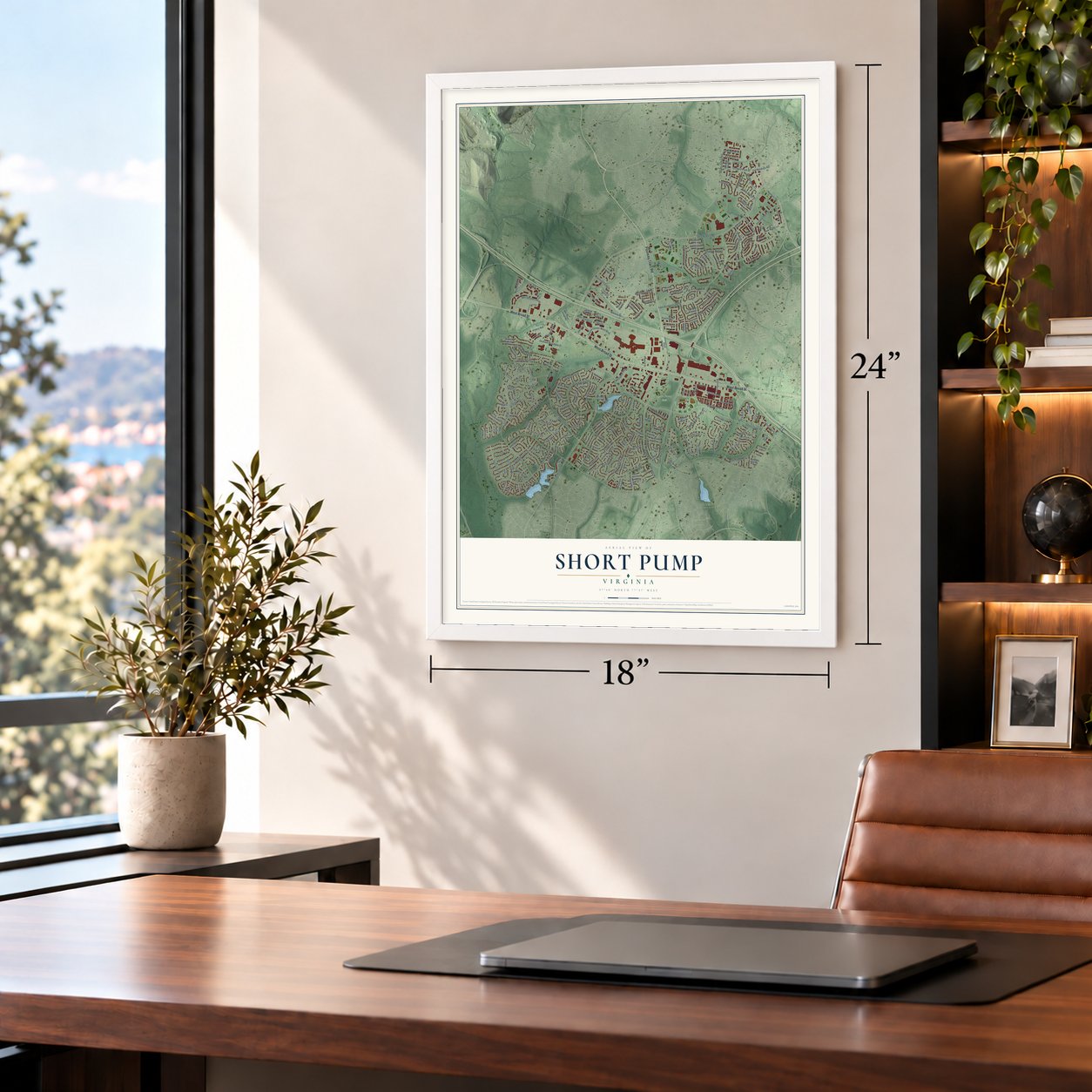
Short Pump, Virginia Map Art
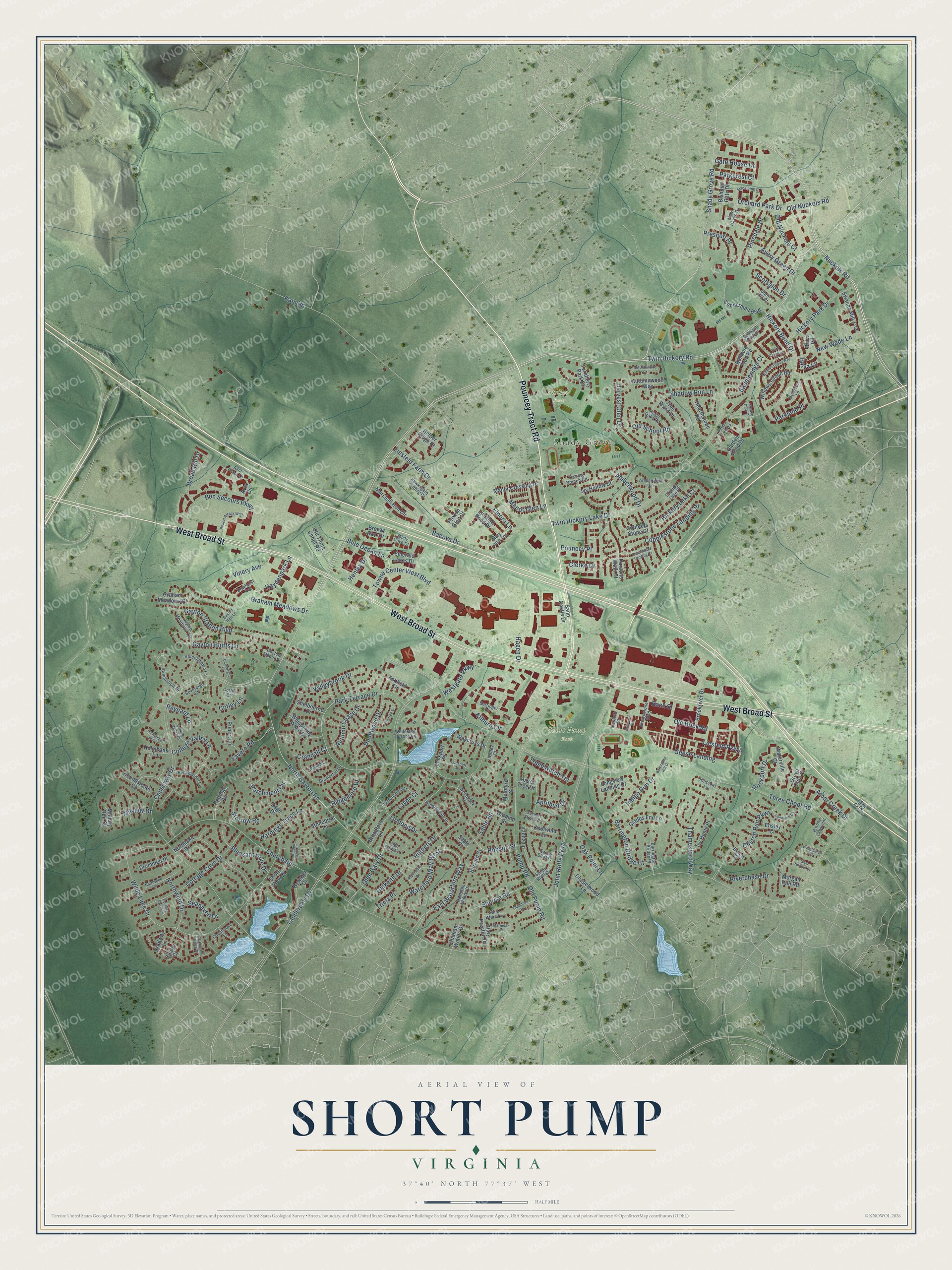
A new map of Short Pump, Virginia, made in 2026 and printed to order on thick archival matte paper.
12" x 18" Archival Matte Print
A Map of Home. A Work of Art.
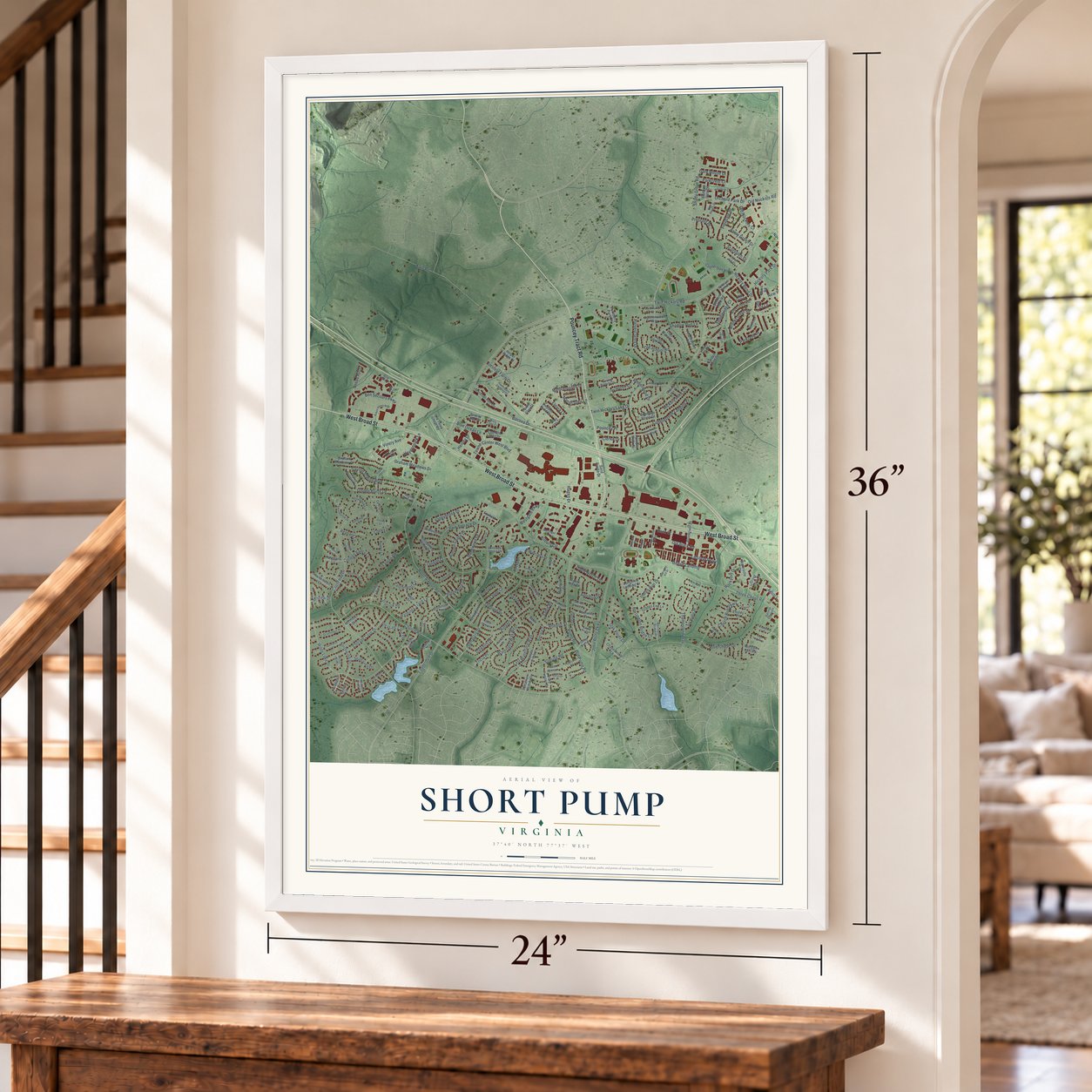
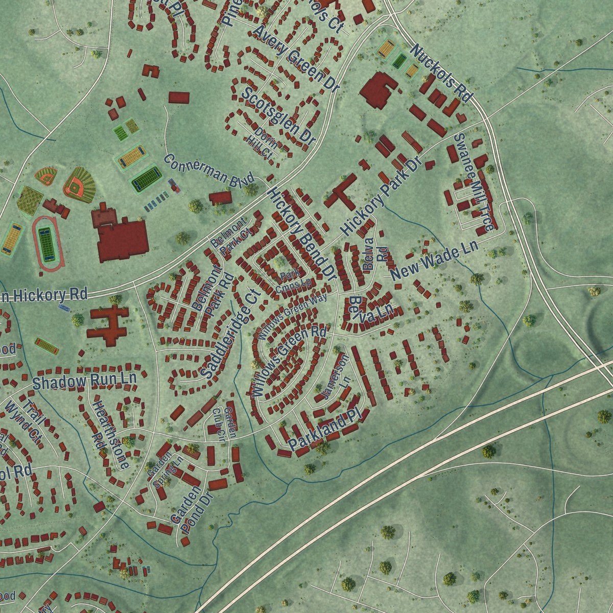
Explore Short Pump, Virginia from a whole new perspective. Created using aerial imagery and detailed geographic data, this map captures Short Pump building by building, with labeled streets, familiar landmarks, and shaded topographical relief that highlights the natural contours of the landscape.
Combining modern data with the timeless character of a vintage atlas, this map is just as interesting up close as it is beautiful on the wall. Whether you grew up in Short Pump, spent memorable years there, or call it home today, this unique map is a great way to celebrate a place that means something to you. Zoom in on the preview to look for your street, and then order a print to put your memories on the wall.
Three ways to hang it
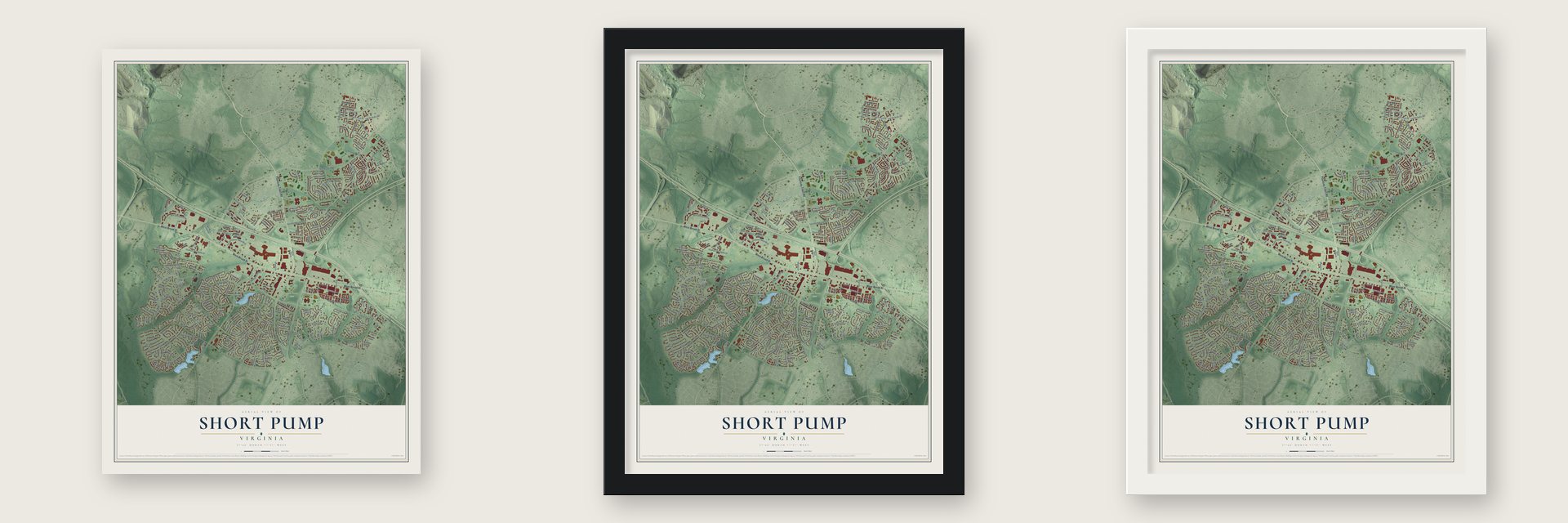
Unframed archival matte, a black wood frame or a white wood frame.
Up close
Geography Worth Displaying
This map was created using accurate cartographic data and authoritative geographic sources, including the U.S. Geological Survey and the Census Bureau. The map brings together terrain, waterways, roads, and building detail. The majority of the streets are labeled, houses are accurately depicted, and the topography is derived from government sources. Combining local data with carefully composed color and shading leads to this beautifully detailed Short Pump artwork for your wall.
Rather than simply showing street outlines, we’ve included as many of the street names as we could reasonably fit on the map while keeping their names legible. Zoom in on the high resolution preview to see exactly what’s on the map. We truly set out to create a statement piece for anyone who loves Short Pump. So whether it’s for you, or a gift for someone you love, we hope this map of Short Pump brings back fond memories.
Read the story behind this map of Short Pump, Virginia from 2026.
About Short Pump, Virginia
Short Pump is a community of 30,626 people in Henrico County, west of Richmond. It grew up around a tavern where Three Chopt Road, the Richmond Turnpike and Pouncey Tract Road met. Col. Robert H. Saunders bought the tavern around 1814 and began to enlarge it. It stood on the main road from Richmond to Charlottesville and the Blue Ridge towns. Its trade grew with the coal business, the new roads built after the Revolution and the families moving west.
For about 35 years the tavern fed and lodged travelers. It was also the post office, the polling place and the local market. For a short time young white men studied at a school there, and a doctor lived on the premises. The tavern depended on enslaved workers and sometimes hosted slave auctions. Its business faded in the later nineteenth century, and by the early twentieth century the building was nearly gone, but the crossroads kept its name.
- Named by 1853Local legend says the name came from a short-handled pump under the tavern porch, where stagecoach horses stopped to drink, though people still debate it. A Henrico County map kept by the Virginia Historical Society shows the crossroads officially called Short Pump by 1853.
- A new school in 1911On December 6, 1911, the whole community gathered to dedicate a new school in Short Pump, according to the Henrico County Historical Society. In those years cars were replacing horses, filling stations and garages opened near the crossroads, and residents began to think of Short Pump as a suburb of Richmond.
- Short Pump Town CenterDevelopers opened Short Pump Town Center, an open-air mall of 1,200,000 square feet, in 2003. It was central to the change of the 1990s and 2000s that turned the old rural crossroads into an edge city in Richmond's Far West End.
Find your street
Names on the Short Pump map
Every name below is printed on this map. Look for your street, your school, the park where you played, or the pond down the road.
Places and landmarks3
- Shady Grove
- Short Pump Park
- Striker Park
Streets and roads229
- Pouncey Tract Road
- West Broad Street
- North Gayton Road
- Twin Hickory Road
- Shady Grove Road
- Nuckols Road
- Geese Landing
- East Waterford Way
- Blue Ocean Lane
- Orchard Park Drive
- Parkcrest Court
- Robson Street
- Church Road
- Three Chopt Road
- Lauderdale Drive
- John Rolfe Parkway
- Causeway Drive
- Bacova Drive
- Kain Road
- Pump Road
- Park Terrace Drive
- Twin Hickory Lake Drive
- Wilde Lake Drive
- Kilburn Circle
- Liesfeld Farm Drive
- Rutgers Drive
- Glen Gary Drive
- Gayton Station Boulevard
- Hickory Bend Drive
- Liesfeld Parkway
Show all 229 streets
- Old Brick Road
- Parchment Circle
- Graham Meadows Drive
- Old Nuckols Road
- Cottage Cove Drive
- Church Run Parkway
- Bon Secours Parkway
- Waterford Way West
- Thamesford Way
- Sunrise Road
- Vinery Avenue
- Gayton Bluffs Lane
- Rockport Drive
- New Wade Lane
- Old School Road
- Hickory Park Drive
- Danewood Drive
- Oak Point Lane
- Cobblestone Landing Place
- College Valley Lane
- Elnora Lane
- Towne Center West Boulevard
- Milview Drive
- Harvest Glen Drive
- Parkland Place
- Ormond Drive
- Shadow Run Lane
- Autumn Chase Drive
- Barrington Bridge Court
- Westgate Parkway
- Hardings Trace Lane
- Favero Road
- Ridgemere Drive
- Dalkeith Drive
- Amberwood Drive
- Sable Road
- Haydenpark Lane
- Pinedale Drive
- Saddleridge Court
- Broad Hill Drive
- Northwind Drive
- Riverchase Drive
- Layne Court
- Avery Green Drive
- Manor Glen Lane
- Valleybrook Drive
- Old Pump Road
- Hickory Lake Court
- Pleasant Lake Drive
- Back Street
- Arbor Creek Drive
- Old Nuckols Court
- Triple Notch Terrace
- Storrow Road
- Prescott Place
- Indigo Run Drive
- Hagen Drive
- Seahaven Drive
- Gate House Drive
- Henley Drive
- Cotley Lane
- Pouncey Place
- Scotsglen Drive
- Tricia Place
- Crandall Court
- Aprilbud Drive
- Clerke Drive
- Reynard Lane
- Belva Lane
- Clary Preston Drive
- Brookriver Drive
- Marshall Run Circle
- Northlake Drive
- Shore View Drive
- Breezy Bay Circle
- Bywater Drive
- Connerman Boulevard
- Parsons Walk Court
- Old Three Chopt Road
- Willows Green Road
- Ivy Hollow Court
- Liesfeld Pond Drive
- Vanna Lane
- Foxfield Circle
- Manor Crossing Drive
- Rolridge Road
- McIntyre Street
- Belva Road
- Autumnwood Way
- Hearthstone Road
- Glades End Lane
- Longview Landing Drive
- Swanee Mill Trce
- Whispering Wood Drive
- Belmont Park Road
- Waterville Court
- Cox Road
- Broadford Lane
- Ivy Home Place
- Avia Circle
- Graham Meadows Place
- Cobblers Stone Court
- Houndstooth Court
- Garden Pond Drive
- Sage Drive
- Waycross Drive
- Ensley Court
- Coolwind Lane
- Stonebriar Lane
- Helper Ridge Court
- Trail Wynd Court
- Chapelwood Lane
- Caitlin Court
- Turnberry Park Drive
- Drammen Place
- Shelbourne Drive
- Emerald Lakes Drive
- Holmbank Lane
- Chatham Woods Drive
- Bradway Lane
- Bishops Gate Drive
- Lockport Place
- Paxton Glen Court
- Grove Gate Court
- Burrard Street
- Carmon Street
- Sand Castle Drive
- Rupert Lane
- Morgan Run Road
- Milbury Run Street
- Hazel Tree Drive
- Sable Court
- Bremerton Drive
- Swanhollow Drive
- Amberwood Lane
- Avia Plaza Lane
- Sandy Bluff Drive
- Glen Gary Circle
- Misty Cove Court
- Brownstone Boulevard
- Barrington Bridge Place
- Wiltonshire Drive
- Pennmardel Lane
- Gayton Meadows Terrace
- Hampton Woods Drive
- Horselydown Lane
- Barony Crescent
- Windingdale Drive
- Mary Jane Terrace
- Jamerson Lane
- New Haven Drive
- Regal Oaks Road
- Coachouse Lane
- Dewhurst Avenue
- Woodmark Court
- Hawksgate Landing Court
- Sandy Bluff Place
- Turning Branch Circle
- Sovereign Court
- Wellesley Terrace Lane
- Dorin Hill Court
- Teasdale Court
- Harcourt Lane
- Barringer Lane
- Country Lake Place
- Belmont Park Court
- Gayton Manor Place
- Cotley Court
- Saint Marc Lane
- Liesfeld Place
- Byfield Court
- Nutley Court
- Park Cmns Lp
- Garden Spring Lane
- Coachmans Landing Court
- Willows Green Way
- Robert Attack Way
- Macalpine Circle
- Barrington Hill Drive
- Gayton Hills Lane
- Langtree Drive
- Northwind Place
- Garden Club Circle
- Huntsteed Way
- Summer Stream Drive
- Lockport Terrace
- Cartwright Lane
- Fanwood Court
- Aspinwald Drive
- Thaddeus Drive
- Hidden Oaks Lane
- Marnelan Place
- Autumnwood Court
- College Valley Court
- Winchester Pointe Drive
- Woodbaron Court
- Glen Hollow Court
- Cottage Cove Court
- Rebound Road
Names are listed as they appear on the printed map. Zoom into the product photos to find them.
The art of mapping a place
How This Map Was Made
Real places. Remarkable detail. Discover the layers that turn geographic data into a map of home.

The view from above
Aerial imagery reveals the character of the land: woodland, open fields, and the patterns of a place.

The shape of the land
Elevation data brings hills, valleys, and subtle changes in the landscape into view.

The details of home
Roads, waterways, and building footprints come together to make the map feel unmistakably local.

Geography becomes art
Considered color, shading, and typography bring the layers together in a map made for your wall.


Process illustrated with Mendon, Massachusetts. Aerial imagery: USDA NAIP. Terrain: USGS 3D Elevation Program. Map details and finished artwork: KNOWOL.
The Details
About This Print
Choose an archival matte print, or a black or white Ayous wood frame. The archival matte print is unframed.
Select your size and finish above to see the matching product image and price.
Materials & Craftsmanship
A contemporary map with the character of a classic atlas, printed on archival matte paper. Optional frames are made from Ayous wood.
Your printed map does not include the watermark shown in the full-map preview.
Shipping & Delivery
Free shipping within the United States. Every print is made to order in the USA.
Buying a gift? Add a note in your cart and we'll include it. We never put prices in the package.
Prints ship within 2 to 3 business days. Allow 7 to 10 days total from ordering for delivery. Timing may vary during holidays or periods of high order volume.
Read our shipping policy.
Returns and damaged prints
Each print is made to order. Change-of-mind refunds are not available after production.
If your print arrives damaged, misprinted or incorrect, contact support@knowol.com within 30 days of receiving it. Include your order number, photos and a description of the issue.
Read our full refund and replacement policy. For questions about your order, email support@knowol.com.
Find your town
Looking for another city?
Find a map of home in our Virginia collection, or any town in the country.
Nearby
Maps of towns near Short Pump
Know someone from one of these towns? Their map makes a great gift.
 Innsbrook
, Virginia
From $39.99See the map
 Wyndham
, Virginia
From $39.99See the map
 Tuckahoe
, Virginia
From $39.99See the map
More maps nearby: Laurel, Dumbarton, Glen Allen, Lakeside and Bon Air.