
Search for another town


Free U.S. delivery 7 to 10 days after you order
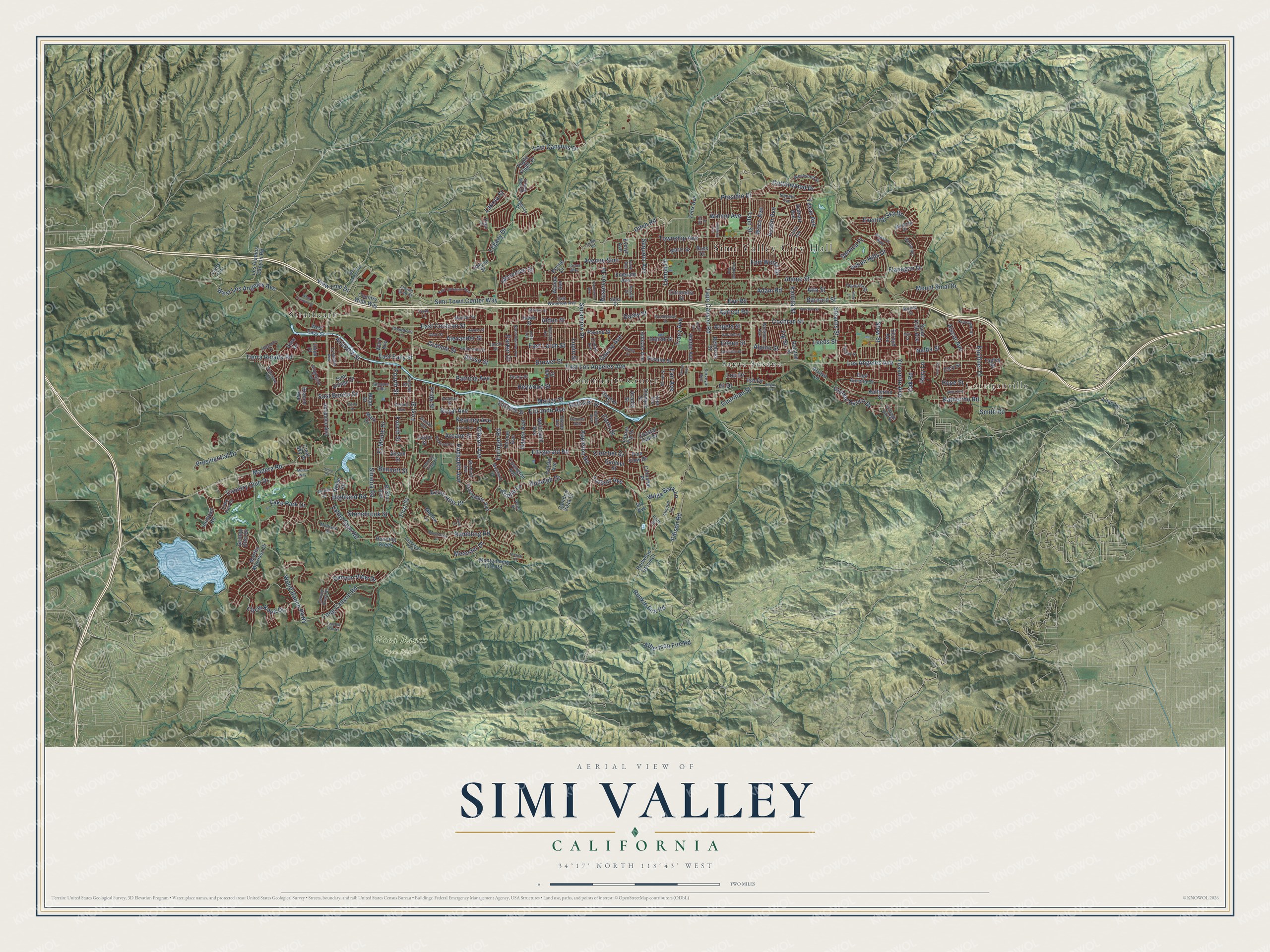
Simi Valley, California Map Art
Building by building, with labeled streets and shaded relief.
12" x 18" Archival Matte Print
A Map of Home. A Work of Art.
Explore Simi Valley, California from a whole new perspective. Created using aerial imagery and detailed geographic data, this map captures Simi Valley building by building, with labeled streets, familiar landmarks, and shaded topographical relief that highlights the natural contours of the landscape.
Combining modern data with the timeless character of a vintage atlas, this map is just as interesting up close as it is beautiful on the wall. Whether you grew up in Simi Valley, spent memorable years there, or call it home today, this unique map is a great way to celebrate a place that means something to you. Zoom in on the preview to look for your street, and then order a print to put your memories on the wall.
Three ways to hang it

Unframed archival matte, a black wood frame or a white wood frame.
Up close
Geography Worth Displaying
This map was created using accurate cartographic data and authoritative geographic sources, including the U.S. Geological Survey and the Census Bureau. The map brings together terrain, waterways, roads, and building detail. The majority of the streets are labeled, houses are accurately depicted, and the topography is derived from government sources. Combining local data with carefully composed color and shading leads to this beautifully detailed Simi Valley artwork for your wall.
Rather than simply showing street outlines, we’ve included as many of the street names as we could reasonably fit on the map while keeping their names legible. Zoom in on the high resolution preview to see exactly what’s on the map. We truly set out to create a statement piece for anyone who loves Simi Valley. So whether it’s for you, or a gift for someone you love, we hope this map of Simi Valley brings back fond memories.
Read the story behind this map of Simi Valley, California from 2026.

Find your street
Names on the Simi Valley map
Every name below is printed on this map. Look for your street, your school, the park where you played, or the pond down the road.
Places and landmarks7
- Simi Valley City Hall
- Corriganville
- Wood Ranch Open Space
- Strathearn
- Community Center
- Santa Susana
- Challenger Park
Streets and roads275
- Cochran Street
- Stow Street
- East Bonita Drive
- Katherine Road
- Tapo Street
- Country Club Drive
- Barnard Street
- Madera Road
- East Los Angeles Avenue
- Royal Avenue
- Alamo Street
- Sequoia Avenue
- Albertson Fire Road
- Tapo Canyon Road
- First Street
- Lost Canyons Drive
- Los Angeles Avenue
- Edison Road
- Fitzgerald Road
- Sycamore Drive
- Yosemite Avenue
- Erringer Road
- Sinaloa Road
- Wood Ranch Parkway
- Avenue Simi
- Walnut Avenue
- Kuehner Drive
- Township Avenue
- West Los Angeles Avenue
- Long Canyon Road
Show all 275 streets
- East Cochran Street
- Runkle Fire Road
- Rambling Road
- Lake Park Drive
- Galena Avenue
- Presidential Drive
- Arcane Street
- Kadota Street
- Elizondo Avenue
- White Bark Lane
- Heywood Street
- Stearns Street
- Mount Sinai Drive
- Appleton Road
- Presidio Drive
- Cottonwood Drive
- Circle Knoll Drive
- Tierra Rejada Road
- Talbert Avenue
- Hidden Ranch Drive
- East Easy Street
- Azure Hills Drive
- Texas Avenue
- Adam Road
- Valley Gate Road
- East Larch Street
- Morley Street
- Evening Sky Drive
- Corto Street
- Hudspeth Avenue
- Canyon View Drive
- Stonebrook Street
- Fourth Street
- Brower Street
- Lemon Drive
- Patricia Avenue
- Flanagan Drive
- Apricot Road
- Alexander Street
- Waco Avenue
- Simi Town Center Way
- Highland Road
- Austin Avenue
- Indian Hills Drive
- El Monte Drive
- Rudolph Drive
- Alscot Avenue
- Gibson Avenue
- Legacy Drive
- Ditch Road
- Angela Street
- Aristotle Street
- Graham Street
- Smith Road
- Fletcher Street
- Pride Street
- Reservoir Drive
- Seneca Place
- Leeds Street
- View Line Drive
- Tracy Avenue
- Stoneman Street
- Kearney Avenue
- Fig Street
- Nelda Street
- Meander Drive
- Hollister Street
- Fort Worth Drive
- Guardian Street
- Eileen Street
- Haven Avenue
- Alta Street
- Bennett Street
- Eve Road
- Alpine Street
- Alden Street
- Hope Street
- Ish Drive
- Lupin Street
- Arielle Lane
- Rory Lane
- Oak Road
- Parker Court
- Lakota Street
- Alviso Street
- Lou Drive
- Fair Avenue
- Darby Street
- Hi Drive
- Los Alamos Canyon Road
- Saint Clair Avenue
- Hawk Street
- Montgomery Fire Road
- Mellow Lane
- Country Wide Way
- Martha Morrison Drive
- Dalhart Avenue
- Elizondo Street
- Sunnydale Avenue
- Hilldale Avenue
- Katherine Street
- Eagle Flight Drive
- Lee Street
- Crosby Avenue
- Acapulco Avenue
- West Easy Street
- Whitcomb Avenue
- Olympic Street
- Covington Avenue
- Catlin Street
- Racine Street
- Ralston Street
- Bristol Avenue
- Camden Vista Court
- Rebecca Street
- Golden Glen Drive
- Innwood Road
- Simi Village Drive
- Coastal Oak Drive
- East Aurelia Court
- Delilah Street
- Gardner Street
- Felix Avenue
- Renee Court
- Hietter Avenue
- Wanda Avenue
- Laurel Fig Drive
- Citronella Street
- Donner Avenue
- Deacon Street
- Running Creek
- Pine View Drive
- Lions Circle
- Emerald Avenue
- Mark Drive
- Rosalie Street
- Redwood Grove Court
- Fir Avenue
- Branch Avenue
- Cinnabar Place
- Ward Avenue
- Martz Street
- Acadia Street
- Evelyn Avenue
- Noble Road
- Clear Sky Place
- Lilac Lane
- Anson Street
- Tapley Street
- Falcon Street
- Cory Street
- View Drive
- Arroyo Lane
- Ecroyd Avenue
- Union Place
- Milan Drive
- Russ Court
- Flower Glen Street
- Westwood Street
- Travis Avenue
- Larch Street
- Sinaloa Villa
- Legends Drive
- Anderson Street
- Sitka Avenue
- Keystone Street
- Placerita Drive
- Young Wolf Drive
- Muirfield Street
- Sojka Drive
- Mayfair Street
- Lindale Avenue
- Summit Avenue
- Lysander Avenue
- East Woodrow Avenue
- Ridgegate Lane
- Second Street
- Geronimo
- Anasazi Way
- Links View Drive
- Wishard Avenue
- Mustang Drive
- Workman Avenue
- Almond Lane
- Canyon Crest Drive
- Hartley Avenue
- Palm Street
- Mollison Drive
- Surveyor Avenue
- Dennis Avenue
- Chambers Lane
- Denny Street
- Arabian Street
- Sawyer Avenue
- Peter Place
- Gantlin Avenue
- Ivory Avenue
- Jones Way
- Daunet Avenue
- Vintage Oak Street
- Serena Street
- Sasha Court
- Tivoli Lane
- Trego Court
- Agnew Street
- Barnes Street
- Ahart Street
- East Jefferson Way
- Nonchalant Drive
- West Cochran Street
- Copley Street
- Sheri Drive
- Justin Avenue
- Brea Canyon Road
- North Bigelow Avenue
- Elmdale Avenue
- Woodhaven Street
- Angus Avenue
- Darrah Avenue
- Winterdew Avenue
- Gertrude Street
- Carlotta Street
- Twisted Oak Drive
- Parkhurst Street
- Dakin Avenue
- Marilyn Street
- Wildlife Drive
- Huntley Street
- Borders Street
- Cimmaron Avenue
- Sunglow Avenue
- Algonquin Drive
- Fairbanks Avenue
- Love Circle
- Hemlock Ridge Court
- Dana Avenue
- Irvine Road
- Casual Court
- Morro Way
- Sharp Road
- Quiet Court
- Boalt Avenue
- Carla Drive
- Starr Lane
- Muir Street
Names are listed as they appear on the printed map. Zoom into the product photos to find them.
About Simi Valley, California
Simi Valley is a city of 126,356 people in Ventura County, in a valley whose rim is formed by two ranges, the Santa Susana Mountains and the Simi Hills. In 1795 Spain granted Santiago Pico the 113,009-acre Rancho Simí, the first colonial grant anywhere in Ventura or Santa Barbara Counties. His sons held it after he died in 1815, and in 1842 José de la Guerra y Noriega, a captain at the Santa Barbara Presidio, bought it to raise cattle.
Dry years in the 1860s ruined the De la Guerra family, and in 1865 they lost everything but the Tapo. That year Thomas A. Scott, president of the Pennsylvania Railroad, bought 96,000 acres here in hopes of finding oil. Sheep, cattle and grain, then citrus, walnuts and apricots, filled the valley until the first tract houses went up in 1957 and 1958. In 1969 residents voted 6,454 to 3,685 to become a city, and by 1970 the census counted 59,832 people.
“The word Simiji in Indian meant the little white wind clouds so often seen when the wind blows up here and Indians living on the coast, would never venture up here when those wind clouds were in the sky.”
- Simiopolis in 1888After the Simi Land and Water Company cut the old rancho into farms, a Chicago investor group, the California Mutual Benefit Colony, laid out a townsite between First and Fifth Streets and called it Simiopolis. It shipped twelve precut houses from a Chicago lumberyard by train to Saticoy, then by wagon to Simi. These colony houses made up the town's first neighborhood, and the Simiopolis name lasted only about six months. The first Simi School opened nearby in 1890.
- A depot named Santa SusanaThe Santa Susana Train Depot went up in 1903, and the rail tunnel was finished in 1904. Shops and then homes grew around the depot on Los Angeles Avenue, east of Tapo Street, forming the town of Santa Susana. When the valley incorporated, voters also picked the city's name, and Simi Valley beat Santa Susana by 2,000 votes. The depot was moved off Kuehner in 1975.
- A president's resting placeThe Ronald Reagan Presidential Library stands in Simi Valley, and the former president was buried there in 2004.
Keep exploring California
Simi Valley is one of 1,990 California towns we've mapped. Every dot on the map is a print of its own.
The search covers every state, California first.
Near Simi Valley
Order 2 or more town maps and save 10%. Shown in the size and finish you picked above, so they hang as a set.
- Santa Susana 12" x 18" / Archival Matte Print $39.99
- Bell Canyon 12" x 18" / Archival Matte Print $39.99
- Oak Park 12" x 18" / Archival Matte Print $39.99

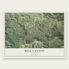
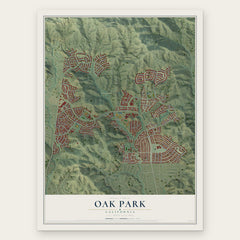
More maps nearby: Moorpark, West Hills, Agoura Hills, Hidden Hills and Thousand Oaks.
The art of mapping a place
How This Map Was Made
Real places. Remarkable detail. Discover the layers that turn geographic data into a map of home.

The view from above
Aerial imagery reveals the character of the land: woodland, open fields, and the patterns of a place.

The shape of the land
Elevation data brings hills, valleys, and subtle changes in the landscape into view.

The details of home
Roads, waterways, and building footprints come together to make the map feel unmistakably local.

Geography becomes art
Considered color, shading, and typography bring the layers together in a map made for your wall.


Process illustrated with Mendon, Massachusetts. Aerial imagery: USDA NAIP. Terrain: USGS 3D Elevation Program. Map details and finished artwork: KNOWOL.
The Details
About This Print
Choose an archival matte print, or a black or white Ayous wood frame. The archival matte print is unframed.
Select your size and finish above to see the matching product image and price.
Materials & Craftsmanship
A contemporary map with the character of a classic atlas, printed on archival matte paper. Optional frames are made from Ayous wood.
Your printed map does not include the watermark shown in the full-map preview.
Shipping & Delivery
Free shipping within the United States. Every print is made to order in the USA.
Buying a gift? Add a note in your cart and we'll include it. We never put prices in the package.
Prints ship within 2 to 3 business days. Allow 7 to 10 days total from ordering for delivery. Timing may vary during holidays or periods of high order volume.
Read our shipping policy.
Returns and damaged prints
Each print is made to order. Change-of-mind refunds are not available after production.
If your print arrives damaged, misprinted or incorrect, contact support@knowol.com within 30 days of receiving it. Include your order number, photos and a description of the issue.
Read our full refund and replacement policy. For questions about your order, email support@knowol.com.