
Search for another town


Free U.S. delivery 7 to 10 days after you order
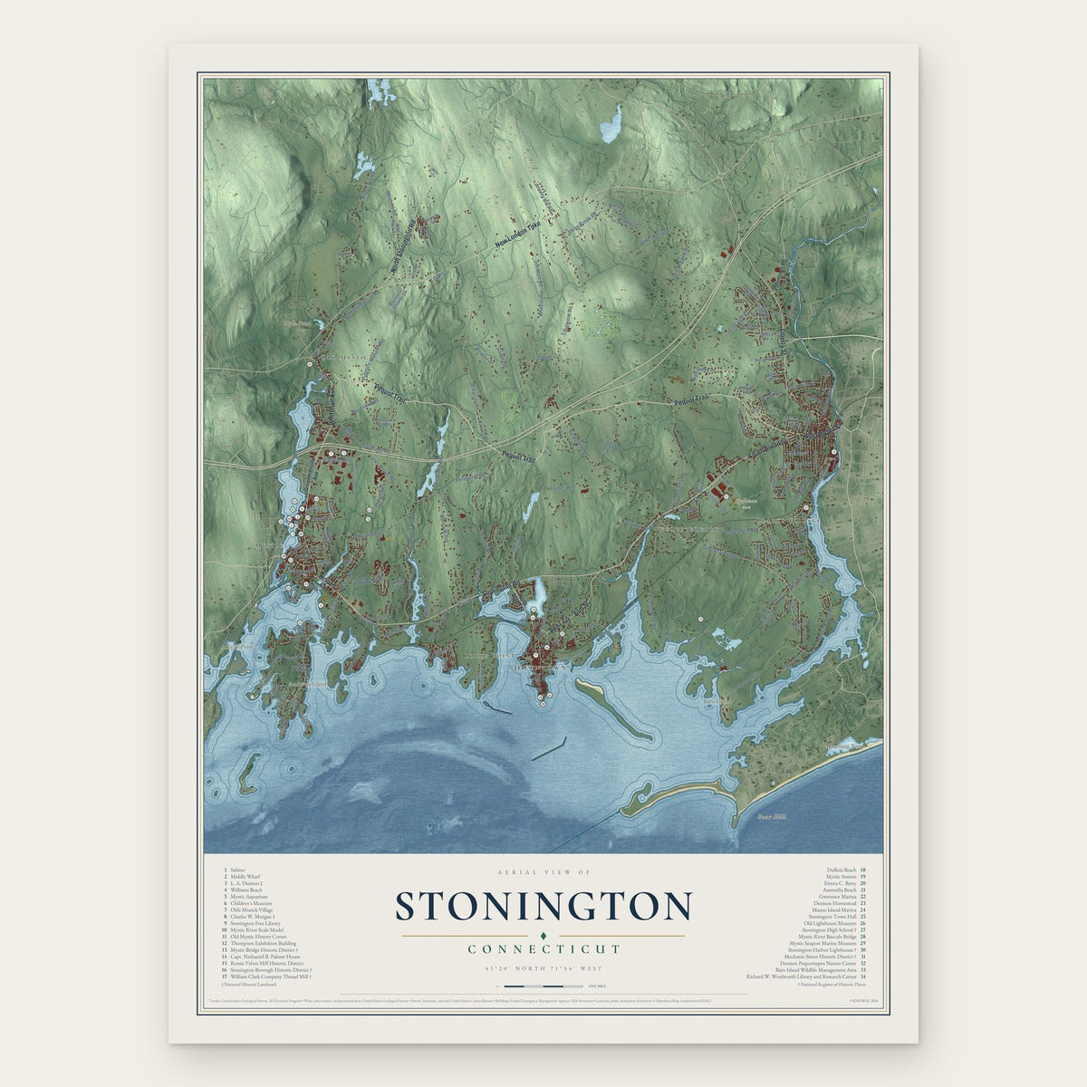
Stonington, Connecticut Map Art
Building by building, with labeled streets and shaded relief.
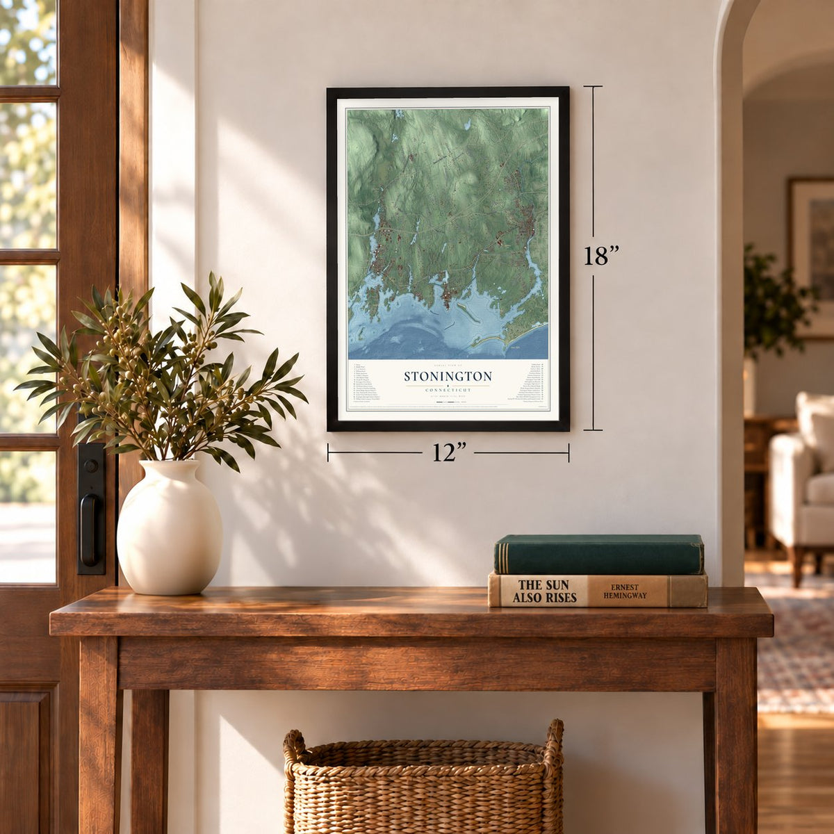
12" x 18" Archival Matte Print
A Map of Home. A Work of Art.
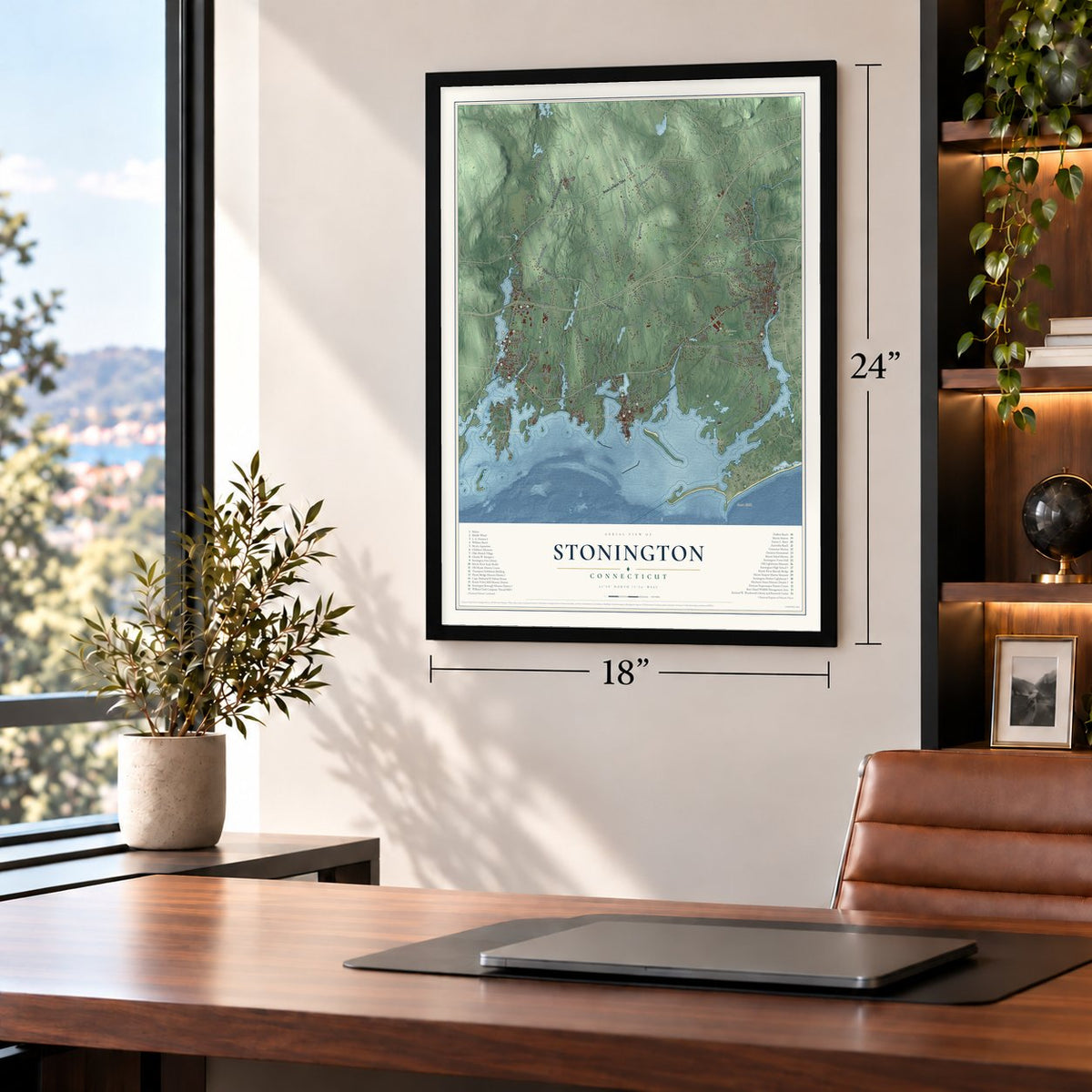
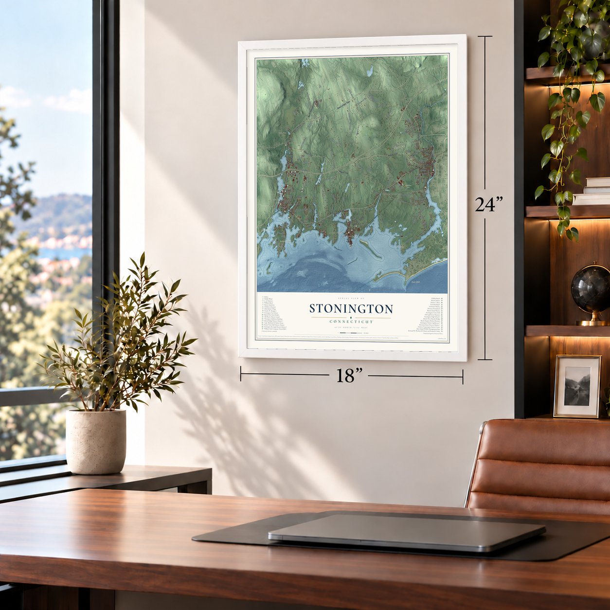
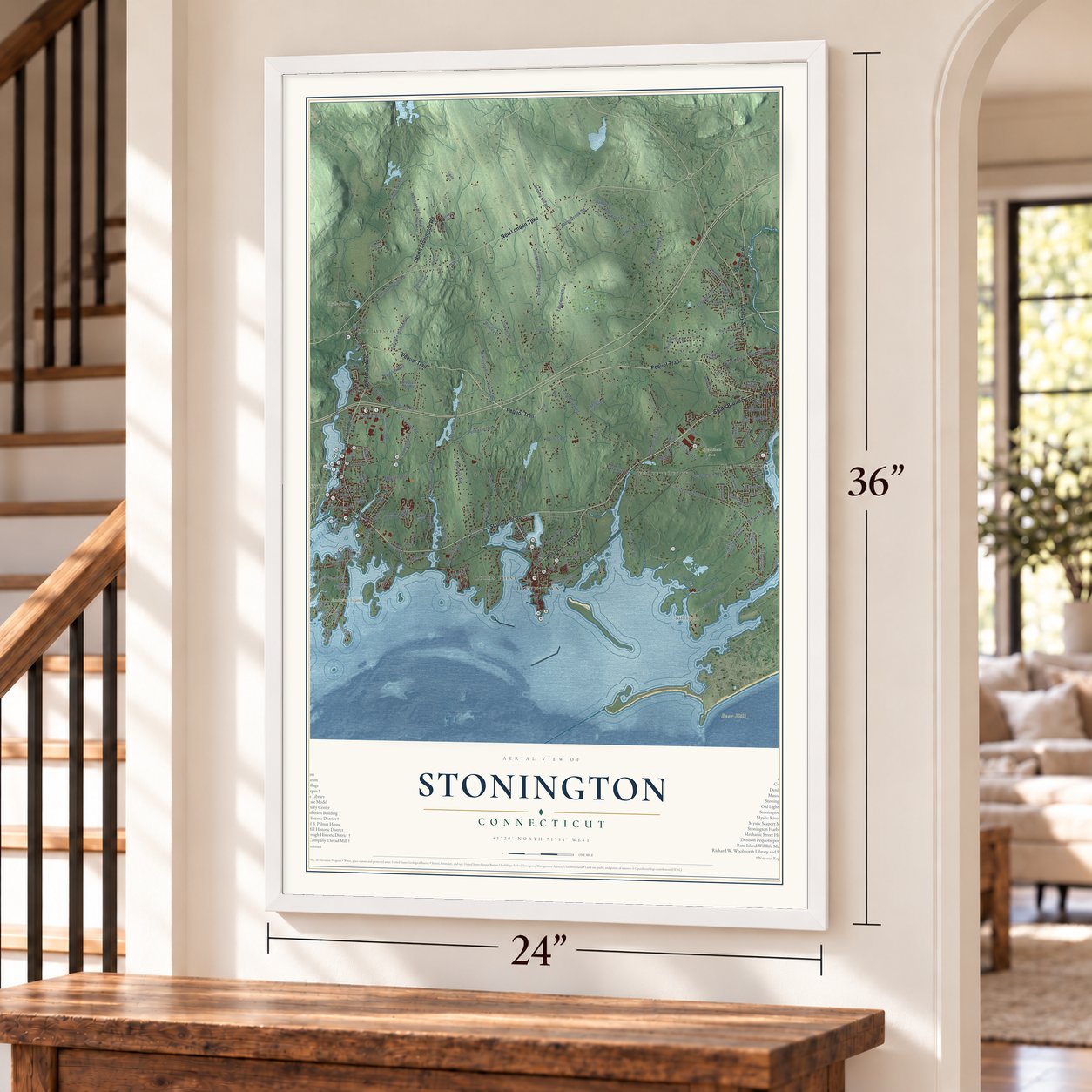
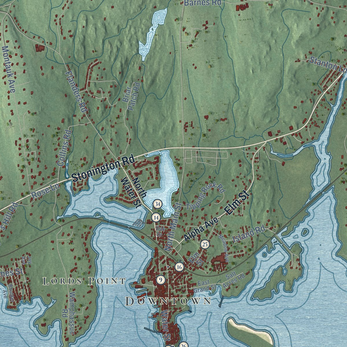
Explore Stonington, Connecticut from a whole new perspective. Created using aerial imagery and detailed geographic data, this map captures Stonington building by building, with labeled streets, familiar landmarks, and shaded topographical relief that highlights the natural contours of the landscape.
Combining modern data with the timeless character of a vintage atlas, this map is just as interesting up close as it is beautiful on the wall. Whether you grew up in Stonington, spent memorable years there, or call it home today, this unique map is a great way to celebrate a place that means something to you. Zoom in on the preview to look for your street, and then order a print to put your memories on the wall.

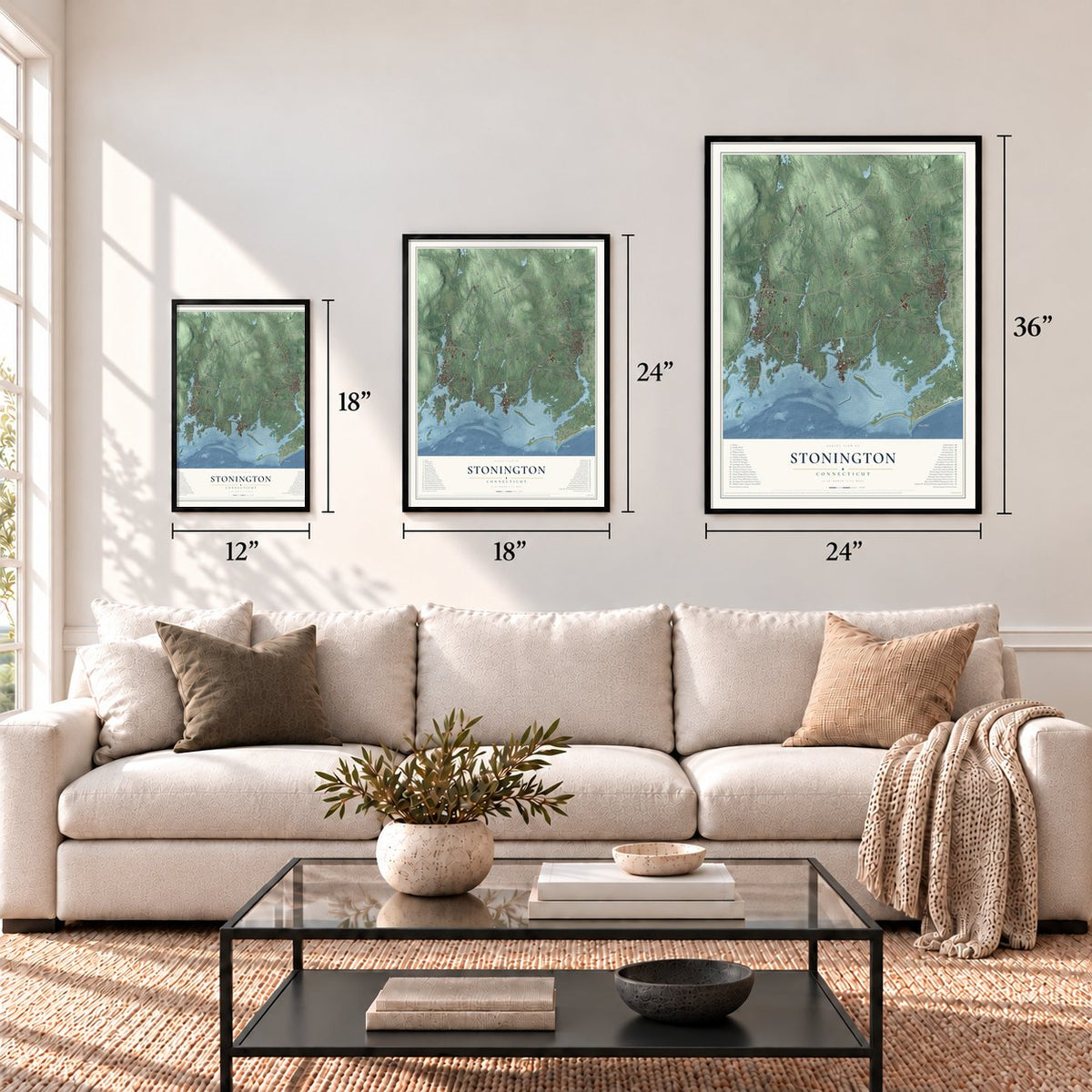
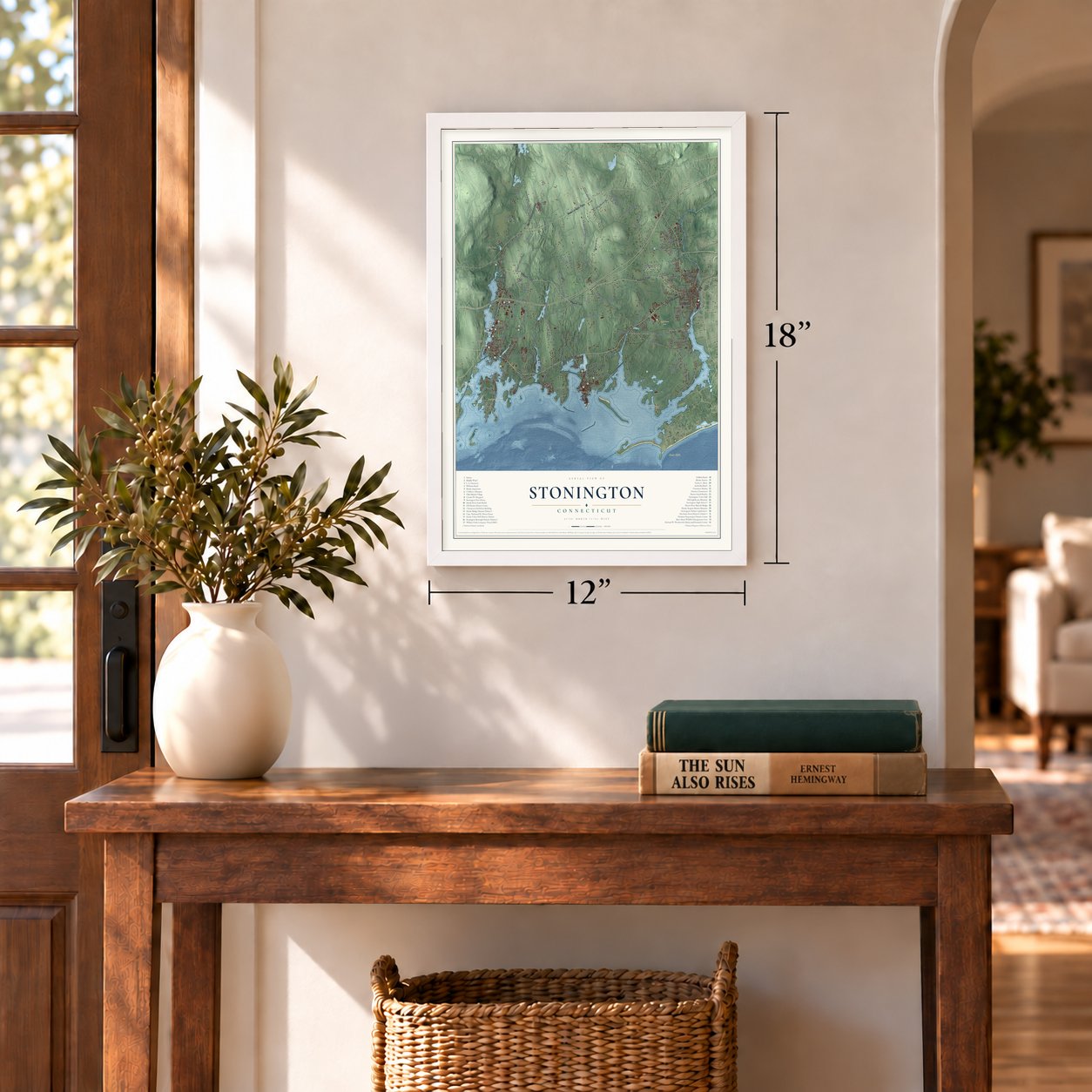
Three ways to hang it
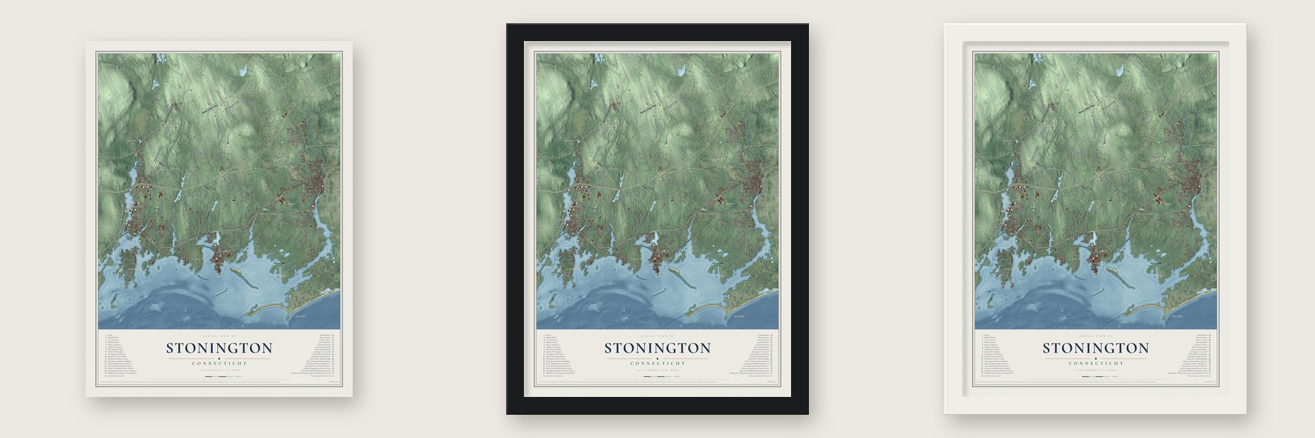
Unframed archival matte, a black wood frame or a white wood frame.
Up close
Geography Worth Displaying
This map was created using accurate cartographic data and authoritative geographic sources, including the U.S. Geological Survey (USGS) and FEMA. The map brings together terrain, waterways, roads, and building detail. The majority of the streets are labeled, houses are accurately depicted, and the topography is derived from government sources. Combining local data with carefully composed color and shading leads to this beautifully detailed Stonington artwork for your wall.
Rather than simply showing street outlines, we’ve included as many of the street names as we could reasonably fit on the map while keeping their names legible. Zoom in on the high resolution preview to see exactly what’s on the map. We truly set out to create a statement piece for anyone who loves Stonington. So whether it’s for you, or a gift for someone you love, we hope this map of Stonington brings back fond memories.
Explore the full map of Stonington, Connecticut and read about the local places it shows.
Find your street
Names on the Stonington map
Every name below is printed on this map. Look for your street, your school, the park where you played, or the pond down the road.
Places and landmarks13
- Downtown
- Abigail Point
- Andrews Island
- Barn Island
- Bear Hill
- Hyde Pond
- Maschaug Pond
- Spellman Park
- Wequetequock
- Lords Point
- Old Mystic
- Mystic
Show all 13 places
- Clarks Village
Streets and roads172
- Pequot Trail
- Stonington Road
- South Broad Street
- West Broad Street
- Whitehall Avenue
- New London Turnpike
- Liberty Street
- North Stonington Road
- Elm Street
- Greenhaven Road
- Masons Island Road
- Osbrook Point
- Deer Ridge Road
- Jerry Brown Road
- Green Haven Road
- River Road
- Mistuxet Avenue
- School House Road
- Stillman Avenue
- School Street
- Al Harvey Road
- Wheeler Road
- Taugwonk Road
- Lantern Hill Road
- Harvey Road
- North Main Street
- North Anguilla Road
- Flanders Road
- Farmholme Road
- Jim Main Road
Show all 172 streets
- Deans Mill Road
- Palmer Neck Road
- Montauk Avenue
- Cove Road
- South Anguilla Road
- Whitford Road
- Mechanic Street
- Elmridge Road
- Pawcatuck Avenue
- Dawley Drive
- Nautilus Way
- Miner Pentway
- High Ridge Drive
- Barnes Road
- Hewitt Road
- Water Street
- Palmer Street
- Pellegrino Road
- Asher Avenue
- Red Oak Lane
- Coogan Boulevard
- Stony Brook Road
- Prentice Williams Road
- Sherwood Drive
- Rowley Drive
- Washington Street
- Collins Road
- Moss Street
- Wilcox Road
- Jeremy Hill Road
- River Crest Drive
- West Vine Street
- Mary Hall Road
- Wilbur Road
- Island Road
- Lords Hill Road
- Extrusion Drive
- Sunrise Avenue
- Field Street
- Stanton Lane
- Elmata Avenue
- Cronin Avenue
- Rossie Street
- James Street
- Skiff Lane
- Robin Street
- Aimee Drive
- Oak Lane
- Rose Lane
- Mark Street
- Greenmanville Avenue
- Williams Avenue
- North Water Street
- Alpha Avenue
- Voluntown Road
- Nauyaug Point Road
- Willow Drive
- Quiambog Cove Road
- Wolf Neck Road
- Wamphassuc Road
- Pequotsepos Road
- Sergio Franchi Drive
- Laurence Eleanor Street
- Long Wharf Drive
- Latimer Point Road
- Church Street
- Briar Patch Road
- Riverside Drive
- Noyes Avenue
- Tipping Rock Road
- Hatch Street
- Money Point Road
- Circle Drive
- Old North Road
- Clipper Drive
- Jerry Browne Road
- Lathrop Avenue
- Yacht Club Road
- Morgan Street
- Russell Avenue
- Pheasant Run Road
- Parkwood Drive
- Oakwood Avenue
- Schiller Avenue
- Stephen Drive
- Garden Street
- Stewart Road
- Jeffrey Road
- Soundview Drive
- Brucker Pentway
- Damato Drive
- Sommers Lane
- Peguot Trail
- East Forest Road
- Holmes Street
- Kidds Way
- Lambs Way
- Timber Ridge Drive
- Black Duck Road
- North Broad Street
- Mystic Avenue
- Marie Avenue
- Ram Point Road
- Lane Way
- Mystic Hill Road
- Dubois Drive
- Sisk Drive
- Mill Street
- River Street
- Main Street
- Spellman Drive
- Fairview Drive
- Old Stonington Road
- East Grand Street
- Rivercrest Drive
- Salt Acres Road
- Whittaker Drive
- Maritime Drive
- Reynolds Hill Road
- Green Avenue
- Maritime Road
- Griswold Street
- Rossie Pentway
- Marjorie Street
- Olivia Lane
- Penny Court
- Ball Street
- Commer Street
- Knight Street
- Boulder Avenue
- Meadow Avenue
- Clipper Point Road
- Roseleah Drive
- Swan Street
- Billings Street
- Manor Road
- Fair Acres Lane
- Fenner Lane
- Albert Court
- Spring Hill Lane
- Oak Drive
- Joy Avenue
Names are listed as they appear on the printed map. Zoom into the product photos to find them.
About Stonington, Connecticut
Stonington, a New London County town of 18,335 people, sits on Long Island Sound, where its land runs from the Mystic River to the Pawcatuck. The Pequot knew this land as Paquatuck and Mistack. In 1649 William Chesebrough, a blacksmith from Rehoboth, built a home at Wequetequock Cove, and Thomas Stanton opened a trading house at Pawcatuck. Connecticut's leaders feared a smith would repair guns for the Indians, so in March 1651 Chesebrough had to answer to the General Court at Hartford, which let him stay.
Massachusetts called the settlement Southerton in 1658, and it passed to Connecticut in 1662 under the colony's royal charter. After a year as Mistick, it took the name Stonington, the "stony town," in 1666. From the 1790s the harbor sent out sealing ships, and on November 16, 1820, Nathaniel Palmer, a young captain sailing with a Stonington fleet led by Benjamin Pendleton, sighted the Antarctic land later called Palmer Land. Stonington became a port of entry in 1842, and Portuguese families from the Azores arrived on its whaling vessels. Today the town keeps the last commercial fishing fleet in Connecticut.
“They kill'd a goose, they kill'd a hen, Three hogs they wounded in a pen.”
- The frigate Rose in 1775In August 1775 the British frigate Rose came after cattle that Block Island had sent to Stonington to keep them out of British hands. Musket-bearing men from Long Point, along with militiamen from the Road district, stopped her boats from coming ashore. Her guns struck nearly every house in town, yet the only person hurt on shore was Jonathan Weaver Jr., a musician.
- Three days of British gunsOn August 9, 1814, four warships under Sir Thomas Hardy appeared off Stonington Point and demanded the town's surrender. The selectmen refused. For three days the squadron shelled the town, and its defenders fired back with two 18-pounder cannons, aided by six volunteers who came on foot from Mystic. After losing several killed and wounded, the British left on August 12. Both cannons now stand beside a granite obelisk in Cannon Square.
- America's oldest lighthouse museumThe stone Stonington Harbor Lighthouse went up at the tip of Stonington Point in 1840, built in part from the stones of an earlier light that erosion had claimed. Its lamp went dark in 1889, and in 1925 the Stonington Historical Society opened it as a museum, the oldest lighthouse museum in America.
- Mystic Seaport since 1929The Greenman brothers built ships on the Stonington side of the Mystic River from the 1840s to the 1890s. Their yard became Mystic Seaport in 1929, now the largest maritime museum in the country. In 1941 the museum took in the Charles W. Morgan, a New Bedford whaler of 1841 and the world's oldest surviving merchant vessel.
Keep exploring Connecticut
Stonington is one of 375 Connecticut towns we've mapped. Every dot on the map is a print of its own.
The search covers every state, Connecticut first.
Near Stonington
Order 2 or more town maps and save 10%. Shown in the size and finish you picked above, so they hang as a set.
- Mystic 12" x 18" / Archival Matte Print $39.99
- Pawcatuck 12" x 18" / Archival Matte Print $39.99
- Old Mystic 12" x 18" / Archival Matte Print $39.99


More maps nearby: Noank, Poquonock Bridge, Groton Long Point, Groton and Long Hill.
The art of mapping a place
How This Map Was Made
Real places. Remarkable detail. Discover the layers that turn geographic data into a map of home.

The view from above
Aerial imagery reveals the character of the land: woodland, open fields, and the patterns of a place.

The shape of the land
Elevation data brings hills, valleys, and subtle changes in the landscape into view.

The details of home
Roads, waterways, and building footprints come together to make the map feel unmistakably local.

Geography becomes art
Considered color, shading, and typography bring the layers together in a map made for your wall.


Process illustrated with Mendon, Massachusetts. Aerial imagery: USDA NAIP. Terrain: USGS 3D Elevation Program. Map details and finished artwork: KNOWOL.
The Details
About This Print
Choose an archival matte print, or a black or white Ayous wood frame. The archival matte print is unframed.
Select your size and finish above to see the matching product image and price.
Materials & Craftsmanship
A contemporary map with the character of a classic atlas, printed on archival matte paper. Optional frames are made from Ayous wood.
Your printed map does not include the watermark shown in the full-map preview.
Shipping & Delivery
Free shipping within the United States. Every print is made to order in the USA.
Buying a gift? Add a note in your cart and we'll include it. We never put prices in the package.
Prints ship within 2 to 3 business days. Allow 7 to 10 days total from ordering for delivery. Timing may vary during holidays or periods of high order volume.
Read our shipping policy.
Returns and damaged prints
Each print is made to order. Change-of-mind refunds are not available after production.
If your print arrives damaged, misprinted or incorrect, contact support@knowol.com within 30 days of receiving it. Include your order number, photos and a description of the issue.
Read our full refund and replacement policy. For questions about your order, email support@knowol.com.