


Search for another town





Free U.S. delivery 7 to 10 days after you order
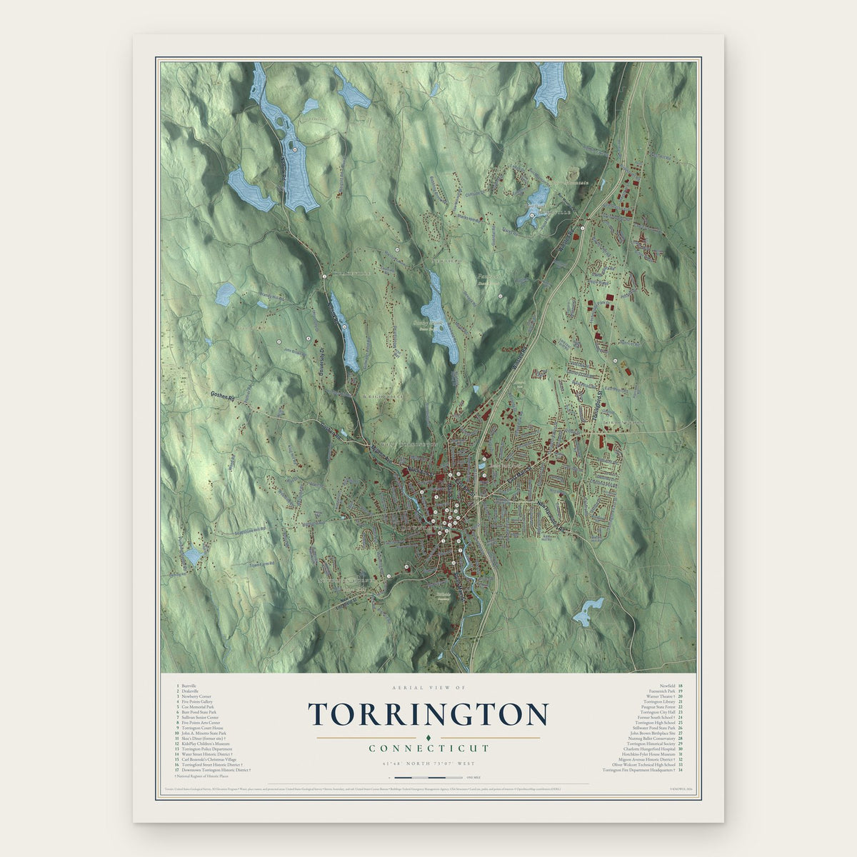
Torrington, Connecticut Map Art
Building by building, with labeled streets and shaded relief.
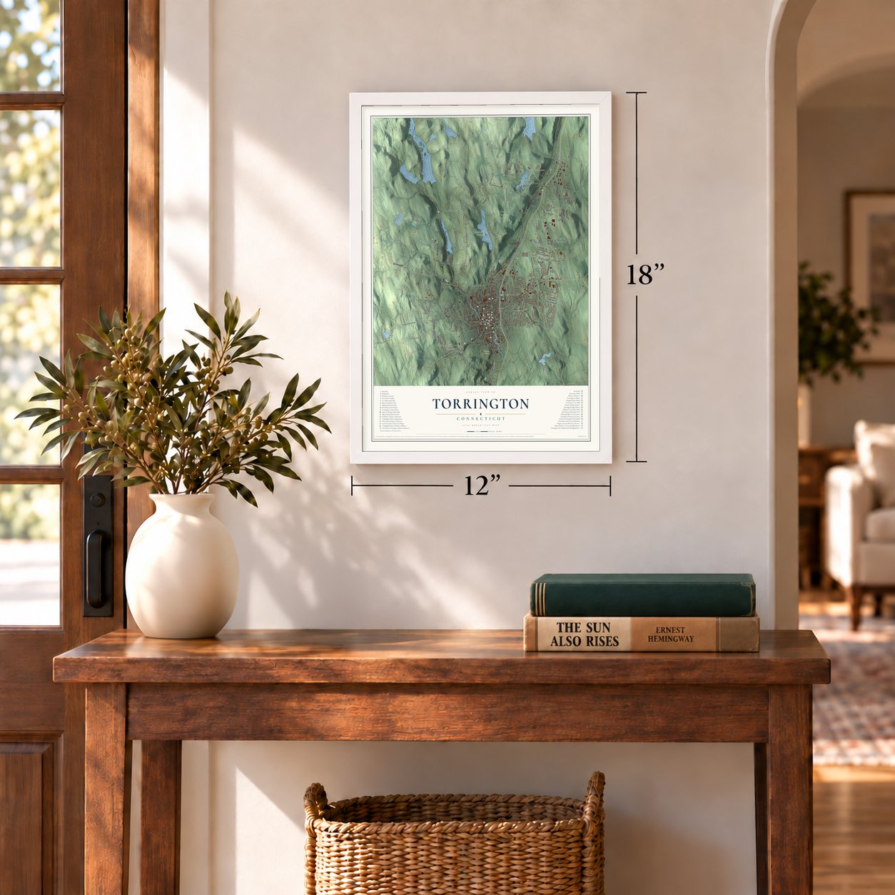
12" x 18" Archival Matte Print
A Map of Home. A Work of Art.
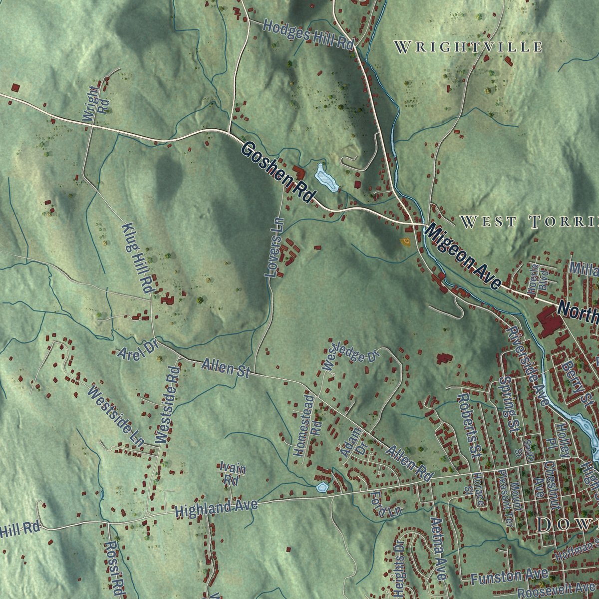
Explore Torrington, Connecticut from a whole new perspective. Created using aerial imagery and detailed geographic data, this map captures Torrington building by building, with labeled streets, familiar landmarks, and shaded topographical relief that highlights the natural contours of the landscape.
Combining modern data with the timeless character of a vintage atlas, this map is just as interesting up close as it is beautiful on the wall. Whether you grew up in Torrington, spent memorable years there, or call it home today, this unique map is a great way to celebrate a place that means something to you. Zoom in on the preview to look for your street, and then order a print to put your memories on the wall.

Three ways to hang it
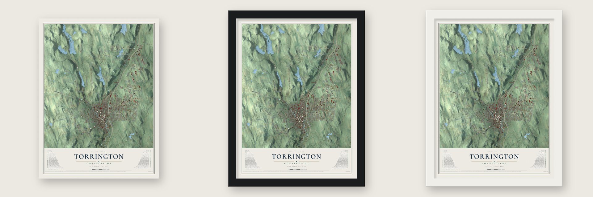
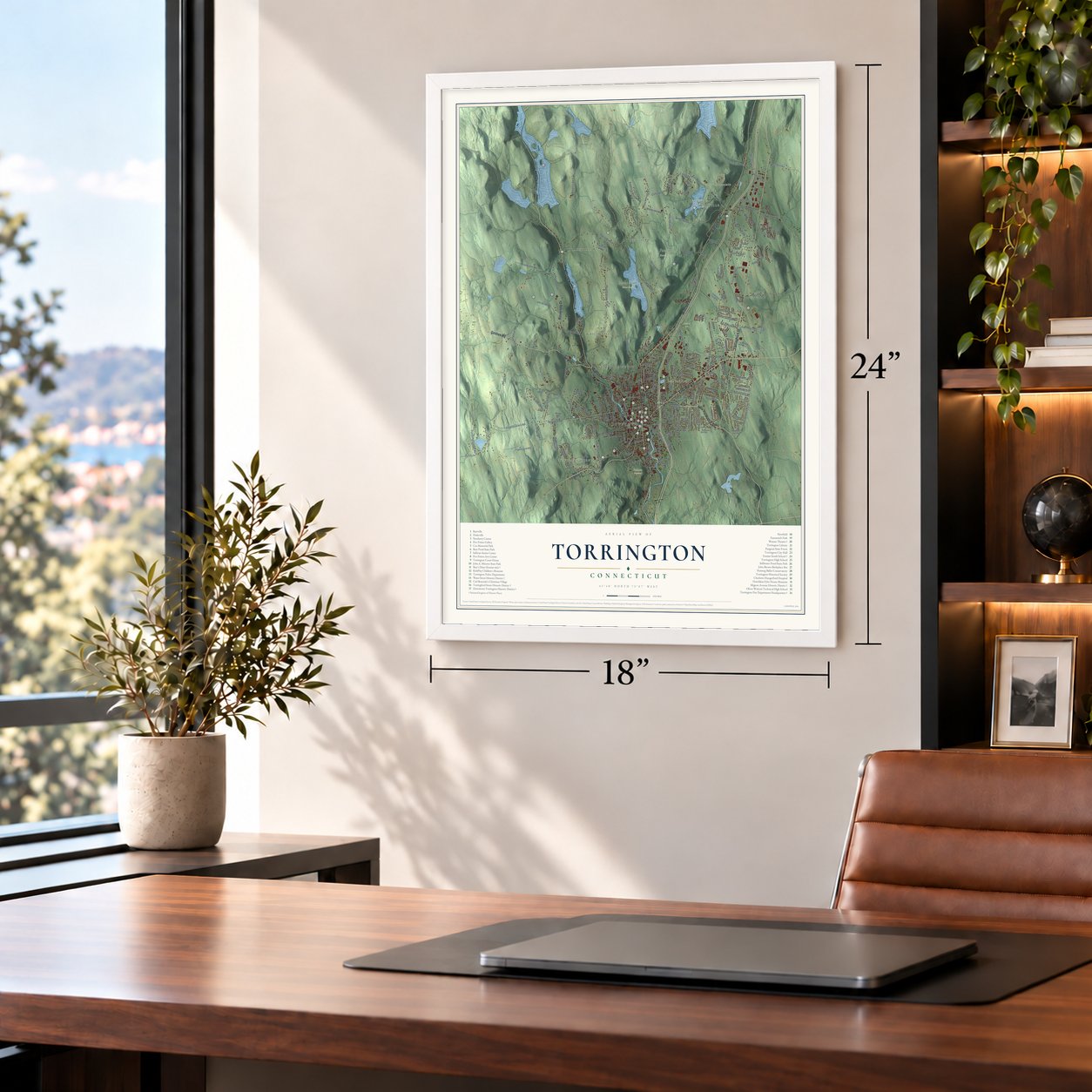
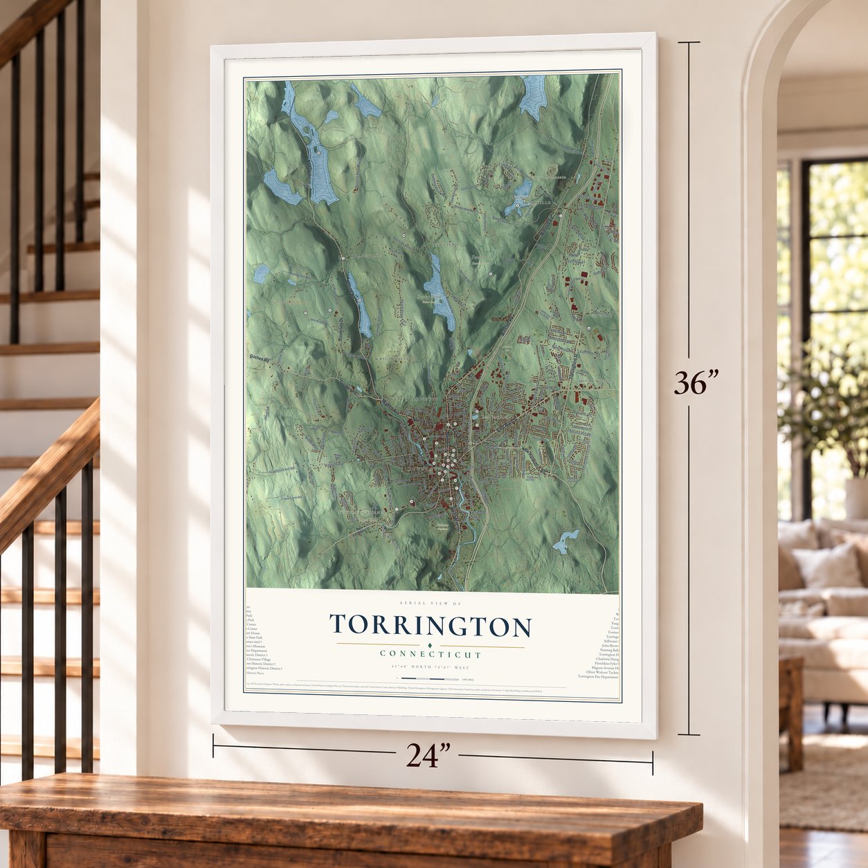
Unframed archival matte, a black wood frame or a white wood frame.
Up close
Geography Worth Displaying
This map was created using accurate cartographic data and authoritative geographic sources, including the U.S. Geological Survey (USGS) and FEMA. The map brings together terrain, waterways, roads, and building detail. The majority of the streets are labeled, houses are accurately depicted, and the topography is derived from government sources. Combining local data with carefully composed color and shading leads to this beautifully detailed Torrington artwork for your wall.
Rather than simply showing street outlines, we’ve included as many of the street names as we could reasonably fit on the map while keeping their names legible. Zoom in on the high resolution preview to see exactly what’s on the map. We truly set out to create a statement piece for anyone who loves Torrington. So whether it’s for you, or a gift for someone you love, we hope this map of Torrington brings back fond memories.
Explore the full map of Torrington, Connecticut and read about the local places it shows.

Find your street
Names on the Torrington map
Every name below is printed on this map. Look for your street, your school, the park where you played, or the pond down the road.
Places and landmarks18
- Downtown
- Burrville
- Newberry Corner
- Torringford
- Drakeville
- Newfield
- Besse Hill
- Brandy Hill
- Burr Mountain
- Besse Park Pond
- Burr Pond
- Alvord Park
Show all 18 places
- Camp Ouleout
- Hillside Cemetery
- Paugnut State Forest
- Sunny Brook State Park
- West Torrington
- Wrightville
Streets and roads229
- Norfolk Road
- East Main Street
- Goshen Road
- Migeon Avenue
- South Main Street
- Main Street
- North Elm Street
- Torringford Street
- Winsted Road
- New Harwinton Road
- University Drive
- East Elm Street
- Highland Avenue
- Riverside Avenue
- Soapstone Hill Road
- Rossi Road
- Weed Road
- Hill Street
- Newfield Road
- Torringford East Street
- Ledge Drive
- Harwinton Avenue
- Klug Hill Road
- Pumping Station Road
- Spencer Road
- Peck Road
- Torringford West Street
- Mountain Road
- Guerdat Road
- Starks Hill Road
Show all 229 streets
- Pothier Road
- Brandy Hill Road
- Starks Road
- Stillwater Pond Road
- Litchfield Street
- Charles Street
- Circle Drive
- Allen Road
- Allen Street
- Kennedy Drive
- Devaux Road
- Hayden Hill Road
- Alvord Park Road
- Blue Street
- Weigold Road
- County Road
- Lovers Lane
- Greenwoods Road
- Clearview Avenue
- Oxbow Drive
- Brightwood Avenue
- Technology Park Drive
- Westside Road
- High Street
- Funston Avenue
- Westside Lane
- Pond Road
- Hillside Avenue
- Cliffside Drive
- Ella Grasso Avenue
- Hillandale
- Allison Drive
- Babbling Brook Road
- Pinewoods Road
- Upper Valley Road
- Oak Avenue
- Park Avenue
- Edgewood Drive
- Stoneridge Drive
- Albrecht Road
- Country Club Road
- West Pearl Road
- East Pearl Road
- Cedar Lane
- Chestnut Hill Road
- West Hill Road
- Industrial Lane
- Torcon Drive
- Meyer Road
- Wyoming Avenue
- Fairlawn Drive
- Pineridge Road
- Arbor Ridge
- Aetna Avenue
- Hogan Drive
- Baltic Road
- Dorothy Drive
- Daley Drive
- Hodges Hill Road
- Ginger Lane
- Kinney Street
- Spring Street
- Lyman Drive
- Dibble Street
- McKinley Street
- Red Oak Hl
- Town Farm Road
- Forest Street
- Eagle Ridge
- Eno Avenue
- Garden Street
- Pearl Street
- Trotters Way
- Richard Road
- Roberts Street
- Herman Road
- Albert Street
- Arthur Street
- Benham Street
- Carriage Lane
- College Avenue
- Millard Street
- French Street
- Berry Street
- Durand Street
- Blake Street
- Pierce Street
- Arel Drive
- New Litchfield Street
- Perkins Street
- Burr Mountain Road
- Oliver Street
- Harrison Road
- Ryan Terrace
- Harwinton Avenue No 2
- Notting Hill Gate
- Wright Road
- Marshall Lake Road
- Saw Mill Hill Road
- Buttrick Road
- John Brown Road
- Westledge Drive
- Wimbledon Gate North
- White Pine Road
- Heights Drive
- Evergreen Drive
- Trailsend Drive
- Roosevelt Avenue
- Laurel Hill Road
- Crestwood Road
- Highland Lake Road
- Buena Vista Avenue
- Old Winsted Road
- Doman Drive
- Sunny Lane
- Bradford Road
- Larkspur Farm Road
- Torrington Heights Road
- Darling Street
- Newfield Spring Road
- Chestnut Avenue
- Dawes Avenue
- Machuga Road
- Marshall Street
- Gaylord Lane
- Greenridge Road
- Wadhams Avenue
- Penny Lane
- Apter Drive
- Homestead Road
- Oxford Way
- Franklin Drive
- Silver Fox Lane
- Caulfield Road
- Wood Street
- Pulaski Street
- Revere Street
- Deming Road
- Dutton Hill Road
- Irving Avenue
- Alice Street
- East Hill Road
- View Street
- Harris Drive
- Holley Place
- Tara Drive
- Ford Lane
- Adam Drive
- Sage Way
- Farley Place
- Mill Lane
- Heron Road
- The Way
- Elsie Street
- Ivain Road
- Windtree Street
- Hassig Road
- Ascot Lane
- Weed Street
- Chamberlain Street
- Mc Donald Street
- Hoffman Street
- Old Farms
- Grove Street
- Scoville Street
- Mount Pleasant Terrace
- Carroll Drive
- Farmstead Lane
- Tognalli Drive
- Horace Street
- Cole Street
- Willow Street
- Falcon Ridge Road
- Colin Drive
- Fern Drive
- Hoerle Boulevard
- Putter Lane
- Red Mountain Avenue
- Cedar Swamp Road
- Hinsdale Road
- Northside Drive
- Surrey Lane
- Sherwood Drive
- Rock Creek Lane
- Silver Brook Lane
- Summer Street
- Laurelton Drive
- Lafayette Street
- Lexington Avenue
- Loretta Road
- Spruce Drive
- Britton Avenue
- King Street
- Smith Street
- North Street
- Essex Court
- Lake Drive
- Calli Street
- Fox Run
Names are listed as they appear on the printed map. Zoom into the product photos to find them.
About Torrington, Connecticut
Torrington is a city of 35,515 people in Litchfield County, on the Naugatuck River. In 1732 the colony named a new township, allotted to Windsor proprietors, after Torrington in Devon, England. Ebenezer Lyman Jr. of Durham settled here in 1735, and the first families put their school, church, store and tavern up on the hills west of the river. In October 1740 the town won the right to organize a government and incorporate.
The valley below was Mast Swamp, a forest of pines tall and straight enough for ships' masts. A dam on the Naugatuck for Amos Wilson's sawmill started a village there in 1751, and in 1803 John Brooker beat his neighbor Benoni Leach by about a week to raise its first frame house. When the Wolcotts raised their woolen mill in 1813, Rev. Alexander Gillet called out the name Wolcottville, and it held until the post office renamed the village Torrington in 1881. Town meetings had moved down from the hills in 1836, and the valley village became a borough in 1887 and a city in 1923.
“The quick eye and ready hand of Wolcottville Yankees soon secured experts in the making of brass kettles.”
- Brass kettles in 1834In 1834 Israel Coe and Erastus Hodges started building two brass mills on the Naugatuck, and Coe's company began hammering out brass kettles at Wolcottville, the first time anyone in America had tried it. To do the work, thirty-eight men, women and children came over from England together on a single ship. The trade spread through the whole Naugatuck Valley, and after the railroad reached town in 1849, Torrington turned out needles, hardware, bicycles and tacks as well.
- 150,000 needles a monthThe Excelsior Needle Company was organized on March 2, 1866, to make sewing machine needles by machine, each one the same size and shape. By 1878 it was shipping 150,000 a month to Wheeler and Wilson. Its English-born superintendent, James Alldis, built a Queen Anne house with a round tower in 1895, and the James Alldis House joined the National Register in 1982.
- Gail Borden's condensed milkGail Borden, who found a way to preserve milk by evaporating and condensing it, built the first commercial milk condensery in 1856, at Wolcottville, and a second factory at Burrville in 1857. His milk proved especially useful to the Union Army in the Civil War. Fire destroyed the Wolcottville mill in 1877, and a bronze tablet below the falls marks where it stood.
- John Brown's birthplaceThe abolitionist John Brown came into the world on May 9, 1800, at a farm in western Torrington where his father, Owen, ran a tannery. He was five when the family left for Ohio. In 1901 the house was restored and opened as a museum, but it burned in 1918, and a granite monument followed in 1932. The Torrington Historical Society took over the site in 2000.
- The Warner Theatre, 1931Warner Bros. opened Thomas W. Lamb's Art Deco movie palace on August 19, 1931, with Governor Wilbur Cross in the crowd. By the early 1980s the theater had closed and faced demolition, so local people bought it and brought it back as an arts center on May 22, 1983. It joined the National Register in 1984, and the Nutmeg Ballet company now performs on its stage.
Keep exploring Connecticut
Torrington is one of 382 Connecticut towns we've mapped. Every dot on the map is a print of its own.
The search covers every state, Connecticut first.
Near Torrington
Order 2 or more town maps and save 10%. Shown in the size and finish you picked above, so they hang as a set.
- Northwest Harwinton 12" x 18" / Archival Matte Print $39.99
- Goshen 12" x 18" / Archival Matte Print $39.99
- Harwinton 12" x 18" / Archival Matte Print $39.99


More maps nearby: Winchester, New Hartford, Winsted, Litchfield and New Hartford Center.
The art of mapping a place
How This Map Was Made
Real places. Remarkable detail. Discover the layers that turn geographic data into a map of home.

The view from above
Aerial imagery reveals the character of the land: woodland, open fields, and the patterns of a place.

The shape of the land
Elevation data brings hills, valleys, and subtle changes in the landscape into view.

The details of home
Roads, waterways, and building footprints come together to make the map feel unmistakably local.

Geography becomes art
Considered color, shading, and typography bring the layers together in a map made for your wall.


Process illustrated with Mendon, Massachusetts. Aerial imagery: USDA NAIP. Terrain: USGS 3D Elevation Program. Map details and finished artwork: KNOWOL.
The Details
About This Print
Choose an archival matte print, or a black or white Ayous wood frame. The archival matte print is unframed.
Select your size and finish above to see the matching product image and price.
Materials & Craftsmanship
A contemporary map with the character of a classic atlas, printed on archival matte paper. Optional frames are made from Ayous wood.
Your printed map does not include the watermark shown in the full-map preview.
Shipping & Delivery
Free shipping within the United States. Every print is made to order in the USA.
Buying a gift? Add a note in your cart and we'll include it. We never put prices in the package.
Prints ship within 2 to 3 business days. Allow 7 to 10 days total from ordering for delivery. Timing may vary during holidays or periods of high order volume.
Read our shipping policy.
Returns and damaged prints
Each print is made to order. Change-of-mind refunds are not available after production.
If your print arrives damaged, misprinted or incorrect, contact support@knowol.com within 30 days of receiving it. Include your order number, photos and a description of the issue.
Read our full refund and replacement policy. For questions about your order, email support@knowol.com.