
Search for another town





Free U.S. delivery 7 to 10 days after you order
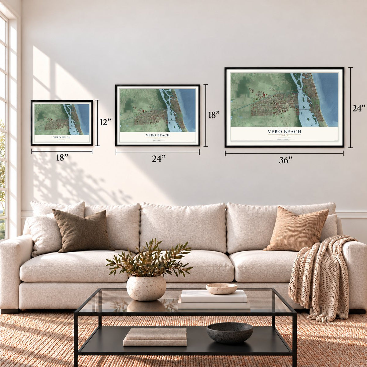
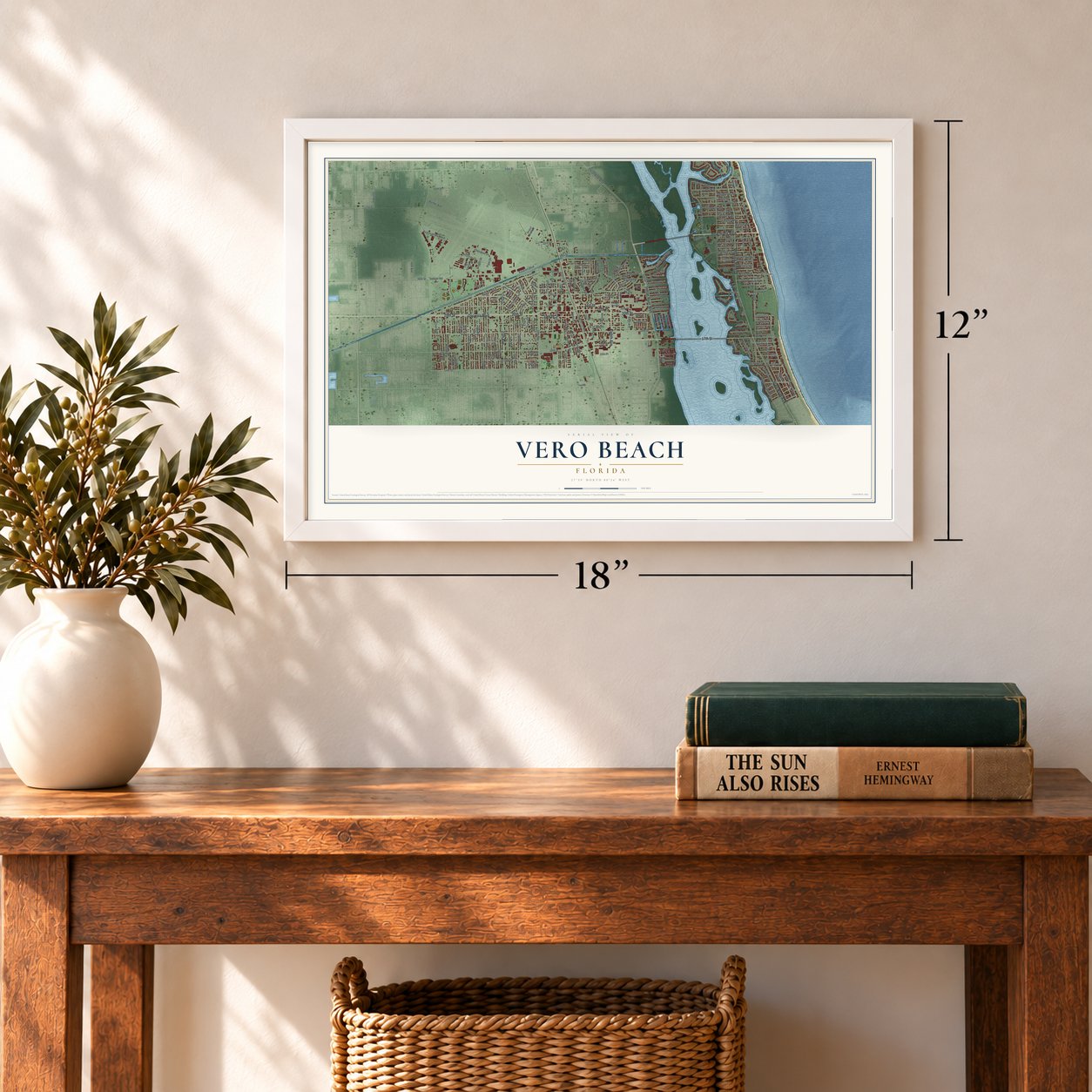
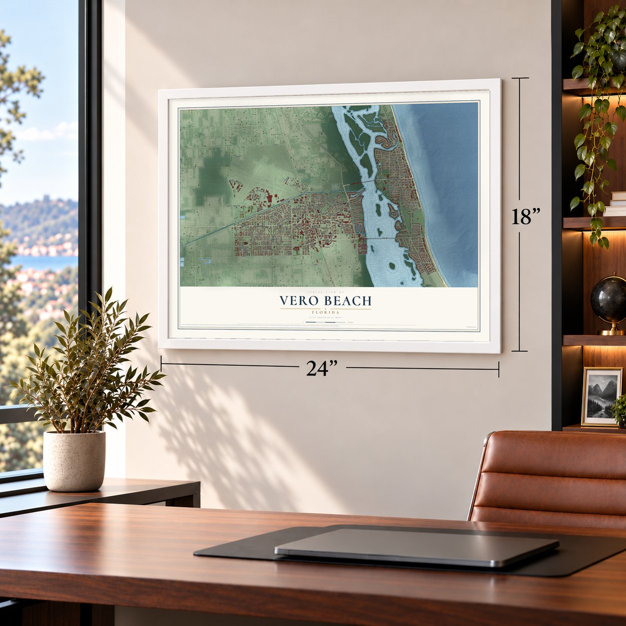
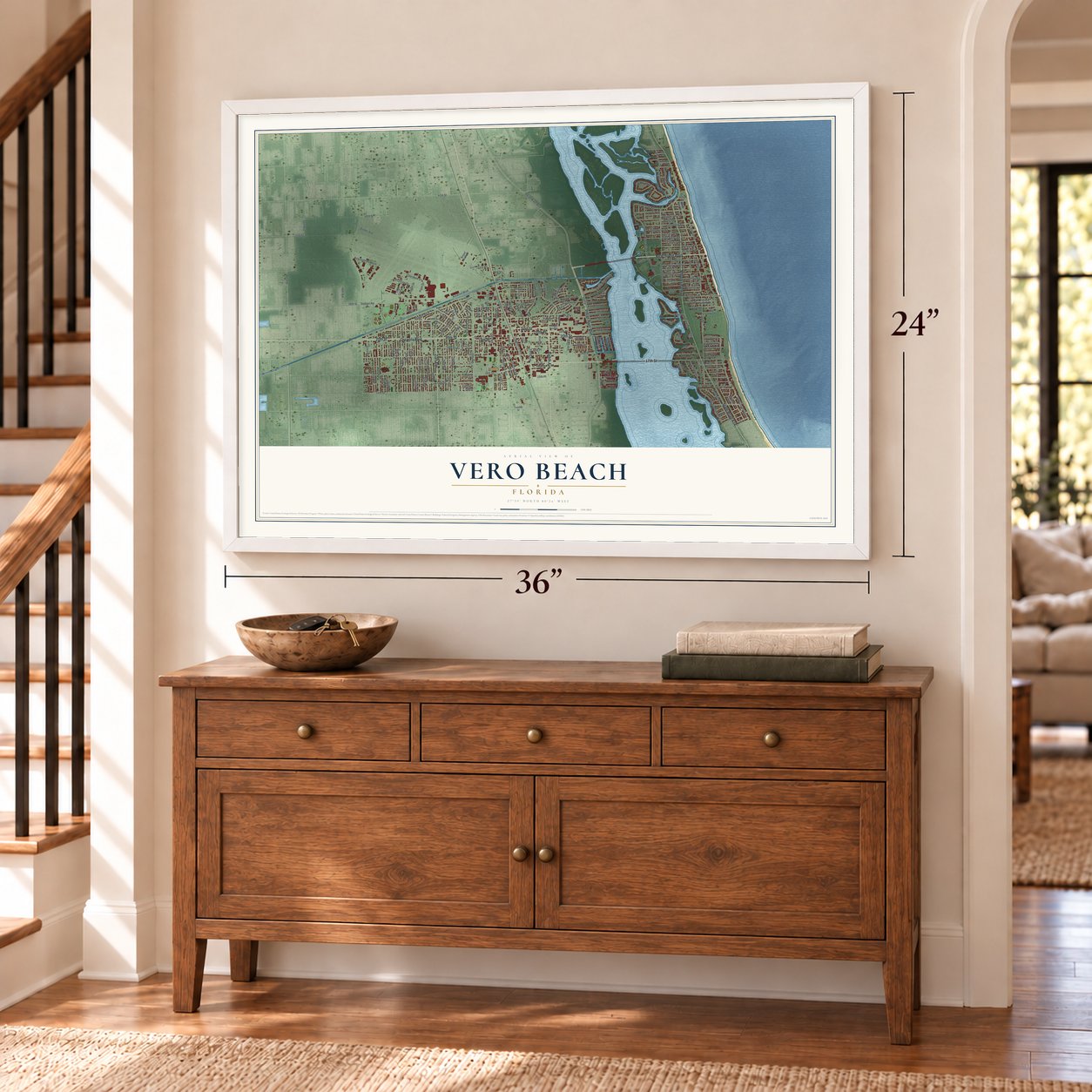
Vero Beach, Florida Map Art
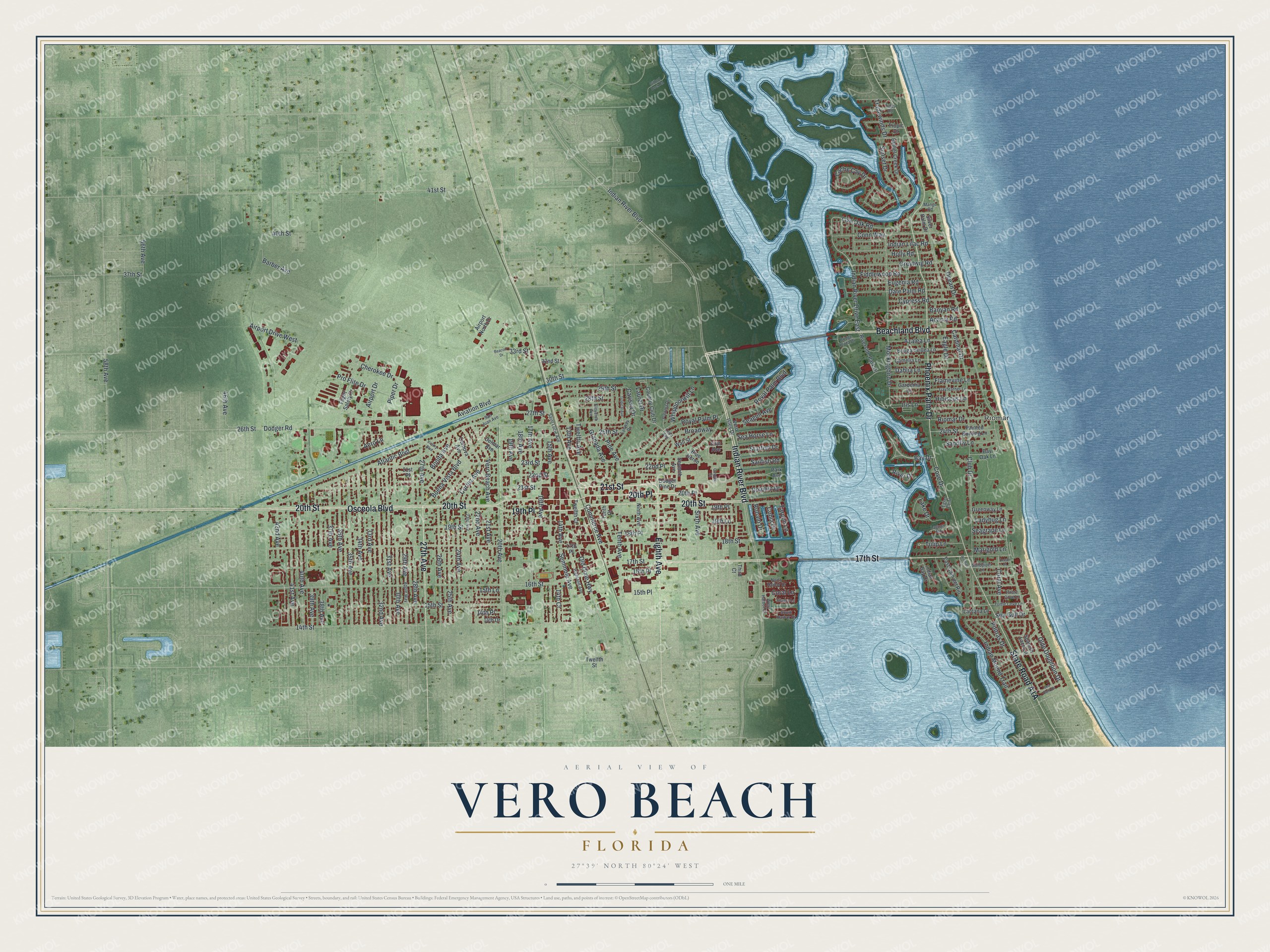
A new map of Vero Beach, Florida, made in 2026 and printed to order on thick archival matte paper.
12" x 18" Archival Matte Print
A Map of Home. A Work of Art.
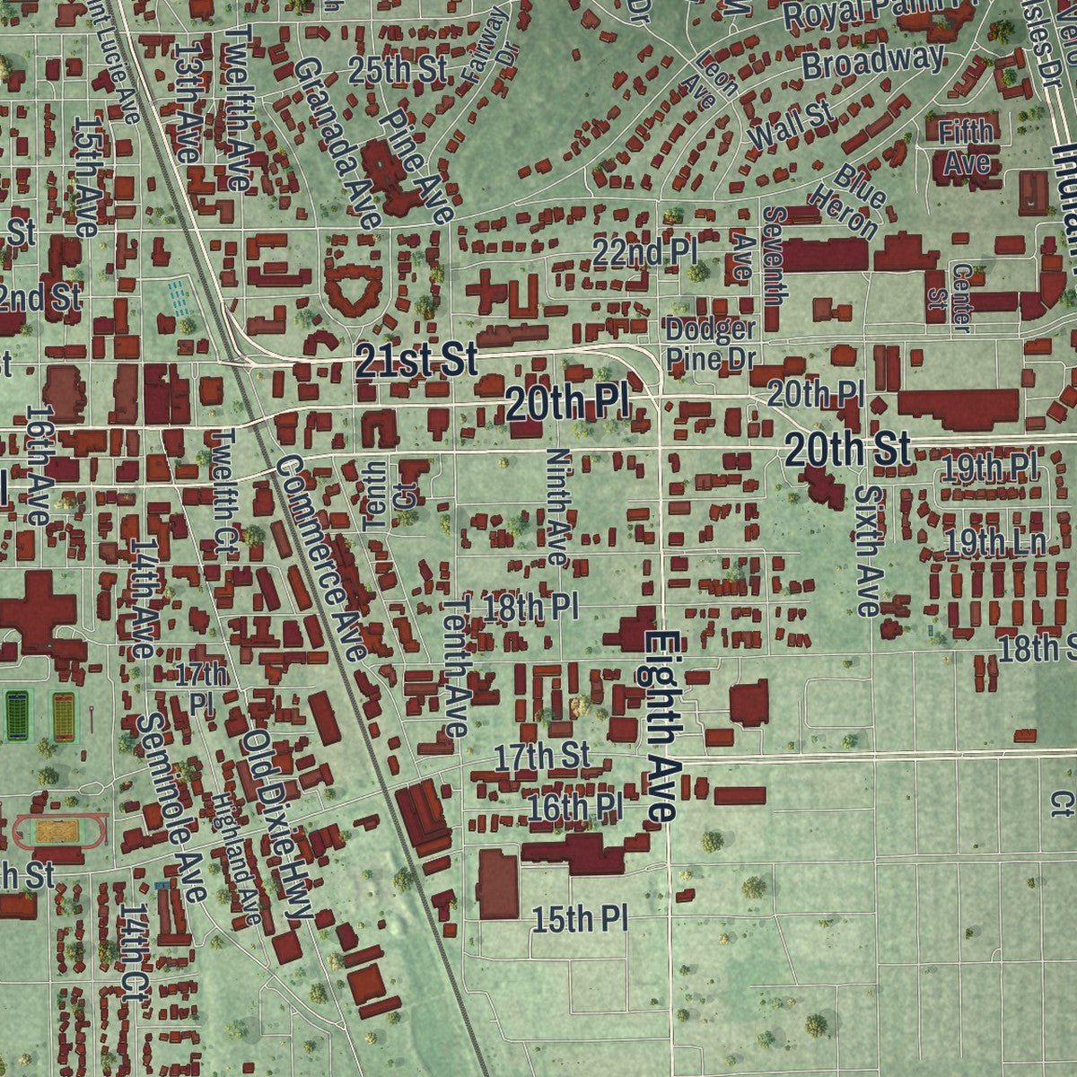
Explore Vero Beach, Florida from a whole new perspective. Created using aerial imagery and detailed geographic data, this map captures Vero Beach building by building, with labeled streets, familiar landmarks, and shaded topographical relief that highlights the natural contours of the landscape.
Combining modern data with the timeless character of a vintage atlas, this map is just as interesting up close as it is beautiful on the wall. Whether you grew up in Vero Beach, spent memorable years there, or call it home today, this unique map is a great way to celebrate a place that means something to you. Zoom in on the preview to look for your street, and then order a print to put your memories on the wall.
Three ways to hang it
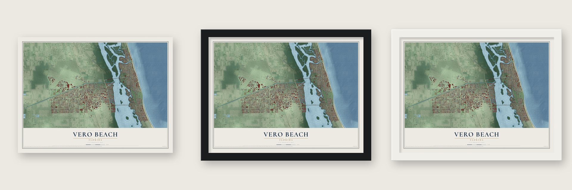
Unframed archival matte, a black wood frame or a white wood frame.
Up close
Geography Worth Displaying
This map was created using accurate cartographic data and authoritative geographic sources, including the U.S. Geological Survey (USGS) and FEMA. The map brings together terrain, waterways, roads, and building detail. The majority of the streets are labeled, houses are accurately depicted, and the topography is derived from government sources. Combining local data with carefully composed color and shading leads to this beautifully detailed Vero Beach artwork for your wall.
Rather than simply showing street outlines, we’ve included as many of the street names as we could reasonably fit on the map while keeping their names legible. Zoom in on the high resolution preview to see exactly what’s on the map. We truly set out to create a statement piece for anyone who loves Vero Beach. So whether it’s for you, or a gift for someone you love, we hope this map of Vero Beach brings back fond memories.
Explore the full map of Vero Beach, Florida and read about the local places it shows.

About Vero Beach, Florida
Vero Beach is a city of 16,354 people on the Indian River Lagoon and the Atlantic Ocean, and it is the county seat of Indian River County. Captain Allen W. Estes settled in the area in 1870, and in 1872 he secured the first land patent for the strip between the ocean and the lagoon.
Henry Flagler's Florida East Coast Railway began running through in 1893, and Vero received its town charter on June 10, 1919, when it had 71 residents. When Indian River County was carved out of St. Lucie County, Vero became the new county's seat on May 19, 1925, and took the name Vero Beach. In 1951 the first Barber Bridge linked the mainland to the barrier islands, and a new Merrill P. Barber Bridge replaced it in 1995.
- Spanish silver in 1715In 1715 a hurricane sank eleven of twelve Spanish treasure ships off the coast here. The lost silver drew pirates: Henry Jennings led 300 out-of-work English privateers who took about £87,500 in gold and silver from the wrecks, their first act of piracy. Coins from the fleet still wash up on the beach.
- Ice Age bones in 1915In 1915 parts of a human skeleton turned up north of Vero alongside the remains of Pleistocene animals. For years most experts held that the human bones were far younger. Then in 2006 a bone carved with a mastodon or mammoth was found near the same spot, and forensic study showed it was probably carved in the Pleistocene. Mercyhurst University dug at the Old Vero Man site in 2014 and 2015, and Florida Atlantic University joined in 2016.
- A depot from 1903The Vero Railroad Station served the town and the farms around it for almost 65 years, from 1903 to 1968. Today the old depot houses a county historical exhibit.
- Dodgertown until 2008The Navy built a Naval Air Station around the city's airport in 1942. In the fall of 1947 local businessman Bud Holman offered that land to the Brooklyn Dodgers, met Buzzie Bavasi at the train and kept him from going on to Fort Pierce and Stuart. The lease cost $1.00 a year. Dodger Town was the first racially integrated spring training camp in the South, where Jackie Robinson and Roy Campanella trained, and the Dodgers stayed until 2008.
- Piper Aircraft since 1957Piper Aircraft began research and development work in Vero Beach in 1957. After adding to its buildings, it moved its offices and manufacturing here in 1961. By July 2015 it employed about 750 people, more than any other private employer in Indian River County.
Find your street
Names on the Vero Beach map
Every name below is printed on this map. Look for your street, your school, the park where you played, or the pond down the road.
Places and landmarks1
- Riomar
Streets and roads210
- 20th Place
- 21st Street
- Eighth Avenue
- Indian River Boulevard
- 20th Street
- 17th Street
- Beachland Boulevard
- Phoenix Palm Drive
- Osceola Boulevard
- 27th Avenue
- 19th Place
- Aviation Boulevard
- Indian River Drive East
- Piper Drive
- 26th Street
- Dodger Road
- 23rd Street
- Cherokee Drive
- 16th Street
- Olde Doubloon Drive
- Royal Palm Boulevard
- Tenth Avenue
- Live Oak Road
- Bay Drive
- Pine Avenue
- 18th Street
- 20th Avenue
- Ocean Drive
- 19th Street
- Atlantic Boulevard
Show all 210 streets
- 14th Street
- 14th Avenue
- Mockingbird Drive
- Club Drive
- Cache Cay Drive
- 34th Avenue
- 22nd Street
- 15th Street
- 31st Avenue
- 32nd Avenue
- Old Dixie Highway
- 16th Avenue
- 41st Street
- 35th Avenue
- 24th Street
- 17th Avenue
- 28th Avenue
- 36th Avenue
- 33rd Avenue
- Twelfth Avenue
- 15th Avenue
- 40th Avenue
- 41st Avenue
- 30th Avenue
- 25th Street
- 26th Avenue
- 19th Avenue
- Dahlia Lane
- 25th Avenue
- Airport Drive West
- Conn Way
- 18th Avenue
- Buena Vista Boulevard
- Royal Palm Place
- Date Palm Road
- Greytwig Road
- Riomar Drive
- 27th Street
- Eagle Drive
- 18th Place
- 38th Avenue
- Flamevine Lane
- 39th Avenue
- Lake Drive
- Fiddlewood Road
- Holly Road
- Indian Lilac Road
- Commerce Avenue
- Acacia Road
- 37th Avenue
- Cortez Avenue
- Eugenia Road
- Vero Beach Avenue
- Indian Mound Trail
- 13th Avenue
- Airport Drive
- Cardinal Drive
- Azalea Lane
- 58th Avenue
- 24th Avenue
- 15th Place
- Tulip Lane
- 33rd Street
- Seminole Avenue
- Iris Lane
- 22nd Place
- 29th Street
- 29th Avenue
- Poitras Drive
- Banyan Road
- Broadway
- Cypress Road
- Sunset Drive
- Pro Flite Drive
- 28th Street
- Coral Avenue
- Sixth Avenue
- 14th Court
- Seagull Avenue
- Sandfly Lane
- 22nd Avenue
- 42nd Avenue
- 14th Place
- Whippoorwill Lane
- Barber Avenue
- 16th Place
- Granada Avenue
- 37th Street
- Bonita Avenue
- Tradewinds Drive
- Laurel Drive
- 21st Avenue
- Sea Horse Lane
- Starfish Drive
- Sailfish Road
- River Drive
- Hibiscus Lane
- Tarpon Lane
- 56th Avenue
- Carissa Drive
- Marigold Lane
- Dolphin Drive
- 46th Avenue
- Ladybug Lane
- Seagrape Lane
- Cove Drive
- Coral Lane
- Sea Gull Drive
- 30th Street
- Cobia Drive
- 40th Street
- Robalo Drive
- Aero Lane
- 15th Lane
- 19th Lane
- Dodger Pine Drive
- Vero Isles Drive
- Third Court
- Cordova Avenue
- Camelia Lane
- Bougainvillea Lane
- Airport North Drive
- Flight Safety Drive
- Ninth Avenue
- Park Avenue
- Painted Bunting Lane
- Bethel Creek Drive
- 17th Place
- Fifth Avenue
- Silver Palm Drive
- Spanish Lace Lane
- Seventh Avenue
- Riverside Park Drive
- East Cam del Rio
- Country Club Drive
- Gardenia Lane
- Wall Street
- Greenway Lane
- Bay Oak Lane
- Tenth Court
- Lantana Lane
- Indian Bay Drive
- Twelfth Court
- 14th Drive
- Tropic Drive
- Twelfth Street
- Delmar Avenue
- 32nd Street
- Blue Heron
- 21st Place
- North Harbor Drive
- Apple Way
- South Harbor Drive
- Highland Avenue
- Eleventh Avenue
- Turtle Cove Lane
- Pirate Cove Lane
- Gayfeather Lane
- 23rd Avenue
- Sandpiper Lane
- Fairway Drive
- Paloma Drive
- Bridge Plaza Drive
- Leon Avenue
- Silvery Lane
- West Harbor Drive
- Saint Lucie Avenue
- Tides Road
- Egret Point
- San Juan Avenue
- Lagoon Road
- Mango Road
- Center Street
- Sea Hunt Drive
- Victory Boulevard
- Beacon Drive
- Tropical Avenue
- Riomar Cv
- Gifford Dock Road
- Ocean Place
Names are listed as they appear on the printed map. Zoom into the product photos to find them.
The art of mapping a place
How This Map Was Made
Real places. Remarkable detail. Discover the layers that turn geographic data into a map of home.

The view from above
Aerial imagery reveals the character of the land: woodland, open fields, and the patterns of a place.

The shape of the land
Elevation data brings hills, valleys, and subtle changes in the landscape into view.

The details of home
Roads, waterways, and building footprints come together to make the map feel unmistakably local.

Geography becomes art
Considered color, shading, and typography bring the layers together in a map made for your wall.


Process illustrated with Mendon, Massachusetts. Aerial imagery: USDA NAIP. Terrain: USGS 3D Elevation Program. Map details and finished artwork: KNOWOL.
The Details
About This Print
Choose an archival matte print, or a black or white Ayous wood frame. The archival matte print is unframed.
Select your size and finish above to see the matching product image and price.
Materials & Craftsmanship
A contemporary map with the character of a classic atlas, printed on archival matte paper. Optional frames are made from Ayous wood.
Your printed map does not include the watermark shown in the full-map preview.
Shipping & Delivery
Free shipping within the United States. Every print is made to order in the USA.
Buying a gift? Add a note in your cart and we'll include it. We never put prices in the package.
Prints ship within 2 to 3 business days. Allow 7 to 10 days total from ordering for delivery. Timing may vary during holidays or periods of high order volume.
Read our shipping policy.
Returns and damaged prints
Each print is made to order. Change-of-mind refunds are not available after production.
If your print arrives damaged, misprinted or incorrect, contact support@knowol.com within 30 days of receiving it. Include your order number, photos and a description of the issue.
Read our full refund and replacement policy. For questions about your order, email support@knowol.com.
Find your town
Looking for another city?
Find a map of home in our Florida collection, or any town in the country.
Nearby
Maps of towns near Vero Beach
Know someone from one of these towns? Their map makes a great gift.
 Gifford
, Florida
From $39.99See the map
 Vero Beach South
, Florida
From $39.99See the map
 Indian River Shores
, Florida
From $39.99See the map
More maps nearby: Florida Ridge, Winter Beach, West Vero Corridor, South Beach and Wabasso Beach.