
Search for another town





Free U.S. delivery 7 to 10 days after you order
Wade Hampton, South Carolina Map Art
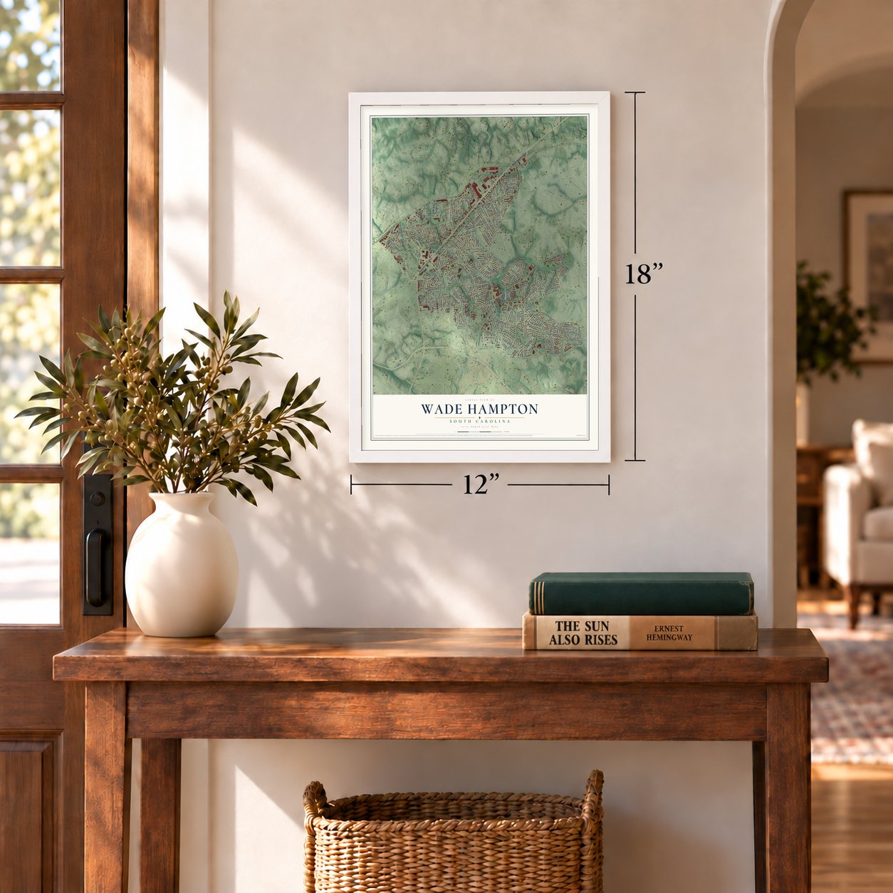
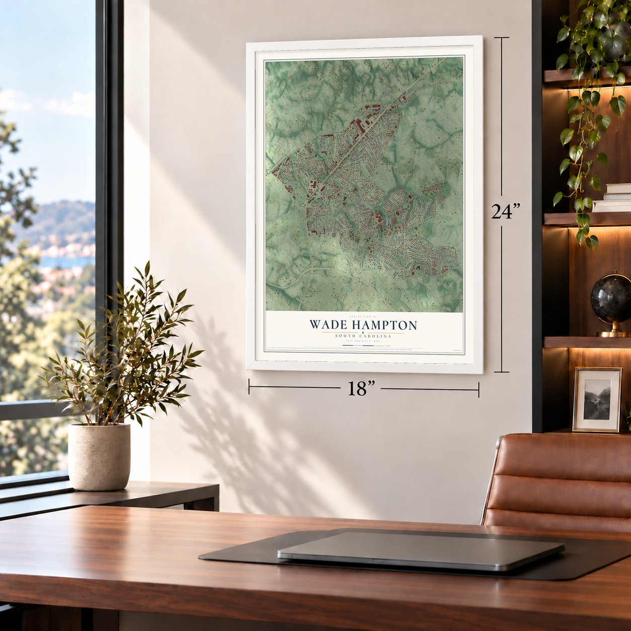
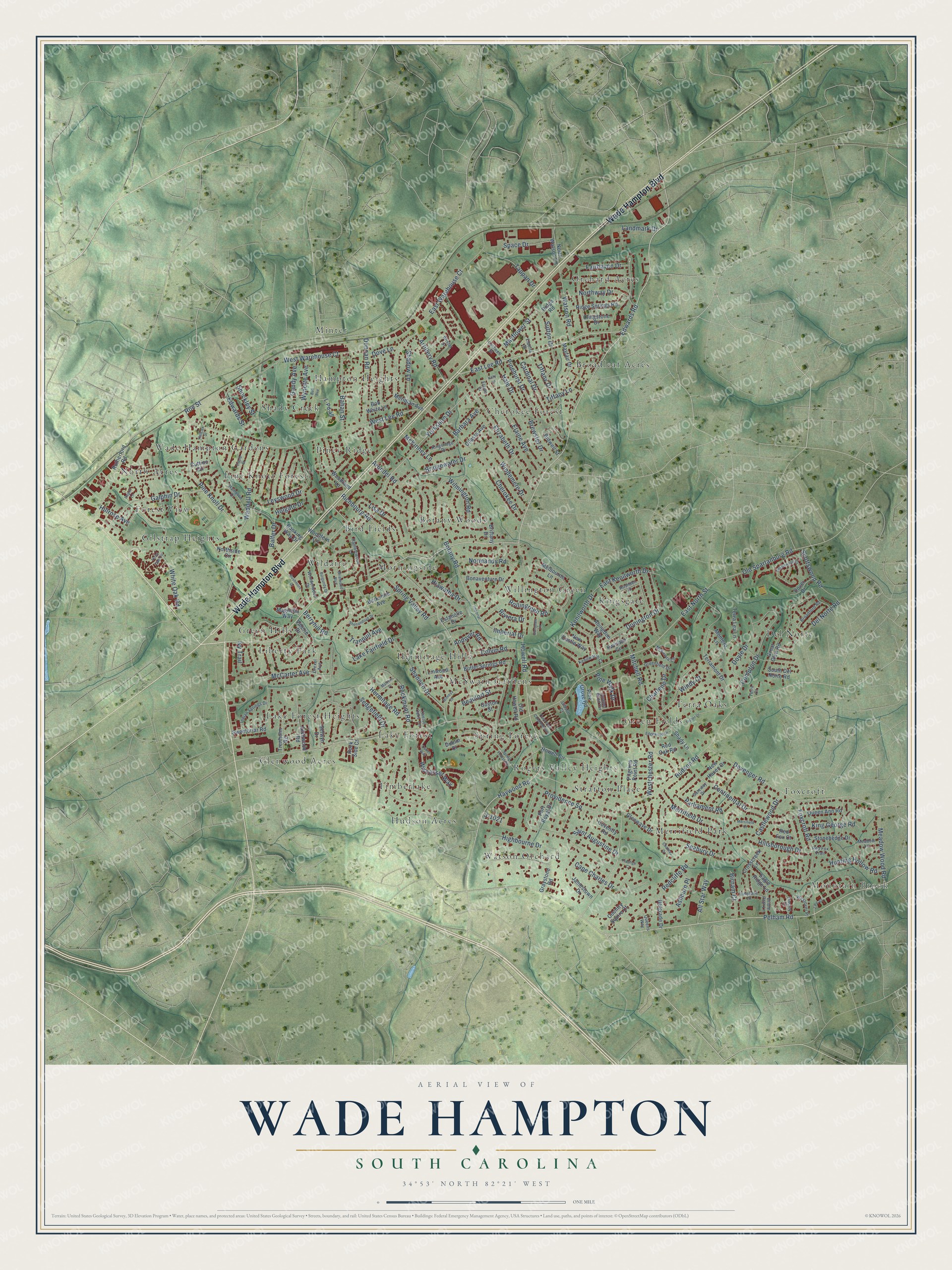
A new map of Wade Hampton, South Carolina, made in 2026 and printed to order on thick archival matte paper.
12" x 18" Archival Matte Print
A Map of Home. A Work of Art.
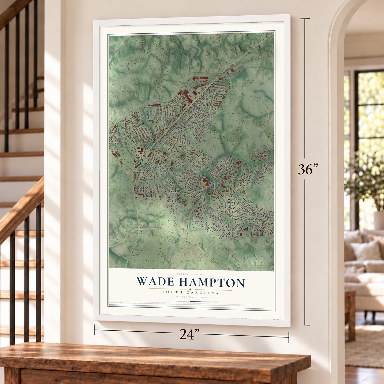
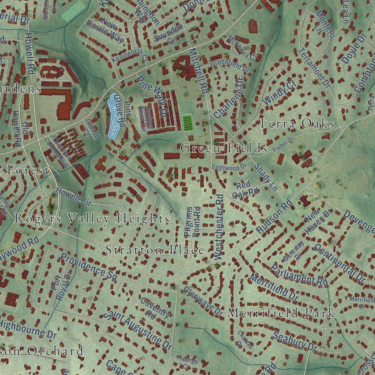
Explore Wade Hampton, South Carolina from a whole new perspective. Created using aerial imagery and detailed geographic data, this map captures Wade Hampton building by building, with labeled streets, familiar landmarks, and shaded topographical relief that highlights the natural contours of the landscape.
Combining modern data with the timeless character of a vintage atlas, this map is just as interesting up close as it is beautiful on the wall. Whether you grew up in Wade Hampton, spent memorable years there, or call it home today, this unique map is a great way to celebrate a place that means something to you. Zoom in on the preview to look for your street, and then order a print to put your memories on the wall.
Three ways to hang it
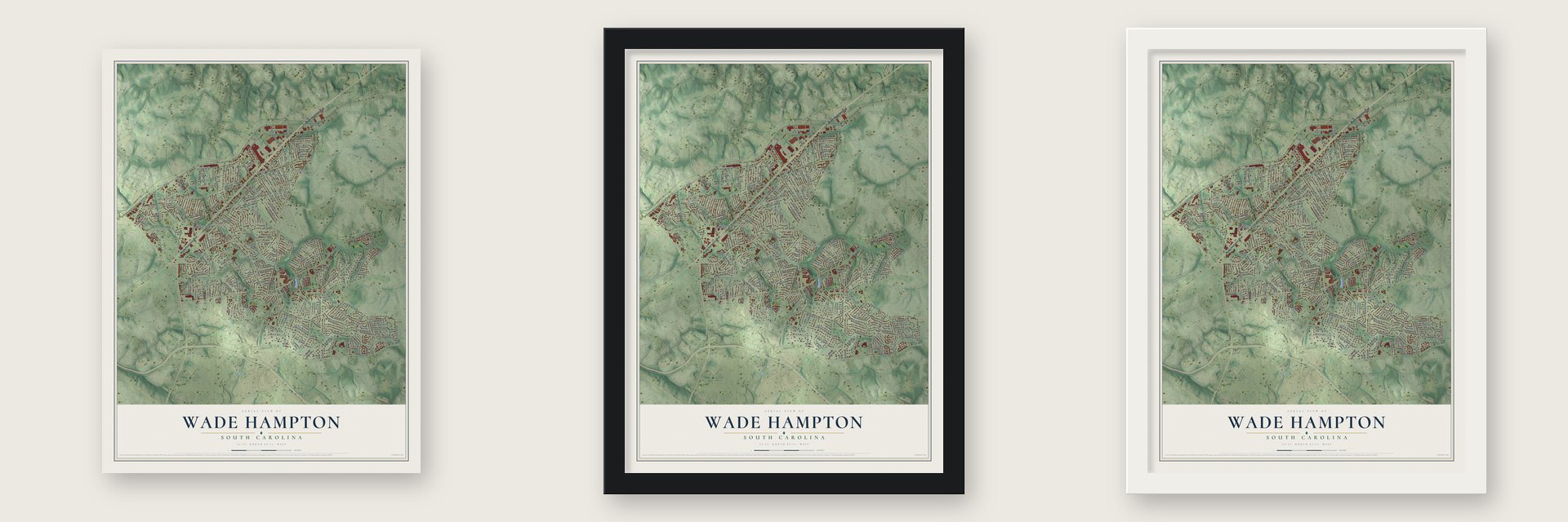
Unframed archival matte, a black wood frame or a white wood frame.
Up close
Geography Worth Displaying
This map was created using accurate cartographic data and authoritative geographic sources, including the U.S. Geological Survey and the Census Bureau. The map brings together terrain, waterways, roads, and building detail. The majority of the streets are labeled, houses are accurately depicted, and the topography is derived from government sources. Combining local data with carefully composed color and shading leads to this beautifully detailed Wade Hampton artwork for your wall.
Rather than simply showing street outlines, we’ve included as many of the street names as we could reasonably fit on the map while keeping their names legible. Zoom in on the high resolution preview to see exactly what’s on the map. We truly set out to create a statement piece for anyone who loves Wade Hampton. So whether it’s for you, or a gift for someone you love, we hope this map of Wade Hampton brings back fond memories.
Read the story behind this map of Wade Hampton, South Carolina from 2026.
About Wade Hampton, South Carolina
From the Greenville County Schools: "Wade Hampton High School is a 9th through 12th grade high school located on Pine Knoll Drive, right off of well known Wade Hampton Blvd. in Greenville, SC. Wade Hampton High school has a tradition of excellence in athletics, academics and arts."
Find your street
Names on the Wade Hampton map
Every name below is printed on this map. Look for your street, your school, the park where you played, or the pond down the road.
Places and landmarks37
- Mountain Brook
- Bird Fields
- Botany Woods
- Broadleaf Acres
- Cherokee Forest
- Del Norte
- Forest View
- Foxcroft
- Gilstrap Heights
- Glenwood Acres
- Green Fields
- Green Hills
Show all 37 places
- Hampton Heights
- Hermitage Hills
- Hudson Acres
- Kingsgate
- Lake Forest
- Lake Forest Heights
- Liberty Park
- McSwain Gardens
- Merrifield Park
- Minter
- Morningside
- North Acres
- Orchard Acres
- Pine Knott Forest
- Piney Ridge
- Rogers Valley Heights
- Shady Creek
- Spring Forest
- Stratton Place
- Terra Oaks
- Timberlake
- Wade Hampton Gardens
- Watson Orchard
- Wildaire
- Willington Green
Streets and roads219
- Wade Hampton Boulevard
- Edwards Road
- Pelham Road
- Pine Knoll Drive
- Haywood Road
- East Lee Road
- Richbourg Road
- East North Street
- Hudson Road
- West Lee Road
- Botany Road
- Rockmont Road
- West Warehouse Court
- Devenger Road
- Providence Square
- Waddell Road
- Yorkshire Drive
- Howell Road
- East Warehouse Court
- Kenilworth Drive
- Shannon Drive
- Hillsborough Drive
- Cherokee Drive
- Bridgewater Drive
- Elizabeth Drive
- Mitchell Road
- Hermitage Road
- Foxcroft Road
- Lake Fairfield Drive
- Compton Drive
Show all 219 streets
- Donnan Road
- Elaine Avenue
- Highbourne Drive
- Balfer Drive
- Fairhaven Drive
- Galphin Drive
- Rollingreen Road
- Leyswood Drive
- Saint Augustine Drive
- Hillrose Avenue
- White Oak Road
- Old Spartanburg Road
- Merrifield Drive
- Continental Drive
- Arundel Road
- Beaufort Street
- Cardinal Drive
- Imperial Drive
- Parliament Road
- Windemere Drive
- Sutton Drive
- Del Norte Road
- Redcliffe Road
- Donington Drive
- Cape Charles Drive
- Artillery Road
- Meadow Wood Road
- Bahan Street
- Watson Road
- McCarter Avenue
- Doyle Drive
- Spring Valley Road
- Seabury Drive
- Wilmington Road
- All Star Way
- Tappan Drive
- Pinehurst Drive
- Ivy Trail
- Scottswood Road
- Lisa Drive
- Gandy Avenue
- East Kenilworth Drive
- Northway Drive
- Hunting Hollow Road
- Shadow Lane
- Hiawatha Drive
- Normandy Road
- Ashburn Place
- Castlewood Drive
- Landmark Drive
- King George Road
- Hale Drive
- Wynette Avenue
- Colvin Road
- Wiscasset Way
- Space Drive
- Tranquil Avenue
- Mayflower Street
- McKinney Lane
- Brewster Drive
- Tiffany Drive
- Birnam Court
- Andover Road
- Tiffany Lane
- Pine Walk Drive
- Sedgefield Drive
- Westchester Road
- Edwards Street
- Berryhill Road
- Holgate Drive
- Charlene Drive
- Barbara Avenue
- Shockley Street
- Dove Lane
- Riviera Drive
- Windy Court
- J-1021
- Roe Street
- Howell Circle
- Old Howell Road
- Butler Springs Road
- Terramont Drive
- Melbourne Lane
- Great Glen Road
- Meridian Avenue
- Sweetbriar Road
- Rutherford Road
- Shady Lane
- Woodfern Circle
- Valerie Drive
- Stonehedge Drive
- Selwyn Drive
- Jamestown Drive
- Ridge Springs Road
- Coventry Road
- Crosscreek Lane
- South Del Norte Road
- Swindon Circle
- Glenwood Road
- Mayfair Drive
- Montero Lane
- Pilgrims Point Road
- Terra Lea Lane
- Graystone Road
- Glenwaye Drive
- Bonaventure Drive
- Queen Ann Road
- L-Pd-45
- Northside Circle
- North Watson Road
- Banking Way Drive
- Abingdon Way
- Country Squire Court
- Berkshire Avenue
- Cuttino Circle
- Port Royal Drive
- Chasta Avenue
- Eagle Ridge Lane
- Trenholm Road
- Brittany Drive
- Bob White Lane
- Red Oak Road
- New Castle Way
- Pine Grove Road
- Linwood Avenue
- New Haven Drive
- Belgrade Drive
- Dover Drive
- Clingstone Drive
- Ridge Road
- Woodland Lane
- Magnolia Way
- Bidwell Street
- Estanolle Drive
- Guyton Street
- Red Fox Court
- Rock Side Court
- Dublin Court
- Juniper Bend Circle
- Bristol Drive
- Ramblewood Lane
- Indian Springs Drive
- McKenna Circle
- Elberta Street
- Kingsridge Drive
- Greenfield Drive
- Hampton Court
- Broadford Road
- Vineyard Lane
- Kenilworth Court
- Wonderwood Drive
- Red Fox Trail
- Bridle Path Lane
- Tinsley Court
- Westover Place
- Caldwell Street
- Meadow Lane
- Gateway Drive
- Drexel Avenue
- Twelve Oaks Terrace
- Rushden Drive
- Queens Way
- Elaine Court
- Gibson Court
- Terra Court
- Spring Forest Road
- Chateau Drive
- J-Pd-65
- Mimosa Drive
- Fisher Drive
- Rushmore Drive
- Devonwood Court
- Bell Avenue
- Burgundy Drive
- Briarwood Boulevard
- Merrifield Court
- Three Oak Circle
- Hallcox Street
- Oriole Street
- Cutler Way
- Edgewood Drive
- Shenandoah Drive
- Town Park Condominium
- Malvern Place
- Sandown Lane
- Prestige Court
- Imperial
- Ragon Lane
- Kitty Lane
Names are listed as they appear on the printed map. Zoom into the product photos to find them.
The art of mapping a place
How This Map Was Made
Real places. Remarkable detail. Discover the layers that turn geographic data into a map of home.

The view from above
Aerial imagery reveals the character of the land: woodland, open fields, and the patterns of a place.

The shape of the land
Elevation data brings hills, valleys, and subtle changes in the landscape into view.

The details of home
Roads, waterways, and building footprints come together to make the map feel unmistakably local.

Geography becomes art
Considered color, shading, and typography bring the layers together in a map made for your wall.


Process illustrated with Mendon, Massachusetts. Aerial imagery: USDA NAIP. Terrain: USGS 3D Elevation Program. Map details and finished artwork: KNOWOL.
The Details
About This Print
Choose an archival matte print, or a black or white Ayous wood frame. The archival matte print is unframed.
Select your size and finish above to see the matching product image and price.
Materials & Craftsmanship
A contemporary map with the character of a classic atlas, printed on archival matte paper. Optional frames are made from Ayous wood.
Your printed map does not include the watermark shown in the full-map preview.
Shipping & Delivery
Free shipping within the United States. Every print is made to order in the USA.
Buying a gift? Add a note in your cart and we'll include it. We never put prices in the package.
Prints ship within 2 to 3 business days. Allow 7 to 10 days total from ordering for delivery. Timing may vary during holidays or periods of high order volume.
Read our shipping policy.
Returns and damaged prints
Each print is made to order. Change-of-mind refunds are not available after production.
If your print arrives damaged, misprinted or incorrect, contact support@knowol.com within 30 days of receiving it. Include your order number, photos and a description of the issue.
Read our full refund and replacement policy. For questions about your order, email support@knowol.com.
Find your town
Looking for another city?
Find a map of home in our South Carolina collection, or any town in the country.
Nearby
Maps of towns near Wade Hampton
Know someone from one of these towns? Their map makes a great gift.
 Taylors
, South Carolina
From $39.99See the map
 Greenville
, South Carolina
From $39.99See the map
 Sans Souci
, South Carolina
From $39.99See the map
More maps nearby: City View, Judson, Greer, Dunean and Parker.