
Search for another town





Free U.S. delivery 7 to 10 days after you order
Greer, South Carolina Map Art
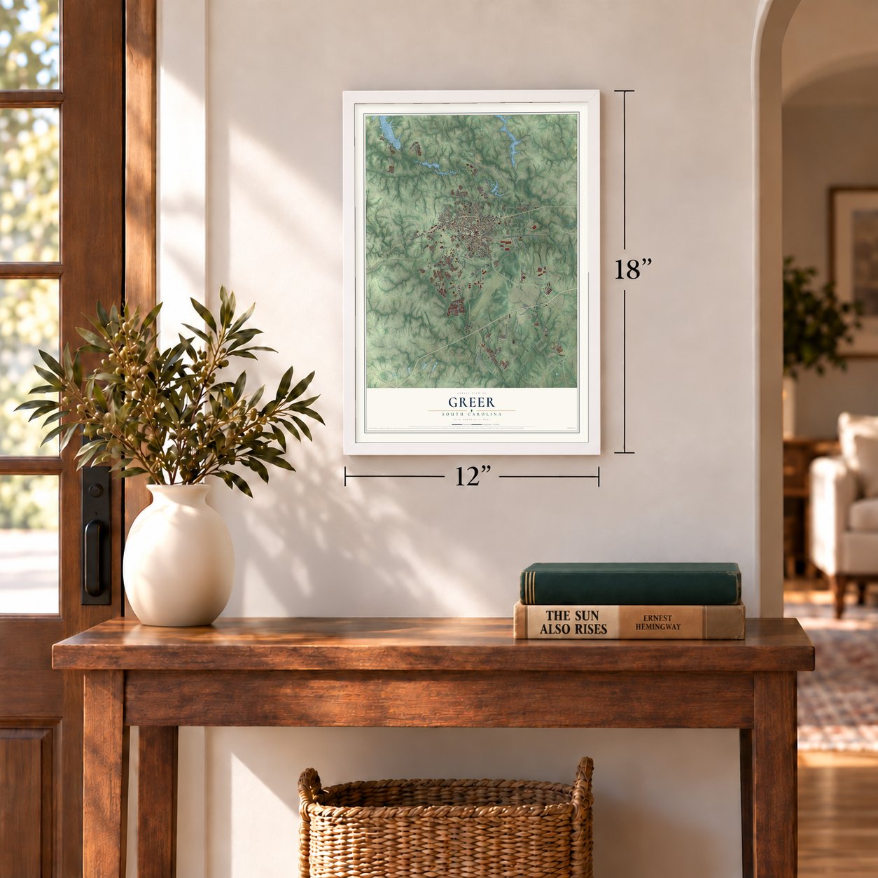
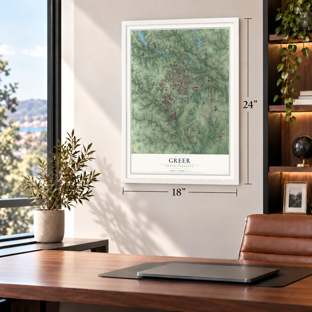
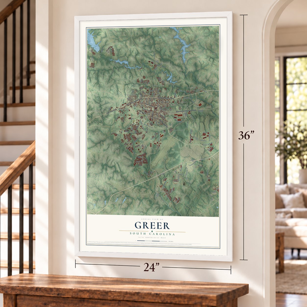
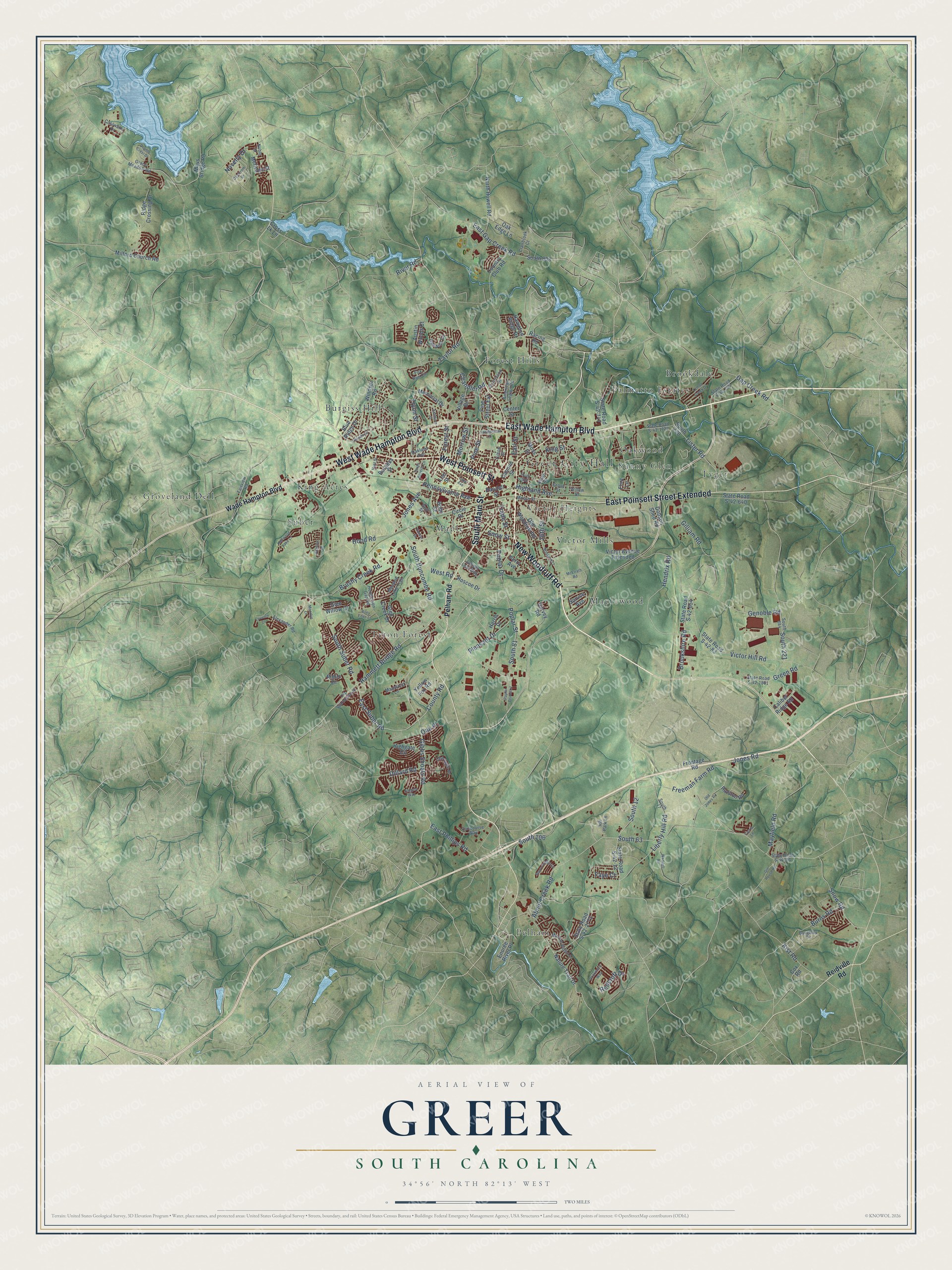
A new map of Greer, South Carolina, made in 2026 and printed to order on thick archival matte paper.
12" x 18" Archival Matte Print
A Map of Home. A Work of Art.
Explore Greer, South Carolina from a whole new perspective. Created using aerial imagery and detailed geographic data, this map captures Greer building by building, with labeled streets, familiar landmarks, and shaded topographical relief that highlights the natural contours of the landscape.
Combining modern data with the timeless character of a vintage atlas, this map is just as interesting up close as it is beautiful on the wall. Whether you grew up in Greer, spent memorable years there, or call it home today, this unique map is a great way to celebrate a place that means something to you. Zoom in on the preview to look for your street, and then order a print to put your memories on the wall.
Three ways to hang it
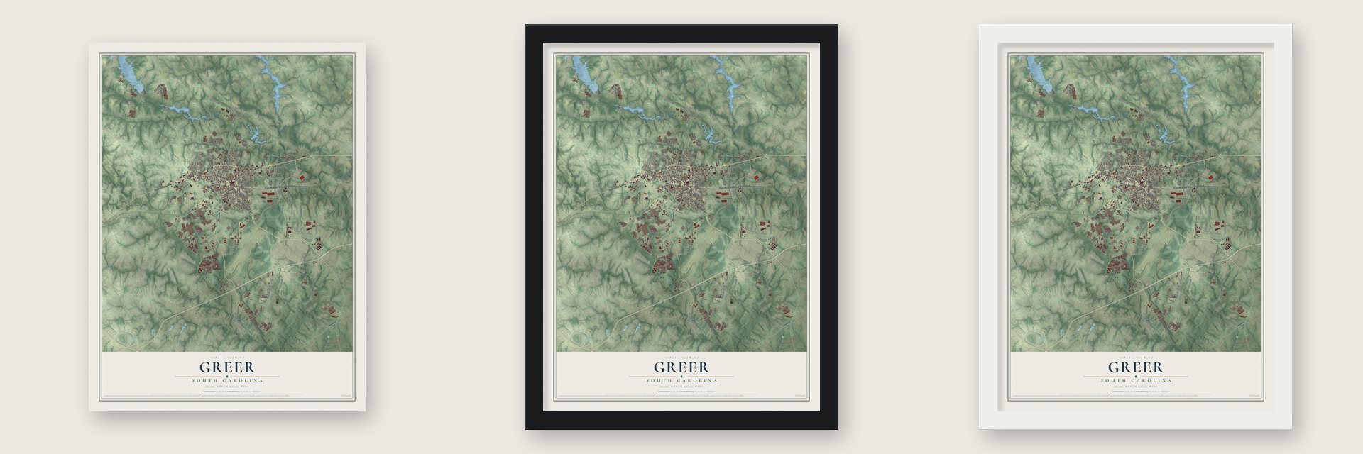
Unframed archival matte, a black wood frame or a white wood frame.
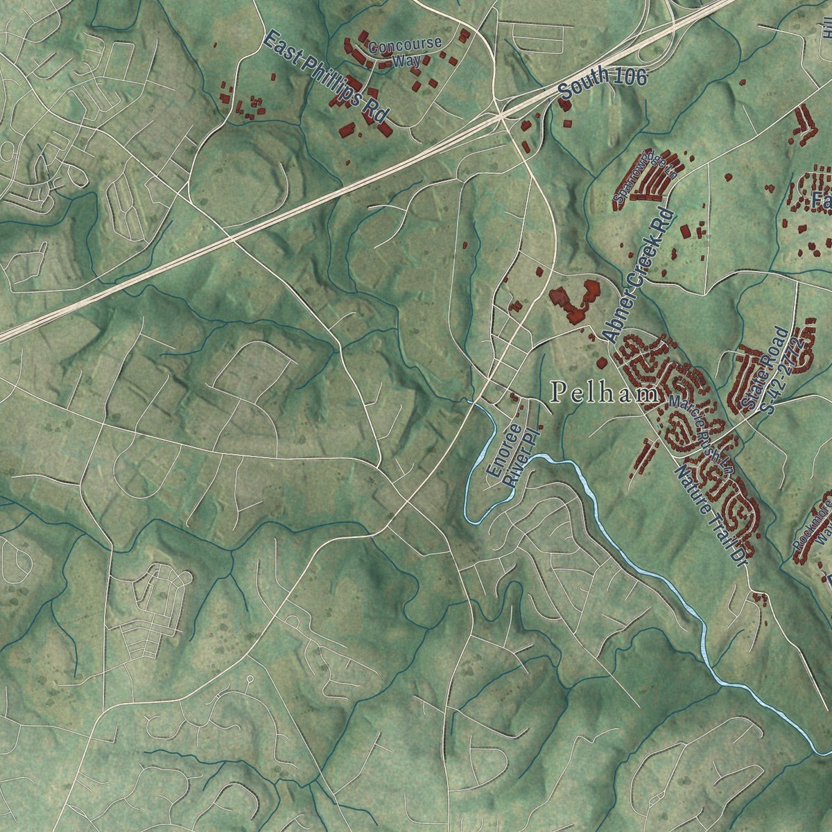
Up close
Geography Worth Displaying
This map was created using accurate cartographic data and authoritative geographic sources, including the U.S. Geological Survey and the Census Bureau. The map brings together terrain, waterways, roads, and building detail. The majority of the streets are labeled, houses are accurately depicted, and the topography is derived from government sources. Combining local data with carefully composed color and shading leads to this beautifully detailed Greer artwork for your wall.
Rather than simply showing street outlines, we’ve included as many of the street names as we could reasonably fit on the map while keeping their names legible. Zoom in on the high resolution preview to see exactly what’s on the map. We truly set out to create a statement piece for anyone who loves Greer. So whether it’s for you, or a gift for someone you love, we hope this map of Greer brings back fond memories.
Read the story behind this map of Greer, South Carolina from 2026.

About Greer, South Carolina
Greer is a city of 35,308 people in Greenville and Spartanburg counties. Before the Revolution this land belonged to the Cherokee, and it became part of South Carolina in 1777. In 1873 the Richmond and Danville Air Line Railway built its line from Atlanta to Charlotte and put a station on land owned by James Manning Greer. The stop was called Greer's Station, and its depot held the first post office. The town was incorporated in 1876 as the Town of Greer's, and a century later it officially dropped the "s" and became the City of Greer.
Merchants, blacksmiths and doctors opened shops around the station, and the Bank of Greer's, the town's first, opened in 1900. A second railroad, the Piedmont and Northern, came through in 1914, so local farmers could ship cotton and peaches out of state. Textile mills followed, among them Victor, Franklin, Apalache and Greer Mills. When imports hit the textile industry in the 1970s, residents worked together to bring in new employers. In 1992 BMW picked Greer for its first complete car factory outside Germany.
- A depot torn down in 1976Greer's first depot was a red brick Victorian building with a slate roof and a cupola. It stood beside the tracks between Trade Street and Depot Street, facing Moore Street. Its owner, the Southern Railway System, demolished it in 1976 to avoid paying property taxes.
- North America's largest BMW plantBMW's plant at Greer is the company's largest in North America. In June 2005 The Greenville News reported that it employed about 9,000 people and had drawn dozens of suppliers to South Carolina, which provided more than 12,000 jobs. Greer is also home to the BMW Zentrum Museum, and no other city in North America has a museum devoted to the carmaker.
- A WPA stadium from 1938Greer City Stadium was finished in 1938 as a WPA project. It seats 3,000 and has hosted little league, school and semi-professional games, along with the American Legion World Series.
Find your street
Names on the Greer map
Every name below is printed on this map. Look for your street, your school, the park where you played, or the pond down the road.
Places and landmarks17
- Greer City Hall
- Brookdale
- Burgiss Hills
- Forest Hills
- Groveland Dell
- King Acres
- Maple
- Maplewood
- Oakwood
- Palmetto Estates
- Pelham
- Suber
Show all 17 places
- Sunny Glen
- Teton Forest
- Tyger
- Victor Heights
- Victor Mills
Streets and roads175
- West Wade Hampton Boulevard
- East Wade Hampton Boulevard
- South Main Street
- West Poinsett Street
- New Woodruff Road
- East Poinsett Street Extended
- South Suber Road
- Hammett Bridge Road
- East Suber Road
- Pleasant Drive
- South Buncombe Road
- Gibbs Shoals Road
- Pennsylvania Avenue
- 26th Street
- County Road
- Brushy Creek Road
- Abner Creek Road
- South 63
- Freeman Farm Road
- Victor Hill Road
- Gilliam Road
- Hood Road
- Hendrix Road
- Jones Road
- Gap Creek Road
- Brookshire Road
- East Gap Creek Road
- Chandler Road
- South 81
- Liberty Hill Road
Show all 175 streets
- Taylor Road
- Novelty Drive
- Poplar Street
- Snow Street
- Lister Road
- Tryon Street
- East Phillips Road
- Faye Court
- Poplar Drive
- Jones Avenue
- Trade Street
- Highland Avenue
- Mayfield Road
- Dillard Road
- Snow Road
- Genoble Road
- Burns Road
- Pine Street
- South 106
- Kist Road
- South 12
- Morrow Street
- Redcroft Drive
- West Road
- King Street
- South 221
- Earl Street
- Forest Street
- River Road
- Green Road
- Oak Place
- Pelham Road
- Wade Hampton Boulevard
- Reidville Road
- Nature Trail Drive
- Glen Creek Drive
- Racing Road
- State Road S-42-2772
- State Road S-42-12
- Old Woodruff Road
- Ridge Crossing Drive
- Country Club Road
- State Road S-42-83
- Harvey Road
- South 908
- State Road S-42-654
- State Road S-42-640
- Memorial Drive
- Highgate Circle
- South 220
- North Howell Road
- Yellow Fox Road
- Mays Bridge Road
- Milford Church Road
- Ralston Road
- Meritage Street
- Hampton Ridge Drive
- Victor Avenue Extended
- Pine Street Extension
- Village Drive
- State Road S-42-747
- Enoree River Place
- Frontage Road
- Blue Ridge Drive
- Windsor Road
- Roscoe Drive
- Dobson Shed Road
- Glen Willow Court
- Circle Drive
- Caliber Ridge Road
- Randall Street
- Austin Woods Court
- Cannon Street
- Oak Edge Lane
- Bobo Street
- Harris Drive
- Moss Street
- Flint Lane
- Burgess Street
- Perry Avenue
- Center Street
- Spruce Avenue
- Cross Lk Lane
- Riello Drive
- Cox Road
- Lee Street
- Moore Street
- Cornelson Drive
- State Road S-42-63
- South 577
- Chartwell Drive
- South 17
- Henderson Gap Road
- South 98
- Burghley Circle
- American Legion Road
- Grace Meadow Road
- State Road S-42-1722
- State Road S-42-1861
- Oak Wind Circle
- Marcie Rush Lane
- Alexander Road
- Meadow Lake Trail
- Fox Run Circle
- State Road S-42-745
- Oakland Avenue
- Concourse Way
- South 644
- Juniper Leaf Way
- Clairbrook Court
- Fairview Road
- Mansfield Lane
- Coolwater Drive
- Golf Street
- Hill Park Lane
- Willow Drive
- Noble Street
- Grove Street
- Hilton Street
- Old Jones Road
- Double Crest Drive
- Lemon Creek Drive
- Gin House Road
- Waddell Road
- Daystrom Drive
- McElrath Road
- Hartwood Lake Lane
- Old Spartanburg Road
- Sparrowridge Lane
- Vandiventer Drive
- South 2000
- Aldgate Way
- Lovvorn Court
- South Beverly Lane
- Hillside Drive
- Rockmore Way
- Ashmore Street
- Riley Eden Lane
- Poplar Drive Extension
- Hunt Street
- Moorlyn Lane
- Admiral Lane
- Vassar Drive
- Cierra Lane
- Lake Avenue
Names are listed as they appear on the printed map. Zoom into the product photos to find them.
The art of mapping a place
How This Map Was Made
Real places. Remarkable detail. Discover the layers that turn geographic data into a map of home.

The view from above
Aerial imagery reveals the character of the land: woodland, open fields, and the patterns of a place.

The shape of the land
Elevation data brings hills, valleys, and subtle changes in the landscape into view.

The details of home
Roads, waterways, and building footprints come together to make the map feel unmistakably local.

Geography becomes art
Considered color, shading, and typography bring the layers together in a map made for your wall.


Process illustrated with Mendon, Massachusetts. Aerial imagery: USDA NAIP. Terrain: USGS 3D Elevation Program. Map details and finished artwork: KNOWOL.
The Details
About This Print
Choose an archival matte print, or a black or white Ayous wood frame. The archival matte print is unframed.
Select your size and finish above to see the matching product image and price.
Materials & Craftsmanship
A contemporary map with the character of a classic atlas, printed on archival matte paper. Optional frames are made from Ayous wood.
Your printed map does not include the watermark shown in the full-map preview.
Shipping & Delivery
Free shipping within the United States. Every print is made to order in the USA.
Buying a gift? Add a note in your cart and we'll include it. We never put prices in the package.
Prints ship within 2 to 3 business days. Allow 7 to 10 days total from ordering for delivery. Timing may vary during holidays or periods of high order volume.
Read our shipping policy.
Returns and damaged prints
Each print is made to order. Change-of-mind refunds are not available after production.
If your print arrives damaged, misprinted or incorrect, contact support@knowol.com within 30 days of receiving it. Include your order number, photos and a description of the issue.
Read our full refund and replacement policy. For questions about your order, email support@knowol.com.
Find your town
Looking for another city?
Find a map of home in our South Carolina collection, or any town in the country.
Nearby
Maps of towns near Greer
Know someone from one of these towns? Their map makes a great gift.
 Duncan
, South Carolina
From $39.99See the map
 Taylors
, South Carolina
From $39.99See the map
 Lyman
Lyman, South Carolina
From $39.99See the map
More maps nearby: Wade Hampton, Wellford, Startex, Reidville and Five Forks.