
Search for another town





Free U.S. delivery 7 to 10 days after you order
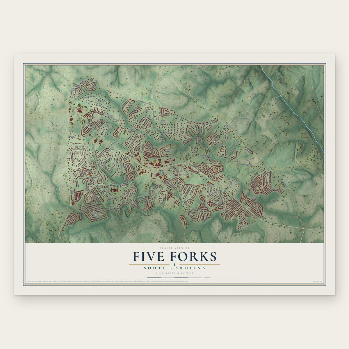
Five Forks, South Carolina Map Art
A new map of Five Forks, South Carolina, made in 2026 and printed to order on thick archival matte paper.
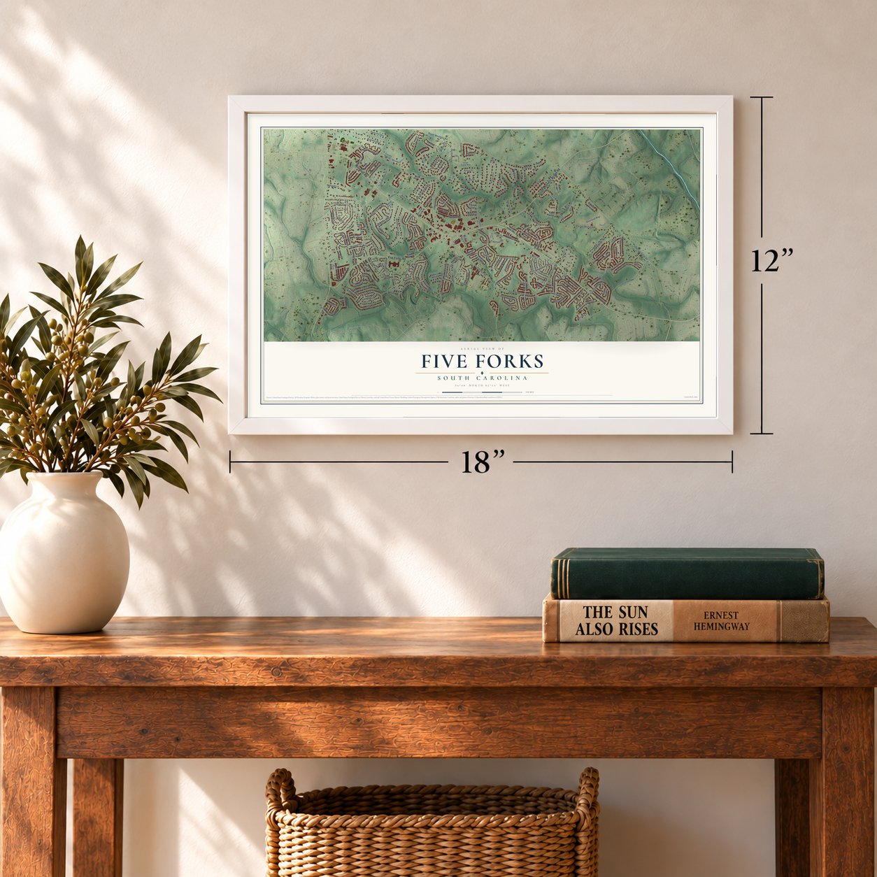
12" x 18" Archival Matte Print
A Map of Home. A Work of Art.
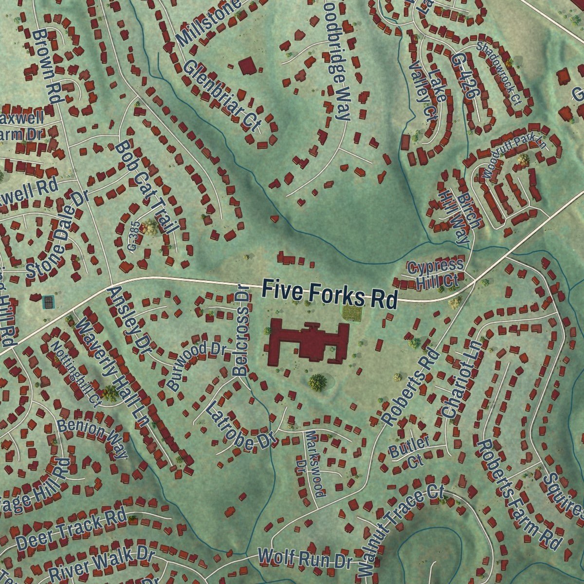
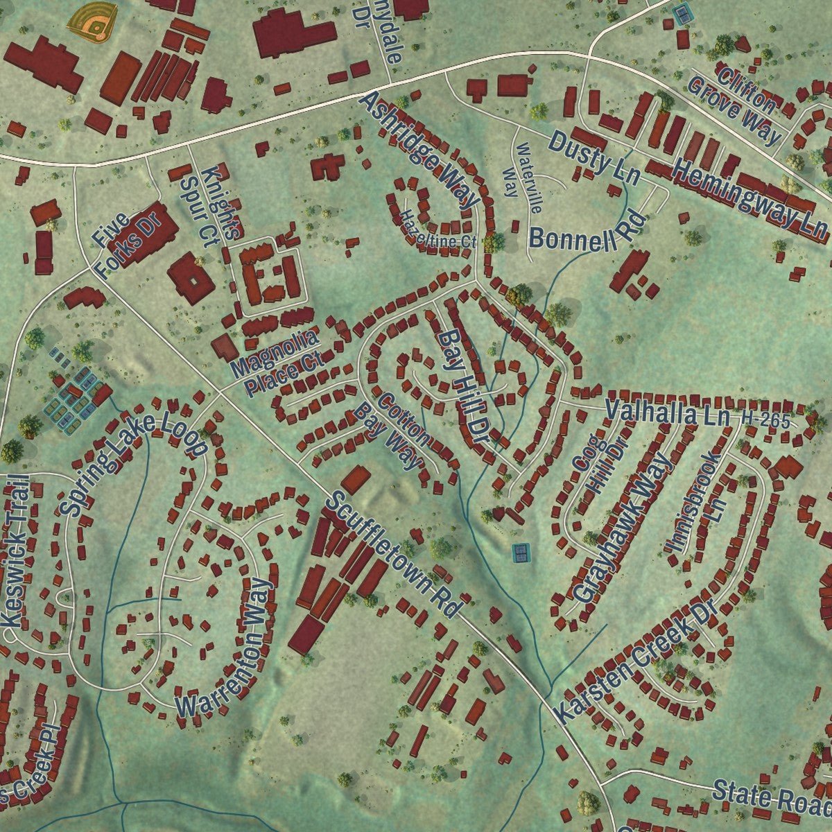
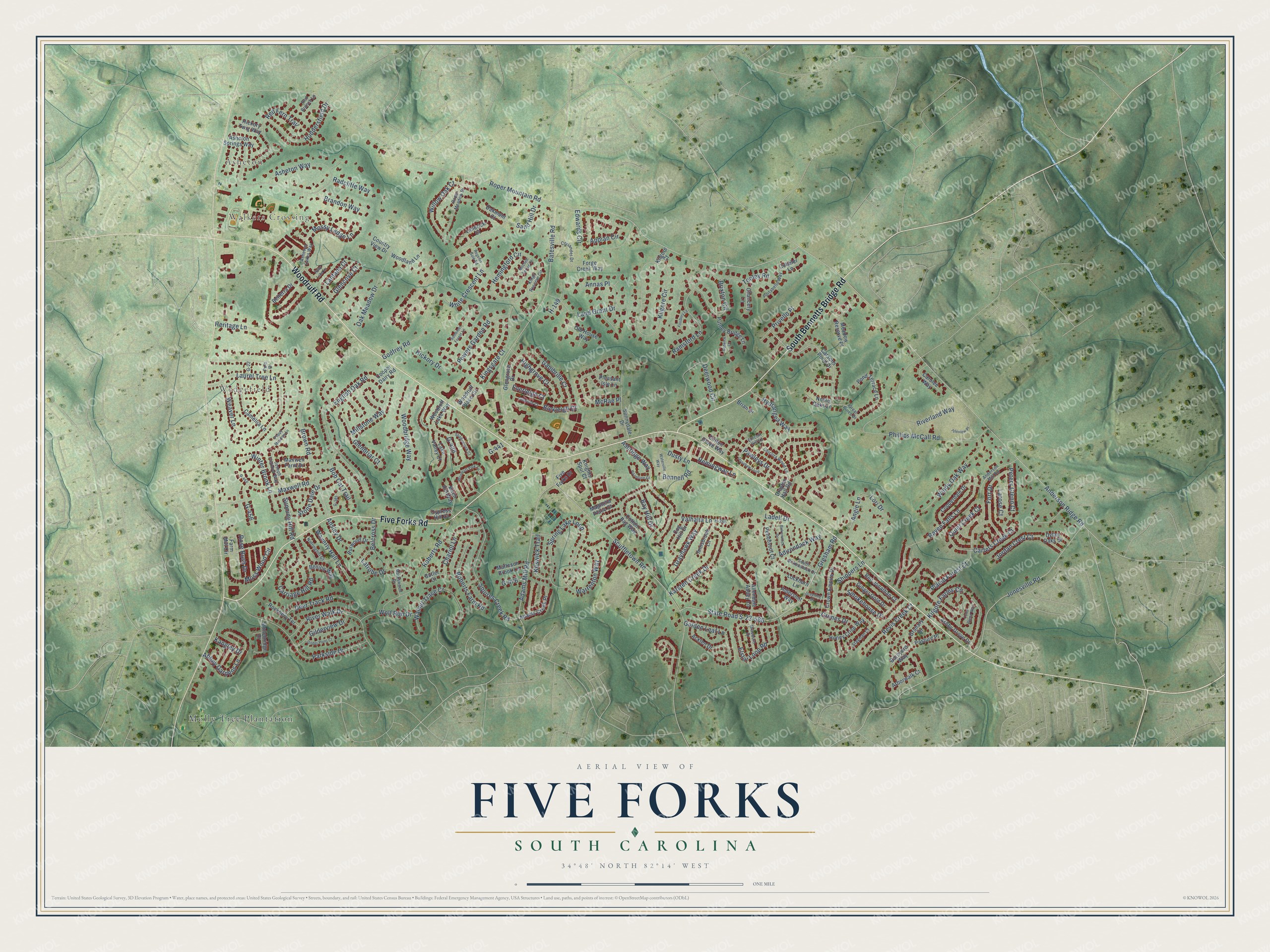
Explore Five Forks, South Carolina from a whole new perspective. Created using aerial imagery and detailed geographic data, this map captures Five Forks building by building, with labeled streets, familiar landmarks, and shaded topographical relief that highlights the natural contours of the landscape.
Combining modern data with the timeless character of a vintage atlas, this map is just as interesting up close as it is beautiful on the wall. Whether you grew up in Five Forks, spent memorable years there, or call it home today, this unique map is a great way to celebrate a place that means something to you. Zoom in on the preview to look for your street, and then order a print to put your memories on the wall.
Three ways to hang it
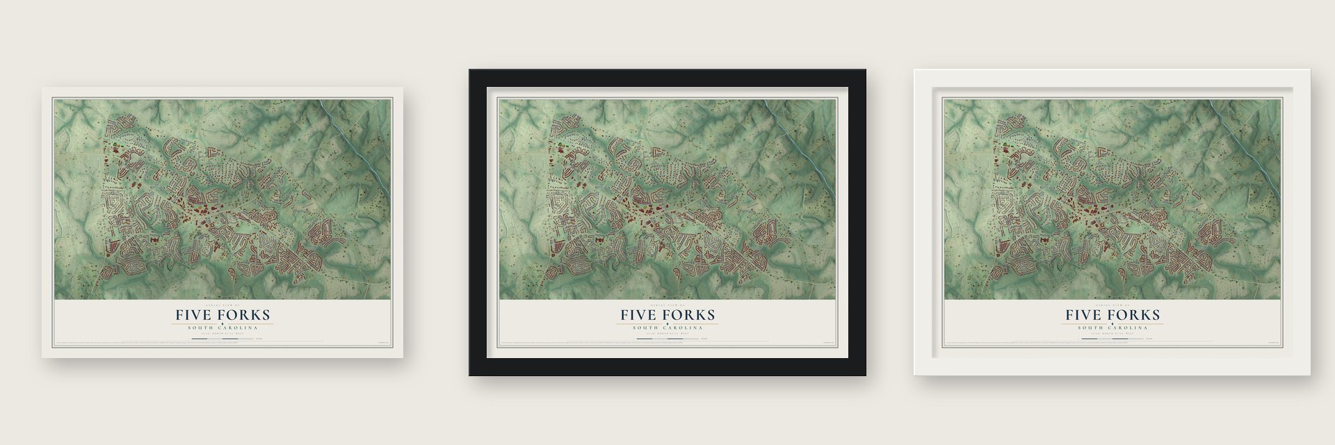
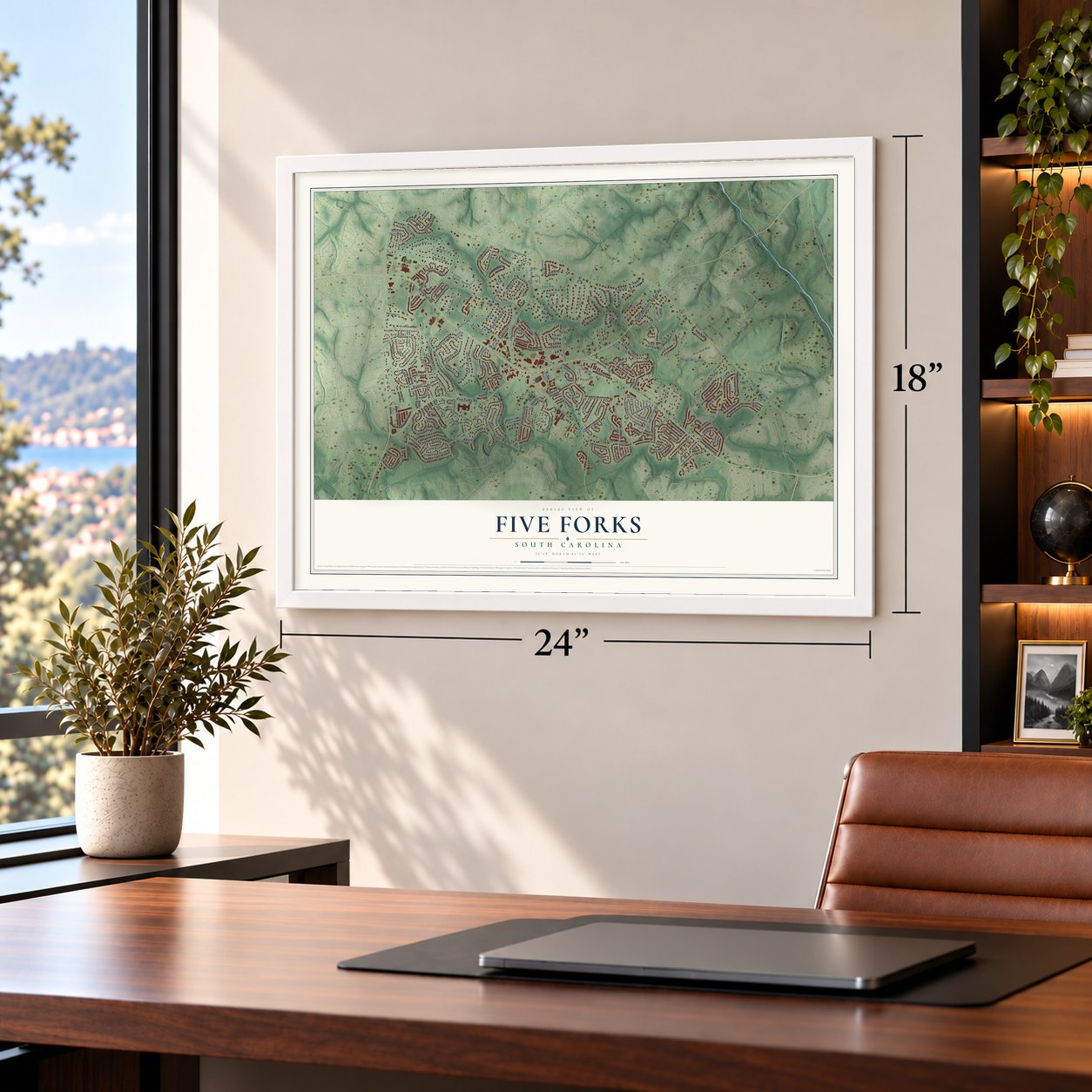
Unframed archival matte, a black wood frame or a white wood frame.
Up close
Geography Worth Displaying
This map was created using accurate cartographic data and authoritative geographic sources, including the U.S. Geological Survey and the Census Bureau. The map brings together terrain, waterways, roads, and building detail. The majority of the streets are labeled, houses are accurately depicted, and the topography is derived from government sources. Combining local data with carefully composed color and shading leads to this beautifully detailed Five Forks artwork for your wall.
Rather than simply showing street outlines, we’ve included as many of the street names as we could reasonably fit on the map while keeping their names legible. Zoom in on the high resolution preview to see exactly what’s on the map. We truly set out to create a statement piece for anyone who loves Five Forks. So whether it’s for you, or a gift for someone you love, we hope this map of Five Forks brings back fond memories.
Read the story behind this map of Five Forks, South Carolina from 2026.

About Five Forks, South Carolina
Five Forks is a community of 17,737 people in Greenville County, 11 miles east of downtown Greenville. It takes its name from five roads that came together here: Woodruff, Batesville, Scuffletown, Bennetts Bridge and one known today as Five Forks Road.
Until the early 1990s this was a very rural place. Fast growth after that turned it into a destination for shopping, restaurants and entertainment, and the census counted 8,064 people in 2000, 14,140 in 2010 and 17,737 in 2020.
- A star of roads in 1983A 1983 USGS map shows the old crossing shaped like a star. Woodruff ran straight through, and Adams Mill, Five Forks and Scuffletown met it there. Later a Woodruff bypass and other changes reshaped the intersection that gave the place its name.
- Residents wrote the planIn early 2018, residents asked the county council to have its planning staff help them write a new plan for the area. They met often through 2018 and 2019 to deal with heavy traffic, lost trees and uneven growth. The county posted the plan in March 2021, and nobody spoke against it at a hearing that May. In August 2021 the council voted unanimously to adopt it.
- The tornado of April 2019In April 2019 an EF1 tornado touched down in Simpsonville. Its path ended in Five Forks.
Find your street
Names on the Five Forks map
Every name below is printed on this map. Look for your street, your school, the park where you played, or the pond down the road.
Places and landmarks4
- Asheton
- Walkers Crossing
- Wedgefield
- Molly Tree Plantation
Streets and roads216
- Woodruff Road
- Five Forks Road
- South Bennetts Bridge Road
- Brown Road
- Karsten Creek Drive
- Roper Mountain Road
- Anderson Ridge Road
- Scuffletown Road
- Jonesville Road
- Batesville Road
- Godfrey Road
- Phillips McCall Road
- Asheton Way
- Gresham Road
- State Road S-23-586
- Pawleys Drive
- Kilgore Circle
- English Oak Road
- Spring Lake Loop
- Adams Mill Road
- Parkside Drive
- Laurel Tree Lane
- Squires Creek Road
- Oak Meadow Drive
- Raven Falls Lane
- Brixton Circle
- Hemingford Circle
- Carriage Hill Road
- Roberts Road
- Ashridge Way
Show all 216 streets
- Kingsgate Court
- Deerwood Circle
- River Walk Drive
- Woodbridge Way
- Kilgore Farms Circle
- Grimes Drive
- Edwards Circle
- Red Fern Trail
- Placid Forest Court
- Maxwell Road
- Land Grant Drive
- McRae Place
- Weaver Lane
- Walnut Trace Court
- Elstar Loop Road
- Appian Circle
- Windy Oak Way
- Abbey Gardens Lane
- Huddersfield Drive
- Lori Drive
- Ramsford Lane
- Fort Drive
- Smokehouse Drive
- Moss Wood Circle
- Hydrangea Way
- Golden Leaf Lane
- Hemingway Lane
- Warrenton Way
- Willow Oak Court
- Jordan Crest Court
- Roberts Farm Road
- Millstone Way
- Chariot Lane
- Powers Garden Road
- Quiet Creek Court
- Riverland Way
- Dusty Lane
- Shippers Lane
- Adirondack Way
- Highgrove Court
- Deer Track Road
- Waverly Hall Lane
- Revis Creek Court
- Gilderview Drive
- Stone Dale Drive
- Glenbriar Court
- Mossy Ledge Lane
- Bob Cat Trail
- Annas Place
- White Crescent Lane
- Valhalla Lane
- Wolf Run Drive
- Grayhawk Way
- Winter Brook Lane
- Ladell Drive
- Keswick Trail
- Rose Bush Drive
- Carters Creek Court
- Brandon Way
- Sand Hill Drive
- Ganibrille Court
- Bay Hill Drive
- Peters Glenn Court
- Glencove Court
- Angie Lane
- Hickory Drive
- Heritage Lane
- Lantana Court
- Sunning Hill Road
- Radcliffe Way
- Larose Court
- Latrobe Drive
- G-456
- Belcross Drive
- Bonnell Road
- Tooley Road
- Ansley Drive
- Everleigh Court
- Bickleigh Court
- Privello Place
- Kangley Drive
- G-476
- G-426
- G-441
- H-149
- Carsons Pond Drive
- Innisbrook Lane
- Farm Mill Circle
- Knights Spur Court
- Sunnydale Drive
- Woodruff Place Circle
- Woodruff Lake Way
- Cotton Bay Way
- Pond Terrace Lane
- Crown Empire Drive
- Camellia Lane
- Ginger Gold Drive
- Copperdale Drive
- Chancery Lane
- Acklen Drive
- Ashby Grove Drive
- Lockhorn Lane
- Allendale Abbey Lane
- Honey Crisp Way
- Adams Creek Place
- Cog Hill Drive
- Red Jonathan Court
- Putney Bridge Lane
- Lake Valley Court
- Glengrove Drive
- Old House Way
- Belterra Drive
- Carolee Way
- Maxwell Farm Drive
- Penobscot Court
- Woodland Lane
- Five Forks Drive
- Rockbery Terrace
- Meadow Reserve Place
- Asheton Springs Way
- Aldershot Way
- Stonebridge Drive
- Arborwalk Court
- Granary Drive
- Barnyard Way
- Burwood Drive
- Birch Hill Way
- Forge Creek Way
- Matteson Brook Lane
- Pleasant Isle Lane
- Noble Oaks Lane
- Benion Way
- Clifton Grove Way
- Oakmont Court
- Cypress Hill Court
- Magnolia Place Court
- Dylan Oaks Drive
- Pasture Place
- Drayton Hall Road
- Country View Drive
- Hickory Twig Way
- Cobbler Lane
- Brian Drive
- Limerick Court
- Cooper Dairy Road
- Butler Court
- Kilgore Court
- Great Pines Drive
- H-265
- Roper Meadow Drive
- South Birkenstock Drive
- Anderson Mill Road
- Kings Reserve Circle
- Asheton Lakes Way
- Joseph Fletcher Way
- Portabello Way
- Nottinghill Court
- Coriander Drive
- Stayman Court
- Chicora Wood Lane
- Braeburn Drive
- Polo Drive
- Markswood Drive
- Ellicott Hill Lane
- Red Branch Lane
- G-22
- G-455
- Woodruff Park Lane
- Ossabaw Loop
- Regents Gate Road
- Isleview Place
- Waterville Way
- Shadowrock Court
- Ruby Lake Lane
- Dillworth Court
- Gilder Point Court
- Birkenstock Drive
- Hazeltine Court
- Greening Drive
- Cedar Glenn Way
- G-385
- Poppy Meadow Lane
- Gatwick Lane
- Finsbury Lane
- Mitchell Spring Court
- Somerset Forest Lane
Names are listed as they appear on the printed map. Zoom into the product photos to find them.
The art of mapping a place
How This Map Was Made
Real places. Remarkable detail. Discover the layers that turn geographic data into a map of home.

The view from above
Aerial imagery reveals the character of the land: woodland, open fields, and the patterns of a place.

The shape of the land
Elevation data brings hills, valleys, and subtle changes in the landscape into view.

The details of home
Roads, waterways, and building footprints come together to make the map feel unmistakably local.

Geography becomes art
Considered color, shading, and typography bring the layers together in a map made for your wall.


Process illustrated with Mendon, Massachusetts. Aerial imagery: USDA NAIP. Terrain: USGS 3D Elevation Program. Map details and finished artwork: KNOWOL.
The Details
About This Print
Choose an archival matte print, or a black or white Ayous wood frame. The archival matte print is unframed.
Select your size and finish above to see the matching product image and price.
Materials & Craftsmanship
A contemporary map with the character of a classic atlas, printed on archival matte paper. Optional frames are made from Ayous wood.
Your printed map does not include the watermark shown in the full-map preview.
Shipping & Delivery
Free shipping within the United States. Every print is made to order in the USA.
Buying a gift? Add a note in your cart and we'll include it. We never put prices in the package.
Prints ship within 2 to 3 business days. Allow 7 to 10 days total from ordering for delivery. Timing may vary during holidays or periods of high order volume.
Read our shipping policy.
Returns and damaged prints
Each print is made to order. Change-of-mind refunds are not available after production.
If your print arrives damaged, misprinted or incorrect, contact support@knowol.com within 30 days of receiving it. Include your order number, photos and a description of the issue.
Read our full refund and replacement policy. For questions about your order, email support@knowol.com.
Find your town
Looking for another city?
Find a map of home in our South Carolina collection, or any town in the country.
Nearby
Maps of towns near Five Forks
Know someone from one of these towns? Their map makes a great gift.
 Mauldin
, South Carolina
From $39.99See the map
 Simpsonville
, South Carolina
From $39.99See the map
 Reidville
, South Carolina
From $39.99See the map
More maps nearby: Fountain Inn, Conestee, Greenville, Wade Hampton and Greer.