
Search for another town





Free U.S. delivery 7 to 10 days after you order
Walnut, California Map Art
Building by building, with labeled streets and shaded relief.
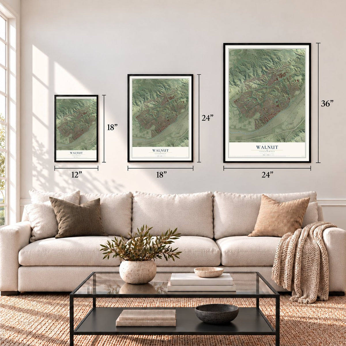
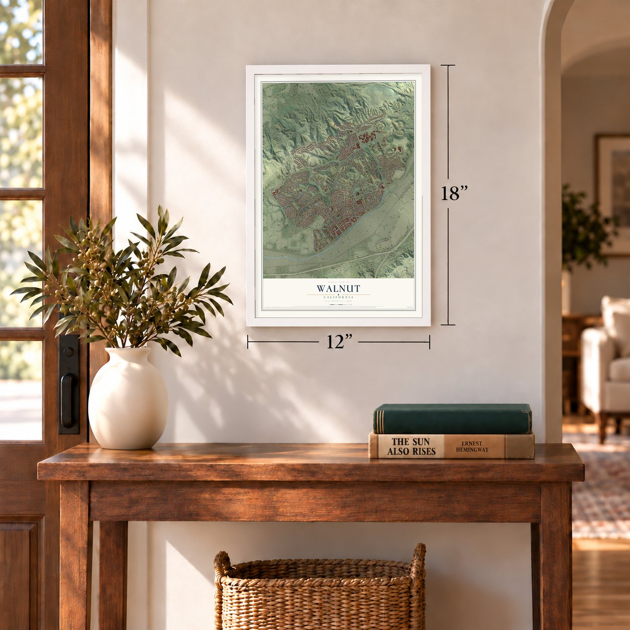
12" x 18" Archival Matte Print
A Map of Home. A Work of Art.
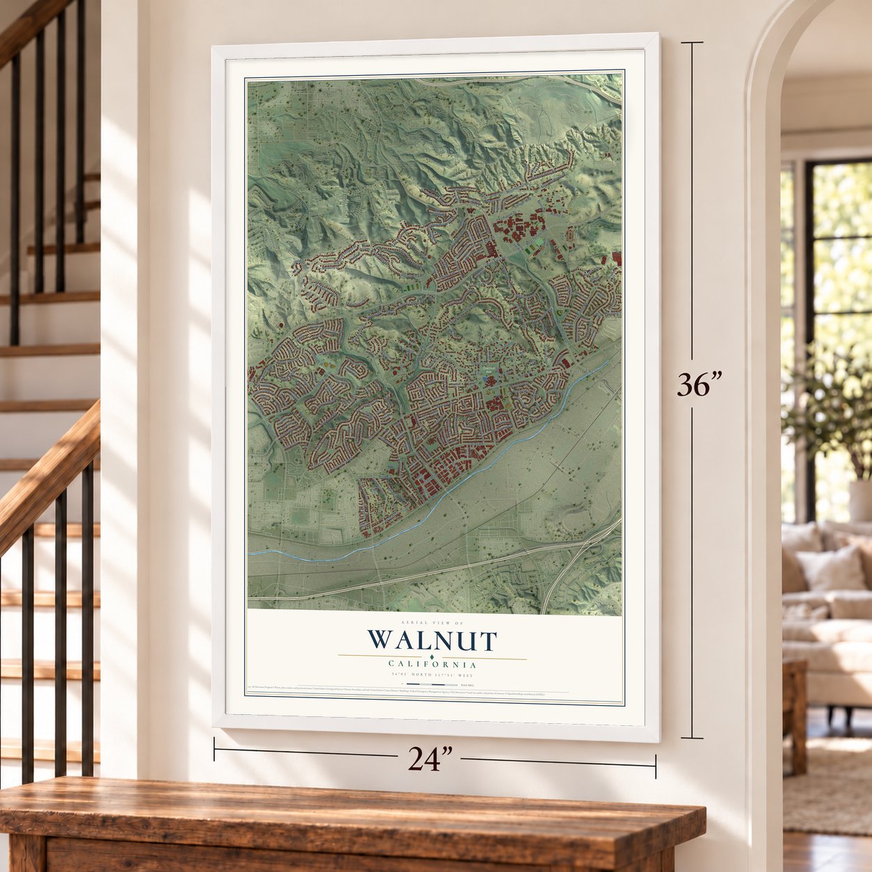
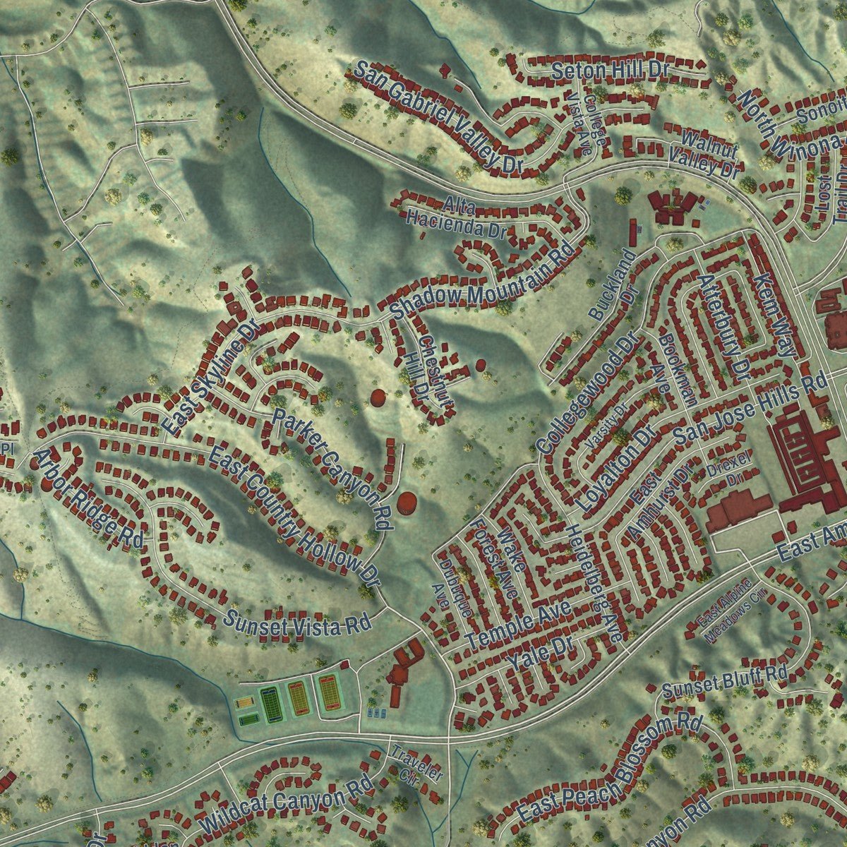
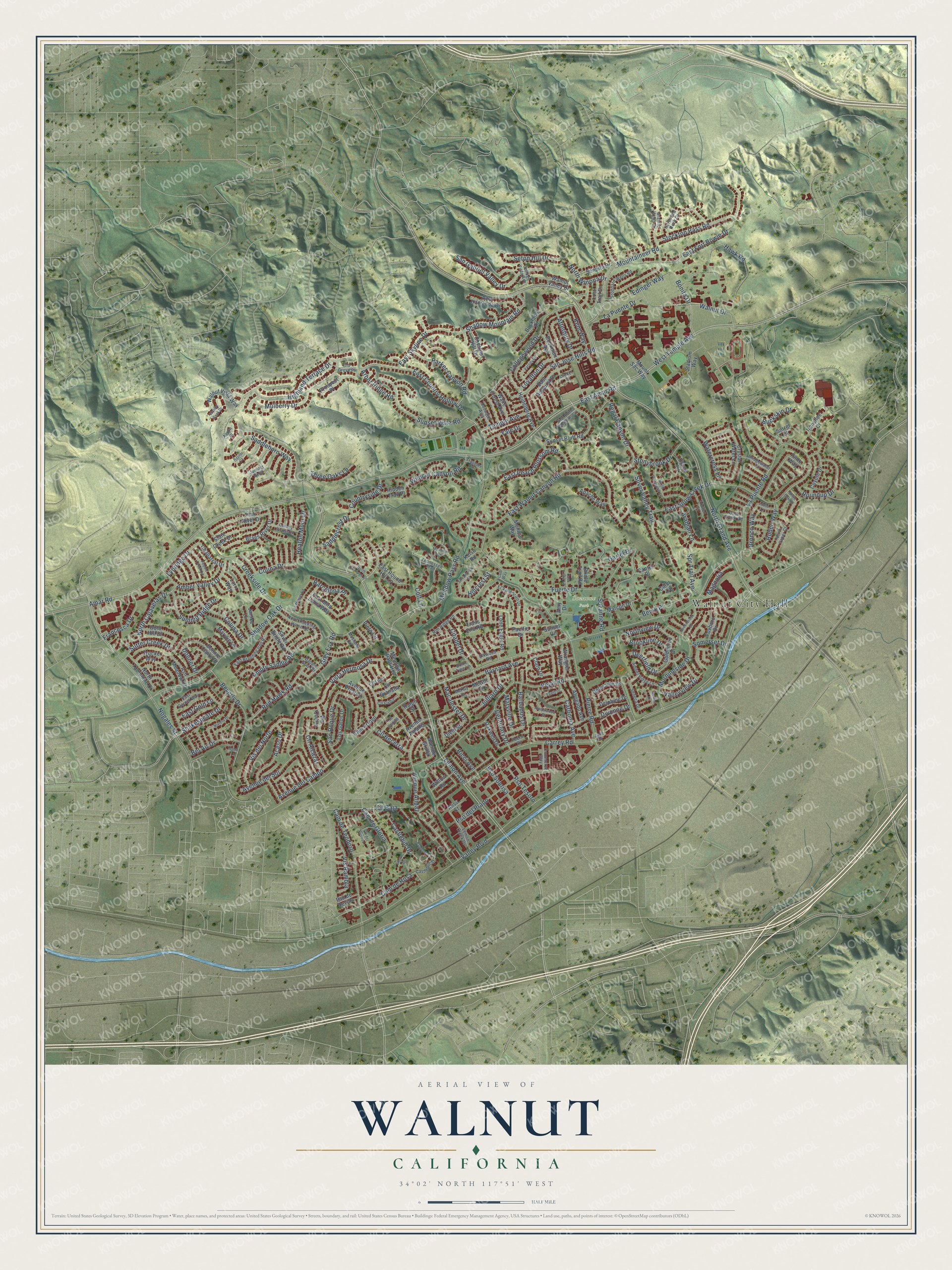
Explore Walnut, California from a whole new perspective. Created using aerial imagery and detailed geographic data, this map captures Walnut building by building, with labeled streets, familiar landmarks, and shaded topographical relief that highlights the natural contours of the landscape.
Combining modern data with the timeless character of a vintage atlas, this map is just as interesting up close as it is beautiful on the wall. Whether you grew up in Walnut, spent memorable years there, or call it home today, this unique map is a great way to celebrate a place that means something to you. Zoom in on the preview to look for your street, and then order a print to put your memories on the wall.
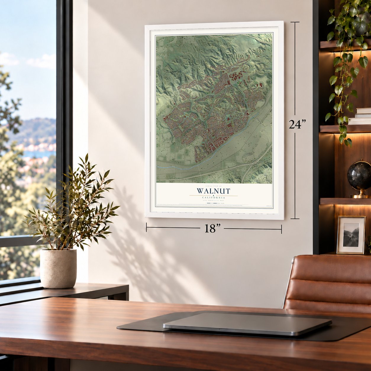
Three ways to hang it
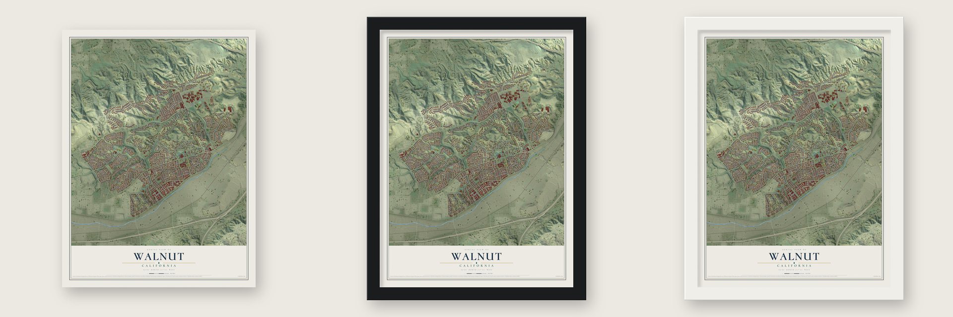
Unframed archival matte, a black wood frame or a white wood frame.
Up close
Geography Worth Displaying
This map was created using accurate cartographic data and authoritative geographic sources, including the U.S. Geological Survey and the Census Bureau. The map brings together terrain, waterways, roads, and building detail. The majority of the streets are labeled, houses are accurately depicted, and the topography is derived from government sources. Combining local data with carefully composed color and shading leads to this beautifully detailed Walnut artwork for your wall.
Rather than simply showing street outlines, we’ve included as many of the street names as we could reasonably fit on the map while keeping their names legible. Zoom in on the high resolution preview to see exactly what’s on the map. We truly set out to create a statement piece for anyone who loves Walnut. So whether it’s for you, or a gift for someone you love, we hope this map of Walnut brings back fond memories.
Read the story behind this map of Walnut, California from 2026.

Find your street
Names on the Walnut map
Every name below is printed on this map. Look for your street, your school, the park where you played, or the pond down the road.
Places and landmarks2
- Walnut City Hall
- Suzanne Park
Streets and roads248
- Meadow Pass Road
- East Amar Road
- Edinger Way
- West Temple Avenue
- Mountaineer Road
- Amar Road
- Shadow Mountain Road
- North Grand Avenue
- La Puente Road
- Valley Boulevard
- Lemon Avenue
- Pierre Road
- Nogales Street
- Gartel Drive
- La Puente Drive
- Creekside Drive
- Fuerte Drive
- East Walnut Canyon Road
- East Snow Creek Drive
- East Fort Bowie Drive
- Vejar Road
- Shadow Oak Drive
- Vista Hermosa Drive
- Carrey Road
- Collegewood Drive
- Avenue Alipaz
- East Country Hollow Drive
- Silver Valley Trail
- Hawk Road
- Morningside Drive
Show all 248 streets
- Cam de Teodoro
- Highland Terrace Drive
- Walnut Drive
- Pso del Prado
- Cam de Gloria
- Sunset Vista Road
- Beverly Drive
- Spr Trail Avenue
- San Gabriel Valley Drive
- Carbonia Avenue
- Regal Canyon Drive
- East Peach Blossom Road
- Bonita Drive
- Vis del Norte
- Barnard Avenue
- Saddlehorn Way
- Divonne Drive
- San Jose Hills Road
- Amber Valley Drive
- Cam de Rosa
- Roundup Drive
- Buckskin Drive
- Stockton Pass Road
- Suzanne Road
- Parker Canyon Road
- Cll Baja
- Colusa Drive
- Wildcat Canyon Road
- East Skyline Drive
- Red Hawk Road
- Loyalton Drive
- Avenue del Sol
- Empty Saddle Road
- North Calaveras Drive
- San Roque Drive
- Summit Ridge Drive
- Avenue del Campo
- Shakespeare Drive
- Acaso Drive
- Rodeo Way
- Centinary Drive
- Barcelona Place
- Maryville Drive
- Francesca Drive
- Vis Rambla
- Mulberry Drive
- Citadel Drive
- Castlehill Drive
- Julliard Drive
- Temple Avenue
- Saddlecrest Drive
- Stonybrook Drive
- Heaton Moor Drive
- Pso Sonrisa
- Northview Drive
- Seton Hill Drive
- Countryside Drive
- Bel Air Drive
- Benik Place
- Grey Fox Road
- Barbados Drive
- Sutter Creek Drive
- Three Oaks Lane
- Cll Alcazar
- Watercress Lane
- Arabian Lane
- Atterbury Drive
- Kem Way
- Yale Drive
- Colina Drive
- Lynridge Drive
- North Winona Drive
- Bronco Way
- Brookline Drive
- Arbor Ridge Road
- Macalester Drive
- Valleyview Drive
- Pso Tesoro
- Deerfield Drive
- East Gold Lane
- Magnolia
- Cll Becerra
- Somerset Drive
- Ricci Avenue
- Colt Lane
- Donner Drive
- Hillcrest Street
- Meadow Pass Heights
- Cam Arroyo
- Sunset Bluff Road
- Heidelberg Avenue
- Avenue Presidio
- Ironshoe Court
- Mount Sac Way
- Walnut Vista Way
- Marcon Drive
- Deloraine Drive
- Los Gatos Drive
- East Amhurst Drive
- Buckland Drive
- Alta Hacienda Drive
- Abogado Avenue
- Bookman Avenue
- Crystal Water Lane
- Braes River Drive
- East Mira Loma Way
- Coyote Drive
- North Tuolumne Drive
- Silver Bridle Road
- Bonnie Claire Drive
- Lost Trail Drive
- Lone Eagle Road
- Sonoita Drive
- Monica Way
- Trails End Road
- East Round Hill Lane
- Oakwell Drive
- Wake Forest Avenue
- Ralph Street
- Apache Way
- Wrangler Way
- Stadium Way
- Goldenrod Drive
- Ash Meadow Drive
- Chestnut Hill Drive
- Delphine Drive
- Chaparral Drive
- Willow Road
- Platt River Drive
- Cofer Court
- Foxboro Drive
- Marylie Lane
- Walnut Valley Drive
- Avenue Grulla
- Avenue Amadis
- Diehl Street
- Hidden Trail Place
- Via Quinto
- Slate Creek Drive
- Trucke Way
- Bridle Trail Road
- Prospect Place
- Janice Lane
- Cll Granada
- Estate Court
- Pinto Way
- Pinto Circle
- Pso de Sevilla
- Gold Hill Drive
- Lorri Way
- Pacific Drive
- Claro Drive
- Cantel Place
- Sorrel Court
- Sunset Circle
- Kelso Road
- McGill Drive
- Alisu Court
- Amy Drive
- Granite Wells Drive
- El Vallencito Drive
- East Branding Iron Road
- North Rocking Horse Road
- Fuero Drive
- Castlehill Street
- Lemon Creek Drive
- College Vista Avenue
- Rim Ridge Road
- Stoddard Wells Road
- Amber Ridge Lane
- Deep Creek Road
- Bridgewater Lane
- East Garnet Way
- Tennessee Trail
- North Red Rock Drive
- Commerce Way
- Juniper Bend
- Trotter Court
- Dubuque Avenue
- North Pacer Court
- Seneca Drive
- Elkwood Road
- Cll Cadiz
- Cll Senita
- McKay Drive
- Mustang Circle
- Cll Lago
- Acorn Place
- Old Grove Place
- Drexel Drive
- Dapple Gray Circle
- Traveler Circle
- Burnt Tree Lane
- Jade Drive
- North Carriage Lane
- Amberwood Drive
- North Plantation Lane
- Varsity Drive
- Greenbrook Drive
- Streamview Street
- Esplendor
- Riviera Drive
- Conway Springs Lane
- Cll del Reposo
- Pebble Creek Lane
- San Miguel Road
- East Alpine Meadows Circle
- Casa Loma Lane
- Walnut Peak Drive
- Lasso Lane
- Slope Drive
- Evant Drive
- Monarch Court
- Raptor Court
- White Oak Road
- Merion Lane
- Sable Lane
- Curt Way
Names are listed as they appear on the printed map. Zoom into the product photos to find them.
About Walnut, California
Walnut is a city of 28,430 people in eastern Los Angeles County, set in the San Gabriel Valley below the San Jose Hills. The Tongva people lived here first. After Spanish missionaries arrived in the 18th century, the land became grazing range for the cattle and sheep of the San Gabriel Mission. When the missions were secularized in the 1830s, the Mexican government of Alta California split the old mission lands into ranchos and handed them out as grants.
In 1837 Ricardo Vejar and Ygnacio Palomares received Rancho San Jose. Jose De La Cruz Linares got Rancho Los Nogales in 1840, and John Rowland and William Workman were granted Rancho La Puente in 1842. The city's name comes from Los Nogales, Spanish for "walnut trees," because the native California black walnut grows in these hills. In 1868 Rowland and Workman split La Puente, and Rowland's eastern half took in the west side of today's Walnut. Ranchers there raised cattle and grew wheat, grapes and fruit trees, mostly citrus.
- Lemon before WalnutThe first U.S. post office here opened in 1895 under the name Lemon, for its spot on Lemon Road. Wikipedia dates the change to Walnut to 1908, while the Los Angeles Almanac says 1912 and suggests the slang meaning of lemon was the reason. The post office today sits on Lemon Avenue, still a main street of the town.
- A city since 1959Walnut was incorporated as a general law city on January 19, 1959. Residents elect a five-member city council, which picks one of its members each year to serve a twelve-month term as mayor and appoints a city manager to run daily business.
- The Mt. SAC RelaysSince 1959 the Mt. SAC Relays have drawn elite athletes from many countries each April to Hilmer Lodge Stadium at Mt. San Antonio College. The stadium also hosted the 1968 Olympic Trials and two USA Outdoor Track and Field Championships. Many world records were set at the Relays, so "Walnut, California" appears in record books worldwide. Each October a cross country invitational runs in the hills around the stadium.
- Family Matters and the majorsWalnut's notable people include Darius McCrary, who played Eddie Winslow on the television show Family Matters, the major league catcher Lance Parrish, and Aja Naomi King, an actress on How to Get Away with Murder.
Keep exploring California
Walnut is one of 1,990 California towns we've mapped. Every dot on the map is a print of its own.
The search covers every state, California first.
Near Walnut
Order 2 or more town maps and save 10%. Shown in the size and finish you picked above, so they hang as a set.
- South San Jose Hills 12" x 18" / Archival Matte Print $39.99
- Diamond Bar 12" x 18" / Archival Matte Print $39.99
- West Covina 12" x 18" / Archival Matte Print $39.99


More maps nearby: Covina, Valinda, Charter Oak, Industry and Rowland Heights.
The art of mapping a place
How This Map Was Made
Real places. Remarkable detail. Discover the layers that turn geographic data into a map of home.

The view from above
Aerial imagery reveals the character of the land: woodland, open fields, and the patterns of a place.

The shape of the land
Elevation data brings hills, valleys, and subtle changes in the landscape into view.

The details of home
Roads, waterways, and building footprints come together to make the map feel unmistakably local.

Geography becomes art
Considered color, shading, and typography bring the layers together in a map made for your wall.


Process illustrated with Mendon, Massachusetts. Aerial imagery: USDA NAIP. Terrain: USGS 3D Elevation Program. Map details and finished artwork: KNOWOL.
The Details
About This Print
Choose an archival matte print, or a black or white Ayous wood frame. The archival matte print is unframed.
Select your size and finish above to see the matching product image and price.
Materials & Craftsmanship
A contemporary map with the character of a classic atlas, printed on archival matte paper. Optional frames are made from Ayous wood.
Your printed map does not include the watermark shown in the full-map preview.
Shipping & Delivery
Free shipping within the United States. Every print is made to order in the USA.
Buying a gift? Add a note in your cart and we'll include it. We never put prices in the package.
Prints ship within 2 to 3 business days. Allow 7 to 10 days total from ordering for delivery. Timing may vary during holidays or periods of high order volume.
Read our shipping policy.
Returns and damaged prints
Each print is made to order. Change-of-mind refunds are not available after production.
If your print arrives damaged, misprinted or incorrect, contact support@knowol.com within 30 days of receiving it. Include your order number, photos and a description of the issue.
Read our full refund and replacement policy. For questions about your order, email support@knowol.com.