
Search for another town



Free U.S. delivery 7 to 10 days after you order
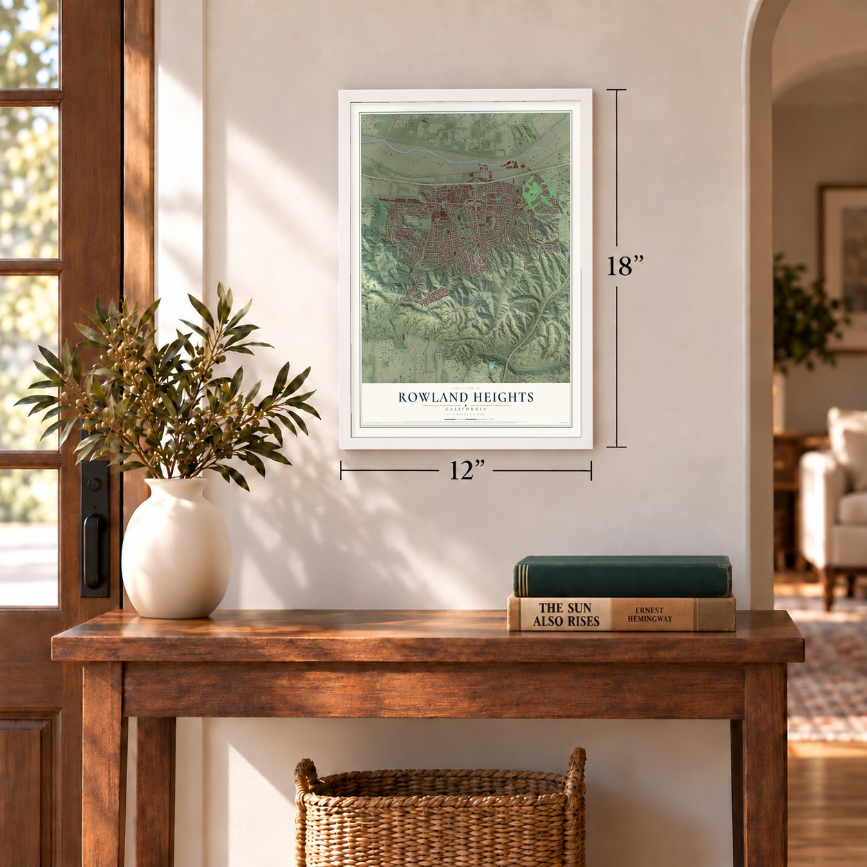
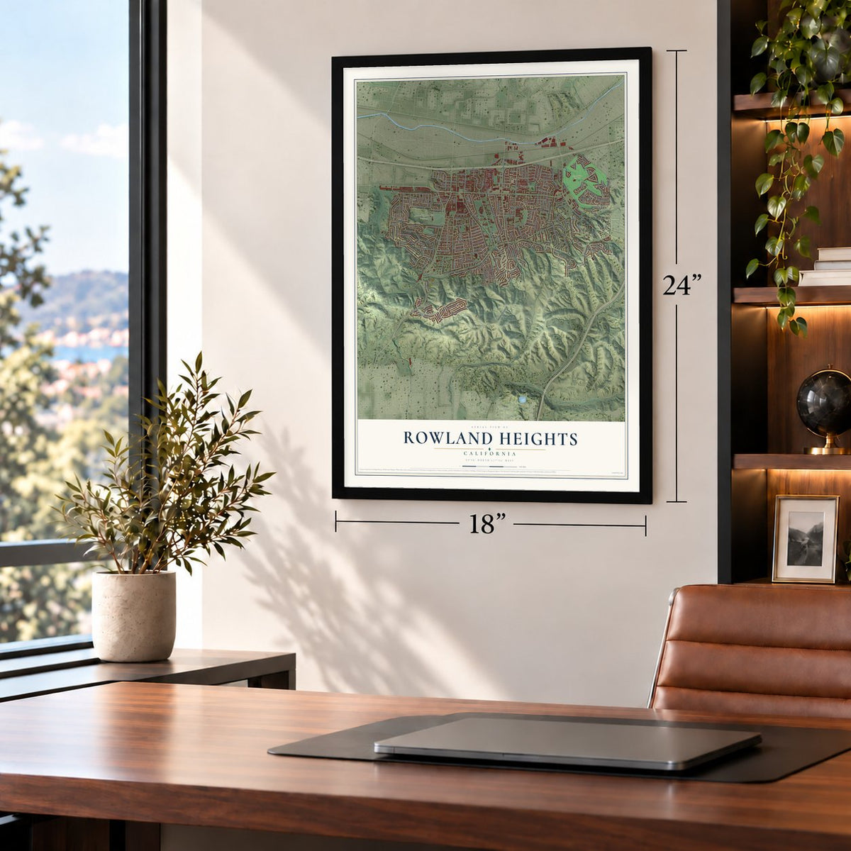
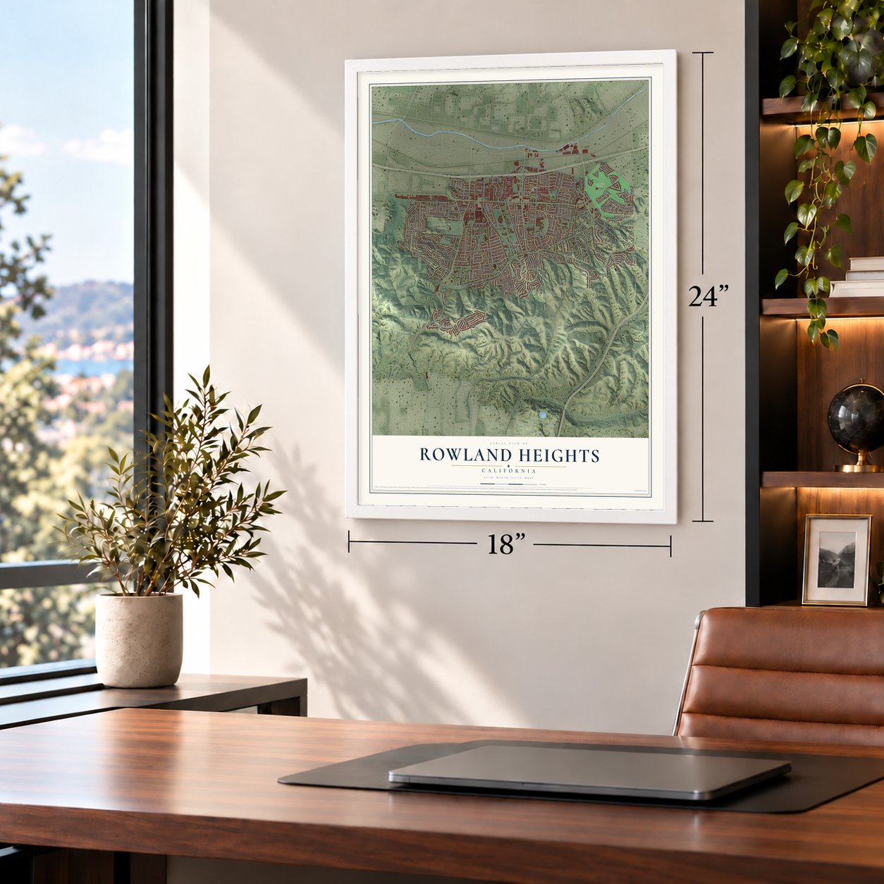
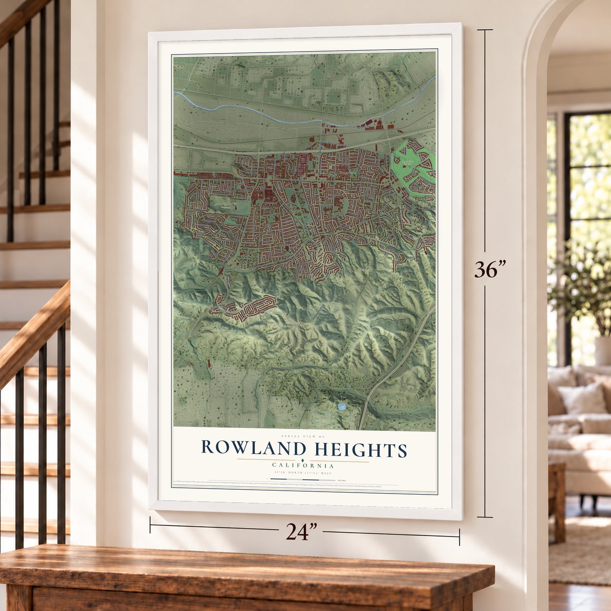
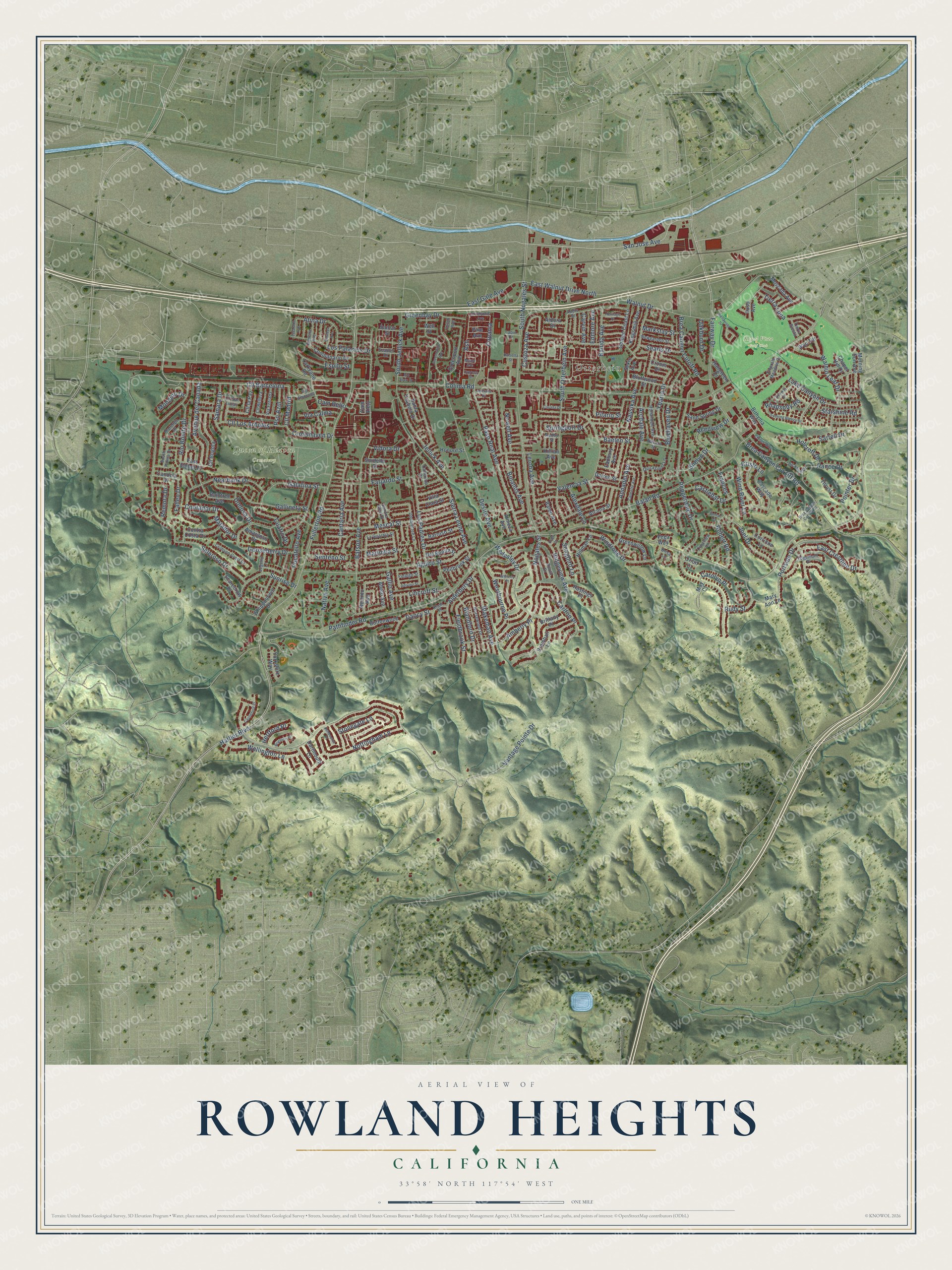
Rowland Heights, California Map Art
Building by building, with labeled streets and shaded relief.
12" x 18" Archival Matte Print
A Map of Home. A Work of Art.
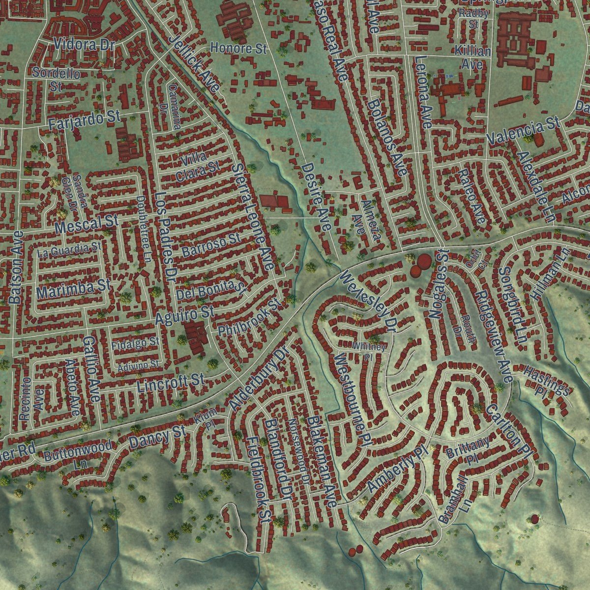
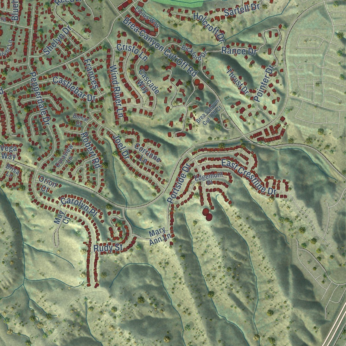
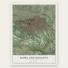
Explore Rowland Heights, California from a whole new perspective. Created using aerial imagery and detailed geographic data, this map captures Rowland Heights building by building, with labeled streets, familiar landmarks, and shaded topographical relief that highlights the natural contours of the landscape.
Combining modern data with the timeless character of a vintage atlas, this map is just as interesting up close as it is beautiful on the wall. Whether you grew up in Rowland Heights, spent memorable years there, or call it home today, this unique map is a great way to celebrate a place that means something to you. Zoom in on the preview to look for your street, and then order a print to put your memories on the wall.
Three ways to hang it
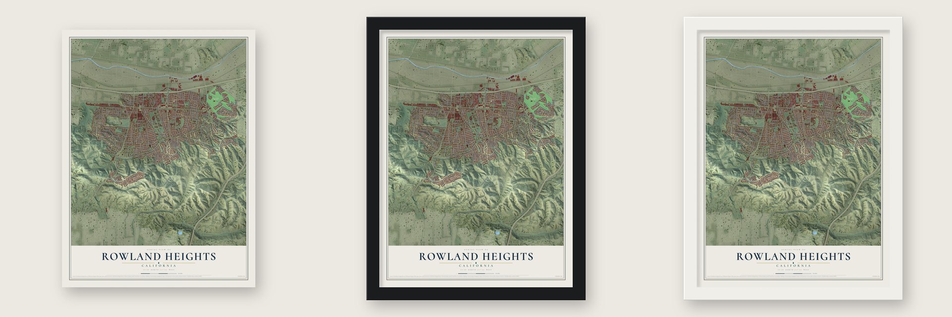
Unframed archival matte, a black wood frame or a white wood frame.
Up close
Geography Worth Displaying
This map was created using accurate cartographic data and authoritative geographic sources, including the U.S. Geological Survey and the Census Bureau. The map brings together terrain, waterways, roads, and building detail. The majority of the streets are labeled, houses are accurately depicted, and the topography is derived from government sources. Combining local data with carefully composed color and shading leads to this beautifully detailed Rowland Heights artwork for your wall.
Rather than simply showing street outlines, we’ve included as many of the street names as we could reasonably fit on the map while keeping their names legible. Zoom in on the high resolution preview to see exactly what’s on the map. We truly set out to create a statement piece for anyone who loves Rowland Heights. So whether it’s for you, or a gift for someone you love, we hope this map of Rowland Heights brings back fond memories.
Read the story behind this map of Rowland Heights, California from 2026.
Find your street
Names on the Rowland Heights map
Every name below is printed on this map. Look for your street, your school, the park where you played, or the pond down the road.
Places and landmarks3
- Otterbein
- Queen of Heaven Cemetery
- Royal Vista Golf Club
Streets and roads237
- Harbor Boulevard
- San Jose Avenue
- Custoza Avenue
- Cll Barcelona
- Fullerton Road
- Cll Madrid
- Crosshaven Drive
- Rance Drive
- Atina Drive
- Colima Road
- Pathfinder Road
- Vantage Pointe Drive
- Batson Avenue
- South Nogales Street
- Saleroso Drive
- South Otterbein Avenue
- Aguiro Street
- Pepperdale Drive
- Brea Canyon Cut Off Road
- Mescal Street
- Paso Real Avenue
- Sierra Leone Avenue
- Los Padres Drive
- Walnut Drive
- Balan Road
- Desire Avenue
- Gallineta Street
- Galatina Street
- Arcdale Avenue
- Annadel Avenue
Show all 237 streets
- Valencia Street
- Fieldbrook Street
- Bolanos Avenue
- Portside Drive
- Jellick Avenue
- Windrose Drive
- Springport Drive
- Walnut Leaf Drive
- Bluehaven Drive
- Ridgeview Avenue
- Lake Canyon Drive
- Banida Avenue
- Blandford Drive
- Sunrise Drive
- Fairway Drive
- Pilario Street
- Pointer Drive
- East Walnut Drive North
- Joel Drive
- Wellesley Drive
- Searls Drive
- Avenue del Canada
- Amberly Place
- Cantaria Avenue
- Nottingham Lane
- Los Palacios Drive
- Wellington Lane
- Brea Canyon Cutoff Road
- Lerona Avenue
- Blakeman Avenue
- Nearbank Drive
- Marimba Street
- Carlton Place
- Cupania
- Tierra Luna
- Farjardo Street
- Nowell Avenue
- Cll Los Arboles
- East Crestline Drive
- Edmore Avenue
- Ybarra Drive
- Donosa Drive
- Greenbay Drive
- South Jellick Avenue
- Alderbury Drive
- East Gale Avenue
- Cam Bello
- Wind River Lane
- Ash
- Gallio Avenue
- Starshine Road
- Dancy Street
- Rio Bonito Drive
- Robert Road
- Contador Drive
- Pocatello Avenue
- Native Avenue
- Gooseberry Drive
- Lincroft Street
- Westbourne Place
- Reedview Drive
- Espito Street
- Castlebar Drive
- Stonegate Lane
- Rudy Street
- Vidora Drive
- Baelen Street
- Nausika Avenue
- Holcroft Drive
- Sartell Drive
- Samara Drive
- Songbird Lane
- Shelyn Drive
- Carvin Avenue
- Nogales Street
- Cuatro Drive
- Oakburn Drive
- Alexdale Lane
- Markstay Street
- Pso Azul
- Matador Drive
- Rhapsody Road
- Senteno Street
- Via Calma
- Remora Drive
- Mondino Drive
- Fallen Drive
- Carolyn Place
- Hertford Place
- Cristo Lane
- Frances
- Companario Drive
- Barroso Street
- Villa Clara Street
- Del Bonita Street
- Honore Street
- Cll Bogota
- Raleo Avenue
- Cascade Way
- Whippoorwill Drive
- Greenport Avenue
- Iluso Avenue
- Recinto Avenue
- Bramhall Lane
- Hillman Lane
- Bluffwood Street
- Cronin Drive
- Kingsmill Avenue
- Golden Coast Lane
- Eadbury Avenue
- Morning Sun Avenue
- Chapel Hill Drive
- Sordello Street
- Buttonwood Lane
- Brittany Place
- Santa Ysabela Drive
- Contra Costa Drive
- Greenwillow Lane
- Sand Spring Drive
- Moscada Avenue
- Bithynia Way
- Killian Avenue
- Dartmouth Lane
- Cam Viejo
- Philbrook Street
- Corrinne Lane
- Sekio Avenue
- Baintree Avenue
- Hastings Place
- Dairen Street
- East Ember Drive
- Thrust Drive
- Cll la Paz
- Mary Ann Lane
- Scarecrow Place
- Larkvane Road
- Yorkshire Way
- Alcona Street
- Abeto Avenue
- Amargoso Drive
- Candela Drive
- Hallgreen Drive
- Wyn Terrace
- Santar Street
- Almeza Avenue
- Aldora Drive
- Pine Avenue
- Vega Way
- Orion Court
- Well Street
- May Court
- La Guardia Street
- Doubletree Lane
- Norsewood Drive
- Bickford Drive
- Edgemont Place
- Hollandale Avenue
- Fidalgo Street
- Emerald Meadow Drive
- Nacora Street
- Crimson Crest Drive
- Addis Street
- Radby Street
- Klum Place
- Quicksilver Lane
- Via Entrada
- Newgarden Street
- Cll Belleza
- Coraview Lane
- Routh Drive
- Livius Way
- Almena Avenue
- Via Amorosa
- Camarina Drive
- Marengo Drive
- Legend Lane
- Sandra Glen Drive
- Seadler Drive
- Cll San Lucas
- South Palma Drive
- Tierra Siesta
- Brisa Lane
- Labin Court
- Felch Avenue
- Eucalyptus Avenue
- Greencastle Avenue
- Andrada Drive
- Carreta Drive
- Rio Seco Drive
- Bellavista Drive
- Calmette Avenue
- Evening Breeze Drive
- Daisetta Street
- Whitney Place
- Castleford Place
- Donway Drive
- Maple Avenue
- Destoya Avenue
- Brea Canyon Cut-Off Court
- Heritage Place
- Brighton Place
- Ashbourne Place
- Adivino Street
- Escalada Avenue
- Cypress Street
- Bomar Court
- Orbit Court
Names are listed as they appear on the printed map. Zoom into the product photos to find them.
About Rowland Heights, California
Rowland Heights is an unincorporated community of 48,231 people in Los Angeles County, at the foot of the Puente Hills. In April 1842 Governor Juan B. Alvarado gave John Rowland the Mexican land grant called Rancho La Puente, about 18,000 acres. Three years later Governor Pio Pico enlarged it to nearly 49,000 acres and made William Workman a partner. Once the United States confirmed their title with a federal patent, the two men split the ranch in 1868. Rowland took the north, south and east, which held most of today's Rowland Heights.
For many years the Rowland land was mostly orange groves. As Los Angeles spread east, working-class neighborhoods and low-cost housing went up, and the 60 freeway was pushed out past the community's western edge. Land beside the freeway was zoned for industry, and those jobs helped pay for new homes. In the 1980s and 1990s wealthy families from Taiwan moved in, and people began calling the area "Little Taipei."
- The Rowland family still owns landJohn A. Rowland III, a grandson of the first owner, had his ranch behind what is now the 99 Ranch Market, near Gale Avenue and Nogales Street. His family still holds part of that ground and rents most of it out to businesses.
- 500 plum trees from JapanSchabarum Regional Park is named for Peter F. Schabarum, the county supervisor who once represented this district. In 1992 it became a sister park of Kairaku-en in Mito, Ibaraki, Japan, which gave it 500 ume trees. The park is now known for its ume and sakura blossoms, along with its riding trails in the Puente Hills.
- A 750,000-pound visitorIn March 2012 a granite boulder two stories tall stopped on Pathfinder Road. Crews were hauling it west out of Riverside County, bound for the Los Angeles County Museum of Art, where it became the centerpiece of Michael Heizer's Levitated Mass.
- Harbor Boulevard opened in 1992That year a road linking Rowland Heights to La Habra and northern Orange County opened, and Fullerton Road became one of the busiest streets in the region.
Keep exploring California
Rowland Heights is one of 1,982 California towns we've mapped. Every dot on the map is a print of its own.
The search covers every state, California first.
Near Rowland Heights
Order 2 or more town maps and save 10%. Shown in the size and finish you picked above, so they hang as a set.
- South San Jose Hills 12" x 18" / Archival Matte Print $39.99
- La Habra Heights 12" x 18" / Archival Matte Print $39.99
- Brea 12" x 18" / Archival Matte Print $39.99


More maps nearby: La Habra, Diamond Bar, Industry, Walnut and Hacienda Heights.
The art of mapping a place
How This Map Was Made
Real places. Remarkable detail. Discover the layers that turn geographic data into a map of home.

The view from above
Aerial imagery reveals the character of the land: woodland, open fields, and the patterns of a place.

The shape of the land
Elevation data brings hills, valleys, and subtle changes in the landscape into view.

The details of home
Roads, waterways, and building footprints come together to make the map feel unmistakably local.

Geography becomes art
Considered color, shading, and typography bring the layers together in a map made for your wall.


Process illustrated with Mendon, Massachusetts. Aerial imagery: USDA NAIP. Terrain: USGS 3D Elevation Program. Map details and finished artwork: KNOWOL.
The Details
About This Print
Choose an archival matte print, or a black or white Ayous wood frame. The archival matte print is unframed.
Select your size and finish above to see the matching product image and price.
Materials & Craftsmanship
A contemporary map with the character of a classic atlas, printed on archival matte paper. Optional frames are made from Ayous wood.
Your printed map does not include the watermark shown in the full-map preview.
Shipping & Delivery
Free shipping within the United States. Every print is made to order in the USA.
Buying a gift? Add a note in your cart and we'll include it. We never put prices in the package.
Prints ship within 2 to 3 business days. Allow 7 to 10 days total from ordering for delivery. Timing may vary during holidays or periods of high order volume.
Read our shipping policy.
Returns and damaged prints
Each print is made to order. Change-of-mind refunds are not available after production.
If your print arrives damaged, misprinted or incorrect, contact support@knowol.com within 30 days of receiving it. Include your order number, photos and a description of the issue.
Read our full refund and replacement policy. For questions about your order, email support@knowol.com.