
Search for another town





Free U.S. delivery 7 to 10 days after you order
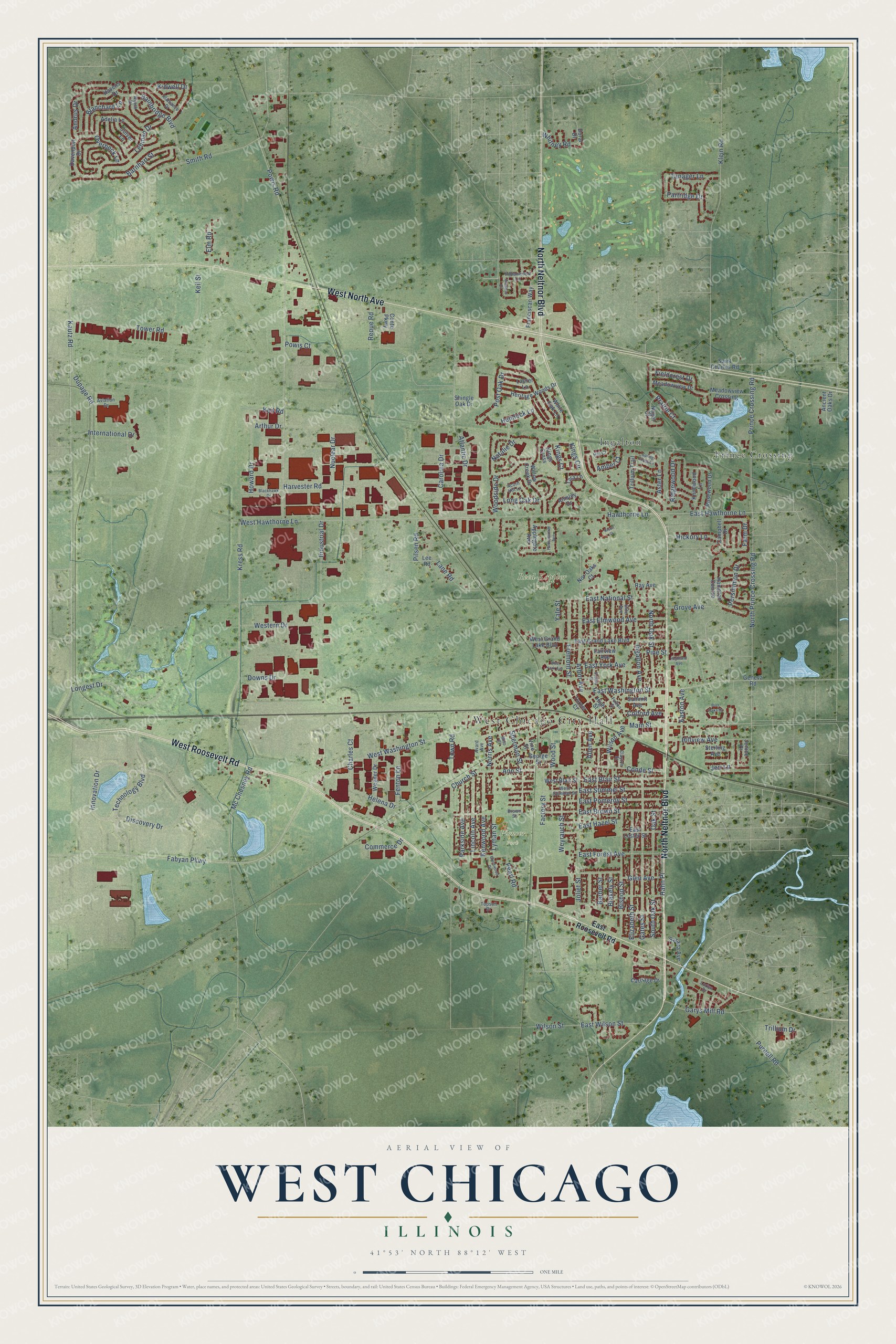
West Chicago, Illinois Map Art
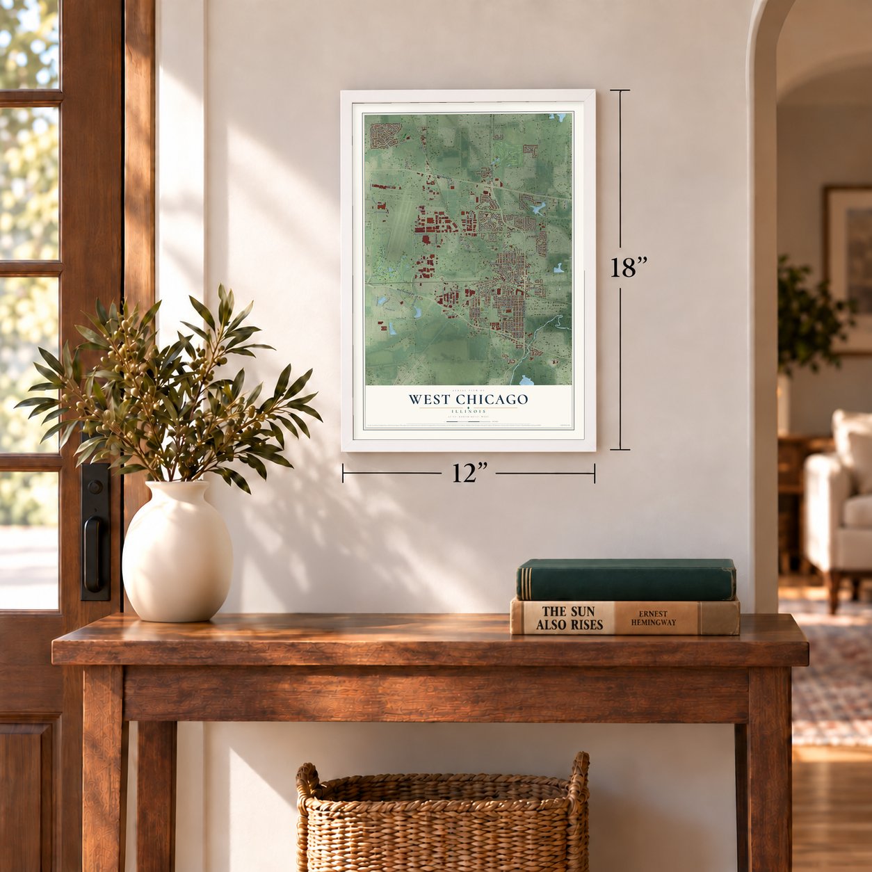
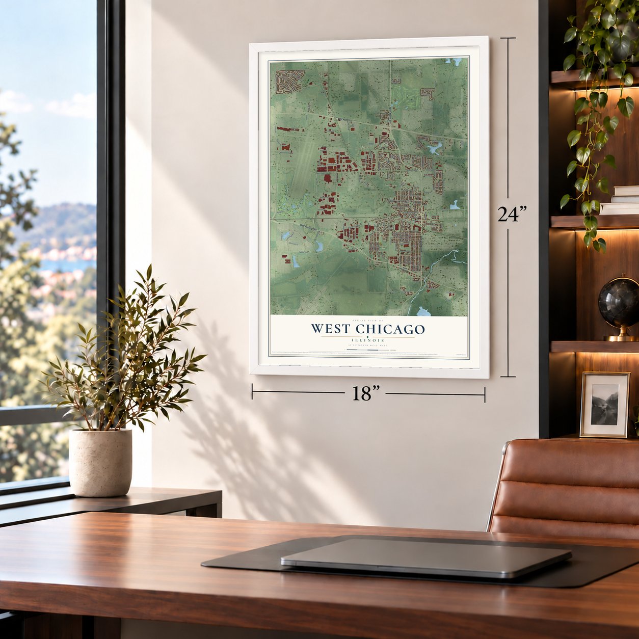
A new map of West Chicago, Illinois, made in 2026 and printed to order on thick archival matte paper.
12" x 18" Archival Matte Print
A Map of Home. A Work of Art.
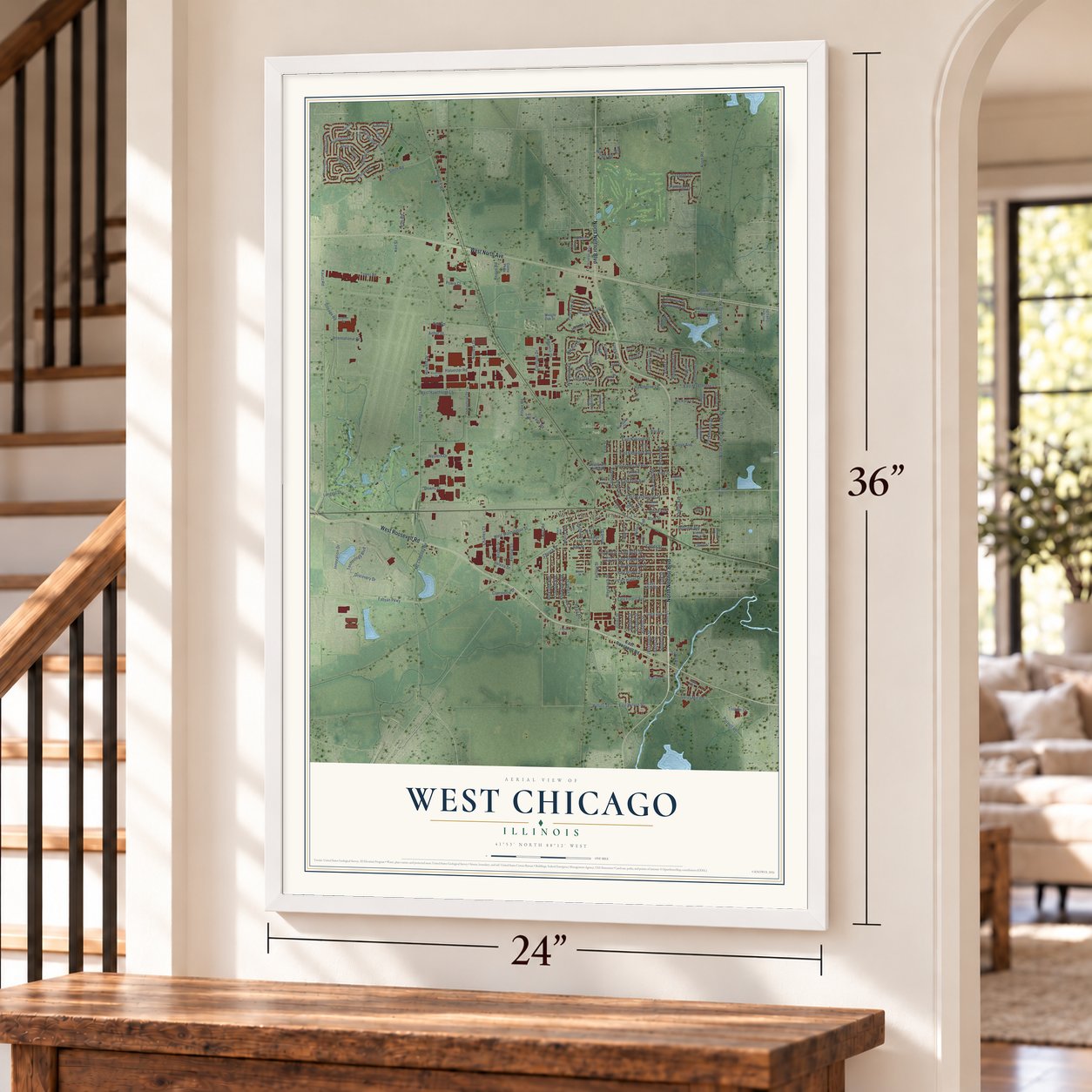
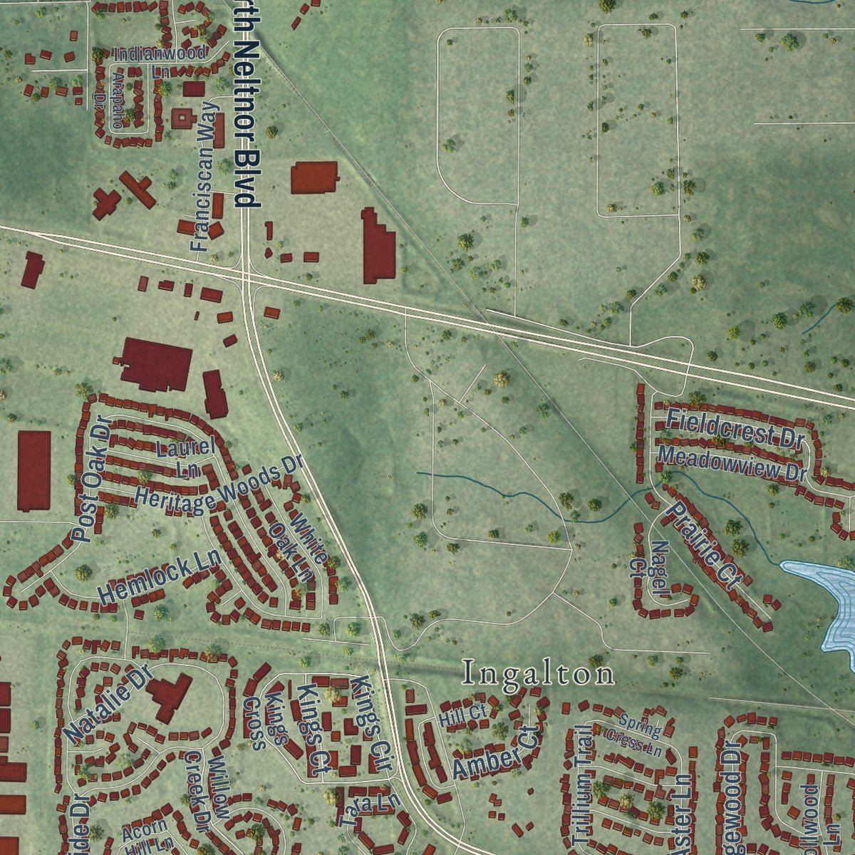
Explore West Chicago, Illinois from a whole new perspective. Created using aerial imagery and detailed geographic data, this map captures West Chicago building by building, with labeled streets, familiar landmarks, and shaded topographical relief that highlights the natural contours of the landscape.
Combining modern data with the timeless character of a vintage atlas, this map is just as interesting up close as it is beautiful on the wall. Whether you grew up in West Chicago, spent memorable years there, or call it home today, this unique map is a great way to celebrate a place that means something to you. Zoom in on the preview to look for your street, and then order a print to put your memories on the wall.
Three ways to hang it
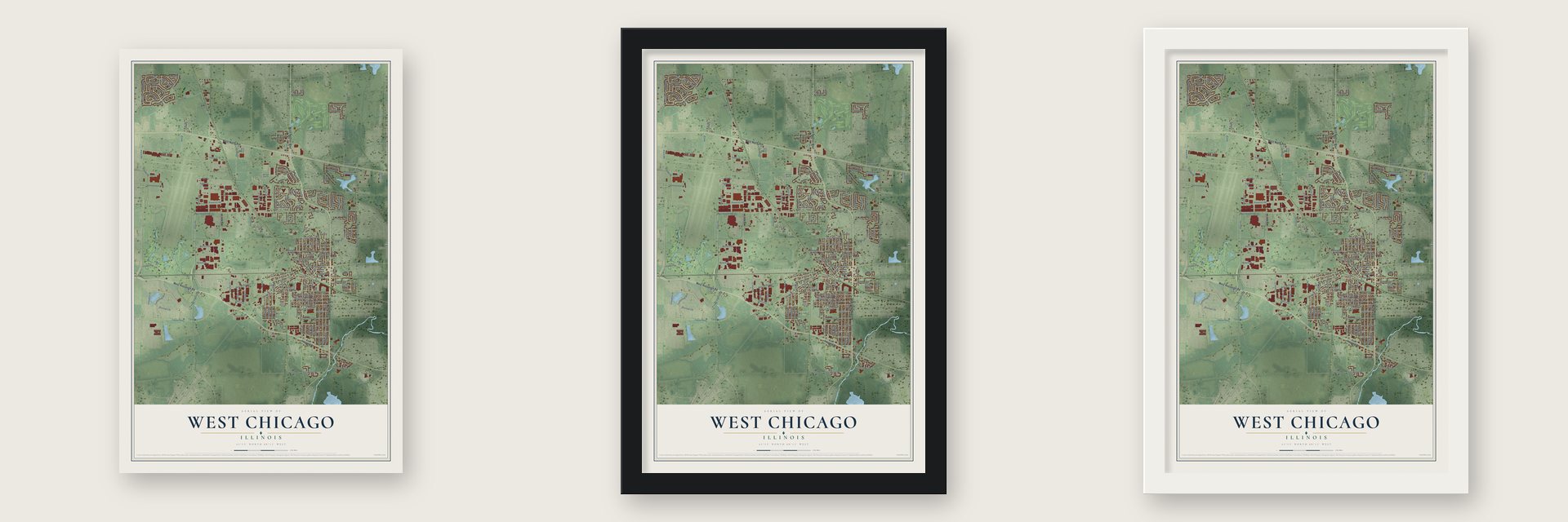
Unframed archival matte, a black wood frame or a white wood frame.
Up close
Geography Worth Displaying
This map was created using accurate cartographic data and authoritative geographic sources, including the U.S. Geological Survey and the Census Bureau. The map brings together terrain, waterways, roads, and building detail. The majority of the streets are labeled, houses are accurately depicted, and the topography is derived from government sources. Combining local data with carefully composed color and shading leads to this beautifully detailed West Chicago artwork for your wall.
Rather than simply showing street outlines, we’ve included as many of the street names as we could reasonably fit on the map while keeping their names legible. Zoom in on the high resolution preview to see exactly what’s on the map. We truly set out to create a statement piece for anyone who loves West Chicago. So whether it’s for you, or a gift for someone you love, we hope this map of West Chicago brings back fond memories.
Read the story behind this map of West Chicago, Illinois from 2026.
About West Chicago, Illinois
West Chicago is a city of 25,614 people in DuPage County. The Galena and Chicago Union Railroad reached the site in 1849. The next year the Aurora Branch Railroad built southwest from here, which made this the first railroad junction west of Chicago in America. Trains stopped for water and fuel, so the railroads added a roundhouse, an eating-house and a hotel, and workers moved in with their families. John B. Turner, the railroad's president, owned land at the center and recorded it in 1855 as the Town of Junction.
Dr. Joseph McConnell and Mary, his wife, laid out a second town just to the north in 1857 and named it Turner, for the railroad president. People called the pair Turner Junction, and residents incorporated as the Village of Turner in 1873. The Elgin, Joliet & Eastern freight line arrived in 1888 and offered free factory sites. Businessmen led by Charles Bolles wanted a name that would impress factory owners, so in 1896 Turner became the Village of West Chicago. It became a city in 1906, and banker Grant A. Dayton was its first mayor.
- 2,378 people by 1910The new name and the free factory sites did their work. By the turn of the century, Hinsdale was the only DuPage County town with more people. By 1910 West Chicago had 2,378 residents, along with a Borden's plant that condensed milk and two local firms, Turner Cabinet Company and Turner Brick Company.
- The country trolleyIn 1909 the Chicago, Wheaton and Western Railway, an electric interurban line, came in from the east. It ran down the middle of Junction and Depot streets, which are both Main Street today, and then curved west toward Geneva. The Chicago Aurora and Elgin Railroad soon bought it. Few riders used the trolley, and it was abandoned in 1937. The Illinois Prairie Path's Geneva Spur follows its old route.
- A prairie found in 1976Mayor Richard Truitt often walked the open land west of the city. In 1976 he discovered a prairie that had survived because it sat on railroad land that was never farmed. Today the land is the Truitt-Hoff Nature Preserve, within the West Chicago Prairie Forest Preserve of DuPage County, and it ranks among the Midwest's largest and best preserved prairies.
- A cleanup won by residentsIn the 1930s a plant was built here by the Lindsay Light and Chemical Company, and over the years harmful waste from this Rare Earths Facility spread around town. Reed-Keppler Park even sat on a landfill that took some of it. Residents uncovered the problem in the 1980s and 1990s. Kerr-McGee had bought the plant in 1967 and ran it until 1973. The company reached a settlement with the city and removed the waste.
Find your street
Names on the West Chicago map
Every name below is printed on this map. Look for your street, your school, the park where you played, or the pond down the road.
Places and landmarks5
- West Chicago City Hall
- Pioneer Park
- Reed-Keppler Park
- Ingalton
- Prince Crossing
Streets and roads192
- North Neltnor Boulevard
- West Roosevelt Road
- West North Avenue
- Technology Boulevard
- East Elmwood Avenue
- Discovery Drive
- Fabyan Parkway
- East Hawthorne Lane
- West Hawthorne Lane
- Hawthorne Lane
- West Washington Street
- Innovation Drive
- Charles Court
- Helena Drive
- East Washington Street
- Post Oak Drive
- East National Street
- Farm Drive
- Carolina Drive
- Grove Avenue
- Powis Road
- Kautz Road
- North Prince Crossing Road
- Prince Crossing Road
- Joliet Street
- Kress Road
- Arbor Avenue
- Atlantic Drive
- Smith Road
- Longest Drive
Show all 192 streets
- Town Road
- Ingalton Avenue
- Main Street
- Gates Street
- Bainbridge Boulevard
- Industrial Drive
- Mc Chesney Road
- Klein Road
- International Drive
- Harvester Road
- Elizabeth Street
- Bishop Street
- Dupage Road
- Church Street
- Tower Road
- Wilson Street
- Lehman Drive
- Wood Street
- Kings Circle
- East Blair Street
- Downs Drive
- Ann Street
- Sherman Street
- Barber Street
- Fremont Street
- North Oak Street
- Reque Road
- Purnell Road
- Conde Street
- East Brown Street
- East Stimmel Street
- East Pomeroy Street
- Glen Avenue
- East Forest Avenue
- Kenwood Avenue
- Hillview Avenue
- Lincoln Avenue
- Blakely Street
- Weyrauch Street
- Western Drive
- Woodside Drive
- Norris Avenue
- Parkside Avenue
- Barnhart Street
- Lyman Street
- Garys Mill Road
- East Wilson Street
- Oak Street
- Howard Drive
- Blanchard Lane
- Keil Street
- Allen Avenue
- South Oak Street
- East York Avenue
- Fenton Lane
- Whitney Road
- Easton Avenue
- Factory Street
- Ridgewood Drive
- Trillium Drive
- Nuclear Drive
- Overbeck Lane
- Fieldcrest Drive
- Persimmon Drive
- Hemlock Lane
- Long Oak Drive
- Andrus Drive
- Hickory Lane
- Wilson Avenue
- Natalie Drive
- Pearl Road
- Colford Avenue
- Tanager Lane
- Powis Court
- Keil Road
- East Hazel Street
- Jeri Lane
- Elm Road
- Hahn Place
- Partridge Drive
- Pilsen Road
- Prairie Court
- Commerce Drive
- Lane Road
- Aster Lane
- Kidwell Drive
- Amber Court
- Arthur Drive
- Kings Court
- Pine Street
- Yale Street
- East Roosevelt Road
- Sarana Avenue
- East Grand Lake Boulevard
- Wegner Drive
- Kings Cross
- Carriage Drive
- Rosewood Drive
- Hampton Course
- West Blair Street
- Meadowview Crossing
- Heritage Woods Drive
- Willow Creek Drive
- Davenport Drive
- Franciscan Way
- Adelia Lane
- George Street
- Shingle Oak Drive
- Ray Avenue
- Ainsley Drive
- West Grand Lake Boulevard
- Meadowview Drive
- White Oak Lane
- Saint Charles Road
- East Lester Street
- Havens Drive
- Knollwood Lane
- Nagel Court
- Culver Lane
- Applegate Avenue
- Laurel Lane
- Trillium Trail
- High Street
- Ancient Oaks Drive
- Campbell Drive
- Tara Lane
- Doral Drive
- Nor-Oaks Court
- Sterling Avenue
- Turner Court
- Lee Road
- Conte Parkway
- Geneva Road
- Summit Avenue
- Jenice Court
- Fairview Avenue
- Vine Street
- West Stimmel Street
- Alamance Drive
- Wyeth Drive
- Elite Avenue
- Acorn Hill Lane
- Indianwood Lane
- Lorlyn Drive
- Fulton Street
- Aviation Drive
- Clayton Street
- Topsoil Drive
- Avard Avenue
- Brown Street
- Hill Court
- Milo Court
- Highland Avenue
- Burr Oaks Drive
- Sophia Street
- Blackhawk Drive
- Spring Cress Lane
- Honeysuckle Avenue
- West York Avenue
- Brentwood Drive
- Arapaho Drive
- Risch Court
Names are listed as they appear on the printed map. Zoom into the product photos to find them.
The art of mapping a place
How This Map Was Made
Real places. Remarkable detail. Discover the layers that turn geographic data into a map of home.

The view from above
Aerial imagery reveals the character of the land: woodland, open fields, and the patterns of a place.

The shape of the land
Elevation data brings hills, valleys, and subtle changes in the landscape into view.

The details of home
Roads, waterways, and building footprints come together to make the map feel unmistakably local.

Geography becomes art
Considered color, shading, and typography bring the layers together in a map made for your wall.


Process illustrated with Mendon, Massachusetts. Aerial imagery: USDA NAIP. Terrain: USGS 3D Elevation Program. Map details and finished artwork: KNOWOL.
The Details
About This Print
Choose an archival matte print, or a black or white Ayous wood frame. The archival matte print is unframed.
Select your size and finish above to see the matching product image and price.
Materials & Craftsmanship
A contemporary map with the character of a classic atlas, printed on archival matte paper. Optional frames are made from Ayous wood.
Your printed map does not include the watermark shown in the full-map preview.
Shipping & Delivery
Free shipping within the United States. Every print is made to order in the USA.
Buying a gift? Add a note in your cart and we'll include it. We never put prices in the package.
Prints ship within 2 to 3 business days. Allow 7 to 10 days total from ordering for delivery. Timing may vary during holidays or periods of high order volume.
Read our shipping policy.
Returns and damaged prints
Each print is made to order. Change-of-mind refunds are not available after production.
If your print arrives damaged, misprinted or incorrect, contact support@knowol.com within 30 days of receiving it. Include your order number, photos and a description of the issue.
Read our full refund and replacement policy. For questions about your order, email support@knowol.com.
Find your town
Looking for another city?
Find a map of home in our Illinois collection, or any town in the country.
Nearby
Maps of towns near West Chicago
Know someone from one of these towns? Their map makes a great gift.
 Winfield
, Illinois
From $39.99See the map
 Wayne
Wayne, Illinois
From $39.99See the map
 Carol Stream
, Illinois
From $39.99See the map
More maps nearby: St. Charles, Bartlett, Warrenville, Geneva and Batavia.