
Search for another town



Free U.S. delivery 7 to 10 days after you order
Westphalia, Maryland Map Art
Building by building, with labeled streets and shaded relief.
12" x 18" Archival Matte Print
A Map of Home. A Work of Art.
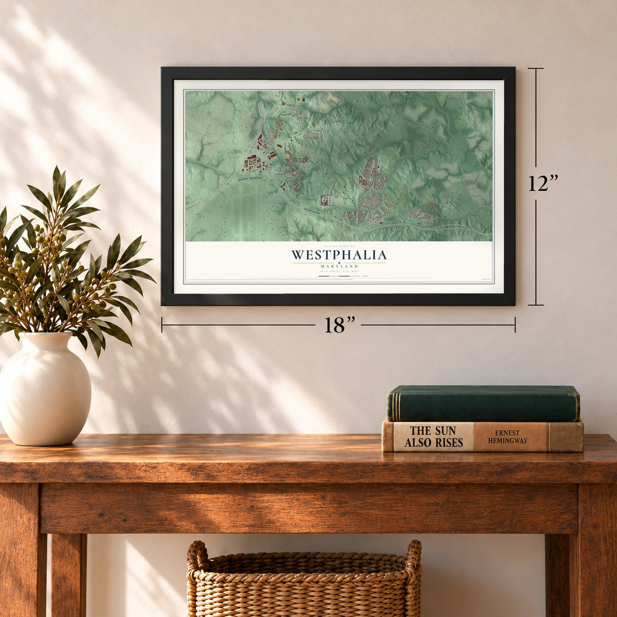
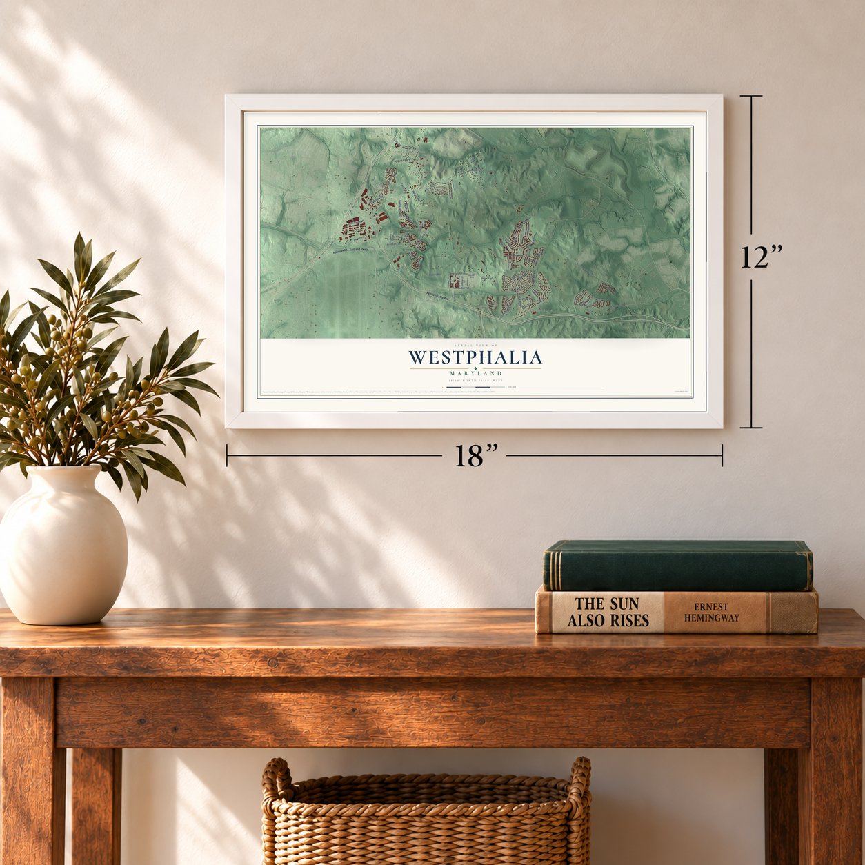
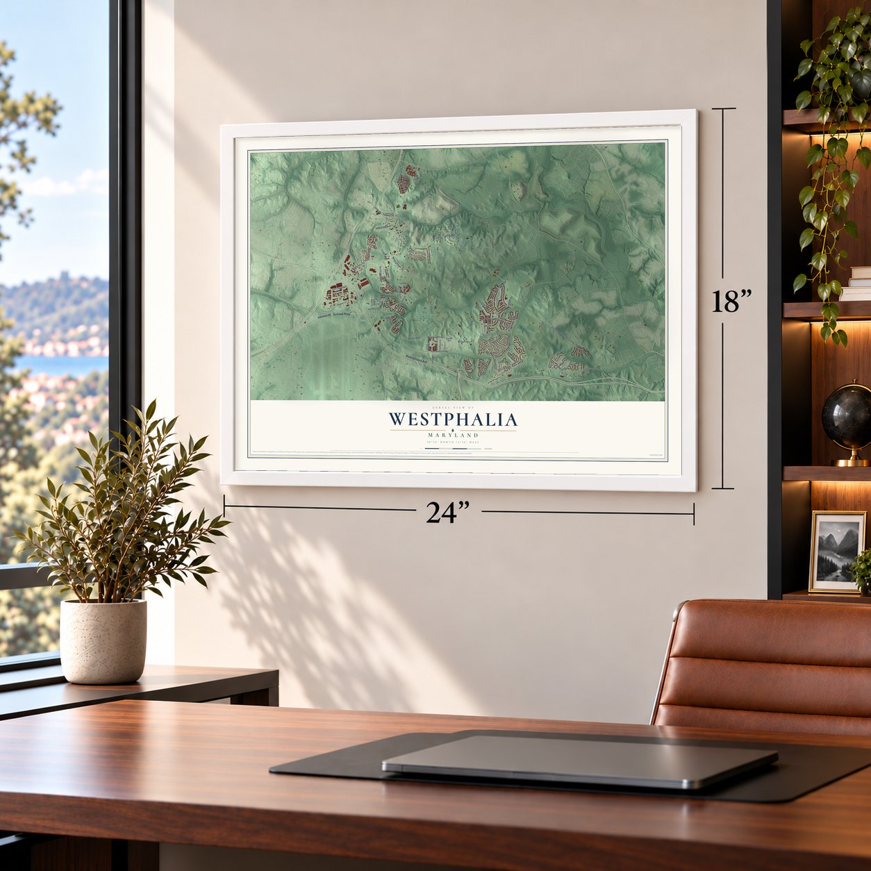
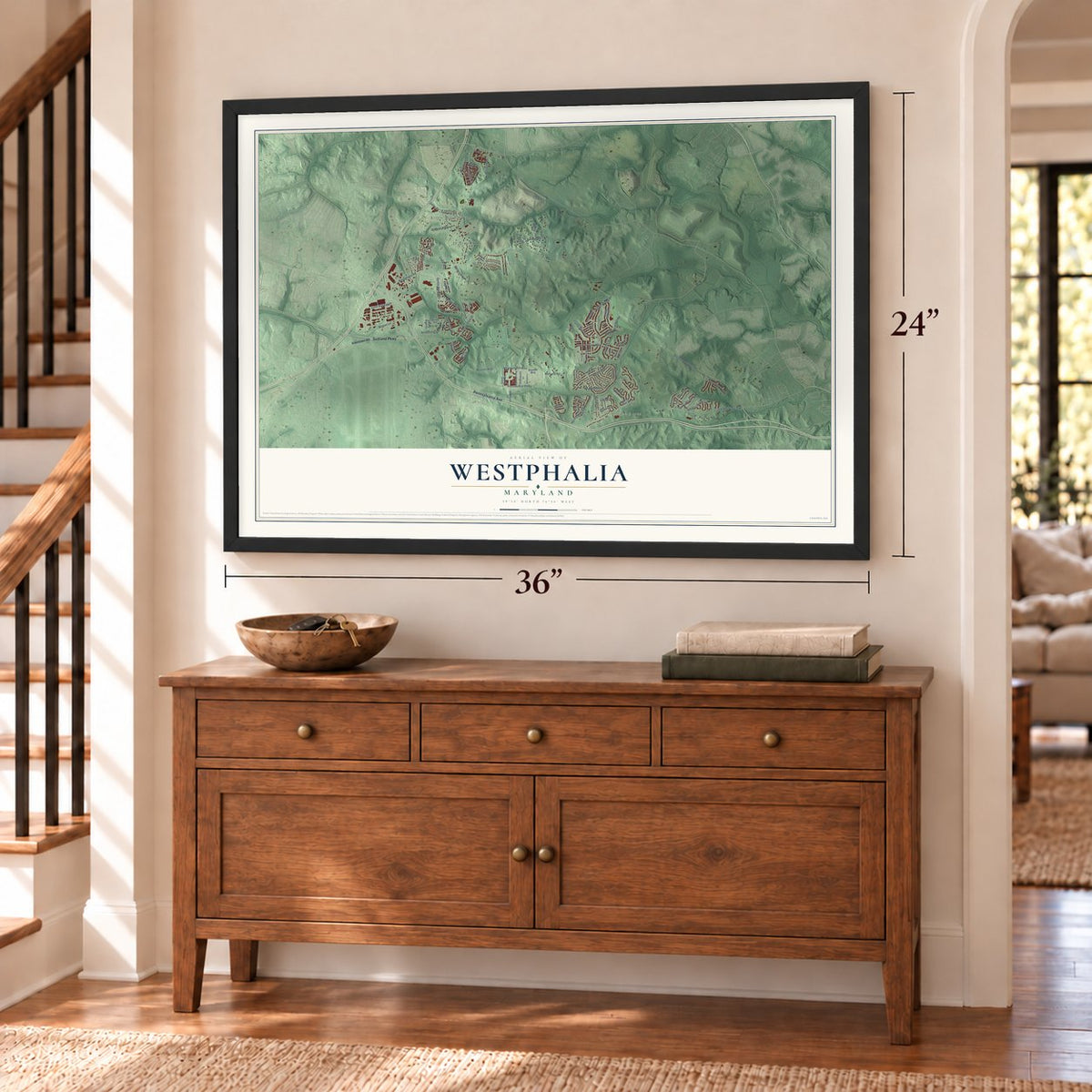
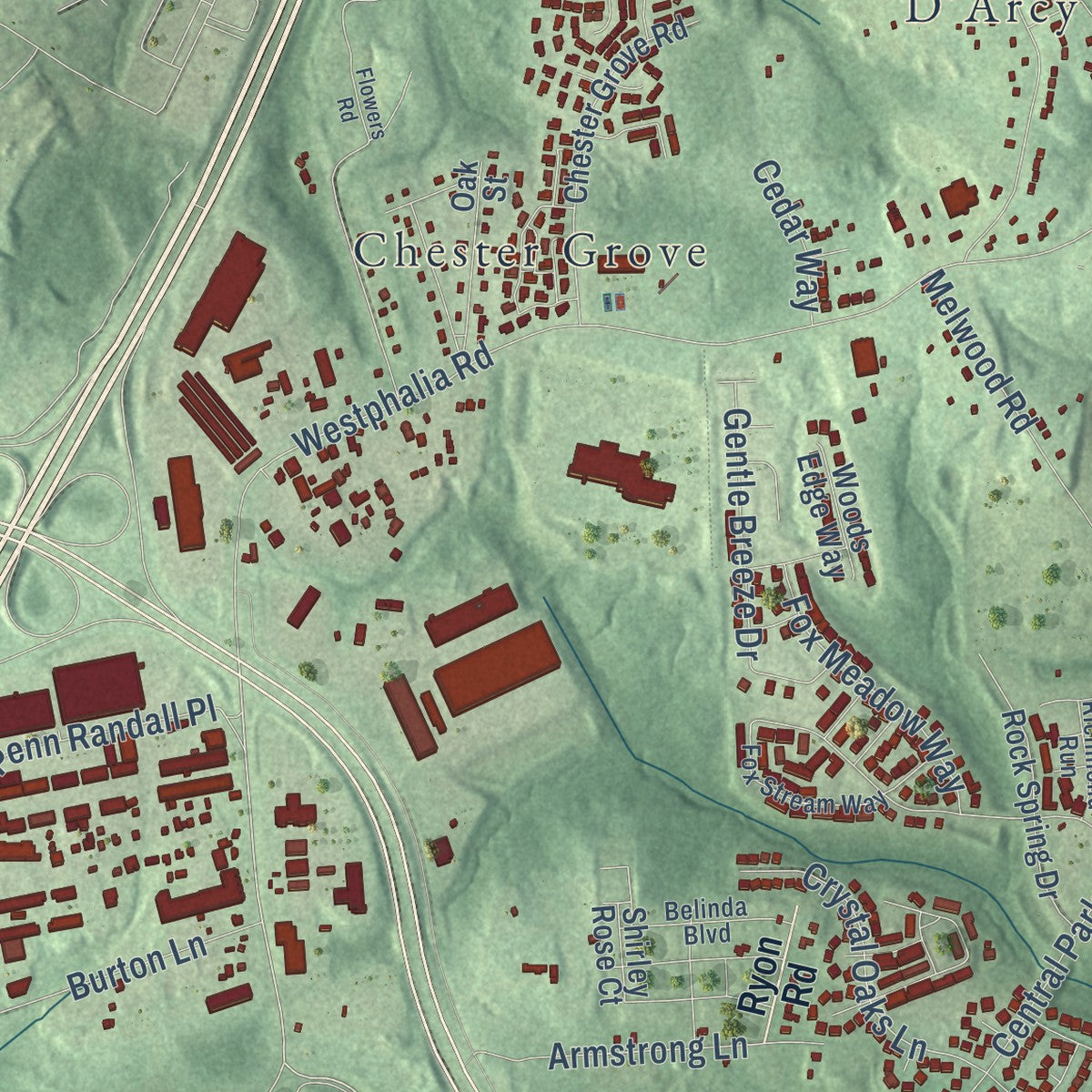
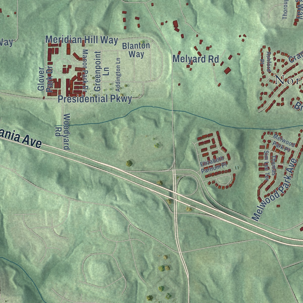
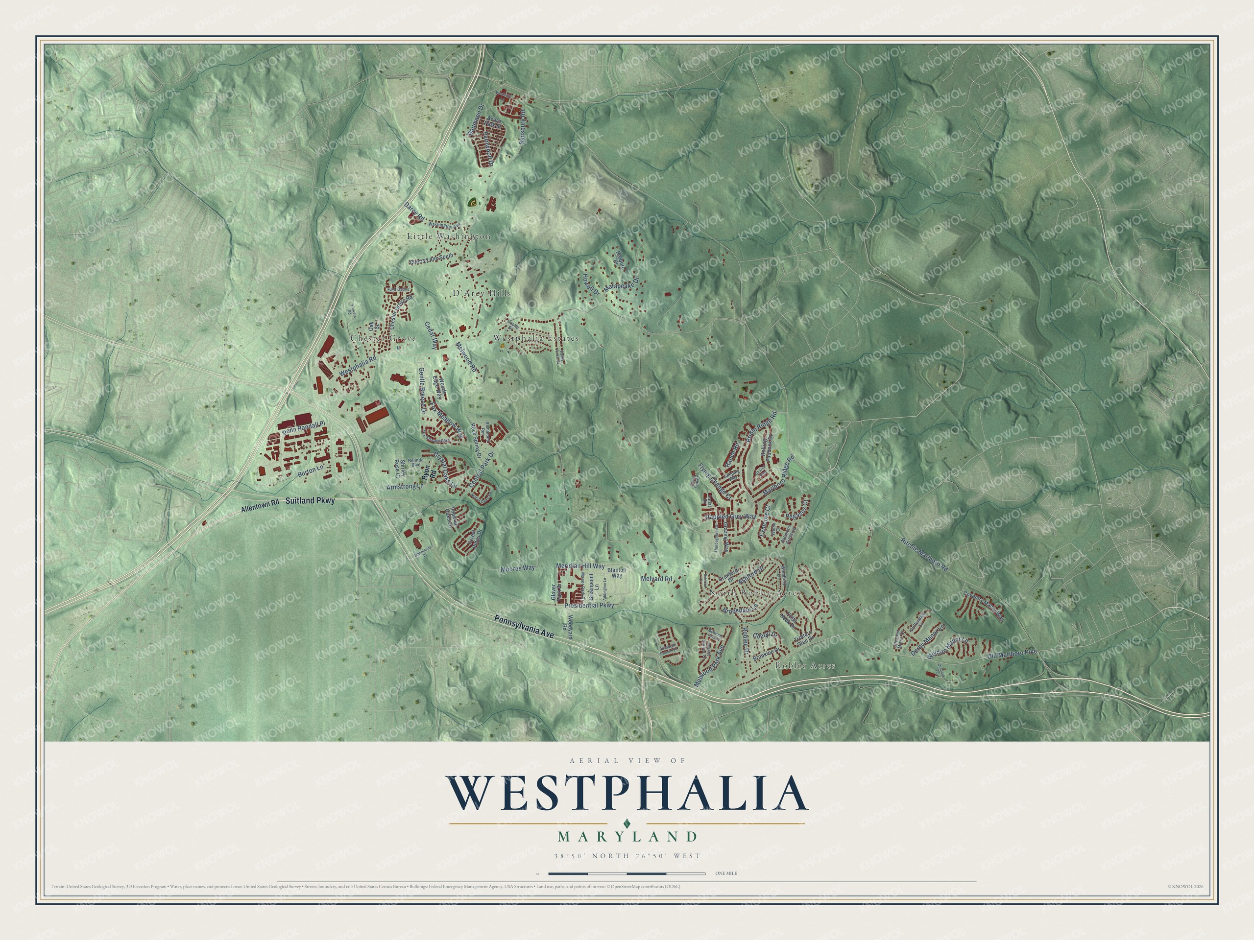
Explore Westphalia, Maryland from a whole new perspective. Created using aerial imagery and detailed geographic data, this map captures Westphalia building by building, with labeled streets, familiar landmarks, and shaded topographical relief that highlights the natural contours of the landscape.
Combining modern data with the timeless character of a vintage atlas, this map is just as interesting up close as it is beautiful on the wall. Whether you grew up in Westphalia, spent memorable years there, or call it home today, this unique map is a great way to celebrate a place that means something to you. Zoom in on the preview to look for your street, and then order a print to put your memories on the wall.
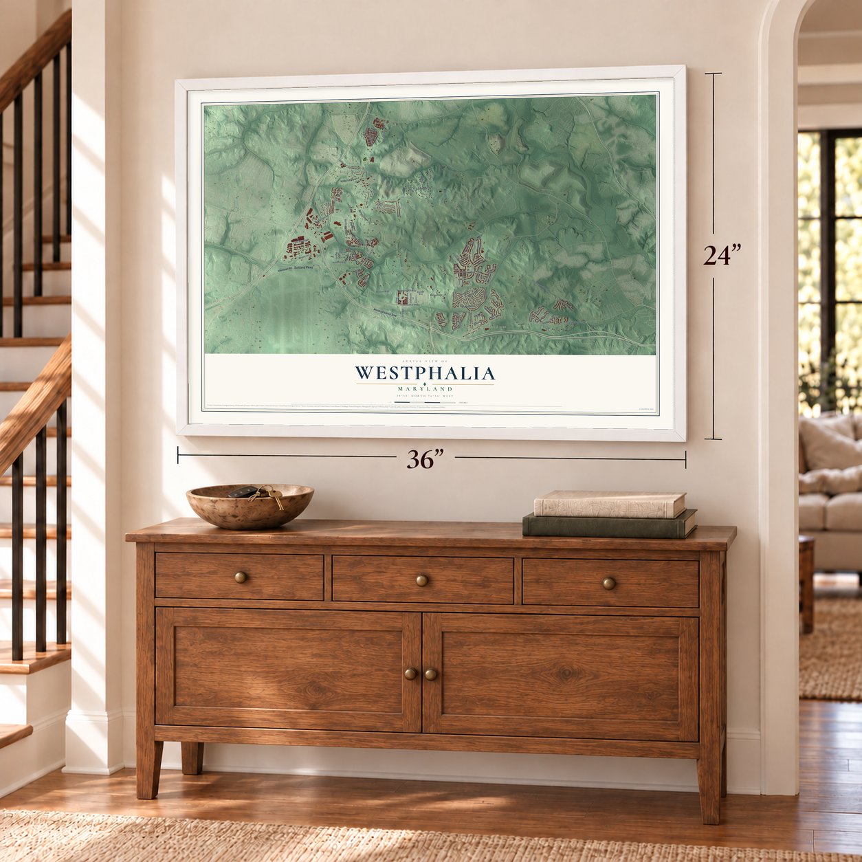
Three ways to hang it
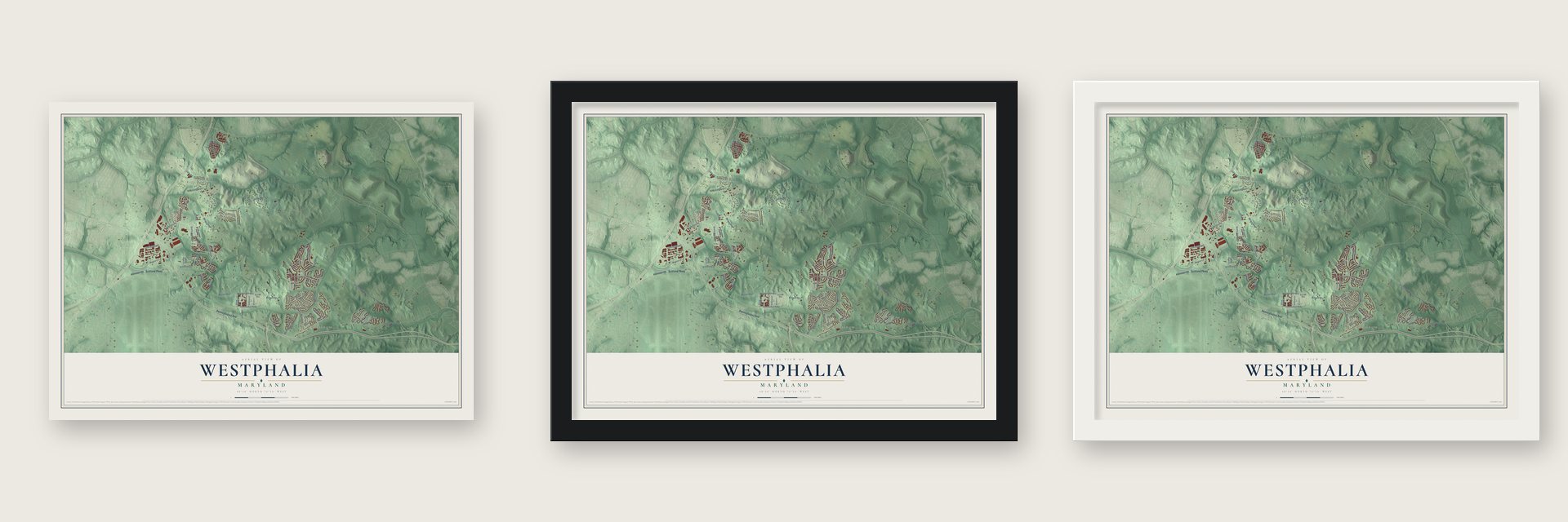
Unframed archival matte, a black wood frame or a white wood frame.
Up close
Geography Worth Displaying
This map was created using accurate cartographic data and authoritative geographic sources, including the U.S. Geological Survey and the Census Bureau. The map brings together terrain, waterways, roads, and building detail. The majority of the streets are labeled, houses are accurately depicted, and the topography is derived from government sources. Combining local data with carefully composed color and shading leads to this beautifully detailed Westphalia artwork for your wall.
Rather than simply showing street outlines, we’ve included as many of the street names as we could reasonably fit on the map while keeping their names legible. Zoom in on the high resolution preview to see exactly what’s on the map. We truly set out to create a statement piece for anyone who loves Westphalia. So whether it’s for you, or a gift for someone you love, we hope this map of Westphalia brings back fond memories.
Read the story behind this map of Westphalia, Maryland from 2026.
Find your street
Names on the Westphalia map
Every name below is printed on this map. Look for your street, your school, the park where you played, or the pond down the road.
Places and landmarks6
- Roblee Acres
- Little Washington
- Chester Grove
- Westphalia Estates
- North Roblee Acres
- D'Arcy Hills
Streets and roads89
- Pennsylvania Avenue
- Suitland Parkway
- Old Marlboro Pike
- Ritchie Marlboro Road
- Westphalia Road
- Presidential Parkway
- Melwood Road
- Bridle Ridge Road
- Sansbury Road
- Darcy Road
- Moores Way
- Meridian Hill Way
- Central Park Drive
- Roblee Drive
- Fernwood Drive
- Ashford Drive
- Dappled Grey Way
- Penn Randall Place
- Matapeake Drive
- Burton Lane
- Gentle Breeze Drive
- Crystal Oaks Lane
- Melwood Park Avenue
- Armstrong Lane
- Marlboro Ridge Road
- Weldon Manor Lane
- Fox Meadow Way
- Flying Change Court
- Brookdale Lane
- Baumann Drive
Show all 89 streets
- Derby Manor Lane
- Cheryl Drive
- Exmoore Court
- Howell Drive
- Melyard Road
- Ranch Road
- Cedar Way
- Pegasus Court
- Allentown Road
- Ryon Road
- Woodyard Road
- Trotters Glen Drive
- Cranford Drive
- Forest Pines Drive
- Chester Grove Road
- Rolling Paddock Drive
- Hatboro Place
- Rock Spring Drive
- Coventry Manor Way
- Brooklee Drive
- Shirley Rose Court
- Cherry Lane South
- Grazing Way
- Blanton Way
- Greenpoint Lane
- Glover Park Drive
- Acorn Park Street
- Oak Street
- Imperial Oaks Lane
- Woods Edge Way
- Colts Neck Drive
- Fox Stream Way
- Woodford Lane
- Palomino Crossing
- Castle Drive
- Washington Avenue
- Manor Park Drive
- Belinda Boulevard
- Chestnut Manor Court
- Griffendale Lane
- East Grove
- Jumping Way
- Richmond Run
- Lariat Drive
- Welsh Court
- Flowers Road
- Thoroughbred Drive
- Manor Oaks Vw
- Chariot Way
- Valley Forest Drive
- Thomas Sim Lee Terrace
- Orchard Terrace
- Addington Lane
- Ashford Place
- Weshurst Lane
- Melwood Park Place
- Machinists Place
- Elizabeth Parnum Place
- Spring Foal Court
Names are listed as they appear on the printed map. Zoom into the product photos to find them.
About Westphalia, Maryland
Westphalia is a community of 11,770 people in southern Prince George's County, with the Capital Beltway on its west side and Maryland Route 4 to the south. Its recorded history begins in 1729, when the merchant William Digges bought 550 acres here from the Darnall family. That land became the Melwood Park plantation.
The Digges family stayed at Melwood Park for close to a century, and George Washington counted them as friends and came to see them often. Digges left the plantation to his son Ignatius. Ignatius's daughter Mary married Thomas Sim Lee, who served two terms as governor of Maryland.
- A British general in 1814In 1814 Mary Carroll Digges welcomed the British General Ross to Melwood Park while he was marching his army toward Bladensburg. Ross then led his troops on to Washington, where they set fire to the public buildings.
- Little Washington since 1938Leon Ellsworth Tayman started selling lots in 1938 in what grew into Little Washington, an African American neighborhood of the mid-twentieth century. Families built its first houses from the late 1930s through the 1940s. They were wood frame homes a story and a half tall, each with four rooms and two bedrooms and a gable facing the street.
- A town center planned in 2007Prince George's County's council voted for the Westphalia Sector Plan on February 6, 2007, and rezoned land across the area. The plan calls for a dense town center built around transit and walking, ringed by three village centers. It foresees 14,000 to 15,300 new homes, room for businesses totaling 4.5 million square feet, and a 150-acre Central Park just north of the town center.
Keep exploring Maryland
Westphalia is one of 880 Maryland towns we've mapped. Every dot on the map is a print of its own.
The search covers every state, Maryland first.
Near Westphalia
Order 2 or more town maps and save 10%. Shown in the size and finish you picked above, so they hang as a set.
- Brown Station 12" x 18" / Archival Matte Print $39.99
- Forestville 12" x 18" / Archival Matte Print $39.99
- Largo 12" x 18" / Archival Matte Print $39.99


More maps nearby: Melwood, Marlboro Village, Andrews AFB, Queensland and Morningside.
The art of mapping a place
How This Map Was Made
Real places. Remarkable detail. Discover the layers that turn geographic data into a map of home.

The view from above
Aerial imagery reveals the character of the land: woodland, open fields, and the patterns of a place.

The shape of the land
Elevation data brings hills, valleys, and subtle changes in the landscape into view.

The details of home
Roads, waterways, and building footprints come together to make the map feel unmistakably local.

Geography becomes art
Considered color, shading, and typography bring the layers together in a map made for your wall.


Process illustrated with Mendon, Massachusetts. Aerial imagery: USDA NAIP. Terrain: USGS 3D Elevation Program. Map details and finished artwork: KNOWOL.
The Details
About This Print
Choose an archival matte print, or a black or white Ayous wood frame. The archival matte print is unframed.
Select your size and finish above to see the matching product image and price.
Materials & Craftsmanship
A contemporary map with the character of a classic atlas, printed on archival matte paper. Optional frames are made from Ayous wood.
Your printed map does not include the watermark shown in the full-map preview.
Shipping & Delivery
Free shipping within the United States. Every print is made to order in the USA.
Buying a gift? Add a note in your cart and we'll include it. We never put prices in the package.
Prints ship within 2 to 3 business days. Allow 7 to 10 days total from ordering for delivery. Timing may vary during holidays or periods of high order volume.
Read our shipping policy.
Returns and damaged prints
Each print is made to order. Change-of-mind refunds are not available after production.
If your print arrives damaged, misprinted or incorrect, contact support@knowol.com within 30 days of receiving it. Include your order number, photos and a description of the issue.
Read our full refund and replacement policy. For questions about your order, email support@knowol.com.