
Search for another town





Free U.S. delivery 7 to 10 days after you order
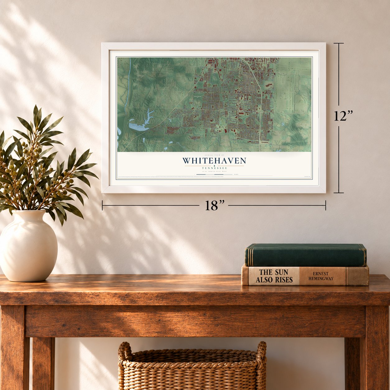
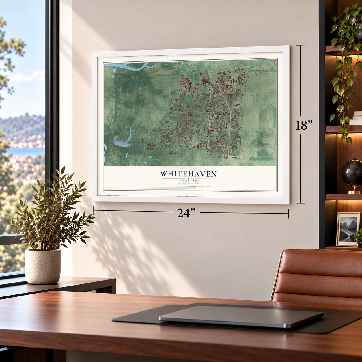
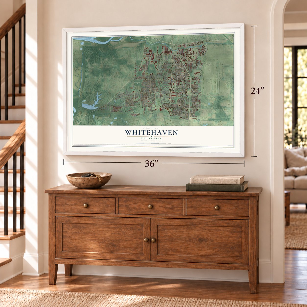
Whitehaven, Tennessee Map Art
Building by building, with labeled streets and shaded relief.
12" x 18" Archival Matte Print
A Map of Home. A Work of Art.
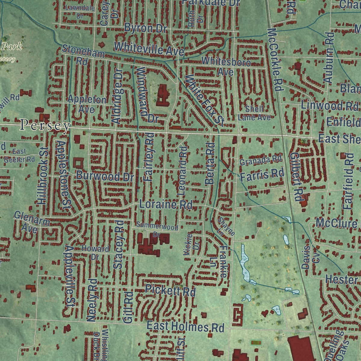
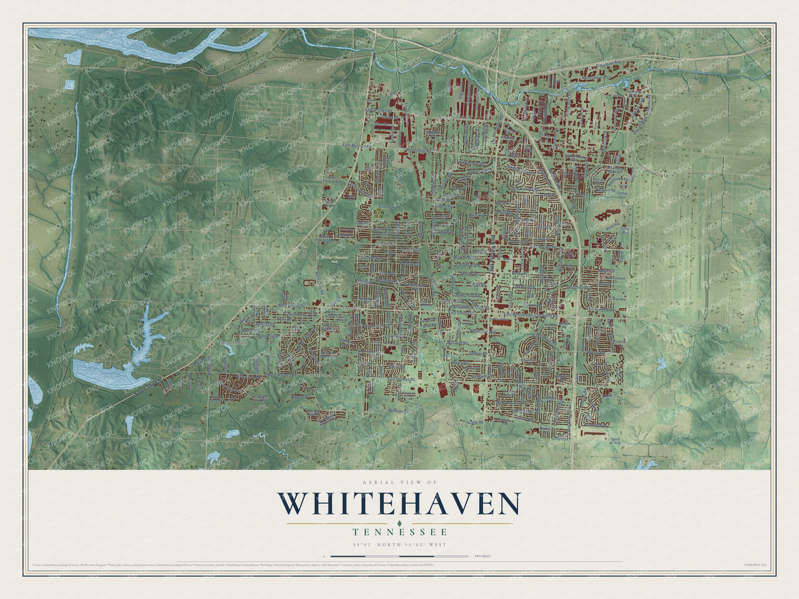
Explore Whitehaven, Tennessee from a whole new perspective. Created using aerial imagery and detailed geographic data, this map captures Whitehaven building by building, with labeled streets, familiar landmarks, and shaded topographical relief that highlights the natural contours of the landscape.
Combining modern data with the timeless character of a vintage atlas, this map is just as interesting up close as it is beautiful on the wall. Whether you grew up in Whitehaven, spent memorable years there, or call it home today, this unique map is a great way to celebrate a place that means something to you. Zoom in on the preview to look for your street, and then order a print to put your memories on the wall.
Three ways to hang it
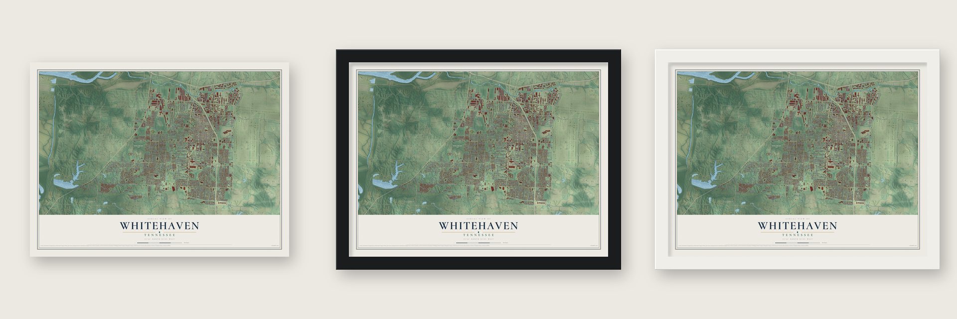
Unframed archival matte, a black wood frame or a white wood frame.
Up close
Geography Worth Displaying
This map was created using accurate cartographic data and authoritative geographic sources, including the U.S. Geological Survey and the Census Bureau. The map brings together terrain, waterways, roads, and building detail. The majority of the streets are labeled, houses are accurately depicted, and the topography is derived from government sources. Combining local data with carefully composed color and shading leads to this beautifully detailed Whitehaven artwork for your wall.
Rather than simply showing street outlines, we’ve included as many of the street names as we could reasonably fit on the map while keeping their names legible. Zoom in on the high resolution preview to see exactly what’s on the map. We truly set out to create a statement piece for anyone who loves Whitehaven. So whether it’s for you, or a gift for someone you love, we hope this map of Whitehaven brings back fond memories.
Read the story behind this map: Detailed Map of Whitehaven, Tennessee.

Find your street
Names on the Whitehaven map
Every name below is printed on this map. Look for your street, your school, the park where you played, or the pond down the road.
Places and landmarks9
- New Park Cemetery
- Walter Chandler Park
- Barnesville
- Nonconnah
- Scaife
- Goodman
- Acklena
- Raines
- Persey
Streets and roads310
- South Third Street
- Elvis Presley Boulevard
- East Shelby Drive
- Airways Boulevard
- Weaver Road
- East Mitchell Road
- East Raines Road
- Winchester Road
- Horn Lake Road
- West Shelby Drive
- Santa Monica Street
- Millbranch Road
- East Brooks Road
- East Holmes Road
- Neely Road
- Tulane Road
- East Whitehaven Capleville Road
- Nonconnah Boulevard
- Lakeview Road
- West Holmes Road
- Boeingshire Drive
- Kent Road
- McCorkle Road
- Auburn Road
- Mickey Drive
- Gill Road
- Hillbrook Street
- Hodge Road
- Corporate Avenue
- Graceland Drive
Show all 310 streets
- Finley Road
- Hester Road
- Wilson Road
- Paula Drive
- Honduras Road
- Windsor Road
- Haleville Road
- Janis Drive
- Hudgins Road
- Berta Road
- Old Hickory Road
- Plough Boulevard
- Lochinvar Road
- Hermitage Drive
- Winfield Road
- Whitehaven Lane
- Oakwood Drive
- Cazassa Road
- Graves Road
- Hewlett Road
- Craft Road
- Whitworth Road
- Delta Road
- Parkdale Drive
- Appleville Street
- Richland Drive
- Jonetta Street
- Loraine Road
- Ford Road
- Faronia Road
- Timothy Drive
- Goodhaven Drive
- Byron Drive
- Kilarney Avenue
- Victoria Road
- Eighth Road
- David Drive
- Windward Drive
- Bonnie Drive
- Brownlee Road
- Mart Road
- George Road
- Charter Avenue
- Shofner Avenue
- Jeanne Drive
- Alice Drive
- Carrier Street
- Nellie Road
- Clower Road
- Bonita Drive
- Hancock Drive
- Applestone Street
- Hale Road
- Farrow Road
- Childs Drive
- Fairley Road
- Twelfth Road
- Pickett Road
- Singing Trees Drive
- East Levi Road
- Windcrest Road
- Aldridge Drive
- Southland Street
- Ivan Road
- Fontaine Road
- Stacey Road
- Carol Drive
- Tully Road
- Mill Branch Road
- Gemstone Way
- Hornsby Drive
- Orleans Road
- Lehr Drive
- Bluebird Road
- Linwood Road
- Gemini Drive
- McClure Road
- Winbrook Drive
- Eason Avenue
- Palmer Road
- Twinkletown Road
- East Fairway Avenue
- Directors Row
- Butterworth Road
- Mary Lee Drive
- Fleetbrook Drive
- Whiteville Avenue
- Jordan Drive
- Chambliss Road
- Blanchard Road
- Mosby Road
- East Rosita Circle
- Cresser Street
- Dolan Drive
- Saint James Drive
- Old Hernando Road
- Nicolet Drive
- Gilbert Road
- Santa Barbara Street
- Lucibill Road
- Dogwood Lane
- Barton Drive
- Norbrook Drive
- Birthstone Avenue
- Michael Road
- Cheryl Drive
- White Fox Street
- Fairfield Road
- Ravenden Road
- Dolan Road
- Josibpet Lane
- Eastwind Drive
- Sidney Road
- Tranquility Drive
- Shirley Drive
- Saturn Drive
- Whitaker Drive
- Datsun Drive
- Sandbrook Street
- Convair Road
- Burwood Drive
- Titan Drive
- Winbranch Drive
- Scaife Road
- Haledale Road
- Joyce Lane
- One Place
- Waldrup Street
- Tulip Road
- Tranquil Lane
- Ortie Drive
- Louise Road
- Enfield Road
- Hartz Drive
- Lexie Drive
- Farris Road
- Lunar Drive
- Holly Circle
- Pace Street
- Jeff Drive
- Frankie Lane
- Norma Road
- Leonard Road
- Sullivan Drive
- Dreger Road
- Mary Jane Avenue
- Grovehaven Drive
- Marlin Road
- Dianne Drive
- Jamie Drive
- Laudeen Drive
- Stoneham Road
- Crossfield Road
- Kingsgate Drive
- Manson Road
- Democrat Road
- Fedex Boulevard
- Lydgate Road
- Colfax Avenue
- Percy Road
- Whitesboro Avenue
- Mill Stream Drive
- Dellrose Drive
- Bender Road
- Southaven Road
- Prado Avenue
- Ravensworth Drive
- Farmwood Drive
- Hazelhedge Drive
- Spiegel Drive
- Emerald View Way
- North Big Bend Drive
- Hickory Ridge Drive
- West Fairway Avenue
- Buxton Road
- Heritage Lake Drive
- East Winchester Place
- West Raines Road
- Appleton Avenue
- September Avenue
- Ryanwood Avenue
- Cane Ridge Drive
- Rockdale Avenue
- Davis Cv
- Sussex Avenue
- Bradcliff Street
- Gateway Drive
- Brakebill Avenue
- West Grand Heights Drive
- Eugene Road
- Coughlin Drive
- Cecil Drive
- Glenarm Avenue
- Duelling Oaks
- Crimson Road
- Ruby Creek Place
- Tammy Lane
- West Falls Road
- West Van Huesen Drive
- Longate Drive
- West Byfield Drive
- Carey Drive
- Villa del Rey Drive
- Two Place
- Spirit of 76 Drive
- Mona Drive
- West Levi Road
- Faronia Drive
- Tacoma Avenue
- Durant Street
- Dorff Drive
- Ben Bow Drive
- Oxford Park Drive
- Haas Avenue
- Baskel Drive
- Bruins Drive
- Chism Road
- Hillridge Street
- Howard Drive
- Craigwood Drive
- Whitman Road
- Marty Street
- Vickie Drive
- Brushwood Drive
- Southland Mall
- Dubois Drive
- Wesley Drive
- Airview Road
- Ernie Drive
- Scottie Drive
- Crossroads Drive
- Summer Shade Lane
- Granada Road
- Goodwill Road
- Days Creek Boulevard
- Nandina Street
- Dycus Street
- Whistling Duck Drive
- Huntley Drive
- Eleventh Road
- Quail Ridge Lane
- Santa Clara Avenue
- Kirkwood Road
- Shell Lane Avenue
- Fifth Street
- Ruth Drive
- Schutt Road
- Devon Drive
- East Dugan Circle
- McKellar Woods Drive
- Acacia Street
- West Rosita Circle
- Berwind Road
- Wisteria Drive
- South Center Road
- Southhill Avenue
- Commercial Parkway
- Rosebanks Road
- Shayne Lane
- Brockwood Avenue
- Summerwood Drive
- Piping Rock Drive
- West Gloria Road
- East Geeter Road
- Lydgate Avenue
- Haverwood Avenue
- Lawndale Drive
- Bellbrook Drive
- Peggy Jo Drive
- Fourth Street
- Sapphire Avenue
- Directors Cv
- Cedar Way Court
- Venture Drive
- Eastman Road
- Babs Road
- Leigh Drive
- Starnes Cv
- Borden Drive
- Extension
Names are listed as they appear on the printed map. Zoom into the product photos to find them.
About Whitehaven, Tennessee
Elvis Presley bought his famous home in Whitehaven in 1957. He lived there for two decades and was a well-liked neighbor. Graceland mansion and the yearly Elvis Week still draw many thousands of visitors.
Whitehaven is named for Colonel Francis Marion White, an early settler who ran a railroad. He helped bring a rail line to the spot first called White's Station. He held more than 200 people in slavery. Trains began running in 1856.
- Home of Graceland (more)Southland Mall opened in Whitehaven in 1966. It was the first enclosed mall in Memphis and helped the community prosper.
Keep exploring Tennessee
Whitehaven is one of 640 Tennessee towns we've mapped. Every dot on the map is a print of its own.
The search covers every state, Tennessee first.
Near Whitehaven
Order 2 or more town maps and save 10%. Shown in the size and finish you picked above, so they hang as a set.
- South Memphis 12" x 18" / Archival Matte Print $39.99
- Cooper-Young 12" x 18" / Archival Matte Print $39.99
- Memphis 12" x 18" / Archival Matte Print $39.99


More maps nearby: Orange Mound, Midtown, Downtown Memphis, Parkway Village and East Memphis.
The art of mapping a place
How This Map Was Made
Real places. Remarkable detail. Discover the layers that turn geographic data into a map of home.

The view from above
Aerial imagery reveals the character of the land: woodland, open fields, and the patterns of a place.

The shape of the land
Elevation data brings hills, valleys, and subtle changes in the landscape into view.

The details of home
Roads, waterways, and building footprints come together to make the map feel unmistakably local.

Geography becomes art
Considered color, shading, and typography bring the layers together in a map made for your wall.


Process illustrated with Mendon, Massachusetts. Aerial imagery: USDA NAIP. Terrain: USGS 3D Elevation Program. Map details and finished artwork: KNOWOL.
The Details
About This Print
Choose an archival matte print, or a black or white Ayous wood frame. The archival matte print is unframed.
Select your size and finish above to see the matching product image and price.
Materials & Craftsmanship
A contemporary map with the character of a classic atlas, printed on archival matte paper. Optional frames are made from Ayous wood.
Your printed map does not include the watermark shown in the full-map preview.
Shipping & Delivery
Free shipping within the United States. Every print is made to order in the USA.
Buying a gift? Add a note in your cart and we'll include it. We never put prices in the package.
Prints ship within 2 to 3 business days. Allow 7 to 10 days total from ordering for delivery. Timing may vary during holidays or periods of high order volume.
Read our shipping policy.
Returns and damaged prints
Each print is made to order. Change-of-mind refunds are not available after production.
If your print arrives damaged, misprinted or incorrect, contact support@knowol.com within 30 days of receiving it. Include your order number, photos and a description of the issue.
Read our full refund and replacement policy. For questions about your order, email support@knowol.com.