
Search for another town




Free U.S. delivery 7 to 10 days after you order
Wilton, New York Map Art
Building by building, with labeled streets and shaded relief.
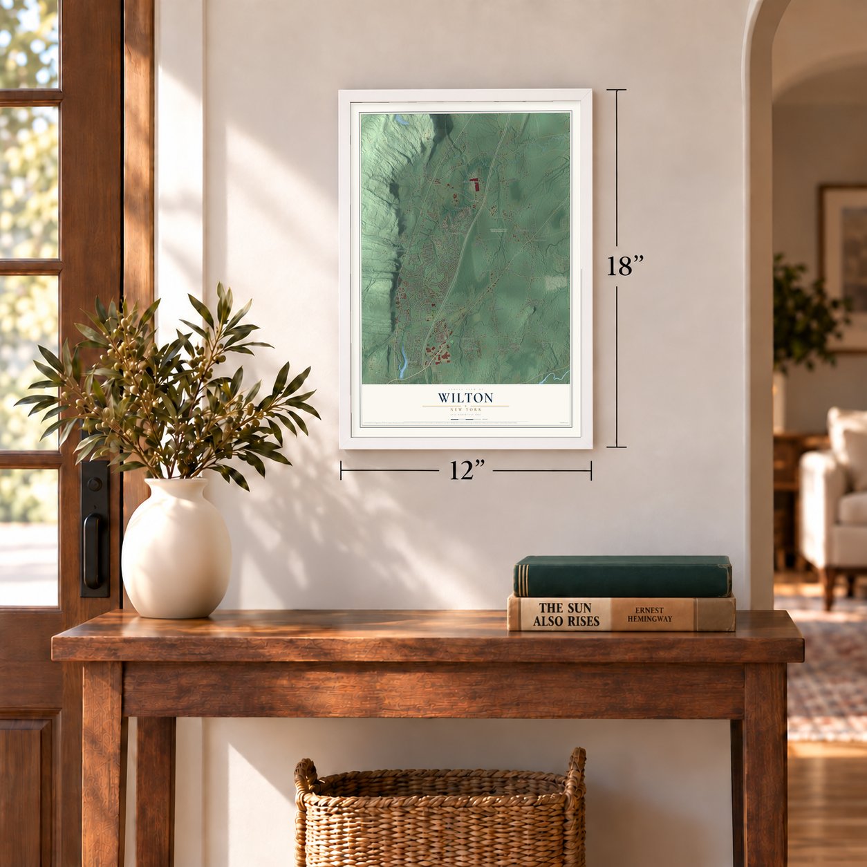
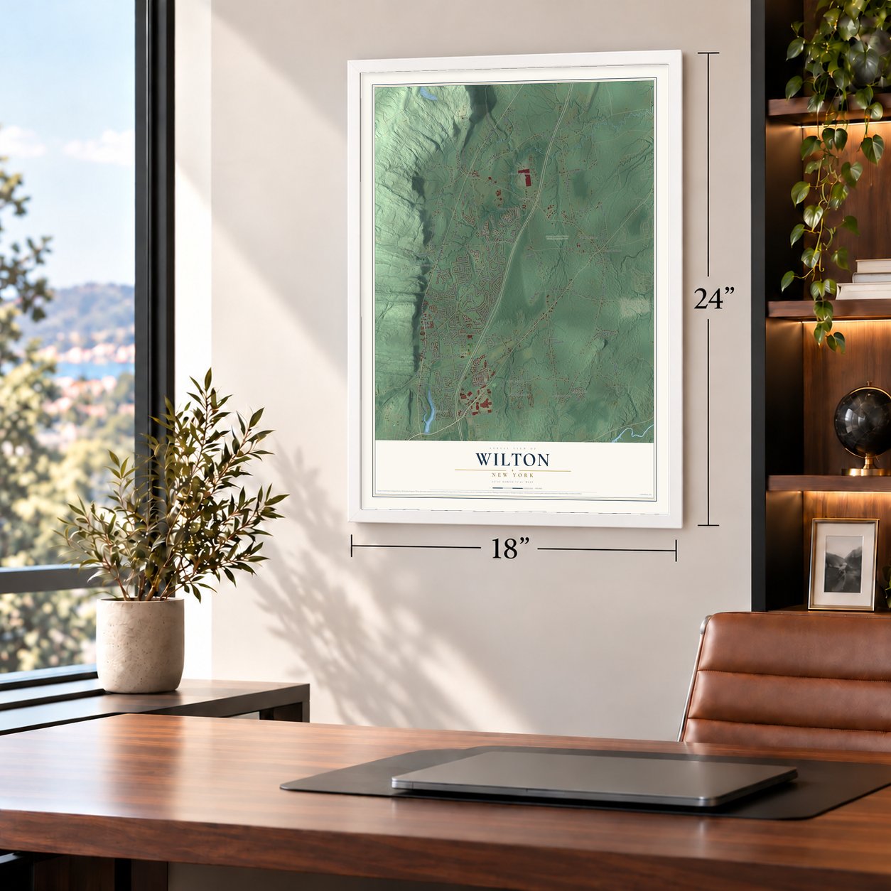
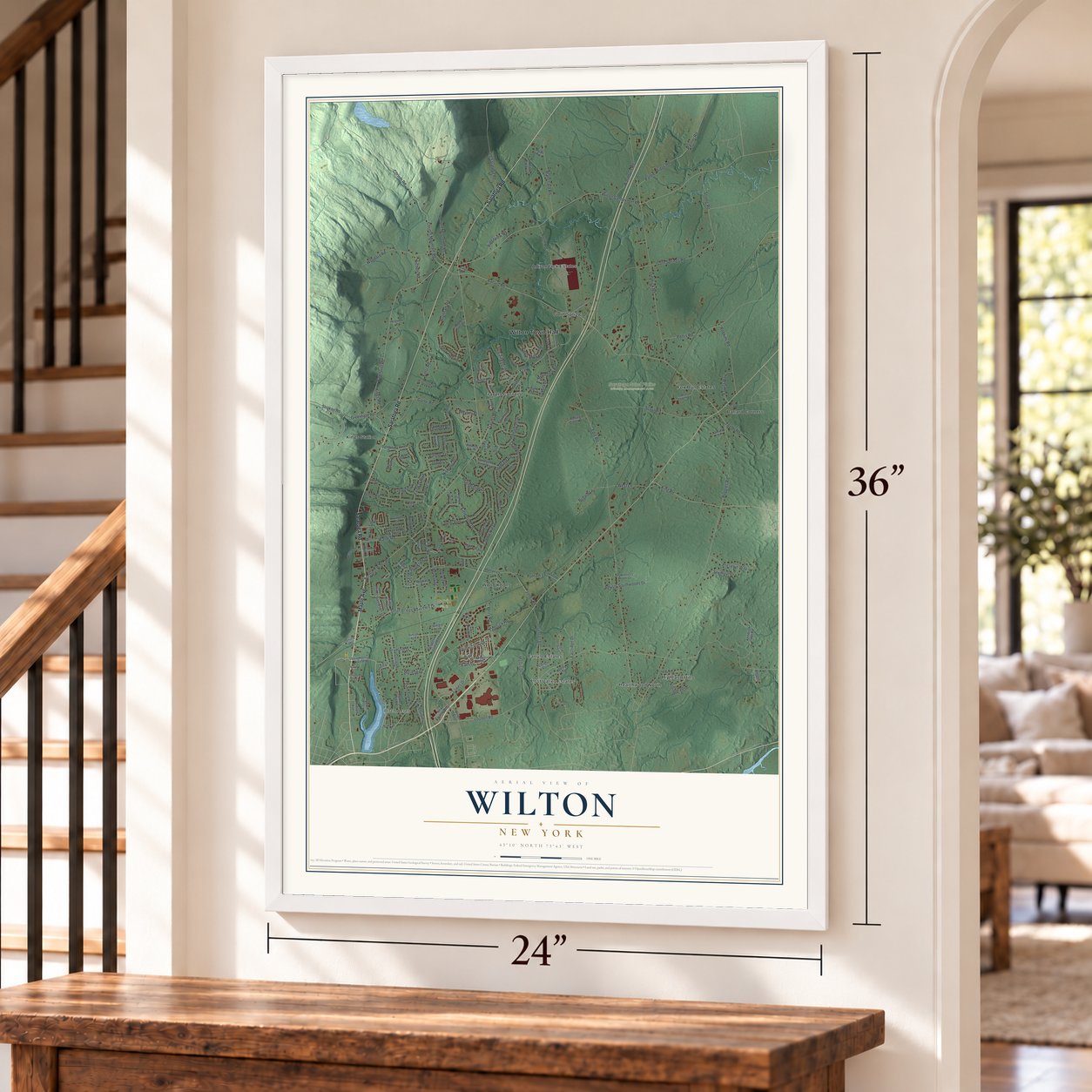
12" x 18" Archival Matte Print
A Map of Home. A Work of Art.
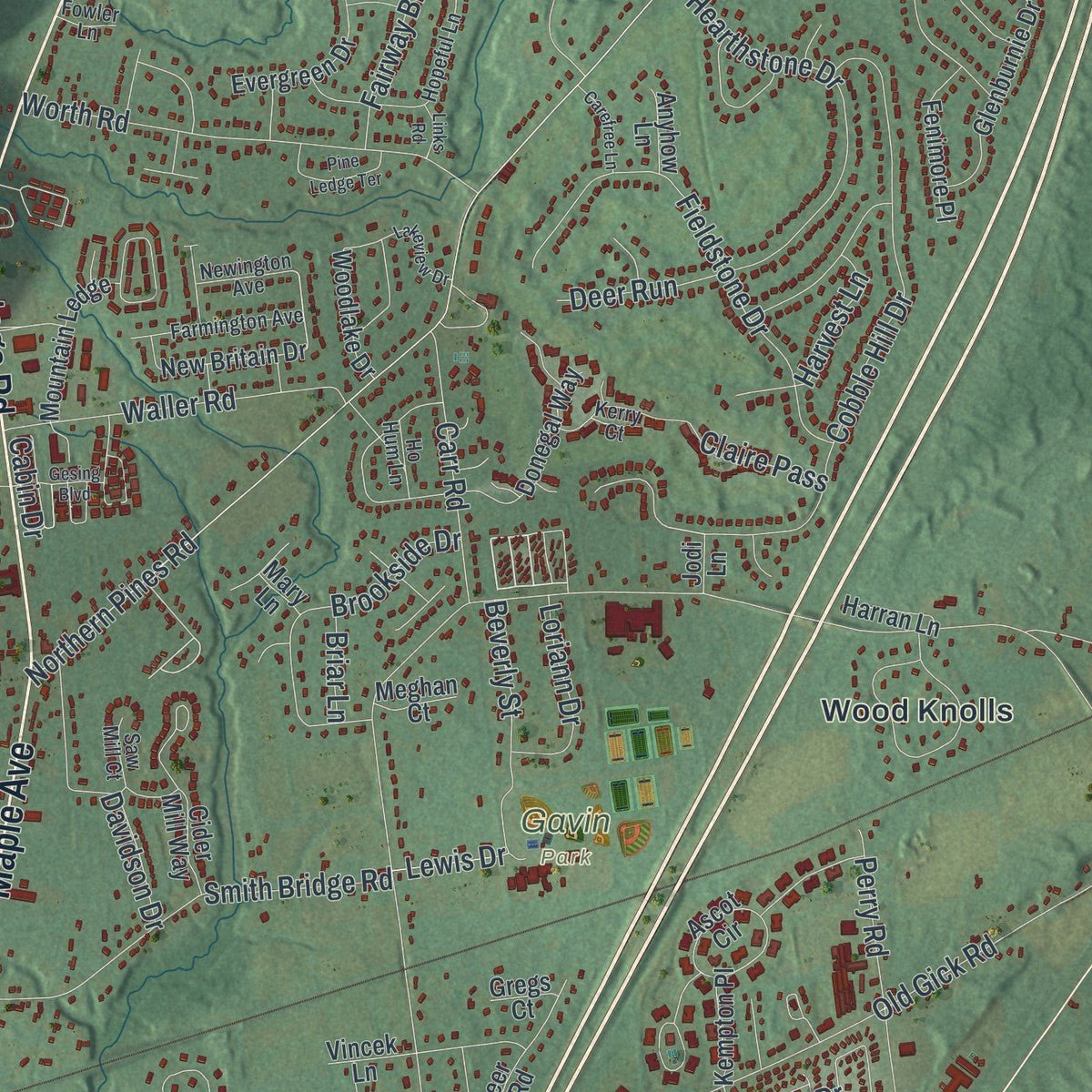
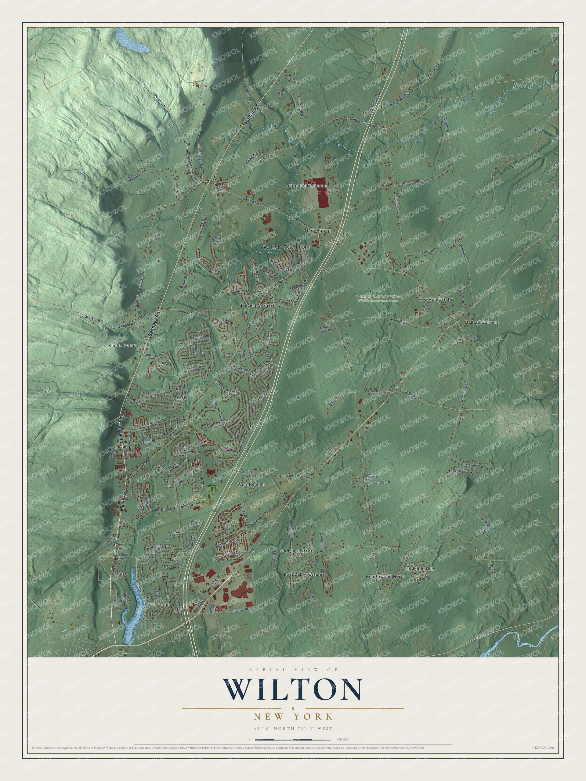
Explore Wilton, New York from a whole new perspective. Created using aerial imagery and detailed geographic data, this map captures Wilton building by building, with labeled streets, familiar landmarks, and shaded topographical relief that highlights the natural contours of the landscape.
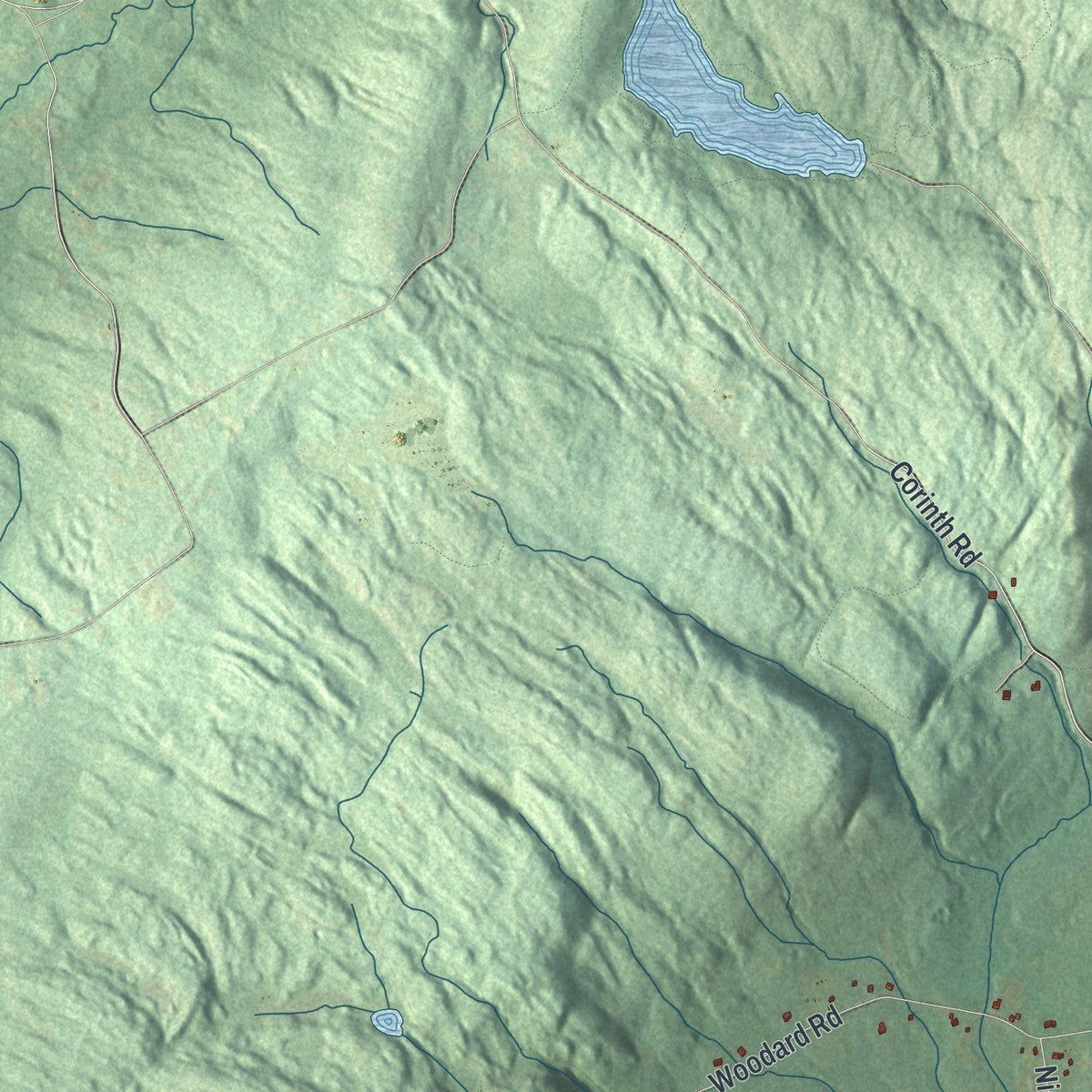
Combining modern data with the timeless character of a vintage atlas, this map is just as interesting up close as it is beautiful on the wall. Whether you grew up in Wilton, spent memorable years there, or call it home today, this unique map is a great way to celebrate a place that means something to you. Zoom in on the preview to look for your street, and then order a print to put your memories on the wall.
Three ways to hang it
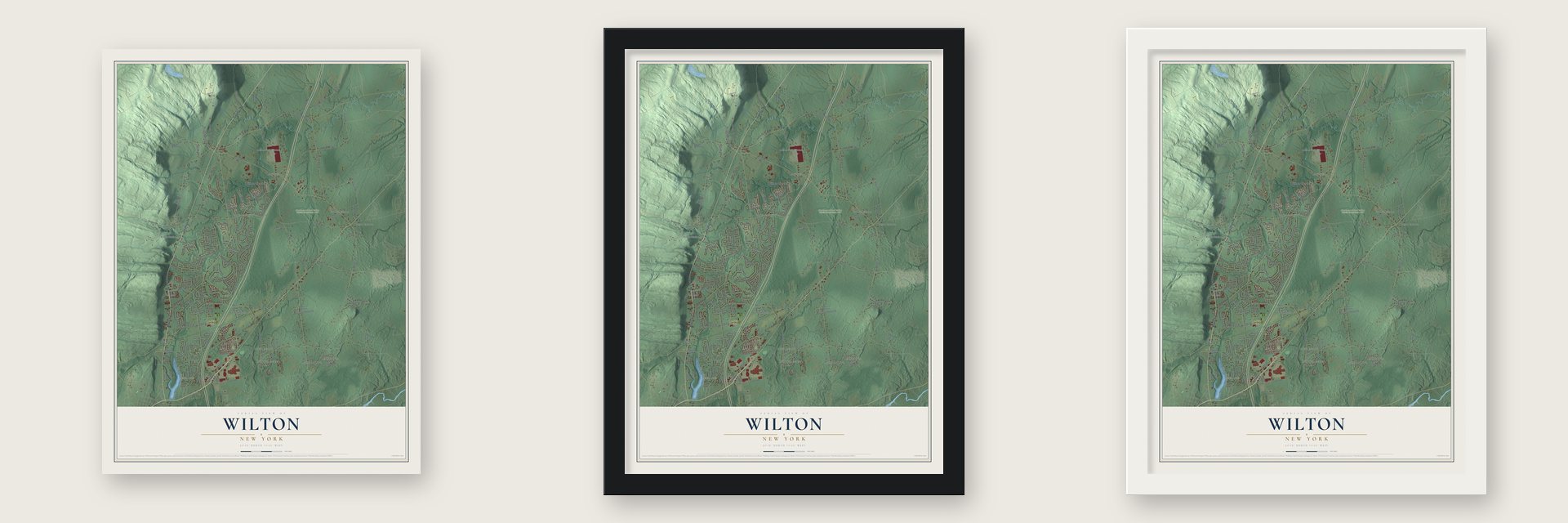
Unframed archival matte, a black wood frame or a white wood frame.
Up close
Geography Worth Displaying
This map was created using accurate cartographic data and authoritative geographic sources, including the U.S. Geological Survey (USGS) and FEMA. The map brings together terrain, waterways, roads, and building detail. The majority of the streets are labeled, houses are accurately depicted, and the topography is derived from government sources. Combining local data with carefully composed color and shading leads to this beautifully detailed Wilton artwork for your wall.
Rather than simply showing street outlines, we’ve included as many of the street names as we could reasonably fit on the map while keeping their names legible. Zoom in on the high resolution preview to see exactly what’s on the map. We truly set out to create a statement piece for anyone who loves Wilton. So whether it’s for you, or a gift for someone you love, we hope this map of Wilton brings back fond memories.
Explore the full map of Wilton, New York and read about the local places it shows.

Find your street
Names on the Wilton map
Every name below is printed on this map. Look for your street, your school, the park where you played, or the pond down the road.
Places and landmarks15
- Wilton Town Hall
- Birch Acres
- Gavin Park
- Saratoga Sand Plains Wildlife Management Area
- Adirondack Estates
- Ballard Corners
- Carlyle Estates
- Fox Run Estates
- Gurn Spring
- Hearthwood North
- Highland Hills
- Kings Station
Show all 15 places
- Lost Valley Estates
- Travers Corners
- Wood Knolls
Streets and roads181
- Saratoga Road
- Maple Avenue
- Parkhurst Road
- Lowes Drive
- Travers Road
- Mount McGregor Road
- Greenfield Road
- Louden Road
- Northern Pines Road
- Edie Road
- Ballard Road
- Jones Road
- Ruggles Road
- Wilton Gansevoort Road
- Gurn Springs Road
- Gailor Road
- Ernst Road
- Old Gick Road
- Dimmick Road
- Scout Road
- Corinth Mountain Road
- Traver Road
- Cobble Hill Drive
- King Road
- North Road
- Ingersoll Road
- Palmer Ridge Road
- Palmer Road
- Damascus Drive
- Woodard Road
Show all 181 streets
- Corinth Road
- Fieldstone Drive
- Washburn Road
- Blanchard Road
- Worth Road
- Hearthstone Drive
- Smith Bridge Road
- Pettis Road
- Nicklaus Drive
- Perry Road
- Sheffield Road
- Brookside Drive
- Old Saratoga Road
- Fairway Boulevard
- Waller Road
- Southwoods Drive
- Palm Drive
- Davidson Drive
- Preserve Way
- Moonglow Road
- Robbins Road
- Burnham Road
- Claire Pass
- Timbira Drive
- Seymour Drive
- Palmer Terrace
- Old Hickory Drive
- Morris Drive
- Beverly Street
- Carr Road
- Bradford Drive
- Tom Sawyer Drive
- West Lane
- Forest Way
- Strong Road
- Bullard Lane
- Strakos Road
- Putnam Lane
- Nottingham Drive
- Taylor Road
- Cabin Drive
- Cherry Tree Lane
- Loriann Drive
- Ridgeview Road
- Nichols Road
- Kings Mills Road
- Foxhound Run
- Kings Road
- Eastridge Drive
- Deer Run
- Harvest Lane
- Dakota Drive
- Thunder Run
- Craw Lane
- Melanie Drive
- Waverly Place
- Plum Court
- Lewis Drive
- Briar Lane
- Loughberry Lake Road
- Rolling Hills Drive
- Kendrick Hill Road
- Kempton Place
- Glenburnie Drive
- Oxford Drive
- Fairmount Drive
- Challedon Drive
- Carlyle Terrace
- Cider Mill Way
- Rose Trce
- Dandelion Drive
- Apple Tree Lane
- Donegal Way
- Amy Lane
- Christina Court
- Lonesome Pine Trail
- Santee Drive
- Hillside Avenue
- Evergreen Drive
- New Britain Drive
- Old Deer Camp Road
- Woodlake Drive
- Mountain Ledge
- Fenimore Place
- Rolling Green Drive
- New Country Way
- Joseph Lane
- Sydney Hill Road
- White Birch Lane
- Ascot Circle
- Hilltop Drive
- Tawny Terrace
- Weibel Avenue
- Donna Drive
- Hudson Avenue
- Harran Lane
- Arnolds Lane
- Sepia Lane
- Howe Street
- Vincek Lane
- Anyhow Lane
- Meghan Court
- Daniels Road
- Gregs Court
- Ryan Road
- Dusty Trail
- Lenca Court
- Jodi Lane
- East Lane
- Mary Lane
- Wellington Drive
- Hopeful Lane
- Greylock Drive
- Hillcrest Lane
- Wilton Woods Court
- Highgate Road
- Farmington Avenue
- Suffolk Lane
- Maple Lane
- Conklin Court
- Blue Lupine Lane
- Brackett Drive
- Saw Mill Court
- Carpenter Lane
- Kyer Farm Road
- Newington Avenue
- Thistle Road
- Canfield Court
- Tamiami Trail
- Ho Hum Lane
- Hosford Lane
- Fowler Lane
- Kelso Boulevard
- Kerry Court
- Sarro Lane
- Castleberry Drive
- Lakeview Drive
- Whispering Pines Road
- Sunshine Drive
- Pine Ledge Terrace
- Gordan Lane
- Maya Drive
- Carefree Lane
- Hammond Drive
- Gesing Boulevard
- Duncan Road
- Birchwood Drive
- Traver Lane
- Daffodil Drive
- Links Road
- Laurie Lane
Names are listed as they appear on the printed map. Zoom into the product photos to find them.
About Wilton, New York
Wilton is a town in Saratoga County, situated northeast of and bordering Saratoga Springs. Its population was 17,361 in the 2020 census. The town includes communities such as Ballard Corners, Gurn Spring, and Birch Acres, along with Gavin Park and the Saratoga Sand Plains Wildlife Management Area.
- From Palmertown to WiltonThe area was once known as Palmertown; Europeans settled there around 1764, and Wilton was created from Northumberland in 1818.
- Grant's Final ChapterAt this historic site, President Ulysses S. Grant succumbed to throat cancer in 1885, soon after he finished writing his memoirs.
- Land and WaterWilton covers 36.0 square miles, including 35.9 square miles of land and 0.1 square miles of water.
- Rail Through TownThe narrow-gauge Saratoga, Mount McGregor and Lake George Railroad was built in 1882 and passed through Wilton.
Keep exploring New York
Wilton is one of 2,165 New York towns we've mapped. Every dot on the map is a print of its own.
The search covers every state, New York first.
Near Wilton
Order 2 or more town maps and save 10%. Shown in the size and finish you picked above, so they hang as a set.
- Northumberland 12" x 18" / Archival Matte Print $39.99
- Saratoga Springs 12" x 18" / Archival Matte Print $39.99
- Moreau 12" x 18" / Archival Matte Print $39.99


More maps nearby: Greenfield, Saratoga, Schuylerville, Town of Fort Edward and West Glens Falls.
The art of mapping a place
How This Map Was Made
Real places. Remarkable detail. Discover the layers that turn geographic data into a map of home.

The view from above
Aerial imagery reveals the character of the land: woodland, open fields, and the patterns of a place.

The shape of the land
Elevation data brings hills, valleys, and subtle changes in the landscape into view.

The details of home
Roads, waterways, and building footprints come together to make the map feel unmistakably local.

Geography becomes art
Considered color, shading, and typography bring the layers together in a map made for your wall.


Process illustrated with Mendon, Massachusetts. Aerial imagery: USDA NAIP. Terrain: USGS 3D Elevation Program. Map details and finished artwork: KNOWOL.
The Details
About This Print
Choose an archival matte print, or a black or white Ayous wood frame. The archival matte print is unframed.
Select your size and finish above to see the matching product image and price.
Materials & Craftsmanship
A contemporary map with the character of a classic atlas, printed on archival matte paper. Optional frames are made from Ayous wood.
Your printed map does not include the watermark shown in the full-map preview.
Shipping & Delivery
Free shipping within the United States. Every print is made to order in the USA.
Buying a gift? Add a note in your cart and we'll include it. We never put prices in the package.
Prints ship within 2 to 3 business days. Allow 7 to 10 days total from ordering for delivery. Timing may vary during holidays or periods of high order volume.
Read our shipping policy.
Returns and damaged prints
Each print is made to order. Change-of-mind refunds are not available after production.
If your print arrives damaged, misprinted or incorrect, contact support@knowol.com within 30 days of receiving it. Include your order number, photos and a description of the issue.
Read our full refund and replacement policy. For questions about your order, email support@knowol.com.