
Search for another town


Free U.S. delivery 7 to 10 days after you order
Wyckoff, New Jersey Map Art
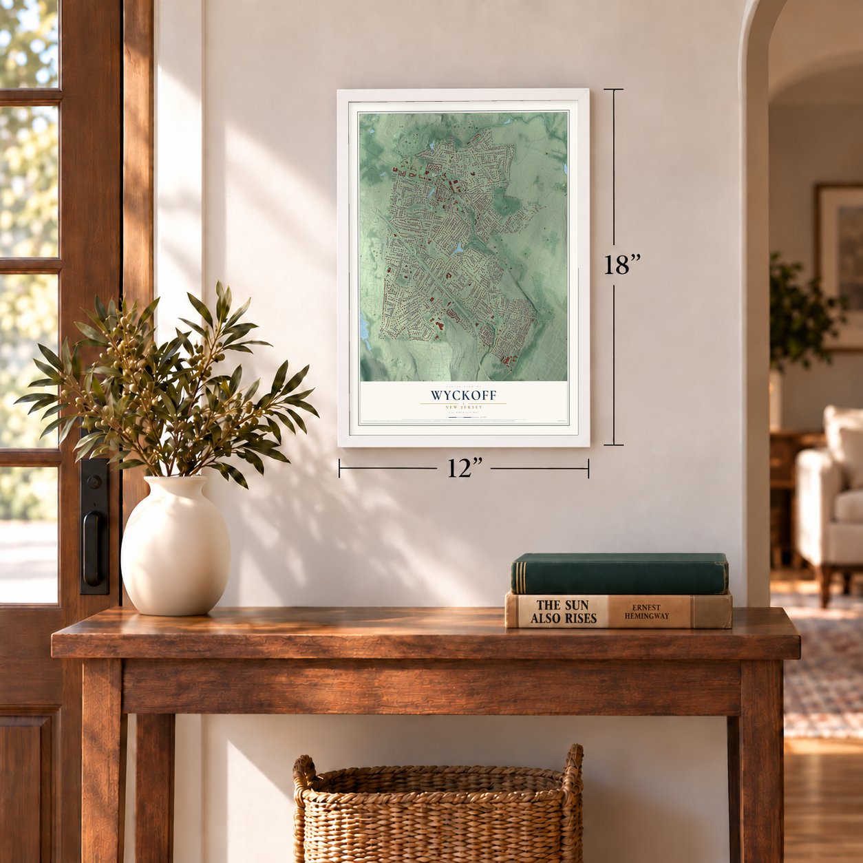
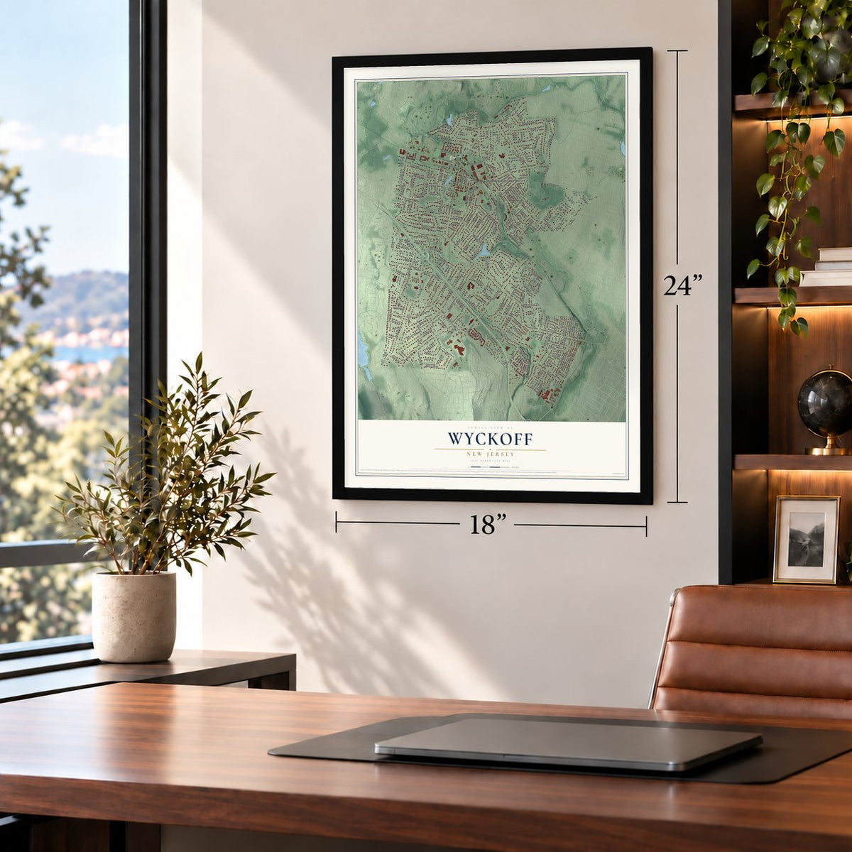
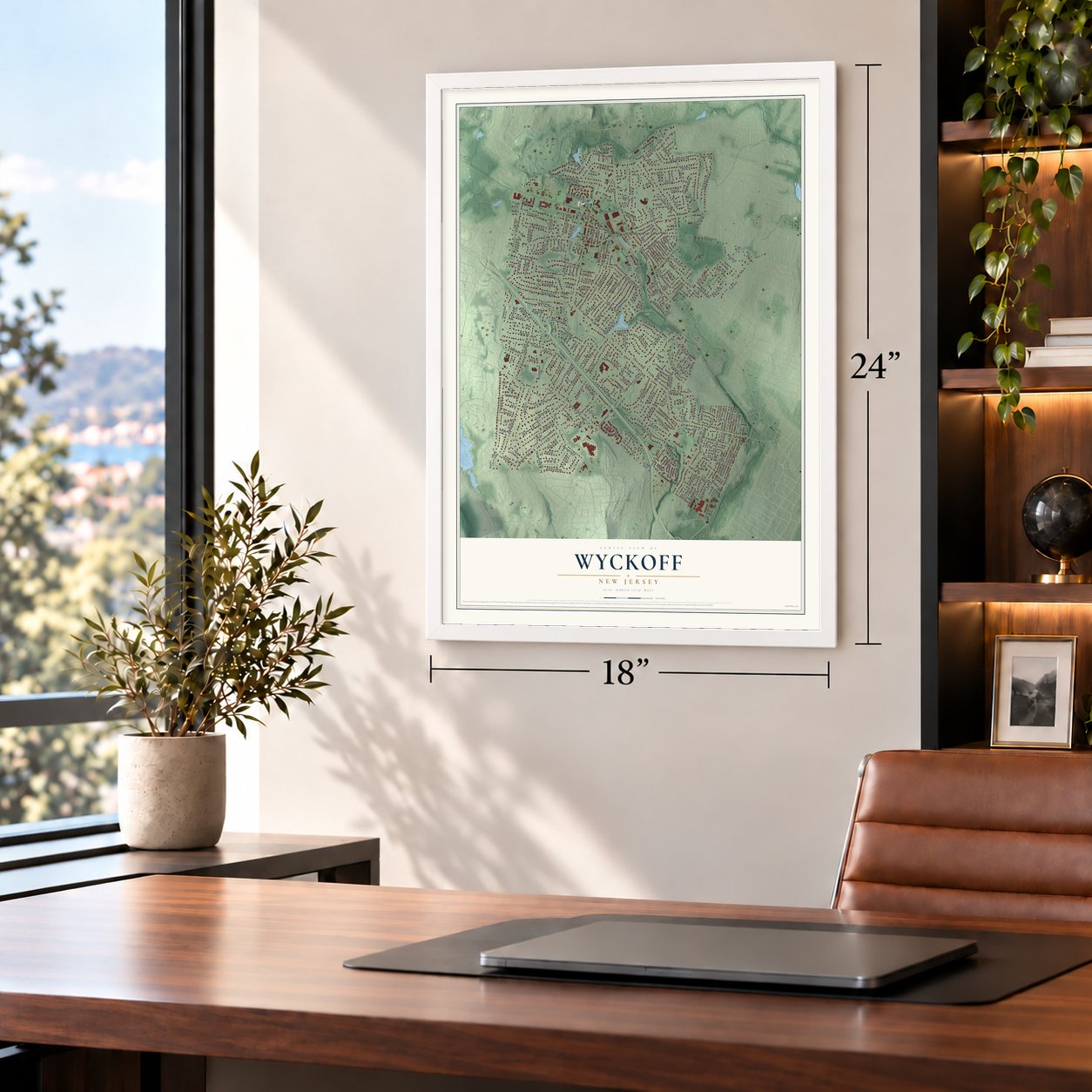
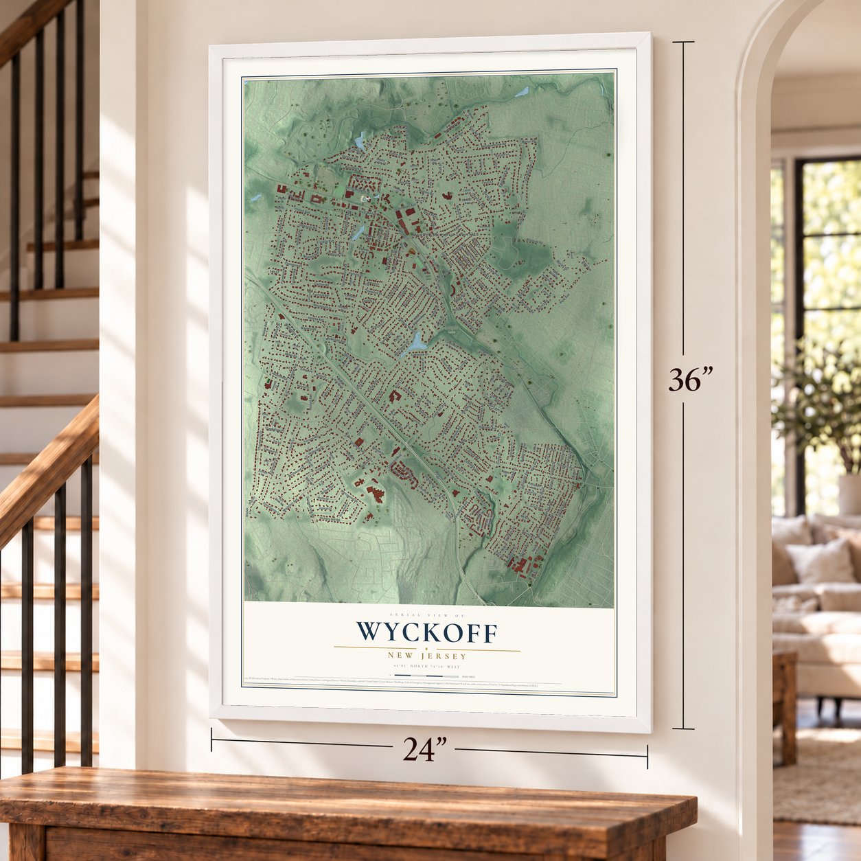
A new map of Wyckoff, New Jersey, made in 2026 and printed to order on thick archival matte paper.
12" x 18" Archival Matte Print
A Map of Home. A Work of Art.
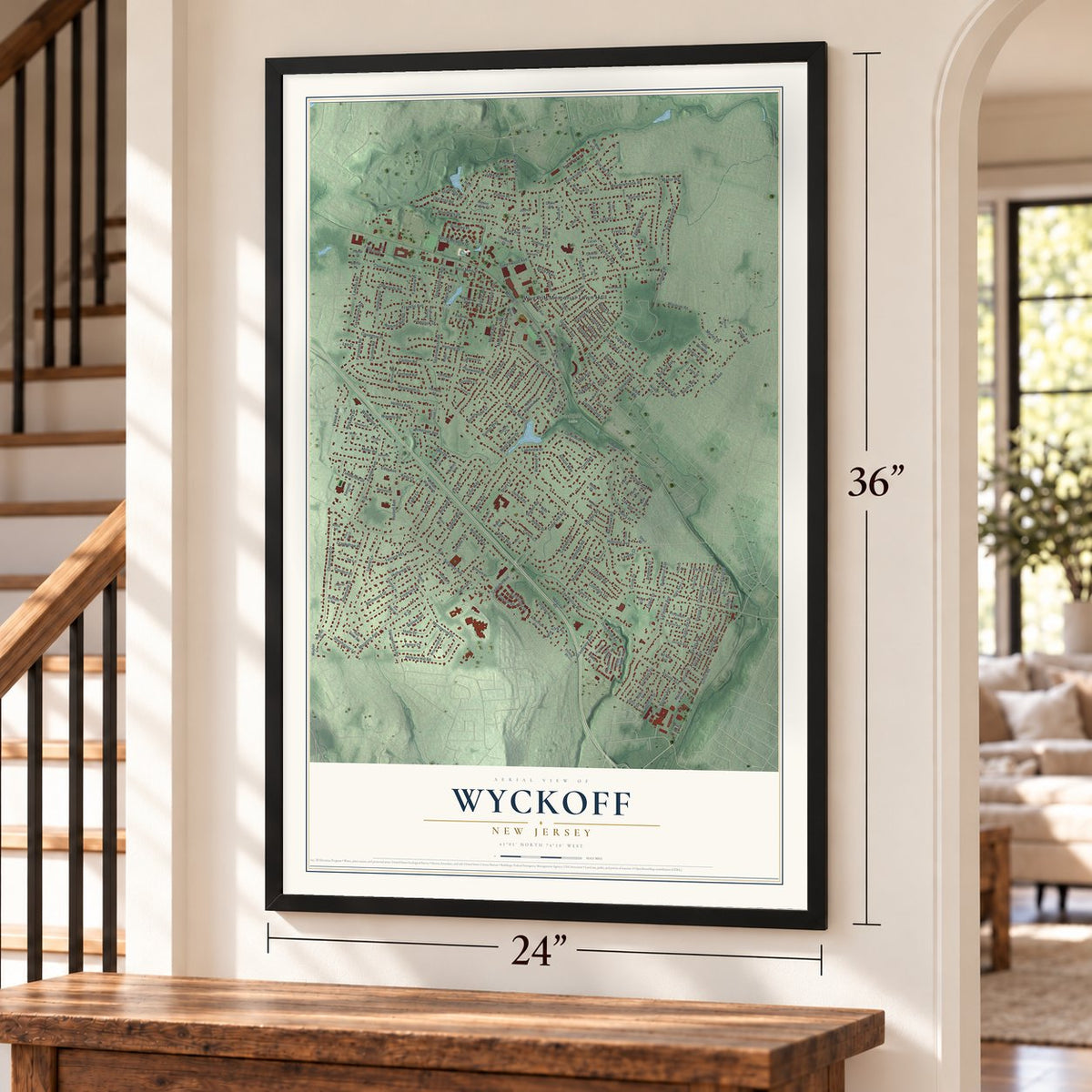
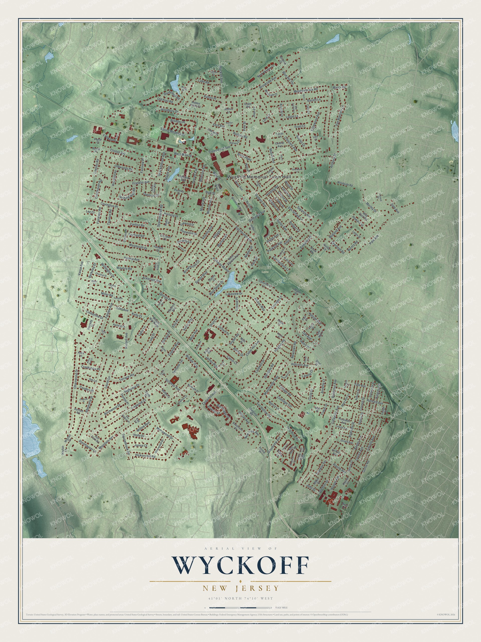
Explore Wyckoff, New Jersey from a whole new perspective. Created using aerial imagery and detailed geographic data, this map captures Wyckoff building by building, with labeled streets, familiar landmarks, and shaded topographical relief that highlights the natural contours of the landscape.
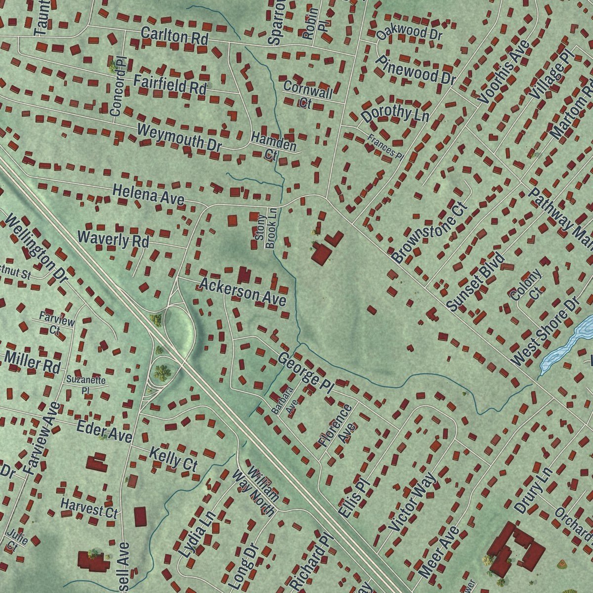
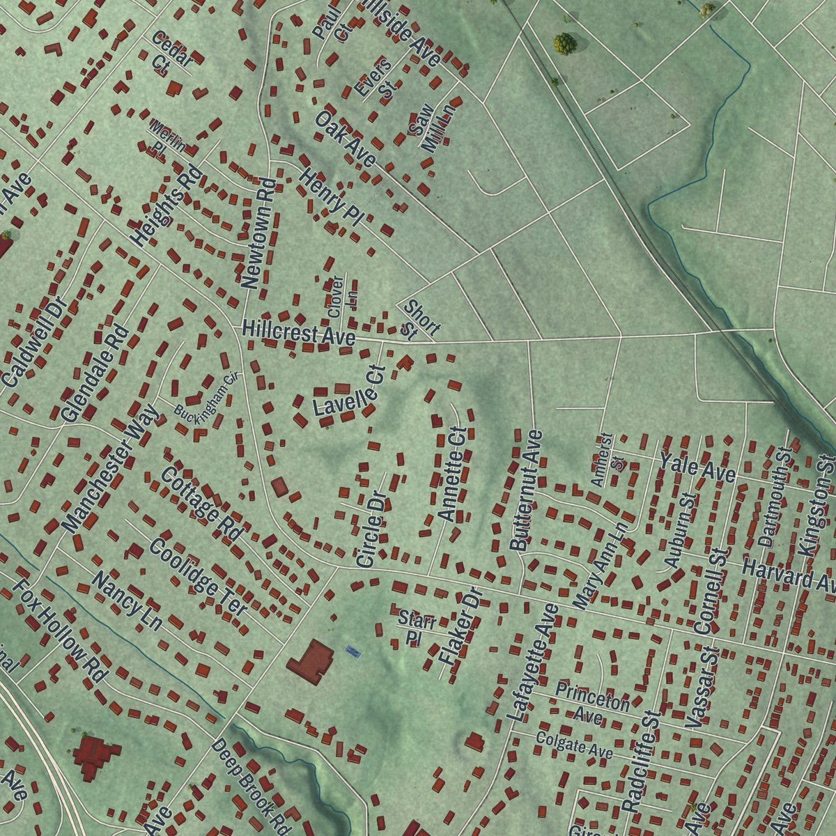
Combining modern data with the timeless character of a vintage atlas, this map is just as interesting up close as it is beautiful on the wall. Whether you grew up in Wyckoff, spent memorable years there, or call it home today, this unique map is a great way to celebrate a place that means something to you. Zoom in on the preview to look for your street, and then order a print to put your memories on the wall.
Three ways to hang it
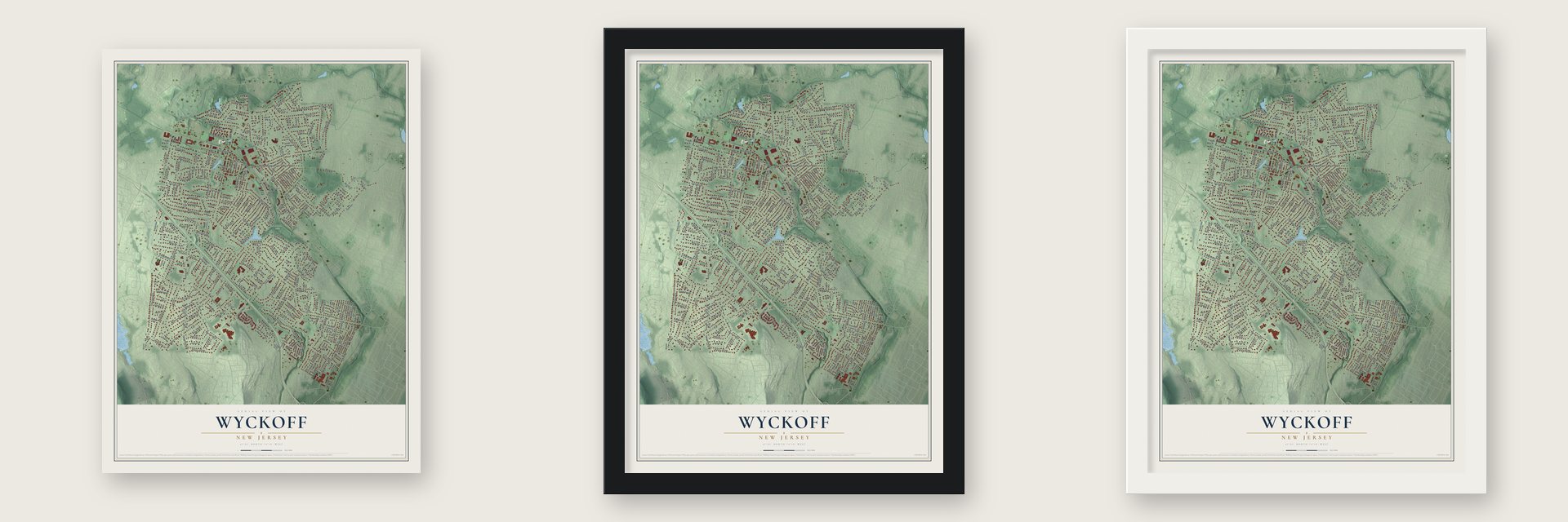
Unframed archival matte, a black wood frame or a white wood frame.
Up close
Geography Worth Displaying
This map was created using accurate cartographic data and authoritative geographic sources, including the U.S. Geological Survey (USGS) and FEMA. The map brings together terrain, waterways, roads, and building detail. The majority of the streets are labeled, houses are accurately depicted, and the topography is derived from government sources. Combining local data with carefully composed color and shading leads to this beautifully detailed Wyckoff artwork for your wall.
Rather than simply showing street outlines, we’ve included as many of the street names as we could reasonably fit on the map while keeping their names legible. Zoom in on the high resolution preview to see exactly what’s on the map. We truly set out to create a statement piece for anyone who loves Wyckoff. So whether it’s for you, or a gift for someone you love, we hope this map of Wyckoff brings back fond memories.
Explore the full map of Wyckoff, New Jersey and read about the local places it shows.

About Wyckoff, New Jersey
Wyckoff is a Bergen County township with Dutch settlement roots and a long farming tradition. It carried the Franklin Township name until residents chose Wyckoff in 1926, after decades in which surrounding communities had separated into their own municipalities.
- Settled by 1720John and William Van Voor Haze bought 550 acres as the first recorded permanent settlers.
- Wyckoff since 1926Residents approved the new township name by 243 votes out of 337.
- Rail service in 1870The New Jersey Midland Railway began serving the township before passenger trains ended in 1966.
- 16,585 peopleCounted in the 2020 United States census.
Find your street
Names on the Wyckoff map
Every name below is printed on this map. Look for your street, your school, the park where you played, or the pond down the road.
Places and landmarks2
- Wyckoff Memorial Town Hall
- Maple Lake
Streets and roads299
- Morley Drive
- Louisa Avenue
- Hillcrest Avenue
- Sicomac Avenue
- Harvard Avenue
- Wyckoff Avenue
- Franklin Avenue
- Crescent Avenue
- Godwin Avenue
- James Way
- Cedar Hill Avenue
- Russell Avenue
- Mountain Avenue
- Clinton Avenue
- Goffle Road
- Meadowbrook Road
- William Way
- Ravine Avenue
- Charnwood Drive
- Carlton Road
- Monroe Avenue
- Merrywood Drive
- Birchwood Drive
- Weymouth Drive
- Highview Drive
- Lafayette Avenue
- Albemarle Street
- Newtown Road
- Park Avenue
- Farview Avenue
Show all 299 streets
- Voorhis Avenue
- Grandview Avenue
- Hartung Drive
- Hickory Hill Road
- Martom Road
- Old Post Road
- Helena Avenue
- Sunset Boulevard
- Van Blarcom Lane
- Frederick Court
- Midland Avenue
- Van Houten Avenue
- Hurley Avenue
- Carriage Lane
- Brookside Avenue
- Caldwell Drive
- Lawlins Road
- Woodbury Drive
- Barrett Lane
- Fox Hollow Road
- Holly Drive
- Edgewood Avenue
- West Shore Drive
- Glendale Road
- Eder Avenue
- Cottage Road
- Wellington Drive
- Meer Avenue
- Terrace Heights
- Miller Road
- Fairfield Road
- Harding Road
- Everett Avenue
- Oldwoods Road
- Ellis Place
- Patton Place
- Lincoln Avenue
- West Main Street
- Lakeview Drive
- Logan Lane
- Manchester Way
- Yale Avenue
- Bromley Place
- Vance Avenue
- Allison Way
- Cedarhill Avenue
- Laurel Lane
- Morse Avenue
- Van Schaik Lane
- Overlook Drive
- Kingston Street
- Covington Place
- George Place
- Birch Parkway
- Richard Place
- Pathway Manor
- Elmwood Place
- Greenwood Avenue
- Rodney Road
- Main Street
- Lydia Lane
- Village Place
- Radcliffe Street
- Wishing Well Road
- Nancy Lane
- Spring Meadow Drive
- Burma Road
- Demarest Avenue
- New York Avenue
- Baxter Avenue
- Pine Street
- Franklin Terrace
- Madison Avenue
- Dale Avenue
- Barnstable Drive
- Navajo Drive
- Howard Street
- Spencer Drive
- Long Drive
- Timberline Drive
- Calvin Court
- Terhune Terrace
- Cornell Street
- Coolidge Terrace
- Quackenbush Avenue
- Victor Way
- Eugene Way
- Hillside Avenue
- Willow Run
- Annette Court
- Frost Court
- Steinhauser Lane
- Brownstone Court
- Rodger Court
- Butternut Avenue
- Snyder Road
- Fairview Place
- Sturbridge Road
- Pinewood Drive
- Ullman Avenue
- Cumberland Court
- Crankshaw Place
- Sheldon Street
- Ivy Lane
- Blue Hill Terrace
- Ackerson Avenue
- Joan Place
- Lake Road
- Fieldstone Terrace
- Waverly Road
- Drury Lane
- Janice Court
- Saxonia Avenue
- Linden Street
- Sparrowbush Road
- Bohny Drive
- Pace Drive
- Anthony Place
- Atwood Place
- Colona Street
- Hopper Avenue
- Henry Place
- Deerfield Road
- Fairmont Road
- Edison Street
- Cresthaven Road
- John Street
- Wood Street
- Oak Avenue
- Heights Road
- Packard Avenue
- Taunton Road
- Berkeley Drive
- Neelen Drive
- Coudert Place
- Maple Avenue
- Manor Road
- Mason Avenue
- Lavelle Court
- Dorothy Lane
- Flaker Drive
- Circle Drive
- Lee Court
- Kelly Court
- Vassar Street
- High Street
- Ralph Avenue
- Krysch Lane
- Fern Avenue
- William Way North
- Woodland Avenue
- Canterbury Lane
- Hil Ray Avenue
- West Stevens Avenue
- Princeton Avenue
- Dartmouth Street
- Mary Ann Lane
- Smith Place
- Brewster Road
- Lyons Street
- Briarwood Drive
- Highland Avenue
- Auburn Street
- North Windam Court
- Red Rock Road
- Woodfield Road
- Concord Place
- Orchard Road
- Robertson Drive
- Windham Court
- Joshua Lane
- Ward Avenue
- Girard Avenue
- Thomas Place
- Harvey Court
- Deep Brook Road
- Drake Road
- Woodside Road
- Colony Court
- Wiley Place
- Central Avenue
- Ruit Farm Road
- Wiltsie Court
- Oakwood Drive
- Kennedy Court
- Wild Duck Road
- Parmley Street
- Brook Road
- Marginal Road
- Jeffer Court
- Albert Street
- Cornwall Court
- Kenneth Place
- Harvest Court
- Mulberry Court
- Scott Plaza
- Barrister Court
- Paul Court
- Durham Road
- Cully Lane
- Robin Place
- Bridle Path
- Florence Avenue
- Lawrence Court
- Hilltop Lane
- Stratton Court
- Evers Street
- Wayfair Lane
- Saw Mill Lane
- Daniel Court
- Vennik Place
- Ridge Road
- Hidden Valley Court
- Hamden Court
- Lehigh Street
- Wayfair Circle
- Mills Place
- Ravine Court
- Kay Lane
- Hurley Court
- Burritt Place
- Lucas Lane
- Maple Drive
- Landi Court
- Cedar Court
- Paine Road
- Poplar Court
- Starr Place
- Short Street
- Anna Lane
- Bush Lane
- Lisa Court
- Colgate Avenue
- Godwin Drive
- Colonial Drive
- Chestnut Street
- Stonewall Court
- Buena Vista Way
- Van Syckel Lane
- Madison Heights
- Norma Street
- Obrien Court
- Sherwood Lane
- Van Beekum Place
- Clover Lane
- Merlin Place
- Farview Court
- Stony Brook Lane
- Kaitlyn Lane
- Leonard Drive
- Amherst Street
- Mystic Court
- Lynch Road
- Miller Court
- Julie Court
- Buckingham Circle
- Heather Lane
- Greenhaven Road
- Frances Place
- Chapman Place
- Barbara Avenue
- Beth Lane
- Eisenhower Court
- Willow Pond Court
- Suzanette Place
- Megan Court
- Booth Court
- Bride Path
- Adams Court
Names are listed as they appear on the printed map. Zoom into the product photos to find them.
The art of mapping a place
How This Map Was Made
Real places. Remarkable detail. Discover the layers that turn geographic data into a map of home.

The view from above
Aerial imagery reveals the character of the land: woodland, open fields, and the patterns of a place.

The shape of the land
Elevation data brings hills, valleys, and subtle changes in the landscape into view.

The details of home
Roads, waterways, and building footprints come together to make the map feel unmistakably local.

Geography becomes art
Considered color, shading, and typography bring the layers together in a map made for your wall.


Process illustrated with Mendon, Massachusetts. Aerial imagery: USDA NAIP. Terrain: USGS 3D Elevation Program. Map details and finished artwork: KNOWOL.
The Details
About This Print
Choose an archival matte print, or a black or white Ayous wood frame. The archival matte print is unframed.
Select your size and finish above to see the matching product image and price.
Materials & Craftsmanship
A contemporary map with the character of a classic atlas, printed on archival matte paper. Optional frames are made from Ayous wood.
Your printed map does not include the watermark shown in the full-map preview.
Shipping & Delivery
Free shipping within the United States. Every print is made to order in the USA.
Buying a gift? Add a note in your cart and we'll include it. We never put prices in the package.
Prints ship within 2 to 3 business days. Allow 7 to 10 days total from ordering for delivery. Timing may vary during holidays or periods of high order volume.
Read our shipping policy.
Returns and damaged prints
Each print is made to order. Change-of-mind refunds are not available after production.
If your print arrives damaged, misprinted or incorrect, contact support@knowol.com within 30 days of receiving it. Include your order number, photos and a description of the issue.
Read our full refund and replacement policy. For questions about your order, email support@knowol.com.
Find your town
Looking for another city?
Find a map of home in our New Jersey collection, or any town in the country.
Nearby
Maps of towns near Wyckoff
Know someone from one of these towns? Their map makes a great gift.
 Midland Park
, New Jersey
From $39.99See the map
 Franklin Lakes
, New Jersey
From $39.99See the map
 Waldwick
, New Jersey
From $39.99See the map
More maps nearby: North Haledon, Allendale, Hawthorne, Ridgewood and Glen Rock.