
Search for another town





Free U.S. delivery 7 to 10 days after you order
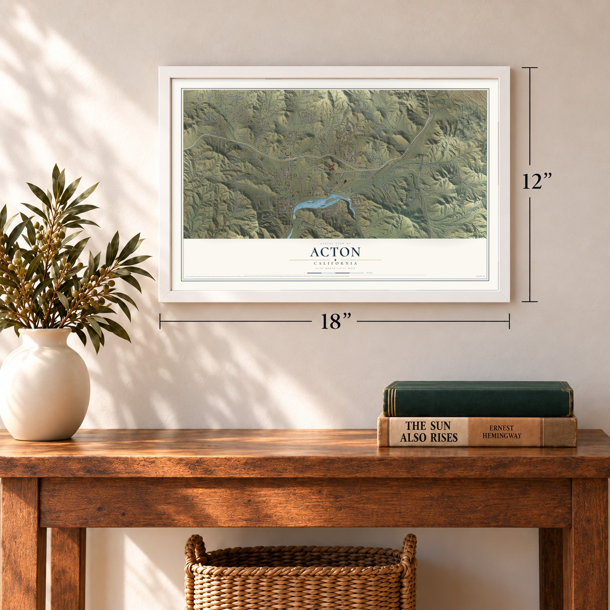
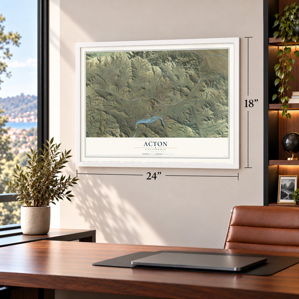
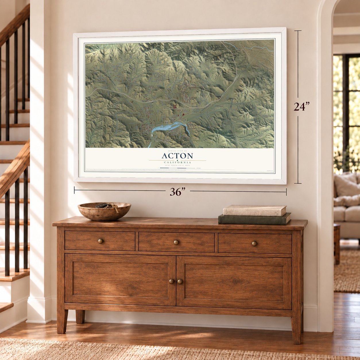
Acton, California Map Art
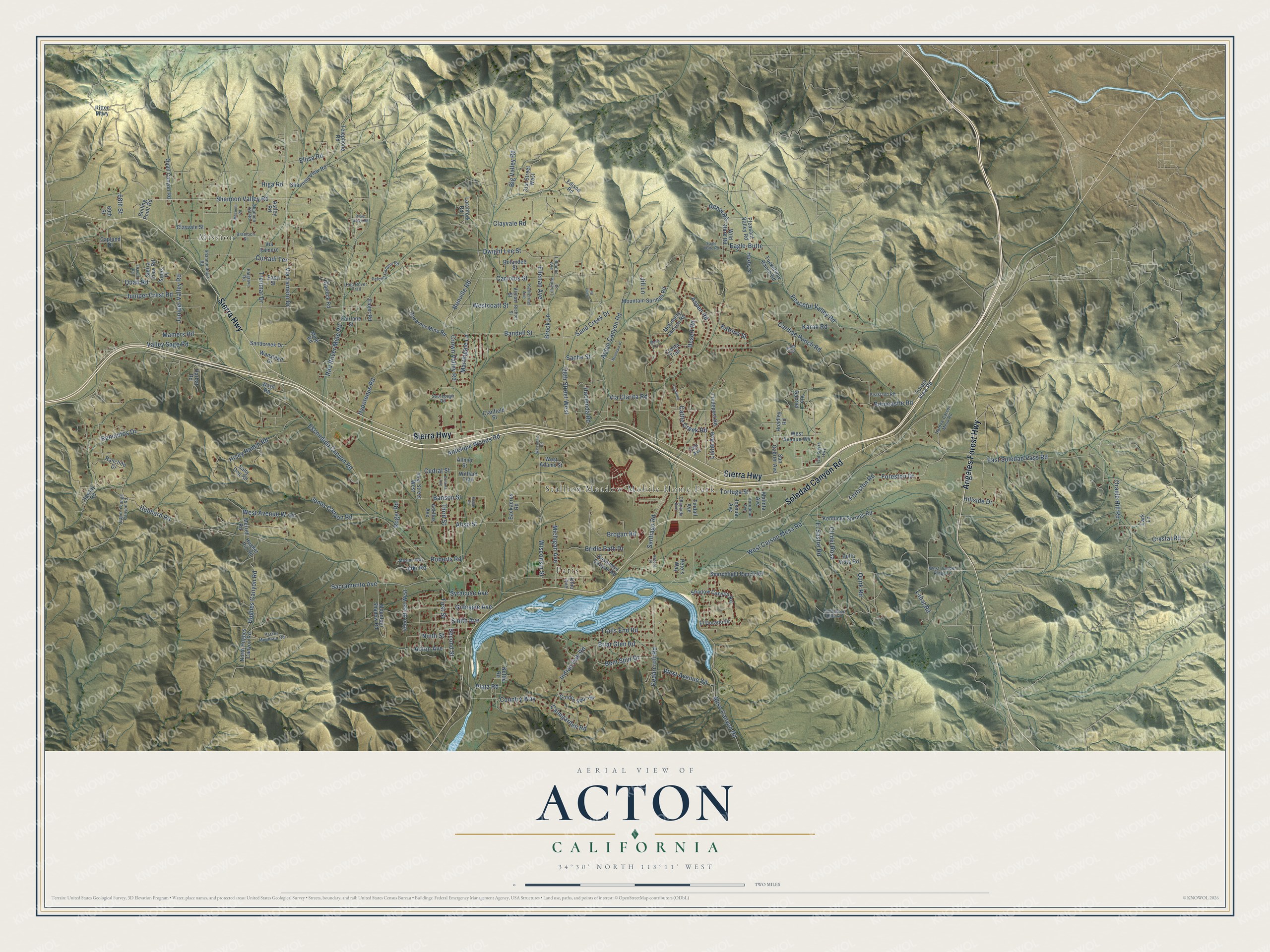
A new map of Acton, California, made in 2026 and printed to order on thick archival matte paper.
12" x 18" Archival Matte Print
A Map of Home. A Work of Art.
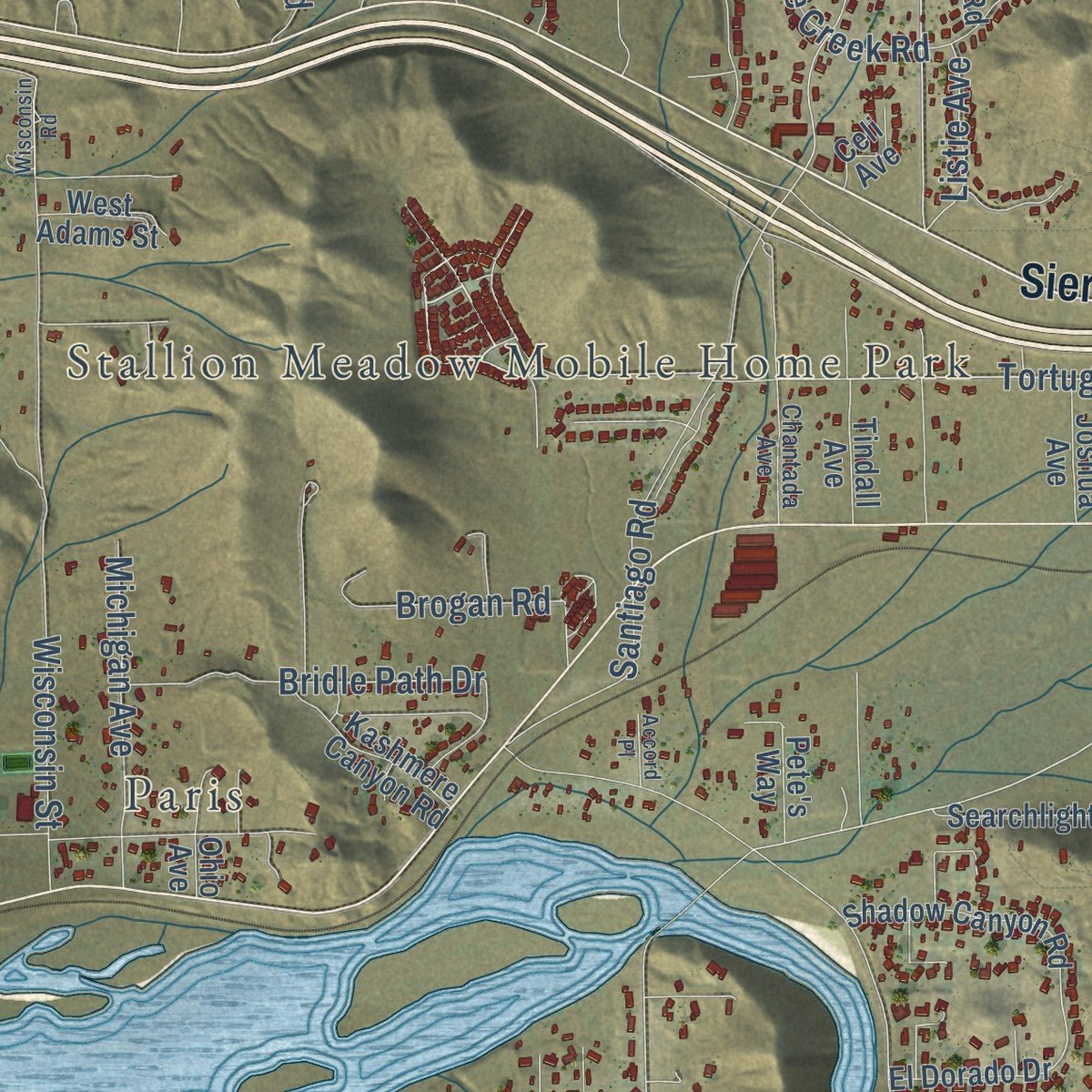
Explore Acton, California from a whole new perspective. Created using aerial imagery and detailed geographic data, this map captures Acton building by building, with labeled streets, familiar landmarks, and shaded topographical relief that highlights the natural contours of the landscape.
Combining modern data with the timeless character of a vintage atlas, this map is just as interesting up close as it is beautiful on the wall. Whether you grew up in Acton, spent memorable years there, or call it home today, this unique map is a great way to celebrate a place that means something to you. Zoom in on the preview to look for your street, and then order a print to put your memories on the wall.
Three ways to hang it
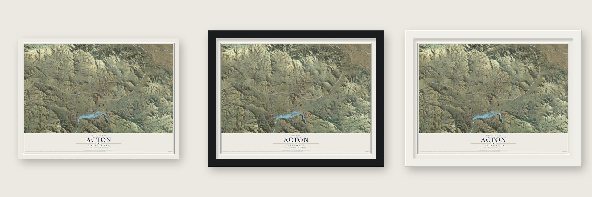
Unframed archival matte, a black wood frame or a white wood frame.
Up close
Geography Worth Displaying
This map was created using accurate cartographic data and authoritative geographic sources, including the U.S. Geological Survey and the Census Bureau. The map brings together terrain, waterways, roads, and building detail. The majority of the streets are labeled, houses are accurately depicted, and the topography is derived from government sources. Combining local data with carefully composed color and shading leads to this beautifully detailed Acton artwork for your wall.
Rather than simply showing street outlines, we’ve included as many of the street names as we could reasonably fit on the map while keeping their names legible. Zoom in on the high resolution preview to see exactly what’s on the map. We truly set out to create a statement piece for anyone who loves Acton. So whether it’s for you, or a gift for someone you love, we hope this map of Acton brings back fond memories.
Read the story behind this map of Acton, California from 2026.

About Acton, California
From the Los Angeles County History: "The Padre Mine is situated on the eastern spur of Gleason Mountain, in the Gleason Mountain mining district, about six miles south of Acton Station, on the Southern Pacific Railroad, and is 6,000 feet above the sea level."
Find your street
Names on the Acton map
Every name below is printed on this map. Look for your street, your school, the park where you played, or the pond down the road.
Places and landmarks3
- Mission
- Paris
- Stallion Meadow Mobile Home Park
Streets and roads200
- Sierra Highway
- Soledad Canyon Road
- Angeles Forest Highway
- Shannon Valley Road
- Sache Street
- Westcoatt Street
- Tortuga Street
- Indian Oak Road
- West Carson Mesa Road
- Santiago Road
- Listie Avenue
- Syracuse Avenue
- Crown Valley Road
- Escondido Canyon Road
- Hubbard Road
- Red Rover Mine Road
- East Soledad Pass Road
- Aliso Canyon Road
- Desert Road
- Brinville Road
- Peaceful Valley Road
- Trenmar Drive
- Via Famero Drive
- Wisconsin Street
- Acton Canyon Road
- Foreston Drive
- Foreston Road
- Hisey Ranch Road
- Valley Sage Road
- Sacramento Avenue
Show all 200 streets
- 28th Street West
- Hillside Drive
- Cedarcroft Road
- Antelope Woods Road
- Corradi Terrace
- Oracle Hill Road
- Carrolos Street
- El Sastre Road
- Aliso Street
- Hughes Canyon Road
- Cedral Street
- Banson Street
- Rebel Road
- West Avenue W-14
- Gillespie Avenue
- Bandell Street
- Dwight Lee Street
- Country Way
- Sand Creek Drive
- Juniper Valley Road
- Hacienda Road
- Third Street
- Juniper Crest Road
- Bent Spur Drive
- Quail Road
- Aspen Road
- Cll del Rosa
- Smith Avenue
- First Street
- Clayvale Road
- Cardiac Ranch Road
- Bridle Path Drive
- Labat Road
- Berncastle Road
- Second Street
- Jones Canyon Road
- Crystal Road
- Michigan Avenue
- Katrina Street
- Ranchitos Drive
- West Avenue Y8
- Mamers Road
- Briar Glen Road
- Calmgarden Road
- Cattle Creek Road
- Acton Avenue
- Trails End Road
- Hypotenus Road
- Martingale Lane
- Brogan Road
- Ellisa Road
- Eagle-Butte
- Ellenan Avenue
- Big Valley Road
- Higa Road
- Quirk Road
- Oki Road
- Ninth Street
- Via Clarita Road
- Roberts Road
- Karak Road
- Brock Lane
- Platz Road
- Roger Road
- 68th Street
- Jill Lane
- Astley Road
- Shannon View Road
- Rolandee Street
- Edison Road
- McEnnery Canyon Road
- Boiling Point Road
- Searchlight Ranch Road
- Telephone Road
- San Gabriel Avenue
- 31st Street West
- Clanfield Street
- 41st Street West
- Mountain Springs Road
- Clayvale Street
- Tuckerway Ranch Road
- 42nd Street West
- Kentucky Springs Road
- Hughet Pin Road
- Mountain Shadow Road
- Governor Mine Road
- North Hughes Canyon Road
- Merritt Road
- Pleasant Valley Road
- Acklins Avenue
- Tindall Avenue
- Shadow Canyon Road
- Ranchito Drive
- Wild Hare Road
- Garlock Road
- Golden Spur Road
- Ritter Mtwy
- Bulla Vista Road
- Quail Canyon Road
- Violan Street
- Eager Road
- Salty Dog Road
- Sierra View Road
- Mine Road
- West Avenue W4
- Harbat Road
- Tradepost Road
- Sandcreek Drive
- Fairlane Street
- Backacres Road
- El Dorado Drive
- Wanstead Drive
- Easy Street
- Kashmere Canyon Road
- Cresta Trail
- Haxby Street
- Forest View Road
- Joshua Avenue
- Via Famero
- Malinta Avenue
- Larchfork Road
- West Adams Street
- Ohio Avenue
- Sipes Place
- Hoadley Road
- Hawley Road
- Lark Lane
- Pete's Way
- William Trail
- Nettie Road
- Capland Drive
- Allmer Street
- Via Gabriel
- 69th Street
- Celi Avenue
- Ward Road
- West Juniper Ridge Lane
- Shannondale Road
- Parker Mountain Road
- Palgrave Road
- Old Sierra Highway
- Enchanted Hills Road
- Pelona Canyon Road
- Harbea-Carson Mesa Road
- Braeloch Street
- Chantada Avenue
- Katherinel Avenue
- Peakland Road
- Richter Street
- Upper Youngs Canyon Road
- Horndean Avenue
- Shannon Val Road
- Maxine Way
- Red Rover Trail
- Sourdough Road
- Lillianne Street
- Lillianne Avenue
- Mountain Place
- Rover Ridge Road
- Gault Road
- Dorama Avenue
- Macomb Road
- Clanfield
- Elkhorn Road
- Simla Road
- Eagle Butte Road
- Wisconsin Road
- Accord Place
- Poppy Road
- Malia Court
Names are listed as they appear on the printed map. Zoom into the product photos to find them.
The art of mapping a place
How This Map Was Made
Real places. Remarkable detail. Discover the layers that turn geographic data into a map of home.

The view from above
Aerial imagery reveals the character of the land: woodland, open fields, and the patterns of a place.

The shape of the land
Elevation data brings hills, valleys, and subtle changes in the landscape into view.

The details of home
Roads, waterways, and building footprints come together to make the map feel unmistakably local.

Geography becomes art
Considered color, shading, and typography bring the layers together in a map made for your wall.


Process illustrated with Mendon, Massachusetts. Aerial imagery: USDA NAIP. Terrain: USGS 3D Elevation Program. Map details and finished artwork: KNOWOL.
The Details
About This Print
Choose an archival matte print, or a black or white Ayous wood frame. The archival matte print is unframed.
Select your size and finish above to see the matching product image and price.
Materials & Craftsmanship
A contemporary map with the character of a classic atlas, printed on archival matte paper. Optional frames are made from Ayous wood.
Your printed map does not include the watermark shown in the full-map preview.
Shipping & Delivery
Free shipping within the United States. Every print is made to order in the USA.
Buying a gift? Add a note in your cart and we'll include it. We never put prices in the package.
Prints ship within 2 to 3 business days. Allow 7 to 10 days total from ordering for delivery. Timing may vary during holidays or periods of high order volume.
Read our shipping policy.
Returns and damaged prints
Each print is made to order. Change-of-mind refunds are not available after production.
If your print arrives damaged, misprinted or incorrect, contact support@knowol.com within 30 days of receiving it. Include your order number, photos and a description of the issue.
Read our full refund and replacement policy. For questions about your order, email support@knowol.com.
Find your town
Looking for another city?
Find a map of home in our California collection, or any town in the country.
Nearby
Maps of towns near Acton
Know someone from one of these towns? Their map makes a great gift.
 Desert View Highlands
, California
From $39.99See the map
 Agua Dulce
, California
From $39.99See the map
 Palmdale
, California
From $39.99See the map
More maps nearby: Leona Valley, Quartz Hill, Littlerock, Sun Village and Lancaster.